Bible Maps
to
14
62
31
55
31
21
18
17
12
8
7
7
6
4
4
3
3
3
3
3
3
3
3
3
3
2
2
2
1
1
1
1
1
1
1
1
1
1
1
1
8
3
3
1
1
Sort By
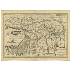
Antique Bible Map of the Middle East by A. Schut, 1743
Located in Langweer, NL
Antique map titled 'De Gelegentheyt van 't Paradys en 't Landt Canaan'. Dutch Bible map covering
Category
Antique Mid-18th Century Maps
Materials
Paper
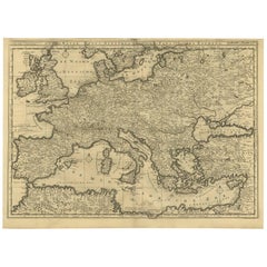
Rare Antique Bible Map of Southern Europe by A. Schut, 1743
Located in Langweer, NL
Antique map of the Mediterranean and a large part of Europe, illustrating the voyage of St. Paul to
Category
Antique Mid-18th Century Maps
Materials
Paper
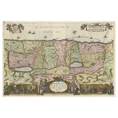
Detailed Map of the Holy Land, Showing the Travels of Christ & Apostles, ca.1650
Located in Langweer, NL
crucifiction of Christ. An excellent example of a Duch Bible map. Dutch text on verso. Source unknown, to be
Category
Antique 1650s Maps
Materials
Paper
H 44.2 in W 52.3 in D 0.002 in
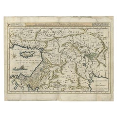
Antique Map of the Mediterranean and the Persian Gulf by Danckerts, c.1718
Located in Langweer, NL
Antique map titled 'De Gelegentheyt Van't Paradys en 't Landt Canaan.' Dutch Bible map covering the
Category
Antique 18th Century Maps
Materials
Paper
H 16.34 in W 21.26 in D 0 in
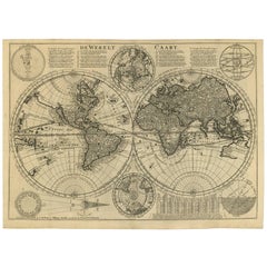
Antique Bible World Map by R. & J. Wetstein, 1743
Located in Langweer, NL
Antique world map titled 'De Werelt Caart'.
A scarce and richly detailed double hemisphere world
Category
Antique Mid-18th Century Maps
Materials
Paper
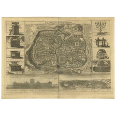
Antique Bible Plan of Ancient Jerusalem, 1743
Located in Langweer, NL
This plan originates from ‘Biblia Sacra, dat is, de H. Schriftuer van het Oude, en het Nieuwe Testament, naer de laetste Roomsche keure der gemeine Latijnsche overzettinge, in nederd...
Category
Antique Mid-18th Century Maps
Materials
Paper
Antique Bible Plan of Jerusalem by Covens & Mortier, 1743
Located in Langweer, NL
This plan originates from ‘Biblia Sacra, dat is, de H. Schriftuer van het Oude, en het Nieuwe Testament, naer de laetste Roomsche keure der gemeine Latijnsche overzettinge, in nederd...
Category
Antique Mid-18th Century Maps
Materials
Paper
Antique Map of the World by Stoopendaal, c.1714
Located in Langweer, NL
from 1685 to 1713. Both Daniel and Bastiaan Stoopendaal made maps for the so-called Keur Bibles
Category
Antique 18th Century Maps
Materials
Paper
Rare and Interesting Small Antique Woodcut Map of the Mediterranean
Located in Langweer, NL
.
This map originates from 'The Bishop's Bible' published in 1568. The Bishops' Bible is an English
Category
Antique 16th Century Maps
Materials
Paper
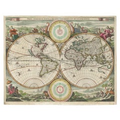
Antique Double Hemisphere World Map with California as an Island, 1710
Located in Langweer, NL
hemisphere world map from a Dutch bible by Cornelis Dankerts (Danckerts), engraved by Albert Schut, printed
Category
Antique 1710s Maps
Materials
Paper
Map Holy Promise Land Canaan Richard Palmer Richard Blome 1687 Joseph Moxon
Located in BUNGAY, SUFFOLK
English Bible, end of the 17th century.
The map is an exact copy of Nicolaes Visscher's map, with
Category
Antique 17th Century British Baroque Maps
Materials
Paper
H 12.21 in W 19.69 in D 0.4 in
Antique Map of Ancient Jerusalem, depicting The Temple of Solomon, c.1725
Located in Langweer, NL
Antique map titled 'Nieuwe Plattegrond van het Oude Jeruzalem Volgens den Schryver.'
Bird's-eye
Category
Antique 18th Century Maps
Materials
Paper
H 19.49 in W 15.56 in D 0 in
Antique Map of Eastern Mediterranean and Asia Minor by a Benedictine, c.1725
Located in Langweer, NL
Antique map titled 'Byzondere Afbeelding der Landschappen, van de Apostelen bevaren en doorwandelt
Category
Antique 18th Century Maps
Materials
Paper
H 19.1 in W 22.05 in D 0 in
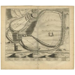
Spectacular Antique Original Engraving of a Town Plan of Jerusalem, 1708
Located in Langweer, NL
sens from the bible.
Certainly one of the most remarkable holyland maps of the period.
This map
Category
Antique Early 1700s Maps
Materials
Paper
Original Antique Engraving of the Creation of the World According to Mozes, 1725
Located in Langweer, NL
Antique map titled 'De Schepping der Wereldt volgens de Beschryving van Mozes' - This plate shows
Category
Antique 18th Century Maps
Materials
Paper
H 15.75 in W 9.57 in D 0 in
Beautiful Original Print of The Creation of the World According to Moses, 1725
Located in Langweer, NL
Antique map, titled: 'De Schepping der Wereldt volgens de Beschryving van Mozes.'
Two separate
Category
Antique 1720s Maps
Materials
Paper
H 15.75 in W 9.93 in D 0 in
Bird's Eye Plan of the Ancient City of Jerusalem Based on Old Records, c.1725
Located in Langweer, NL
Antique map titled 'Beschryving van het oude Jeruzalem volgens Villalpandus.'
Bird's eye plan of
Category
Antique 18th Century Maps
Materials
Paper
H 20.2 in W 16.74 in D 0 in
Steel Engraving of Shimoda, a Port Located in Shizuoka Prefecture, Japan, C.1840
Located in Langweer, NL
, Bibliographisches Institut, in Gotha in 1826. It published several editions of the Bible, works of classical
Category
Antique 1840s Maps
Materials
Paper
H 7.09 in W 11.03 in D 0 in
Old Engraving the City and Harbour of Pathmos, Patmos or Patimo in Greece, 1725
Located in Langweer, NL
all aspects of the history, geography and culture of the Bible and Biblical times. This Dutch
Category
Antique 1720s Maps
Materials
Paper
H 15.63 in W 19.61 in D 0 in
Ancient Babylon with The Tower of Babel According to Herodotus & Kircherus, 1730
Located in Langweer, NL
encyclopaedic dictionary on all aspects of the history, geography and culture of the Bible and Biblical times
Category
Antique 1730s Maps
Materials
Paper
H 14.49 in W 17.68 in D 0 in
Spectacular View of the Siege of Jerusalem by King Nebuchadnezzar, ca.1730
Located in Langweer, NL
encyclopaedic dictionary on all aspects of the history, geography and culture of the Bible and Biblical times
Category
Antique 1730s Maps
Materials
Paper
H 14.69 in W 19.57 in D 0 in
Religious Bible Mural Journey of Apostle Paul Rollable Vintage Map Wall Chart
Located in Berghuelen, DE
A colorful picturous map showing the journey of the apostle Paul, published by Becker´s Hamburg
Category
Late 20th Century German Country Prints
Materials
Paper, Canvas, Wood
H 66.15 in W 85.44 in D 0.79 in
The Holy Bible, Standard Edition, Illustrated Family Bible, 1885
Located in Colorado Springs, CO
The “Standard” Edition of The Holy Bible, Containing the Old and New Testaments and Apocrypha
Category
Antique 1880s American Late Victorian Books
Materials
Leather, Paper
The Holy Bible, Containing the Old and New Testaments, 1887
Located in Colorado Springs, CO
The Holy Bible, Containing the Old and New Testaments, Translated out of the Original Tongues: And
Category
Antique 1880s English Late Victorian Books
Materials
Leather, Paper
Antique Bible Print of Abram from the Biblia Sacra, 1743
Located in Langweer, NL
The print is from a Dutch Bible known as "Biblia Sacra," which is the Holy Scripture of the Old and
Category
Antique Mid-18th Century Prints
Materials
Paper
Antique Print of a Trappist Monk Reading a Bible by Tiron, 1845
Located in Langweer, NL
Antique print titled 'Trappiste'. Print of a Trappist Monk reading a Bible. This print originates
Category
Antique 19th Century Prints
Materials
Paper
Dutch Luther Bible with fine hand-coloured and highlighted in gold illustrations
By Claes Jansz. Visscher (II)
Located in ZWIJNDRECHT, NL
Beautifully bound mid-17th-century "Visscher edition" of the Dutch Luther Bible with expertly hand
Category
Antique 1640s Dutch Dutch Colonial Books
Materials
Gold
Free Shipping
H 15 in W 11 in D 4.5 in
Cambridgeshire map 17th century engraving by John Speed
By John Speed
Located in London, GB
."
John Speed (1551 or 1552 - 1629)
Map of Cambridgeshire
Engraving with later hand colouring
39 x 53 cm
Category
1610s Landscape Prints
Materials
Engraving
Cambridge map 17th century engraving after John Speed
By John Speed
Located in London, GB
."
Pieter van den Keere (1571 - circa 1646) after John Speed (1551 or 1552 - 1629)
Map of Cambridgeshire
Category
1620s Landscape Prints
Materials
Engraving
Antique Map of the Ancient City of Jerusalem by A. Calmet, 1725
Located in Langweer, NL
Antique map, titled: 'Nieuwe Plattegrond van het Oude Jeruzalem Volgens den Schryver.' - Bird's-eye
Category
Antique Early 18th Century Prints
Materials
Paper
10K And 14K Yellow Gold Cable Link Charms Bracelet
Located in Guaynabo, PR
golf bag, a dress rack, a bell, a wedding rings, a rocking chair, a tennis racket, a Bible, an airplane
Category
20th Century Unknown Modern Chain Bracelets
Materials
Yellow Gold, 10k Gold, 14k Gold
Antique Print of Fortress Nieuwersluis in the Netherlands, 1719
Located in Langweer, NL
Bastiaan Stoopendaal made maps for the so-called Keur Bibles (published from 1666-1756). Most probably both
Category
Antique 18th Century Prints
Materials
Paper
Antique Print of Estate Wallestein Near Utrecht, the Netherlands, 1719
Located in Langweer, NL
Stoopendaal (Dutch) was active in Amsterdam from 1685 to 1713. Both Daniel and Bastiaan Stoopendaal made maps
Category
Antique 18th Century Prints
Materials
Paper
Antique Print of Estate Vijverhof by Stoopendaal, 1719
Located in Langweer, NL
active in Amsterdam from 1685 to 1713. Both Daniel and Bastiaan Stoopendaal made maps for the so-called
Category
Antique 18th Century Prints
Materials
Paper
Antique Print of Delphi, Greece, 1837
Located in Langweer, NL
hometown Gotha in 1826. He published bibles, literature and geographis atlasses. He was very succes with
Category
Antique 19th Century Prints
Materials
Paper
Antique Print of Daulatabad Fort, India, 1836
Located in Langweer, NL
several editions of the Bible, works of classical literature ("Miniatur-Bibliothek der deutschen Classiker
Category
Antique 19th Century Prints
Materials
Paper
Antique Print of German Franz Heinrich Zitz, a Prominent Mainz Attorney, c.1850
Located in Langweer, NL
of the Bible, works of classical literature ("Miniatur-Bibliothek der deutschen Classiker", "Groschen
Category
Antique 19th Century Prints
Materials
Paper
H 7.68 in W 5.12 in D 0 in
Antique Hand-Colored Print of 'the Deluge' by Becquet, circa 1840
Located in Langweer, NL
of the Catholic Bible, from the creation of Adam and Eve, to the persecution of the Maccabees. Mostly
Category
Antique 19th Century Prints
Materials
Paper
Nelson's Guide to the City of New York and its Neighbourhood, 1858
Located in Langweer, NL
topics including a Historical Retrospect, Places of Amusement, the vibrant Broadway scene, the New Bible
Category
Antique 1850s Books
Materials
Paper
Stories from Genesis - Etching by Antonio Tempesta - 17th Century
By Antonio Tempesta
Located in Roma, IT
realizing some maps in the Room of Geographical Maps in the Vatican, including the famous Map of Rome (1593
Category
17th Century Modern Figurative Prints
Materials
Etching
H 14.18 in W 18.12 in D 0.2 in
The New Testament /// Old Masters Biblical Religious Engraving Dutch Angel Art
By Michael Burghers
Located in Saint Augustine, FL
Bible
*Signed by Burghers in the plate (printed signature) lower left
Year: 1680
Medium: Original
Category
1680s Old Masters Figurative Prints
Materials
Watercolor, Engraving, Etching, Laid Paper, Intaglio
The World of Bruegel by Timothy Foote Hardcover Art Book in Sleeve
Located in North Hollywood, CA
.
Description: 192 pages : illustrations (some color), genealogical table, maps
Contents: The Northern View
Category
20th Century Belgian Folk Art Books
Materials
Paper
Stories from Genesis - Etching by Antonio Tempesta - 17th Century
By Antonio Tempesta
Located in Roma, IT
in 1573, he worked for Pope Gregory XIII realizing some maps in the Room of Geographical Maps in the
Category
17th Century Modern Figurative Prints
Materials
Etching
H 14.18 in W 18.12 in D 0.79 in
“Ascension of Christ” Black and White Biblical Figurative Lithograph
By Nicolas Beatrizet
Located in Houston, TX
ascending on the 3rd day according to the bible as he is surrounded by his apostles. Signed and dated on
Category
16th Century Realist Prints and Multiples
Materials
Lithograph
H 23.5 in W 24.5 in D 1.75 in
Historic Houses of the Hudson Valley by Harold Donaldson Eberlein
Located in valatie, NY
photographs, endpaper maps, a good index. Sponsored by the Hudson River Conservation Society, Inc. The houses
Category
Vintage 1940s American Books
Materials
Paper
Antique Print of the Nes or Realeneiland by Stoopendaal, 1719
Located in Langweer, NL
. Both Daniel and Bastiaan Stoopendaal made maps for the so-called Keur Bibles (published from 1666-1756
Category
Antique 18th Century Prints
Materials
Paper
Antique Print of the Uitermeersesluis Fortress Seen from Weesp by Stoopendaal
Located in Langweer, NL
1713. Both Daniel and Bastiaan Stoopendaal made maps for the so-called Keur Bibles (published from 1666
Category
Antique 18th Century Prints
Materials
Paper
H 8.08 in W 9.85 in D 0 in
Moshe Castel, “Kings of Jerusalem”, Gold Embossed Serigraph, Signed, circa 1980
Located in San Francisco, CA
background is a historical map or manuscript-style illustration of the Holy City of Jerusalem and its
Category
Vintage 1980s Israeli Prints
Materials
Foil, Brass
H 29.75 in W 37.88 in D 1.13 in
"Four Women in National Costumes, " Etchings by Wenceslaus Hollar
By Wenceslaus Hollar
Located in Milwaukee, WI
embraced a great variety of subjects, including scenes from the bible, historical pictures, maps, portraits
Category
17th Century Old Masters Figurative Prints
Materials
Etching
Reinhard Görner 'Study Center' Duchess Anna Amalia Library, Weimar, Germany
By Reinhard Görner
Located in Los Angeles, CA
and early modern manuscripts
600 ancestral registers
10,000 maps
4,000 musical scores
The research
Category
2010s Conceptual Landscape Photography
Materials
C Print, Lambda
Reinhard Görner 'Study Center' Duchess Anna Amalia Library, Weimar, Germany
By Reinhard Görner
Located in Los Angeles, CA
and early modern manuscripts
600 ancestral registers
10,000 maps
4,000 musical scores
The research
Category
2010s Conceptual Landscape Photography
Materials
C Print, Lambda
Reinhard Görner 'Study Center' Duchess Anna Amalia Library, Weimar, Germany
By Reinhard Görner
Located in Los Angeles, CA
and early modern manuscripts
600 ancestral registers
10,000 maps
4,000 musical scores
The research
Category
2010s Conceptual Landscape Photography
Materials
C Print, Lambda
Portrait of a Man an Engraving by Wenceslaus Hollar
By Wenceslaus Hollar
Located in Milwaukee, WI
variety of subjects, including scenes from the bible, historical pictures, maps, portraits of his chief
Category
Mid-17th Century Old Masters Portrait Prints
Materials
Engraving
Rare Palestine Antique Hebrew Judaica Yahrzeit Synagogue Sign Memorial Plaque
Located in Surfside, FL
produced Jewish-themed color postcards, greeting cards, Jewish National Fund stamps, and maps documenting
Category
Early 20th Century Aesthetic Movement More Art
Materials
Lithograph
Original Vintage WWII Poster Anti British State Values Domination Exploitation
Located in London, GB
and sharp nails digging into the world map under the heading of Domination on the left, a smiling man
Category
Vintage 1940s Italian Posters
Materials
Paper
H 27.56 in W 39.38 in D 0.04 in
Hunting Scene - Original Etching by Antonio Tempesta - Early 17th Century
By Antonio Tempesta
Located in Roma, IT
, he worked for Pope Gregory XIII, frescoing some maps of the Romm of geographical maps in the Vatican
Category
Early 17th Century Baroque Figurative Prints
Materials
Etching
H 8.04 in W 10.83 in D 0.08 in
'Portrait of Henrico van der Borcht, ' original W. Hollar engraving after Holbein
By Wenceslaus Hollar
Located in Milwaukee, WI
, including scenes from the bible, historical pictures, maps, portraits of his chief contemporaries, views of
Category
17th Century Old Masters Portrait Prints
Materials
Engraving
'Portrait of a Young Woman' original Hollar engraving after Hans Holbein
By Wenceslaus Hollar
Located in Milwaukee, WI
, including scenes from the bible, historical pictures, maps, portraits of his chief contemporaries, views of
Category
17th Century Old Masters Portrait Prints
Materials
Engraving
Four original etchings of women from 'Aula Veneris' series by Wenceslaus Hollar
By Wenceslaus Hollar
Located in Milwaukee, WI
the bible, historical pictures, maps, portraits of his chief contemporaries, views of cities, flower
Category
17th Century Old Masters Figurative Prints
Materials
Etching, Paper
'Portrait of M. Morett, ' original Wenceslaus Hollar engraving after Hans Holbein
By Wenceslaus Hollar
Located in Milwaukee, WI
variety of subjects, including scenes from the bible, historical pictures, maps, portraits of his chief
Category
17th Century Old Masters Portrait Prints
Materials
Engraving
- 1
Get Updated with New Arrivals
Save "Bible Maps", and we’ll notify you when there are new listings in this category.
Bible Maps For Sale on 1stDibs
At 1stDibs, there are several options of bible maps available for sale. The range of distinct bible maps — often made from paper, metal and silver — can elevate any home. Bible maps have been produced for many years, with earlier versions available from the 18th Century and newer variations made as recently as the 20th Century. Bible maps made by Art Deco designers — as well as those associated with folk art — are very popular at 1stDibs. There have been many well-made bible maps over the years, but those made by Wenceslaus Hollar, Reinhard Görner and Nicolas Beatrizet are often thought to be among the most beautiful.
How Much are Bible Maps?
Bible maps can differ in price owing to various characteristics — the average selling price at 1stDibs is $1,104, while the lowest priced sells for $55 and the highest can go for as much as $75,000.
