Brazil Map
5
87
10
6
to
14
83
13
103
102
103
3
2
1
1
36
30
20
16
7
9
4
1
2
3
3
2
1
78
6
6
5
4
20
20
20
7
3
3
2
2
2
1
Sort By
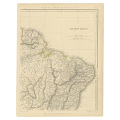
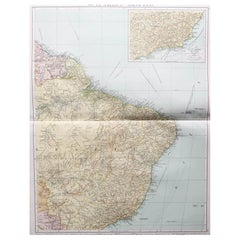
Antique Map of Eastern Brazil, 1849
Located in Langweer, NL
Antique map titled 'Eastern Brazil'. Old map of Eastern Brazil. This map originates from 'Sharpe's
Category
Antique 19th Century Maps
Materials
Paper
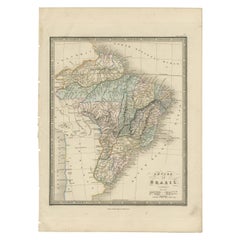
Antique Map of Brazil by Wyld, '1845'
Located in Langweer, NL
Antique map titled 'Empire of Brazil'. Original antique map of Brazil. This map originates from 'An
Category
Antique Mid-19th Century Maps
Materials
Paper
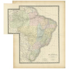
Antique Map of Brazil by Levasseur '1875'
Located in Langweer, NL
Antique map titled 'Carte du Brésil'. Large map of Brazil, with small fold out. This map originates
Category
Antique Late 19th Century Maps
Materials
Paper
Antique Map of the Brazilian Coast by A. Van Krevelt
Located in Langweer, NL
Uncommon edition of this accurate map of part of Brazil, from San Salvador till Rio de Janeiro and
Category
Antique Late 18th Century Brazilian Maps
Materials
Paper
Large Original Vintage Map of Brazil, circa 1920
Located in St Annes, Lancashire
Great map of Brazil
Original color. Good condition
Published by Alexander Gross
Unframed.
Category
Vintage 1920s English Edwardian Maps
Materials
Paper
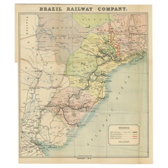
Antique Map of the Brazil Railway Company, '1912'
Located in Langweer, NL
Antique map titled 'Brazil Railway Company'. This folding map is attached to the booklet titled
Category
Early 20th Century Maps
Materials
Paper
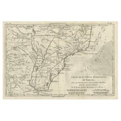
Antique Map of Brazil of Southern Brazil, Uruguay, and Northern Argentina, c1780
Located in Langweer, NL
Antique map titled 'Carte de la Partie Méridionale du Bresil (..)'. This antique map of Brazil
Category
Antique 1780s Maps
Materials
Paper
H 9.85 in W 15.16 in D 0 in
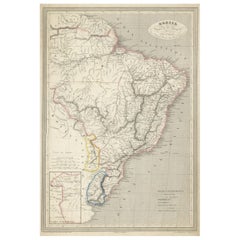
Antique Map of of Brazil, Paraguay and Uruguay
Located in Langweer, NL
Antique map titled 'Bresil Paraguay et Uruguay'. Fine steel engraved map of Brazil, Paraguay and
Category
Antique Mid-19th Century Maps
Materials
Paper
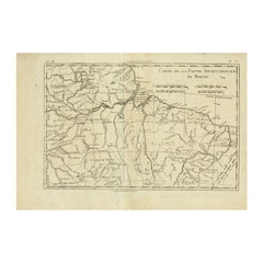
Antique Map of Northern Brazil by Bonne, c.1780
Located in Langweer, NL
Antique map titled 'Carte de la Partie Septentrionale du Bresil.' Detailed map of the northern
Category
Antique 18th Century Maps
Materials
Paper
Antique Map of Southern Brazil by Bonne, c.1780
Located in Langweer, NL
"Antique map titled 'Carte de la Partie Méridionale du Bresil (..)'. This antique map of Brazil
Category
Antique 18th Century Maps
Materials
Paper
Antique Map of La Plata, Chili and Southern Brazil, 1849
Located in Langweer, NL
Antique map titled 'La Plata - Chili and Southern Brazil'.
Old map of La Plata, Chili and
Category
Antique 19th Century Maps
Materials
Paper
Antique Map of Brazil with Original Outline Hand-Colouring, c.1844
Located in Langweer, NL
Antique map titled 'Brazil'. Beautiful map with outline color of Brazil, engraved by S. Hall
Category
Antique 19th Century Maps
Materials
Paper
Antique Map of Brazil, Ecuador, Colombia and Venezuela by Lapie, 1842
Located in Langweer, NL
Antique map titled 'Carte de Colombie contenant les Républiques (..)'. Map of northern Brazil
Category
Antique 19th Century Maps
Materials
Paper
Antique Map of the Northern Part of Brazil by Raynal, 1784
Located in Langweer, NL
Antique map titled 'Kaart van het Noordlijk gedeelte van Bresil'. Rare antique map of the northern
Category
Antique 18th Century Maps
Materials
Paper
Antique Map of Southern Brazil and Uruguay by Bonne, c.1780
Located in Langweer, NL
Voisines Qui en Sont a l'Ouest.' Map of southern Brazil and present-day Uruguay from Porto Seguro in the
Category
Antique 18th Century Maps
Materials
Paper
Antique Map of the Bahia Todos Santos 'Brazil' by Tirion, circa 1750
Located in Langweer, NL
Antique map titled 'Kaart Van De Aller-Heiligen Baay Waar aan de Hoofdstad legt van Brazil
Category
Antique Mid-18th Century Maps
Materials
Paper
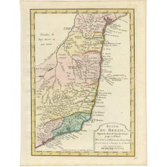
Antique Map of the Coast of Southern Brazil by Bellin, c.1755
By Jacques-Nicolas Bellin
Located in Langweer, NL
Antique map titled ‘Suite de Bresil’. Map of the coast of southern Brazil, with Lagoa Mirim, and
Category
Antique 18th Century Maps
Materials
Paper
Antique Map of Brazil, Uruguay, Paraguay and Guyana by A & C. Black, 1870
Located in Langweer, NL
Antique map titled 'Brazil'. Original antique map of Brazil, Uruguay, Paraguay and Guyana. This map
Category
Antique Late 19th Century Maps
Materials
Paper
H 17.52 in W 13 in D 0.02 in
Antique Map of Brazil, Including Part of Colombia, Peru and Chili, c.1880
Located in Langweer, NL
Antique map South America titled 'Brazil'. This map depicts Brazil and its surroundings including
Category
Antique 19th Century Maps
Materials
Paper
H 16.54 in W 13.19 in D 0 in
Antique Map of the Eastern Part of Brazil by A. Van Krevelt, 1772
Located in Langweer, NL
Rare edition of this accurate map of eastern part of Brazil. This map originates from 'Atlas
Category
Antique Late 18th Century Maps
Materials
Paper
Old Color Engraving of Blaeu's first Map of Brazil, North Oriented to the Right
By Willem Blaeu
Located in Langweer, NL
Antique map titled 'Novus Brasiliae Typus'. Fine old color example of Blaeu's first map of Brazil
Category
Antique Mid-17th Century Maps
Materials
Paper
H 19.3 in W 22.84 in D 0.02 in
Rare Map of South America of Chili, La Plata, Paraguay, Brazil, Peru, c.1775
Located in Langweer, NL
Antique map titled 'South America agreeable to the most approved maps and charts'.
Rare map of
Category
Antique 1770s Maps
Materials
Paper
H 13.78 in W 16.93 in D 0 in
Rare Antique Map of the Rio De La Plata, Buenos Ayres, Brazil, ca.1760
Located in Langweer, NL
Description: Antique map titled 'De Ingang van Rio de la Plata, Waar aan de Stad Buenos Ayres ligt
Category
Antique 1760s Maps
Materials
Paper
Antique Map of Brazil Extending South to the Mouth of the Rio de la Plata
Located in Langweer, NL
Antique map titled 'Carte du Brésil'. ?Beautiful map of Brazil extending south to the mouth of the
Category
Antique Early 19th Century Maps
Materials
Paper
H 23.31 in W 17.33 in D 0.02 in
Antique Map of South America by Johnston '1909'
Located in Langweer, NL
Antique map titled 'South America, Southern Sheet'. Depicting Chile, Argentina, Brazil, Patagonia
Category
Early 20th Century Maps
Materials
Paper
Antique Map of South America by Finlayson, 1822
Located in Langweer, NL
America'. This map depicts part of South America (including part of Brazil and Chili) and provides a lot
Category
Antique 19th Century Maps
Materials
Paper
Antique Map of South America by V. Levasseur, 1854
By Victor Levasseur
Located in Langweer, NL
scenes of natives and their life. Depicting Colombia, Brazil, Chile, Bolivia and more. This map
Category
Antique Mid-19th Century Maps
Materials
Paper
Antique Map of South America by Tirion 'circa 1765'
Located in Langweer, NL
Antique map titled 'Kaart van het Onderkoningschap van Peru, zig uitstrekkende over Chili, Paraguay
Category
Antique Mid-18th Century Maps
Materials
Paper
Antique Map of South America by Conder, c.1775
Located in Langweer, NL
Antique map titled 'South America agreeable to the most approved maps and charts'. Rare map of
Category
Antique 18th Century Maps
Materials
Paper
Antique Map of South America Depicting Guayana, c.1780
Located in Langweer, NL
Mayapa, a Brazilian state, and Cap de Nord in the south. This map originates from G. Raynal's 'Atlas de
Category
Antique 18th Century Maps
Materials
Paper
Antique Map of South America by Wyld, circa 1850
By J. Wyld
Located in Langweer, NL
Beautiful folding map of South America titled 'Colombia Prima or South America Drawn from the Large
Category
Antique Mid-19th Century British Maps
Materials
Paper
Antique Map of South America by Tirion, c.1765
By Thomas Kitchin
Located in Langweer, NL
Antique map titled 'Kaart van het Onderkoningschap van Peru zig uitstrekkende: over Chile, Paraguay
Category
Antique 18th Century Maps
Materials
Paper
Attractive Antique Hand-Coloured Map of South America, ca.1765
Located in Langweer, NL
Antique map titled 'Kaart van het Onderkoningschap van Peru zig uitstrekkende: over Chile, Paraguay
Category
Antique 1760s Maps
Materials
Paper
Original Antique Map of Brasil, Published in the 16th Century, 1561
Located in Langweer, NL
This important Ruscelli map of Brazil, from his work La Geografia di Claudio Tolomeo Alessandrino
Category
Antique 1660s Maps
Materials
Paper
No Reserve
H 8.67 in W 11.82 in D 0 in
Antique Map of South America ‘North’ by A.K. Johnston, 1865
Located in Langweer, NL
Antique map titled 'South America, Northern Sheet'. Depicting Guiana, Ecuador, Brazil, Bolivia the
Category
Antique Mid-19th Century Maps
Materials
Paper
Antique Map of Part of South America by Archer, C.1860
Located in Langweer, NL
Antique map titled 'South America'. This antique map depicts the north-east of South America
Category
Antique 19th Century Maps
Materials
Paper
Antique Map the Windward or South Caribbean Islands and Guiana, 1859
Located in Langweer, NL
Antique map titled 'The Windward or South Caribbean Islands'. Original antique map of South
Category
Antique Mid-19th Century Maps
Materials
Paper
Antique Map of the City of Rio de Janeiro by Balbi '1847'
Located in Langweer, NL
Antique map titled 'Rio de Janeiro'. Original antique map of the city of Rio de Janeiro, Brazil
Category
Antique Mid-19th Century Maps
Materials
Paper
Antique Map of the Northern Part of South America by Delamarche, 1806
Located in Langweer, NL
Antique map titled 'Terre-Ferme, Perou, Bresil, Pays de L'Amazone.' This map shows the northern
Category
Antique 19th Century Maps
Materials
Paper
Decorative Original HandColoredAntique Map of South America by J.B. Elwe, 1792
By J.B. Elwe
Located in Langweer, NL
This image depicts 'L'Amerique Meridionale', an antique map of South America. The map is carefully
Category
Antique Late 18th Century Maps
Materials
Paper
Free Shipping
H 21.46 in W 25.6 in D 0.02 in
Exploring South America's North: Antique Map from the Royal Atlas of 1909
Located in Langweer, NL
The antique map titled 'South America, Northern Sheet' is a historical cartographic representation
Category
Early 20th Century Maps
Materials
Paper
H 19.49 in W 24.41 in D 0.02 in
Antique Map of South America with inset of the Quito Highlands, Hand-Colored
Located in Langweer, NL
Antique map titled 'Zuid-Amerika'. Original antique map of South America including Brazil, Peru
Category
Antique Mid-19th Century Maps
Materials
Paper
H 13.51 in W 10.16 in D 0.02 in
A Tallis Map of British Guiana with Colonial Vignettes and Other Landmarks, 1851
Located in Langweer, NL
This Tallis map of British Guiana (now known as Guyana) is a richly decorated document, much like
Category
Antique 1850s Maps
Materials
Paper
H 14.26 in W 10.71 in D 0 in
Africa: A Large 17th Century Hand-Colored Map by Sanson and Jaillot
By Nicolas Sanson
Located in Alamo, CA
This large original hand-colored copperplate engraved map of Africa entitled "L'Afrique divisee
Category
Antique 1690s French Maps
Materials
Paper
Antique Map of the Islands Near Batavia, Capital of the Dutch East Indies, 1682
Located in Langweer, NL
Antique map titled 'Caerte van de Eylanden voor Batavia.'
Map of the islands near Batavia
Category
Antique 17th Century Maps
Materials
Paper
H 11.82 in W 7.49 in D 0 in
Early Bird's-Eye View of Rio Di Janeiro and Guanabara Bay, Brazil, 1702
Located in Langweer, NL
Antique print titled 'Rio Janeiro'.
Bird's-eye view of Rio di Janeiro and Guanabara Bay, Brazil
Category
Antique Early 1700s Maps
Materials
Paper
Islands of Diversity: Portugal's Atlantic Archipelagos in 1903
Located in Langweer, NL
The image is an original historical map from 1903 depicting Portuguese possessions in the Atlantic
Category
Antique Early 1900s Maps
Materials
Paper
Free Shipping
H 14.77 in W 20.08 in D 0 in
Original Antique Print of the Chinese City of Kinnungam with its Ramparts, 1665
Located in Langweer, NL
/ Nieuhoff / Neuhof (1618-1672) was a Dutch traveler who wrote about his journeys to Brazil, China and India
Category
Antique 1660s Maps
Materials
Paper
H 11.93 in W 14.53 in D 0 in
Krevelt, Map, Coast of Brazil, South America, Amazon, Hand Coloured
Located in Norwich, GB
Detailed regional map of the coast of Brazil, from Maracana to Baye de Tous les Saints.
Covers Capitanie
Category
Antique Late 18th Century French Prints
Materials
Paper
Original Vintage Poster Brazil Rio Varig Super G Constellation Luxury Air Travel
Located in London, GB
Original vintage travel poster advertising Brazil Overnight Flights to Rio in Super G Constellation
Category
Vintage 1950s Brazilian Posters
Materials
Paper
H 39.38 in W 24.02 in D 0.04 in
Original Vintage Advertising Poster Unilever South America Illustrated Map Art
Located in London, GB
map marking the factories - Lever & Atkinson Lima Peru / Atkinson Santiago Chile / Lever Atkinson
Category
Vintage 1950s British Posters
Materials
Paper
H 29.93 in W 20.48 in D 0.04 in
Seminal guide to the East and West Indies, with 42 coloured maps and plates
By Jan Huygen van Linschoten
Located in ZWIJNDRECHT, NL
Seminal guide to the East and West Indies, with 42 double-page and folding plates, including 6 maps
Category
Antique Early 17th Century Dutch Dutch Colonial Books
Materials
Paper
Free Shipping
H 12.6 in W 8.27 in D 1.58 in
Natural Citrine Cluster with Crystal Flower, Golden Orange Color, Natural Decor
Located in Ametista Do Sul, BR
specimen are World-Class, with a formation that resembles a map. We custom-ordered a stand to best showcase
Category
2010s Brazilian Natural Specimens
Materials
Agate, Amethyst, Crystal, Rock Crystal
Free Shipping
H 13.4 in W 7.5 in D 4 in
Natural Rich Orange Citrine Cluster with Orange Citrine Druzy and Flower Rosette
Located in Ametista Do Sul, BR
are gorgeous, featuring a map-like formation set in a made-to-order stand that showcases the specimen
Category
2010s Brazilian Natural Specimens
Materials
Agate, Amethyst, Crystal, Rock Crystal
Free Shipping
H 12.5 in W 8.7 in D 5 in
Natural Citrine Cluster with AAA, Large Orange Druzy
Located in Ametista Do Sul, BR
specimen is gorgeous, with a map-like formation that was set in a made-to-order stand that showcases the
Category
2010s Brazilian Natural Specimens
Materials
Amethyst, Crystal, Rock Crystal
Natural Citrine Cluster with AAA, Large Madeira Orange Citrine Druzy on Stand
Located in Ametista Do Sul, BR
specimen is gorgeous, with a map-like formation that was set in a made-to-order stand that showcases the
Category
2010s Brazilian Natural Specimens
Materials
Amethyst, Crystal, Rock Crystal
Free Shipping
H 12 in W 10 in D 5 in
Antique Print of a Chinese Royal Banquet in Canton, 1668
By Johannes Nieuhof
Located in Langweer, NL
/ Nieuhoff / Neuhof (1618-1672) was a Dutch traveler who wrote about his journeys to Brazil, China and India
Category
Antique 17th Century Prints
Materials
Paper
Antique Print of Chishui in China by Nieuhof, 1665
Located in Langweer, NL
(1618 in Uelsen-1672) was a Dutch traveler who wrote about his journeys to Brazil, China and India. The
Category
Antique 17th Century Prints
Materials
Paper
Antique Print of Church Valley on the Island of St. Helena and a Hunting Scene
By Johannes Nieuhof
Located in Langweer, NL
) was a Dutch traveler who wrote about his journeys to Brazil, China and India. The most famous of these
Category
Antique 18th Century Prints
Materials
Paper
H 13.31 in W 8.08 in D 0 in
Antique Print of Government Houses in Batavia (Jakarta), Indonesia, 1682
By Johannes Nieuhof
Located in Langweer, NL
Brazil, China and India.
Condition: Very good, please study image carefully. Dutch text on verso.
Date
Category
Antique 17th Century Prints
Materials
Paper
- 1
Get Updated with New Arrivals
Save "Brazil Map", and we’ll notify you when there are new listings in this category.
Brazil Map For Sale on 1stDibs
At 1stDibs, there are many versions of the ideal Brazil map for your home. A Brazil map — often made from paper, quartz and stone — can elevate any home. If you’re shopping for a Brazil map, we have 10 options in-stock, while there are 1 modern editions to choose from as well. Your living room may not be complete without a Brazil map — find older editions for sale from the 18th Century and newer versions made as recently as the 21st Century. Each Brazil map bearing hallmarks is very popular.
How Much is a Brazil Map?
Prices for a Brazil map start at $71 and top out at $8,567 with the average selling for $309.
More Ways To Browse
Large Citrine
Orange Citrine
Antique Colombia
18th 19th C Cabinet
Vintage South Sea
Trade Key
Vintage Poster Brazil
Amethyst Large Faceted
The Bombay Furniture
Maison Charles Of Paris
American Antique Wood Box
Gemstone Specimen
Executive Desk Deco
17th C English
Map Case
Art Deco Executive Desk
Sea Mine
Kitchen Pendant French
