Charles Atlas
8
to
25
194
114
110
89
60
58
50
36
30
27
25
25
24
21
20
18
15
13
12
11
10
8
6
6
5
4
3
3
3
2
2
2
1
1
1
1
1
1
1
1
1
1
1
1
1
1
1
66
42
14
13
9
Sort By
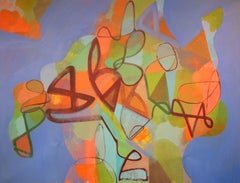
I Dreamt I Met Charles Atlas, Painting, Acrylic on Canvas
By Hal Mayforth
Located in Yardley, PA
Loose thick and thin abstract brushstrokes of browns, and green interspersed with passages of reds, oranges, greens and blues, on a background of vivid blue. I see a body builder her...
Category
2010s Abstract Abstract Paintings
Materials
Acrylic
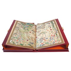
Atlas Miller, One-Time Only Limited Facsimile Edition of the Atlas of 1519
Located in BARCELONA, ES
Atlas Miller, devised as a present from Manuel I of Portugal to fool Emperor Charles I, made by
Category
Early 2000s Portuguese Renaissance Books
Materials
Leather
Free Shipping
H 23.63 in W 16.54 in D 1.97 in
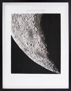
POSIDONIUS_ATLAS_CORNE BORÉALE. - Héliogravure of the Moon's Surface
Located in London, GB
Héliogravure after photographs by Loewy and Puiseux depicting the Moon’s surface, from Atlas
Category
1890s Naturalistic Black and White Photography
Materials
Other Medium
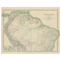
Exploring South America's North: Antique Map from the Royal Atlas of 1909
Located in Langweer, NL
Isles and Lima Callao. It is sourced from the 'Royal Atlas of Modern Geography,' which was published by
Category
Early 20th Century Maps
Materials
Paper
H 19.49 in W 24.41 in D 0.02 in
Antique Map of France under the Reign of Charles VII by Zannoni, 1765
Located in Langweer, NL
Antique map France titled 'La France sous le Règne de Charles VII (..)'.
Beautiful old map of
Category
Antique 18th Century Maps
Materials
Paper
Antique Map of France under the Reign of Charles IX by Zannoni, 1765
Located in Langweer, NL
Antique map France titled 'Tableau du Domaine sous Charles IX (..)'. Beautiful old map of France
Category
Antique 18th Century Maps
Materials
Paper
Antique Map of France under the reign of Charles VII by Zannoni, 1765
Located in Langweer, NL
map originates from 'Atlas Historique de la France Ancienne et Moderne' by M. Rizzi Zannoni. Artists
Category
Antique 18th Century Maps
Materials
Paper
Cosmgraphy and Astrology, 1686 by Richard Blome from the First Edition
By Richard Blome
Located in BUNGAY, SUFFOLK
new folio world atlas, the first in over 60 years to publish a new set of folio county maps, the first
Category
Antique 1680s English Charles II Decorative Art
Materials
Paper
H 16.34 in W 10.44 in D 0.04 in
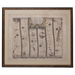
Road Map Britannia No 32 the Road from London to Barnstable John Ogilby Framed
By John Ogilby
Located in BUNGAY, SUFFOLK
A road map from Britannia, by John Ogilby Esq., Cosmographer and Geographick Printer to Charles II
Category
Antique Late 17th Century English Charles II Maps
Materials
Paper
H 20.48 in W 24.41 in D 0.6 in
Road Map No43 London to Kings Lynn, Royston to Downham, John Ogilby, Britannia
By John Ogilby
Located in BUNGAY, SUFFOLK
John Ogilby (British 1600-1676) Cosmographer and Geographick Printer to Charles II.
A road map
Category
Antique Late 17th Century British Charles II Maps
Materials
Paper
H 20.48 in W 24.41 in D 0.4 in
Road Map Britannia No 25 London to the Lands End, John Ogilby Brown Gilded Frame
By John Ogilby
Located in BUNGAY, SUFFOLK
Earl of Strafford, Charles I's most senior minister. Ever one to exploit his contacts, Ogilby became a
Category
Antique Late 17th Century British Charles II Maps
Materials
Paper
H 22.05 in W 26.19 in D 0.6 in
Road Map Britannia No 15 London to St Davids John Ogilby Brown Gilt Frame
By John Ogilby
Located in BUNGAY, SUFFOLK
Earl of Strafford, Charles I's most senior minister. Ever one to exploit his contacts, Ogilby became a
Category
Antique Late 17th Century British Charles II Maps
Materials
Paper
H 22.05 in W 26.19 in D 0.6 in
Road Map Britannia 1675/6 No 5 Road London to Barwick, London Stilton Grey Frame
By John Ogilby
Located in BUNGAY, SUFFOLK
John Ogilby (British 1600-1676) cosmographer and geographick printer to Charles II.
A road map from
Category
Antique Late 17th Century British Charles II Maps
Materials
Paper
H 22.84 in W 25.99 in D 0.4 in
18th Century Cartographic Depiction of Upper India and Ceylon, 1835
Located in Langweer, NL
,' masterfully crafted by the renowned 18th-century French cartographer, Charles Marie Rigobert Bonne. This pair
Category
Antique 1830s Maps
Materials
Paper
Free Shipping
H 10.04 in W 14.57 in D 0 in
Antique Colourful and Decorative County Map of Bedfordshire, England, 1804
Located in Langweer, NL
include Bedford, Todington, and Potton.
Charles Smith was a cartographer working in London from circa
Category
Antique Early 1800s Maps
Materials
Paper
H 25.2 in W 21.26 in D 0 in
Antique Hand-Colored County Map of Rutland, England, 1804
Located in Langweer, NL
include Oakham, Uppingham, and Normanton.
Charles Smith was a cartographer working in London from circa
Category
Antique Early 1800s Maps
Materials
Paper
18th-century signs of the zodiac - Gemini
Located in London, GB
chart from the Atlas Coelestis, the largest and most accurate star atlas published up to that time
Category
1750s Naturalistic Figurative Prints
Materials
Watercolor, Engraving
18th-century celestial - Pegasus
Located in London, GB
the Atlas Coelestis, the largest and most accurate star atlas published up to that time.
Charles II
Category
1750s Naturalistic Figurative Prints
Materials
Watercolor, Engraving
18th-century celestial - Cetus
Located in London, GB
the Atlas Coelestis, the largest and most accurate star atlas published up to that time.
Charles II
Category
1750s Naturalistic Figurative Prints
Materials
Watercolor, Engraving
18th-century celestial - Andromeda Perseus Triangulum
Located in London, GB
fine star chart from the Atlas Coelestis, the largest and most accurate star atlas published up to that
Category
1750s Naturalistic Figurative Prints
Materials
Watercolor, Engraving
H 26.58 in W 32.29 in D 1.58 in
18th-century celestial - Hydra Crater Corvus Sextans Virgo
Located in London, GB
.
A fine star chart from the Atlas Coelestis, the largest and most accurate star atlas published up to
Category
1750s Naturalistic Figurative Prints
Materials
Watercolor, Engraving
H 26.58 in W 47.05 in D 1.58 in
18th-century celestial - Eridanus Orion Lepus
Located in London, GB
star chart from the Atlas Coelestis, the largest and most accurate star atlas published up to that time
Category
1750s Naturalistic Figurative Prints
Materials
Watercolor, Engraving
18th-century celestial - Lyra Cygnus Lacerta Vulpec & Anser Sagitta
Located in London, GB
. Nourse, 1753.
A fine star chart from the Atlas Coelestis, the largest and most accurate star atlas
Category
1750s Naturalistic Figurative Prints
Materials
Watercolor, Engraving
H 26.78 in W 31.62 in D 1.58 in
18th-century celestial - Cassiopea Cephus Ursa Minor Draco
Located in London, GB
.
A fine star chart from the Atlas Coelestis, the largest and most accurate star atlas published up to
Category
1750s Naturalistic Figurative Prints
Materials
Watercolor, Engraving
H 26.78 in W 33.75 in D 1.58 in
18th-century celestial - Camelopardal & Auriga
Located in London, GB
the Atlas Coelestis, the largest and most accurate star atlas published up to that time.
Charles II
Category
1750s Naturalistic Figurative Prints
Materials
Watercolor, Engraving
18th-century celestial - Aquila Sagitta.Vulpecula & Anser Delphinus
Located in London, GB
the second edition of Flamsteed’s Atlas Coelestis.
Framed and glazed, overall size: 80.3 x 68 cm x
Category
Mid-18th Century Naturalistic Figurative Prints
Materials
Watercolor, Gouache
H 26.78 in W 31.62 in D 1.58 in
Antique County Map of Monmouthshire, England, circa 1804
Located in Langweer, NL
illustrated include Newport, Chepstow, Rockfield, and Pontypool.
Charles Smith was a cartographer working
Category
Antique Early 1800s Maps
Materials
Paper
Antique County Map of Derbyshire, England, 1804
Located in Langweer, NL
illustrated include Chesterfield, Wirksworth, Derby, and Stanton.
Charles Smith was a cartographer working
Category
Antique Early 1800s Maps
Materials
Paper
eighteenth century sign of the zodiac - Libra
Located in London, GB
the Atlas Coelestis, the largest and most accurate star atlas published up to that time.
Charles II
Category
1750s Naturalistic Prints and Multiples
Materials
Watercolor, Engraving
eighteenth century sign of the zodiac - Aries
Located in London, GB
Atlas Coelestis, the largest and most accurate star atlas published up to that time.
Charles II founded
Category
1750s Naturalistic Prints and Multiples
Materials
Watercolor, Engraving
Original Hand-Colored Antique Map of the County of Hereford in England, 1804
Located in Langweer, NL
Avenbury, Ashpurton, Kineton, and Bromyard.
Charles Smith was a cartographer working in London from
Category
Antique Early 19th Century Maps
Materials
Paper
H 25.2 in W 21.26 in D 0.02 in
Antique Decorative Map of The County of Nottinghamshire, England, 1804
Located in Langweer, NL
illustrated include Worksop, Neware, Tuxford, and Maplebeck.
Charles Smith was a cartographer working in
Category
Antique Early 1800s Maps
Materials
Paper
H 25.2 in W 21.26 in D 0.02 in
Original Hand-Colored Antique County Map of Durham, England, 1804
Located in Langweer, NL
include Gateshead, South Shields, and Darlington.
Charles Smith was a cartographer working in London
Category
Antique Early 1800s Maps
Materials
Paper
No Reserve
H 21.26 in W 25.2 in D 0 in
A Louis XIV Style Bureau Plat By Cueunières, Paris, After the Model by Cressent
By L. Cueunieres Ebeniste.
Located in Brighton, West Sussex
by Charles Cressent.
Stamped to underside 'L. CUEUNIERES JNE / ÉBÉNISTE'
The original gilt
Category
Antique 19th Century French Louis XIV Desks
Materials
Ormolu
H 31.89 in W 73.04 in D 37.01 in
Mid 19th Century French Globe on Carved Walnut Base Signed Ch. Perigot, Paris
Located in Dallas, TX
part (see detailed image).
Charles Auguste Perigot (1828-1885) was a French geographer and historian
Category
Antique Mid-19th Century French Globes
Materials
Brass
An extremely rare pair of miniature globes by Johann Baptist Homann
By Johann Baptist Homann
Located in ZWIJNDRECHT, NL
appointed Imperial Geographer to Charles VI in 1715 and became the most important map and atlas producer in
Category
Antique 1710s German Dutch Colonial Globes
Materials
Other
Antique Map of North Africa and South Africa by Black, 1854
Located in Langweer, NL
Morocco, Algeria and South Africa. This map orginates from 'General Atlas Of The World: Containing Upwards
Category
Antique 19th Century Maps
Materials
Paper
Antique Chart with Isomagnetic Lines by Black, 1854
Located in Langweer, NL
continents, except for North America. This map orginates from 'General Atlas Of The World: Containing Upwards
Category
Antique 19th Century Prints
Materials
Paper
Religious Antique Map of the Twelve Tribes of Israel, circa 1750
Located in Langweer, NL
Homann Heirs for the Maior Atlas Superiore following the cartography of the theologian Johann Christoph
Category
Antique Mid-18th Century Maps
Materials
Paper
Free Shipping
H 20.32 in W 25.04 in D 0.02 in
Map of Oxfordshire coloured 18th century engraving by Thomas Kitchin
By Thomas Kitchin
Located in London, GB
trappings like rolls of parchment. The cartouche in the upper right corner dedicates the map to Charles
Category
1760s Landscape Prints
Materials
Engraving
Original Antique Map of Malabar, Coromandel 'India' and Ceylon
Located in Langweer, NL
as a leading German cartographer, and in 1715 was appointed Imperial Geographer by Emperor Charles VI
Category
Antique Mid-18th Century Maps
Materials
Paper
City View of Nuremberg, Germany: An 18th Century Hand-Colored Map by M. Seutter
By Matthew Seutter
Located in Alamo, CA
des Heiligen Römischen Reichs Freyen Stadt Nürnberg" by Matthaus Seutter from his "Atlas novus sive
Category
Antique Mid-18th Century German Maps
Materials
Paper
H 22 in W 24.25 in D 0.13 in
Antique Map of Saxony, Germany
Located in Langweer, NL
'Atlas Novus Terrarum Orbis Imperia Regna et Status Exactis Fabulis Geographice Demonstrans'. Published
Category
Antique Early 18th Century Maps
Materials
Paper
1955 "Quaternary: Ice-Age Landscape" Woolly Mammoth Vintage Wall Hanging
Located in Colorado Springs, CO
paleoartists Rudolph Ballinger and Charles R. Knight.
Black and white versions of Zerritsch’s original
Category
Vintage 1950s Austrian Mid-Century Modern Prints
Materials
Metal
Vintage Moroccan Beni Ourain Beige Wool Floor Rug
Located in Detroit, MI
.
Handcrafted by women artisans from the Middle Atlas Mountain region of Morocco, Beni Ourain rugs were
Category
Late 20th Century Moroccan Tribal Moroccan and North African Rugs
Materials
Wool
Ireland
By John Senex
Located in London, GB
mapmakers over the course of his career, including Jeremiah Seller and Charles Price. In 1728, Senex was
Category
1710s More Art
Materials
Engraving
Antique Map of Oceania by Delamarche, 1836
Located in Langweer, NL
from 'Atlas de la Geographie Ancienne, du Moyen-age et Moderne', by Felix Delamarche. Artists and
Category
Antique 19th Century Maps
Materials
Paper
Antique Decorative and Detailed County Map of Cumberland, England, 1804
Located in Langweer, NL
include Carlisle, Penrith, Copeland Forest, and Wigton.
Charles Smith was a cartographer working in
Category
Antique Early 1800s Maps
Materials
Paper
Antique Decorative County Map of Lincolnshire, England, 1804
Located in Langweer, NL
, Spalding, Boston, and Market Raisin.
Charles Smith was a cartographer working in London from circa 1800
Category
Antique Early 1800s Maps
Materials
Paper
Antique County Map of Leicestershire, England, 1804
Located in Langweer, NL
illustrated include Lutterworth, Ashby, Hinkley, and Market Harborough.
Charles Smith was a cartographer
Category
Antique Early 1800s Maps
Materials
Paper
Antique Decorative County Map of Huntingdonshire, England, 1804
Located in Langweer, NL
, Chesterton, Folkesworth, and Great Stewkeley.
Charles Smith was a cartographer working in London from
Category
Antique Early 1800s Maps
Materials
Paper
No Reserve
H 25.2 in W 21.26 in D 0 in
Vintage Beni Ourain Moroccan Rug, Mid-Century Modern Meets Tribal Enchantment
By Berber Tribes of Morocco
Located in Dallas, TX
Atlas Mountains of Morocco, skilled hands meticulously weave the captivating tales of Beni Ourain rugs
Category
Mid-20th Century Moroccan Bohemian Moroccan and North African Rugs
Materials
Wool
Senex Map of Castile, Leon & La Mancha in The Spanish Heartland, 1714
Located in Langweer, NL
Clavell and collaborated with notable mapmakers such as Jeremiah Seller and Charles Price. In 1728
Category
Antique Early 18th Century Maps
Materials
Paper
H 19.81 in W 26.89 in D 0.02 in
Superb, Large Map of British India, Chinese Empire, Indochina, Malaysia, 1860
Located in Langweer, NL
parts of Sumatra and Borneo. This large original antique map originates from: 'Atlas Universel Physique
Category
Antique 1860s Maps
Materials
Paper
H 22.8 in W 31.07 in D 0 in
Old Map of the Pacific, Incl Australia, Polynesia, Melanesia and Malaysia, 1872
Located in Langweer, NL
unexplored interior. Originates from Mitchell's 'New General Atlas'.
Artists and Engravers: Samuel Augustus
Category
Antique 1870s Maps
Materials
Paper
No Reserve
H 12.21 in W 15.16 in D 0 in
Vintage Beni Ourain Moroccan Rug, Mid-Century Modern Meets Tribal Enchantment
By Beni Ourain
Located in Dallas, TX
tribes nestled in the North-Eastern Middle Atlas Mountains of Morocco. Drawing inspiration from the
Category
Mid-20th Century Moroccan Mid-Century Modern Moroccan and North African ...
Materials
Wool
Vintage Beni Ourain Moroccan Rug, Mid-Century Modern Style Meets Tribal Allure
By Berber Tribes of Morocco
Located in Dallas, TX
nestled in the North-Eastern Middle Atlas Mountains of Morocco. Drawing inspiration from the rich weaving
Category
Mid-20th Century Moroccan Mid-Century Modern Moroccan and North African ...
Materials
Wool
Mid-19th Century French Terrestrial Globe with Brass Frame Signed Ch. Perigot
Located in Dallas, TX
.
Charles Auguste Perigot (1828-1885) was a French geographer and historian. He attended the Ecole Normale
Category
Antique Mid-19th Century French Napoleon III Globes
Materials
Brass
Antique Set 4 Sterling Silver Entree Dishes & Covers Finley & Taylor 1890 19th C
By Edgar Finley & Hugh Taylor
Located in London, GB
Charles Street, Birmingham, with London showrooms at 41 Hatton Garden. In 1859, Joseph Hirons left the
Category
Antique 1890s English Sterling Silver
Materials
Sterling Silver
H 5.71 in W 12.01 in D 8.86 in
Salsta Castle in Pastoral Uppland, Sweden: A Dahlberg Engraving, 1694
Located in Langweer, NL
in Lena parish, Uppsala, Uppland. Created as part of the renowned Swedish Atlas by Erik Dahlberg, the
Category
Antique Late 17th Century Prints
Materials
Paper
Free Shipping
H 13.59 in W 17.72 in D 0 in
- 1
Get Updated with New Arrivals
Save "Charles Atlas", and we’ll notify you when there are new listings in this category.
Charles Atlas For Sale on 1stDibs
On 1stDibs, you can find the most appropriate charles atlas for your needs in our varied inventory. Find Pop Art versions now, or shop for Pop Art creations for a more modern example of these cherished works. You’re likely to find the perfect charles atlas among the distinctive items we have available, which includes versions made as long ago as the 18th Century as well as those made as recently as the 21st Century. When looking for the right charles atlas for your space, you can search on 1stDibs by color — popular works were created in bold and neutral palettes with elements of beige, white, gray and orange. A charles atlas from Stefanie Schneider, Doug Bloodworth, Johann Baptist Homann, Johann Gabriel Doppelmayr and Mark Schiff — each of whom created distinctive versions of this kind of work — is worth considering. These artworks were handmade with extraordinary care, with artists most often working in polaroid, paper and c print.
How Much is a Charles Atlas?
A charles atlas can differ in price owing to various characteristics — the average selling price for items in our inventory is $386, while the lowest priced sells for $98 and the highest can go for as much as $125,000.
More Ways To Browse
Hermes Heir
Loewy Moon
Spare Parts Stefanie
Stefanie Schneider Spare Parts
Native American Tribes Map
Map Of Native American Tribes
New Delisle
Durham Antique Map
Sandy Murphy
Mercurius Hermes
Cloud Atlas
Moravia Map
Maison Delisle
Charles Vyse
Antique Map Cornwall
Nicholas I Bust
Lincolnshire Antique Map
Antique Maps Cornwall
