Frontier Map
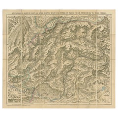
Antique Map of the North-West Frontier by Stanford, 1895
By E. Stanford
Located in Langweer, NL
Antique map titled 'Stanford's Sketch Map of the North West Frontier of India from Peshawar to the
Category
Antique Late 19th Century Maps
Materials
Linen, Paper
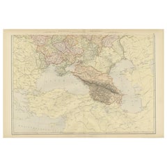
Imperial Frontiers: A 19th Century Map of Southern Russia and the Caucasus, 1882
Located in Langweer, NL
This map, sourced from the comprehensive 1882 atlas by Blackie & Son, delineates the southern part
Category
Antique 1880s Maps
Materials
Paper
No Reserve
H 14.97 in W 22.45 in D 0 in
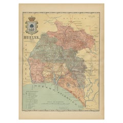
Huelva 1901: A Cartographic Presentation of Andalusia's Atlantic Frontier
Located in Langweer, NL
The map displays the province of Huelva, located in the southwestern part of the autonomous
Category
Antique Early 1900s Maps
Materials
Paper
Free Shipping
H 20.08 in W 14.77 in D 0 in
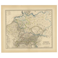
Roman Frontiers Engraved: Germania, Raetia, and Noricum, Published in 1880
Located in Langweer, NL
frontier regions, which were critical for defense and the expansion of Roman influence.
The map was part
Category
Antique 1880s Maps
Materials
Paper
No Reserve
H 15.56 in W 18.51 in D 0 in
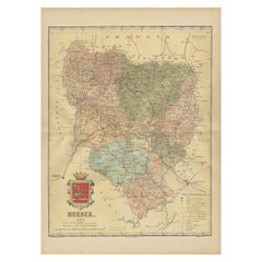
Huesca 1901: A Geographic Overview of Aragon's Northern Frontier in Spain
Located in Langweer, NL
The map provided is of the province of Huesca, located in the northeastern part of Spain, within
Category
Antique Early 1900s Maps
Materials
Paper
Free Shipping
H 20.08 in W 14.77 in D 0 in
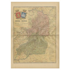
Beira Baixa: A Cartographic Portrait of Portugal's Historic Frontier in 1903
Located in Langweer, NL
The uploaded image is a historical map of the Beira Baixa region in Portugal. The map details the
Category
Antique Early 1900s Maps
Materials
Paper
Free Shipping
H 20.08 in W 14.77 in D 0 in
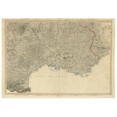
Striking Large Format Antique Map of Southeastern France, 1799
Located in Langweer, NL
Antique map titled 'The South Eastern Part of France which includes Roussillon-Languedoc, with a
Category
Antique 1790s Maps
Materials
Paper
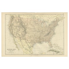
Antique Map of The United States of North America, 1882
Located in Langweer, NL
This is a historical map titled "The United States of North America, Central Part" from the 1882
Category
Antique 1880s Maps
Materials
Paper
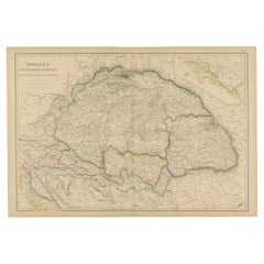
Antique Map of Hungary, Transylvania and Dalmatia by W. G. Blackie, 1859
Located in Langweer, NL
(Romania), Dalmatia (Croatia) and the Military Frontiers (Croatia, Slavonia & Banat) with inset map of
Category
Antique Mid-19th Century Maps
Materials
Paper
H 14.57 in W 21.26 in D 0.02 in
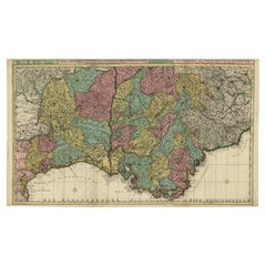
Map of Languedoc-Roussillon and Provence in France and Piedmont in Italy, c1680
Located in Langweer, NL
Title: Antique map titled 'La basse Partie du Gouvernement de Languedoc, environne des Frontiers
Category
Antique 1680s Maps
Materials
Paper
H 21.19 in W 35.83 in D 0 in
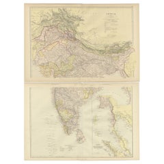
Cartographic Elegance: The British Raj's India, 1882 Atlas by Blackie and Son
Located in Langweer, NL
for the time.
The northern map includes the Himalayan frontier, with color-coded regions denoting
Category
Antique 1880s Maps
Materials
Paper
H 14.97 in W 22.45 in D 0 in
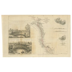
Traversing the Volcanic Frontier: A South Australian Expedition of 1844
Located in Langweer, NL
This is a historical document and part of a map and illustration from an expedition. The text
Category
Antique 1840s Prints
Materials
Paper
Free Shipping
H 8.39 in W 13.51 in D 0 in
Charting the West: Surveyor General Roe’s Western Australian Expedition , 1852
Located in Langweer, NL
This map is a historical document, focused on Western Australia. It illustrates the route of an
Category
Antique 1850s Prints
Materials
Paper
Free Shipping
H 8.47 in W 16.93 in D 0 in
Wall Sculpture Black Contemporary Geometric Totem Brutalist Wood Paper Pulp
By Las Animas
Located in Seville, ES
acquires that organic, malleable and sinuous appearance, as if it were a map of the terrain. It is not
Category
21st Century and Contemporary Spanish Modern Abstract Sculptures
Materials
Composition
H 27.56 in W 13.78 in D 3.55 in
Wall Sculpture White Contemporary Geometric Totem Brutalist Wood organic plaster
By Las Animas
Located in Seville, ES
, as if it were a map of the terrain. It does not pretend to be the reflection of a territory, nor a
Category
21st Century and Contemporary Spanish Modern Abstract Sculptures
Materials
Composition
H 27.56 in W 13.78 in D 3.55 in
Wall Sculpture Black Contemporary Geometric Totem Brutalist Wood Paper Pulp
By Las Animas
Located in Seville, ES
that organic, malleable and sinuous appearance, as if it were a map of the terrain. It is not intended
Category
21st Century and Contemporary Spanish Modern Abstract Sculptures
Materials
Composition
H 27.56 in W 13.78 in D 3.55 in
Wall Sculpture White Contemporary Geometric Totem Brutalist Wood Organic Plaster
By Las Animas
Located in Seville, ES
, as if it were a map of the terrain. It does not pretend to be the reflection of a territory, nor a
Category
21st Century and Contemporary Spanish Modern Abstract Sculptures
Materials
Composition
H 27.56 in W 13.78 in D 3.55 in
Wall Sculpture Black Contemporary Geometric Totem Brutalist Wood Paper Pulp
By Las Animas
Located in Seville, ES
that organic, malleable and sinuous appearance, as if it were a map of the terrain. It is not intended
Category
21st Century and Contemporary Spanish Modern Abstract Sculptures
Materials
Composition
H 27.56 in W 13.78 in D 3.55 in
A History of the American People, Signed by Woodrow Wilson, Alumni Edition #29 o
Located in Colorado Springs, CO
, and is profusely illustrated throughout with hundreds of portraits, maps, and in-text illustrations
Category
Antique Early 1900s American Books
Materials
Paper
H 11.25 in W 11 in D 7.25 in
Pair Plateau Parfleche Packets
By Plateau Indians
Located in Coeur d'Alene, ID
that were maps, geographical depictions such as rivers and mountains, or symbols that told the family’s
Category
Antique Early 1900s American Native American Native American Objects
Materials
Other
Recent Sales
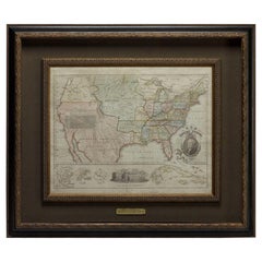
1828 "Map of the United States" by T. Ensign
Located in Colorado Springs, CO
Presented is Timothy Ensign’s “Map of the United States,” published in 1828. The map is one of the
Category
Antique 1820s American Maps
Materials
Paper
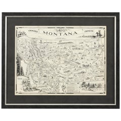
1937 Pictorial Map of Montana by Irvin Shope
Located in Colorado Springs, CO
Presented is a pictorial map of Montana by Irvin Shope. The map was published by the Montana State
Category
Vintage 1930s Maps
Roosevelt's "The Winning of the West, " "American Ideals" and "Wilderness Hunter"
Located in Colorado Springs, CO
the trans- Appalachian frontier from the French and Indian War through the end of the 18th century
Category
Antique Early 1900s Books
Get Updated with New Arrivals
Save "Frontier Map", and we’ll notify you when there are new listings in this category.
Frontier Map For Sale on 1stDibs
With a vast inventory of beautiful furniture at 1stDibs, we’ve got just the frontier map you’re looking for. Frequently made of paper, composition and masonite, every frontier map was constructed with great care. If you’re shopping for a frontier map, we have 7 options in-stock, while there are 3 modern editions to choose from as well. Your living room may not be complete without a frontier map — find older editions for sale from the 18th Century and newer versions made as recently as the 21st Century. Each frontier map bearing modern hallmarks is very popular. A well-made frontier map has long been a part of the offerings for many furniture designers and manufacturers, but those produced by Las Animas and Plateau Indians are consistently popular.
How Much is a Frontier Map?
A frontier map can differ in price owing to various characteristics — the average selling price 1stDibs is $3,603, while the lowest priced sells for $220 and the highest can go for as much as $16,945.
More Ways To Browse
Antique Mediterranean Map
Antique Maps Of Boston
Antique Map Of Boston
Oregon Trail
Flat Map
Ghana Paintings
Mississippi Map
Adams Mirrors Antique
Indian Containers
Stanford Antique Furniture
Antique Florida Maps
Antique Maps Florida
Antique Map Florida
Antique Florida Map
Set Four Maps
Antique Furniture Iowa
Antique Mirror Canada
Antique Mirrors Canada
