Georgia Map

12
123
3
to
12
95
30
126
126
126
61
4
3
3
1
1
1
1
57
54
12
3
1
5
4
1
1
1
1
1
1
1
88
30
11
10
7
81
73
58
12
12
3
3
2
2
2
Sort By
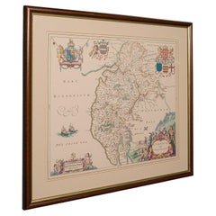
Antique Lithography Map, Cumbria, English, Framed Cartography Interest, Georgian
Located in Hele, Devon, GB
This is an antique lithography map of Cumbria. An English, framed engraving of cartographic
Category

Antique Early 18th Century British Georgian Maps

Materials

Wood

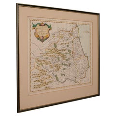
Antique Lithography Map, Durham, English, Framed, Cartography, Early Georgian
Located in Hele, Devon, GB
This is an antique lithography map of Durham. An English, framed engraving of cartographic interest
Category

Antique Early 18th Century British Georgian Maps

Materials

Wood

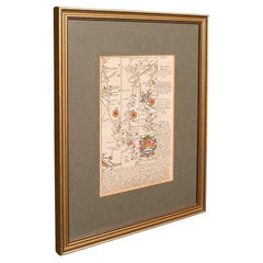
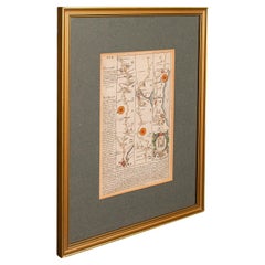
Antique Coaching Road Map, South Devon, English, Framed, Cartography, Georgian
Located in Hele, Devon, GB
quality antique coaching road map of South Devon, with fine cartographic interest to the quality Georgian
Category

Antique Early 18th Century British Georgian Maps

Materials

Wood

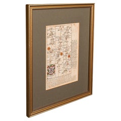
Antique Coaching Road Map, Devon, English, Regional Cartography, Georgian, 1720
Located in Hele, Devon, GB
This is an antique coaching road map of Devon. An English, framed lithograph engraving of regional
Category

Antique Early 18th Century British Georgian Maps

Materials

Wood

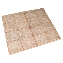
Antique Folding London Map, English, Cartography, Historic, Georgian, Dated 1783
Located in Hele, Devon, GB
This is an antique folding London map. An English, paper on linen cartographical study of the
Category

Antique Late 18th Century British Georgian Maps

Materials

Linen, Paper

Antique Coach Road Map, East Devon, English, Framed, Cartography, Georgian, 1720
Located in Hele, Devon, GB
map of East Devon, with fine cartographic interest to the quality Georgian lithography. Delivered
Category

Antique Early 18th Century British Georgian Maps

Materials

Wood

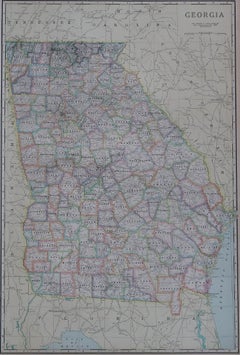
Large Original Antique Map of Georgia, USA, circa 1900
Located in St Annes, Lancashire
Fabulous map of Georgia Original color Engraved and printed by the George F. Cram Company
Category

Antique 1890s American Maps

Materials

Paper

Antique Map of Georgia and Alabama by Johnson, 1872
Located in Langweer, NL
Antique map titled 'Johnson's Georgia and Alabama'. Original map of Georgia and Alabama. This map
Category

Antique Late 19th Century Maps

Materials

Paper

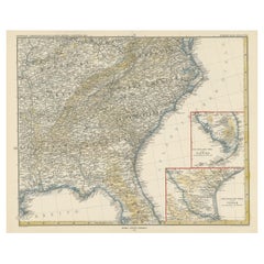
Antique Map of the Region of Georgia with Inset Maps of Florida and Texas
Located in Langweer, NL
Antique map of part of the United States showing Alabama, Georgia, North Carolina, South Carolina
Category

Antique Late 19th Century Maps

Materials

Paper

Antique Map of Persia, Georgia and Kazakhstan, ca.1780
Located in Langweer, NL
Persia, Georgia and Kazakhstan. This map shows current days Georgia, Iran, Irak, Kazakhstan, Armenia
Category

Antique 1780s Maps

Materials

Paper

Antique Map of Tennessee, Kentucky, Virginia, Alabama, Georgia and Surroundings
Located in Langweer, NL
Antique map of part of the United States showing Alabama, Georgia, North Carolina, South Carolina
Category

Antique Mid-19th Century Maps

Materials

Paper

Antique Map of Persia, Georgia and Kazakhstan by Bonne, c.1780
Located in Langweer, NL
Persia, Georgia and Kazakhstan. This map shows current days Georgia, Iran, Irak, Kazakhstan, Armenia
Category

Antique 18th Century Maps

Materials

Paper

French Framed Copper Engraved Hand Colored Map of Carolina & Georgia, Circa 1757
Located in Hollywood, SC
French copper engraved hand colored map of Carolina & Georgia matted under glass with a painted
Category

Antique 1750s French Louis XV Maps

Materials

Glass, Wood, Paint, Paper

Map Bedfordshire General Framed
Located in BUNGAY, SUFFOLK
A general map of Bedfordshire with its hundreds A scale of 5 miles in the original green mount
Category

Antique 18th Century English Georgian Maps

Materials

Paper

Map Bedfordshire General Framed
H 36 in W 28 in D 2 in
Map Jersey Guernsey Scilly Islands Alderney
Located in BUNGAY, SUFFOLK
Rare map of The Islands of Guernsey and Jersey, including Alderney & the Scilly Islands just
Category

Antique 18th Century English Georgian Maps

Materials

Paper

Map Jersey Guernsey Scilly Islands Alderney
H 12.21 in W 14.18 in D 0.79 in
Map Bedfordshire No 3 General Framed
Located in BUNGAY, SUFFOLK
A general map of Bedfordshire with its hundreds. Measure: 37cm 14 1/2" high A scale of 5 miles
Category

Antique 18th Century English Georgian Maps

Materials

Paper

Map Bedfordshire No 3 General Framed
H 14.57 in W 12.21 in D 0.79 in
Map North Wales Robert Marsden Anglesey
Located in BUNGAY, SUFFOLK
Map of North Wales by Robert Marsden Including Anglesey Charming topography and detail and
Category

Antique 18th Century English Georgian Maps

Materials

Paper

Map North Wales Robert Marsden Anglesey
H 20.87 in W 23.23 in D 0.79 in
Original Antique Map of Asia. C.1780
Located in St Annes, Lancashire
Great map of Asia Copper-plate engraving Published C.1780 Two small worm holes to right side of
Category

Antique Early 1800s English Georgian Maps

Materials

Paper

Original Antique Map of Asia. C.1780
No Reserve
H 8.75 in W 12.25 in D 0.07 in
Original Antique Map of India. C.1780
Located in St Annes, Lancashire
Great map of India Copper-plate engraving Published C.1780 Three small worm holes to right
Category

Antique Early 1800s English Georgian Maps

Materials

Paper

Original Antique Map of India. C.1780
No Reserve
H 8.75 in W 12.5 in D 0.07 in
Original Antique Map of Italy. C.1780
Located in St Annes, Lancashire
Great map of Italy Copper-plate engraving Published C.1780 Unframed.
Category

Antique Early 1800s English Georgian Maps

Materials

Paper

Original Antique Map of Italy. C.1780
No Reserve
H 8.25 in W 12 in D 0.07 in
Map Kyle Carrick Aireshire Thomas Kitchen 1749
By Thomas Kitchin
Located in BUNGAY, SUFFOLK
A Map of Kyle & Carrick Aireshire Thomas Kitchen 1749 In original black and gold frame Just
Category

Antique 18th Century English Georgian Maps

Materials

Paper

Original Antique Map of South America. C.1780
Located in St Annes, Lancashire
Great map of South America Copper-plate engraving Published C.1780 Two small worm holes to left
Category

Antique Early 1800s English Georgian Maps

Materials

Paper

Original Antique Map of South America. C.1780
No Reserve
H 8.75 in W 12.75 in D 0.07 in
Map Suffolk Southwold Aldeburgh Dunwich Bawdsey Harwich Ipswich
Located in BUNGAY, SUFFOLK
Map Suffolk including many popular destinations on the coast Southwold, Dunwich, Aldeburgh bawdsey
Category

Antique 19th Century European Georgian Maps

Materials

Paper

Map Turkey in Europe & Hungary Thomas Kitchin, 1783
Located in BUNGAY, SUFFOLK
Thomas Kitchen (1718 - 1784) : Map of Turkey in Europe & Hungary 1783 Visible sheet within the
Category

Antique 18th Century English Georgian Maps

Materials

Paper

Map Southern Scotland Thomas Conder Alex Hogg 1795
Located in BUNGAY, SUFFOLK
A new map of the southern part of Scotland containing the counties of Stirling, Lanerk, Renfrew
Category

Antique 18th Century English Georgian Maps

Materials

Paper

Map Shropshire Joseph Ellis Robert Sayer Carington Bowles Framed
Located in BUNGAY, SUFFOLK
A modern map of Shropshire Drawn from the latest surveys corrected and improved by the best
Category

Antique 18th Century English Georgian Maps

Materials

Paper

Map Wiltshire Joshua Archer Pentonville London framed 35cm 14" high
Located in BUNGAY, SUFFOLK
Map of Wiltshire Drawn & Engraved by Joshua Archer Pentonville London Window Parts of Wiltshire in
Category

Antique 19th Century English Georgian Maps

Materials

Paper

Map Berkshire C&J Greenwood Windsor Castle JDower Polling Hundreds
Located in BUNGAY, SUFFOLK
Map of the County of Berkshire from an Actual Survey made in the Years 1822 & 1823 by C&J Greenwood
Category

Antique 19th Century English Georgian Maps

Materials

Paper

New Map of North America from the Latest Discoveries, 1763
Located in Philadelphia, PA
A fine antique 18th century map of the North American seaboard. Entitled "A New Map of North
Category

Antique Mid-18th Century English Georgian Maps

Materials

Paper

Staffordshire 1645 Hand Colored Antique Print Staffordiensis Comitatvs Map
Located in GB
We are delighted to offer for sale this lovely antique Atlas page map of Staffordshire printed in
Category

Antique Early 1800s English Georgian Maps

Materials

Paper

Map Lancashire 1793 John Cary engraver 37cm 14 1/2" high
Located in BUNGAY, SUFFOLK
Map of Lancashire by John Cary engraver published 1st Jan 1793 by J Cary Engraver & Mapseller
Category

Antique 18th Century English Georgian Maps

Materials

Paper

Large Original Antique Folding Map of Manchester, England, Dated 1793
Located in St Annes, Lancashire
Superb map of Manchester and Salford Folding map. Printed on paper laid on to the original
Category

Antique 1790s English Georgian Maps

Materials

Canvas, Paper

Large Scale Antique Scroll Map of Lincolnshire, England, Dated 1778
Located in St Annes, Lancashire
Wonderful scroll map of Lincolnshire By Captain Armstrong, 1778 Copper plate engraving on
Category

Antique 1770s English Georgian Maps

Materials

Wood, Paper

Double Sided Northamptonshire 1645 Hand Colored Antique Print Map Rare Find
Located in GB
We are delighted to this lovely antique Atlas page map of Northamptonshire printed in 1645
Category

Antique Early 1800s English Georgian Maps

Materials

Paper

Map Silk Embroidered Western Eastern Hemisphere New Old World Asia America Afri
Located in BUNGAY, SUFFOLK
A rare, late-18th century, silk, embroidered, double hemisphere, world map, blackwork, sampler
Category

Antique 18th Century British Georgian Maps

Materials

Silk

Double Sided and Glazed Cheshire 1645 Hand Colored Antique Print Map Rare Find
Located in GB
We are delighted to offer for sale this lovely antique Atlas page map of Cheshire printed in 1645
Category

Antique Early 1800s English Georgian Maps

Materials

Paper

Antique Map of Turkey in Asia by Lowry '1852'
Located in Langweer, NL
Antique map titled 'Turkey in Asia, Georgia & Western Persia'. Two individual sheets of Turkey in
Category

Antique Mid-19th Century Maps

Materials

Paper

Antique Map of Turkey in Asia by Lowry '1852'
H 12.21 in W 9.65 in D 0.02 in
Historical Map of the Black Sea and Surrounding Regions, 1705
Located in Langweer, NL
Title: "Map of Turcomania, Georgia, and Comania" This print presents an intricately detailed map
Category

Antique Early 1700s Maps

Materials

Paper

Black Sea in Antiquity: Pontus Euxinus Map, Published in 1880
Located in Langweer, NL
This map, titled "PONTUS EUXINUS," depicts the Black Sea region, historically known as the Pontus
Category

Antique 1880s Maps

Materials

Paper

Black Sea in Antiquity: Pontus Euxinus Map, Published in 1880
Free Shipping
H 15.56 in W 18.51 in D 0 in
Detailed Original Antique Map of the Turkish Empire with Arabia, 1778
Located in Langweer, NL
. . . 1753 Detailed map of the Turkish Empire, extending to the Black Sea, Georgia, the Caspian
Category

Antique 1770s Maps

Materials

Paper

Mid 19th Century Map of the Black Sea with Decorative Vignettes, 1851
Located in Langweer, NL
Map of the Black Sea and contingent lands, including Turkey, Russia, Georgia, Azerbaijan, Bulgaria
Category

Antique Mid-19th Century Maps

Materials

Paper

Imperial Frontiers: A 19th Century Map of Southern Russia and the Caucasus, 1882
Located in Langweer, NL
This map, sourced from the comprehensive 1882 atlas by Blackie & Son, delineates the southern part
Category

Antique 1880s Maps

Materials

Paper

Detailed Antique Map of the Southern Part of European Russia and Ukraine, 1752
Located in Langweer, NL
Antique map titled 'Partie meridionale de la Russie Européenne'. Detailed map of the southern
Category

Antique 1750s Maps

Materials

Paper

Hand-Colored 18th Century Homann Map of the Black Sea, Turkey and Asia Minor
By Johann Baptist Homann
Located in Alamo, CA
An attractive original early 18th century hand-colored map of the Black Sea and Turkey entitled
Category

Antique Early 18th Century German Maps

Materials

Paper

Old Antique of the Southern Georgia and the Sandwich Islands by Capt Cook, 1803
Located in Langweer, NL
Antique map Atlantic titled 'Kaart van de Ontdekkingen gedaan in den Zuider Atlantischen Oceaan
Category

Antique Early 1800s Maps

Materials

Paper

Essex John Cary 1787 Cary's New & Correct English Atlas 40cm 16" long gilt frame
By John Cary
Located in BUNGAY, SUFFOLK
Map of Essex by John Cary Engraver London published as the act directs Sept 1st 1787 by J Cary
Category

Antique 18th Century English Georgian Maps

Materials

Paper

Cambridgeshire J Cary
By John Cary
Located in BUNGAY, SUFFOLK
Cambridgeshire published may 1 1814 engraver no 181 strand Maker John Cary c. 1754 – 1835.
Category

Antique 19th Century English Georgian Maps

Materials

Paper

Cambridgeshire J Cary
H 8.67 in W 6.7 in D 0.6 in
Ancient Crossroads: Albania to Assyria in Antiquity, Published in 1880
Located in Langweer, NL
The map titled "ALBANIA, IBERIA, COLCHIS, ARMENIA, MESOPOTAMIA, BABYLONIA, ASSYRIA" portrays the
Category

Antique 1880s Maps

Materials

Paper

Pair of Fine Desk Globes by J. Cary, 1816 and 1824
Located in Amsterdam, NL
England’s leading firms of globe makers in the late Georgian period from the early 1790s until its closing
Category

Antique Early 19th Century Maps

Materials

Other

Pair of Fine Desk Globes by J. Cary, 1816 and 1824
Free Shipping
H 18.51 in W 17.33 in D 17.33 in
Antique Paterson's Guide to Britain, English, Maps, Georgian, Published 1811
Located in Hele, Devon, GB
English, bound book of maps and descriptive tables, published in English by Longman, Hurst et al, this
Category

Antique Early 19th Century British Georgian Books

Materials

Paper

Original Georgian / Regency Military Campaign Desk with Large Map Drawer
Located in GB
We are delighted to offer for sale this stunning circa 1800-1820 original Georgian / Regency
Category

Antique Early 1800s English Georgian Desks

Materials

Hardwood

Map of Indonesia, Semarang, Kartasoera, Soerabaya by Schley
By Jakob van der Schley
Located in Norwich, GB
' Map of the Road between Semarang and Kartasura by Van Schley. Published 1763. Semarang is the
Category

Antique 1760s Indonesian Georgian Prints

Materials

Paper

Jacques Nicolas Bellin, St Lucia, West Indies, Hand Colored Map
By Jacques-Nicolas Bellin
Located in Norwich, GB
Carte De L’Isle De Sainte Lucie Detailed copper engraved map of Saint Lucia by Jacques Nicolas
Category

Antique 1770s Dutch Georgian Prints

Materials

Paper

Original Vintage Soviet Propaganda Poster Great Buildings Of Communism Map USSR
Located in London, GB
map design with an illustration of the Moscow Kremlin and skyscrapers in the capital city linked by
Category

Vintage 1950s Russian Posters

Materials

Paper

Tom Lollar and Jane Manus "Map of Rome" Rectangular Coffee Table, 2010
By Thomas W. Lollar, Jane Manus
Located in New York, NY
Contemporary artists Tom Lollar and Jane Manus' "Map of Rome" Rectangular Coffee Table. Hand-carved
Category

21st Century and Contemporary American Modern Coffee and Cocktail Tables

Materials

Marble, Aluminum

Tom Lollar and Jane Manus "Map of Manhattan" Rectangular Coffee Table, 2010
By Thomas W. Lollar, Jane Manus
Located in New York, NY
Contemporary artists Tom Lollar and Jane Manus' "Map of Manhattan" Rectangular Coffee Table. Hand
Category

21st Century and Contemporary American Modern Coffee and Cocktail Tables

Materials

Marble, Aluminum

Limbus Fatu Orum Map of a Mechanical Opera by Jay Bolotin Woodcut Print, 1992
Located in Dayton, OH
Artist: Jay Bolotin, Georgia Nold, Mark Patsfall Graphics Title: Limbus Fatu’ orum: Map of a
Category

1990s Expressionist Prints

Materials

Paper

4 Vols Antique Botany Books, Flowers of Modern Voyages, English, Georgian, 1820
Located in Hele, Devon, GB
language botany record with maps, dating to the Georgian period, circa 1820. Full title: Flowers of Modern
Category

Antique Early 19th Century British Books

Materials

Paper

Vampyre, The Terrifying Lost Journal of Dr. Cornelius Van Helsing Book
Located in North Hollywood, CA
look inside (if you dare) and discover creepy evidence of true gothic horror--foldout maps, booklets of
Category

Late 20th Century Georgian Books

Materials

Paper

Antique 1798 James Colnett A Voyage to the South Atlantic & Round Cape Hope Book
Located in Hamilton, Ontario
done in the period Georgian style. The book contains several maps and folding charts of the voyage of
Category

Antique Late 18th Century English Georgian Books

Materials

Leather, Paper

  • 1
Get Updated with New Arrivals
Save "Georgia Map", and we’ll notify you when there are new listings in this category.

Georgia Map For Sale on 1stDibs

With a vast inventory of beautiful furniture at 1stDibs, we’ve got just the georgia map you’re looking for. A georgia map — often made from paper, fabric and wood — can elevate any home. There are many kinds of the georgia map you’re looking for, from those produced as long ago as the 18th Century to those made as recently as the 19th Century. When you’re browsing for the right georgia map, those designed in Georgian and Folk Art styles are of considerable interest.

How Much is a Georgia Map?

Prices for a georgia map can differ depending upon size, time period and other attributes — at 1stDibs, they begin at $137 and can go as high as $5,450, while the average can fetch as much as $714.

Read More

Pamela Shamshiri Shares the Secrets behind Her First-Ever Book and Its Effortlessly Cool Interiors

The sought-after designer worked with the team at Hoffman Creative to produce a monograph that beautifully showcases some of Studio Shamshiri's most inspiring projects.

Moroccan Artworks and Objects Take Center Stage in an Extraordinary Villa in Tangier

Italian writer and collector Umberto Pasti opens the doors to his remarkable cave of wonders in North Africa.

Montecito Has Drawn Royalty and Celebrities, and These Homes Are Proof of Its Allure

Hollywood A-listers, ex-pat aristocrats and art collectors and style setters of all stripes appreciate the allure of the coastal California hamlet — much on our minds after recent winter floods.

Whaam! Blam! Pow! — a New Book on Pop Art Packs a Punch

Publishing house Assouline and writer Julie Belcove have teamed up to trace the history of the genre, from Roy Lichtenstein, Andy Warhol and Yayoi Kusama to Mickalene Thomas and Jeff Koons.

The Sparkling Legacy of Tiffany & Co. Explained, One Jewel at a Time

A gorgeous new book celebrates — and memorializes — the iconic jeweler’s rich heritage.

What Makes a Gem-Encrusted Chess Set Worth $4 Million?

The world’s most opulent chess set, weighing in at 513 carats, is literally fit for a king and queen.

Tauba Auerbach’s Geometric Pop-Up Book Is Mighty Rare, Thanks to a Hurricane

This sculptural art book has an epic backstory of its own.

Step inside the Storied Mansions of Palm Beach’s Most Effervescent Architect

From Spanish-style courtyards to fanciful fountains, these acclaimed structures abound in surprising and elegant details.