Korean Map

4
66
1
to
17
54
8
67
66
66
1
1
35
18
13
1
1
8
2
1
1
4
54
6
4
2
2
7
6
6
5
4
1
1
Sort By
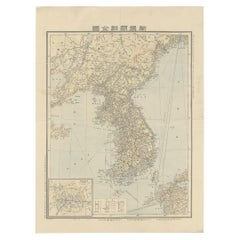
Antique Map of Korea by Kozaki, 1903
Located in Langweer, NL
Old map of Korea by S. Kozaki. Restored and mounted.
Category

20th Century Maps

Materials

Paper

Antique Map of Korea by Kozaki, 1903
H 24.81 in W 18.51 in D 0.02 in
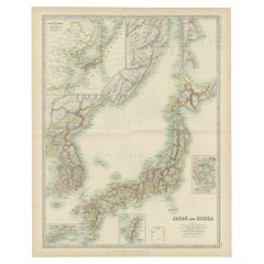
Antique Map of Japan and Korea by Johnston '1909'
Located in Langweer, NL
Antique map titled 'Japan and Korea'. Original antique map of Japan and Korea. With inset maps of
Category

Early 20th Century Maps

Materials

Paper

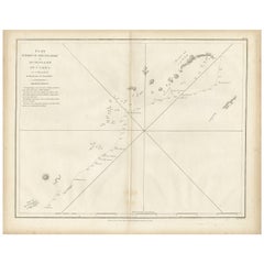
Antique Map of Part of the Korean Archipelago, 1798
Located in Langweer, NL
Antique map titled 'Plan of Part of the Islands or Archipellago of Corea'. This map depicts part of
Category

Antique Late 18th Century Maps

Materials

Paper

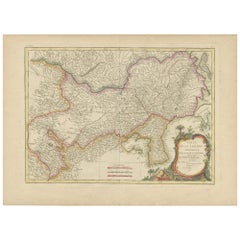
Antique Map of Korea and Southern China by Bonne '1771'
Located in Langweer, NL
Antique map titled 'Carte de la Tartarie Chinoise'. Original antique map of Korea and Southern
Category

Antique Mid-18th Century Maps

Materials

Paper

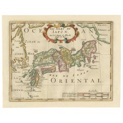
Antique Map of Japan and Korea by Sanson, 'c.1690'
Located in Langweer, NL
Antique map titled 'Les Iles du Iapon (..)'. Original antique map, with beautiful (later) hand
Category

Antique Late 17th Century Maps

Materials

Paper

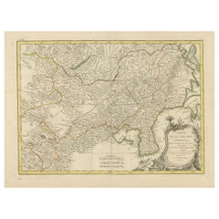
Original Old Map of Present-Day Mongolia, Northeast China and Korea
Located in Langweer, NL
Antique map titled 'Carte de la Tartarie Chinoise. Projettee et assujettie aux observations
Category

Antique Late 18th Century Maps

Materials

Paper

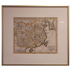
Antique Map of China Including Korea and Taiwan by Vaugondy, 1749
Located in Langweer, NL
Antique map titled 'Empire de la Chine'. Beautiful map of China including Korea and Taiwan (Formosa
Category

Antique Mid-18th Century Maps

Materials

Paper

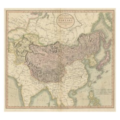
Antique Map of Chinese and Independent Tartary, Korea and Japan, 1806
Located in Langweer, NL
Antique map titled 'A New Map of Chinese & Independent Tartary'. Beautiful map of Chinese Tartary
Category

Antique 19th Century Maps

Materials

Paper

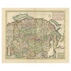
Antique Map of Northern Asia, with Russia, Korea and Northern Japan
Located in Langweer, NL
Antique map titled 'Nieuwe Kaart van Tartarie'. Map op Siberia and Chinese tartary. In the north
Category

Antique Mid-18th Century Maps

Materials

Paper

Rare Hand-Colored Antique Map of Tartary, China and Korea, ca.1741
Located in Langweer, NL
from the Particular Maps of the Jesuit Missionaries'. Rare antique map of Tartary, China and Korea
Category

Antique 1740s Maps

Materials

Paper

Antique Map of China, Korea, Japan and the Northern Philippines, circa 1780
Located in Langweer, NL
'. Interesting and detailed map of China, Korea, Japan and the Northern Philippines. Published circa 1780.
Category

Antique Late 18th Century Maps

Materials

Paper

Beautiful Antique Map of China and Korea by Famous Mapmaker Janssonius, c.1660
Located in Langweer, NL
Antique map titled 'Imperii Sinarum Nova Descriptio'. Beautiful map of China and Korea. This map
Category

Antique 17th Century Maps

Materials

Paper

Decorative Map of the Empire of China, Korea, Japan, Taiwan, Lucon, Macau, 1780
Located in Langweer, NL
Antique map titled 'Carte de L'Empire de la Chine.' Decorative map of the Empire of China
Category

Antique 1780s Maps

Materials

Paper

Antique Map of China, Also Depicting Formosa 'Taiwan' and Part of Korea, c.1840
Located in Langweer, NL
Antique map titled 'China'. Old map of China, also depicting Formosa (Taiwan) and part of Korea
Category

Antique 19th Century Maps

Materials

Paper

Antique Map of China and Korea incl Formosa and Hainan, by Janssonius, ca.1650
Located in Langweer, NL
Antique map titled 'Imperii Sinarum Nova Descriptio'. Beautiful map of China and Korea, much detail
Category

Antique 17th Century Maps

Materials

Paper

Rare Unusual Antique Map of Asia with a Landbridge from Korea to America, 1717
Located in Langweer, NL
Antique map titled 'L'Asie Suivant les Nouvelles Decouvertes (..).' Interesting and very unusual
Category

Antique 18th Century Maps

Materials

Paper

Original Old China Map, From Korea and the Sea of Japan to Teypin Island, 1803
Located in Langweer, NL
and the Tributary Kingdoms of Corea, Tonkin'. Old map depicting China, extending from Korea and
Category

Antique Early 1800s Maps

Materials

Paper

Antique Map of Asia and the East Indies and Korea as a Peninsula, ca.1660
Located in Langweer, NL
Antique map titled 'Asiae nova delineatio'. Decorative map of Asia and the East Indies. The map
Category

Antique 17th Century Maps

Materials

Paper

Antique Map of China by Wilkinson '1803'
Located in Langweer, NL
and the Tributary Kingdoms of Korea, Tonkin'. Old map depicting China, extending from Korea and the
Category

Antique Early 19th Century Maps

Materials

Paper

Antique Map of China by Wilkinson '1803'
H 10.24 in W 12.8 in D 0.02 in
1814 Map of "Russian Empire" Ric.r032
Located in Norton, MA
1814 Map of "Russian Empire" Ric.r032 Russian Empire. Description: This is an 1814 John
Category

Antique 19th Century Unknown Maps

Materials

Paper

1814 Map of "Russian Empire" Ric.r032
H 20.87 in W 24.81 in D 0.4 in
Antique Political Map of the Japanese Empire, 1922
Located in Langweer, NL
, Korea and surroundings. This map originates from 'The Times' atlas. Artists and Engravers: John
Category

20th Century Maps

Materials

Paper

Antique Map of Siberia and Russia, c.1885
Located in Langweer, NL
Antique map titled 'Siberie ou Russie d?Asie'. This is a fine example of J. Migeon's map of Russia
Category

Antique 19th Century Maps

Materials

Paper

Antique Map of Siberia and Russia, c.1885
H 13.39 in W 18.71 in D 0 in
Antique Map of North and East Asia, 1751
Located in Langweer, NL
maps on one sheet, showing California, Alaska and Siberia, Korea and Japan. South to Korea the island
Category

Antique 18th Century Maps

Materials

Paper

Antique Map of North and East Asia, 1751
H 18.35 in W 14.97 in D 0 in
Old Map of the Chinese Empire and Japan, 1882
Located in Langweer, NL
An original antique map titled "The Chinese Empire and Japan," dating from an 1882 atlas by Blackie
Category

Antique 1880s Maps

Materials

Paper

Old Map of the Chinese Empire and Japan, 1882
No Reserve
H 14.97 in W 22.45 in D 0 in
Antique Map of China and Japan by Tardieu, 1821
Located in Langweer, NL
Antique map titled 'Carte de la Chine et du Japon'. Detailed map of China, showing Korea, Japan and
Category

Antique Early 19th Century Maps

Materials

Paper

Antique Map of Asia by Pierre du Val, '1663'
Located in Langweer, NL
Antique map titled 'L'Asie'. Antique map of the Asian continent by Pierre Duval, dated 1663. Most
Category

Antique Mid-17th Century Maps

Materials

Paper

Antique Map of Asia by Pierre du Val, '1663'
H 16.15 in W 20.87 in D 0.02 in
Antique Map of Asia by A. Blondeau, circa 1800
Located in Langweer, NL
This is a fine circa 1800 map of Asia by Alexandre Blondeau. It covers the entire continent from
Category

Antique Early 19th Century Maps

Materials

Paper

Antique Map of Russia and Siberia by Migeon, 1880
Located in Langweer, NL
Antique map titled 'Sibérie ou Russie d'Asie'. Migeon's map covers the Russian empire in Asia from
Category

Antique 19th Century Maps

Materials

Paper

Original Antique Map Covering the Russian Empire in Asia, 1880
Located in Langweer, NL
Antique map titled 'Sibérie ou Russie d'Asie'. Migeon's map covers the Russian empire in Asia
Category

Antique 1880s Maps

Materials

Paper

Antique Map of Tartary, Also Showing the Great Wall of China
Located in Langweer, NL
Russia, Central Asia, China and Korea, first published by Guillaume De L'Isle in 1706. The map extends
Category

Antique Early 18th Century Maps

Materials

Paper

Antique Map of the Philippines and Guam by Scherer, circa 1702
Located in Langweer, NL
attractive map of the Mariana Islands, Philippines, Korea, Japan and Indonesia with an inset of the island
Category

Antique Early 18th Century Maps

Materials

Paper

Antique Map of the Bay of Terney by La Pérouse, 1797
Located in Langweer, NL
Antique map titled 'Plan de la Baie de Ternai'. Old map of the north eastern coast of Russia. This
Category

Antique 18th Century Maps

Materials

Paper

Antique Map of the Empire of China by Bonne, c.1780
By Rigobert Bonne
Located in Langweer, NL
Antique map titled 'Carte de L'Empire de la Chine.' Decorative map of the Empire of China
Category

Antique 18th Century Maps

Materials

Paper

Antique Map of North Europe and East Asia by Vaugondy, circa 1750
Located in Langweer, NL
Asia. Five maps on one sheet, showing California, Alaska and Syberia, Korea and Japan. South to Korea
Category

Antique Mid-18th Century Maps

Large Antique Map of Asia including All of Southeast Asia, c.1792
Located in Langweer, NL
Antique map titled 'L' Asie Divisee en ses Empires, Royaumes, et Etats'. Attractive, large map of
Category

Antique 18th Century Maps

Materials

Paper

Decorative Ancient World Map with Large Parts of the World Still Unknown, c 1731
Located in Langweer, NL
Interesting ancient map of the world, based upon Strabo. The Southern tip of Africa is undiscovered
Category

Antique 1730s Maps

Materials

Paper

Antique Map of China with insets the Island of Chusan and Canton River, c.1860
Located in Langweer, NL
Antique map titled 'China'. Large map of China, with insets the Island of Chusan, and the Estuary
Category

Antique 19th Century Maps

Materials

Paper

China with Hainan and Formosa Islands and the Kingdoms Corea and Tonkin, 1802
Located in Langweer, NL
and the Tributary Kingdoms of Korea, Tonkin'. Old map depicting China, extending from Korea and
Category

Antique Early 1800s Maps

Materials

Paper

Original Antique Engrving of Chinese Tartary in the 18th Century, 1737
Located in Langweer, NL
The antique map titled " Ozieme feuille particuls de la Tartarie Chinoise, qui contient un pays
Category

Antique 1730s Maps

Materials

Paper

Late 20th Century Educational Geographic Map - Japan - Korea
Located in Hook, Hampshire
Late 20th Century Educational Geographic Map – Japan – Korea Late 20th Century Educational
Category

Late 20th Century Czech Posters

Materials

Cotton

Vintage Rollable Map Asia Japan Korea Wall Chart Poster Countrycore Decoration
Located in Berghuelen, DE
A decorative country core pull-down map depicting Japan and Korea. Published by Haack-Paincke
Category

Late 20th Century German Country Prints

Materials

Canvas, Wood, Paper

Antique Mycology Print of the Suillus Luteus, C.1860
By Elias Magnus Fries
Located in Langweer, NL
the British Isles to Korea, it has been introduced widely elsewhere, including North and South America
Category

Antique 19th Century Prints

Materials

Paper

Antique Print of Two Japanese Vessels, 1799
Located in Langweer, NL
map of the Bay Area, Plan du Port du St. Francois, which was reproduced as Map 33 in L. Aubert's 1797
Category

Antique 1790s Prints

Materials

Paper

Moon Vase by Jung Hong
Located in Geneve, CH
porcelain, inlay, high temparature fired, polished silky fine surface (the moon map image is inlaid/drawn by
Category

2010s German Post-Modern Vases

Materials

Porcelain

Moon Vase by Jung Hong
H 13.39 in W 16.93 in D 16.93 in
Memoirs: Year of Decisions and Years of Trial and Hope, Signed by Harry Truman
Located in Colorado Springs, CO
dated by Truman. In publisher's original silver embossed black boards with Missouri map endpapers
Category

Vintage 1950s American Mid-Century Modern Books

Materials

Paper

Chinese Antique Pottery White Porcelain Bowl /1050-1200/Beautiful and Rare Bowl
Located in Sammu-shi, Chiba
of Beijing, and it is baked around the kiln. (The part marked with a red circle on the map in the
Category

Antique 15th Century and Earlier Chinese Other Vases

Materials

Pottery

Rare 1790s Russian Map of the World
Located in La Jolla, CA
Rare set of Eastern Hemisphere and Western Hemisphere maps, with place names in Cyrillic, likely
Category

Antique 1790s Russian Prints

Materials

Paper

Antique Map of Eastern China, Japan and Korea by Stanford, 1898
Located in Langweer, NL
Antique map titled 'Stanford's Map of Eastern China, Japan and Korea'. Beautiful folding map of the
Category

Antique 19th Century Maps

Materials

Paper

Antique Map of China, Tartary, Korea and Japan by F. de Wit, circa 1680
Located in Langweer, NL
Engraved map of Siberia / Tartaria with China, Japan and the peninsulas of Korea by Frederick de
Category

Antique Late 17th Century Maps

Materials

Paper

1940 Vintage Denoyer Geppert Co. Military Teaching Metal Globe
By Denoyer-Geppert
Located in Surrey, BC
globe sold by “A. J. Nystrom or Maps Globes Charts Models” probably during the Korean War or later. The
Category

Vintage 1940s American Machine Age Globes

Materials

Metal

Soldier's Story, Inscribed by Omar Bradley, First Trade Edition, 1951
Located in Colorado Springs, CO
, Omar N. Bradley.” The book is illustrated throughout with photographs and maps. This award-winning
Category

Vintage 1950s American Books

Materials

Paper

Original Vintage Poster Brasil Africa Reise Cruise Travel Hamburg Sud Windrush
By Ottomar Anton
Located in London, GB
sea on an orange shaded background with a route map showing the stops from Europe and Africa across
Category

Vintage 1930s German Art Deco Posters

Materials

Paper

Harry Truman's Memoirs, Signed and Inscribed, Special Kansas City Edition, 1956
Located in Colorado Springs, CO
. The special edition was released before the trade edition and includes a red and white map of Missouri
Category

Vintage 1950s American Books

Materials

Paper

1958 Ronald Markman Whimsical Figural Entertainers Etching New Haven 18"
Located in Dayton, OH
in 1962, when a Fulbright award took him to Rome, where his fascination with antique Italian maps
Category

Vintage 1950s Prints

Materials

Paper

Framed Rare Map of Japan and Korea
Located in Greenwich, CT
A framed rare map of Japan and Korea in 1797. Provenance: JP Morgan, Tokyo, Japan.
Category

Antique 18th Century and Earlier Japanese Maps

Framed Rare Map of Japan and Korea
H 21.5 in W 26.7 in D 1 in
Antique Map of Korea by T. Kitchin, circa 1747
Located in Langweer, NL
Rare map of Korea, engraved by Thomas Kitchin. This map is one of the first maps of Korea published
Category

Antique Mid-18th Century Maps

A Collection of Six Antique Maps
Located in Langweer, NL
Antique Map of China, Tartary, Korea and Japan by F. de Wit, circa 1680. Antique Map of Palestine
Category

Antique Late 17th Century Maps

Materials

Paper

A Collection of Six Antique Maps
H 20.79 in W 24.81 in D 0.02 in
Original Antique Map of Japan, circa 1890
Located in St Annes, Lancashire
Great map of Japan and Korea Original color. Published, circa 1890 A couple of minor edge
Category

Antique 1890s English Other Maps

Materials

Paper

Original Antique Map of Japan, circa 1890
Free Shipping
H 16 in W 11.75 in D 0.07 in
Antique Map of Japan by R. Morden, 1687
Located in Langweer, NL
Rare early map of Japan, which includes some fascinating mythical information. Hokkaido is shown as
Category

Antique Late 17th Century Maps

Antique Map of Japan by R. Morden, 1687
H 7.92 in W 6.07 in D 0.02 in
Antique World War II Map of Japan, 1940
Located in Langweer, NL
Very rare propaganda map of China, Korea and Japan. It shows the extent of Japanese expansionism in
Category

Mid-20th Century Maps

Materials

Paper

Antique World War II Map of Japan, 1940
H 29.93 in W 21.07 in D 0.02 in
  • 1
Get Updated with New Arrivals
Save "Korean Map", and we’ll notify you when there are new listings in this category.

Korean Map For Sale on 1stDibs

Find many varieties of an authentic korean map available at 1stDibs. Frequently made of paper, canvas and fabric, every korean map was constructed with great care. You’ve searched high and low for the perfect korean map — we have versions that date back to the 18th Century alongside those produced as recently as the 20th Century are available.

How Much is a Korean Map?

The average selling price for a korean map at 1stDibs is $703, while they’re typically $260 on the low end and $3,192 for the highest priced.

Read More

Pamela Shamshiri Shares the Secrets behind Her First-Ever Book and Its Effortlessly Cool Interiors

The sought-after designer worked with the team at Hoffman Creative to produce a monograph that beautifully showcases some of Studio Shamshiri's most inspiring projects.

Moroccan Artworks and Objects Take Center Stage in an Extraordinary Villa in Tangier

Italian writer and collector Umberto Pasti opens the doors to his remarkable cave of wonders in North Africa.

Montecito Has Drawn Royalty and Celebrities, and These Homes Are Proof of Its Allure

Hollywood A-listers, ex-pat aristocrats and art collectors and style setters of all stripes appreciate the allure of the coastal California hamlet — much on our minds after recent winter floods.

Whaam! Blam! Pow! — a New Book on Pop Art Packs a Punch

Publishing house Assouline and writer Julie Belcove have teamed up to trace the history of the genre, from Roy Lichtenstein, Andy Warhol and Yayoi Kusama to Mickalene Thomas and Jeff Koons.

The Sparkling Legacy of Tiffany & Co. Explained, One Jewel at a Time

A gorgeous new book celebrates — and memorializes — the iconic jeweler’s rich heritage.

What Makes a Gem-Encrusted Chess Set Worth $4 Million?

The world’s most opulent chess set, weighing in at 513 carats, is literally fit for a king and queen.

Tauba Auerbach’s Geometric Pop-Up Book Is Mighty Rare, Thanks to a Hurricane

This sculptural art book has an epic backstory of its own.

Step inside the Storied Mansions of Palm Beach’s Most Effervescent Architect

From Spanish-style courtyards to fanciful fountains, these acclaimed structures abound in surprising and elegant details.