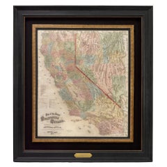
Large Scale Map
6
to
54
406
292
355
255
175
128
116
68
55
51
42
31
30
22
20
18
18
17
17
16
14
11
11
10
9
8
8
7
7
6
5
5
5
5
4
4
3
3
3
3
2
2
2
2
2
2
2
1
1
1
1
1
1
1
1
81
54
42
42
25
Sort By
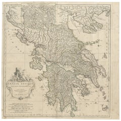
Large Scale Map of Greece, Extending to Cythera with Inset of Macedonia, ca.1786
Located in Langweer, NL
Antique map titled 'Graeciae Antiquae'.
Large scale map of Greece, extends south to the island
Category
Antique 1780s Maps
Materials
Paper
H 21.26 in W 21.26 in D 0 in
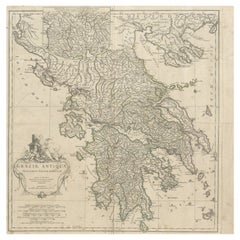
Large Scale Map of Greece with Inset Map of Macedonia, c.1786
Located in Langweer, NL
Antique map titled 'Graeciae Antiquae'. Large scale map of Greece, extends south to the island of
Category
Antique 18th Century Maps
Materials
Paper
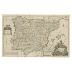
Beautiful Large Scale Map of Spain and Portugal Published by Herman Moll in 1711
Located in Langweer, NL
issued quatrefolds, surface dirt, minor creasing throughout,. Large engraved map on two conjoined sheets
Category
Antique 1710s Maps
Materials
Paper
H 24.81 in W 39.38 in D 0.02 in
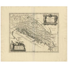
Antique Map of the Adriatic Sea and the Balkan by J. Janssonius, circa 1650
Located in Langweer, NL
Striking large-scale map of the Greater Balkans. Decorated with two large-scale cartouches, one
Category
Antique Mid-17th Century Maps
Materials
Paper
H 20.79 in W 24.81 in D 0.02 in
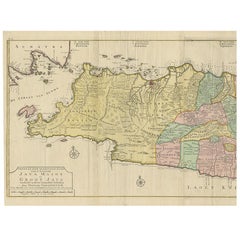
Large Antique Map of Java ‘Indonesia’ by F. Valentijn, 1728
Located in Langweer, NL
large-scale map of Java is richly engraved with details of agricultural fields, roads, temples, and
Category
Antique Early 18th Century Maps
Materials
Paper
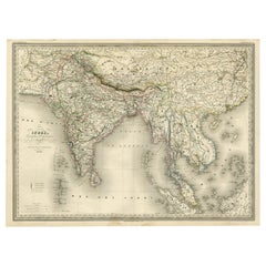
Superb, Large Map of British India, Chinese Empire, Indochina, Malaysia, 1860
Located in Langweer, NL
. A superb, large-scale map of British India, the Chinese Empire, Indochina, the Malay Peninsula, and
Category
Antique 1860s Maps
Materials
Paper
H 22.8 in W 31.07 in D 0 in
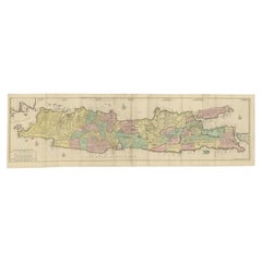
Huge Old Map of Java, Indonesia, Published by the Dutch in Colonial Times, 1728
Located in Langweer, NL
large-scale map of Java is richly engraved with details of agricultural fields, roads, temples, and
Category
Antique 18th Century Maps
Materials
Paper
H 68.12 in W 21.07 in D 0 in
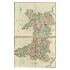
Two Sheet Map of the Principality of Wales Divided into Counties, 1804
Located in Langweer, NL
A well engraved and detailed large-scale map of Wales, printed on two sheets .
The map is
Category
Antique Early 1800s Maps
Materials
Paper
H 21.26 in W 25.2 in D 0.02 in
1873 "Map of the States of California and Nevada" by Chas. Drayton Gibbes
Located in Colorado Springs, CO
is considered to be one of the finest large-scale maps of California to appear in the second half of
Category
Antique 1870s American Maps
Materials
Paper
Stunning Large Scale Antique Map of Martinique, Rare, Published 1758
Located in Langweer, NL
Journaux de la Marine.'
Superb, large scale chart of the island Martinique filled with incredible
Category
Antique 18th Century Maps
Materials
Paper
Large Scale Antique Scroll Map of Lincolnshire, England, Dated 1778
Located in St Annes, Lancashire
Wonderful scroll map of Lincolnshire
By Captain Armstrong, 1778
Copper plate engraving on
Category
Antique 1770s English Georgian Maps
Materials
Wood, Paper
Free Shipping
H 84 in W 60 in D 1.5 in
1842 Wall Map of the United States by J. H. Young, Published by S. A. Mitchell
Located in Colorado Springs, CO
. This map was also very likely the first, large-scale map to have been steel plate-engraved
Category
Antique 1840s American Maps
Materials
Paper
H 45 in W 38 in D 1 in
Set of 10 Large Scale Vintage Maps of The United Kingdom, circa 1900
Located in St Annes, Lancashire
Great set of maps of the UK
Lithographs. By John Bartholomew & Co.
Published by The Edinburgh
Category
Antique Early 1900s English Maps
Materials
Paper
No Reserve
H 18 in W 23.5 in D 0.13 in
Hardesty, Sectional & Township Map of Ohio, Very Large
Located in Norwich, GB
sections. Colour printed in part.
Chicago, 1880.
Scale: 1:633,600
Fine early large scale map which
Category
Antique 1880s American Prints
Materials
Paper
Antique Detailed Map of Jerusalem in Israël with Extensive Key and Scale, 1698
Located in Langweer, NL
Antique map titled 'Jerusalem.'
Plan of the ancient city of Jerusalem. With extensive key and
Category
Antique 17th Century Maps
Materials
Paper
H 15.16 in W 12.01 in D 0 in
Large Map of Castile's Southern Realms - Granada, Andalusia, and Murcia, 1652
Located in Langweer, NL
This antique map, titled 'Les Etats de la Couronne de Castille', represents the southern regions of
Category
Antique Mid-17th Century Maps
Materials
Paper
H 17.64 in W 23.75 in D 0.02 in
Large Antique Map of Asia including All of Southeast Asia, c.1792
Located in Langweer, NL
Antique map titled 'L' Asie Divisee en ses Empires, Royaumes, et Etats'. Attractive, large map of
Category
Antique 18th Century Maps
Materials
Paper
No Reserve
H 20.67 in W 25.4 in D 0 in
Portugal: A Large 17th Century Hand-colored Map by Sanson and Jaillot
By Nicolas Sanson
Located in Alamo, CA
This large hand-colored map entitled "Le Royaume de Portugal et des Algarves Divisee en see
Category
Antique 1690s French Maps
Materials
Paper
Africa: A Large 17th Century Hand-Colored Map by Sanson and Jaillot
By Nicolas Sanson
Located in Alamo, CA
This large original hand-colored copperplate engraved map of Africa entitled "L'Afrique divisee
Category
Antique 1690s French Maps
Materials
Paper
Antique Map of Silesia centered on Glogau
Located in Langweer, NL
especially ornate coat of arms and a key to the symbols used in the map. At bottom right is a fine scale of
Category
Antique Mid-17th Century Maps
Materials
Paper
Antique Map of Madagascar by Mariette 'c.1670'
Located in Langweer, NL
(..)'. Original large-scale antique map of Madagascar, Africa. Published by Pierre Mariette, circa 1670.
Category
Antique Mid-17th Century Maps
Materials
Paper
Antique Map of the Empire of the Great Mogul
Located in Langweer, NL
features of the map, along with the large mythical lake of Chiamay Lacus located in northern Burma. Wild
Category
Antique Late 17th Century Maps
Materials
Paper
Antique Map of Zeeland, The Netherlands, by Jaillot, 1693
Located in Langweer, NL
larger scale.
Condition: Good, given age. Some staining and soiling, mainly in the margins. A few minor
Category
Antique 17th Century Maps
Materials
Paper
Antique Map of Greece by J. Jansson, circa 1653
Located in Langweer, NL
, circa 1653. This striking 17th century map of Greece was based on “Totius Graeciae Descriptio,” a large
Category
Antique Mid-17th Century Maps
Materials
Paper
Antique Map Depicting Burma, Siam, Annam (Vietnam) and Japan, 1882
Located in Langweer, NL
the bottom left corner shows the "Loo-Choo Islands" (Ryukyu Islands) on a larger scale.
Both maps are
Category
Antique 1880s Maps
Materials
Paper
Free Shipping
H 14.97 in W 22.45 in D 0 in
Antique Map of Switzerland by N. Visscher, circa 1690
Located in Langweer, NL
Italy. This map features two decorative cartouches: the larger is flanked by two putti, one in military
Category
Antique Late 17th Century Maps
Materials
Paper
Road Map, John Ogilby, No 54, London, Yarmouth, Britannia
By John Ogilby
Located in BUNGAY, SUFFOLK
English countryside. Fortunately, his maps were printed in relatively large numbers for the period, so
Category
Antique 1670s English Baroque Maps
Materials
Paper
Antique Map of the Region of Bretagne by Janssonius '1657'
By Johannes Janssonius
Located in Langweer, NL
the title, key and scale, a large armorial and several vignette galleons. This map originates from
Category
Antique Mid-17th Century Maps
Materials
Paper
Map of Polynesia Highlighting Cultural Landscapes and Maritime Activities, 1851
Located in Langweer, NL
of large-scale decorative cartography before the trend moved towards more utilitarian and scientific
Category
Antique 1850s Maps
Materials
Paper
H 10.71 in W 14.26 in D 0 in
Authentic Old Map of Persia with Original Border Coloring, 1745
Located in Langweer, NL
Title: "Kaartje van Persien na de stelling van den Heer Guillaume de L'Isle"
Translates to "Map
Category
Antique 1740s Maps
Materials
Paper
Antique Map of the County of Hainaut by Jaillot, 1692
Located in Langweer, NL
joined the Sanson heirs and redrew Nicolas Sanson's maps on a larger scale.
Condition: Fair, original
Category
Antique 17th Century Maps
Materials
Paper
Antique Map of Northern Italy by Homann Heirs, c.1730
Located in Langweer, NL
, Mantua and Mirandol. Large title cartouche, key and scale. Source unknown, to be determined. Artists and
Category
Antique 18th Century Maps
Materials
Paper
Antique Map of the Beaujolais Region by Homann Heirs, 1762
Located in Langweer, NL
on map publishing in Germany. Apart from the atlases the firm published a very large number of
Category
Antique 18th Century Maps
Materials
Paper
1654 Joan Blaeu Map the Sutherland, Scotland, Entitled "Southerlandia, "Ric0007
Located in Norton, MA
large title cartouche with the royal arms, a scale cartouche and coat of arms. Latin text on verso
Category
Antique 17th Century Dutch Maps
Materials
Paper
H 20.36 in W 23.23 in D 0.4 in
Antique Engraved Map of Saxonia in Northern Germany, ca.1721-1750
Located in Langweer, NL
Principatus accurate divisus ex conatibus -
A large map of Lower Saxony, extending from Hamburg with the
Category
Antique Mid-18th Century Maps
Materials
Paper
Antique Map of the Holy Land by Van Luchtenburg, c.1720
Located in Langweer, NL
Antique map titled 'Heylige Land verdeeld in de Twaalf Stammen Israels (..).' Highly detailed map
Category
Antique 18th Century Maps
Materials
Paper
Antique Map of Macedonia by the Famous Mapmaker Blaeu, c.1650
Located in Langweer, NL
ship and a milage scale. Macedonia is shown in the centre of the map. With many details of placenames
Category
Antique 17th Century Maps
Materials
Paper
Superb Antique Map of the Province of Gelderland, the Netherlands, ca.1575
Located in Langweer, NL
Antique map titled 'Gelriae, Cliviae, Finitimorumque Locorum Verissima Descriptio Christiano Schrot
Category
Antique 16th Century Maps
Materials
Paper
H 16.86 in W 21.97 in D 0 in
Regional Map of Germany, inc Hamburg, Luneberg, Hannover, Braunsweig etc, c.1720
Located in Langweer, NL
. Apart from the atlases the firm published a very large number of individual maps. The Homanns produced a
Category
Antique 1720s Maps
Materials
Paper
H 20.67 in W 24.73 in D 0 in
Imperium Romanum: A Detailed Map of the Roman Empire in its Zenith, 1880
Located in Langweer, NL
divisions, showing how the larger territory was managed and organized.
8. **Grid and Scale**: A latitude
Category
Antique 1880s Maps
Materials
Paper
Free Shipping
H 15.56 in W 18.51 in D 0 in
Antique Map of the Region of Orleans by Homann Heirs, c.1760
By Homann Heirs
Located in Langweer, NL
. This map was published by Homann Heirs in 1762 and has decorative title and key/scale cartouches
Category
Antique 18th Century Maps
Materials
Paper
Antique Map of Canada, The Province of Ontario and Part of Quebec, 1882
Located in Langweer, NL
larger provincial map.
The map's legend, likely located on the left side, probably lists the towns and
Category
Antique 1880s Maps
Materials
Paper
Free Shipping
H 14.97 in W 22.45 in D 0 in
Antique Decorative Map of the Low Countries, '17 Provinces, Netherlands', c.1680
Located in Langweer, NL
. Embellished with a large and decorative title-cartouche and a cartouche with scales and a coat-of-arms. Source
Category
Antique 1680s Maps
Materials
Paper
H 21.26 in W 24.89 in D 0 in
Antique Map of Dutch & Belgium Provinces Limburg, Namen and Ardennes, ca.1635
Located in Langweer, NL
Antique print, titled: 'Leodiensis Dioecesis.'
Detailed map including the Dutch and Belgium
Category
Antique 1630s Maps
Materials
Paper
H 19.97 in W 23.51 in D 0 in
Almería 1901: Coastal Contours and Landscapes in a Map of Southeastern Spain
Located in Langweer, NL
large-scale production of fruits and vegetables, often under vast plastic greenhouses, a practice that
Category
Antique Early 1900s Maps
Materials
Paper
Free Shipping
H 14.77 in W 20.08 in D 0 in
Map Road Strip Britannia Sheet 2 John Ogilby London Aberistwith Islip Bramyard
By John Ogilby
Located in BUNGAY, SUFFOLK
of England and Wales.
Strip map Islip to Bramyard, on a scale of approximately one inch to the mile
Category
Antique 17th Century English Baroque Maps
Materials
Paper
H 14.38 in W 19.3 in D 0.79 in
Antique Map of the Biblical Land of Canaan by Lindeman, c.1758
Located in Langweer, NL
bezitters (..).' - Map of the biblical Land of Canaan. With large title cartouche, compass rose and scale
Category
Antique 18th Century Maps
Materials
Paper
Antique Map of the Course of the Rhine River by Blaeu, circa 1640
Located in Langweer, NL
depictions of mountains and forests. Oriented with north to the right, the map is embellished with a large
Category
Antique Mid-17th Century Maps
Materials
Paper
Road Map John Ogilby No 75 Kings Lyn Harwich, Britannia Framed Wallhanging
By John Ogilby
Located in BUNGAY, SUFFOLK
English countryside. Fortunately, his maps were printed in relatively large numbers for the period, so
Category
Antique 1670s European Baroque Maps
Materials
Paper
H 15.75 in W 19.69 in D 0.6 in
Map Road John Ogilby Britannia No 74 Ipswich to Norwich Cromer Framed
By John Ogilby
Located in BUNGAY, SUFFOLK
fascinating record of the English countryside. Fortunately, his maps were printed in relatively large numbers
Category
Antique 1670s English Baroque Maps
Materials
Paper
Engraved Map of the Lower Rhine, Meuse, Moselle, Scheldt, Ems & Weser, c.1700
Located in Langweer, NL
Beautiful original hand-colored antique map of a large part of Western Europe.
Title
Category
Antique Early 1700s Maps
Materials
Paper
H 24.02 in W 21.26 in D 0 in
1633 Map "La Souverainete De Sedan Et De Raucourt, Et La Prevoste Ric0011
Located in Norton, MA
1653 map entitled
"La Souverainete de Sedan et de Raucourt, et la Prevoste de Doncheri,"
Ric0011
Category
Antique 17th Century Dutch Maps
Materials
Paper
H 18.9 in W 22.45 in D 0.4 in
Scarce Middle East and Arabia Map Showing The Exodus of the Israelites, 1725
Located in Langweer, NL
, compass rose and scale. This map originates from 'Het algemeen groot historisch, oordeelkundig
Category
Antique 1720s Maps
Materials
Paper
H 15.75 in W 18.51 in D 0 in
Road Map No43 London to Kings Lynn, Royston to Downham, John Ogilby, Britannia
By John Ogilby
Located in BUNGAY, SUFFOLK
. Fortunately, his maps were printed in relatively large numbers for the period, so individual sheets are
Category
Antique Late 17th Century British Charles II Maps
Materials
Paper
H 20.48 in W 24.41 in D 0.4 in
Road Map John Ogilby London St David's Britannia No 15 Abingdon Monmouth Framed
By John Ogilby
Located in BUNGAY, SUFFOLK
John Ogilby (British 1600-1676) Cosmographer and Geographick Printer to Charles II. A road map from
Category
Antique 1670s English Baroque Maps
Materials
Paper
H 20.48 in W 24.41 in D 0.6 in
Antique Map of the Area Around Venice in Italy by H. Hondius, circa 1606
By Jodocus Hondius, Gerard Mercator
Located in Langweer, NL
ornamental scale of miles cartouche. This map originates from the German atlas „Abbildung der gantzen Welt
Category
Antique Early 17th Century Maps
Materials
Paper
H 16.93 in W 21.26 in D 0.02 in
Old Decorative Map of Austria, Centered on the Danube River and Vienna, Ca.1720
Located in Langweer, NL
atlases the firm published a very large number of individual maps. The Homanns produced a Neuer Atlas in
Category
Antique 1720s Maps
Materials
Paper
H 20.87 in W 24.02 in D 0 in
Road Map Britannia No 32 the Road from London to Barnstable John Ogilby Framed
By John Ogilby
Located in BUNGAY, SUFFOLK
English countryside. Fortunately, his maps were printed in relatively large numbers for the period, so
Category
Antique Late 17th Century English Charles II Maps
Materials
Paper
H 20.48 in W 24.41 in D 0.6 in
Road Map Britannia No 15 London to St Davids John Ogilby Brown Gilt Frame
By John Ogilby
Located in BUNGAY, SUFFOLK
. Fortunately, his maps were printed in relatively large numbers for the period, so individual sheets are
Category
Antique Late 17th Century British Charles II Maps
Materials
Paper
H 22.05 in W 26.19 in D 0.6 in
Highly Detailed Antique Map of the Holy Land Showing 12 Tribes of Israel, c.1720
Located in Langweer, NL
map of the Holy Land divided into 12 tribes of Israel. With beautiful large title cartouche, vignette
Category
Antique 1720s Maps
Materials
Paper
Free Shipping
H 17.72 in W 20.28 in D 0 in
- 1
- ...
Get Updated with New Arrivals
Save "Large Scale Map", and we’ll notify you when there are new listings in this category.
Large Scale Map For Sale on 1stDibs
At 1stDibs, there are many versions of the ideal large scale map for your home. Each large scale map for sale was constructed with extraordinary care, often using paper, wood and plastic. Whether you’re looking for an older or newer large scale map, there are earlier versions available from the 18th Century and newer variations made as recently as the 20th Century. A large scale map is a generally popular piece of furniture, but those created in Georgian styles are sought with frequency. You’ll likely find more than one large scale map that is appealing in its simplicity, but Gerard van Keulen, Herman Moll and Nicolas Joannes Piscator produced versions that are worth a look.
How Much is a Large Scale Map?
The average selling price for a large scale map at 1stDibs is $1,948, while they’re typically $200 on the low end and $225,000 for the highest priced.
Questions About Large Scale Map
- 1stDibs ExpertMarch 31, 2023A large-scale photograph is a photo that is larger than standard sizes. The ability to produce these oversized images emerged in the 1980s, and artists like Cindy Sherman and Jeff Wall began to use them in their work. On 1stDibs, shop a selection of photographic art from some of the world's top galleries.
More Ways To Browse
C Ford Riley
Ford Riley
18 Th Century Oil On Canvas
Nature Jungle Wallpaper
Antique Calipers
Oil Paintings From 19 Th Century
Oil South Pacific 18th Century
19 Th C Portrait
Alan Thompson
19th Century Painting19th Century Portraits
James Edward Meadows
Portraits 18th 19 Th Century
Large 19 Th Century Oil Painting
Johannes Janssonius On Sale
Small Mid19th
17 Th And 18th Century Oil Paintings
John Ogilby
16 Th C Century Paintings
