Louis Atlas
2
to
14
119
90
99
76
60
33
29
22
21
19
16
12
9
8
7
6
5
5
4
4
4
3
2
2
2
2
2
2
1
1
1
1
1
1
1
1
1
1
1
1
1
1
42
16
14
13
10
Sort By
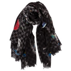
New in Box Louis Vuitton Atlas Silk Wool Black Shawl
By Louis Vuitton
Located in West Hollywood, CA
Louis Vuitton limited edition oversized silk and cashmere shawl with atlas map design. Jacquard
Category
21st Century and Contemporary French Scarves
Atlas of Brutalist Architecture
Located in New York City, NY
, Lina Bo Bardi, Le Corbusier, Carlo Scarpa, Ernö Goldfinger, Frank Lloyd Wright, Louis Kahn, Oscar
Category
21st Century and Contemporary Books
Materials
Paper
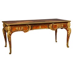
A Louis XIV Style Bureau Plat By Cueunières, Paris, After the Model by Cressent
By L. Cueunieres Ebeniste.
Located in Brighton, West Sussex
A Louis XIV Style Gilt-Bronze Mounted Mahogany Bureau Plat, By Cueunières, Paris. After the Model
Category
Antique 19th Century French Louis XIV Desks
Materials
Ormolu
H 31.89 in W 73.04 in D 37.01 in
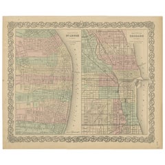
Antique Map of St. Louis and Chicago
Located in Langweer, NL
Antique map titled 'The City of St. Louis Missouri - The City of Chicago Illinois'. Dual map on
Category
Antique Mid-19th Century Maps
Materials
Paper
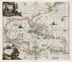
Indiarum Occidentalium Tractus Littorales cum Insulis Caribicis / Pascaert van W
By Louis Renard
Located in New York, NY
This early 18th-century engraved map was published by Louis Renard in Amsterdam. The image size is
Category
18th Century Other Art Style More Prints
Materials
Engraving
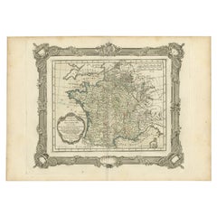
Antique Map of France under the Reign of Louis XIII by Zannoni, 1765
Located in Langweer, NL
Antique map France titled 'Tableau de la France sous Louis XIII (..)'.
Beautiful old map of
Category
Antique 18th Century Maps
Materials
Paper
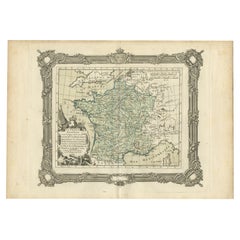
Antique Map of France under the Reign of Louis XV by Zannoni, 1765
Located in Langweer, NL
Antique map titled 'La France renaissante sous le Règne heureux de Louis XV le Bien-Aimé
Category
Antique 18th Century Maps
Materials
Paper
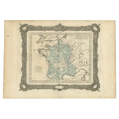
Antique Map of France under the Reign of Louis XI by Zannoni, 1765
Located in Langweer, NL
originates from 'Atlas Historique de la France Ancienne et Moderne' by M. Rizzi Zannoni. Artists and
Category
Antique 18th Century Maps
Materials
Paper
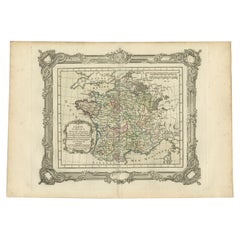
Antique Map of France under the Reign of Louis XI by Zannoni, 1765
Located in Langweer, NL
France. This map originates from 'Atlas Historique de la France Ancienne et Moderne' by M. Rizzi Zannoni
Category
Antique 18th Century Maps
Materials
Paper
Antique Map of France under the Reign of St. Louis by Zannoni, 1765
Located in Langweer, NL
originates from 'Atlas Historique de la France Ancienne et Moderne' by M. Rizzi Zannoni. Artists and
Category
Antique 18th Century Maps
Materials
Paper
Antique Map of France at the end of the Reign of Louis the Great by Zannoni 1765
By G. A. Rizzi-zannoni
Located in Langweer, NL
Antique map France titled 'Etat de la France à la fin du Règne de Louis le Grand (..)'. Beautiful
Category
Antique 18th Century Maps
Materials
Paper
H 11.03 in W 15.75 in D 0 in
Map Holy Land La Terre Sainte Engraved van Loon Published N de Fer 1703 French
Located in BUNGAY, SUFFOLK
from Nicholas de Fer's L'Atlas Curieux ou le Monde. East is oriented at the top.
MAKER Nicolas de
Category
Antique Early 1700s French Louis XIV Maps
Materials
Paper
H 11.03 in W 13.78 in D 0.4 in
Hand-Colored French Map, Carte des Etats Unis, Par Bonne, Late 18th Century
By Rigobert Bonne
Located in Chappaqua, NY
Raynal's Atlas. Rigobert Bonne (1727-1795) was Royal Cartographer to France. Professionally framed and
Category
Antique Late 18th Century French Louis XVI Prints
Materials
Paper
H 16.5 in W 20.13 in D 1 in
18th Century Dutch 'Utrecht' Longcase or Grandfather Clock by W.V. Dadelbeek
By W.V. Dadelbeek
Located in Vancouver, British Columbia
figural finials of Atlas, Father Time and Mercury. The silvered brass dial with engraved silvered arch
Category
Antique Mid-18th Century Dutch Louis XV Grandfather Clocks and Longcase ...
Materials
Walnut
H 104 in W 21 in D 18 in
Antique Plan of the Battle of Abensberg in Germany
Located in Langweer, NL
and a reinforced Austrian corps led by Feldmarschall-Leutnant Archduke Louis of Austria. This print
Category
Antique Mid-19th Century Maps
Materials
Paper
Map of the Circle of Franconia, Germany Bamberg, Wurtzburg and Nuremberg, 1757
Located in Langweer, NL
. Centered on Bamberg, Wurtzburg and Nuremberg. This map originates from 'Atlas Universel (..)'.
Artists
Category
Antique 1750s Maps
Materials
Paper
H 22.05 in W 27.17 in D 0 in
Antique Map of the Circle of Bavaria by Vaugondy, 1757
Located in Langweer, NL
Bamberg to Innsbruck. This map originates from 'Atlas Universel (..)'. Artists and Engravers: Gilles
Category
Antique 18th Century Maps
Materials
Paper
Antique Map of the Circle of Franconia, 1757
Located in Langweer, NL
Bamberg, Wurtzburg and Nuremberg. This map originates from 'Atlas Universel (..)'.
Artists and
Category
Antique 18th Century Maps
Materials
Paper
Mid 19th Century French Globe on Carved Walnut Base Signed Ch. Perigot, Paris
Located in Dallas, TX
Lycee Saint Louis", and drawing by Mouraux. The paper globe with physics, politics and history, rotates
Category
Antique Mid-19th Century French Globes
Materials
Brass
Nicely Colored Original Antique Map of Upper Saxony, Middle Germany, 1756
Located in Langweer, NL
), were leading mapmakers in France during the 18th century. In 1757, they published The Atlas Universel
Category
Antique 1750s Maps
Materials
Paper
H 20.48 in W 25.2 in D 0 in
Antique Map of England with French Title, 1806
Located in Langweer, NL
during the 18th century. In 1757, they published The Atlas Universel, one of the most important atlases
Category
Antique 19th Century Maps
Materials
Paper
Detailed Original Antique Map of the Turkish Empire with Arabia, 1778
Located in Langweer, NL
Didier carried on his father’s impressive work. Together, they published their best-known work, the Atlas
Category
Antique 1770s Maps
Materials
Paper
Detailed Original Antique Map of the Russian Empire in Asia, 1750
Located in Langweer, NL
Louis XV. His son, Didier Robert de Vaugondy (ca. 1723-1786), was also a geographer and the two worked
Category
Antique 1750s Maps
Materials
Paper
Vienna, Austria: A Large 17th Century Hand-Colored Map by Sanson and Jaillot
By Nicolas Sanson
Located in Alamo, CA
originally created by Nicholas Sanson d'Abbeville and published by Hubert Jaillot in "Atlas Nouveau" in Paris
Category
Antique 1690s French Maps
Materials
Paper
H 20 in W 24.88 in D 0.13 in
Vienna, Austria: A Large 17th Century Hand-colored Map by Sanson and Jaillot
By Nicholas Sanson d'Abbeville
Located in Alamo, CA
originally created by Nicholas Sanson d'Abbeville and published by Hubert Jaillot in "Atlas Nouveau" in Paris
Category
1690s Landscape Prints
Materials
Engraving
North Holland, Netherlands: A Large 17th C. Hand-colored Map by Sanson & Jaillot
By Nicholas Sanson d'Abbeville
Located in Alamo, CA
Jaillot in "Atlas Nouveau" in Paris in 1692. It depicts the North Holland province of the Netherlands
Category
1690s Landscape Prints
Materials
Engraving
Antique Map of North America, 1821
Located in Langweer, NL
. Includes the rare pre-Louisiana Purchase territories, including St. Louis, Arkansas and Lawrence. Many
Category
Antique 19th Century Maps
Materials
Paper
China: An Original 18th Century Hand-colored Map by E. Bowen
Located in Alamo, CA
fellow of the Royal Society and as the Royal Mapmaker to both to King George II of England and Louis XV
Category
Mid-18th Century Old Masters Landscape Prints
Materials
Engraving
H 15.75 in W 19.75 in
Europe: An Original 18th Century Hand-colored Map by E. Bowen
Located in Alamo, CA
and as the Royal Mapmaker to both to King George II of England and Louis XV of France. Based in London
Category
Mid-18th Century Old Masters Landscape Prints
Materials
Engraving
Rare Double Sided Vintage North African Moroccan Berber Rug Collectors item
Located in Lohr, Bavaria, DE
. One side is in red traditional Berber design from the Atlas Mountains and the other side is lavender
Category
Late 20th Century Moroccan Tribal Moroccan and North African Rugs
Materials
Wool
Original Detailed Antique Map of Southern India and Most of Ceylon, 1744
Located in Langweer, NL
: Emanuel Bowen (1694?-1767) was a British engraver and print seller. He was most well-known for his atlases
Category
Antique 1740s Maps
Materials
Paper
No Reserve
H 13 in W 9.26 in D 0 in
Mediterranean and Adriatic Seas: Original 18th Century Hand-colored Map by Bowen
Located in Alamo, CA
and as the Royal Mapmaker to both to King George II of England and Louis XV of France. Based in London
Category
Mid-18th Century Old Masters Landscape Prints
Materials
Engraving
Mid-19th Century French Terrestrial Globe with Brass Frame Signed Ch. Perigot
Located in Dallas, TX
is signed Ch. Perigot, "Professeur d'Histoire et de Geographie au Lycee Saint Louis", and drawing by
Category
Antique Mid-19th Century French Napoleon III Globes
Materials
Brass
Map of the Russian Empire: An Original 18th Century Hand-colored Map by E. Bowen
Located in Alamo, CA
of England and Louis XV of France. Based in London, Bowen was highly regarded for producing some of
Category
Mid-18th Century Old Masters Landscape Prints
Materials
Engraving
North African Moroccan Berber Rug Abstract Design Gray Copper Super Soft Quality
By djoharian-design, Berber Tribes of Morocco
Located in Lohr, Bavaria, DE
rug was made in a village south of the Atlas Mountains, Southwest of the town of Quarzazate. The wool
Category
2010s Moroccan Tribal Moroccan and North African Rugs
Materials
Wool
W 60.24 in L 84.65 in
Great Britain, N. France: A Large 17th C. Hand-colored Map by Sanson and Jaillot
By Nicholas Sanson d'Abbeville
Located in Alamo, CA
his maps and atlases with a dual Sanson and Jaillot attribution. Jaillot went on to serve King Louis
Category
1690s Landscape Prints
Materials
Engraving
Map of the East Indies: An Original 18th Century Hand-colored Map by E. Bowen
Located in Alamo, CA
King George II of England and Louis XV of France. Based in London, Bowen was highly regarded for
Category
Mid-18th Century Old Masters Landscape Prints
Materials
Engraving
Original Antique Map of the Northwestern Part of Russia in Europe, 1753
Located in Langweer, NL
, its stock of plates, and a roller press. In 1760 Gilles became geographer to King Louis XV. His son
Category
Antique 1750s Maps
Materials
Paper
Hungary & Eastern Europe: A Large 17th C. Hand-colored Map by Sanson & Jaillot
By Nicholas Sanson d'Abbeville
Located in Alamo, CA
Nicholas Sanson d'Abbeville. This version was published by Hubert Jaillot in "Atlas Nouveau" in Paris in
Category
1690s Landscape Prints
Materials
Engraving
Original Copperplate Engraved Detailed Map of South Africa, ca.1680
Located in Langweer, NL
South Africa. Engraved by Antoine d'Winter for a Dutch edition of Sanson's pocket atlas.
Artists and
Category
Antique 1680s Maps
Materials
Paper
Orginal Antique Handcolored Map of the Turkish Empire, 1748
Located in Langweer, NL
African regions. Originates from 'Atlas Nouveau Portatif' by G.L. le Rouge.
Artists and Engravers
Category
Antique 18th Century Maps
Materials
Paper
The Normandy Region of France: A 17th C. Hand-colored Map by Sanson and Jaillot
By Nicolas Sanson
Located in Alamo, CA
his maps and atlases with a dual Sanson and Jaillot attribution. Jaillot went on to serve King Louis
Category
Antique 1690s French Maps
Materials
Paper
H 24.88 in W 38 in D 0.13 in
The Normandy Region of France: A 17th C. Hand-colored Map by Sanson and Jaillot
By Nicholas Sanson d'Abbeville
Located in Alamo, CA
his maps and atlases with a dual Sanson and Jaillot attribution. Jaillot went on to serve King Louis
Category
1690s Landscape Prints
Materials
Engraving
Detailed Antique Map of the Southern Part of European Russia and Ukraine, 1752
Located in Langweer, NL
. In 1760 Gilles became geographer to King Louis XV. His son, Didier Robert de Vaugondy (ca. 1723-1786
Category
Antique 1750s Maps
Materials
Paper
H 19.69 in W 25.99 in D 0 in
Naples and S. Italy: A Large 17th C. Hand-colored Map by Sanson and Jaillot
By Nicholas Sanson d'Abbeville
Located in Alamo, CA
d'Abbeville and published by Hubert Jaillot in "Atlas Nouveau" in Paris in 1692. It depicts central and
Category
1690s Landscape Prints
Materials
Engraving
Siberia as Explored by Behring: Original 18th Century Hand-colored Map by Bowen
Located in Alamo, CA
George II of England and Louis XV of France. Based in London, Bowen was highly regarded for producing
Category
Mid-18th Century Old Masters Landscape Prints
Materials
Engraving
Original Antique Map of the Philippines, Malaysia, Indonesia, Singapore, c.1690
Located in Langweer, NL
Louis XIV in Paris, gaining special access to the most current records on world geography sent in from
Category
Antique 1690s Maps
Materials
Paper
Free Shipping
H 19.49 in W 27.56 in D 0 in
Southern & Eastern Europe: A Large 17th C. Hand-colored Map by Sanson & Jaillot
By Nicolas Sanson
Located in Alamo, CA
published by Hubert Jaillot in "Atlas Nouveau" in Paris in 1692. It depicts the territories of the Ottoman
Category
Antique 1690s French Maps
Materials
Paper
H 24.88 in W 38 in D 0.13 in
Southern & Eastern Europe: A Large 17th C. Hand-colored Map by Sanson & Jaillot
By Nicholas Sanson d'Abbeville
Located in Alamo, CA
published by Hubert Jaillot in "Atlas Nouveau" in Paris in 1692. It depicts the territories of the Ottoman
Category
1690s Landscape Prints
Materials
Engraving
Portugal: A Large 17th Century Hand-colored Map by Sanson and Jaillot
By Nicolas Sanson
Located in Alamo, CA
and published by Hubert Jaillot in "Atlas Nouveau" in Paris in 1695. It depicts Portugal, including at
Category
Antique 1690s French Maps
Materials
Paper
Portugal: A Large 17th Century Hand-colored Map by Sanson and Jaillot
By Nicholas Sanson d'Abbeville
Located in Alamo, CA
and published by Hubert Jaillot in "Atlas Nouveau" in Paris in 1695. It depicts Portugal, including at
Category
1690s Landscape Prints
Materials
Engraving
Villard Courtyard, St. Patrick's Cathedral, New York
By Richard Haas
Located in New York, NY
51st Streets in Midtown Manhattan, directly across the street from Rockefeller Center, facing the Atlas
Category
1980s Realist Figurative Prints
Materials
Lithograph
Antique Map of North and East Asia, 1751
Located in Langweer, NL
. These plates are engraved by J.A.Defehrt and Bonaventure/Benoit-Louis Prevost after J.R Lucotte or
Category
Antique 18th Century Maps
Materials
Paper
Antique Map of India as Described It Was before the 5th Century, 1744
Located in Langweer, NL
. He was most well-known for his atlases and county maps. Although he died in poverty, he was widely
Category
Antique 18th Century Maps
Materials
Paper
The Arab Butcher, a preparatory drawing by Gustave Guillaumet (1840 - 1887)
Located in PARIS, FR
with a sculpture by Louis Barrias (the brother of his teacher at the Beaux-Arts) depicting a seated
Category
1860s Old Masters Figurative Drawings and Watercolors
Materials
Carbon Pencil, Chalk
Utrecht, Netherlands: A Large 17th Century Hand-colored Map by Sanson & Jaillot
By Nicholas Sanson d'Abbeville
Located in Alamo, CA
published by Hubert Jaillot in "Atlas Nouveau" in Paris in 1692. It depicts the Utrecht province of the
Category
1690s Landscape Prints
Materials
Engraving
Antique Map of 'African' Islands in the Mediterranean Sea and The Atlantic, 1747
Located in Langweer, NL
engraver and print seller. He was most well-known for his atlases and county maps. Although he died in
Category
Antique 18th Century Maps
Materials
Paper
H 19.49 in W 15.16 in D 0 in
Ruin and Redemption in Architecture
Located in New York City, NY
- spaces around the world. Iconic work from the stars of the 20th century including Marcel Breuer, Louis
Category
21st Century and Contemporary Chinese Books
Materials
Paper
North African Moroccan Berber Rug Leopard Cheetah Design Soft Quality Gray Beige
By djoharian-design, Berber Tribes of Morocco
Located in Lohr, Bavaria, DE
rug was made in a village in the Atlas Mountains, Southeast of the towns of Casablanca and Meknes. The
Category
2010s Moroccan Tribal Moroccan and North African Rugs
Materials
Wool
W 60.24 in L 78.75 in
Antique Map of the Netherlands by Zannoni, 1765
Located in Langweer, NL
Antique map titled 'Carte Historique, Geographique et Militaire des Campagnes de Louis XIV dans les
Category
Antique 18th Century Maps
Materials
Paper
- 1
Get Updated with New Arrivals
Save "Louis Atlas", and we’ll notify you when there are new listings in this category.
More Ways To Browse
Antique Maps Philippines
Louisiana Antique Map
Jean Louis Deniot
Antique Maps Caribbean Islands
Maps By Zannoni
Malaysian Map
Map Of Hungary
Constellation Map
Antique Map Of Korea
Antique Constellation Map
Napoleon Map
Antique Newfoundland Canada
Antique Great Lakes Map
Lane Tile
Pierre Bourgogne
Antique Cisterns
Antique Korean Prints
Iron Security Door
