Old World Antique Maps
5
to
73
812
62
434
423
260
140
30
29
29
26
26
26
25
23
18
14
12
10
9
7
7
7
7
5
5
5
4
3
3
3
3
3
3
3
3
3
2
2
2
2
2
1
1
1
1
1
23
17
11
7
6
Sort By
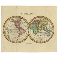
Small Antique World Map in Decorative Old Hand-Colouring, circa 1840
Located in Langweer, NL
Antique map titled 'Wereld Kaart'. Small and very decorative double hemisphere world map. Source
Category
19th Century Old World Antique Maps
Materials
Paper
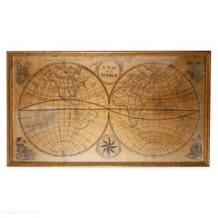
Map Silk Embroidered Western Eastern Hemisphere New Old World Asia America Afri
Located in BUNGAY, SUFFOLK
A rare, late-18th century, silk, embroidered, double hemisphere, world map, blackwork, sampler
Category
18th Century British Georgian Old World Antique Maps
Materials
Silk
H 0.4 in W 0.4 in D 0.4 in
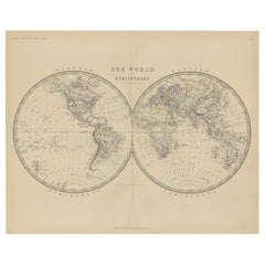
Antique World Map by Johnston, 1882
Located in Langweer, NL
Antique map titled 'The World in Hemispheres'. Old double-hemisphere world map. This map originates
Category
19th Century Old World Antique Maps
Materials
Paper
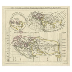
Antique Map of the Old World Projection, Entitled Orbis Terrarum Ad Mentem, 1825
Located in Langweer, NL
Antique map titled 'Orbis Terrarum ad Mentem (..)'. Old map of the world originating from 'Atlas
Category
19th Century Old World Antique Maps
Materials
Paper
H 8.51 in W 9.77 in D 0 in
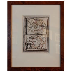
Antique Miniature Map of the Old World and France by Mallet, circa 1683
Located in Langweer, NL
shows a hemisphere of the Old World. The lower map shows France. This map originates from 'Description
Category
Late 17th Century Old World Antique Maps
Materials
Paper
H 11.03 in W 8.86 in D 0.6 in
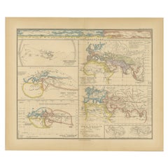
Original Old Composite of Several Maps of the Ancient World on One Sheet, 1880
Located in Langweer, NL
Theodorus Menke. The map is a detailed depiction of the ancient world. The atlas it comes from is known for
Category
1880s Old World Antique Maps
Materials
Paper
Free Shipping
H 15.56 in W 18.51 in D 0 in
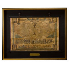
1847 “World at One View” Antique Hand-Colored Wall Map of the World
Located in Colorado Springs, CO
This is a highly desirable hanging wall map of the "World at One View", published in 1847 by Ensign
Category
19th Century American Old World Antique Maps
Materials
Paper
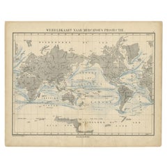
Antique Mercator Projection World Map by Petri, c.1873
Located in Langweer, NL
Antique world map titled 'Wereldkaart naar Mercator's Projectie'. Old map of the world. This map
Category
19th Century Old World Antique Maps
Materials
Paper
Decorative Ancient World Map with Large Parts of the World Still Unknown, c 1731
Located in Langweer, NL
marvelous world map, based upon 2000 year old geography. From an early edition of Cellarius' Notitia Orbis
Category
1730s Old World Antique Maps
Materials
Paper
H 9.45 in W 14.57 in D 0 in
Antique Map of Old European Russia, 1846
Located in Langweer, NL
Antique map titled 'Russia in Europe'. Old map of European Russia. This map originates from 'A New
Category
19th Century Old World Antique Maps
Materials
Paper
Old Colourful Map of Sweden and Norway, 1846
Located in Langweer, NL
Antique map titled 'Sweden & Norway'. Old map of Sweden and Norway.
This map originates from 'A
Category
1840s Old World Antique Maps
Materials
Paper
Old Original Antique Map of Western Canada, 1882
Located in Langweer, NL
Antique map titled 'Dominion of Canada'.
Old map of Western Canada. This map originates from
Category
1880s Old World Antique Maps
Materials
Paper
Old Map of Java, Indonesia by Stemler, 1875
By Stemler
Located in Langweer, NL
Antique map titled 'Hoofddriehoeken - Java en madoera.' (Main triangles measured by the
Category
19th Century Old World Antique Maps
Materials
Paper
Colourful Old Map of the Austrian Empire, with an Inset Map of Vienna, 1846
Located in Langweer, NL
Antique map titled 'Austrian Empire'.
Old map of the Austrian Empire, with an inset map of
Category
1840s Old World Antique Maps
Materials
Paper
H 13.78 in W 17.13 in D 0 in
Old Map of Southern Australia, with an Inset Map of Cape York Peninsula, 1882
Located in Langweer, NL
Antique map titled 'South Australia, New South Wales, Victoria & Queensland'.
Old map of
Category
1880s Old World Antique Maps
Materials
Paper
H 24.22 in W 19.53 in D 0 in
Old Colourful Decorative Map of Turkey in Europe, 1846
Located in Langweer, NL
Antique map titled 'Turkey in Europe'. Old map of Turkey in Europe.
This map originates from 'A
Category
1840s Old World Antique Maps
Materials
Paper
Old Antique Colourful Decorative Map of Northern Italy, 1846
Located in Langweer, NL
Description: Antique map titled 'Italy North Part'.
Old map of Northern Italy. This map
Category
1840s Old World Antique Maps
Materials
Paper
Old Engraved Map of Hungary with Decorative Vignettes, 1851
Located in Langweer, NL
the last series of decorative world maps ever produced. The maps were engraved by John Rapkin, a
Category
19th Century Old World Antique Maps
Materials
Paper
Old Map of the French Department of Loiret, France
By Victor Levasseur
Located in Langweer, NL
Antique map titled 'Dépt. du Loiret'. Map of the French department of Loiret, France. Surrounding
Category
Mid-19th Century Old World Antique Maps
Materials
Paper
Old German Antique Map of Iran and Arabia, 1866
Located in Langweer, NL
maps to collectors, historians, educators and interior decorators all over the world. Our collection
Category
19th Century Old World Antique Maps
Materials
Paper
Old Map of Turkmenistan, Uzbekistan, Afghanistan, Tajikistan, Kyrgyzstan, 1757
Located in Langweer, NL
Antique map titled 'Kort over det Lille Bukarie og de naest graensende Lande. af Engelske
Category
1750s Old World Antique Maps
Materials
Paper
H 9.06 in W 13.78 in D 0 in
Old Map of Spain and Portugal, with an Inset Map of the Region of Madrid, 1846
Located in Langweer, NL
Antique map titled 'Kingdom of Spain and Portugal'.
Old map of Spain and Portugal, with an
Category
1840s Old World Antique Maps
Materials
Paper
H 13.78 in W 17.13 in D 0 in
Old Map of Southern India and Ceylon 'Sri Lanka', 1882
Located in Langweer, NL
Antique map titled 'India (Southern Sheet)'.
Old map of Southern India and Ceylon (Sri Lanka
Category
1880s Old World Antique Maps
Materials
Paper
Antique Map of Italy from an Old French Atlas, 1842
Located in Langweer, NL
decorators all over the world. Our collection includes a wide range of authentic antique maps from the 16th
Category
19th Century Old World Antique Maps
Materials
Paper
Old Map of the Bourbonnais Region of France, ca.1630
Located in Langweer, NL
Antique map titled 'Bourbonois - Borbonium Ducatus'.
Old map of the Bourbonnais region of
Category
1630s Old World Antique Maps
Materials
Paper
Old Map of Vaucluse, France: A Cartographic Celebration of Viticulture, 1852
Located in Langweer, NL
This original hand-colored map is from the "Atlas National Illustré," a work by Victor Levasseur, a
Category
1850s Old World Antique Maps
Materials
Paper
H 14.18 in W 20.99 in D 0 in
Antique Map of the Old Lands of Friesland by Halma, 1718
Located in Langweer, NL
Antique map Friesland titled 'Descriptio Agri Frisii (..)'. Old map of Friesland, the Netherlands
Category
18th Century Old World Antique Maps
Materials
Paper
Antique Map of the Old Lands of FriesLand by Halma, 1718
Located in Langweer, NL
Antique map Friesland titled 'Descriptio Agri Frisii (..)'. Old map of Friesland, the Netherlands
Category
18th Century Old World Antique Maps
Materials
Paper
Colourful Old Detailed Map of Northern Carolina, United States of America
Located in Langweer, NL
map of North Carolina. This map originates from Commercial Atlas of the World'. Published 1931.
Category
Early 20th Century Old World Antique Maps
Materials
Paper
H 15.56 in W 21.46 in D 0.02 in
Authentic Old Map of Southeast Asia with Original Border Coloring, 1745
Located in Langweer, NL
mapping and understanding the world. Their maps were known for their accuracy and detail, contributing
Category
1740s Old World Antique Maps
Materials
Paper
Antique Map of Greece from an Old French School Atlas, 1880
Located in Langweer, NL
Antique map titled 'Grèce Moderne '. Old map of Greece and surroundings. This map originates from
Category
19th Century Old World Antique Maps
Materials
Paper
Old Map of the Western Part of Central Europe, c.1680
Located in Langweer, NL
Antique map titled 'Carta nova accurate del Passagio et strada dalli Paesi Bassi'. Old map of the
Category
17th Century Old World Antique Maps
Materials
Paper
Antique Map of Germany from an Old English Atlas, c.1802
Located in Langweer, NL
world. Our collection includes a wide range of authentic antique maps from the 16th to the 20th
Category
19th Century Old World Antique Maps
Materials
Paper
Antique Map of France from an Old Dutch School Atlas, 1852
Located in Langweer, NL
decorators all over the world. Our collection includes a wide range of authentic antique maps from the 16th
Category
19th Century Old World Antique Maps
Materials
Paper
Antique Map of Europe from an Old Dutch School-Atlas, 1852
Located in Langweer, NL
maps to collectors, historians, educators and interior decorators all over the world. Our collection
Category
19th Century Old World Antique Maps
Materials
Paper
Very Old Antique Map of the Persian Empire by Magini, c.1597
Located in Langweer, NL
Antique map titled 'Persiae Regnum sive Sophorum Imperium'. Old map of the Persian Empire. This map
Category
16th Century Old World Antique Maps
Materials
Paper
Old Map of Turkey in Europe, incl Romania, Servia, Montenegro & Bulgaria, 1882
Located in Langweer, NL
Antique map titled 'Turkey in Europe'.
Old map of Turkey in Europe, also depicting part of
Category
1880s Old World Antique Maps
Materials
Paper
H 19.53 in W 24.14 in D 0 in
Old Antique Map of the Province of Friesland, the Netherlands, c.1580
Located in Langweer, NL
Antique map titled 'Frisia Occidentalis'. Old map of the province of Friesland, the Netherlands
Category
16th Century Old World Antique Maps
Materials
Paper
Old Engraving of Batavia 'Jakarta, Indonesia' with Map and Harbour View, 1750
Located in Langweer, NL
over the world. Our collection includes a wide range of authentic antique maps from the 16th to the
Category
1750s Old World Antique Maps
Materials
Paper
H 11.82 in W 15.75 in D 0 in
Antique Map of Russia in Asia from An Old German Atlas, 1845
By Meyer
Located in Langweer, NL
Antique map titled 'Asiatisches Russland'. This map depicts Russia in Asia and originates from
Category
19th Century Old World Antique Maps
Materials
Paper
Old Engraved Map of Hungary, European Balkan Countries, Greece and Crete, 1806
Located in Langweer, NL
Antique map titled 'Hongrie, Turquie Europe'.
Decorative map of Hungary, southeast European
Category
19th Century Old World Antique Maps
Materials
Paper
H 15.08 in W 11.34 in D 0 in
Old Map of Part of France: Poitou, Berry, Bourbonnais, and Nivernais in 1768
Located in Langweer, NL
The map with text neatly mounted on both sides of the map on the plate, is a section of an old map
Category
1760s Old World Antique Maps
Materials
Paper
H 13.19 in W 20.28 in D 0 in
Antique Map of the Old Land of Batavia and Friesland by Halma, 1718
Located in Langweer, NL
Antique map Friesland titled 'Descriptio veteris Agri Batavi et Frisii (..)'. Old map of Friesland
Category
18th Century Old World Antique Maps
Materials
Paper
Antique Map of the Old Land of Batavia and Friesland by Halma, 1718
Located in Langweer, NL
Antique map Friesland titled 'Descriptio veteris Agri Batavi et Frisii (..)'. Old map of Friesland
Category
18th Century Old World Antique Maps
Materials
Paper
Antique Map of the Old Land of Batavia and FriesLand, The Netherlands, 1697
Located in Langweer, NL
Antique map Friesland titled 'Descriptio veteris Agri Batavi et Frisii (..)'. Old map of Friesland
Category
17th Century Old World Antique Maps
Materials
Paper
H 16.15 in W 19.89 in D 0 in
Antique Map of the Old Land of Batavia and FriesLand by Halma, 1718
Located in Langweer, NL
Antique map Friesland titled 'Descriptio veteris Agri Batavi et Frisii (..)'. Old map of Friesland
Category
18th Century Old World Antique Maps
Materials
Paper
Old Map of the Cook Islands Takutea, Atiu, Mangaiac and Tubuai, Polynesia, 1781
Located in Langweer, NL
Antique map titled 'Mangeea Island, Toobouai Island (..)'. Map of three of the Cook Islands
Category
18th Century Old World Antique Maps
Materials
Paper
H 12.21 in W 9.45 in D 0 in
Antique Map of Germany and Switzerland from an Old Dutch School Atlas, 1852
Located in Langweer, NL
Antique map titled 'Duitschland en Zwitersland'. Map of Germany and Switzerland. This map
Category
19th Century Old World Antique Maps
Materials
Paper
H 10.63 in W 13.59 in D 0 in
Old Map of the Dutch Provinces of Friesland and Groningen, The Netherlands, 1604
Located in Langweer, NL
Duisburg, Germany where he published his famous 18-sheet world map in 1569 with his own new projection
Category
Early 1600s Old World Antique Maps
Materials
Paper
H 17.05 in W 21.15 in D 0 in
Old Ptolemaic Map of the Region Between the Persian Gulf and Caspian Sea, 1598
Located in Langweer, NL
, and maps of the Old World were revised. Ptolemy's Geographia continued to be revised and published by
Category
16th Century Old World Antique Maps
Materials
Paper
H 7.09 in W 9.81 in D 0 in
Antique Map of Germany and Switzerland from an Old Dutch School Atlas, c.1873
Located in Langweer, NL
Antique map titled 'Deutschland en Zwitserland'. Old map depicting Germany and Switzerland. This
Category
19th Century Old World Antique Maps
Materials
Paper
H 12.88 in W 10.32 in D 0 in
Detailed Original Old Map of the Southern Region of the Kingdom of Algiers 1773
Located in Langweer, NL
Antique map titled 'Kaart van het Zuidelyk Gedeelte van het Ryk Algiers'.
Old map of the
Category
18th Century Old World Antique Maps
Materials
Paper
H 16.34 in W 10.24 in D 0 in
Old Map of Southern Russia, Incl the Extent of the Kingdom of Poland, 1882
Located in Langweer, NL
Antique map titled 'South-West Russia'.
Old map of southern Russia, also showing the extent of
Category
1880s Old World Antique Maps
Materials
Paper
H 19.53 in W 24.1 in D 0 in
Old Map of the Moluccas and Part of Sulawesi Indonesia by Vandermaelen, c 1825
Located in Langweer, NL
original antique maps to collectors, historians, educators and interior decorators all over the world. Our
Category
19th Century Old World Antique Maps
Materials
Paper
H 20.87 in W 26.38 in D 0 in
Old Map of Ancient Rome Illustrating Major Monuments and the Seven Hills, c.1704
Located in Langweer, NL
over the world. Our collection includes a wide range of authentic antique maps from the 16th to the
Category
18th Century Old World Antique Maps
Materials
Paper
H 9.65 in W 14.18 in D 0 in
Handsome Old Detailed Map of the Low Countries by Famous Mapmaker Blaeu, ca.1635
Located in Langweer, NL
sought after- detailed map of the Low Countries by the world most famous map maker Blaeu. With beautiful
Category
1630s Old World Antique Maps
Materials
Paper
H 17.72 in W 23.12 in D 0 in
Old Detailed Trade Route and Shipping Map from Italy to the Low Countries, c1671
Located in Langweer, NL
world. Our collection includes a wide range of authentic antique maps from the 16th to the 20th
Category
17th Century Old World Antique Maps
Materials
Paper
H 24.81 in W 20.08 in D 0 in
Detailed Old Map of the Seven Provinces of the Belgian/Dutch Federation, ca.1748
Located in Langweer, NL
Antique map titled 'Septem Provinciae seu Belgium Foederatum quod generliter Hollandia
Category
18th Century Old World Antique Maps
Materials
Paper
H 25.2 in W 21.07 in D 0 in
Antique Map Made After a Roman Papyrus Travel Map, Known as Peutinger Map, 1773
Located in Langweer, NL
Old Dutch engraving with title: 'Romeinsche Reis Kaart van K. Peutinger'.
Rare antique map based
Category
18th Century Old World Antique Maps
Materials
Paper
H 15.56 in W 18.51 in D 0 in
Old Map of the Empire of the Assyriens & the Tigres and Euphrates Rivers, 1683
Located in Langweer, NL
, maps of the ancient and modern world, and a synopsis of the customs, religion and government of the
Category
1680s Old World Antique Maps
Materials
Paper
H 8.27 in W 5.12 in D 0 in
- 1
- ...
Get Updated with New Arrivals
Save "Old World Antique Maps", and we’ll notify you when there are new listings in this category.
Old World Antique Maps For Sale on 1stDibs
An assortment of old world antique maps is available at 1stDibs. Each of these unique old world antique maps was constructed with extraordinary care, often using paper, animal skin and metal. Old world antique maps have been made for many years, and versions that date back to the 18th Century alongside those produced as recently as the 20th Century. There are many kinds of old world antique maps to choose from, but at 1stDibs, Georgian, Art Deco and louis xv old world antique maps are of considerable interest. Many old world antique maps are appealing in their simplicity, but Johannes Janssonius, G. A. Rizzi-zannoni and James Cook produced popular old world antique maps that are worth a look.
How Much are Old World Antique Maps?
Old world antique maps can differ in price owing to various characteristics — the average selling price at 1stDibs is $263, while the lowest priced sells for $49 and the highest can go for as much as $135,000.
