Paris City Maps
3
to
21
184
125
114
102
62
60
58
51
35
33
27
21
21
18
16
13
12
11
11
10
7
7
7
6
6
5
5
4
4
4
4
4
4
4
3
2
2
2
2
2
1
1
1
1
1
1
1
13
13
11
9
7
Sort By
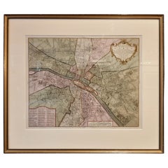
Antique Map of the City of Paris by Tirion '1763'
Located in Langweer, NL
Antique map titled 'Nieuwe Kaart der platte Grond van de Stad Parys (..)'. Beautiful city plan of
Category
Antique Mid-18th Century Maps
Materials
Paper
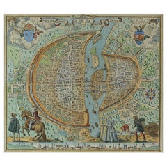
French Map of Paris, Musuem Carnavalet Rossingol University Map, 1576
Located in Gardena, CA
- English: Map of Paris (1576) / museum Carnavalet Rossignol, it is the true fortrict of the City, City
Category
Antique 16th Century French Maps
Materials
Paper
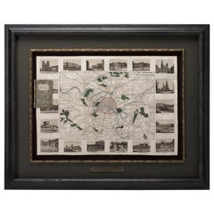
Antique Map of Paris, "Carte Routiere des Environs de Paris" 1841
Located in Colorado Springs, CO
This beautiful hand-colored road map of Paris was published in 1841. The map shows Paris and the
Category
Antique 1840s French Maps
Materials
Paper
Plan of Paris, France, by A. Vuillemin, Antique Map, 1845
Located in Colorado Springs, CO
This large and detailed plan of Paris was published by Alexandre Vuillemin in 1845. The map conveys
Category
Antique 1840s American Maps
Materials
Paper
Antique Map of Cities of the Jiangsu Region in China, c.1760
By Jacques-Nicolas Bellin
Located in Langweer, NL
ville de Su-Tcheou-Fou.' A map of the city of Nanking or Nanjing and a second map shows Suzhou (?) in
Category
Antique 18th Century Maps
Materials
Paper
Antique Map of Cities of the Province of Shanxi in China, 1749
By Jacques-Nicolas Bellin
Located in Langweer, NL
Generale des Voyages' (Paris 1746-1759).
Artists and Engravers: Jacques-Nicolas Bellin (1703-1772) was a
Category
Antique 18th Century Maps
Materials
Paper
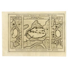
Antique Map of Cities in the Region of Hubei in China, 1758
Located in Langweer, NL
Antique map titled 'Plans de Quelques villes de la province de Hou-Quang.' Three plans of cities in
Category
Antique 18th Century Maps
Materials
Paper
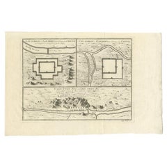
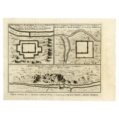
Antique Map of Three Chinese Cities in Chensi and Koei Tcheou, c.1758
Located in Langweer, NL
plans of old Chinese cities. While these maps by Van Schley after Bellin were initially made for
Category
Antique 18th Century Maps
Materials
Paper
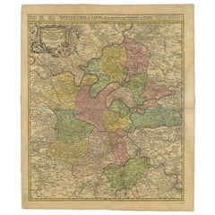
Antique Map of the Region of Paris by Homann Heirs, c.1720
By Homann Heirs
Located in Langweer, NL
. Centered on Paris, the map extends to show these cities at the extremities - Ablis, Messe, Herissy, Senlies
Category
Antique 18th Century Maps
Materials
Paper
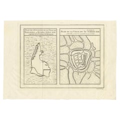
Antique Map of Cities Nanking and Suzhou in the Jiangsu Region, China, c.1758
Located in Langweer, NL
ville de Su-Tcheou-Fou.' A map of the city of Nanking or Nanjing. A second map shows Suzhou (?) in the
Category
Antique 18th Century Maps
Materials
Paper
H 9.38 in W 12.68 in D 0 in
Antique Map of the Region of Paris ‘France’ by H. Heirs, circa 1720
Located in Langweer, NL
. Centered on Paris, the map extends to show these cities at the extremities - Ablis, Messe, Herissy, Senlies
Category
Antique Early 18th Century Maps
Materials
Paper
Decorative Antique Map of the Seine River and Paris in France, ca.1854
By Victor Levasseur
Located in Langweer, NL
Antique map titled 'Dépt. de la Seine'. Map of the French department of Seine. Focusing on Paris
Category
Antique Mid-19th Century Maps
Materials
Paper
H 13.98 in W 20.67 in D 0.02 in
Antique Map of the Tunquin River and Bay to Cacho, the Capital City, Siam, 1758
Located in Langweer, NL
Tunquin River and Bay, extending north to Cacho, the capital city. While these maps by Van Schley after
Category
Antique 18th Century Maps
Materials
Paper
H 10.16 in W 7.45 in D 0 in
1864 Map of North America, Antique Hand-Colored Map, by Adolphe Hippolyte Dufour
Located in Colorado Springs, CO
Offered is a map of North America entitled Amerique du Nord from 1864. This rare, separately
Category
Antique 1860s French Maps
Materials
Paper
H 44.5 in W 33 in D 1.5 in
1812 United States Map, by Pierre Tardieu, Antique French Map Depicting the U.S.
By Pierre François Tardieu
Located in Colorado Springs, CO
Map by Tardieu
This attractive map, published in Paris in 1812, is one of the most rare large
Category
Antique 1810s French Maps
Materials
Paper
H 43.5 in W 48 in D 2.25 in
1705 Golfe de Mexico and Florida Framed Map
Located in Stamford, CT
Framed map of Mexico & Florida circa 1705, Paris. Small map with Mexico and the Gulf Coast. Inset
Category
Antique Early 1700s French Spanish Colonial Maps
Materials
Glass, Wood, Paper
French Geographical, Statistical and Historical Map of Pensylvania, 1825
Located in Langweer, NL
. Carez in Paris. (1825)
Hand colored engraved map. Relief shown by hachures. Text and tables at sides
Category
Antique 1820s Maps
Materials
Paper
H 20.08 in W 25.99 in D 0 in
Antique Map of Isère ‘France’ by V. Levasseur, 1854
By Victor Levasseur
Located in Langweer, NL
Antique map titled 'Dépt. de l'Isère'. Map of the French department Isere. It is presented with a
Category
Antique Mid-19th Century Maps
Materials
Paper
Antique Map of Loiret ‘France’ by V. Levasseur, 1854
Located in Langweer, NL
Antique map titled 'Dépt. du Loiret'. Map of the French department of Loiret, France. Surrounding
Category
Antique Mid-19th Century Maps
Materials
Paper
Antique Map of Sarthe 'France' by V. Levasseur, 1854
By Victor Levasseur
Located in Langweer, NL
city is Le Mans, and other important centres are La Fleche and Mamers. This map originates from ‘Atlas
Category
Antique Mid-19th Century Maps
Materials
Paper
Antique Plan of the City of Bayonne, France
Located in Langweer, NL
Antique map titled 'Plan de Bayonne'. Original old plan of the city of Bayonne, France. This map
Category
Antique Mid-18th Century Maps
Materials
Paper
Antique Map of Tarn and Garonne in France, 1854
By Victor Levasseur
Located in Langweer, NL
, France. This map is centered around the city of Moissac, which is known for its fine desert grapes. This
Category
Antique Mid-19th Century Maps
Materials
Paper
1590 Mercator Map Entitled "France Picardie Champaigne, Ric.0001
Located in Norton, MA
cities of Caen, Paris, Melun, Auxerre, Verdun, etc. Copperplate engraving on verge type hand laid paper
Category
Antique 16th Century Dutch Maps
Materials
Paper
Antique Map of Var 'France' by V. Levasseur, 1854
By Victor Levasseur
Located in Langweer, NL
Antique map titled 'Dépt. du Var'. Map of the French department of Var, the heart of the French
Category
Antique Mid-19th Century Maps
Materials
Paper
1859 Classic Map of France: Blackie's Imperial Geographic Masterpiece
Located in Langweer, NL
The "Antique Map of France" from 'The Imperial Atlas of Modern Geography', published in 1859 by W
Category
Antique Mid-19th Century Maps
Materials
Paper
H 21.26 in W 14.57 in D 0.02 in
Original Steel Engraved Map of French Colonies in America, 1854
Located in Langweer, NL
from ‘Atlas National de la France Illustré’. Published by A. Combette, Paris, 1854.
On the antique map
Category
Antique Mid-19th Century Maps
Materials
Paper
Free Shipping
H 13.12 in W 18.71 in D 0.02 in
Antique Map of Upper Vienne ‘France’ by V. Levasseur, 1854
By Victor Levasseur
Located in Langweer, NL
capital city Limoges, in the region of Limousin. This map originates from ‘Atlas National de la France
Category
Antique Mid-19th Century Maps
Materials
Paper
Old Map of Vaucluse, France: A Cartographic Celebration of Viticulture, 1852
Located in Langweer, NL
name, A. Combette from Paris, and the addresses of the various contributors to the map's creation, like
Category
Antique 1850s Maps
Materials
Paper
H 14.18 in W 20.99 in D 0 in
Antique Map of Seine et Oise 'France' by V. Levasseur, 1854
By Victor Levasseur
Located in Langweer, NL
Pontoise to Etampes. Paris figures prominently in the right hand section of the map. Also shows the city
Category
Antique Mid-19th Century Maps
Materials
Paper
Antique Map of Western Europe and Spain by Scherer, circa 1703
Located in Langweer, NL
Untitled map of Western Europe and Spain. Depicting Rome, Edinburgh, Paris, Madrid, Stockholm and
Category
Antique 18th Century Maps
Materials
Paper
Antique Map of part of Europe by Scherer, c.1703
Located in Langweer, NL
Untitled map of Europe depicting Calais, Münster, Paris, Lion, Prag, Wien, Berlin, Clermont and
Category
Antique 18th Century Maps
Materials
Paper
Antique Map Depicting Sydney and Surrounding Areas, Known as Port Jackson, c1889
Located in Langweer, NL
," published in Paris.
The map is a color-printed engraving, a common technique of the time, which allowed for
Category
Antique 1880s Maps
Materials
Paper
Free Shipping
H 10.16 in W 13.39 in D 0 in
1852 Map of Haut-Rhin: An Illustrated Gateway to Alsace's Viticultural Splendors
Located in Langweer, NL
name, A. Combette from Paris, and the addresses of the various contributors to the map's creation, like
Category
Antique 1850s Maps
Materials
Paper
H 14.18 in W 20.75 in D 0 in
Detailed Map of the Madura Strait, between Java & Madura Island, Indonesia, 1825
Located in Langweer, NL
the city Bangkalam. In the lower part of the map a view of the strait of Madura between Java and the
Category
Antique 1820s Maps
Materials
Paper
Free Shipping
H 26.78 in W 19.89 in D 0 in
1752 Vaugoundy Map of Flanders : Belgium, France, and the Netherlands, Ric.a002
Located in Norton, MA
cartouche is depicted at the lower-left corner.
This map was published in Paris by Gilles Robert de
Category
Antique 17th Century Unknown Maps
Materials
Paper
H 51.5 in W 66 in D 1 in
"Nova Barbariae Descriptio", a 17th Century Hand-Colored Map of North Africa
By Johannes Janssonius
Located in Alamo, CA
This original attractive 17th century hand-colored map of North Africa entitled "Nova Barbariae
Category
Antique Mid-17th Century Dutch Maps
Materials
Paper
H 22.38 in W 29 in D 0.13 in
Old Map of Part of France: Poitou, Berry, Bourbonnais, and Nivernais in 1768
Located in Langweer, NL
, which is a city in the Allier department in the center of France.
The text included on the map gives a
Category
Antique 1760s Maps
Materials
Paper
H 13.19 in W 20.28 in D 0 in
Antique Map of the Region of Île-de-France by Hondius, circa 1630
Located in Langweer, NL
("Paris Region") because it includes the city of Paris. This map originates from a composite atlas and
Category
Antique Mid-17th Century Maps
Materials
Paper
Map of Rhône: Culture and Commerce in Lyon's Silk and Wine Legacy, 1852
Located in Langweer, NL
name, A. Combette from Paris, and the addresses of the various contributors to the map's creation, like
Category
Antique 1850s Maps
Materials
Paper
Antique Map of Ancient Jerusalem, depicting The Temple of Solomon, c.1725
Located in Langweer, NL
Antique map titled 'Nieuwe Plattegrond van het Oude Jeruzalem Volgens den Schryver.'
Bird's-eye
Category
Antique 18th Century Maps
Materials
Paper
H 19.49 in W 15.56 in D 0 in
The Illustrated Map of the Var Department from the Atlas National Illustré, 1856
Located in Langweer, NL
This original hand-colored map is from the "Atlas National Illustré," a work by Victor Levasseur, a
Category
Antique 1850s Maps
Materials
Paper
H 14.18 in W 20.87 in D 0 in
Antique Map of the Region of 'Île de France' by Janssonius, circa 1650
By Johannes Janssonius
Located in Langweer, NL
Antique map of France titled 'Le Gouvernement de L'Isle de France'. Paris is represented by a
Category
Antique Mid-17th Century Maps
Materials
Paper
H 19.3 in W 22.64 in D 0.02 in
Interesting Map of the Thousand Islands in the Bay of Batavia 'Jakarta', ca.1740
Located in Langweer, NL
de cartes et plans des quatre parties du Monde. Paris: Bellin, 1764, but again they are smaller. Map
Category
Antique 1740s Maps
Materials
Paper
H 11.42 in W 8.27 in D 0 in
Plan for the City of Washington by Andrew Ellicott, Antique Print, 19th Century
Located in Colorado Springs, CO
By Andrew Ellicott (1754-1820) and Pierre Charles L'Enfant (1754-1825). Plan of the City of
Category
Antique Late 19th Century American Maps
Materials
Paper
H 36 in W 43.75 in D 3 in
Old Map of North India From Kandahar East to Burma 'Pegu' and South to Goa, 1776
Located in Langweer, NL
(fl. 1743 - 1793) was a Paris based bookseller, engraver, and map publisher active in the mid to late
Category
Antique 1770s Maps
Materials
Paper
H 14.77 in W 19.1 in D 0 in
Old Engraving the City and Harbour of Pathmos, Patmos or Patimo in Greece, 1725
Located in Langweer, NL
view of the city and harbour of Pathmos, Patmos or Patimo in Greece. This plate originates from: 'Het
Category
Antique 1720s Maps
Materials
Paper
H 15.63 in W 19.61 in D 0 in
Bird's Eye Plan of the Ancient City of Jerusalem Based on Old Records, c.1725
Located in Langweer, NL
the ancient city of Jerusalem based on Villalpando's foundation map. The plan shows only the major
Category
Antique 18th Century Maps
Materials
Paper
H 20.2 in W 16.74 in D 0 in
Ancient Gaul: A Cartographic Overview of Gallic Tribes and Roman Provinces, 1880
Located in Langweer, NL
The print titled "GALLIA," is a historical map of ancient Gaul, which corresponds to modern-day
Category
Antique 1880s Maps
Materials
Paper
Free Shipping
H 15.56 in W 18.51 in D 0 in
Mapping the Heart of France: Willem Blaeu's 17th Century Île-de-France, ca.1650
Located in Langweer, NL
region, which historically was one of the provinces of France and contained the city of Paris and its
Category
Antique 1650s Maps
Materials
Paper
Free Shipping
H 20.08 in W 24.02 in D 0 in
Levasseur's 1852 Cartographic Portrait of Gironde: Celebrating the Bordeaux Wine
Located in Langweer, NL
name, A. Combette from Paris, and the addresses of the various contributors to the map's creation, like
Category
Antique 1850s Maps
Materials
Paper
H 20.67 in W 14.06 in D 0 in
Map of Paris - Original Etching - 19th Century
Located in Roma, IT
artwork is very good.
This artwork represents a detailed map of the city of Paris..
Category
19th Century Figurative Prints
Materials
Etching
1861 Original vintage map of Paris - Historical cartography
Located in PARIS, FR
the city and the defenses that protected it.
Today, the Nouveau Plan Illustré de la Ville de Paris of
Category
1860s Prints and Multiples
Materials
Paper, Lithograph
H 33.86 in W 42.92 in
Le Corbusier, Map of Paris, Le Corbusier Œuvre Plastique (after)
By Le Corbusier
Located in Auburn Hills, MI
Badovici, Paris; printed by Éditions Albert Morancé, 1938.
LE CORBUSIER (1887-1965), was a Swiss-French
Category
1930s Modern Landscape Prints
Materials
Lithograph
Original Vintage Illustrated Map Poster Railway Travel Normandy Brittany Paris
By Lucien Boucher
Located in London, GB
Original vintage travel poster featuring a colourful Illustrated Map of the State Railways Sea and
Category
Vintage 1930s French Posters
Materials
Paper
H 39.38 in W 24.61 in D 0.04 in
1851 Original map by Maillard - Plan de Paris et ses Fortifications
Located in PARIS, FR
enlightening view of Paris during a period of significant transformation. This extraordinary map not only
Category
1850s Prints and Multiples
Materials
Linen, Paper, Lithograph
H 30.71 in W 39.38 in
1848 Original map by Maillard - Plan de Paris et ses Fortifications
Located in PARIS, FR
, encapsulating the essence of a place at a specific moment in time. The 1848 vintage map, "Plan de Paris et ses
Category
1840s Prints and Multiples
Materials
Paper, Lithograph, Linen
H 27.96 in W 40.56 in
Antique Map of the Ancient City of Jerusalem by A. Calmet, 1725
Located in Langweer, NL
Antique map, titled: 'Nieuwe Plattegrond van het Oude Jeruzalem Volgens den Schryver.' - Bird's-eye
Category
Antique Early 18th Century Prints
Materials
Paper
Paris Street View #9 – Michael Wolf, Google Maps, Color Photography, Pixel
By Michael Wolf
Located in Zurich, CH
new way of reading the city. Two people embracing on a busy Paris street, for instance, are a playful
Category
Early 2000s Contemporary Color Photography
Materials
C Print
Free Shipping
H 70.01 in W 90.01 in
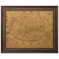
French Mid-Century Reprint of Early 18th Century Map of Paris in Sepia Colors
Located in Haddonfield, NJ
Custom Wooden Framed Map of 1700's Hundreds Paris, France.
This reprint of the early antique map
Category
Mid-20th Century French Baroque Decorative Art
Materials
Linen, Wood, Paper
H 21.5 in W 25.5 in D 1.35 in
French 1930s Map of Paris à Vol d'Oiseau under Glass in Custom Iron Frame
Located in Atlanta, GA
A French map of Paris from the early 20th century, with custom iron frame. Created in Paris during
Category
Early 20th Century French Prints
Materials
Iron
H 28.75 in W 40.25 in D 1 in
- 1
Get Updated with New Arrivals
Save "Paris City Maps", and we’ll notify you when there are new listings in this category.
Paris City Maps For Sale on 1stDibs
Find a variety of paris city maps available on 1stDibs. There are many contemporary, abstract and Art Deco versions of these works for sale. These items have been produced for many years, with earlier versions available from the 18th Century and newer variations made as recently as the 21st Century. Paris city maps available on 1stDibs span a range of colors that includes gray, brown, beige, blue and more. These artworks have been a part of the life’s work for many artists, but the versions made by Maestro Bouchon, Alexander Ross, Dong Kingman, Philippe Halaburda and Suzanne Benton are consistently popular. The range of these distinct pieces — often created in paint, oil paint and fabric — can elevate any room of your home.
How Much are Paris City Maps?
Prices for pieces in our collection of paris city maps start at $30 and top out at $150,000 with the average selling for $2,533.
More Ways To Browse
Map Of Luxembourg
Isadora Duncan Book
Robert Whistler
Hutch On Hutch
Melun Paris
Lucy Paris
Tomorrows House
Old Map California
Old Map Of California
Madrid Map
Antique Map Of Philadelphia
Moroccan Fountain
Weather Forecast
Retro Wooden Ladders Ladders
Retro Wooden Ladder
Charles S Anderson
Islamic Calligraphy Painting
Mississippi Map
