Prints Of Antique Maps
76
to
335
2,820
806
2,107
1,397
1,221
644
238
223
223
223
219
197
168
154
141
137
98
73
64
63
55
50
50
48
48
46
45
43
41
39
35
33
30
30
28
28
28
27
25
24
23
22
21
20
19
17
16
15
15
11
6
2
104
66
44
36
33
Sort By
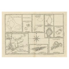
Print of Maps of Islands of the South Pacific, Incl. Pitcairn & Dusky Bay, 1788
Located in Langweer, NL
Antique map titled 'Esquisse de la Bay Dusky, Dans La Nouvelle Zeelande / I. Pitcairn / Isles de
Category
1780s Prints Of Antique Maps
Materials
Paper
No Reserve
H 12.21 in W 18.31 in D 0 in
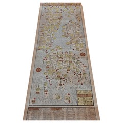
Antique Woodblock Print Map of Japan 'circa 1860'
Located in Langweer, NL
Original Japanese woodblock print map of Japan. Very large and fascinating map, rebacking with
Category
Late 19th Century Prints Of Antique Maps
Materials
Paper
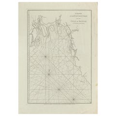
Antique Map of the Bay of Bengal Printed for Robert Sayer, 1787
Located in Langweer, NL
Antique map titled 'A Chart of the Eastern Coast of the Gulf of Bengal'. Original antique map of
Category
Late 18th Century Prints Of Antique Maps
Materials
Paper
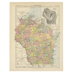
Antique Map of Wisconsin with Inset Geological Map of Wisconsin
Located in Langweer, NL
geological map of Wisconsin. This print originates from 'Encyclopaedia Britannica', Ninth Edition. Published
Category
Late 19th Century Prints Of Antique Maps
Materials
Paper
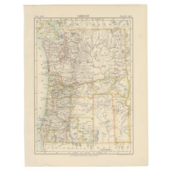
Antique Map of Oregon
Located in Langweer, NL
Antique map titled 'Oregon'. Original antique map of Oregon, United States. This print originates
Category
Late 19th Century Prints Of Antique Maps
Materials
Paper
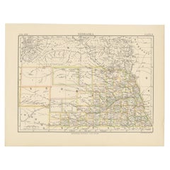
Antique Map of Nebraska
Located in Langweer, NL
Antique map titled 'Nebraska'. Original antique map of Nebraska, United States. This print
Category
Late 19th Century Prints Of Antique Maps
Materials
Paper
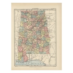
Antique Map of Alabama
Located in Langweer, NL
Antique map titled 'Alabama'. Original antique map of Alabama, United States. This print originates
Category
Late 19th Century Prints Of Antique Maps
Materials
Paper
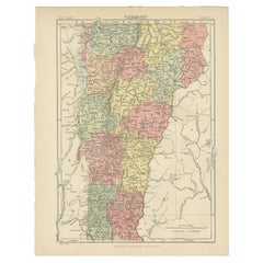
Antique Map of Vermont
Located in Langweer, NL
Antique map titled 'Vermont'. Original antique map of Vermont, United States. This print originates
Category
Late 19th Century Prints Of Antique Maps
Materials
Paper
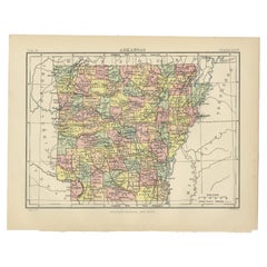
Antique Map of Arkansas
Located in Langweer, NL
Antique map titled 'Arkansas'. Original antique map of Arkansas, United States. This print
Category
Late 19th Century Prints Of Antique Maps
Materials
Paper
Antique Map of Iowa
Located in Langweer, NL
Antique map titled 'Iowa'. Original antique map of Iowa, United States. This print originates from
Category
Late 19th Century Prints Of Antique Maps
Materials
Paper
Antique Map of Kentucky
Located in Langweer, NL
Antique map titled 'Kentucky'. Original antique map of Kentucky, United States. This print
Category
Late 19th Century Prints Of Antique Maps
Materials
Paper
Set of 2 Costume Prints and a Map of Spain and Portugal, circa 1720
Located in Langweer, NL
Set of two costume prints and a map of Spain and Portugal. The costume prints show costumes of
Category
Early 18th Century Prints Of Antique Maps
Materials
Paper
Antique Map of Virginia, with Inset Map of the South Western Continuation
Located in Langweer, NL
Antique map titled 'Virginia'. Original antique map of Virginia, United States. With inset map of
Category
Late 19th Century Prints Of Antique Maps
Materials
Paper
H 8.27 in W 10.63 in D 0.02 in
Antique Map of North Carolina, with inset map of the western part
Located in Langweer, NL
inset map of the western part of North Carolina. This print originates from 'Encyclopaedia Britannica
Category
Late 19th Century Prints Of Antique Maps
Materials
Paper
Antique Map of Ohio, with Inset Maps of Cleveland, Columbus and Cincinnati
Located in Langweer, NL
Antique map titled 'Ohio'. Original antique map of Ohio, United States. With inset maps of
Category
Late 19th Century Prints Of Antique Maps
Materials
Paper
H 8.27 in W 10.63 in D 0.02 in
Antique Map of Virginia, with Inset Map of the Northern Part of West Viriginia
Located in Langweer, NL
Antique map titled 'West Virginia'. Original antique map of Virginia, United States. With inset map
Category
Late 19th Century Prints Of Antique Maps
Materials
Paper
H 8.27 in W 10.63 in D 0.02 in
1907 Map of Colorado, Antique Topographical Map, by Louis Nell
Located in Colorado Springs, CO
along fold lines. Printed color is bold. Paper is healthy, with no tears.
The map has been framed
Category
Early 1900s American Prints Of Antique Maps
Materials
Paper
Antique Map of New Hampshire
Located in Langweer, NL
Antique map titled 'New Hampshire'. Original antique map of New Hampshire, United States. This
Category
Late 19th Century Prints Of Antique Maps
Materials
Paper
17th Century Map of Cumberland County in Northwest England Printed by John Speed
By John Speed
Located in Middleburg, VA
Rare extremely early map of the county of Cumberland in the Northwest of England. Printed by John
Category
Early 17th Century English Prints Of Antique Maps
Materials
Paper
H 23 in W 27 in D 1 in
Antique Map of Swabia, 1685
Located in Langweer, NL
Antique map titled 'Sueviae quae cis Codanum fuit finum Antiqua defcriptio.' Miniature map of
Category
17th Century Prints Of Antique Maps
Materials
Paper
Staffordshire 1645 Hand Colored Antique Print Staffordiensis Comitatvs Map
Located in GB
We are delighted to offer for sale this lovely antique Atlas page map of Staffordshire printed in
Category
Early 1800s English Georgian Prints Of Antique Maps
Materials
Paper
H 22.45 in W 25.32 in D 0.99 in
Map of North and East coast of Asia with Japan & inset maps of Kamchatka, c1750
Located in Langweer, NL
east coast of Asia, showing an oddly shaped Japan and inset maps of Kamchatka. This old antique print
Category
1750s Prints Of Antique Maps
Materials
Paper
H 14.77 in W 17.45 in D 0 in
1854 Map of Massachusetts, Connecticut and Rhode Island, Antique Wall Map
Located in Colorado Springs, CO
map and print publisher based in New York during the middle part of the 19th century. Ensign was born
Category
19th Century American Prints Of Antique Maps
Materials
Paper
H 38.13 in W 45 in D 3.5 in
Early Map of Puerto Rico Printed in Venice by G. F. Camocio in 1571
Located in Langweer, NL
Porcacchi's map of the Island of Puerto Rico. One of the earliest obtainable maps of the Island and one of the
Category
16th Century Prints Of Antique Maps
Materials
Paper
Free Shipping
H 4.34 in W 5.91 in D 0.01 in
"Clason's Guide Map of Montana" by The Clason Map Company, Circa 1920s
Located in Colorado Springs, CO
condition overall, with only slight marginal wear and creases present. Color map, color is printed and
Category
1920s American Art Deco Prints Of Antique Maps
Materials
Paper
H 23.13 in W 33.88 in D 1.5 in
Antique Map of New Zealand, 1895
Located in Langweer, NL
attractive original old antique print / plate / map originates from 1885-1907 editions of a famous German
Category
19th Century Prints Of Antique Maps
Materials
Paper
German Antique Map of Oceania, 1895
Located in Langweer, NL
Antique map titled 'Oceanie.' Map of Oceania. This attractive original old antique print / plate
Category
19th Century Prints Of Antique Maps
Materials
Paper
Antique Map of Friesland Also Know as the Peacock Map, C.1580
Located in Langweer, NL
Antique map titled ?Frisia Occidentalis?. Original antique map of the province of Friesland, the
Category
18th Century Prints Of Antique Maps
Materials
Paper
Antique Map of New Ireland, 1774
Located in Langweer, NL
Antique print titled 'Neu Irrland (..)'. Antique map of New Ireland with 7 coastal profiles, Papua
Category
18th Century Prints Of Antique Maps
Materials
Paper
Colored wall map of the WORLD
By Chambon
Located in ZWIJNDRECHT, NL
huge wall map of the world in two hemispheres printed on two sheets, depicting the Eastern and Western
Category
Mid-18th Century French French Provincial Prints Of Antique Maps
Materials
Wood, Paper
Pictorial Map of Chicago, circa 1926
Located in Colorado Springs, CO
architecture in the 1920s.
On the "Pictorial Map of Chicago" side, a declaration is printed from the
Category
1920s American Prints Of Antique Maps
Materials
Paper
Antique Map of the Westphalia region of Germany
Located in Langweer, NL
Antique map titled 'Circulus Westphaliae (..)'. Original old map of the Westphalia region, Germany
Category
Late 17th Century Prints Of Antique Maps
Materials
Paper
Antique Map of the Archdiocese of Cologne, Germany
Located in Langweer, NL
Antique map titled 'Archevesche et Eslectorat de Cologne avec ses Enclaves'. Original old map of
Category
Late 17th Century Prints Of Antique Maps
Materials
Paper
Antique Map of Part of Russia, c.1740
Located in Langweer, NL
Antique map titled 'Ienisensis Provinicia cum adjacentibus Toboliensis & Irkutensis'. Old map of
Category
18th Century Prints Of Antique Maps
Materials
Paper
Framed 1838 Mexico & Gulf of Mexico Map
Located in Stamford, CT
Framed 1838 Mexico & Gulf of Mexico map. Printed by Fisher, Son & Co. of London in 1838. As found
Category
1830s English American Classical Prints Of Antique Maps
Materials
Glass, Wood, Paper
Original Antique Map of England and Wales
Located in Langweer, NL
Improvements'. Original antique map of England and Wales. Printed by Alex Hogg, London for George Henry
Category
Late 18th Century Prints Of Antique Maps
Materials
Paper
Double Sided Northamptonshire 1645 Hand Colored Antique Print Map Rare Find
Located in GB
We are delighted to this lovely antique Atlas page map of Northamptonshire printed in 1645
Category
Early 1800s English Georgian Prints Of Antique Maps
Materials
Paper
H 22.25 in W 25.6 in D 0.79 in
Antique Map of the Coromandel Peninsula, 1754
Located in Langweer, NL
Coromandel printed for the London Magazine.
Artists and Engravers: This map is not attributed, so it may
Category
18th Century Prints Of Antique Maps
Materials
Paper
Antique Map of Yemen by Schraembl, 1789
Located in Langweer, NL
map is the first printed map specifically of Yemen, and the earliest map based on actual exploration
Category
Late 18th Century Prints Of Antique Maps
Materials
Paper
Antique Map of Buckinghamshire in England, 1743
Located in Langweer, NL
tradition by using the prints of other publishers, notably the maps of Blaeu and Jansson. Only when these
Category
18th Century Prints Of Antique Maps
Materials
Paper
Antique Map of Sweden by Bowen, 1747
Located in Langweer, NL
Antique map titled 'A New & Accurate Map of Sweden'. This map covers Sweden and Finland (shown as
Category
18th Century Prints Of Antique Maps
Materials
Paper
Antique Map of Sneek by Kuyper, 1868
Located in Langweer, NL
Antique map titled 'Provincie Friesland - Gemeente Sneek'. Map of the township of Sneek, Friesland
Category
19th Century Prints Of Antique Maps
Materials
Paper
Antique Map of Stavoren by Kuyper, 1868
Located in Langweer, NL
Antique map titled 'Provincie Friesland - Gemeente Stavoren'. Map of the township of Stavoren
Category
19th Century Prints Of Antique Maps
Materials
Paper
Colton's Map of Illinois, with an Inset of Chicago
Located in Langweer, NL
. Colton Company maps were printed using engraved steel plates, which produced higher quality prints than
Category
Mid-19th Century Prints Of Antique Maps
Materials
Paper
Antique Map of Ooststellingwerf by Kuyper, 1868
Located in Langweer, NL
Antique map titled 'Provincie Friesland - Gemeente Oost-Stellingwerf'. Map of the township of
Category
19th Century Prints Of Antique Maps
Materials
Paper
Antique Map of Schoterland by Kuyper, 1868
Located in Langweer, NL
Antique map titled 'Provincie Friesland - Gemeente Schoterland'. Map of the township of Schoterland
Category
19th Century Prints Of Antique Maps
Materials
Paper
Antique Map of Oostdongeradeel by Kuyper, 1868
Located in Langweer, NL
Antique map titled 'Provincie Friesland - Gemeente Oost Dongeradeel'. Map of the township of
Category
19th Century Prints Of Antique Maps
Materials
Paper
German Antique Map of Australia, Meyers, 1885
Located in Langweer, NL
original old antique print / plate / map originates from 1885-1907 editions of a famous German encyclopedia
Category
19th Century Prints Of Antique Maps
Materials
Paper
Antique Map of Siberia by Reclus, 1881
Located in Langweer, NL
Antique map titled 'Itineraires en Siberie.' This map shows the itineraries of famous explorers in
Category
19th Century Prints Of Antique Maps
Materials
Paper
Antique Map of Asia by Larousse, 1897
Located in Langweer, NL
Front: 'Carte Generale de l'Asie.' (General map of Asia). Rear: 'Asie.' (Asia, scenes of Asia
Category
19th Century Prints Of Antique Maps
Materials
Paper
Antique Map of Overijssel by Brugsma, 1864
Located in Langweer, NL
Antique map titled 'De Provincie Overijssel'. Map of the province of Overijssel, the Netherlands
Category
19th Century Prints Of Antique Maps
Materials
Paper
Antique Map of Overijssel by Kuyper, 1883
Located in Langweer, NL
Antique map titled 'De Provincie Overijssel'. Map of the province of Overijssel, the Netherlands
Category
19th Century Prints Of Antique Maps
Materials
Paper
Antique Map of Smallingerland by Kuyper, 1868
Located in Langweer, NL
Antique map titled 'Provincie Friesland - Gemeente Smallingerland'. Map of the township of
Category
19th Century Prints Of Antique Maps
Materials
Paper
Antique Map of Ooststellingwerf by Kuyper, 1868
Located in Langweer, NL
Antique map titled 'Provincie Friesland - Gemeente Oost-Stellingwerf'. Map of the township of
Category
19th Century Prints Of Antique Maps
Materials
Paper
Antique Map of Oostdongeradeel by Kuyper, 1868
Located in Langweer, NL
Antique map titled 'Provincie Friesland - Gemeente Oost Dongeradeel'. Map of the township of
Category
19th Century Prints Of Antique Maps
Materials
Paper
Antique Map of Peru by Carey, 1822
Located in Langweer, NL
Antique map titled 'Peru'. Geographical, historical, and statistical map of Peru, surrounded by
Category
19th Century Prints Of Antique Maps
Materials
Paper
Antique Map of Sweden by Delamarche, 1806
Located in Langweer, NL
Antique map titled 'La Suede.' Decorative map of Sweden and part of Finland by Robert de Vaugondy
Category
19th Century Prints Of Antique Maps
Materials
Paper
Antique Map of Overijssel by Bachiene, 1758
Located in Langweer, NL
Antique map titled 'Over-Yssel'. Map of the Overijssel, the Netherlands. This map originates from
Category
18th Century Prints Of Antique Maps
Materials
Paper
Antique Map of Russia in Europe, 1842
Located in Langweer, NL
Antique map titled 'Carte de la Russie d'Europe'. Map of Russia in Europe. This map originates from
Category
19th Century Prints Of Antique Maps
Materials
Paper
Antique Map of Oceania by Delamarche, 1836
Located in Langweer, NL
Antique map titled 'Carte de l'Oceanie contenant l'Australie la Poynesie et les iles Asiatiques
Category
19th Century Prints Of Antique Maps
Materials
Paper
- 1
- ...
Get Updated with New Arrivals
Save "Prints Of Antique Maps", and we’ll notify you when there are new listings in this category.
Prints Of Antique Maps For Sale on 1stDibs
An assortment of prints of antique maps is available at 1stDibs. Each of these unique prints of antique maps was constructed with extraordinary care, often using paper, wood and fabric. There are all kinds of prints of antique maps available, from those produced as long ago as the 18th Century to those made as recently as the 20th Century. Prints of antique maps made by Victorian designers — as well as those associated with Neoclassical — are very popular at 1stDibs. Many prints of antique maps are appealing in their simplicity, but Abraham Ortelius, Antonio Vallardi Editore and F. Valentijn produced popular prints of antique maps that are worth a look.
How Much are Prints Of Antique Maps?
Prices for prints of antique maps start at $92 and top out at $17,500 with the average selling for $413.
More Ways To Browse
Antique Printers Case
Antique Florida Map
Antique Map Florida
Antique Maps Florida
Antique Florida Maps
Map Of Wisconsin
Dutch Server
Antique Maps Of Florida
Antique Map Of Florida
Map Louisiana
Blaeu India
Antique Mississippi Maps
Antique Mississippi Map
Antique Map Of Mississippi
Atlas Du Monde Antique
Washington Antique Map
Antique Furniture Western Australia
Chart Cabinet
