Antique Cartography
42
to
152
1,344
224
955
558
548
226
135
110
89
84
77
77
75
65
59
58
48
37
34
28
27
27
16
16
14
13
13
12
12
11
9
9
8
8
6
6
4
4
4
3
3
3
3
2
2
2
2
2
1
1
1
1
102
18
15
14
9
Sort By
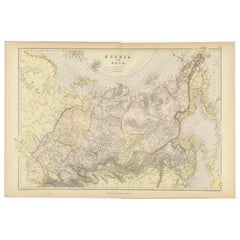
Detailed Antique Cartography of Asian Russia, 1882
Located in Langweer, NL
This exquisite map, hailing from the year 1882, is a remarkable historical cartographic artifact
Category
1880s Antique Cartography
Materials
Paper
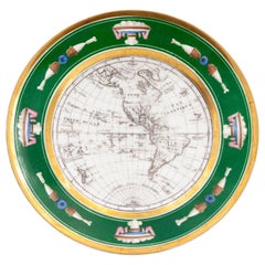
French Empire Style Porcelain Cartographic Cabinet Plate
Located in Fort Lauderdale, FL
A beautiful French Empire style porcelain cartographic cabinet plate made circa 1825 featuring a
Category
Early 19th Century French Empire Antique Cartography
Materials
Porcelain
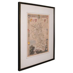
Antique Lithography Map, Buckinghamshire, English, Framed Cartography, Victorian
Located in Hele, Devon, GB
cartographic interest, dating to the mid 19th century and later.
Superb lithography of Buckinghamshire and its
Category
Mid-19th Century British Victorian Antique Cartography
Materials
Wood, Paper
H 16.15 in W 13.19 in D 0.6 in
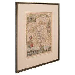
Antique Lithography Map, Worcestershire, English, Framed Engraving, Cartography
Located in Hele, Devon, GB
cartographic interest, dating to the early 19th century and later.
Superb lithography of Worcestershire and
Category
Early 19th Century British Regency Antique Cartography
Materials
Wood
H 15.95 in W 13.19 in D 0.6 in
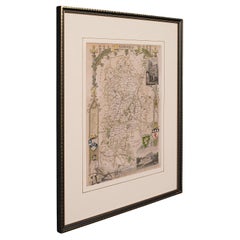
Antique Lithography Map, Bedfordshire, English, Framed Engraving, Cartography
Located in Hele, Devon, GB
cartographic interest, dating to the mid 19th century and later.
Superb lithography of Bedfordshire and its
Category
Mid-19th Century British Victorian Antique Cartography
Materials
Wood
H 15.75 in W 13.19 in D 0.6 in
Antique Lithography Map, Hertfordshire, English, Framed Engraving, Cartography
Located in Hele, Devon, GB
cartographic interest, dating to the mid 19th century and later.
Superb lithography of Hertfordshire and its
Category
Mid-19th Century British Victorian Antique Cartography
Materials
Wood
H 13.59 in W 15.75 in D 16.34 in
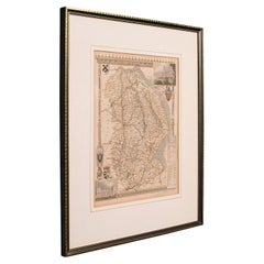
Antique Lithography Map, Lincolnshire, English, Framed, Engraving, Cartography
Located in Hele, Devon, GB
cartographic interest, dating to the mid 19th century and later.
Superb lithography of Lincolnshire and its
Category
Mid-19th Century British Victorian Antique Cartography
Materials
Wood
H 15.95 in W 13.39 in D 0.6 in
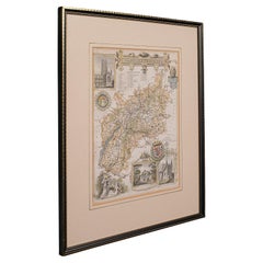
Antique Lithography Map, Gloucestershire, English, Framed Engraving, Cartography
Located in Hele, Devon, GB
cartographic interest, dating to the mid 19th century and later.
Superb lithography of Gloucestershire and its
Category
Mid-19th Century British Victorian Antique Cartography
Materials
Wood
H 15.75 in W 13 in D 0.6 in
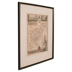
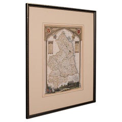
Antique Lithography Map, Northumberland, English, Framed, Engraving, Cartography
Located in Hele, Devon, GB
cartographic interest, dating to the mid 19th century and later.
Superb lithography of Northumberland and its
Category
Mid-19th Century British Victorian Antique Cartography
Materials
Wood
H 16.74 in W 13.98 in D 0.6 in
1861 Original vintage map of Paris - Historical cartography
Located in PARIS, FR
Forts Détachés" of 1861, drawn up by A. Vuillemin, is a remarkable historical cartography that bears
Category
1860s Antique Cartography
Materials
Paper, Lithograph
H 33.86 in W 42.92 in
Roman Italy and Provinces: A Cartographic Snapshot, 1880
Located in Langweer, NL
The map titled "ITALIA, Gallia Cisalpina, Sicilia, Sardinia, Corsica" focuses on Italy and its surrounding regions during Roman times. It offers a detailed depiction of the Italian p...
Category
1880s Antique Cartography
Materials
Paper
Zaragoza: Crossroads of Heritage - The 1901 Cartographic Chronicle
Located in Langweer, NL
The print on sale is a historical map of the province of Zaragoza, Spain, dated 1901. The title on the map is "ZARAGOZA. 1901." This map details the geographical features of Zaragoza...
Category
Early 1900s Antique Cartography
Materials
Paper
Free Shipping
H 14.77 in W 20.08 in D 0 in
A Catalonian Cartographic Depiction of Tarragona Province, 1901
Located in Langweer, NL
This image depicts a historical map of the province of Tarragona, which is in the northeastern part of Spain, within the autonomous community of Catalonia. The map is dated 1901, sug...
Category
Early 1900s Antique Cartography
Materials
Paper
Free Shipping
H 14.77 in W 20.08 in D 0 in
Cartographic Survey of Pontevedra, 1902: Crossroads of Galicia"
Located in Langweer, NL
This original old map of over 100 years old depicts the province of Pontevedra as it was in 1902. Pontevedra is located in the northwest of Spain, in the autonomous community of Gali...
Category
Early 1900s Antique Cartography
Materials
Paper
Free Shipping
H 20.08 in W 14.77 in D 0 in
Antique Draughtsman's Tool Set, English, Cartography, Instruments, Edwardian
Located in Hele, Devon, GB
This is an antique master draughtsman's tool set. An English, case of cartographer's drawing instruments, dating to the Edwardian period, circa 1910.
Comprehensive set of 17 pieces,...
Category
Early 20th Century British Edwardian Antique Cartography
Materials
Wood
H 1.97 in W 14.38 in D 5.32 in
Antique County Map, Norfolk, English, Framed Lithography, Cartography, Victorian
Located in Hele, Devon, GB
This is an antique lithography map of Norfolk. An English, framed atlas engraving of cartographic
Category
Mid-19th Century British Victorian Antique Cartography
Materials
Glass, Wood
H 14.57 in W 16.93 in D 0.6 in
Antique County Map, Rutlandshire, English, Framed, Cartography, Victorian, 1860
Located in Hele, Devon, GB
cartographic interest, dating to the mid 19th century and later.
Superb lithography of Rutlandshire and its
Category
Mid-19th Century British Victorian Antique Cartography
Materials
Wood
H 15.75 in W 13.19 in D 0.6 in
Antique Lithography Map, County Durham, English, Framed Cartography, Victorian
Located in Hele, Devon, GB
cartographic interest, dating to the mid 19th century and later.
Superb lithography of County Durham and
Category
Mid-19th Century British Mid-Century Modern Antique Cartography
Materials
Wood
H 13.98 in W 16.15 in D 0.6 in
Antique Lithography Map of Cheshire, English, Framed, Cartography, Victorian
Located in Hele, Devon, GB
This is an antique lithography map of Cheshire. An English, framed atlas engraving of cartographic
Category
Mid-19th Century British Victorian Antique Cartography
Materials
Wood
H 13.59 in W 15.56 in D 0.6 in
Antique Lithography Map, Northamptonshire, English, Framed Cartography, C.1860
Located in Hele, Devon, GB
cartographic interest, dating to the mid 19th century and later.
Superb lithography of Northamptonshire and
Category
Mid-19th Century British Victorian Antique Cartography
Materials
Wood
H 15.95 in W 13.19 in D 0.6 in
Antique Draughtsman's Railway Curves, English, Pearwood, Cartography, Edwardian
Located in Hele, Devon, GB
This is a set of antique draughtsman's railway curves. An English, pearwood set of drawing instruments in a mahogany case, dating to the Edwardian period, circa 1910.
Wonderfully ...
Category
Early 20th Century British Edwardian Antique Cartography
Materials
Pearwood
H 3.55 in W 14.77 in D 2.17 in
Antique Lithography Map, Cumbria, English, Framed Cartography Interest, Georgian
Located in Hele, Devon, GB
This is an antique lithography map of Cumbria. An English, framed engraving of cartographic
Category
Early 18th Century British Georgian Antique Cartography
Materials
Wood
H 21.86 in W 25.2 in D 0.79 in
Antique Lithography Map, Durham, English, Framed, Cartography, Early Georgian
Located in Hele, Devon, GB
This is an antique lithography map of Durham. An English, framed engraving of cartographic interest
Category
Early 18th Century British Georgian Antique Cartography
Materials
Wood
H 20.28 in W 21.86 in D 0.6 in
Antique Lithography Map, Western Russia, English, Framed, Cartography, Victorian
Located in Hele, Devon, GB
cartographic interest by John Rapkin, dating to the early Victorian period and later, circa 1850.
John Rapkin
Category
Mid-19th Century British Early Victorian Antique Cartography
Materials
Wood
H 21.46 in W 17.33 in D 0.6 in
Antique Lithography Map, West Africa, English, Framed, Cartography, Victorian
Located in Hele, Devon, GB
cartographic interest by John Rapkin, dating to the early Victorian period and later, circa 1850.
John Rapkin
Category
Mid-19th Century British Early Victorian Antique Cartography
Materials
Wood
H 17.52 in W 19.89 in D 0.79 in
Antique Lithography Map, Black Sea, English, Framed, Cartography, Victorian
Located in Hele, Devon, GB
cartographic interest by John Rapkin, dating to the early Victorian period and later, circa 1850.
John Rapkin
Category
Mid-19th Century British Early Victorian Antique Cartography
Materials
Wood
H 17.72 in W 20.48 in D 0.79 in
Antique Lithography Map, South America, English, Framed, Cartography, Victorian
Located in Hele, Devon, GB
cartographic interest by John Rapkin , dating to the early Victorian period and later, circa 1850.
John Rapkin
Category
Mid-19th Century British Early Victorian Antique Cartography
Materials
Wood
H 21.86 in W 17.13 in D 0.79 in
Duchy of Brunswick-Lüneburg, 1595: A Renaissance Cartographic Masterpiece
Located in Langweer, NL
exquisite example of Abraham Ortelius’s cartographic craftsmanship: an original antique copper engraving
Category
16th Century Antique Cartography
Materials
Paper
H 16.93 in W 11.03 in D 0 in
Antique Technical Drawing Set, German, Architect, Cartography, Wichmann
Located in Hele, Devon, GB
This is an antique technical drawing set. A German, architect's or cartographer's instrument case by Wichmann, dating to the early 20th century, circa 1920.
Quality, 14-piece inst...
Category
Early 20th Century German Edwardian Antique Cartography
Materials
Nickel
H 0.99 in W 11.03 in D 4.53 in
Ancient Cartography of Britannia and Hibernia, Published in 1880
Located in Langweer, NL
This map depicts the geographical area of Great Britain and Ireland, labeled "BRITANNIA et HIBERNIA." It is a historical map, as indicated by the Latin titles and the classical names...
Category
1880s Antique Cartography
Materials
Paper
Free Shipping
H 18.51 in W 15.56 in D 0 in
Ancient Cartography of the Indian Subcontinent, Published in 1880
Located in Langweer, NL
This map is titled "INDIA," and it provides a detailed view of the Indian subcontinent with various inset maps that offer additional historical and geographical context.
The main ma...
Category
1880s Antique Cartography
Materials
Paper
Free Shipping
H 15.56 in W 18.51 in D 0 in
Barcelona 1901: A Cartographic Portrait of Catalonia's Capital Province
Located in Langweer, NL
This orignal antique map is a historical depiction of the province of Barcelona from 1901.
It showcases the varied terrain of the province, with the Serra de Collserola ridge near ...
Category
Early 1900s Antique Cartography
Materials
Paper
Free Shipping
H 14.77 in W 20.08 in D 0 in
Jaén 1902: A Cartographic Depiction of Andalusia's Olive Heartland
Located in Langweer, NL
This original antique map displays the province of Jaén, located in the autonomous community of Andalusia in southern Spain, as of the year 1902. It contains various geographic and i...
Category
Early 1900s Antique Cartography
Materials
Paper
Free Shipping
H 20.08 in W 14.77 in D 0 in
1902 Murcia: A Cartographic Snapshot of Spain's Southeastern Province
Located in Langweer, NL
The map represents the province of Murcia, Spain, as it was in 1902. Here's an overview of its characteristics:
- **Geography**: It displays the varied terrain of Murcia, from the c...
Category
Early 1900s Antique Cartography
Materials
Paper
Free Shipping
H 20.08 in W 14.77 in D 0 in
Topographical and Administrative Cartography of Segovia in Spain, 1902
Located in Langweer, NL
An original old map of the province of Segovia from the year 1902. Segovia is a historic area located in the central part of Spain, northwest of Madrid. Known for its rich history, a...
Category
Early 1900s Antique Cartography
Materials
Paper
Free Shipping
H 14.77 in W 20.08 in D 0 in
Málaga 1901: A Cartographic Detailing of Andalusia's Coastal Jewel
Located in Langweer, NL
The map depicts the province of Málaga, located in the autonomous community of Andalusia in southern Spain, as it was in 1901. Here are the key features illustrated on the map:
- **...
Category
Early 1900s Antique Cartography
Materials
Paper
Free Shipping
H 14.77 in W 20.08 in D 0 in
Granada 1902: A Cartographic Exploration of Andalusia's Mountainous Province
Located in Langweer, NL
This original antique map depicts the province of Granada, part of the autonomous community of Andalusia in southern Spain, as of 1902. The map features several important details:
I...
Category
Early 1900s Antique Cartography
Materials
Paper
Free Shipping
H 14.77 in W 20.08 in D 0 in
Huelva 1901: A Cartographic Presentation of Andalusia's Atlantic Frontier
Located in Langweer, NL
The map displays the province of Huelva, located in the southwestern part of the autonomous community of Andalusia in Spain, as of the year 1901. It outlines various geographic and m...
Category
Early 1900s Antique Cartography
Materials
Paper
Free Shipping
H 20.08 in W 14.77 in D 0 in
Cartographic Tapestry: Antique Map of Asia Minor, circa 1640
Located in Langweer, NL
cartography during the 17th century. It captures the allure of Asia Minor and its enduring significance in the
Category
Mid-17th Century Antique Cartography
Materials
Paper
Antique Lithography Map, Isle of Thanet, Kent, English, Cartography, Victorian
Located in Hele, Devon, GB
engraving of cartographic interest, dating to the mid 19th century and later.
Superb lithography of the
Category
Mid-19th Century British Victorian Antique Cartography
Materials
Wood
H 14.57 in W 16.15 in D 0.6 in
Antique Lithography Map, Cornwall, English Framed Engraving, Cartography, C.1850
Located in Hele, Devon, GB
cartographic interest, dating to the early 19th century and later.
Superb lithography of Conrwall and its
Category
Mid-19th Century British Victorian Antique Cartography
Materials
Wood
H 13.98 in W 16.34 in D 0.6 in
Antique Lithography Map, Isle of Wight, English, Framed, Engraving, Cartography
Located in Hele, Devon, GB
cartographic interest, dating to the early 19th century and later.
Superb lithography of the Isle and its
Category
Early 19th Century British Regency Antique Cartography
Materials
Wood
H 13.59 in W 15.56 in D 0.6 in
18th Century Cartographic Depiction of Upper India and Ceylon, 1835
Located in Langweer, NL
, creating a seamless and expansive cartographic display. Once framed together, they transform into a
Category
1830s Antique Cartography
Materials
Paper
Free Shipping
H 10.04 in W 14.57 in D 0 in
Antique Coaching Road Map, Devon, English, Regional Cartography, Georgian, 1720
Located in Hele, Devon, GB
interest, dating to the early 18th century and later.
Fascinating 18th century highway cartography of
Category
Early 18th Century British Georgian Antique Cartography
Materials
Wood
H 12.21 in W 9.65 in D 0.6 in
Antique Coaching Road Map, South Devon, English, Framed, Cartography, Georgian
Located in Hele, Devon, GB
cartography of Dartmouth to Exeter
Displays a desirable aged patina and in very good order
Unusual and
Category
Early 18th Century British Georgian Antique Cartography
Materials
Wood
H 12.21 in W 9.65 in D 0.4 in
Antique Folding London Map, English, Cartography, Historic, Georgian, Dated 1783
Located in Hele, Devon, GB
This is an antique folding London map. An English, paper on linen cartographical study of the
Category
Late 18th Century British Georgian Antique Cartography
Materials
Linen, Paper
H 6.3 in W 6.11 in D 0.6 in
Albacete, Spain - 1902: A Cartographic Depiction of Landscape and Infrastructure
Located in Langweer, NL
Albacete, Spain - 1902: A Cartographic Depiction of Landscape and Infrastructure
An original and
Category
Early 1900s Antique Cartography
Materials
Paper
Free Shipping
H 14.77 in W 20.08 in D 0 in
Burgundy's Viticultural Landscape: A 1640 Cartographic Engraving by Willem Blaeu
Located in Langweer, NL
flourishing cartography businesses of the 17th century. His works are known for their rich detail and
Category
1640s Antique Cartography
Materials
Paper
Free Shipping
H 18.51 in W 23.43 in D 0 in
Levasseur's 1852 Cartographic Portrait of Gironde: Celebrating the Bordeaux Wine
Located in Langweer, NL
National Illustré' is celebrated for its combination of cartographic detail and artistic embellishment
Category
1850s Antique Cartography
Materials
Paper
H 20.67 in W 14.06 in D 0 in
1902 Cartographic View of Salamanca: The Golden Province of Spain
Located in Langweer, NL
This map showcases the province of Salamanca in the year 1902. Salamanca is located in the autonomous community of Castile and León in western Spain. It is bordered by the provinces ...
Category
Early 1900s Antique Cartography
Materials
Paper
Free Shipping
H 14.77 in W 20.08 in D 0 in
Toledo 1902: A Historical Cartographic Study of this Spanish Province
Located in Langweer, NL
The print is a historical map of the province of Toledo from 1902. It's a detailed, colored map, highlighting topographical features, such as mountain ranges and rivers, as well as i...
Category
Early 1900s Antique Cartography
Materials
Paper
Free Shipping
H 14.77 in W 20.08 in D 0 in
Córdoba 1901: A Cartographic Journey Through Andalusia’s Heartland in Spain
Located in Langweer, NL
The map provided is of the province of Córdoba, part of the autonomous community of Andalusia in southern Spain, as of the year 1901. It details various elements:
The map displays t...
Category
Early 1900s Antique Cartography
Materials
Paper
Free Shipping
H 20.08 in W 14.77 in D 0 in
Beira Alta: A Cartographic Journey Through Portugal's Heartland in 1903
Located in Langweer, NL
The uploaded image is a historical map of the Beira Alta region in Portugal. The map is detailed, showing the topography, hydrography, and transportation networks of the region, incl...
Category
Early 1900s Antique Cartography
Materials
Paper
Free Shipping
H 14.77 in W 20.08 in D 0 in
La Coruña 1901: A Cartographic View of Galicia's Maritime Province
Located in Langweer, NL
This antique map for sale showcases the province of La Coruña (in Galician, A Coruña), located in the northwest of Spain, within the autonomous community of Galicia, as of the year 1...
Category
Early 1900s Antique Cartography
Materials
Paper
Free Shipping
H 20.08 in W 14.77 in D 0 in
Map of Soria Province, 1901: Detailed Cartography of Northeastern Spain
Located in Langweer, NL
The map is a historical map of the province of Soria from 1901.
A decorative coat of arms enhances the aesthetic of the map, signifying the historical and cultural significance of ...
Category
Early 1900s Antique Cartography
Materials
Paper
Free Shipping
H 14.77 in W 20.08 in D 0 in
Antique Coach Road Map, East Devon, English, Framed, Cartography, Georgian, 1720
Located in Hele, Devon, GB
cartography of Exeter to Bridport
Displays a desirable aged patina and in very good order
Unusual and charming
Category
Early 18th Century British Georgian Antique Cartography
Materials
Wood
H 12.01 in W 9.45 in D 0.4 in
Champagne: The Sparkling Heart of France - A Blaeu Cartographic Engraving, c1650
Located in Langweer, NL
valuable for their historical context and as artifacts of the cartographic arts. They provide insights into
Category
1650s Antique Cartography
Materials
Paper
Free Shipping
H 20.08 in W 23.82 in D 0 in
Cartographic Elegance of Touraine: A 17th-Century Map Showing French Heritage
Located in Langweer, NL
cartographic detail and artistic presentation. Their work represents a high point in the Golden Age of Dutch
Category
1630s Antique Cartography
Materials
Paper
Free Shipping
H 20.08 in W 23.82 in D 0 in
Ornate Cartography of Colonial Grandeur: The West India Islands around 1851
Located in Langweer, NL
. John Tallis & Company, mentioned in the caption, was an English cartographic publisher active during
Category
1850s Antique Cartography
Materials
Paper
H 10.71 in W 14.26 in D 0 in
Old Map of Vaucluse, France: A Cartographic Celebration of Viticulture, 1852
Located in Langweer, NL
National Illustré' is celebrated for its combination of cartographic detail and artistic embellishment
Category
1850s Antique Cartography
Materials
Paper
H 14.18 in W 20.99 in D 0 in
- 1
- ...
Get Updated with New Arrivals
Save "Antique Cartography", and we’ll notify you when there are new listings in this category.
Antique Cartography For Sale on 1stDibs
Find many varieties of an authentic antique cartography available at 1stDibs. An antique cartography — often made from paper, wood and metal — can elevate any home. You’ve searched high and low for the perfect antique cartography — we have versions that date back to the 18th Century alongside those produced as recently as the 20th Century are available. An antique cartography, designed in the Empire, Louis XVI or Art Nouveau style, is generally a popular piece of furniture. You’ll likely find more than one antique cartography that is appealing in its simplicity, but Jacques-Nicolas Bellin, Nicolas Sanson and Jakob van der Schley produced versions that are worth a look.
How Much is a Antique Cartography?
An antique cartography can differ in price owing to various characteristics — the average selling price 1stDibs is $253, while the lowest priced sells for $52 and the highest can go for as much as $238,935.
More Ways To Browse
Old Maryland Engraved
Bodega Bay
Les Scala
Colombia Map
Burma Antique Map
South Seas Tribal Art
Romania Antique Map
Croatia Antique Map
Bulgaria Antique Map
Antique Map Of Cyprus
Map Venezuela
Cyprus Antique Maps
Antique Water Wagon
Cape Cod Maps
Mercator Framed
Antique South Carolina Maps
Latin Art Core
Madagascar Antique Map
