Antique Map Of Africa

19
to
93
414
86
312
202
138
95
71
54
54
48
48
38
32
32
23
21
17
16
13
11
10
9
9
9
9
8
8
7
6
6
5
5
4
4
4
4
4
4
2
2
2
2
2
2
1
1
1
1
1
1
8
5
4
4
4
Sort By
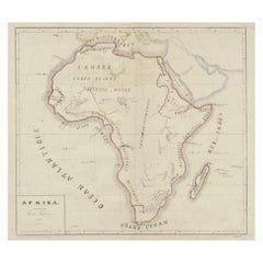
Original Antique Map of Africa
Located in Langweer, NL
Antique map titled 'Afrika'. Original antique map of Africa, drawn by Van Beusekom. Published by
Category

Late 19th Century Antique Map Of Africa

Materials

Paper

Original Antique Map of Africa
H 13.39 in W 17.09 in D 0.02 in
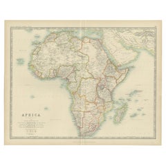
Antique Map of Africa by Johnston (1909)
Located in Langweer, NL
Antique map titled 'Africa'. Original antique map of Africa. This map originates from the ‘Royal
Category

Early 20th Century Antique Map Of Africa

Materials

Paper

Antique Map of Africa by Johnston (1909)
H 19.49 in W 24.41 in D 0.02 in
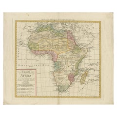
Antique Map of Africa by Homann Heirs, '1804'
Located in Langweer, NL
Antique map titled 'Charte von Africa'. Large, original antique map of Africa by Franz Ludwig
Category

Early 19th Century Antique Map Of Africa

Materials

Paper

Antique Map of Africa by Homann Heirs, '1804'
H 21.86 in W 25.99 in D 0.02 in
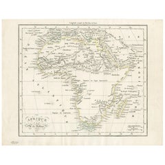
Antique Map of Africa by Dufour, circa 1834
Located in Langweer, NL
Antique map titled 'Afrique'. Uncommon map of Africa. Published by or after A.H. Dufour, circa 1834
Category

Mid-19th Century Antique Map Of Africa

Materials

Paper

Antique Map of Africa by Dufour, circa 1834
H 8.08 in W 10.24 in D 0.02 in
Antique Map of Africa by Lapie, 1842
Located in Langweer, NL
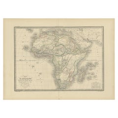
Antique map titled 'Carte d'Afrique'. Map of Africa. This map originates from 'Atlas universel de
Category

Mid-19th Century Antique Map Of Africa

Materials

Paper

Antique Map of Africa by Lapie, 1842
H 19.89 in W 26.78 in D 0.02 in
Old Original Map of Africa and Arabia, 1848
Located in Langweer, NL
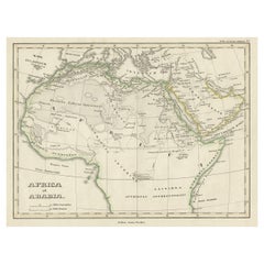
Antique map titled 'Africa et Arabia'. Old map of Africa and Arabia originating from 'Orbis
Category

1840s Antique Map Of Africa

Materials

Paper

Antique Map of Africa by Levasseur 'c.1840'
Located in Langweer, NL
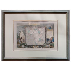
Antique map titled 'Afrique'. Original antique map of Africa. Decorative map of the continent
Category

Mid-19th Century Antique Map Of Africa

Materials

Paper

Antique Map of Africa by Levasseur 'c.1840'
H 22.84 in W 30.52 in D 1.19 in
Antique Map of Africa by A & C, Black, 1870
Located in Langweer, NL
Antique map titled 'Africa'. Original antique map of Africa. This map originates from ‘Black's
Category

Late 19th Century Antique Map Of Africa

Materials

Paper

Antique Map of Africa by A & C, Black, 1870
H 23.63 in W 17.52 in D 0.02 in
Original Antique Map of Africa with large decorative cartouche
Located in Langweer, NL
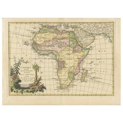
Original antique map titled 'L'Afrique divisée en ses principaux États'. Attractive and precise map
Category

Late 18th Century Antique Map Of Africa

Materials

Paper

Antique Map of Africa by Keizer & de Lat, 1788
Located in Langweer, NL
Antique map titled 'Kaartje van Africa (..)'. Uncommon original antique map of Africa. This map
Category

Late 18th Century Antique Map Of Africa

Materials

Paper

Original Antique Hand- Map of Africa by Allard '1697'
Located in Langweer, NL
Antique map titled 'Novissima et Perfectissima Africae (..)'. Beautiful large map of Africa. This
Category

Late 17th Century Antique Map Of Africa

Materials

Paper

Antique Map of Africa with Mountain Ranges and other details
Located in Langweer, NL
Antique map titled 'Carte générale et Politique de l'Afrique'. Original antique map of Africa
Category

Late 18th Century Antique Map Of Africa

Materials

Paper

Antique Map of Africa with Mountain Ranges and other details
Free Shipping
H 19.06 in W 25.44 in D 0.02 in
Antique Map of Africa Made after Hondius, circa 1655
Located in Langweer, NL
Antique map titled 'Africa Nova Tabula Auct Jud. Hondio'. Beautiful and rare paneled map of Africa
Category

Mid-17th Century Antique Map Of Africa

Materials

Paper

Antique Map of Africa by Claude Buy de Mornas '1761'
Located in Langweer, NL
Antique map titled 'Afrique'. Original antique map of Africa flanked with descriptions containing
Category

Mid-18th Century Antique Map Of Africa

Materials

Paper

Antique Map of Africa with Original Hand Coloring
Located in Langweer, NL
Antique map titled 'Kaart van Afrika door den Heer d'Anville'. Detailed original old map of Africa
Category

Mid-18th Century Antique Map Of Africa

Materials

Paper

Antique Map of Africa by Bordiga Fratelli 'circa 1818'
Located in Langweer, NL
Antique map titled 'Carta dell Africa'. Large and quite scarce Italian map of Africa, reflecting
Category

Early 19th Century Antique Map Of Africa

Materials

Paper

Set of Three Antique Maps of Africa by Colton (circa 1855)
Located in Langweer, NL
Set of three individual maps of Africa including 'North West Africa', 'North Eastern Africa' and
Category

Mid-19th Century Antique Map Of Africa

Materials

Paper

Original Hand-Colored Antique Map of Africa by Elwe '1792'
Located in Langweer, NL
Antique map titled 'l'Afrique Divisée en ses Empires, Royaumes, et Etats'. Decorative large map of
Category

Late 18th Century Antique Map Of Africa

Materials

Paper

Antique Map of Africa by Delamarche, 1806
Located in Langweer, NL
Antique map titled 'L'Afrique'. Decorative map of Africa by Robert de Vaugondy, revised and
Category

19th Century Antique Map Of Africa

Materials

Paper

Antique Map of Africa with Decorative Vignette of Saint Helena, 1880
Located in Langweer, NL
Antique map titled 'Afrique'. Old map of Africa, covering the African continent. With decorative
Category

19th Century Antique Map Of Africa

Materials

Paper

Antique Map of Africa with European Language Borders, 1852
Located in Langweer, NL
Antique map titled 'Afrika'. Map of Africa. This map originates from 'School-Atlas van alle deelen
Category

19th Century Antique Map Of Africa

Materials

Paper

Map of Africa - Original Etching by C. Brue - 1820
Located in Roma, IT
Map of Africa is an original etching realized by C.Brue in 1820. The print comes from the Series
Category

1820s Modern Antique Map Of Africa

Materials

Etching

Antique Map of Africa, Cartouche with Elephant Tusks and Horned Serpent, 1737
Located in Langweer, NL
Antique map of Africa titled 'Africa Secundum Legitimas Projectionis Stereographicae regulas
Category

18th Century Antique Map Of Africa

Materials

Paper

Ancient Map of Africa - Etching - 19th century
Located in Roma, IT
This Map of Africa is an etching realized in the 19th century. The state of preservation of the
Category

19th Century Antique Map Of Africa

Materials

Etching

Antique Map of Africa with French Cartouche and Scale, c.1780
Located in Langweer, NL
Antique map titled 'L'Afrique'. Original antique map of Africa. With beautiful title cartouche and
Category

18th Century Antique Map Of Africa

Materials

Paper

Antique Old Map of Africa with Insets of Mauritius, Reunion and Natal, 1882
Located in Langweer, NL
The uploaded image is a historical map of Africa from the 1882 atlas by Blackie & Son. The map
Category

1880s Antique Map Of Africa

Materials

Paper

Antique Map of Africa with a Decorative Dedication to the Dauphin, 1717
Located in Langweer, NL
Decouvertes (..).' This map is a reduced derivative of De Fer's wall map of Africa (1696-98) with its
Category

18th Century Antique Map Of Africa

Materials

Paper

Large University Chart “Physical Map of Africa” by Bacon
Located in Chillerton, Isle of Wight
Large university chart “Physical Map of Africa” by Bacon W&A K Johnston’s Charts of Physical
Category

Early 20th Century Folk Art Antique Map Of Africa

Materials

Linen

"Africae Accurata", a Hand-Colored 17th Century Map of Africa by Visscher
By Nicolaes Visscher II
Located in Alamo, CA
An 18th century hand-colored map of Africa entitled "Africae Accurata Tabula ex officina" by
Category

Late 17th Century Dutch Antique Map Of Africa

Materials

Paper

Antique Map of Africa with Ocean Currents and Other Details, C.1780
Located in Langweer, NL
Antique map titled 'Afrique.' Detailed map of Africa, showing towns, rivers, some topographical
Category

18th Century Antique Map Of Africa

Materials

Paper

Antique Map of Africa and Arabia with Inset Map of Ethiopia and Eritrea, 1845
Located in Langweer, NL
Antique map titled 'Mittel- und Nord-Africa (östl. Theil) und Arabien'. This map depicts North and
Category

19th Century Antique Map Of Africa

Materials

Paper

Antique Map of 'African' Islands in the Mediterranean Sea and The Atlantic, 1747
Located in Langweer, NL
Antique map titled 'Particular draughts of some of the chief African Islands in the Mediterranean
Category

18th Century Antique Map Of Africa

Materials

Paper

Antique Map of North Africa and South Africa by Black, 1854
Located in Langweer, NL
Antique map titled 'Africa north part - Africa south part'. Old map of Africa showing the region of
Category

19th Century Antique Map Of Africa

Materials

Paper

Antique Frontispiece by Tirion, Showing a Map of Africa, an Elephant Etc, 1731
Located in Langweer, NL
Antique frontispiece of the 3rd volume of 'Hedendaagsche historie of tegenwoordige staat van allen volkeren (..)' by Thomas Salmon. This volume describes Pegu, Arrakan, India, Ceylon...
Category

18th Century Antique Map Of Africa

Materials

Paper

Old Map of North Africa Depicting Libya, Morocco, Algeria, Tunis Etc, 1922
Located in Langweer, NL
Antique map of Africa titled 'Northern Africa'. Old map of North Africa depicting Libya
Category

1920s Antique Map Of Africa

Materials

Paper

Large University Chart “Africa Physical ” by Bacon
Located in Chillerton, Isle of Wight
Large University chart “Africa Physical ” by Bacon W&A K Johnston’s charts of physical maps by G
Category

Early 20th Century Beaux Arts Antique Map Of Africa

Materials

Linen

"Africa Vetus": a 17th Century Hand-Colored Map by Sanson
By Nicolas Sanson
Located in Alamo, CA
This original hand-colored copperplate engraved map of Africa entitled "Africa Vetus, Nicolai
Category

Late 17th Century French Antique Map Of Africa

Materials

Paper

Africa: A Large 17th Century Hand-Colored Map by Sanson and Jaillot
By Nicolas Sanson
Located in Alamo, CA
This large original hand-colored copperplate engraved map of Africa entitled "L'Afrique divisee
Category

1690s French Antique Map Of Africa

Materials

Paper

Old Decorative Map of the West African Coast & St. Thomae Island, c.1600
Located in Langweer, NL
Antique map titled 'Guineae Nova Descriptio.' This very decorative map shows the West African
Category

Early 1600s Antique Map Of Africa

Materials

Paper

West Africa Entitled "Guinea Propria": An 18th Century Hand Colored Homann Map
By Johann Baptist Homann
Located in Alamo, CA
This is a scarce richly hand colored copper plate engraved map of Africa entitled "Guinea Propria
Category

Mid-18th Century German Antique Map Of Africa

Materials

Paper

Antique Map of Senegal, West Africa
Located in Langweer, NL
Original antique map titled 'Carta del Senegal'. Antique map of Senegal, West Africa. This map
Category

Mid-18th Century Antique Map Of Africa

Materials

Paper

Antique Map of Senegal, West Africa
H 10.04 in W 14.49 in D 0.02 in
Antique Map of Gambia, West Africa
Located in Langweer, NL
Antique map titled 'Carte du Cours de la Riviere de Gambra ou Gambie (..)'. Detailed map of Gambia
Category

Mid-18th Century Antique Map Of Africa

Materials

Paper

Antique Map of Gambia, West Africa
H 9.97 in W 14.97 in D 0.02 in
Antique Map of N.W. Africa & Central Africa by Johnston (1909)
Located in Langweer, NL
Antique map titled 'N.W. Africa & Central Africa'. Original antique map of N.W. Africa & Central
Category

Early 20th Century Antique Map Of Africa

Materials

Paper

Antique Map of the West Coast of Africa, 1771
By Rigobert Bonne
Located in Langweer, NL
qu'ils sont connus'. Map of the West Coast of Africa. Covers from the Cape Verde Islands eastward to the
Category

18th Century Antique Map Of Africa

Materials

Paper

Antique Map of the Coast of Guinea, Africa, 1820
Located in Langweer, NL
Antique map Africa titled 'Carte de la Haute et de la Basse Guinée'. Map of the Coast of Guinea
Category

19th Century Antique Map Of Africa

Materials

Paper

Antique Map of the Coast of Guinea, Africa, 1820
Free Shipping
H 10.44 in W 16.54 in D 0 in
Antique Map of South Africa by Wyld '1845'
Located in Langweer, NL
Antique map titled 'South Africa'. Original antique map of South Africa. This decorative original
Category

Mid-19th Century Antique Map Of Africa

Materials

Paper

Antique Map of South Africa by Wyld '1845'
H 10.24 in W 14.18 in D 0.02 in
Uncoulored Original Antique Map of Western Africa, 1749
Located in Langweer, NL
Africa (..)'. Original antique map of Western Africa. This map originates from 'Neue Sammlung der
Category

Mid-18th Century Antique Map Of Africa

Materials

Paper

Antique Map of West Africa by Lowry, 1852
Located in Langweer, NL
Antique map titled 'West Africa'. Three individual sheets of West Africa. This map originates from
Category

Mid-19th Century Antique Map Of Africa

Materials

Paper

Antique Map of West Africa by Lowry, 1852
H 12.21 in W 9.65 in D 0.02 in
Antique Map of South Africa by Lowry, 1852
Located in Langweer, NL
Antique map titled 'South Africa'. Two individual sheets of South Africa. This map originates from
Category

Mid-19th Century Antique Map Of Africa

Materials

Paper

Antique Map of South Africa by Lowry, 1852
H 12.21 in W 9.65 in D 0.02 in
Antique Map of North Africa by Lowry '1852'
Located in Langweer, NL
Antique map titled 'North Africa Marocco Algiers & Tunis'. Two individual sheets of North Africa
Category

Mid-19th Century Antique Map Of Africa

Materials

Paper

Antique Map of North Africa by Lowry '1852'
H 12.21 in W 9.65 in D 0.02 in
Antique Map of Southern Africa by Levasseur, 1875
Located in Langweer, NL
Antique map titled 'Afrique Méridionale'. Large map of Southern Africa. This map originates from
Category

Late 19th Century Antique Map Of Africa

Materials

Paper

Antique Map of Northern Africa by Levasseur, '1875'
Located in Langweer, NL
Antique map titled 'Carte de l'Afrique Septentrionale'. Large map of Northern Africa. This map
Category

Late 19th Century Antique Map Of Africa

Materials

Paper

Original Antique Map of South Africa, Arrowsmith, 1820
Located in St Annes, Lancashire
Great map of South Africa. Drawn under the direction of Arrowsmith. Copper-plate engraving
Category

1820s English Antique Map Of Africa

Materials

Paper

Original Antique Map of South Africa, Arrowsmith, 1820
No Reserve
H 10.5 in W 16 in D 0.07 in
Antique Map of Western Africa by Levasseur '1875'
Located in Langweer, NL
Antique map titled 'Carte de la Senegambie Soudan et Guinée'. Large map of Western Africa. This map
Category

Late 19th Century Antique Map Of Africa

Materials

Paper

Antique Map of the Kingdom of Tunisia, Africa, 1773
Located in Langweer, NL
Antique map titled 'Kaart van het Koningryk van Tunis'. Old map of the Kingdom of Tunisia
Category

18th Century Antique Map Of Africa

Materials

Paper

Antique Map of Northern Africa by Perthes, 1848
Located in Langweer, NL
Antique map titled 'Africa Propria (..)'. Old map of North Africa and the region of Babylon
Category

19th Century Antique Map Of Africa

Materials

Paper

Antique Map of North Africa showing Egypt, Mauritania and Africa Minor, 1672
Located in Langweer, NL
Antique map titled 'Africa Minor, Mauritania , Aegyptus.' Charming miniature map of North Africa
Category

17th Century Antique Map Of Africa

Materials

Paper

Antique Map of the Coast of Guinea, Africa, c.1780
Located in Langweer, NL
Antique map Africa titled 'Carte de la Haute et de la Basse Guinée'. Map of the Coast of Guinea
Category

18th Century Antique Map Of Africa

Materials

Paper

Antique Map of North Africa including the Sahara Desert
Located in Langweer, NL
Antique map titled 'Charte von Nord-Africa'. Scarce map of North Africa. Includes a fantastic
Category

Early 19th Century Antique Map Of Africa

Materials

Paper

Decorative Antique Map of the Southern Part of Africa, 1806
Located in Langweer, NL
Antique map titled 'Congo, Cafrerie.' Decorative map of the southern part of Africa by Robert
Category

Early 1800s Antique Map Of Africa

Materials

Paper

  • 1
Get Updated with New Arrivals
Save "Antique Map Of Africa", and we’ll notify you when there are new listings in this category.

Antique Map Of Africa For Sale on 1stDibs

With a vast inventory of beautiful furniture at 1stDibs, we’ve got just the antique map of Africa you’re looking for. Each antique map of Africa for sale was constructed with extraordinary care, often using paper, wood and oak. Whether you’re looking for an older or newer antique map of Africa, there are earlier versions available from the 18th Century and newer variations made as recently as the 20th Century. Each antique map of Africa bearing Folk Art, Industrial or Neoclassical hallmarks is very popular. You’ll likely find more than one antique map of Africa that is appealing in its simplicity, but Jacques-Nicolas Bellin, Vincenzo Coronelli and Samuel Boulton produced versions that are worth a look.

How Much is a Antique Map Of Africa?

The average selling price for an antique map of Africa at 1stDibs is $390, while they’re typically $25 on the low end and $51,160 for the highest priced.

Read More

Pamela Shamshiri Shares the Secrets behind Her First-Ever Book and Its Effortlessly Cool Interiors

The sought-after designer worked with the team at Hoffman Creative to produce a monograph that beautifully showcases some of Studio Shamshiri's most inspiring projects.

Moroccan Artworks and Objects Take Center Stage in an Extraordinary Villa in Tangier

Italian writer and collector Umberto Pasti opens the doors to his remarkable cave of wonders in North Africa.

Montecito Has Drawn Royalty and Celebrities, and These Homes Are Proof of Its Allure

Hollywood A-listers, ex-pat aristocrats and art collectors and style setters of all stripes appreciate the allure of the coastal California hamlet — much on our minds after recent winter floods.

Whaam! Blam! Pow! — a New Book on Pop Art Packs a Punch

Publishing house Assouline and writer Julie Belcove have teamed up to trace the history of the genre, from Roy Lichtenstein, Andy Warhol and Yayoi Kusama to Mickalene Thomas and Jeff Koons.

The Sparkling Legacy of Tiffany & Co. Explained, One Jewel at a Time

A gorgeous new book celebrates — and memorializes — the iconic jeweler’s rich heritage.

What Makes a Gem-Encrusted Chess Set Worth $4 Million?

The world’s most opulent chess set, weighing in at 513 carats, is literally fit for a king and queen.

Tauba Auerbach’s Geometric Pop-Up Book Is Mighty Rare, Thanks to a Hurricane

This sculptural art book has an epic backstory of its own.

Step inside the Storied Mansions of Palm Beach’s Most Effervescent Architect

From Spanish-style courtyards to fanciful fountains, these acclaimed structures abound in surprising and elegant details.