Antique Map New England
13
to
22
160
91
124
110
74
64
27
26
26
26
20
20
19
19
14
11
9
8
8
7
6
5
5
4
4
4
4
3
3
3
3
3
3
2
2
2
2
1
1
1
1
1
1
1
5
5
4
4
4
Sort By
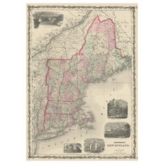
Large Antique Map of New England with decorative Vignettes
Located in Langweer, NL
Antique map titled 'Johnson's New England'. Large map of New England, comprising the states
Category
Mid-19th Century Antique Map New England
Materials
Paper
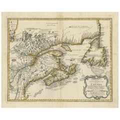
Antique Map of New England and Part of Canada by Vaugondy 'circa 1755'
Located in Langweer, NL
'. Decorative and highly detailed map of New England and part of Canada, extending east to Newfoundland, with a
Category
Mid-18th Century Antique Map New England
Materials
Paper
H 20.08 in W 25.99 in D 0.02 in
Antique Map of New England and Eastern Canada by Homann Heirs, circa 1755
Located in Langweer, NL
of New England and Eastern Canada made after J.N. Bellin. The map extends from Lake Ontario, the St
Category
Mid-18th Century Antique Map New England
Materials
Paper
No Reserve
H 21.07 in W 24.22 in D 0.02 in
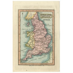
Miniature Antique Map of England and Wales
Located in Langweer, NL
Miniature map titled 'England & Wales'. Original antique map of England & Wales. This map
Category
Early 19th Century Antique Map New England
Materials
Paper
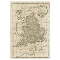
Original Antique Map of England and Wales
Located in Langweer, NL
Antique map titled 'A New and Correct Map of England and Wales from the Latest and Best
Category
Late 18th Century Antique Map New England
Materials
Paper
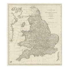
Large Antique Map of England and Wales
Located in Langweer, NL
Antique map titled 'An Accurate Map of England and Wales'. Original old map of England and Wales
Category
Early 19th Century Antique Map New England
Materials
Paper
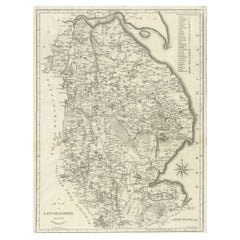
Large Antique County Map of Lincolnshire, England
Located in Langweer, NL
Lincolnshire, England. Engraved by John Cary. Originates from 'New British Atlas' by John Stockdale, published
Category
Early 19th Century Antique Map New England
Materials
Paper
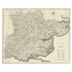
Large Antique County Map of Essex, England
Located in Langweer, NL
, England. Engraved by John Cary. Originates from 'New British Atlas' by John Stockdale, published 1805
Category
Early 19th Century Antique Map New England
Materials
Paper
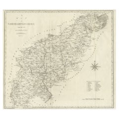
Large Antique County Map of Northamptonshire, England
Located in Langweer, NL
of Northamptonshire, England. Engraved by John Cary. Originates from 'New British Atlas' by John
Category
Early 19th Century Antique Map New England
Materials
Paper
Large Antique County Map of Somersetshire, England
Located in Langweer, NL
Somersetshire, England. Engraved by John Cary. Originates from 'New British Atlas' by John Stockdale, published
Category
Early 19th Century Antique Map New England
Materials
Paper
Large Antique County Map of Hertfordshire, England
Located in Langweer, NL
Hertfordshire, England. Engraved by John Cary. Originates from 'New British Atlas' by John Stockdale, published
Category
Early 19th Century Antique Map New England
Materials
Paper
Large Antique County Map of Ruthlandshire, England
Located in Langweer, NL
Ruthlandshire, England. Engraved by John Cary. Originates from 'New British Atlas' by John Stockdale, published
Category
Early 19th Century Antique Map New England
Materials
Paper
Large Antique County Map of Norfolk, England
Located in Langweer, NL
, England. Engraved by John Cary. Originates from 'New British Atlas' by John Stockdale, published 1805
Category
Early 19th Century Antique Map New England
Materials
Paper
Large Antique County Map of Middlesex, England
Located in Langweer, NL
Middlesex, England. Engraved by John Cary. Originates from 'New British Atlas' by John Stockdale, published
Category
Early 19th Century Antique Map New England
Materials
Paper
Large Antique County Map of Huntingdonshire, England
Located in Langweer, NL
Huntingdonshire, England. Engraved by John Cary. Originates from 'New British Atlas' by John Stockdale, published
Category
Early 19th Century Antique Map New England
Materials
Paper
Large Antique County Map of Cambridgeshire, England
Located in Langweer, NL
Cambridgeshire, England. Engraved by John Cary. Originates from 'New British Atlas' by John Stockdale, published
Category
Early 19th Century Antique Map New England
Materials
Paper
Large Antique County Map of Nottinghamshire, England
Located in Langweer, NL
Nottinghamshire, England. Engraved by John Cary. Originates from 'New British Atlas' by John Stockdale, published
Category
Early 19th Century Antique Map New England
Materials
Paper
Large Antique County Map of Suffolk, England
Located in Langweer, NL
, England. Engraved by John Cary. Originates from 'New British Atlas' by John Stockdale, published 1805
Category
Early 19th Century Antique Map New England
Materials
Paper
Large Antique County Map of Surrey, England
Located in Langweer, NL
, England. Engraved by John Cary. Originates from 'New British Atlas' by John Stockdale, published 1805
Category
Early 19th Century Antique Map New England
Materials
Paper
Large Antique County Map of Westmorland, England
Located in Langweer, NL
Westmorland, England. Engraved by John Cary. Originates from 'New British Atlas' by John Stockdale, published
Category
Early 19th Century Antique Map New England
Materials
Paper
Large Antique County Map of Buckinghamshire, England
Located in Langweer, NL
Buckinghamshire, England. Engraved by John Cary. Originates from 'New British Atlas' by John Stockdale, published
Category
Early 19th Century Antique Map New England
Materials
Paper
Large Antique County Map of Worcestershire, England
Located in Langweer, NL
Worcestershire, England. Engraved by John Cary. Originates from 'New British Atlas' by John Stockdale, published
Category
Early 19th Century Antique Map New England
Materials
Paper
Large Antique County Map of Northumberland, England
Located in Langweer, NL
Northumberland, England. Engraved by John Cary. Originates from 'New British Atlas' by John Stockdale, published
Category
Early 19th Century Antique Map New England
Materials
Paper
Large Antique County Map of Derbyshire, England
Located in Langweer, NL
Derbyshire, England. Engraved by John Cary. Originates from 'New British Atlas' by John Stockdale, published
Category
Early 19th Century Antique Map New England
Materials
Paper
Large Antique County Map of Warwickshire, England
Located in Langweer, NL
Warwickshire, England. Engraved by John Cary. Originates from 'New British Atlas' by John Stockdale, published
Category
Early 19th Century Antique Map New England
Materials
Paper
Large Antique County Map of Cumberland, England
Located in Langweer, NL
Cumberland, England. Engraved by John Cary. Originates from 'New British Atlas' by John Stockdale, published
Category
Early 19th Century Antique Map New England
Materials
Paper
Large Antique County Map of Durham, England
Located in Langweer, NL
, England. Engraved by John Cary. Originates from 'New British Atlas' by John Stockdale, published 1805
Category
Early 19th Century Antique Map New England
Materials
Paper
Antique County Map of Derbyshire, England, 1804
Located in Langweer, NL
Antique county map of Derbyshire first published, circa 1800. Villages, towns, and cities
Category
Early 1800s Antique Map New England
Materials
Paper
Antique County Map of Leicestershire, England, 1804
Located in Langweer, NL
published as an atlas, Smith's New English Atlas.
The maps are large and contain information required by
Category
Early 1800s Antique Map New England
Materials
Paper
Large Antique County Map of North Wales, England
Located in Langweer, NL
North Wales, England. Engraved by John Cary. Originates from 'New British Atlas' by John Stockdale
Category
Early 19th Century Antique Map New England
Materials
Paper
Large Antique County Map of Wiltshire, England, 1805
Located in Langweer, NL
Wiltshire, England. Engraved by John Cary. Originates from 'New British Atlas' by John Stockdale, published
Category
Early 19th Century Antique Map New England
Materials
Paper
Large Antique County Map of South Wales, England
Located in Langweer, NL
South Wales, England. Engraved by John Cary. Originates from 'New British Atlas' by John Stockdale
Category
Early 19th Century Antique Map New England
Materials
Paper
Large Antique County Map of Leicestershire, England, 1805
Located in Langweer, NL
, England, with this original old county map engraved by the renowned cartographer John Cary. Titled 'A Map
Category
Early 19th Century Antique Map New England
Materials
Paper
Antique Map of England with French Title, 1806
Located in Langweer, NL
Antique map titled 'L'Angleterre.' Map of England by Robert de Vaugondy, revised and published by
Category
19th Century Antique Map New England
Materials
Paper
Antique County Map of Monmouthshire, England, circa 1804
Located in Langweer, NL
Antique county map of Monmouthshire first published circa 1800. Villages, towns, and cities
Category
Early 1800s Antique Map New England
Materials
Paper
Antique Decorative County Map of Lincolnshire, England, 1804
Located in Langweer, NL
New English Atlas.
The maps are large and contain information required by a traveler of the time
Category
Early 1800s Antique Map New England
Materials
Paper
Antique Decorative County Map of Huntingdonshire, England, 1804
Located in Langweer, NL
atlas, Smith's New English Atlas.
The maps are large and contain information required by a traveler
Category
Early 1800s Antique Map New England
Materials
Paper
No Reserve
H 25.2 in W 21.26 in D 0 in
Large Antique Map of England Hand Colored by Counties
Located in Langweer, NL
Antique map titled 'A New Map of England from the latest Authorities'. Large map of England, hand
Category
Early 19th Century Antique Map New England
Materials
Paper
Antique Map of England and Wales by Johnson '1872'
Located in Langweer, NL
Antique map titled 'Johnson's England and Wales'. Original map of England and Wales. This map
Category
Late 19th Century Antique Map New England
Materials
Paper
Antique Map of Herefordshire 'England' by R. Morden, 1708
Located in Langweer, NL
entitled 'The New Description and State of England', however, a subsequent edition by Herman Moll in 1708
Category
Early 18th Century Antique Map New England
Materials
Paper
Antique Hand-Colored County Map of Rutland, England, 1804
Located in Langweer, NL
Antique county map of Rutland first published c.1800. Villages, towns, and cities illustrated
Category
Early 1800s Antique Map New England
Materials
Paper
Large Antique County Map of Warwickshire, England, with Hand Coloring
Located in Langweer, NL
Warwickshire, England. Engraved by John Cary. Originates from 'New British Atlas' by John Stockdale, published
Category
Early 19th Century Antique Map New England
Materials
Paper
H 22.17 in W 17.21 in D 0.02 in
Large Antique County Map of Leicestershire, England, with Outline Coloring
Located in Langweer, NL
Leicestershire, England. Engraved by John Cary. Originates from 'New British Atlas' by John Stockdale, published
Category
Early 19th Century Antique Map New England
Materials
Paper
H 22.21 in W 17.21 in D 0.02 in
Antique Map of England and Wales with Decorative Vignettes, 1851
Located in Langweer, NL
Antique map titled ‘England and Wales’. Includes decorative vignettes titled The grand stand on the
Category
19th Century Antique Map New England
Materials
Paper
Antique Colourful and Decorative County Map of Bedfordshire, England, 1804
Located in Langweer, NL
Antique county map of Bedfordshire first published c.1800. Villages, towns, and cities illustrated
Category
Early 1800s Antique Map New England
Materials
Paper
H 25.2 in W 21.26 in D 0 in
Antique Decorative Map of The County of Nottinghamshire, England, 1804
Located in Langweer, NL
Antique county map of Nottinghamshire first published c.1800. Villages, towns, and cities
Category
Early 1800s Antique Map New England
Materials
Paper
H 25.2 in W 21.26 in D 0.02 in
Original Hand-Colored Antique County Map of Durham, England, 1804
Located in Langweer, NL
Antique county map of Durham first published c.1800. Villages, towns, and cities illustrated
Category
Early 1800s Antique Map New England
Materials
Paper
No Reserve
H 21.26 in W 25.2 in D 0 in
Antique Decorative and Detailed County Map of Cumberland, England, 1804
Located in Langweer, NL
published as an atlas, Smith's New English Atlas.
The maps are large and contain information required by
Category
Early 1800s Antique Map New England
Materials
Paper
Large Antique County Map of the East Riding of Yorkshire, England
Located in Langweer, NL
county map of the East Riding of Yorkshire, England. Engraved by John Cary. Originates from 'New British
Category
Early 19th Century Antique Map New England
Materials
Paper
Colourful Antique Map of England and Wales Divided in Counties, 1854
Located in Langweer, NL
Antique map titled 'A Map Shewing the Places in England & Wales Sending Members to Parliament with
Category
19th Century Antique Map New England
Materials
Paper
New Map of North America from the Latest Discoveries, 1763
Located in Philadelphia, PA
A fine antique 18th century map of the North American seaboard.
Entitled "A New Map of North
Category
Mid-18th Century English Georgian Antique Map New England
Materials
Paper
Antique "New Plan of London" Map by John Bartholomew, 1900
Located in Bridgeport, CT
Produced for the W.H. Smith guide, folded in the original. The map here is unfolded and framed flat
Category
Early 1900s English Victorian Antique Map New England
Materials
Paper
Large Antique County Map of Cornwall and the Isles of Scilly, England
Located in Langweer, NL
Cornwall, England. With inset map of the Scilly Islands. Engraved by John Cary. Originates from 'New
Category
Early 19th Century Antique Map New England
Materials
Paper
H 17.37 in W 21.66 in D 0.02 in
17th Century Hand-Colored Map of Southeastern England by Mercator and Hondius
By Gerard Mercator
Located in Alamo, CA
A 17th century copperplate hand-colored map entitled "The Sixt Table of England" by Gerard Mercator
Category
Mid-17th Century Dutch Antique Map New England
Materials
Paper
H 12 in W 14 in D 0.13 in
Large Original Vintage Map of New Zealand, North Island, circa 1920
Located in St Annes, Lancashire
Great map of North Island, New Zealand
Original color.
Good condition / minor foxing to
Category
1920s English Edwardian Antique Map New England
Materials
Paper
No Reserve
H 25 in W 19.5 in D 0.07 in
Large Original Vintage Map of New South Wales, Australia, circa 1920
Located in St Annes, Lancashire
Great map of New South Wales
Original color.
Good condition
Published by Alexander Gross
Category
1920s English Edwardian Antique Map New England
Materials
Paper
No Reserve
H 25 in W 19.5 in D 0.07 in
1863 "Lloyd's New Map of the United States, the Canadas, and New Brunswick"
Located in Colorado Springs, CO
Presented is “Lloyd's New Map of the United States, the Canadas and New Brunswick, From the latest
Category
1860s American Antique Map New England
Materials
Linen, Wood, Paper
H 37 in W 49.5 in D 1 in
Large Original Vintage Map of New Zealand, South Island, circa 1920
Located in St Annes, Lancashire
Great map of South Island, New Zealand
Original color.
Good condition / repair to a minor
Category
1920s English Edwardian Antique Map New England
Materials
Paper
No Reserve
H 25 in W 19.5 in D 0.07 in
Large Antique County Map of the West Riding of Yorkshire 'South Part', England
Located in Langweer, NL
Authorities'. Original old county map of the south part of the West Riding of Yorkshire, England. Engraved by
Category
Early 19th Century Antique Map New England
Materials
Paper
H 16.46 in W 21.66 in D 0.02 in
Large Antique County Map of the West Riding of Yorkshire 'North Part', England
Located in Langweer, NL
Authorities'. Original old county map of the north part of the West Riding of Yorkshire, England. Engraved by
Category
Early 19th Century Antique Map New England
Materials
Paper
H 16.54 in W 21.38 in D 0.02 in
- 1
Get Updated with New Arrivals
Save "Antique Map New England", and we’ll notify you when there are new listings in this category.
Antique Map New England For Sale on 1stDibs
At 1stDibs, there are many versions of the ideal antique map new England for your home. Frequently made of paper, every antique map new England was constructed with great care. There are many kinds of the antique map new England you’re looking for, from those produced as long ago as the 18th Century to those made as recently as the 20th Century. When you’re browsing for the right antique map new England, those designed in Victorian and Folk Art styles are of considerable interest.
How Much is a Antique Map New England?
An antique map new England can differ in price owing to various characteristics — the average selling price 1stDibs is $724, while the lowest priced sells for $50 and the highest can go for as much as $4,650.
More Ways To Browse
F Clocks
Clock F
Empire Display Case
Antique 3 Legs Turned Table
Heavily Carved Desks
Library Antique Wood Table
Carved Wooden Post
Second Empire Table
Used Face Frame Table
Antique Colonial Desk
Midcentury Scroll Desk
Fleur De Lis Wall
Mahogany Occasional Chairs
Lyre Chair Antique
Arched Insert
Lyre Back Chairs
Greek Key Desk
British Victorian Table
