Israel Map

10
64
1
to
7
52
13
65
65
65
5
1
1
35
8
21
1
7
10
3
4
1
1
5
1
1
54
10
4
3
3
15
8
7
4
4
2
1
1
1
1
Sort By
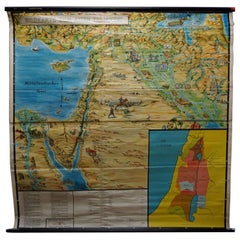
Picture Poster Old Testament Rollable Wall Chart Religious Mural Israel Map
Located in Berghuelen, DE
A traditional pull-down wall chart illustrating picutres of the old testament, published by Ewald Becker, Hamburg. Colorful print on paper reinforced with canvas. Measurements: Width...
Category

Mid-20th Century German Country Prints

Materials

Canvas, Wood, Paper

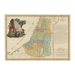
Original Rare Map of the Holy Land Showing the Twelve Tribes of Israel's, 1782
Located in Langweer, NL
Antique map titled 'Carte des Douze Tribus D'Israel (..).' Map of the Holy Land showing the
Category

Antique 1780s Maps

Materials

Paper

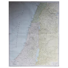
Large Original Vintage Map of Israel, circa 1920
Located in St Annes, Lancashire
Great map of Israel Original color. Good condition Published by Alexander Gross
Category

Vintage 1920s English Edwardian Maps

Materials

Paper

Large Original Vintage Map of Israel, circa 1920
No Reserve
H 25 in W 19.5 in D 0.07 in
Antique Map Travel Children of Israel by Keur, 1748
Located in Langweer, NL
Antique biblical map titled 'Perigrinatie ofte veertigh-Iarige Reyse der Kinderen Israels uyt
Category

Antique Mid-18th Century Dutch Maps

Materials

Paper

Antique Uncommon Dutch Map of Ancient Israel, c.1730
Located in Langweer, NL
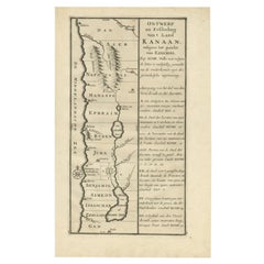
.' Uncommon map of ancient Israel. This map shows Israel from Hethelon in the north to Kades, just south of
Category

Antique 18th Century Maps

Materials

Paper

Antique Map of the Israel Township of Ohio by Titus '1871'
Located in Langweer, NL
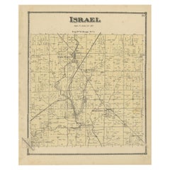
Antique map titled 'Israel'. Original antique map of Israel, Ohio. This map originates from 'Atlas
Category

Antique Late 19th Century Maps

Materials

Paper

Religious Antique Map of the Twelve Tribes of Israel, circa 1750
Located in Langweer, NL
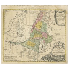
Harenberg. The map divides the region into the territories of the Twelve Tribes of Israel, as well as
Category

Antique Mid-18th Century Maps

Materials

Paper

Religious Antique Map of the Twelve Tribes of Israel, circa 1750
Free Shipping
H 20.32 in W 25.04 in D 0.02 in
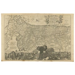
Antique Map of Israel Filled with Biblical Scenes, Published in 1748
Located in Langweer, NL
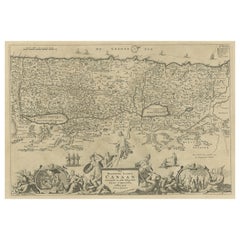
Christo neffens zyne Apostelen'. Antique map of Israel filled with biblical scenes. A compass rose
Category

Antique 1740s Maps

Materials

Paper

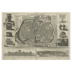
Antique Map of the Holy City Jerusalem in Israël, c.1700
Located in Langweer, NL
Antique map of the Holy City titled 'De Stadt Ierusalem'. Rare state of this bird's eye plan of
Category

Antique 18th Century Maps

Materials

Paper

Antique Map of Biblical Palestine with Inset of Israel's 12 Tribes, 1758
Located in Langweer, NL
Antique map titled 'De IIIde Landkaart 't land Kanaan en Gilead onder de XII stammen Israëls
Category

Antique 18th Century Maps

Materials

Paper

Antique Map of the Biblical Kingdom of Israel by Lindeman, c.1758
Located in Langweer, NL
Antique map titled 'De IVde Landkaart vertoonende het Koningryk Israels benevens deszelfs
Category

Antique 18th Century Maps

Materials

Paper

Antique Map of Eastern Turkey, Caucasus, Israel through Iraq and part of Arabia
Located in Langweer, NL
Heilige Land'. Beautiful map including eastern Turkey, the Caucasus, Israel through Iraq, with a part of
Category

Antique Mid-18th Century Maps

Materials

Paper

Antique Detailed Map of Jerusalem in Israël with Extensive Key and Scale, 1698
Located in Langweer, NL
Antique map titled 'Jerusalem.' Plan of the ancient city of Jerusalem. With extensive key and
Category

Antique 17th Century Maps

Materials

Paper

Highly Detailed Antique Map of the Holy Land Showing 12 Tribes of Israel, c.1720
Located in Langweer, NL
Antique map titled 'Heylige Land verdeeld in de Twaalf Stammen Israels (..).' Highly detailed
Category

Antique 1720s Maps

Materials

Paper

Bird's-Eye Plan of Jerusalem in Israël, a Rare Original Engraving, 1750
Located in Langweer, NL
Bergen en Dalen (..).' Bird's-eye plan of Jerusalem in Israel. This map shows the most important
Category

Antique 18th Century Maps

Materials

Paper

Antique Map of the Holy Land, c.1717
Located in Langweer, NL
Antique map Israel titled 'Tabula Geographica Terrae Sanctae'. Rare edition made after a map of the
Category

Antique 18th Century Maps

Materials

Paper

Antique Map of the Holy Land, c.1717
H 9.85 in W 27.56 in D 0 in
Antique Map of the Holy Land, c.1710
Located in Langweer, NL
Antique map titled 'Totius Terrae Sanctae Delineatio'. Map of the Holy Land extending to Egypt and
Category

Antique 18th Century Maps

Materials

Paper

Antique Map of the Holy Land, c.1710
H 11.82 in W 8.27 in D 0 in
The Biblical Kingdom of Israel under the Kings Saul, David and Solomon, Ca.1758
Located in Langweer, NL
Antique map titled 'De IVde Landkaart vertoonende het Koningryk Israels benevens deszelfs
Category

Antique 1750s Maps

Materials

Paper

Antique Map of the Holy Land by Keur, 1748
Located in Langweer, NL
Antique biblical map titled 'Perigrinatie ofte veertigh-Iarige Reyse der Kinderen Israels uyt
Category

Antique 18th Century Maps

Materials

Paper

Beautiful Rare Antique Map of the Holy Land, 1648
Located in Langweer, NL
Antique map Holy Land titled 'Perigrinatie ofte Veertich-Iarige Reyse, der kinderen Israels uyt
Category

Antique 1640s Maps

Materials

Paper

Antique Map of the Holy Land with Picture Frame Border
Located in Langweer, NL
Antique map titled 'Terre Sainte Suivant les Nouvelles Observations (..)'. Original old map of the
Category

Antique Early 18th Century Maps

Materials

Paper

Antique Map of the Holy Land with Picture Frame Border
No Reserve
H 11.66 in W 17.01 in D 0.02 in
Original Antique Map of the Holy Land with Decorative Cartouche
Located in Langweer, NL
Antique map titled 'Totius Terrae Sanctae'. Original old map of the Holy Land, with a large
Category

Antique Late 17th Century Maps

Materials

Paper

Antique Map of the Holy Land by Danckerts, c.1710
Located in Langweer, NL
Antique map titled 'Afbeeldinge van de Veertich-Iaarige Reyse der Kinderen Israëls uyt Egypten door
Category

Antique 18th Century Maps

Materials

Paper

Antique Map of the Arabian Desert by Cellarius, 1731
Located in Langweer, NL
Antique map titled 'Arabia Petraea et Deserta.' Arabian desert with present day Israel, Jordania
Category

Antique 18th Century Maps

Materials

Paper

Antique Map of the Holy Land by Van Luchtenburg, c.1720
Located in Langweer, NL
Antique map titled 'Heylige Land verdeeld in de Twaalf Stammen Israels (..).' Highly detailed map
Category

Antique 18th Century Maps

Materials

Paper

Historical Map of Canaan with Insets of Jerusalem and Surrounding Regions, 1880
Located in Langweer, NL
divided monarchy of Israel. 6. **Archaeological and Historical Sites**: The map may also mark locations
Category

Antique 1880s Maps

Materials

Paper

Scarce Antique Map of the Middle East, Surrounded by Latin Text, 1624
Located in Langweer, NL
, surrounded by Latin text. The two insets show Israel and an oval world map. This map (from the last edition
Category

Antique 1620s Maps

Materials

Paper

Antique Map of the Holy Land, Showing the Location of the Various Tribes
Located in Langweer, NL
Antique map titled 'Judaea seu Terra Sancta quae Hebraeorum sive Israelitarum (..)'. Map of The
Category

Antique Early 18th Century Maps

Materials

Paper

Antique Map of Eastern Mediterranean and Asia Minor by a Benedictine, c.1725
Located in Langweer, NL
Antique map titled 'Byzondere Afbeelding der Landschappen, van de Apostelen bevaren en doorwandelt
Category

Antique 18th Century Maps

Materials

Paper

18th Century French Map and City View of Joppe/Jaffa 'Tel Aviv' by Sanson
By Nicolas Sanson
Located in Alamo, CA
Tel Aviv, Israel as it appeared in 1668 . It depicts a very busy harbor with numerous boats. A large
Category

Antique Early 18th Century French Maps

Materials

Paper

Map of the Holy Land Divided into 12 Tribes, the Travels of Jesus Christ, 1700
Located in Langweer, NL
Antique map titled 'Het Heylige Land verdeeld in de Twaalf Stammen Israels (..)'. Decorative
Category

Antique Early 1700s Maps

Materials

Paper

Middle East Saudia Arabia Israel India Map Rollable Mural Vintage Wall Chart
Located in Berghuelen, DE
The pull-down school map is depicting the region of the Middle East (Turkey, Israel, Egypt, Saudi
Category

Late 20th Century German Country Prints

Materials

Canvas, Wood, Paper

Moshe Castel, “Kings of Jerusalem”, Gold Embossed Serigraph, Signed, circa 1980
Located in San Francisco, CA
Jerusalem” by renowned Israeli artist Moshe Castel (b. 1909–1991), professionally framed. A large and
Category

Vintage 1980s Israeli Prints

Materials

Foil, Brass

Terrestrial World Globe on Iron Stand by George F. Cram and Co. circa 1946
Located in Dallas, TX
WW2, this globe does not show Israel, which tells you it was made before 1948. Furthermore, it shows
Category

Mid-20th Century American Globes

Materials

Iron

Memoirs: Year of Decisions and Years of Trial and Hope, Signed by Harry Truman
Located in Colorado Springs, CO
dated by Truman. In publisher's original silver embossed black boards with Missouri map endpapers
Category

Vintage 1950s American Mid-Century Modern Books

Materials

Paper

Light Up Library Glass Globe on Metal Base by Barrere and Thomas France, 1950s
By Barrère & Thomas, Paris
Located in Atlanta, GA
on a chromed metal and aluminum stand. Besides regular countries' maps, there are ocean currents and
Category

Vintage 1950s French Art Deco Globes

Materials

Metal, Aluminum, Chrome

Antique Map of the Departure of the Children of Israel for Egypt, 1669
Located in Langweer, NL
Antique map titled 'Sortie des Enfans D'Israel hors D'Egypte leur Passage Par la Mer Rouge
Category

Antique 1660s Maps

Materials

Paper

Antique Map of the Holy Land, Divided into 12 Tribes of Israel, C.1720
Located in Langweer, NL
Antique map titled 'Heylige Land verdeeld in de Twaalf Stammen Israels (..).' Highly detailed map
Category

Antique 18th Century Maps

Materials

Paper

Original Vintage Colourful Travel Map Poster by Renluc for Air France Israel
By Renluc
Located in London, GB
Mediterranean Sea towards a colorful map of Israel in the Middle East with images depicting points of interest
Category

Vintage 1950s French Posters

Materials

Paper

Early 20th Century Large JNF Tin Charity Box
Located in New York, NY
Painted blue and white tin charity box, circa 1925. Decorated with a Star of David and the map of
Category

Early 20th Century Israeli Decorative Boxes

Materials

Metal

Early 20th Century Silver Mezuzah by Avraham Moshe Sokolka, Jerusalem
Located in New York, NY
Palestine, Jerusalem, silver, marked in Hebrew: "Eretz Israel" Moshe Avraham Sokolka was born in Vistnitz
Category

Early 20th Century Israeli Art Deco Religious Items

Materials

Silver

Early 20th Century South American JNF Iron Charity Box
Located in New York, NY
Extremely rare South American Iron JNF/KKL Charity box, circa 1920. Decorated with a map of Israel
Category

Early 20th Century South American Decorative Boxes

Materials

Iron

Mid-20th Century English JNF Tin Charity Box
Located in New York, NY
Painted blue and white tin charity box, circa 1950. Decorated in the front with the map of Israel
Category

Mid-20th Century English Decorative Boxes

Materials

Metal

Light Up Library Glass Globe on Metal Base by Barrere and Thomas France, 1950s
By Barrère & Thomas, Paris
Located in Atlanta, GA
on a chromed metal and aluminum stand. Besides regular countries' maps, there are ocean currents and
Category

Vintage 1950s French Art Deco Globes

Materials

Metal, Aluminum, Chrome

Solar Holes Passage into the Plexsus Acrylic Oil Painting by Lydia Dona, 1992
By Lydia Dona
Located in Dayton, OH
and fled with her parents to Israel in 1961. Her artistic education began in Jerusalem at the Bezalel
Category

1990s Expressionist Paintings

Materials

Canvas, Paint

Harry Truman's Memoirs, Signed and Inscribed, Special Kansas City Edition, 1956
Located in Colorado Springs, CO
. The special edition was released before the trade edition and includes a red and white map of Missouri
Category

Vintage 1950s American Books

Materials

Paper

Antique Map of the Twelve Tribes of Israel
Located in Langweer, NL
'. This large map shows the twelve tribes of Israel and the kingdoms of Judea and Israel. The map provides
Category

Antique Early 19th Century Maps

Materials

Paper

Antique Map of the Twelve Tribes of Israel
1 bid
No Reserve
H 18.82 in W 24.3 in D 0.02 in
Large Original Vintage Map of Israel, circa 1920
Located in St Annes, Lancashire
Great map of Israel Original color. Good condition Published by Alexander Gross Unframed.  
Category

Vintage 1920s English Edwardian Maps

Materials

Paper

Large Original Vintage Map of Israel, circa 1920
Free Shipping
H 25 in W 19.5 in D 0.07 in
Large Original Vintage Map of Israel, circa 1920
Located in St Annes, Lancashire
Great map of Israel Original color. Good condition Published by Alexander Gross Unframed.  
Category

Vintage 1920s English Edwardian Maps

Materials

Paper

Large Original Vintage Map of Israel, circa 1920
5 bids
No Reserve
H 25 in W 19.5 in D 0.07 in
Antique Bible Map of Israel by A. Schut, 1743
Located in Langweer, NL
Decorative map of the Holy Land divided into the 12 Tribes of Israel, depicting the Exodus from
Category

Antique Mid-18th Century Maps

Antique Bible Map of Israel by A. Schut, 1743
H 15.56 in W 21.07 in D 0.02 in
Large Original Antique Map of Israel by William Hughes, 1847
Located in St Annes, Lancashire
Great map of Israel Drawn and engraved by William Hughes Steel engraving Original colour
Category

Antique 1840s Scottish Maps

Materials

Paper

Large Original Antique Map of Israel by William Hughes, 1847
1 bid
No Reserve
H 17.25 in W 12.25 in D 0.07 in
Antique Map of the Holy Land, Israel by J.B. Elwe, 1792
Located in Langweer, NL
map is divided into the twelve tribes of Israel. Several roads are depicted and the route of the
Category

Antique Late 18th Century Maps

Materials

Paper

Antique Map of Modern-Day Armenia, Iran, Iraq, Syria, Israel and Surroundings
Located in Langweer, NL
'. Detailed regional map of modern day Armenia, Iran, Iraq, Syria, Israel, Jordan, Turkmenistan, Afghanistan
Category

Antique Late 17th Century Maps

Materials

Paper

Antique Map of Syria by J. Wyld, 1840
By J. Wyld
Located in Langweer, NL
Large original color map of the Ottoman province of Syria, covering modern Syria, Israel, Gaza and
Category

Antique Mid-19th Century Maps

Antique Map of Syria by J. Wyld, 1840
H 39.38 in W 26.38 in D 0.02 in
Antique Map of the Holy Land, c.1700
Located in Langweer, NL
Antique biblical map titled 'Perigrinatie ofte veertigh-Iarige Reyse der Kinderen Israels uyt
Category

Antique 17th Century Maps

Materials

Paper

Antique Map of the Holy Land, c.1700
H 16.54 in W 18.9 in D 0 in
Original Antique Map of Turkey in Asia, 1880
Located in Langweer, NL
Antique map titled 'Turquie d'Asie et les Provinces du Caucase'. This map covers from the
Category

Antique 1880s Maps

Materials

Paper

Antique Map of the Holy Land, with Frame Style Border
Located in Langweer, NL
Ancient Jerusalem, Israel. This map originates from Maison Basset's 1852 edition of 'Atlas Illustre
Category

Antique Mid-19th Century Maps

Materials

Paper

Antique Map of the Holy Land, with Frame Style Border
1 bid
No Reserve
H 13.27 in W 10.24 in D 0.02 in
Antique Map of Palestine 'Holy Land' by J.B. Homann, circa 1750
By Johann Baptist Homann
Located in Langweer, NL
Map of the Holy Land divided into the areas of the 12 tribes of Israel. Beneath the cartouche is an
Category

Antique Mid-18th Century Maps

Materials

Paper

Antique Map Covering the Mid-19th Century Claims of The Ottoman Empire, 1884
Located in Langweer, NL
Antique map of Turkey titled 'Turquie d'Asie et les Provinces du Caucase'. This map covers from
Category

Antique 1880s Maps

Materials

Paper

  • 1
Get Updated with New Arrivals
Save "Israel Map", and we’ll notify you when there are new listings in this category.

Israel Map For Sale on 1stDibs

At 1stDibs, there are many versions of the ideal israel map for your home. Each israel map for sale was constructed with extraordinary care, often using paper. Your living room may not be complete without a israel map — find older editions for sale from the 18th Century and newer versions made as recently as the 20th Century. Each israel map bearing hallmarks is very popular. Renluc each produced at least one beautiful israel map that is worth considering.

Finding the Right collectibles-curiosities for You

Antique and vintage collectibles and curiosities can bring whimsy and wonder to any interior. 

Decorating with old scientific instruments, historical memorabilia and vintage musical instruments, as well as other authentic collectibles and curiosities that can be found on 1stDibs, presents an opportunity to create a unique, natural history museum-like atmosphere in your home that can provoke conversation as often as it pays tribute to how far we’ve come in understanding our world. 

And bringing collectibles and curiosities into your space is actually on trend — Wunderkammern, or curiosity cabinets, were all the rage in Europe during the 1500s and continued to have adherents there and in the U.S. in the following centuries. Today, however, they’re experiencing a real surge in popularity and influencing how many interior designers are furnishing and decorating homes — combining contemporary with antique, scientific with tribal, earthly with extraterrestrial, Les Lalanne tables with Flemish tapestries.

The original Wunderkammern were entire rooms filled with objects demonstrating their owners’ worldly knowledge: A proper one included artificiala or preciosa (objets d’art); naturalia (such as skeletons, shells, minerals); exotica (taxidermy or dried plants); and scientifica (scientific instruments), frequently alongside religious relics and ancient artifacts.

Pay tribute to a history of rich and diverse musical traditions that have taken shape all over the world by decorating your home with a collection of antique and vintage musical instruments — with a little help from strong hanging wire or some wall hooks, vintage brass instruments such as a gong, French horn or trumpet can help elevate a home office or complement the efforts you’ve made to ensure a welcoming vibe in your home’s entryway. Bells or antique wind instruments can add provocative metallic contrasts to dark woods as tabletop decorative objects.  

Create an intriguing focal point with Georgian scientific instruments, such as stick barometers with mahogany cases or lacquered brass telescopes. These items stem from an era named for the monarchies of the four King Georges, who ruled England in succession starting in 1714 (plus King William’s reign, which lasted until 1837). Just as there was beautiful jewelry produced during the period that today is coveted by collectors, there is much to be found in the collectibles and curiosities realm too.

Wanderlust, nostalgia and a shared love of good design are contributing factors to certain trends in decorating — just as vintage trunks and luggage have reappeared as furniture or home accents in a bedroom or foyer, decorating with globes, maps or nautical objects is similarly rooted in the allure of travel and a penchant for the stylish finishing touch that collectibles bring to our homes.

Find a wide range of antique and vintage collectibles and curiosities on 1stDibs.

Read More

Pamela Shamshiri Shares the Secrets behind Her First-Ever Book and Its Effortlessly Cool Interiors

The sought-after designer worked with the team at Hoffman Creative to produce a monograph that beautifully showcases some of Studio Shamshiri's most inspiring projects.

Moroccan Artworks and Objects Take Center Stage in an Extraordinary Villa in Tangier

Italian writer and collector Umberto Pasti opens the doors to his remarkable cave of wonders in North Africa.

Montecito Has Drawn Royalty and Celebrities, and These Homes Are Proof of Its Allure

Hollywood A-listers, ex-pat aristocrats and art collectors and style setters of all stripes appreciate the allure of the coastal California hamlet — much on our minds after recent winter floods.

Whaam! Blam! Pow! — a New Book on Pop Art Packs a Punch

Publishing house Assouline and writer Julie Belcove have teamed up to trace the history of the genre, from Roy Lichtenstein, Andy Warhol and Yayoi Kusama to Mickalene Thomas and Jeff Koons.

The Sparkling Legacy of Tiffany & Co. Explained, One Jewel at a Time

A gorgeous new book celebrates — and memorializes — the iconic jeweler’s rich heritage.

What Makes a Gem-Encrusted Chess Set Worth $4 Million?

The world’s most opulent chess set, weighing in at 513 carats, is literally fit for a king and queen.

Tauba Auerbach’s Geometric Pop-Up Book Is Mighty Rare, Thanks to a Hurricane

This sculptural art book has an epic backstory of its own.

Step inside the Storied Mansions of Palm Beach’s Most Effervescent Architect

From Spanish-style courtyards to fanciful fountains, these acclaimed structures abound in surprising and elegant details.