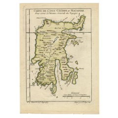
Long Island Map
3
to
15
221
202
161
135
126
113
104
91
51
29
23
23
21
19
16
16
12
10
8
7
6
5
5
5
4
4
3
3
3
2
2
2
2
2
2
1
1
1
1
1
1
1
1
1
1
77
42
42
24
19
Sort By
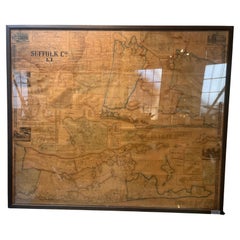
Framed Mid-19th Century Wall Map of Long Island, the Hamptons
Located in Sag Harbor, NY
detailed information about Suffolk County Long Island is staggering. A unique rare New York map
Category
Antique Mid-19th Century American Maps
Materials
Linen, Paper
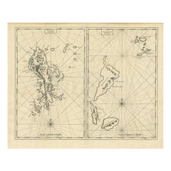
Antique Map of Sangir Island and the Talaud Islands by Valentijn, 1726
Located in Langweer, NL
, a map of Sangir Island, Indonesia. To the right, a map of the Talaud Islands, Indonesia. This map
Category
Antique 18th Century Maps
Materials
Paper
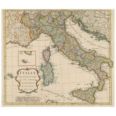
Detailed Antique Map of Italy and surrounding Islands
Located in Langweer, NL
Antique map titled 'Italie volgens de allernieuwste Uitgave van den Heere d'Anville'. Very detailed
Category
Antique Mid-18th Century Maps
Materials
Paper
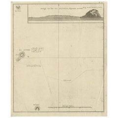
Antique Map of Suffren Island by Cook, 1803
Located in Langweer, NL
Antique map Australia titled 'Gezigt van het Eil. Suffren'. Antique map of Suffren Island
Category
Antique 19th Century Maps
Materials
Paper
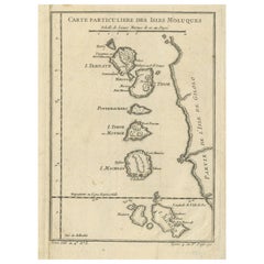
Antique Map of the Maluku Islands or Moluccas, Indonesia
Located in Langweer, NL
Antique map titled 'Carte Particuliere des Isles Moluques'. This map depicts the islands of Herij
Category
Antique Mid-18th Century Maps
Materials
Paper
Antique Map of the Batu Islands by Dornseiffen, 1900
Located in Langweer, NL
Antique map of the Batu Islands with the large title 'Soematra, Bangka en de Riouw-Lingga Archipel
Category
20th Century Maps
Materials
Paper
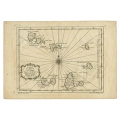
Original Antique Map of the Cape Verde Islands, 1746
Located in Langweer, NL
Antique map titled 'Carte Des Isles Du Cap Verd.' Original antique map of the Cape Verde Islands
Category
Antique 18th Century Maps
Materials
Paper
Antique Map of the Bonin Islands by Hawks, 1856
Located in Langweer, NL
Antique map titled 'Chart of the Bonin Group of Islands.' The Bonin Islands, known in Japan as the
Category
Antique 19th Century Maps
Materials
Paper
Antique Map of Celebes 'Sulawesi', Island in Indonesia, 1754
By Jacques-Nicolas Bellin
Located in Langweer, NL
Antique map titled 'Carte De L'Isle Celebes ou Macassar'. Detailed copper engraved map of Celebes
Category
Antique 18th Century Maps
Materials
Paper
Antique Map of the Banda Islands by Commelin, 1646
Located in Langweer, NL
Plate 15: 'Afteeckeninge van 't Eyland Banda.' Depiction of the Banda Islands, Indonesia. Rare
Category
Antique 17th Century Maps
Materials
Paper
Antique Map of the Bangka Belitun Island by Sanson, 1705
Located in Langweer, NL
Antique map Sunda Islands titled 'De Eilanden van Sunda, waar onder zyn Sumatra, Java, Borneo enz
Category
Antique 18th Century Maps
Materials
Paper
Original Antique Map of the Maluku Islands or Moluccas, Indonesia
Located in Langweer, NL
Antique map titled 'Carte Particuliere des Isles Moluques'. This map depicts the islands of Herij
Category
Antique Mid-18th Century Maps
Materials
Paper
Antique Map of Polynesia with Details of Many Islands, 1840
Located in Langweer, NL
Antique map titled 'Polynesia or Islands in the Pacific Ocean'.
This map depicts various islands
Category
Antique 19th Century Maps
Materials
Paper
Antique Map of the Maluku Islands by Bellin, c.1750
By Jacques-Nicolas Bellin
Located in Langweer, NL
Antique map titled 'Carte Particuliere des Isles Moluques'. This map depicts the islands of Herij
Category
Antique 18th Century Maps
Materials
Paper
Antique Map of Celebes 'Sulawesi', Island in Indonesia, c.1750
By Jacques-Nicolas Bellin
Located in Langweer, NL
Antique map titled 'Carte De L'Isle Celebes ou Macassar'. Detailed copper engraved map of Celebes
Category
Antique 18th Century Maps
Materials
Paper
Antique Map of Schiermonnikoog, Wadden Island of the Netherlands, 1868
Located in Langweer, NL
Antique map titled 'Provincie Friesland - Gemeente Schiermonnikoog'. Map of the township of
Category
Antique 19th Century Maps
Materials
Paper
Antique Map of Schiermonnikoog, an island of the Netherlands, 1868
Located in Langweer, NL
Antique map titled 'Provincie Friesland - Gemeente Schiermonnikoog'. Map of the township of
Category
Antique 19th Century Maps
Materials
Paper
Antique Map of Seram Island by Keizer & De Lat, c.1747
Located in Langweer, NL
Antique map titled 'Kaart van het eiland Ceram'. Rare and uncommon map of Seram Island, Indonesia
Category
Antique 18th Century Maps
Materials
Paper
Antique Map of Anjouan or Ndzuani, Island of The Comoros, 1748
Located in Langweer, NL
Antique map titled ‘Carte de L’Isle D’Anjouan’. Original antique map of Anjouan, also known as
Category
Antique 18th Century Maps
Materials
Paper
Antique Map of the Islands of Denmark by Homann Heirs, 1720
Located in Langweer, NL
Antique map titled 'Insula Danicae in Mari Balthico sitae (..).' - Map of the Danish islands
Category
Antique 18th Century Maps
Materials
Paper
Antique Map of the Banda Islands by De Bry, c.1600
Located in Langweer, NL
Antique map Indonesia titled 'Bandae Insulae designatio'. Antique map depicting the Banda Islands
Category
Antique 17th Century Maps
Materials
Paper
Old 18th Century Composite Map of Key Caribbean Islands with Descriptive Texts
Located in Langweer, NL
elaborate composite map featuring several islands of the Caribbean, each framed within its own colored
Category
Antique 1740s Maps
Materials
Paper
Free Shipping
H 21.26 in W 24.22 in D 0 in
Antique Map of Quinam and the Côn ?ao Islands by Sayer, 1778
Located in Langweer, NL
maps on one sheet. The upper map shows part of the coast of Cochinchina from Cham Collao Island to the
Category
Antique 18th Century Maps
Materials
Paper
Antique Map of the Bay Near Huchou Island by Van Schley, 1758
Located in Langweer, NL
la Province de Foyken.' Original antique map of the bay near Huchou Island, with the entries of
Category
Antique 18th Century Maps
Materials
Paper
Antique Map of the Harbour of Praia, Santiago Island, Cape Verde, c.1750
Located in Langweer, NL
Antique map titled 'A Draught of ye Harbour of Praya in the Island St. Jago (..)'. Uncommon map
Category
Antique 18th Century Maps
Materials
Paper
Antique Map of the Bay and Island of Arguin by Van Schley, 1747
Located in Langweer, NL
van Arguin (..)'. Original antique map of the bay and the island of Arguin. This map originates from
Category
Antique 18th Century Maps
Materials
Paper
Original Old Map East of Stockholm, the Island Ljusterö and Värmdö, Sweden, 1720
Located in Langweer, NL
Antique map titled 'Accurate Carte der Upländischen Scheren mit der Situation und Gegend umb die
Category
Antique 1720s Maps
Materials
Paper
H 21.11 in W 24.89 in D 0 in
Antique Map extending from the Spice Islands to the west of Papua New Guinea
Located in Langweer, NL
Antique map titled 'Kaart van de Papoasche Eilanden'. Beautiful original old map extending from the
Category
Antique Late 18th Century Maps
Materials
Paper
H 17.33 in W 21.66 in D 0.02 in
Old Map of the Moluccas, Known as the Famous Spice Islands, Indonesia, ca.1730
Located in Langweer, NL
long period with a wide range of interests as print sellers, publishers of books, maps, topographical
Category
Antique 1730s Maps
Materials
Paper
H 17.33 in W 23 in D 0 in
Antique Map of the Cape Verde Islands and Part of Senegal, West Africa, 1690
Located in Langweer, NL
inset of the island Goree. This map originates from Coronelli's rare atlas 'Atlante Veneto'. Artists and
Category
Antique 17th Century Maps
Materials
Paper
No Reserve
H 18.9 in W 25.99 in D 0 in
Old Map of The Kurile Islands, from Hokkaido, Japan to Kamchatka, Russia, c.1750
Located in Langweer, NL
Antique map titled 'Carte des Iles Kouriles'. Original antique map of the Kuril Islands.
The
Category
Antique 1750s Maps
Materials
Paper
Free Shipping
H 10.67 in W 11.89 in D 0 in
Hand-Colored 18th Century Homann Map of Denmark and Islands in the Baltic Sea
By Johann Baptist Homann
Located in Alamo, CA
An 18th century copper plate hand-colored map entitled "Insulae Danicae in Mari Balthico Sitae
Category
Antique Early 18th Century German Maps
Materials
Paper
H 20.25 in W 23.25 in D 0.07 in
Old Map of the island of Saint Christopher or St. Kitts in the Caribbean, c.1765
Located in Langweer, NL
Antique map titled 'Carte de l'Isle de Saint-Christophe'.
A detailed map of the island of Saint
Category
Antique 18th Century Maps
Materials
Paper
H 10.24 in W 15.67 in D 0 in
Antique Map of Polynesia by Walker, 1840
Located in Langweer, NL
Antique map titled 'Polynesia or Islands in the Pacific Ocean'. This map depicts various islands
Category
Antique 19th Century Maps
Materials
Paper
1814 Map of "Russian Empire" Ric.r032
Located in Norton, MA
1814 Map of
"Russian Empire"
Ric.r032
Russian Empire. Description: This is an 1814 John
Category
Antique 19th Century Unknown Maps
Materials
Paper
Antique Map of Oceania by Lapie, 1842
Located in Langweer, NL
'. Map of Oceania including Australia, Polynesia and several islands of Asia. This map originates from
Category
Antique 19th Century Maps
Materials
Paper
Antique Map of Sumatra by Tardieu, 1811
Located in Langweer, NL
Antique map Sumatra titled 'Partie de l'Isle Sumatra'. Part of the Island of Sumatra, where the
Category
Antique 19th Century Maps
Materials
Paper
Antique Map of New York by Johnson '1872'
Located in Langweer, NL
Antique map titled 'Johnson's New York'. Original map showing New York, with an inset map of Long
Category
Antique Late 19th Century Maps
Materials
Paper
Antique Map of Southern Sulawesi by Stemfoort, 1885
Located in Langweer, NL
second inset showing the islands just to the south. This map originates from 'Atlas der Nederlandsche
Category
Antique 19th Century Maps
Materials
Paper
Antique Map of Novaya Zemlya by Bellin, 1758
Located in Langweer, NL
'. This map features Novaya Zemlya, the island off northern Russia in the Barents Sea, and extends to
Category
Antique 18th Century Maps
Materials
Paper
Authentic Old Map of Sumatra, Malaysia and Singapore, 1745
Located in Langweer, NL
L'Isle" translates to "Map of the Island of Sumatra and the Malayan Coast based on the work of G. de
Category
Antique 1740s Maps
Materials
Paper
Antique Map of the Gaspar Strait by Huddart, '1788'
Located in Langweer, NL
Sea to the South China Sea. Also includes Salt Island, Middle Island and part of Long Island
Category
Antique Late 18th Century Maps
Materials
Paper
Antique Map of Sulawesi by Winkler Prins, c.1900
Located in Langweer, NL
Antique map titled 'Celebes.' (Sulawesi .) This map shows the Indonesian island of Sulawesi, one of
Category
20th Century Maps
Materials
Paper
Antique Map of Taluti Bay by Stemler, C.1875
Located in Langweer, NL
Antique map titled 'Kaart der Teloeti Baai op Ceram.' This scarce map shows the Taluti Bay on the
Category
Antique 19th Century Maps
Materials
Paper
Antique Map of the Bay of Bantam, c.1720
Located in Langweer, NL
Rare, untitled miniature map of the Bay of Bantam with various Islands including Pulo Dua and Pulo
Category
Antique 18th Century Maps
Materials
Paper
Antique Map of the British Isles by Cluver, 1685
Located in Langweer, NL
Antique map titled 'Britannicarum Insularum Typus.' Charming miniature map of the British Islands
Category
Antique 17th Century Maps
Materials
Paper
Antique Map of Spain and Portugal by Cruchley, 1854
Located in Langweer, NL
"Antique map of Spain and Portugal. Also depicts the islands Formentera, Ibiza, Mallorca and
Category
Antique 19th Century Maps
Materials
Paper
Antique Map of the British Isles by Lotter, 1764
Located in Langweer, NL
Antique map titled 'Le Grand Bretagne ou les Royaumes d'Angleterre et d'Ecosse'. Old engraved map
Category
Antique 18th Century Maps
Materials
Paper
Antique Map of Southern Italy and Sardinia by Johnston, 1882
Located in Langweer, NL
"Antique map titled 'South Italy and the Island of Sardinia'. Old map of Southern Italy and the
Category
Antique 19th Century Maps
Materials
Paper
Stunning Decorative Antique Map of Venice in Italy, ca.1787
Located in Langweer, NL
, later coloring, blank verso. First issued as a separate map circa 1630, according to Wüthrich, and in
Category
Antique Late 18th Century Maps
Materials
Paper
Antique Map of Sumatra and Java by Weller, c.1860
Located in Langweer, NL
Antique map titled 'Sumatra, Java'. A delicately presented and detailed pair of maps of the two
Category
Antique 19th Century Maps
Materials
Paper
Antique Map of Sumatra and Java by Weller, c.1860
Located in Langweer, NL
Antique map titled 'Sumatra, Java'. A delicately presented and detailed pair of maps of the two
Category
Antique 19th Century Maps
Materials
Paper
Antique Map of Part of Sumatra by Stemler, c.1875
Located in Langweer, NL
Antique map titled 'Kaart van een gedeelte van Midden Sumatra.' This map shows a part of the
Category
Antique 19th Century Maps
Materials
Paper
Antique Map of Spain and Portugal by Weller, c.1890
Located in Langweer, NL
Antique map titled 'Spain and Portugal.' Map of Spain and Portugal, with the Balearic Islands
Category
Antique 19th Century Maps
Materials
Paper
Antique Map of Batavia 'Jakarta', Indonesia by Montanus, circa 1669
Located in Langweer, NL
Antique map Batavia titled 'Ware Affbeeldinge wegens het Casteel ende Stadt Batavia'. Antique print
Category
Antique 17th Century Maps
Materials
Paper
19th Century Illustrated Map of Ceylon (Sri Lanka) with Notable Landmarks
Located in Langweer, NL
complexes. The depiction of ruins indicates the long history of the island and the presence of ancient
Category
Antique 1850s Maps
Materials
Paper
H 14.26 in W 10.71 in D 0 in
Antique Map of the Bay of Chin Chew by Child, 1747
Located in Langweer, NL
Antique map titled 'A Chart of the Bay of Chin-Chew or Chang-Chew in China'. Small but very early
Category
Antique 18th Century Maps
Materials
Paper
Antique Map of the Bay of Terney by La Pérouse, 1797
Located in Langweer, NL
Californias in 1786. He stopped at the Presidio of San Francisco long enough to create an outline map of the
Category
Antique 18th Century Maps
Materials
Paper
Original Antique Map of Tartary 'Northern China & Far Eastern Russia', 1757
Located in Langweer, NL
Antique map titled 'Carte de la Tartarie Orientale (..)'.
Original antique map of what is
Category
Antique 1750s Maps
Materials
Paper
H 9.61 in W 13.47 in D 0 in
Antique Map of Denmark with the Danish Royal Crest, c.1730
By Homann Heirs
Located in Langweer, NL
, Scania Blekingia (..).' Map of Denmark and islands, part of Sweden and Germany, drawn by Johann Huber
Category
Antique 18th Century Maps
Materials
Paper
- 1
Get Updated with New Arrivals
Save "Long Island Map", and we’ll notify you when there are new listings in this category.
Long Island Map For Sale on 1stDibs
Choose from an assortment of styles, material and more with respect to the long island map you’re looking for at 1stDibs. Each long island map for sale was constructed with extraordinary care, often using paper, animal skin and fabric. There are many kinds of the long island map you’re looking for, from those produced as long ago as the 19th Century to those made as recently as the 20th Century. A well-made long island map has long been a part of the offerings for many furniture designers and manufacturers, but those produced by Beers Atlas Co. and Julius Bien are consistently popular.
How Much is a Long Island Map?
Prices for a long island map start at $375 and top out at $16,850 with the average selling for $1,475.
More Ways To Browse
Yellow Gold Engraved Charms
Antique Black China Cabinet
Antique Chinese Cabinet Black
Copper Made In Sweden
Dutch Macassar
Black And White Cabinet Antique
Indonesia Colonial
17th C Cabinet
Antique Print Cabinet
Indonesian Colonial
Old Chinese Cabinets
Wine 17th
Dutch Empire Furniture
Antique French Primitive
Used White China Cabinet
Map Cabinet
Long Island Cabinet
Chateau Wine
