Map Of Spain
16
to
62
543
258
284
220
217
164
162
114
103
69
64
52
45
45
34
33
31
31
29
29
19
18
17
16
16
11
10
10
9
8
8
8
7
7
6
5
5
5
4
4
4
3
3
3
3
3
3
2
2
2
2
2
1
1
1
1
1
54
42
42
31
15
Sort By
Large Original Vintage Map of Spain, circa 1920
Located in St Annes, Lancashire
Great map of Spain
Original color.
Good condition
Published by Alexander Gross
Unframed.
Category
Vintage 1920s English Maps
Materials
Paper
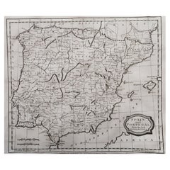
Original Antique Map of Spain and Portugal, circa 1790
Located in St Annes, Lancashire
Super map of Spain and Portugal
Copper plate engraving by A. Bell
Published, circa 1790
Category
Antique 1790s English Other Maps
Materials
Paper
Antique Map of Spain and Portugal by Lowry, '1852'
Located in Langweer, NL
Antique map titled 'Spain and Portugal'. Original map of Spain and Portugal. This map originates
Category
Antique Mid-19th Century Maps
Materials
Paper
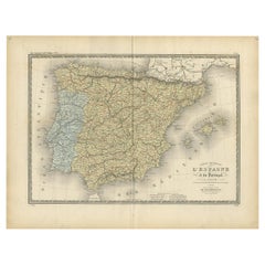
Antique Map of Spain and Portugal by Levasseur, '1875'
Located in Langweer, NL
Antique map titled 'Carte générale de l'Espagne et du Portugal (..)'. Large map of Spain and
Category
Antique Late 19th Century Maps
Materials
Paper
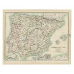
Antique Map of Spain and Portugal by Johnston, '1909'
Located in Langweer, NL
Antique map titled 'Spain and Portugal'. Original antique map of Spain and Portugal. With inset
Category
Early 20th Century Maps
Materials
Paper
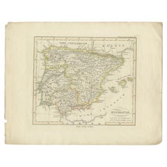
Antique Map of Spain by Perthes, 1848
Located in Langweer, NL
Antique map titled 'Hispania'. Old map of Spain originating from 'Orbis Terrarum Antiquus in usum
Category
Antique 19th Century Maps
Materials
Paper
Antique Map of Spain by Funke, 1825
Located in Langweer, NL
Antique map titled 'Hispania'. Old map of Spain originating from 'Atlas der Oude Wereld'. Artists
Category
Antique 19th Century Maps
Materials
Paper
Original Antique Map of Spain and Portugal, Engraved By Barlow, 1806
Located in St Annes, Lancashire
Great map of Spain And Portugal
Copper-plate engraving by Barlow
Published by Brightly
Category
Antique Early 1800s English Maps
Materials
Paper
No Reserve
H 8 in W 10 in D 0.07 in
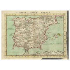
Antique Map of Spain including the Balearic Islands
Located in Langweer, NL
Antique map titled 'Hispania Nova Tabula'. Ruscelli's map of Spain, including the Balearic Islands
Category
Antique 16th Century Maps
Materials
Paper
Original Antique Map of Spain and Portugal by Thomas Clerk, 1817
Located in St Annes, Lancashire
Great map of Spain and Portugal
Copper-plate engraving
Drawn and engraved by Thomas Clerk
Category
Antique 1810s English Maps
Materials
Paper
No Reserve
H 8.25 in W 10.25 in D 0.07 in
Antique Map of Spain by N. de Fer, circa 1700
Located in Langweer, NL
Antique map of Spain and Portugal with a title cartouche. Nicolas de Fer was the youngest son of
Category
Antique Early 18th Century Maps
Materials
Paper
Antique Map of Spain and Portugal, with Frame Style Border
Located in Langweer, NL
Antique map titled 'Espagne et Portugal'. Attractive map of Spain and Portugal. The map covers all
Category
Antique Mid-19th Century Maps
Materials
Paper
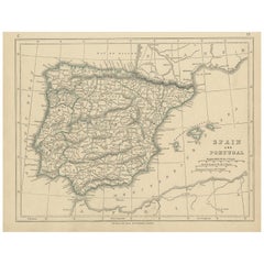
Antique Map of Spain and Portugal by A & C. Black, 1870
Located in Langweer, NL
Antique map titled 'Spain and Portugal'. Original antique map of General map of Spain and Portugal
Category
Antique Late 19th Century Maps
Materials
Paper
Antique Colourful Antique Map of Spain and Portugal, 1815
Located in Langweer, NL
Antique map of Spain and Portugal. Thomson's map includes both countries in full, with Spain being
Category
Antique 1810s Maps
Materials
Paper
Antique Map of Spain and Portugal by Keizer & de Lat, 1788
Located in Langweer, NL
Spain and Portugal. This map originates from 'Nieuwe Natuur- Geschied- en Handelkundige Zak- en
Category
Antique Late 18th Century Maps
Materials
Paper
Antique Map of Spain and Portugal, 1882
Located in Langweer, NL
"Antique map titled 'Spain & Portugal'.
Old map of Spain and Portugal. This map originates from
Category
Antique 19th Century Maps
Materials
Paper
Original Antique Map of Spain and Portugal, 1882
Located in Langweer, NL
Embark on a historical voyage with an original Antique Map of Spain and Portugal from the esteemed
Category
Antique 1880s Maps
Materials
Paper
Antique Map of Spain & Portugal 'Iberian Peninsula', Decorative Cartouche, c1755
Located in Langweer, NL
Antique map titled 'Spain and Portugal'.
Small, detailed antique map of Spain and Portugal
Category
Antique 1750s Maps
Materials
Paper
H 7.88 in W 9.85 in D 0 in
Antique Map of Spain and Portugal by Harris, 1802
Located in Langweer, NL
"Antique map titled 'Spain and Portugal'. Uncommon circular map of Spain and Portugal. Artists and
Category
Antique 19th Century Maps
Materials
Paper
Antique Map of Spain and Portugal by Kitchin, 1770
Located in Langweer, NL
Antique map titled 'Spain and Portugal by Tho. Kitchin'. Rare detailed map of Spain and Portugal
Category
Antique 18th Century Maps
Materials
Paper
Antique Map of Spain and Portugal by Barlow, 1809
Located in Langweer, NL
"Antique map titled 'Spain and Portugal from the best Authorities'. Detailed antique map of Spain
Category
Antique 19th Century Maps
Materials
Paper
Antique Map of Spain and Portugal by Petri, 1852
Located in Langweer, NL
Antique map titled 'Spanje en Portugal'. Map of Spain and Portugal. This map originates from
Category
Antique 19th Century Maps
Materials
Paper
Antique Map of Spain and Portugal by Cruchley, 1854
Located in Langweer, NL
"Antique map of Spain and Portugal. Also depicts the islands Formentera, Ibiza, Mallorca and
Category
Antique 19th Century Maps
Materials
Paper
Antique Map of Spain and Portugal by Migeon, 1880
Located in Langweer, NL
Antique map titled 'Espagne et Portugal'. Old map of Spain and Portugal with a decorative vignette
Category
Antique 19th Century Maps
Materials
Paper
Antique Map of Spain and Portugal by Weller, c.1890
Located in Langweer, NL
Antique map titled 'Spain and Portugal.' Map of Spain and Portugal, with the Balearic Islands
Category
Antique 19th Century Maps
Materials
Paper
Antique Map of Spain by Covens & Mortier, c.1740
Located in Langweer, NL
Antique map Spain titled 'L?Espagne dressée sur la Description qui en a eté faite par Rodrigo
Category
Antique 18th Century Maps
Materials
Paper
Antique Map of Spain and Portugal by Mitchell, 1846
Located in Langweer, NL
Antique map titled 'Kingdom of Spain and Portugal'. Old map of Spain and Portugal, with an inset
Category
Antique 19th Century Maps
Materials
Paper
Set of 2 Costume Prints and a Map of Spain and Portugal, circa 1720
Located in Langweer, NL
Set of two costume prints and a map of Spain and Portugal. The costume prints show costumes of
Category
Antique Early 18th Century Maps
Materials
Paper
Antique Map of Spain and Portugal by Bowles, c.1780
Located in Langweer, NL
"Antique map titled 'Bowles's New Pocket Map of the Kingdom of Spain and Portugal according to De
Category
Antique 18th Century Maps
Materials
Paper
Antique Map of Spain and Part of Africa by Kiepert, C.1870
Located in Langweer, NL
"Antique map titled 'Hispania Mauretania et Africa'. Old map of Spain, also depicting part of
Category
Antique 19th Century Maps
Materials
Paper
Antique Map of Spain and Portugal by Thomson, 1815
Located in Langweer, NL
Antique map titled 'Spain & Portugal.' Map of Spain and Portugal. From Thomson's 'New General Atlas
Category
Antique 19th Century Maps
Materials
Paper
Beautiful Old Map of Spain and Portugal With Decorative Title Cartouche, ca.1740
Located in Langweer, NL
Antique map Spain titled 'L’Espagne dressée sur la Description qui en a eté faite par Rodrigo
Category
Antique 1740s Maps
Materials
Paper
H 20.87 in W 25.6 in D 0 in
Old Map of Spain and Portugal, with an Inset Map of the Region of Madrid, 1846
Located in Langweer, NL
Antique map titled 'Kingdom of Spain and Portugal'.
Old map of Spain and Portugal, with an
Category
Antique 1840s Maps
Materials
Paper
H 13.78 in W 17.13 in D 0 in
Map of Spain & Portugal Incl. the islands of Ibiza, Minorque & Majorque, 1780
Located in Langweer, NL
Antique map titled 'Les Royaumes d'Espagne et de Portugal.'
Map of Spain and Portugal. Includes
Category
Antique 1780s Maps
Materials
Paper
H 10.24 in W 15.16 in D 0 in
18th Century Hand Colored Map of Spain and Portugal by Visscher
By Nicolaes Visscher II
Located in Alamo, CA
This is an early 18th century map of Spain and Portugal, with attractive original hand-coloring
Category
Antique Early 18th Century Dutch Maps
Materials
Paper
Madrid 1901: A Historical Map of Spain's Capital Province
Located in Langweer, NL
The map is of the province of Madrid, the capital region of Spain, as it appeared in 1901. Here are
Category
Antique Early 1900s Maps
Materials
Paper
Beautiful Large Scale Map of Spain and Portugal Published by Herman Moll in 1711
Located in Langweer, NL
Title: A New and Exact Map of Spain & Portugal
Author: Herman Moll
Date: 1711
Medium: ?Hand
Category
Antique 1710s Maps
Materials
Paper
H 24.81 in W 39.38 in D 0.02 in
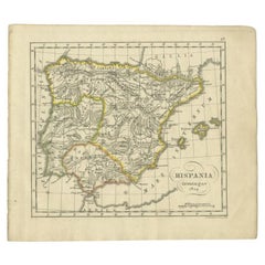
Antique Map of Spain by P.F. Tardieu, circa 1798
By Pierre François Tardieu
Located in Langweer, NL
Antique map titled 'Espagne carte comparative', showing river systems, the modern states of Spain
Category
Antique Late 18th Century Maps
Materials
Paper
Antique Map of Spain and Portugal by Petri, c.1873
Located in Langweer, NL
Antique map titled 'Spanje en Portugal'. Old map depicting Spain and Portugal. This map originates
Category
Antique 19th Century Maps
Materials
Paper
Antique Map of Spain and Portugal by Tirion, c.1760
Located in Langweer, NL
Antique map titled 'Nieuwe Kaart van Spanje en Portugal.' Attractive detailed map showing Spain and
Category
Antique 18th Century Maps
Materials
Paper
Antique Map of Spain and Portugal by Tardieu, circa 1795
Located in Langweer, NL
The image is an antique map titled "Hispanie Betique et Lusitanie", which depicts the Iberian
Category
Antique Late 18th Century Maps
Materials
Paper
Map of Spain and Portugal - Original Etching - Late 19th Century
Located in Roma, IT
This Map of Spain and Portugal is an etching realized by an anonymous artist.
The state of
Category
Late 19th Century Modern Figurative Prints
Materials
Etching
H 7.68 in W 9.45 in D 0.04 in
Map of Spain and Portugal - Etching by Pierre François Tardieu - 1837
Located in Roma, IT
Map of Spain and Portugal is an Etching realized by Pierre François Tardieu in 1837.
Good
Category
1830s Modern Figurative Prints
Materials
Lithograph
H 8.47 in W 11.03 in D 0.04 in
1751 Map of Spain Castilla Robert De Vaugondy 1st Edition, Ric.a001
Located in Norton, MA
Large Spain Castilla Robert De Vaugondy
1751 1st Edition
-Colored- Ric.a001
Coming from a
Category
Antique 18th Century Unknown Maps
Materials
Paper
Antique Map of Spain, Mauritia and Africa by H. Kiepert, circa 1870
By Heinrich Kiepert
Located in Langweer, NL
Antique map titled 'Hispania, Mauretania et Africa'. This map originates from 'Atlas Antiquus
Category
Antique Late 19th Century Maps
Materials
Paper
17th Century Lithograph Framed Map of Spain
Located in Atlanta, GA
In giltwood frame, dated 1652.
Category
Antique 18th Century and Earlier Spanish Baroque Prints
Materials
Ink, Paper
Antique Decorative Map of Portugal and Spain, 1842
Located in Langweer, NL
Antique map titled 'Carte de la Peninsule comprenant l'Espagne et le Portugal'.
Map of Spain
Category
Antique 1840s Maps
Materials
Paper
Vintage Geographic Splendor: 1859 Spain and Portugal
Located in Langweer, NL
The "Vintage Geographic Splendor: 1859 Spain and Portugal" map is an original antique piece from
Category
Antique Mid-19th Century Maps
Materials
Paper
Crossroads of Continents: Spain's North African Enclaves in 1903
Located in Langweer, NL
The image for sale is a historical map of Spanish possessions in North Africa, dated 1903. The map
Category
Antique Early 1900s Maps
Materials
Paper
Free Shipping
H 14.77 in W 20.08 in D 0 in
Antique Map of the Northwestern Coast of Spain
Located in Langweer, NL
Antique map titled 'Gallaecia Regnum'. Original old map of the northwestern coast of Spain
Category
Antique Mid-17th Century Maps
Materials
Paper
Antique Map of Northeastern Spain by Mercator, 1634
Located in Langweer, NL
Northeastern Spain with the areas of Pamplona and Valladolid. This map originates from 'Atlas Minor' by G
Category
Antique 17th Century Maps
Materials
Paper
Anrtique Map of the Province of Valladolid, Central Spain, 1902
Located in Langweer, NL
A historical or archival map of the province of Valladolid, Spain, from the year 1902. Valladolid
Category
Antique Early 1900s Maps
Materials
Paper
Free Shipping
H 14.77 in W 20.08 in D 0 in
Map of Soria Province, 1901: Detailed Cartography of Northeastern Spain
Located in Langweer, NL
autonomous community of Castile and León in Spain. The map reflects the political and geographic
Category
Antique Early 1900s Maps
Materials
Paper
Free Shipping
H 14.77 in W 20.08 in D 0 in
Detailed Antique Map of Northern Spanish Region of Aragon, c.1650
Located in Langweer, NL
Antique map titled 'Arragonia Regnum'.
Detailed map of northern Spanish region of Aragon. The
Category
Antique 1650s Maps
Materials
Paper
Antique Map of France, Spain and Portugal by Johnson, 1872
Located in Langweer, NL
Antique map titled 'Johnson's France (..)'. Original map showing France, Spain and Portugal. With
Category
Antique Late 19th Century Maps
Materials
Paper
Antique Map of Hondarribia Near the Bidasoa River, France & Spain
Located in Langweer, NL
near the Bidasoa river, a river in the Basque Country of northern Spain and southern France. This map
Category
Antique Mid-18th Century Maps
Materials
Paper
Burgos 1902: Geographic Map of Castile's Historic Heartland in Spain
Located in Langweer, NL
The map of the province of Burgos in the autonomous community of Castile and León in Spain, dated
Category
Antique Early 1900s Maps
Materials
Paper
Free Shipping
H 14.77 in W 20.08 in D 0 in
Original Antique Map of Palencia Province, in Northern Spain, 1901
Located in Langweer, NL
This historical map is of Palencia, a province in the northern part of Spain.
Palencia is
Category
Antique Early 1900s Maps
Materials
Paper
Free Shipping
H 14.77 in W 20.08 in D 0 in
Antique Map of the Kingdoms of Spain and Portugal by Wyld '1845'
Located in Langweer, NL
Antique map titled 'Kingdoms of Spain and Portugal'. Original antique map of the Kingdoms of Spain
Category
Antique Mid-19th Century Maps
Materials
Paper
Charming Map of Northeastern Spain with the Areas of Pamplona & Valladolid, 1634
Located in Langweer, NL
Northeastern Spain with the areas of Pamplona and Valladolid. This map originates from 'Atlas Minor' by G
Category
Antique 1630s Maps
Materials
Paper
H 7.05 in W 8.51 in D 0 in
- 1
- ...
Get Updated with New Arrivals
Save "Map Of Spain", and we’ll notify you when there are new listings in this category.
Map Of Spain For Sale on 1stDibs
Choose from an assortment of styles, material and more with respect to the map of Spain you’re looking for at 1stDibs. A map of Spain — often made from paper, giltwood and glass — can elevate any home. You’ve searched high and low for the perfect map of Spain — we have versions that date back to the 18th Century alongside those produced as recently as the 20th Century are available. A map of Spain is a generally popular piece of furniture, but those created in Baroque styles are sought with frequency. A well-made map of Spain has long been a part of the offerings for many furniture designers and manufacturers, but those produced by Antonio Zatta, Gerard Mercator and Johannes Janssonius are consistently popular.
How Much is a Map Of Spain?
A map of Spain can differ in price owing to various characteristics — the average selling price 1stDibs is $407, while the lowest priced sells for $102 and the highest can go for as much as $2,923.
Questions About Map Of Spain
- 1stDibs ExpertApril 5, 2022Yes, there are three Balenciaga boutiques in Spain; one in Barcelona, one in Madrid and finally there is a Balenciaga store located in Zarautz. Considering the brand got its start in Spain, you’d think there would be more stores. However, moving the headquarter to Paris so long ago makes that city almost more like the home of Balenciaga. On 1stDibs, find vintage and contemporary Balenciaga haute couture from top sellers from around the world.
- 1stDibs ExpertMay 5, 2023No, Hermès sandals are not made in Spain. The luxury fashion house's iconic Oran sandals share a name with Spanish Oran, a Spanish-held territory in Algeria that existed during the 16th, 17th and 18th centuries, but the shoes are actually manufactured in-house in factories in Italy. On 1stDibs, shop a range of Hermès sandals.
More Ways To Browse
Spanish Jewelry Gold
Large Diamond Charms
1950 Gold Charms
Large Yellow Gold Charms
1950 Antique Jewelry Sets
Charm 18k Antique
Spanish Antique Jewelry
16th Century Japanese
Antique Portuguese Wood Furniture
Portuguese 17th
17th Century Portuguese
Spanish Coat Of Arms
Coat Of Arms Spain
Antique Folding Door
Very Large Spanish Table
Portugal 17th
17th Century Portuguese Furniture
Antique Renaissance 16th Century


