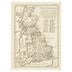
Roman Empire Map

5
92
to
12
55
36
92
92
92
1
1
1
1
41
41
10
5
3
2
1
1
1
71
12
12
6
3
34
12
11
9
5
13
2
2
1
1
Sort By
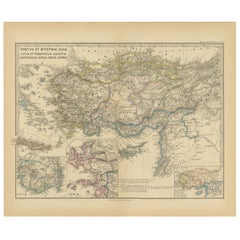
Asia Minor and Provinces: A Roman Empire Map from Spruner-Menke Atlas, 1880
Located in Langweer, NL
during the Roman Empire. The map is interesting for a number of reasons: 1. **Comprehensive Detail
Category

Antique 1880s Maps

Materials

Paper

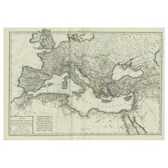
Original Antique Map of the Roman Empire
Located in Langweer, NL
Antique map titled 'Carte de l'Empire Romain'. Original antique map of the Roman Empire, two sheets
Category

Antique Late 18th Century Maps

Materials

Paper

Original Antique Map of the Roman Empire
H 19.06 in W 27.84 in D 0.02 in
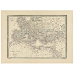
Antique Map of the Roman Empire by Lapie, 1842
Located in Langweer, NL
Antique map titled 'Carte de l'Empire Romain'. Map of the Roman Empire. This map originates from
Category

Antique Mid-19th Century Maps

Materials

Paper

Antique Map of the Roman Empire by Lapie, 1842
H 19.89 in W 26.78 in D 0.02 in
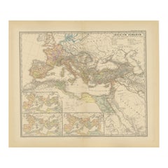
Imperium Romanum: A Detailed Map of the Roman Empire in its Zenith, 1880
Located in Langweer, NL
This original antique map, titled "IMPERIVM ROMANVM", is a detailed depiction of the Roman Empire
Category

Antique 1880s Maps

Materials

Paper

Antique Map of Part of the Roman Empire by H. Kiepert, circa 1870
By Heinrich Kiepert
Located in Langweer, NL
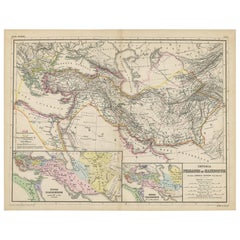
Antique map titled 'Imperia Persarum et Macedonum'. Depicts part of the Roman Empire, from Greece
Category

Antique Late 19th Century Maps

Materials

Paper

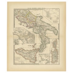
Antique Map of The Regions of Italy and Sicily during the Roman Empire, 1880
Located in Langweer, NL
during the Roman Empire. These regions are distinguished by different colors outlining their boundaries
Category

Antique 1880s Maps

Materials

Paper

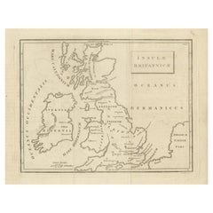
Antique Map of the British Isles According to the Geography of the Roman Empire
Located in Langweer, NL
shows a rudimentary outline of the islands according to the geography of the Roman Empire, after
Category

Antique Late 18th Century Maps

Materials

Paper

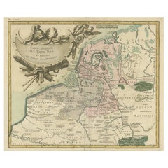
Antique Map of the Netherlands in the time of the Domination by the Roman Empire
Located in Langweer, NL
'. Copper engraved map of the Netherlands in the time of the domination by the Roman Empire. The map also
Category

Antique Mid-18th Century Maps

Materials

Paper

Antique Map of Britain in Roman Times
Located in Langweer, NL
register of the stations and distances along the various roads of the Roman empire. This map originates
Category

Antique Early 19th Century Maps

Materials

Paper

Antique Map of Britain in Roman Times
H 17.6 in W 11.07 in D 0.02 in
Antique Map Made After a Roman Papyrus Travel Map, Known as Peutinger Map, 1773
Located in Langweer, NL
as Peutinger's Tabula or Peutinger Table, is an illustrated itinerarium (ancient Roman road map
Category

Antique 18th Century Maps

Materials

Paper

Antique Map of France in Ancient Roman Times, 1880
Located in Langweer, NL
Antique map titled 'Gaule indépendante et Romaine'. Old map of Gaul or France in ancient Roman
Category

Antique 19th Century Maps

Materials

Paper

Antique Miniature Map of the Roman Province of Illyricum 'Dalmatia'
By Abraham Ortelius
Located in Langweer, NL
Antique miniature map titled 'Illyricum'. Original small map of Illyricum. The Roman province of
Category

Antique Early 17th Century Maps

Materials

Paper

Large Antique Map of Gaul under Roman Rule, ca.1760
Located in Langweer, NL
Antique map titled 'Gallia Augustiniana in suas provincias divisa (..)'. Large antique map of Roman
Category

Antique 1760s Maps

Materials

Paper

Ancient Italy: Regions and Rome in the Roman Empire, Published in 1880
Located in Langweer, NL
. 4. **Infrastructure**: The map includes Roman roads, aqueducts, and possibly the locations of
Category

Antique 1880s Maps

Materials

Paper

The Roman Empire from the Time of Constantine the Great, Published in 1880
Located in Langweer, NL
Roman Empire from the time of Constantine the Great." This map is designed to represent the Roman
Category

Antique 1880s Maps

Materials

Paper

Roman Italy and Provinces: A Cartographic Snapshot, 1880
Located in Langweer, NL
the Roman Republic or early Roman Empire, suggested by the level of detail in regions like Latium and
Category

Antique 1880s Maps

Materials

Paper

Roman Italy and Provinces: A Cartographic Snapshot, 1880
Free Shipping
H 15.56 in W 18.51 in D 0 in
Original Antique Map of the Duchy of Holstein
By Willem Blaeu
Located in Langweer, NL
northernmost territory of the Holy Roman Empire, from the mid-17th Century. To the north lies the Danish Duchy
Category

Antique Mid-17th Century Maps

Materials

Paper

Original Antique Map of the Duchy of Holstein
H 20.48 in W 24.53 in D 0.02 in
Ancient Iberia: Hispania Map from Spruner-Menke Atlas Antiquus, 1880
Located in Langweer, NL
relative peace within the Roman Empire, known as the Pax Romana. The map would be of great interest to
Category

Antique 1880s Maps

Materials

Paper

Antique Map of Greece by J. Jansson, circa 1653
Located in Langweer, NL
Greek territories form mythical times to the founding of the Roman Empire and establishment of
Category

Antique Mid-17th Century Maps

Materials

Paper

Cartographic Tapestry: Antique Map of Asia Minor, circa 1640
Located in Langweer, NL
, including the Roman, Byzantine, Ottoman, and Armenian Empires. It serves as a testament to the complex
Category

Antique Mid-17th Century Maps

Materials

Paper

Black Sea in Antiquity: Pontus Euxinus Map, Published in 1880
Located in Langweer, NL
important ancient empires and peoples. **Features of the map include:** 1. **Regional Focus**: It focuses
Category

Antique 1880s Maps

Materials

Paper

Black Sea in Antiquity: Pontus Euxinus Map, Published in 1880
Free Shipping
H 15.56 in W 18.51 in D 0 in
Roman Balkans: Pannonia, Illyricum, Dacia, Moesia, Thracia, Macedonia and Thyris
Located in Langweer, NL
. 7. **Latin Text**: The map uses Latin, reflecting the language of the Roman Empire and contributing
Category

Antique 1880s Maps

Materials

Paper

Roman Frontiers Engraved: Germania, Raetia, and Noricum, Published in 1880
Located in Langweer, NL
, which are central to Raetia, are prominently displayed. 3. **Roman Settlements and Roads**: The map
Category

Antique 1880s Maps

Materials

Paper

Large Map of Castile's Southern Realms - Granada, Andalusia, and Murcia, 1652
Located in Langweer, NL
This antique map, titled 'Les Etats de la Couronne de Castille', represents the southern regions of
Category

Antique Mid-17th Century Maps

Materials

Paper

Antique Map of Bohemia in the Present-Day Chech Repubic, 1730
Located in Langweer, NL
independent principality, a kingdom in the Holy Roman Empire, and subsequently a part of the Habsburg Monarchy
Category

Antique 18th Century Maps

Materials

Paper

Antique Map of the British Isles with Walls, Settlements and Other Features
Located in Langweer, NL
shows a rudimentary outline of the islands according to the geography of the Roman Empire, after
Category

Antique Late 18th Century Maps

Materials

Paper

Scandinavia & Portions of Eastern Europe: 18th Century Hand-Colored Homann Map
By Johann Baptist Homann
Located in Alamo, CA
, Johann was named Imperial Geographer to the Holy Roman Empire by Charles VI and made a member of the
Category

Antique Early 18th Century German Maps

Materials

Paper

Ancient Gaul: A Cartographic Overview of Gallic Tribes and Roman Provinces, 1880
Located in Langweer, NL
representation of the Roman province before the fall of the Roman Empire. 2. **Rich Detail**: The map includes
Category

Antique 1880s Maps

Materials

Paper

North African Coasts: Marmarica to Mauretania in Roman Times, Published in 1880
Located in Langweer, NL
depicted on the map is during Roman antiquity, specifically during the Roman Republic and Roman Empire when
Category

Antique 1880s Maps

Materials

Paper

Map of The Italian Peninsula with the islands of Sicily, Sardinia, Corsica, 1880
Located in Langweer, NL
, religious, and social life in the Roman Republic and Empire. From the "Spruner-Menke Atlas Antiquus," this
Category

Antique 1880s Maps

Materials

Paper

Hand-Colored 18th Century Homann Map of the Danube, Italy, Greece, Croatia
By Johann Baptist Homann
Located in Alamo, CA
, Johann was named Imperial Geographer to the Holy Roman Empire by Charles VI and made a member of the
Category

Antique Early 18th Century German Maps

Materials

Paper

Antique Map of Italy with Insets of Rome and Major Cities, Published in 1880
Located in Langweer, NL
locales, such as a detailed plan of Rome, showcasing the city's layout during the Roman era. The map is
Category

Antique 1880s Maps

Materials

Paper

Antique Rand McNally & Company Schoolmap. Ancient Oriental Empires. Historical
By Rand McNally & Co.
Located in ROTTERDAM, ZH
made in the late 1920's. The map of all the Ancient Oriental Empires shows the world as it was ruled
Category

Vintage 1920s American American Classical Maps

Materials

Fabric, Paper

18th Century Hand-Colored Homann Map of Germany, Including Frankfurt and Berlin
By Johann Baptist Homann
Located in Alamo, CA
, Johann was named Imperial Geographer to the Holy Roman Empire by Charles VI and made a member of the
Category

Antique Early 18th Century German Maps

Materials

Paper

West Africa Entitled "Guinea Propria": An 18th Century Hand Colored Homann Map
By Johann Baptist Homann
Located in Alamo, CA
. In 1715, Johann was named Imperial Geographer to the Holy Roman Empire by Charles VI and made a
Category

Antique Mid-18th Century German Maps

Materials

Paper

Exploring Ancient Persia: Ptolemaic Map of Iran and Iraq by Ptolemy and Mercator
Located in Langweer, NL
part of the Roman Empire, in the 2nd century AD. One of the most learned and influential men of his
Category

Antique 1610s Maps

Materials

Paper

Old Map of Mediterranean Powers: Pompey to Actium (66-31 BC), Published in 1880
Located in Langweer, NL
This is a historical map that depicts the Mediterranean region during a specific timeframe in Roman
Category

Antique 1880s Maps

Materials

Paper

Sweden & Adjacent Portions of Scandinavia: A Hand-Colored 18th C. Map by Homann
By Johann Baptist Homann
Located in Alamo, CA
, Johann was named Imperial Geographer to the Holy Roman Empire by Charles VI and made a member of the
Category

Antique 1720s German Maps

Materials

Paper

Original Old Composite of Several Maps of the Ancient World on One Sheet, 1880
Located in Langweer, NL
Europe, North Africa, and parts of Asia, reflecting the Roman Empire at its extent. The map includes
Category

Antique 1880s Maps

Materials

Paper

Old Ptolemaic Map of the Region Between the Persian Gulf and Caspian Sea, 1598
Located in Langweer, NL
who worked in Alexandria, then a part of the Roman Empire, in the 2nd century AD. One of the most
Category

Antique 16th Century Maps

Materials

Paper

Hand Colored 18th Century Homann Map of Austria Including Vienna and the Danube
By Johann Baptist Homann
Located in Alamo, CA
European map market. In 1715, Johann was named Imperial Geographer to the Holy Roman Empire by Charles VI
Category

Antique Early 18th Century German Maps

Materials

Paper

The Kingdom of Naples and Southern Italy: A Hand-Colored 18th Century Homann Map
By Johann Baptist Homann
Located in Alamo, CA
the Holy Roman Empire by Charles VI and made a member of the Prussian Academy of Sciences. Most
Category

Antique Early 18th Century German Maps

Materials

Paper

Hand-Colored 18th Century Homann Map of Denmark and Islands in the Baltic Sea
By Johann Baptist Homann
Located in Alamo, CA
, Johann was named Imperial Geographer to the Holy Roman Empire by Charles VI and made a member of the
Category

Antique Early 18th Century German Maps

Materials

Paper

Hand-Colored 18th Century Homann Map of the Black Sea, Turkey and Asia Minor
By Johann Baptist Homann
Located in Alamo, CA
the Holy Roman Empire by Charles VI and made a member of the Prussian Academy of Sciences. Most
Category

Antique Early 18th Century German Maps

Materials

Paper

Mediterranean Encounters: From the Punic Wars to the Hannibalic War, 1880
Located in Langweer, NL
The map, with the title "MARE INTERNUM cum populis adiacentibus a bello Hannibalico usque ad
Category

Antique 1880s Maps

Materials

Paper

Ancient Realms of Northeast Africa: Arabia, Ethiopia, and Egypt, Published 1880
Located in Langweer, NL
antiquity, specifically during the times when these regions were well-known to the Roman Empire. For Egypt
Category

Antique 1880s Maps

Materials

Paper

Ancient Crossroads: Albania to Assyria in Antiquity, Published in 1880
Located in Langweer, NL
The map titled "ALBANIA, IBERIA, COLCHIS, ARMENIA, MESOPOTAMIA, BABYLONIA, ASSYRIA" portrays the
Category

Antique 1880s Maps

Materials

Paper

A Catalonian Cartographic Depiction of Tarragona Province, 1901
Located in Langweer, NL
boundary with the Mediterranean Sea. Known for its rich history dating back to the Roman Empire, Tarragona
Category

Antique Early 1900s Maps

Materials

Paper

1720 Panoramic Vista of Istanbul and the Bosphorus - with Column of Pompey
Located in Langweer, NL
-century Amsterdam. The Aqueduct of Valens, also known in Turkish as Valens Su Kemeri, is a Roman aqueduct
Category

Antique 1720s Maps

Materials

Paper

Antique Portrait of Charles V by Houbraken, c.1750
Located in Langweer, NL
Holy Roman Empire. This print originates from 'Vaderlandsche historie, vervattende de geschiedenissen
Category

Antique 18th Century Prints

Materials

Paper

Persia The Immortal Kingdom by Ghirshman Minorsky Sanghvi 1971
Located in North Hollywood, CA
Vladimir Minorsky, Ramesh Sanghvi and Roman Ghirshman, William MacQuitty (photographs). Orient Commerce
Category

20th Century Islamic Books

Materials

Paper

Circus Flaminius (..), Anonymous, 1704
Located in Langweer, NL
, chariot races, and public events during the Roman Republic and Empire. The print likely showcases the
Category

Antique 18th Century Prints

Materials

Paper

Circus Flaminius (..), Anonymous, 1704
H 14.1 in W 9.3 in D 0.001 in
Antique rare amusing Russian silver model of a bear, St Petersburg, circa 1890
Located in Tel Aviv - Jaffa, IL
which is 925/1000. The Russian bear : The Russian Bear (Russian: Русский медведь, romanized: Russky
Category

Antique 1890s Russian Sterling Silver

Materials

Onyx, Silver

China 100 BC Han Dynasty Ancient Rare Stickman Sculpture in Earthenware Pottery
Located in Miami, FL
, the Han dynasty in the east, rivaled its almost contemporary Roman empire in the west. With only one
Category

Antique 15th Century and Earlier Chinese Han Antiquities

Materials

Iron

8 Vols. Edward Gibbon, The History of the Decline and Fall of the Roman Empire
Located in New York, NY
8 Volumes. Edward Gibbon, The History of the Decline and Fall of the Roman Empire. Bound in full
Category

Antique 19th Century English Books

Materials

Leather

Rare Map 1710 Johann Homann Regnorum Hispaniae et Portugalliae Taula Generalis
By Johann Baptist Homann
Located in Drottningholm, SE
Holy Roman Empire by Charles VI and made a member of the Prussian Academy of Sciences. Most importantly
Category

Antique 1710s Dutch Maps

Materials

Paper

French Wrought Iron Table with Fossilized Marble-Like Wood, circa 1800
Located in Paris, FR
tables under Napoleonic times, where army officers used to unroll maps of forthcoming battles. The base
Category

Antique 1790s French Empire Center Tables

Materials

Bronze, Iron

Duchy of Milan
By Abraham Ortelius
Located in Houston, TX
between 1395-1797. It was part of the Holy Roman Empire, by then a decentralized entity and was ruled by
Category

Antique Early 1600s Dutch Prints

Duchy of Milan
H 18.88 in W 12.25 in D 0.01 in
Vintage Hand-Painted Map of Roman Empire
Located in Houston, TX
Hand-painted school chart in Flemish depicting the Roman Empire and its two chief rivals. The chart
Category

Vintage 1950s Belgian Maps

Florida and Virginia: A 17th Century Hand-colored Map by Hondius after Mercator
By Gerard Mercator
Located in Alamo, CA
his first map in 1540. Charles V, the Holy Roman Emperor, then employed him as a cartographer and
Category

Antique Early 17th Century Dutch Maps

Materials

Paper

  • 1
Get Updated with New Arrivals
Save "Roman Empire Map", and we’ll notify you when there are new listings in this category.

Roman Empire Map For Sale on 1stDibs

At 1stDibs, there are many versions of the ideal roman empire map for your home. Frequently made of paper, animal skin and fabric, every roman empire map was constructed with great care. You’ve searched high and low for the perfect roman empire map — we have versions that date back to the 18th Century alongside those produced as recently as the 20th Century are available. Each roman empire map bearing neoclassical hallmarks is very popular. You’ll likely find more than one roman empire map that is appealing in its simplicity, but Johann Baptist Homann, Heinrich Kiepert and Rand McNally & Co. produced versions that are worth a look.

Finding the Right collectibles-curiosities for You

Antique and vintage collectibles and curiosities can bring whimsy and wonder to any interior. 

Decorating with old scientific instruments, historical memorabilia and vintage musical instruments, as well as other authentic collectibles and curiosities that can be found on 1stDibs, presents an opportunity to create a unique, natural history museum-like atmosphere in your home that can provoke conversation as often as it pays tribute to how far we’ve come in understanding our world. 

And bringing collectibles and curiosities into your space is actually on trend — Wunderkammern, or curiosity cabinets, were all the rage in Europe during the 1500s and continued to have adherents there and in the U.S. in the following centuries. Today, however, they’re experiencing a real surge in popularity and influencing how many interior designers are furnishing and decorating homes — combining contemporary with antique, scientific with tribal, earthly with extraterrestrial, Les Lalanne tables with Flemish tapestries.

The original Wunderkammern were entire rooms filled with objects demonstrating their owners’ worldly knowledge: A proper one included artificiala or preciosa (objets d’art); naturalia (such as skeletons, shells, minerals); exotica (taxidermy or dried plants); and scientifica (scientific instruments), frequently alongside religious relics and ancient artifacts.

Pay tribute to a history of rich and diverse musical traditions that have taken shape all over the world by decorating your home with a collection of antique and vintage musical instruments — with a little help from strong hanging wire or some wall hooks, vintage brass instruments such as a gong, French horn or trumpet can help elevate a home office or complement the efforts you’ve made to ensure a welcoming vibe in your home’s entryway. Bells or antique wind instruments can add provocative metallic contrasts to dark woods as tabletop decorative objects.  

Create an intriguing focal point with Georgian scientific instruments, such as stick barometers with mahogany cases or lacquered brass telescopes. These items stem from an era named for the monarchies of the four King Georges, who ruled England in succession starting in 1714 (plus King William’s reign, which lasted until 1837). Just as there was beautiful jewelry produced during the period that today is coveted by collectors, there is much to be found in the collectibles and curiosities realm too.

Wanderlust, nostalgia and a shared love of good design are contributing factors to certain trends in decorating — just as vintage trunks and luggage have reappeared as furniture or home accents in a bedroom or foyer, decorating with globes, maps or nautical objects is similarly rooted in the allure of travel and a penchant for the stylish finishing touch that collectibles bring to our homes.

Find a wide range of antique and vintage collectibles and curiosities on 1stDibs.

Read More

Pamela Shamshiri Shares the Secrets behind Her First-Ever Book and Its Effortlessly Cool Interiors

The sought-after designer worked with the team at Hoffman Creative to produce a monograph that beautifully showcases some of Studio Shamshiri's most inspiring projects.

Moroccan Artworks and Objects Take Center Stage in an Extraordinary Villa in Tangier

Italian writer and collector Umberto Pasti opens the doors to his remarkable cave of wonders in North Africa.

Montecito Has Drawn Royalty and Celebrities, and These Homes Are Proof of Its Allure

Hollywood A-listers, ex-pat aristocrats and art collectors and style setters of all stripes appreciate the allure of the coastal California hamlet — much on our minds after recent winter floods.

Whaam! Blam! Pow! — a New Book on Pop Art Packs a Punch

Publishing house Assouline and writer Julie Belcove have teamed up to trace the history of the genre, from Roy Lichtenstein, Andy Warhol and Yayoi Kusama to Mickalene Thomas and Jeff Koons.

The Sparkling Legacy of Tiffany & Co. Explained, One Jewel at a Time

A gorgeous new book celebrates — and memorializes — the iconic jeweler’s rich heritage.

What Makes a Gem-Encrusted Chess Set Worth $4 Million?

The world’s most opulent chess set, weighing in at 513 carats, is literally fit for a king and queen.

Tauba Auerbach’s Geometric Pop-Up Book Is Mighty Rare, Thanks to a Hurricane

This sculptural art book has an epic backstory of its own.

Step inside the Storied Mansions of Palm Beach’s Most Effervescent Architect

From Spanish-style courtyards to fanciful fountains, these acclaimed structures abound in surprising and elegant details.