Sea Map

32
727
10
6
to
119
615
126
743
738
739
15
9
5
5
5
3
2
1
1
400
161
166
16
44
102
10
17
10
10
34
19
35
10
4
1
3
670
35
15
15
9
205
69
47
46
44
9
5
5
5
5
Sort By
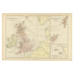
Colorful Detailed Antique Map of The British Islands and `The North Sea, 1882
Located in Langweer, NL
Discover 'The British Islands and The North Sea' Map with Insets of Orkney, Shetland, and Channel
Category

Antique 1880s Maps

Materials

Paper

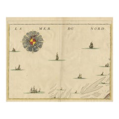
Antique Map of the North Sea and Dunkirk
Located in Langweer, NL
Untitled map of the North Sea, top left a large compass rose, bottom right Dunkirk (Duinkerke
Category

Antique Early 18th Century Maps

Materials

Paper

Antique Map of the North Sea and Dunkirk
H 20.95 in W 24.14 in D 0.02 in
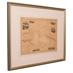
Antique Lithography Map, Black Sea, English, Framed, Cartography, Victorian
Located in Hele, Devon, GB
This is an antique lithography map of the Black Sea region. An English, framed atlas engraving of
Category

Antique Mid-19th Century British Early Victorian Maps

Materials

Wood

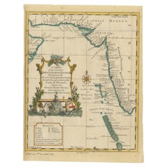
Antique Map of the Region of the Arabian Sea
Located in Langweer, NL
Antique map titled 'A Chart of the Coast of Persia, Guzarat & Malabar'. Old map centered on the
Category

Antique Mid-18th Century Maps

Materials

Paper

Antique Map of the Region of the Arabian Sea
H 11.03 in W 8.39 in D 0.02 in
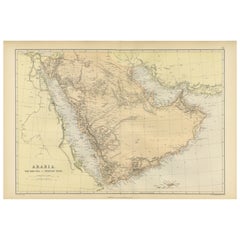
Original 1882 Map of Arabia, Red Sea & Persian Gulf
Located in Langweer, NL
This print is a historically significant map titled "Arabia, the Red Sea, and the Persian Gulf
Category

Antique 1880s Maps

Materials

Paper

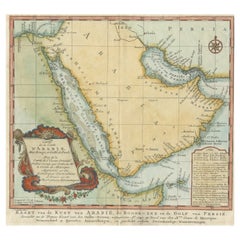
Original Antique Map of Arabia and the Red Sea
Located in Langweer, NL
Dutch version, engraved by J. van Schley, of Bellin's map of Arabia and the Red Sea. The emphasis is the
Category

Antique Mid-18th Century Maps

Materials

Paper

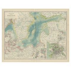
Antique Map of the Baltic Sea by Johnston, '1909'
Located in Langweer, NL
Antique map titled 'Basin of the Baltic'. Original antique map of Baltic Sea. With inset maps of
Category

Early 20th Century Maps

Materials

Paper

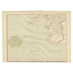
Antique Map of the Java Sea by Dornseiffen, 1900
Located in Langweer, NL
Antique map of the Java Sea. Also depicts Bilitung, the Karimata Islands and Sukadana, Borneo. This
Category

20th Century Maps

Materials

Paper

Antique Map of the Black Sea by Perthes, 1848
Located in Langweer, NL
Antique map titled 'Pontus Euxinus'. Old map of the Black Sea and surroundings originating from
Category

Antique 19th Century Maps

Materials

Paper

Black Sea in Antiquity: Pontus Euxinus Map, Published in 1880
Located in Langweer, NL
This map, titled "PONTUS EUXINUS," depicts the Black Sea region, historically known as the Pontus
Category

Antique 1880s Maps

Materials

Paper

Black Sea in Antiquity: Pontus Euxinus Map, Published in 1880
Free Shipping
H 15.56 in W 18.51 in D 0 in
Historical Map of the Black Sea and Surrounding Regions, 1705
Located in Langweer, NL
Title: "Map of Turcomania, Georgia, and Comania" This print presents an intricately detailed map
Category

Antique Early 1700s Maps

Materials

Paper

Detailed Antique Map of the Black Sea, Balkans and Asia Minor
Located in Langweer, NL
detailed map of the Black Sea, Balkans, and Asia Minor. It is embellished with a simple compass rose and
Category

Antique Mid-18th Century Maps

Materials

Paper

Old Map Depicting Turkey, Persia, Arab and Black Sea Etc, 1778
Located in Langweer, NL
Asia. The map shows all of Turkey and the Black Sea, and extends east to include the Caspian Sea and
Category

Antique 1770s Maps

Materials

Paper

Old Dutch Map of the Region Around the Mediterranean Sea, 1773
Located in Langweer, NL
Antique map titled 'Kaart van een Deel der Middelandsche Zee (..)'. Old map of the region
Category

Antique 1770s Maps

Materials

Paper

Rare Antique Map of Yam Suph, Egypt and Red Sea, 1773
Located in Langweer, NL
Antique print with two maps titled 'Uittreksel van de Kaart van Egipten en de Roode Zee' and
Category

Antique 18th Century Maps

Materials

Paper

Original Antique Map of Abyssinia, Sudan and the Red Sea, 1749
Located in Langweer, NL
Antique map titled 'Nubie, Abissinie et Cote d'Ajan'. Map of Abyssinia, Sudan and the Red Sea by
Category

Antique 1740s Maps

Materials

Paper

Antique Map of the Caspian Sea and Surroundings by Bellin, 1764
Located in Langweer, NL
Caspian Sea. This map originates from 'Le Petit Atlas Maritime Recueil De Cartes et Plans' by J.N. Bellin
Category

Antique 18th Century Maps

Materials

Paper

Antique Map of the Black Sea and Surroundings by Sharpe, 1849
Located in Langweer, NL
Antique map titled 'Russia on the Euxine'. Old map of the Black Sea and the surrounding (Russia
Category

Antique 19th Century Maps

Materials

Paper

Antique Map of Italy and Other Regions Near the Adriatic Sea
Located in Langweer, NL
Antique map titled 'Italie et Provinces Autrichnes sur l'Adriatique'. Original old map of Italy and
Category

Antique Mid-19th Century Maps

Materials

Paper

Fabulous Original Antique two-sheet Map of the Caspian Sea, ca.1723
Located in Langweer, NL
Tartarie", Delisle, Guillaume (2 maps) Subject: Caspian Sea Period: 1723 (circa) Publication: Color: Hand
Category

Antique 1720s Maps

Materials

Paper

Antique Map of Central Asia between the Caspian Sea and Lake Balkhash
Located in Langweer, NL
Antique map titled 'Independent Tartary'. Original steel engraved map of Central Asia. It covers
Category

Antique Mid-19th Century Maps

Materials

Paper

Uncommon Miniature Map of the Region around the Caspian Sea, ca.1800
Located in Langweer, NL
Uncommon miniature map of the region around the Caspian Sea. Including the black sea and
Category

Antique Early 1800s Maps

Materials

Paper

Algarve: A Tapestry of Sea and Sunlight in an Antique Map, 1903
Located in Langweer, NL
The image is a historical map of the Algarve, the southernmost region of Portugal. The map is
Category

Antique Early 1900s Maps

Materials

Paper

Mid 19th Century Map of the Black Sea with Decorative Vignettes, 1851
Located in Langweer, NL
Map of the Black Sea and contingent lands, including Turkey, Russia, Georgia, Azerbaijan, Bulgaria
Category

Antique Mid-19th Century Maps

Materials

Paper

Original Antique Engraved Map of Part of the Red Sea, Arabia, 1775
Located in Langweer, NL
Antique map titled 'Carte de l'Entrée du Golfe de la Mer Rouge'. Uncommon sea chart of the entrance
Category

Antique Late 18th Century Maps

Materials

Paper

Antique Map of the Caspian Sea, Uzbekistan, Northern Persia Etc, C.1735
Located in Langweer, NL
Antique map titled 'Nova Maris Caspii et Regions Usbeck (..).' Detailed map of Central Asia
Category

Antique 18th Century Maps

Materials

Paper

Antique Map Centered on Turkestan, Including the Black and Caspian Seas, 1749
Located in Langweer, NL
Antique map titled 'Carte De Karazm, Turkestan Et Grande Bukarie'. Original antique map centered
Category

Antique 18th Century Maps

Materials

Paper

Map of Region Near the Baltic Sea, Present Day Bulgaria, Romania & Turkey, c1670
Located in Langweer, NL
the area west of the Baltic Sea, present day Bulgaria, Romania, and Turkey. The map is based on the
Category

Antique 1670s Maps

Materials

Paper

Antique Map of the Black Sea and Surroundings by Keizer & de Lat, 1788
Located in Langweer, NL
of the Black Sea and surroundings. This map originates from 'Nieuwe Natuur- Geschied- en
Category

Antique Late 18th Century Maps

Materials

Paper

Antique Map of the Mediterranean Sea and Surroundings by Keizer & de Lat, 1788
Located in Langweer, NL
the Mediterranean Sea and surroundings. This map originates from 'Nieuwe Natuur- Geschied- en
Category

Antique Late 18th Century Maps

Materials

Paper

Antique Map of the Region Around the Baltic Sea by Cordier, c.1670
Located in Langweer, NL
area west of the Baltic Sea, present day Bulgaria, Romania, and Turkey. The map is based on the
Category

Antique 17th Century Maps

Materials

Paper

Antique Map of The Nile, Egypt and the Red Sea by Bachiene, 1765
Located in Langweer, NL
of Biblical Egypt and the Red Sea. With title cartouche, compass rose and scale. This map originates
Category

Antique 18th Century Maps

Materials

Paper

Antique Map of Arabia including Nubia and Abyssinia, also shows the Red Sea
Located in Langweer, NL
Antique map titled 'Nubie et Abissinie'. Original antique map of Nubia, a region along the Nile
Category

Antique Late 18th Century Maps

Materials

Paper

Antique Map of Europe Stretching from Northern Africa to the Baltic Sea, 1719
Located in Langweer, NL
conquestes'. Original antique map of Europe stretching from northern Africa to the Baltic Sea. It shows the
Category

Antique 18th Century Maps

Materials

Paper

Antique Map of 'African' Islands in the Mediterranean Sea and The Atlantic, 1747
Located in Langweer, NL
Antique map titled 'Particular draughts of some of the chief African Islands in the Mediterranean
Category

Antique 18th Century Maps

Materials

Paper

Curious Map of the Laptev Sea 'Arctic Ocean' and the Mediterranean, ca.1700
Located in Langweer, NL
Antique map, untitled. Map of the Laptev Sea (Arctic Ocean) and the Mediterranean, printed for
Category

Antique Early 1700s Maps

Materials

Paper

Antique Map of the Shores of The Baltic Sea by W. G. Blackie, 1859
Located in Langweer, NL
Antique map titled 'The shores of The Baltic sea and of the Gulfs of Bothnia & Finland'. Original
Category

Antique Mid-19th Century Maps

Materials

Paper

Antique Map of the British Islands to the White Sea by J. Imray
Located in Langweer, NL
Antique large nautical chart of the British Islands to the White Sea. With insets of Veshnyak
Category

Antique Late 19th Century Maps

Materials

Paper

Old Ptolemaic Map of the Region Between the Persian Gulf and Caspian Sea, 1598
Located in Langweer, NL
editions contained maps based on his original writings, known as Ptolemaic maps. As geographic knowledge
Category

Antique 16th Century Maps

Materials

Paper

Old Map of the Sinai Peninsula Showing the Mediterranean and the Red Sea, 1773
Located in Langweer, NL
Antique map of the Sinai Peninsula showing the Mediterranean Sea to the north and the Red Sea to
Category

Antique 1770s Maps

Materials

Paper

Antique Map of Ancient Egypt Also Depicting the Nile River and Red Sea, 1845
Located in Langweer, NL
Antique map Egypt titled 'General Karte von Alt Aegypten von A.H. Brué'. Large map of Egypt also
Category

Antique 19th Century Maps

Materials

Paper

Antique Map of the Region Between the Black and Caspian Sea by Cellarius, 1731
Located in Langweer, NL
Antique map titled 'Bosporus, Maeotis, Iberia, Albania, et Sarmatia Asiatica.' Map of the region
Category

Antique 18th Century Maps

Materials

Paper

Rare Antique Map of Persia, Incl the Caspian Sea and the Arabian Peninsula, 1726
Located in Langweer, NL
(Amadabad) in modern day western India. This map, centered on Persia, includes the Caspian Sea and part of
Category

Antique 1720s Maps

Materials

Paper

Antique Map of Russia from the Baltic to the Black Sea by Sharpe, 1849
Located in Langweer, NL
the Baltic to the Black Sea. This map originates from 'Sharpe's Corresponding Atlas (..)' by J. Sharpe
Category

Antique 19th Century Maps

Materials

Paper

16th Century Map of Saudi Arabia, the Persian Gulf and Red Sea, ca. 1574
Located in Langweer, NL
Ptolemaic map of the Arabian Peninsula based on the 1548 map of Giacomo Gastaldi. It covers nearly
Category

Antique 16th Century Maps

Materials

Paper

Hand-Colored 18th Century Homann Map of the Black Sea, Turkey and Asia Minor
By Johann Baptist Homann
Located in Alamo, CA
An attractive original early 18th century hand-colored map of the Black Sea and Turkey entitled
Category

Antique Early 18th Century German Maps

Materials

Paper

Hand-Colored 18th Century Homann Map of Denmark and Islands in the Baltic Sea
By Johann Baptist Homann
Located in Alamo, CA
An 18th century copper plate hand-colored map entitled "Insulae Danicae in Mari Balthico Sitae
Category

Antique Early 18th Century German Maps

Materials

Paper

Uncommon and Rare Map of the Caspian Sea by Order of the Czar, 1742
Located in Langweer, NL
Antique map, titled: 'Kaert van de Kaspische Zee volgens bevel van den Czaer (…).' Uncommon map
Category

Antique 1740s Maps

Materials

Paper

Antique Map of the North Sea From the English Channel to Norway & Sweden, 1746
Located in Langweer, NL
Antique map titled 'A correct Chart of the German Ocean from the North of Scotland to the Start
Category

Antique 1740s Maps

Materials

Paper

Antique Map of the Surroundings of the Baltic Sea by A.K. Johnston, 1865
Located in Langweer, NL
Antique map titled 'Basin of the Baltic'. Depicting, Denmark, Sweden, Finland, Estonia, Poland
Category

Antique Mid-19th Century Maps

Materials

Paper

Antique Map of the Adriatic Sea and the Balkan by J. Janssonius, circa 1650
Located in Langweer, NL
Striking large-scale map of the Greater Balkans. Decorated with two large-scale cartouches, one
Category

Antique Mid-17th Century Maps

Materials

Paper

Old Map of the Black Sea, The Krim, Ukraine, Russia, etc in Historic Times, 1848
Located in Langweer, NL
Antique map titled 'Pontus Euxinus'. Old map of the black Sea and surroundings originating from
Category

Antique 1840s Maps

Materials

Paper

Original Antique Map of the Region Between the Gulf of Lybia and the Red Sea
Located in Langweer, NL
Original antique map titled 'Aegyptus et Cyrene'. Detailed ancient map of the region between the
Category

Antique Early 18th Century Maps

Materials

Paper

Antique Map of Moldova to Thessaly and from the Adriatic to the Black Sea, 1880
Located in Langweer, NL
Antique map titled 'Turquie d'Europe'. Map of the european parts of Turkey. The map covers from
Category

Antique 1880s Maps

Materials

Paper

Old Map of the Gulf of Bothnia, the Northernmost Arm of the Baltic Sea, 1759
Located in Langweer, NL
Antique map titled 'Carte du Golphe de Bothnie'. Original antique map of the Gulf of Bothnia
Category

Antique 1750s Maps

Materials

Paper

Antique Map of the Persian Gulf and Caspian Sea Region by R. Bonne, 1780
Located in Langweer, NL
region from the Persian Gulf and Caspian Sea in the west to the edges of China/Tibet in the east. Drawn
Category

Antique Late 18th Century Maps

Materials

Paper

Original Old China Map, From Korea and the Sea of Japan to Teypin Island, 1803
Located in Langweer, NL
Antique map titled 'China, Contains 15 Subject Provinces Including the 2 Islands of Hainan, Formosa
Category

Antique Early 1800s Maps

Materials

Paper

Antique Map of Asia Minor with Cyprus, Syria and Turkey and the Black Sea, 1747
Located in Langweer, NL
such other provinces of the Turkish Empire (..)'. Beautiful map of Turkey between the Black Sea and
Category

Antique 18th Century Maps

Materials

Paper

Old Map of Persia, incl the Caspian Sea and Part of the Arabian Peninsula, 1726
Located in Langweer, NL
day western India. This map, centered on Persia, includes the Caspian Sea and part of the Arabian
Category

Antique 1720s Maps

Materials

Paper

Map of Tapi or Tapti River in Central India and Along the Arabian Sea, 1726
Located in Langweer, NL
Description: Antique map titled 'De Rivier van Suratta'. This chart shows the Tapti or Tapi
Category

Antique 1720s Maps

Materials

Paper

  • 1
  • ...
Get Updated with New Arrivals
Save "Sea Map", and we’ll notify you when there are new listings in this category.

Sea Map For Sale on 1stDibs

With a vast inventory of beautiful furniture at 1stDibs, we’ve got just the sea map you’re looking for. Frequently made of paper, wood and canvas, every sea map was constructed with great care. There are many kinds of the sea map you’re looking for, from those produced as long ago as the 18th Century to those made as recently as the 20th Century. A sea map made by Art Deco designers — as well as those associated with Regency — is very popular. Captain Greenvile Collins, Johann Baptist Homann and E. Desous each produced at least one beautiful sea map that is worth considering.

How Much is a Sea Map?

The average selling price for a sea map at 1stDibs is $1,025, while they’re typically $124 on the low end and $5,871 for the highest priced.

Read More

Pamela Shamshiri Shares the Secrets behind Her First-Ever Book and Its Effortlessly Cool Interiors

The sought-after designer worked with the team at Hoffman Creative to produce a monograph that beautifully showcases some of Studio Shamshiri's most inspiring projects.

Moroccan Artworks and Objects Take Center Stage in an Extraordinary Villa in Tangier

Italian writer and collector Umberto Pasti opens the doors to his remarkable cave of wonders in North Africa.

Montecito Has Drawn Royalty and Celebrities, and These Homes Are Proof of Its Allure

Hollywood A-listers, ex-pat aristocrats and art collectors and style setters of all stripes appreciate the allure of the coastal California hamlet — much on our minds after recent winter floods.

Whaam! Blam! Pow! — a New Book on Pop Art Packs a Punch

Publishing house Assouline and writer Julie Belcove have teamed up to trace the history of the genre, from Roy Lichtenstein, Andy Warhol and Yayoi Kusama to Mickalene Thomas and Jeff Koons.

The Sparkling Legacy of Tiffany & Co. Explained, One Jewel at a Time

A gorgeous new book celebrates — and memorializes — the iconic jeweler’s rich heritage.

What Makes a Gem-Encrusted Chess Set Worth $4 Million?

The world’s most opulent chess set, weighing in at 513 carats, is literally fit for a king and queen.

Tauba Auerbach’s Geometric Pop-Up Book Is Mighty Rare, Thanks to a Hurricane

This sculptural art book has an epic backstory of its own.

Step inside the Storied Mansions of Palm Beach’s Most Effervescent Architect

From Spanish-style courtyards to fanciful fountains, these acclaimed structures abound in surprising and elegant details.