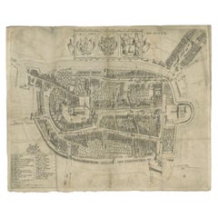
Topographical Plate
1
103
22
1
to
10
84
39
126
107
107
3
3
2
1
1
1
1
68
30
5
23
4
1
3
1
1
89
35
27
18
18
26
26
19
11
5
3
3
2
2
1
Sort By
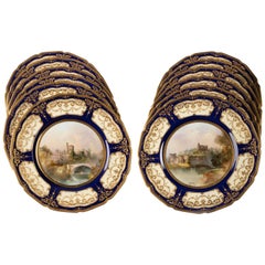
Set of 12 English Porcelain Royal Doulton Topographical Plates, circa 1910
Located in New York, NY
Cream ground with a wide cobalt border decorated with raised gold foliage to shaped cartouches revealing the cream body, polychrome enamel decorated centers titled on the reverse. Si...
Category
Vintage 1910s British Dinner Plates
Materials
Porcelain
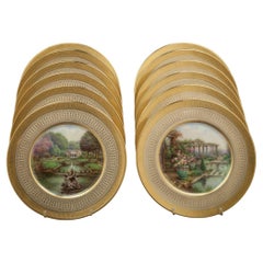
Set of 18 Lenox Topographical Plates, Signed W.M. Morley, circa 1930
Located in New York, NY
Scenes of various English gardens, all marked on the underside.
Category
Vintage 1930s Dinner Plates
Materials
Porcelain
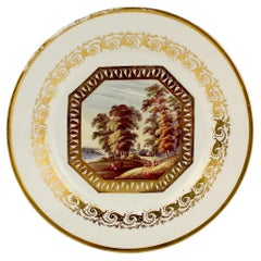
Antique Topographical Derby English Porcelain Plate Entitled 'Near Derby'
By Derby
Located in Philadelphia, PA
A fine antique 19th century Derby hard paste porcelain plate.
Decorated with a hand painted
Category
Antique 19th Century British George III Dinner Plates
Materials
Porcelain
H 1.25 in W 8.78 in D 9.13 in
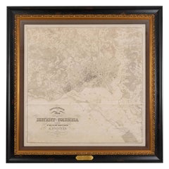
1861 Topographical Map of the District of Columbia, by Boschke, Antique Map
Located in Colorado Springs, CO
Presented is an original map of Albert Boschke's extremely sought-after "Topographical Map of the
Category
Antique 1860s American Historical Memorabilia
Materials
Paper
H 53.25 in W 53.75 in D 3.5 in
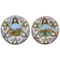
Pair of Thoune "Thuner Majolika" Vedute Plates, circa 1890
Located in Ottawa, Ontario
Pair of thoune "Thuner Majolika" Vedute plates, circa 1890, topographical miniature paintings of
Category
Antique Late 19th Century Swiss Vienna Secession More Furniture and Coll...
Materials
Majolica
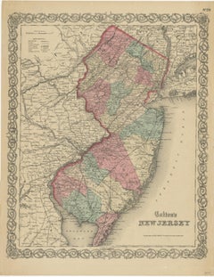
Antique Map of New Jersey
Located in Langweer, NL
plate engraving dating to 1855. Produced by the important mid 19th century American map publisher J. H
Category
Antique Mid-19th Century Maps
Materials
Paper
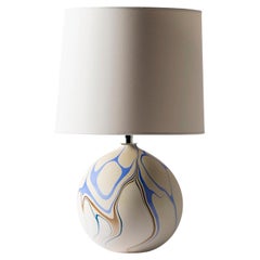
Contemporary Round Marbled Table Lamp in Titan Blue by Elyse Graham
By Elyse Graham
Located in Springfield, OR
topographical maps. We take queues for our palette from the rivers for which the pieces are named. Much like the
Category
2010s American Organic Modern Table Lamps
Materials
Resin, Plaster
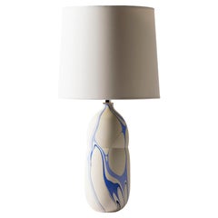
Contemporary Oblong Marbled Mimas Table Lamp in Blue by Elyse Graham
By Elyse Graham
Located in Springfield, OR
topographical maps. We take queues for our palette from the rivers for which the pieces are named. Much like the
Category
2010s American Organic Modern Table Lamps
Materials
Resin, Plaster
Antique Map of the City of Franeker by Bast, 1598
Located in Langweer, NL
topographical engraver from Antwerp.
Artist: Pieter Bast (1550-1605) was a Flemmish topographical engraver
Category
Antique 16th Century Maps
Materials
Paper
Contemporary Round Marbled Table Lamp in Amazon Green by Elyse Graham
By Elyse Graham
Located in Springfield, OR
topographical maps. We take queues for our palette from the rivers for which the pieces are named. Much like the
Category
2010s American Organic Modern Table Lamps
Materials
Resin, Plaster
Baroque Splendor: Ericsberg Castle in Swidde's Suecia Antiqua et Hodierna, 1690
Located in Langweer, NL
who made a significant contribution to Swedish topographical and historical illustration in the late
Category
Antique 1690s Prints
Materials
Paper
Free Shipping
H 12.33 in W 15.95 in D 0 in
Salsta Castle in Pastoral Uppland, Sweden: A Dahlberg Engraving, 1694
Located in Langweer, NL
, meticulously printed from two plates, reveals the precise detail and vibrant hues that bring the scene to life
Category
Antique Late 17th Century Prints
Materials
Paper
Free Shipping
H 13.59 in W 17.72 in D 0 in
Antique Map of the City of Alkmaar by Merian, c.1659
Located in Langweer, NL
one of the most important German topographical engravers and publishers in the Baroque period
Category
Antique 17th Century Maps
Materials
Paper
Antique Map of the City of Alkmaar by Merian, 1659
Located in Langweer, NL
(1627-1686) was one of the most important German topographical engravers and publishers in the Baroque
Category
Antique 17th Century Maps
Materials
Paper
Antique Map of the City of Enkhuizen by Merian, 1659
Located in Langweer, NL
: Caspar Merian (1627-1686) was one of the most important German topographical engravers and publishers in
Category
Antique 17th Century Maps
Materials
Paper
Baroque Dignity: Tessin Palace in Stockholm Captured by J. van den Aveelen, 1702
Located in Langweer, NL
documented, but he is known for his significant contributions to Swedish cartography and topographical
Category
Antique Early 1700s Prints
Materials
Paper
Free Shipping
H 13.59 in W 17.64 in D 0 in
Cartographic Elegance of Touraine: A 17th-Century Map Showing French Heritage
Located in Langweer, NL
of copperplate engraving, a technique where an artist etches a design onto a smooth copper plate
Category
Antique 1630s Maps
Materials
Paper
Free Shipping
H 20.08 in W 23.82 in D 0 in
Drottningholm Palace in Sweden: East and West Views by Dahlbergh, 1707
Located in Langweer, NL
inspiration from the topographical works of Matthäus Merian, a Swiss publisher, and was granted a royal
Category
Antique Early 18th Century Prints
Materials
Paper
Free Shipping
H 13.55 in W 17.52 in D 0 in
The Ekolsund Castle and Gardens in Sweden in Swidde's 1695 Engraving
Located in Langweer, NL
made a significant contribution to Swedish topographical and historical illustration in the late 17th
Category
Antique 1690s Prints
Materials
Paper
Free Shipping
H 13.19 in W 21.26 in D 0 in
Baroque Opulence: The Eastern View of SIQVO Palace in Swidde's 1696 Engraving
Located in Langweer, NL
Swedish topographical and historical illustration in the late 17th century. Born around 1660 in Amsterdam
Category
Antique 1690s Prints
Materials
Paper
Free Shipping
H 13.19 in W 19.97 in D 0 in
2 Antique 18th Century English Nicholson Girtin Engravings Woolwich Rippon 14"
Located in Dayton, OH
Pair of framed 18th century hand colored landscape engravings. One portraying Rippon – Plate 37
Category
Antique Late 18th Century British Colonial Prints
Materials
Paper
H 11.75 in W 0.75 in D 13.5 in
Antique Print of Water Fountains in Paris by Perelle, c.1660
Located in Langweer, NL
in Paris) was a French draftsman and printmaker of topographic views and landscapes
Artist
Category
Antique 17th Century Prints
Materials
Paper
Baroque Grandeur: The Rosersberg Palace Gardens in Swidde's 1695 Engraving
Located in Langweer, NL
and engraver who made a significant contribution to Swedish topographical and historical illustration
Category
Antique 1690s Prints
Materials
Paper
Free Shipping
H 13 in W 18.78 in D 0 in
Early Map of Puerto Rico Printed in Venice by G. F. Camocio in 1571
Located in Langweer, NL
few published in the 16th Century. Excellent topographical detail, if a bit conjectural, and naming
Category
Antique 16th Century Maps
Materials
Paper
Free Shipping
H 4.34 in W 5.91 in D 0.01 in
Antique Print of the 'Haarlemmerpoort' in Amsterdam City, the Netherland, C.1708
Located in Langweer, NL
print sellers, publishers of books, maps, topographical and architectural drawings and globes
Category
Antique 18th Century Prints
Materials
Paper
H 11.23 in W 12.21 in D 0 in
Antique Print of the 'Doelensluis' En Amstel in Amsterdam, Holland, circa 1708
Located in Langweer, NL
wide range of interests as print sellers, publishers of books, maps, topographical and architectural
Category
Antique 18th Century Prints
Materials
Paper
H 11.23 in W 12.21 in D 0 in
The Bååtska Palatset: A Stockholm Treasure by Dahlbergh, 1707
Located in Langweer, NL
, and royal palaces in meticulous detail.
Dahlbergh's inspiration from Matthäus Merian's topographical
Category
Antique Early 18th Century Prints
Materials
Paper
Free Shipping
H 11.97 in W 15.75 in D 0 in
17 Piece Minton Porcelain Dessert Service with Tazze
By Minton
Located in London, GB
A 17 piece Minton porcelain dessert service with tazze
English, 19th century
Measures: Plate
Category
Antique 19th Century English Victorian Porcelain
Materials
Porcelain
Antique Print of the 'Weesperpoort' in Amsterdam by Schenk, c.1708
Located in Langweer, NL
, publishers of books, maps, topographical and architectural drawings and globes.
Condition: Good, general
Category
Antique 18th Century Prints
Materials
Paper
Antique Print of the Weigh-House in Amsterdam by Schenk, c.1708
Located in Langweer, NL
, topographical and architectural drawings and globes.
Condition: Good, passe-partout/matting included. General
Category
Antique 18th Century Prints
Materials
Paper
Antique Map of the Burgundy Region by Merian, 1646
Located in Langweer, NL
: Caspar Merian (1627-1686) was one of the most important German topographical engravers and publishers in
Category
Antique 17th Century Maps
Materials
Paper
Antique Print of Mansion Postwijck and Bergvliet Manor in the Netherlands, 1730
By Abraham Rademaker
Located in Langweer, NL
most frequently with his publications of topographical views of the northern Netherlands, the Rhine and
Category
Antique 18th Century Prints
Materials
Paper
H 15.36 in W 9.85 in D 0 in
Antique Map of Sweden by Bowen, 1747
Located in Langweer, NL
important towns, cities, rivers, roads and other topographic features. Originates from 'A Complete System of
Category
Antique 18th Century Maps
Materials
Paper
Original Antique Map of the Netherlands Incl Amsterdam, Leiden and Haarlem, 1700
Located in Langweer, NL
print sellers, publishers of books, maps, topographical and architectural drawings and globes. Although
Category
Antique Early 1700s Maps
Materials
Paper
H 20.48 in W 24.02 in D 0 in
Rosersberg Palace and Gardens near Stockholm in the Baroque Splendor of 1695
Located in Langweer, NL
," a grand topographical work intended to glorify Sweden, which was a major European power at the time
Category
Antique 1690s Prints
Materials
Paper
Free Shipping
H 13.12 in W 21.07 in D 0 in
Antique Map of Java in The Dutch East Indies, Now Indonesia, c.1690
Located in Langweer, NL
, publishers of books, maps, topographical and architectural drawings and globes. Although they produced some
Category
Antique 17th Century Maps
Materials
Paper
Original Antique Map of the Province of Utrecht, the Netherlands, ca.1720
Located in Langweer, NL
wide range of interests as print sellers, publishers of books, maps, topographical and architectural
Category
Antique 1720s Maps
Materials
Paper
H 20.48 in W 35.44 in D 0 in
Antique Print of Windsor Castle in England, 1783
Located in Langweer, NL
view of the Queen's Palace'. Topographical print, showing a view of Windsor Castle, with George III
Category
Antique 18th Century Prints
Materials
Paper
Framed View of the Brouwersgracht in Amsterdam, the Netherlands, 1708
Located in Langweer, NL
, publishers of books, maps, topographical and architectural drawings and globes. Although they produced some
Category
Antique Early 1700s Maps
Materials
Paper
Antique Map of Southeastern France by Vaugondy, c.1790
Located in Langweer, NL
with decorative cartouche. Map includes topographical detail as well as a reference to the departments
Category
Antique 18th Century Maps
Materials
Paper
Antique Map of Overijssel by Visscher, c.1652
Located in Langweer, NL
long period with a wide range of interests as print sellers, publishers of books, maps, topographical
Category
Antique 17th Century Maps
Materials
Paper
The Sjö Castle and Gardens in the Swedish Countryside, 1696
Located in Langweer, NL
to Erik Dahlbergh's "Suecia Antiqua et Hodierna," a grand topographical work intended to glorify
Category
Antique 1690s Prints
Materials
Paper
Free Shipping
H 13.12 in W 21.07 in D 0 in
Antique Map of Overijssel by Visscher, c.1660
Located in Langweer, NL
long period with a wide range of interests as print sellers, publishers of books, maps, topographical
Category
Antique 17th Century Maps
Materials
Paper
Antique Print of the 'Utrechtse Poort' in The Netherlands by Schenk, c.1708
Located in Langweer, NL
print sellers, publishers of books, maps, topographical and architectural drawings and globes
Category
Antique 18th Century Prints
Materials
Paper
H 11.23 in W 11.82 in D 0 in
A pair of extremely rare Valk table globes
By Gerard and Leonard Valk
Located in ZWIJNDRECHT, NL
inch (39 cm) globes in 1707 and the copper plates went through several states over the years. The
Category
Antique 18th Century Dutch Dutch Colonial Globes
Materials
Other
Antique Map of Russia and Siberia by Migeon, 1880
Located in Langweer, NL
.' Migeon identifies various railway lines, rivers, mountain passes, lakes and other topographical features
Category
Antique 19th Century Maps
Materials
Paper
Antique Print of the Nes or Realeneiland by Stoopendaal, 1719
Located in Langweer, NL
engraved topographical prints and maps.
Condition: Very good, general age-related toning. Blank verso
Category
Antique 18th Century Prints
Materials
Paper
Pocket Globe by Nathaniel Hill, London 1754
Located in Milano, IT
and topographical surveys, working in Yorkshire, in the Fens, and around London.
In 1783 John Newton
Category
Antique 1750s English George II Globes
Materials
Shagreen, Paper
Antique Print of the Uitermeersesluis Fortress Seen from Weesp by Stoopendaal
Located in Langweer, NL
. Daniel engraved topographical prints and maps.
Condition: Good, general age-related toning. Shows
Category
Antique 18th Century Prints
Materials
Paper
H 8.08 in W 9.85 in D 0 in
Antique Map of Flanders, France Incl the Cities Lille, Tournai, Douai, c.1730
Located in Langweer, NL
, topographical and architectural drawings and globes. Although they produced some original maps, most of their
Category
Antique 18th Century Maps
Materials
Paper
H 20.67 in W 24.22 in D 0 in
Antique Print of Dogs of the Goldcoast and Guinea Gulf Birds and Fish, 1744
Located in Langweer, NL
80 Copper Plates . This book is among the most important English topographical publications of the
Category
Antique 1740s Prints
Materials
Paper
H 13.67 in W 17.05 in D 0 in
Rare Antique Engraving of Life Near The Sestro River, Liberia in Africa, 1744
Located in Langweer, NL
Description: Antique print, titled: 'A map of Sestro River (…).' - This plate shows Fish, birds
Category
Antique 1740s Prints
Materials
Paper
No Reserve
H 13.67 in W 16.03 in D 0 in
De Indische Archipel by C.W. Mieling, 1865-1876
Located in Langweer, NL
Indonesia. From both a topographical and artistic point of view the plates are of considerable interest as
Category
Antique Mid-19th Century Books
Materials
Paper
Rare Engraving of Dutch and Danish Forts on the West African Gold Coast, 1744
Located in Langweer, NL
Antique print, titled: 'The Dutch Fort Croevecoeur (…).'
A four panel plate showing forts on
Category
Antique 1740s Maps
Materials
Paper
H 15.36 in W 13.67 in D 0 in
Copperplate Engraving Showing Forts on the West African Gold Coast, Ghana, 1744
Located in Langweer, NL
Engraven on 80 Copper Plates . This book is among the most important English topographical publications of
Category
Antique 1740s Prints
Materials
Paper
H 16.07 in W 12.41 in D 0 in
Antique Map of Siberia and Russia, c.1885
Located in Langweer, NL
railway lines, rivers, mountain passes, lakes and other topographical features. Artists and Engravers: J
Category
Antique 19th Century Maps
Materials
Paper
Antique Print with Various Creatures from A Travel Account, 1744
Located in Langweer, NL
Description: Antique print, titled: 'Papo's Bay (…).' - This plate shows five panels with various
Category
Antique 1740s Prints
Materials
Paper
Old Map of the Moluccas, Known as the Famous Spice Islands, Indonesia, ca.1730
Located in Langweer, NL
long period with a wide range of interests as print sellers, publishers of books, maps, topographical
Category
Antique 1730s Maps
Materials
Paper
H 17.33 in W 23 in D 0 in
Spectacular Large Map of Upper and Lower Austria between Passau and Wien, c.1700
Located in Langweer, NL
. Printed on two sheets and joined. Published by Pieter Schenk junior from the plate by Nicolaas Visscher
Category
Antique Early 1700s Maps
Materials
Paper
H 21.15 in W 35.63 in D 0 in
A Prospect of the Road in the Bay of Sierra Liona '..', Kip, 1732
By Johannes Kip
Located in Langweer, NL
, Johannes Kip settled in England around 1690. He was a topographical engraver most famous for his depictions
Category
Antique 18th Century Prints
Materials
Paper
- 1
Get Updated with New Arrivals
Save "Topographical Plate", and we’ll notify you when there are new listings in this category.
Topographical Plate For Sale on 1stDibs
Find many varieties of an authentic topographical plate available at 1stDibs. A topographical plate — often made from paper, metal and brass — can elevate any home. If you’re shopping for a topographical plate, we have 61 options in-stock, while there are 21 modern editions to choose from as well. Your living room may not be complete without a topographical plate — find older editions for sale from the 18th Century and newer versions made as recently as the 21st Century. A topographical plate made by Georgian designers — as well as those associated with modern — is very popular. Elyse Graham, Derby and Douglas Fanning each produced at least one beautiful topographical plate that is worth considering.
How Much is a Topographical Plate?
Prices for a topographical plate can differ depending upon size, time period and other attributes — at 1stDibs, they begin at $95 and can go as high as $108,000, while the average can fetch as much as $1,369.
More Ways To Browse
Royal Grafton
Ile De Re
Gettysburg Furniture
Old Map California
Old Map Of California
Madrid Map
Old Used Canoe
Shark Skin
18th Century Wood Settle
Aubrey Antique
G Plan Antique Furniture Antique Furniture
Mississippi Map
Cp1 Light
G Plan Furniture Antique Furniture
Flat Map
Large Original Antique City Plan
Extinct Bird
Courtyard Gate
