Us Maps
4
to
62
1,056
601
1,294
781
400
208
132
95
57
54
51
46
39
38
30
28
26
21
20
19
15
12
11
10
7
7
7
7
5
5
3
3
3
2
2
2
2
2
2
2
2
2
1
1
1
1
1
1
1
1
1
1
1
54
51
42
42
42
Sort By
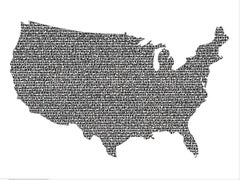
US Map
By Boccanegra
Located in New York, NY
kill time (since there were no iPads around).
This painting, titled "US Map" consists of major cities
Category
21st Century and Contemporary Contemporary Figurative Paintings
Materials
Canvas, Acrylic, Stencil
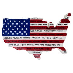
Vintage US Map American Flag Wall Art
Located in San Diego, CA
Beautiful and original wall art in the shape of the US depicting the American Flag along with all
Category
1990s American Folk Art Picture Frames
Materials
Canvas
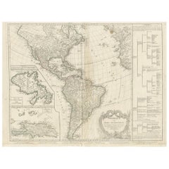
Antique Map of America by Vaugondy, 1778
Located in Langweer, NL
Antique map titled 'Amerique ou Indes Occidentales (..)'. Vaugondy's map of America, pre-dating
Category
Antique Late 18th Century Maps
Materials
Paper
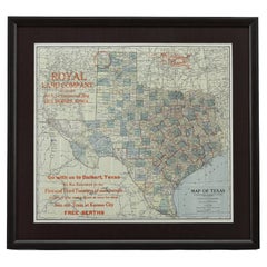
1908 "Map of Texas" by The Kenyon Company
Located in Colorado Springs, CO
map. At the bottom right, the map further invites viewers to: "Go with us to Dalhart, Texas. We run
Category
Antique Early 1900s American Maps
Materials
Paper
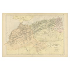
Antique Decorative Coloured Map Marocco, Algeria and Tunis, 1882
Located in Langweer, NL
and refueling.
6. **Comparative Analysis**: When viewed alongside modern maps, it allows us to see
Category
Antique 1880s Maps
Materials
Paper
Free Shipping
H 14.97 in W 22.45 in D 0 in
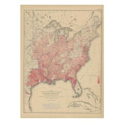
Antique Chart of the US Malarial Deaths, '1874'
Located in Langweer, NL
Antique chart titled 'Map showing the proportion of deaths from malarial diseases to deaths from
Category
Antique Late 19th Century Maps
Materials
Paper
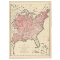
Antique Chart of the US Consumption Deaths, '1874'
Located in Langweer, NL
Antique chart titled 'Map showing the proportion of deaths from consumption to deaths from all
Category
Antique Late 19th Century Maps
Materials
Paper
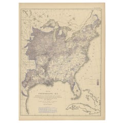
Antique Chart of the US Predominating Sex, 1874
Located in Langweer, NL
Antique chart titled 'Map of predominating sex showing the local excess of males or of females in
Category
Antique Late 19th Century Maps
Materials
Paper
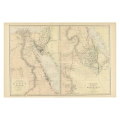
Antique Decorative Coloured Map Egypt, Nubia, Abyssinia and more, 1882
Located in Langweer, NL
This image contains two maps, with the left one being labeled "Egypt" and the right one "Nubia
Category
Antique 1880s Maps
Materials
Paper
Free Shipping
H 14.97 in W 22.45 in D 0 in
Original Antique Coloured Map of Western Africa, Published in 1882
Located in Langweer, NL
This is a map of Western Africa from the 1882 Blackie & Son atlas. The map details the West African
Category
Antique 1880s Maps
Materials
Paper
No Reserve
H 14.97 in W 22.45 in D 0 in
Antique Map of The United States of North America, 1882
Located in Langweer, NL
This is a historical map titled "The United States of North America, Central Part" from the 1882
Category
Antique 1880s Maps
Materials
Paper
Pl. 35 Antique Chart of the US Taxation, 1874
Located in Langweer, NL
Antique chart titled 'Map showing the degree of taxation per capita imposed by state, county or
Category
Antique Late 19th Century Maps
Materials
Paper
Original Hand-Colored Antique Map of America by Danckerts, circa 1680
Located in Langweer, NL
pushed far west of its true mouth. The large lake in the Southeastern US first seen on Le Moyne's map is
Category
Antique Late 17th Century Maps
Materials
Paper
H 20.48 in W 24.22 in D 0.02 in
Two Impressive and Huge Midcentury World Map Wall Globes, Austria, 1950s
Located in Vienna, AT
We proudly offer this outstanding pair of very large wall-mounted modernist globes / world maps
Category
Mid-20th Century Austrian Mid-Century Modern Maps
Materials
Aluminum, Iron
Pl. 34 Antique Chart of the US Public Indebtedness, 1874
Located in Langweer, NL
Antique chart titled 'Map showing the degree of public indebtedness per capita. Contracted by state
Category
Antique Late 19th Century Maps
Materials
Paper
Pl. 40 Antique Chart of the US Birth Rate, 1874
Located in Langweer, NL
Antique chart titled 'Map showing, in five degrees of density, the birth rate prevailing in the
Category
Antique Late 19th Century Maps
Materials
Paper
1859 "Map of the United States of America..." by J. H. Colton
By J.H. Colton
Located in Colorado Springs, CO
Civil War.
The map has an elaborate and decorative pictorial border, with scenes of the “US Capitol
Category
Antique 1850s American Maps
Materials
Paper
Pl. 29 Antique Chart of the US Illiteracy in 1870, '1874'
Located in Langweer, NL
Antique chart titled 'Map showing the illiteracy of the aggregate population. Compiled from the
Category
Antique Late 19th Century Maps
Materials
Paper
Antique Chart of the US Adult Male Illiteracy in 1870, '1874'
Located in Langweer, NL
Antique chart titled 'Map showing the illiteracy of the adult white male population. Compiled from
Category
Antique Late 19th Century Maps
Materials
Paper
Pl. 45 Antique Chart of the US Inestinal Diseases Deaths, 1874
Located in Langweer, NL
Antique chart titled 'Map showing the proportion of deaths from intestinal diseases to deaths from
Category
Antique Late 19th Century Maps
Materials
Paper
Antique Map of Anjouan or Ndzuani Island, Part of The Comoros, 1749
Located in Langweer, NL
Antique map titled ‘Carte de L’Isle D’Anjouan - Kaart van 't Eiland Anjouan’. Original antique map
Category
Antique 18th Century Maps
Materials
Paper
Antique Chart of the US Enteric, Cerebro-Spinal, Typhus Deaths, '1874'
Located in Langweer, NL
Antique chart titled 'Map showing the proportion of deaths from enteric, cerebro-spinal and typhus
Category
Antique Late 19th Century Maps
Materials
Paper
H 21.66 in W 16.15 in D 0.02 in
Antique Chart of the US Foreign Parentage Proportion in 1870, '1874'
Located in Langweer, NL
Antique chart titled 'Map showing the proportion to the aggregate population, of persons having one
Category
Antique Late 19th Century Maps
Materials
Paper
Cartographic Elegance: The Art and Science of 17th-Century Asian Maps, ca.1681
Located in Langweer, NL
antique maps. His engravings, like this map of Asia, serve as historical records that tell us about the
Category
Antique 1680s Maps
Materials
Paper
H 7.49 in W 9.22 in D 0 in
Antique Chart of the US Population in 1870, published in 1874
Located in Langweer, NL
Antique chart titled 'Map showing, in five degrees of density, the distribution, within the
Category
Antique Late 19th Century Maps
Materials
Paper
Pl. 28 Antique Chart of British American, English (..) US Population, 1874
Located in Langweer, NL
Antique chart titled 'Maps showing the distribution, within the territory of the United States
Category
Antique Late 19th Century Maps
Materials
Paper
H 21.66 in W 16.15 in D 0.02 in
Pl. 36A Antique Chart of US Farms, Agriculture and Crops '1874'
Located in Langweer, NL
.. Chart of US crops, farms and total agricultural production. Originates from 'Statistical Atlas of the
Category
Antique Late 19th Century Maps
Materials
Paper
Pl. 33 Antique Chart of the US Wealth Distribution in 1870 '1874'
Located in Langweer, NL
Antique chart titled 'Map showing the distribution of wealth. Compiled from the tables of "true
Category
Antique Late 19th Century Maps
Materials
Paper
Pl. 17A Antique Chart of the US Population 1860 by Walker, '1874'
Located in Langweer, NL
Antique chart titled 'Map showing in five degrees of density, the distribution, within the
Category
Antique Late 19th Century Maps
Materials
Paper
Pl. 17 Antique Chart of the US Population 1850 by Walker, 1874
Located in Langweer, NL
Antique chart titled 'Map showing in five degrees of density, the distribution, within the
Category
Antique Late 19th Century Maps
Materials
Paper
Old Map of the Great Lakes and Upper Mississippi Valley, Northern America, c1780
Located in Langweer, NL
Antique map titled 'Partie Occidentale du Canada'.
A fine example of Rigobert Bonne and
Category
Antique 1780s Maps
Materials
Paper
H 10.32 in W 14.85 in D 0 in
Pl. 25 Antique Chart of the US Foreign Population in 1870, '1874'
Located in Langweer, NL
Antique chart titled 'Map showing five degrees of density the distribution of the foreign
Category
Antique Late 19th Century Maps
Materials
Paper
Pl. 23 Antique Chart of the US Foreign Parentage in 1870, '1874'
Located in Langweer, NL
Antique chart titled 'Map showing, in five degrees of density, the distribution, within the
Category
Antique Late 19th Century Maps
Materials
Paper
Pl. 36 Antique Chart of US Crops, Wheat, Rice, Tobacco, Hops, Oats '1874'
Located in Langweer, NL
Antique chart titled 'Maps showing the range, and within the range, the degree of cultivation of
Category
Antique Late 19th Century Maps
Materials
Paper
H 21.66 in W 16.15 in D 0.02 in
Pl. 26 Antique Chart of the US Foreign Population Proportion in 1870, '1874'
Located in Langweer, NL
Antique chart titled 'Map showing the proportion of the foreign to the aggregate population
Category
Antique Late 19th Century Maps
Materials
Paper
H 21.66 in W 16.15 in D 0.02 in
Pl. 22 Antique Chart of the US Colored Population Proportion in 1870, '1874'
Located in Langweer, NL
Antique chart titled 'Map showing the proportion of the colored to the aggregate population
Category
Antique Late 19th Century Maps
Materials
Paper
H 21.66 in W 16.15 in D 0.02 in
Pl. 16A Antique Chart of the US Population 1830-1840 by Walker, 1874
Located in Langweer, NL
Antique chart titled 'Map showing, in five degrees of density, the distribution, within the
Category
Antique Late 19th Century Maps
Materials
Paper
Pl. 16 Antique Chart of the US Population 1790-1820 by Walker, '1874'
Located in Langweer, NL
Antique chart titled 'The progress of the nation, 1790-1820. Maps showing in five degrees of
Category
Antique Late 19th Century Maps
Materials
Paper
H 21.66 in W 16.15 in D 0.02 in
Pl. 21 Antique Chart of the US Colored Population Density in 1870, '1874'
Located in Langweer, NL
Antique chart titled 'Map showing in five degrees of density the distribution of the colored
Category
Antique Late 19th Century Maps
Materials
Paper
H 21.66 in W 16.15 in D 0.02 in
Pl. 27 Antique Chart of the US Irish and German Population in 1870, '1874'
Located in Langweer, NL
Antique chart titled 'Maps showing the distribution, within the territory of the United States
Category
Antique Late 19th Century Maps
Materials
Paper
H 21.66 in W 16.15 in D 0.02 in
Renaissance Mapping of Sumatra: Featuring Singapore in Münster’s Woodcut, c.1590
Located in Langweer, NL
Description: Antique map titled 'Sumatra ein grosse Insel / so von den alten Geographen Taprobana
Category
Antique 16th Century Maps
Materials
Paper
Free Shipping
H 13.39 in W 16.34 in D 0 in
Old Print of Baltiysk or Pillau, a Seaport Town Near Kaliningrad, Russia, 1652
Located in Langweer, NL
Vistula Lagoon from Gdansk Bay. This print originates from 'Topographia Electorat[us] Brandenburgici et
Category
Antique 1650s Maps
Materials
Paper
H 11.23 in W 14.18 in D 0 in
Jacques Liozu's 1951 illustrated map of the region of Pays d'Ouest
By Jacques Liozu
Located in PARIS, FR
transform a simple map into a dazzling work of art. This map continues to amaze and inspire, reminding us of
Category
1950s Prints and Multiples
Materials
Paper, Lithograph
"48 Flowers, " Colored Pencil on Paper Landscape with Trees signed by Tom Shelton
By Tom Shelton
Located in Milwaukee, WI
, and located where its state is geographically, where a US map superimposed.”
20" x 32 3/8" image
26
Category
1980s Contemporary Drawings and Watercolor Paintings
Materials
Color Pencil
Original Vintage WWII Poster De Dollarpoliep The US Dollar Polyp Octopus War Map
Located in London, GB
Dollarpoliep / The Dollar Polyp or The Dollar Octopus - featuring an image of a US dollar sign with octopus
Category
Vintage 1940s Dutch Posters
Materials
Paper
H 17.72 in W 23.23 in D 0.04 in
Map
By Alex Corno
Located in Dallas, TX
in the 72-page exhibition catalogue published on the occasion of the inaugural US exhibition "Alex
Category
21st Century and Contemporary Contemporary Abstract Sculptures
Materials
Iron
Becoming Us
By Isabel Turban
Located in New York, NY
. Turbán’s collection of maps, gathered from various travels, serve as the most significant material and
Category
2010s Abstract Abstract Paintings
Materials
Mixed Media
Travelers Mind Map
Located in New Orleans, LA
him on his other travels from Europe to US. Enchanted by the old and mestizo city, he returned to
Category
2010s Contemporary Paintings
Materials
Fabric, Oil, Acrylic
Mapped, Claimed, Evaluated
By Jessica Houston
Located in Montreal, Quebec
, this time blue, dominates the landscape in Mapped, Claimed, and Evaluated.
The north is just as much
Category
2010s Contemporary Abstract Prints
Materials
Color
Map, Exploring The World
Located in New York City, NY
300 stunning maps from all periods and from all around the world, exploring and revealing what maps
Category
21st Century and Contemporary Hong Kong Books
Materials
Paper
Great Britain, Money Map Art, Map Art, Finance Artwork, Great British Artwork
By Justine Smith
Located in Deddington, GB
up the map allows for a politically charged worked.
Jusitne Smith is available online and in our
Category
2010s Contemporary Landscape Prints
Materials
Paper, Archival Ink, Inkjet
H 23.43 in W 16.15 in D 0.04 in
Original 'Map of the United States as Californians See It' vintage map poster
Located in Spokane, WA
Original vintage poster: "Map of the United States as Californians See It". 1947, artist: Oren
Category
1940s American Modern Landscape Prints
Materials
Offset
H 16.5 in W 20.5 in D 0.04 in
Large French Paris Metro Map 1960s
Located in North Hollywood, CA
Large French Paris Metro Map 1960s.
A large Vintage French framed map of the Parisian Metro from
Category
Mid-20th Century French Industrial Prints
Materials
Wood, Paper
Christophe Stouvenel "US Army" 2019
By Christophe Stouvenel
Located in Saint Ouen, FR
US ARMY
2020
Stencil on 1881 military geography atlas maps
(military map of the United States
Category
2010s Figurative Drawings and Watercolors
Materials
Glue, Ink, Mixed Media
Original WWII Illustrated Map Poster - Time And Tide Map Of The Atlantic Charter
By "Leslie MacDonald ""Max"" Gill"
Located in London, GB
Original vintage illustrated map poster in Spanish by the notable graphic designer, cartographer
Category
Vintage 1940s British Posters
Materials
Paper
H 44.89 in W 34.85 in D 0.04 in
Map of Northumberland by Joan Blaeu
By Joan (Johannes) Blaeu
Located in London, GB
To see our other original maps, scroll down to "More from this Seller" and below it click on "See
Category
1660s Landscape Prints
Materials
Engraving
Late 20th Century Educational Geographic Map - Australasia
Located in Hook, Hampshire
Late 20th Century Educational Geographic Map – Australasia
Late 20th Century Educational Geographic
Category
Late 20th Century Czech Posters
Materials
Cotton
Late 20th Century Educational Geographic Map - Hemispheres
Located in Hook, Hampshire
Late 20th Century Educational Geographic Map – Hemispheres
Late 20th Century Educational Geographic
Category
Late 20th Century Czech Posters
Materials
Cotton
Mapped Location of Pronounced Situational Density
By Patricia Smith
Located in New York, NY
finish. This painting is created as psychological map that defines alliances.
Greed-Based, Guilt-Based
Category
21st Century and Contemporary Contemporary Abstract Drawings and Waterco...
Materials
Archival Ink, Archival Paper, Watercolor
Jacques Liozu's 1951 illustrated map of Asia
By Jacques Liozu
Located in PARIS, FR
public's imagination. This map continues to fascinate and inspire, reminding us of the importance of art in
Category
1950s Prints and Multiples
Materials
Paper, Lithograph
- 1
- ...
Get Updated with New Arrivals
Save "Us Maps", and we’ll notify you when there are new listings in this category.
Us Maps For Sale on 1stDibs
Find a variety of us maps available on 1stDibs. Frequently made of paper, all us maps available were constructed with great care. Us maps have been made for many years, and versions that date back to the 19th Century alongside those produced as recently as the 21st Century. There have been many well-made us maps over the years, but those made by J.H. Colton are often thought to be among the most beautiful.
How Much are Us Maps?
The average selling price for at 1stDibs is $590, while they’re typically $225 on the low end and $4,500 highest priced.
