Vienna Map
to
15
93
42
48
41
31
25
24
23
16
10
10
7
7
6
6
6
6
5
4
4
3
3
3
3
3
2
2
2
2
2
2
2
1
1
1
1
1
1
1
1
1
1
1
1
13
9
8
4
3
Sort By
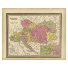
Colourful Old Map of the Austrian Empire, with an Inset Map of Vienna, 1846
Located in Langweer, NL
Vienna. This map originates from 'A New Universal Atlas Containing Maps of the various Empires, Kingdoms
Category
Antique 1840s Maps
Materials
Paper
H 13.78 in W 17.13 in D 0 in
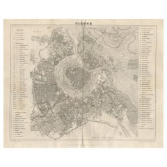
Antique Map of the City of Vienna by Balbi '1847'
Located in Langweer, NL
Antique map titled 'Vienne'. Original antique map of the city of Vienna, Austria. This map
Category
Antique Mid-19th Century Maps
Materials
Paper
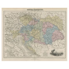
Old Map of the Austrian Empire with Decorative Vignette of Vienna, 1880
Located in Langweer, NL
vignette with a view of Vienna. This map originates from 'Géographie Universelle Atlas-Migeon' by J. Migeon
Category
Antique 1880s Maps
Materials
Paper
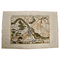
Vienna, Austria: A Large 17th Century Hand-Colored Map by Sanson and Jaillot
By Nicolas Sanson
Located in Alamo, CA
This large 17th century hand-colored map of Vienna, Austria and the surrounding countryside and
Category
Antique 1690s French Maps
Materials
Paper
H 20 in W 24.88 in D 0.13 in
Hand Colored 18th Century Homann Map of Austria Including Vienna and the Danube
By Johann Baptist Homann
Located in Alamo, CA
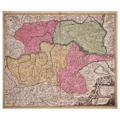
"Archiducatus Austriae inferioris" is a hand colored map of Austria created by Johann Baptist
Category
Antique Early 18th Century German Maps
Materials
Paper
H 20.25 in W 23.63 in D 0.07 in
Antique Map of Austria, Centered Around the Danube from Passau to Vienna, C.1690
Located in Langweer, NL
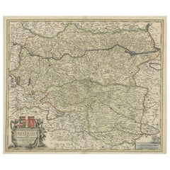
Antique map of Austria titled 'Circuli Austriaci pars septentrionalis in quia archiducatus Austriae
Category
Antique 1690s Maps
Materials
Paper
H 16.93 in W 24.02 in D 0 in
Old Decorative Map of Austria, Centered on the Danube River and Vienna, Ca.1720
Located in Langweer, NL
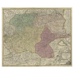
Antique map titled 'Archiducatus Austriae inferioris (..).' Decorative map of Austria, centered on
Category
Antique 1720s Maps
Materials
Paper
H 20.87 in W 24.02 in D 0 in
Antique Map Made After a Roman Papyrus Travel Map, Known as Peutinger Map, 1773
Located in Langweer, NL
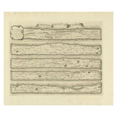
Konrad Peutinger, the map is now conserved at the Austrian National Library in Vienna.
Artists and
Category
Antique 18th Century Maps
Materials
Paper
H 15.56 in W 18.51 in D 0 in
Antique Map of New Zealand, 1895
Located in Langweer, NL
Antique map titled 'Neu-Seeland.' Map of New Zealand. With inset maps of the large cities. This
Category
Antique 19th Century Maps
Materials
Paper
German Antique Map of Oceania, 1895
Located in Langweer, NL
Antique map titled 'Oceanie.' Map of Oceania. This attractive original old antique print / plate
Category
Antique 19th Century Maps
Materials
Paper
Antique Map of the Wadden Islands, 1792
Located in Langweer, NL
Netherlands). This map originates from 'Schauplatz der fünf Theile der Welt' published in Vienna.
Artists
Category
Antique 18th Century Maps
Materials
Paper
Antique Map of Westergo in Friesland, 1791
Located in Langweer, NL
Reilly (1766-1820) was a Vienna based art dealer. He is also known as the author of two atlases. The maps
Category
Antique 18th Century Maps
Materials
Paper
German Antique Map of Australia, Meyers, 1885
Located in Langweer, NL
Australien.' (Map of Australia. With inset maps of the large cities and Tasmania.) This attractive
Category
Antique 19th Century Maps
Materials
Paper
Antique Map of Austria- Hungary by Johnston '1909'
Located in Langweer, NL
Vienna, Dalmatia and Herzegovina. This map originates from the ‘Royal Atlas of Modern Geography
Category
Early 20th Century Maps
Materials
Paper
Antique Map of Friesland by Von Reilly, 1791
Located in Langweer, NL
(1766-1820) was a Vienna based art dealer. He is also known as the author of two atlases. The maps were
Category
Antique 18th Century Maps
Materials
Paper
Antique Map of Oostergo by Von Reilly, 1791
Located in Langweer, NL
(1766-1820) was a Vienna based art dealer. He is also known as the author of two atlases. The maps were
Category
Antique 18th Century Maps
Materials
Paper
Antique Map of Oostergo by Von Reilly, 1791
Located in Langweer, NL
-1820) was a Vienna based art dealer. He is also known as the author of two atlases. The maps were
Category
Antique 18th Century Maps
Materials
Paper
17th Century Nicolas Visscher Map of Southeastern Europe
Located in Hamilton, Ontario
A beautiful, highly detailed map of southeastern Europe by Nicolas Visscher. Includes regions of
Category
Antique 17th Century Dutch Maps
Materials
Paper
Antique Map of Czech Republic by I. Tirion, 1747
Located in Langweer, NL
Antique map titled 'Nieuwe Kaart van t Koninkryk Bohemen t Hertogdom Silesien markgraafschap
Category
Antique Mid-18th Century Maps
Materials
Paper
Antique Map of Southern Zeeland by Von Reilly, 1790
Located in Langweer, NL
"Antique map titled 'Seelands südlicher Theil oder die Inseln Süd Beverland, Tholen, Wolfersdyk und
Category
Antique 18th Century Maps
Materials
Paper
German Antique Map of the Indian Oceaan, Meyers, 1895
Located in Langweer, NL
This attractive original old antique print / plate / map originates from 1885-1907 editions of a
Category
Antique 19th Century Maps
Materials
Paper
Antique Map of China and Japan by Meyer, 1895
Located in Langweer, NL
Antique map titled 'China und Japan'. Map of China, Mongolia, Taiwan and Japan. With an inset map
Category
Antique 19th Century Maps
Materials
Paper
Antique Map of the Austrian Empire by Migeon, 1880
Located in Langweer, NL
with a view of Vienna. This map originates from 'Géographie Universelle Atlas-Migeon' by J. Migeon
Category
Antique 19th Century Maps
Materials
Paper
Antique Map of Part of Overijssel by Von Reilly, 1792
Located in Langweer, NL
(Overijssel). This map originates from 'Schauplatz der fünf Theile der Welt' published in Vienna. Artists and
Category
Antique 18th Century Maps
Materials
Paper
Antique Map of Part of Groningen by Von Reilly, 1792
Located in Langweer, NL
Groningen. This map originates from 'Schauplatz der fünf Theile der Welt' published in Vienna, 1792. Artists
Category
Antique 18th Century Maps
Materials
Paper
German Antique Map of China And Japan by Meyer, 1902
Located in Langweer, NL
Antique map titled 'China und Japan.' (Map of China and Japan). This attractive original old
Category
20th Century Maps
Materials
Paper
Antique Map of the Westerkwartier Region, a Region in Groningen, 1791
Located in Langweer, NL
Antique map titled 'Das Wester Quartier'. Original antique map of Westerkwartier, a region in the
Category
Antique 18th Century Maps
Materials
Paper
Antique Map of Overijssel and Drenthe by Von Reilly, c.1795
Located in Langweer, NL
Reilly (1766-1820) was a Vienna based art dealer. He is also known as the author of two atlases. The maps
Category
Antique 18th Century Maps
Materials
Paper
Antique Map of the Region of Gaasterland, Friesland, The Netherlands, 1791
Located in Langweer, NL
Antique map titled 'Der Provinz Westergo zwey südliche Grietenyen mit dem Gaasterland und der Stadt
Category
Antique 18th Century Maps
Materials
Paper
H 11.42 in W 12.41 in D 0 in
Antique Map of the Rivers and Mountains in Asia, c.1895
By Meyer
Located in Langweer, NL
systems. This map originates from 'Meyers grosses Konversations-Lexikon.', published in Leipzig and Vienna
Category
Antique 19th Century Maps
Materials
Paper
Antique Map of Overijssel and Drenthe by Von Reilly, c.1795
Located in Langweer, NL
) was a Vienna based art dealer. He is also known as the author of two atlases. The maps were engraved
Category
Antique 18th Century Maps
Materials
Paper
Antique German Map of India and Sri Lanka or Ceylon, 1902
By Meyer
Located in Langweer, NL
Antique map titled 'Ostindien.' (Map of India with an inset map of East-Bengal.) This attractive
Category
20th Century Maps
Materials
Paper
Two Impressive and Huge Midcentury World Map Wall Globes, Austria, 1950s
Located in Vienna, AT
We proudly offer this outstanding pair of very large wall-mounted modernist globes / world maps
Category
Mid-20th Century Austrian Mid-Century Modern Maps
Materials
Aluminum, Iron
Original Copper Engraving of a Map of Syria and Lebanon, 1698
Located in Langweer, NL
Antique map titled 'Syriae, sive Soriae, Nova et Accurata Descriptio.'
Map of Syria and Lebanon
Category
Antique 1690s Maps
Materials
Paper
Free Shipping
H 12.41 in W 14.45 in D 0 in
Old Map Showing Info Related to the Ottoman Wars including Conflict Dates, c1690
Located in Langweer, NL
River. It extends from Vienna east to beyond Budapest and from Silesia south to Slavonia. The map
Category
Antique 1690s Maps
Materials
Paper
H 24.02 in W 17.8 in D 0 in
Antique Map of the Region of Bolsward and Sneek by Von Reilly, 1791
Located in Langweer, NL
a Vienna based art dealer. He is also known as the author of two atlases. The maps were engraved by
Category
Antique 18th Century Maps
Materials
Paper
Antique Map of the Region of Leeuwarden and Dokkum in The Netherlands, 1791
Located in Langweer, NL
a Vienna based art dealer. He is also known as the author of two atlases. The maps were engraved by
Category
Antique 18th Century Maps
Materials
Paper
H 11.42 in W 15.56 in D 0 in
Antique Map of the Region of Franeker and Harlingen by Von Reilly, 1791
Located in Langweer, NL
) was a Vienna based art dealer. He is also known as the author of two atlases. The maps were engraved
Category
Antique 18th Century Maps
Materials
Paper
Antique Map of the Region of Bolsward and Sneek by Von Reilly, 1791
Located in Langweer, NL
) was a Vienna based art dealer. He is also known as the author of two atlases. The maps were engraved
Category
Antique 18th Century Maps
Materials
Paper
Antique Detailed Map of Jerusalem in Israël with Extensive Key and Scale, 1698
Located in Langweer, NL
Antique map titled 'Jerusalem.'
Plan of the ancient city of Jerusalem. With extensive key and
Category
Antique 17th Century Maps
Materials
Paper
H 15.16 in W 12.01 in D 0 in
Panoramic Antique View of Bandar-Abbas 'Formerly Gamron, Persia' in Iran, 1714
Located in Langweer, NL
. Best known as a landscape artist, Le Bruyn travelled widely from a young age to Vienna, on to Rome then
Category
Antique 1710s Maps
Materials
Paper
H 6.7 in W 15.16 in D 0 in
Old Engraving of the Trarbach Battle in Rhineland-Palatinate, Germany, c.1710
Located in Langweer, NL
the turning points of the War of the Spanish Succession (1701-14), saving Vienna from the Franco
Category
Antique 1710s Maps
Materials
Paper
H 7.88 in W 9.45 in D 0 in
Vienna, Antique Map from "Civitates Orbis Terrarum" - Etching - Old Master
By Franz Hogenberg
Located in Roma, IT
Braun G., Hogenberg F., "Vienna", from the collection "Civitates Orbis Terrarum", Cologne, T
Category
Early 17th Century Old Masters Figurative Prints
Materials
Etching, Aquatint
Franz HogenbergVienna, Antique Map from "Civitates Orbis Terrarum" - Etching - Old Master, 1572-1617
H 7.88 in W 20.87 in D 0.04 in
Hand Colored 18th Century Homann Map of Austria Including Vienna & the Danube
By Johann Baptist Homann
Located in Alamo, CA
"Archiducatus Austriae inferioris" is a hand colored map of Austria created by Johann Baptist
Category
Early 18th Century Old Masters Landscape Prints
Materials
Engraving
Vienna, Austria: A Large 17th Century Hand-colored Map by Sanson and Jaillot
By Nicholas Sanson d'Abbeville
Located in Alamo, CA
This large 17th century hand-colored map of Vienna, Austria and the surrounding countryside and
Category
1690s Landscape Prints
Materials
Engraving
Matthew Picton "Vienna" Pinned-Film Artwork
By Matthew Picton
Located in Chicago, IL
Artwork depicting city map of greater Vienna. Picton considers his work sculptural, "separating out
Category
Early 2000s American Contemporary Art
Materials
Enamel
Bonn, Map from "Civitates Orbis Terrarum" - by F. Hogenberg - 1575
By Franz Hogenberg
Located in Roma, IT
Braun G., Hogenberg F., Vienna or Bonn, from the collection Civitates Orbis Terrarum, Cologne, T
Category
16th Century Figurative Prints
Materials
Etching, Aquatint
H 3.94 in W 20.99 in D 0.04 in
Original Antique Poster Norvege Norway Midnight Sun Stavkirke Church Travel Map
Located in London, GB
and the building reflected in the calm water next to a route map marking travel over the Atlantic
Category
Antique 1610s Norwegian Posters
Materials
Paper
H 38.98 in W 25.6 in D 0.04 in
Maps Red 17-5 - Geometric Original Colorful Oil Painting with Texture
By Petra Rös-Nickel
Located in Los Angeles, CA
, Germany
Wiener Internationale Kunstmesse, Vienna, Austria
2011 Galerie Jaeschke, Braunschweig, Germany
Category
21st Century and Contemporary Abstract Abstract Paintings
Materials
Canvas, Mixed Media, Oil
Hungary & Eastern Europe: A Large 17th C. Hand-colored Map by Sanson & Jaillot
By Nicholas Sanson d'Abbeville
Located in Alamo, CA
. The map includes the Danube River, present day Budapest, Vienna, Prague, Krakow, and the Dalmatian
Category
1690s Landscape Prints
Materials
Engraving
Very Unique Austrian Silver & Enamel Cigarette Case by Kurzer & Wolf, Dated 1916
By Kurzer & Wolf
Located in Ottawa, Ontario
decorated with a finely detailed road map in coloured enamels, against a white enamelled surface
Category
Early 20th Century Austrian Vienna Secession Tobacco Accessories
Materials
Silver, Enamel
H 0.5 in W 3.5 in D 3.5 in
Carl Auböck Model #3642 Brass and Leather Table
By Werkstätte Carl Auböck
Located in Glendale, CA
. Inspired by the folding map tables carried by French officers under Napolean, the table folds for easy
Category
21st Century and Contemporary Austrian Mid-Century Modern Side Tables
Materials
Brass
Carl Auböck Model #3642 Brass and Oak Table
By Werkstätte Carl Auböck
Located in Glendale, CA
sculptural table is executed in beautifully grained oak and polished brass. Inspired by the folding map
Category
21st Century and Contemporary Austrian Mid-Century Modern Side Tables
Materials
Brass
Occasional table model U 601 designed by Josef Frank for Svenskt Tenn, Sweden
By Josef Frank, Svenskt Tenn
Located in Stockholm, SE
.
Mahogany, glass and brass.
The map is a replica of the world map drawn by the Venetian monk and
Category
Mid-20th Century Swedish Mid-Century Modern Coffee and Cocktail Tables
Materials
Brass
1955 "Quaternary: Ice-Age Landscape" Woolly Mammoth Vintage Wall Hanging
Located in Colorado Springs, CO
of the Life on Earth” suite series was first conceived as a way to illustrate University of Vienna
Category
Vintage 1950s Austrian Mid-Century Modern Prints
Materials
Metal
Antique Plan of the City of Jerusalem
Located in Langweer, NL
Antique map titled 'Jerusalem.' Plan of the ancient city of Jerusalem. With extensive key and scale
Category
Antique Late 17th Century Prints
Materials
Paper
Original Antique Winter Sport & Skiing Poster Murtal Bahn Railway Murau Austria
Located in London, GB
people with sledges above a village between the description and map below. Printed by Christoph Reisser’s
Category
Vintage 1910s Austrian Posters
Materials
Paper
H 40.56 in W 26.58 in D 0.04 in
The Kiss II. Self Nude Portrait Color Photograph.
By Maria José Arjona
Located in Miami Beach, FL
exhibition in New York at the Art Space Location One, in 2012. The Kiss maps a system uniting two bodies. It
Category
2010s Contemporary Portrait Photography
Materials
Archival Pigment, Color
H 39.38 in W 55.12 in D 0.12 in
The Kiss I. Self Nude Portrait Color Photograph.
By Maria José Arjona
Located in Miami Beach, FL
exhibition in New York at the Art Space Location One, in 2012. The Kiss maps a system uniting two bodies. It
Category
2010s Contemporary Portrait Photography
Materials
Archival Pigment, Color
H 39.38 in W 55.12 in D 0.12 in
The Kiss Group of 8. Self Nude Portrait Color Photograph.
By Maria José Arjona
Located in Miami Beach, FL
maps a system uniting two bodies. It is a gesture magnified by the use of sound emerging from the
Category
2010s Contemporary Portrait Photography
Materials
Archival Pigment, Color
H 42.52 in W 94.49 in D 0.12 in
- 1
Get Updated with New Arrivals
Save "Vienna Map", and we’ll notify you when there are new listings in this category.
Vienna Map For Sale on 1stDibs
Choose from an assortment of styles, material and more with respect to the vienna map you’re looking for at 1stDibs. A vienna map — often made from paper, glass and wood — can elevate any home. There are many kinds of the vienna map you’re looking for, from those produced as long ago as the 18th Century to those made as recently as the 19th Century. Johann Baptist Homann and Nicolas Sanson each produced at least one beautiful vienna map that is worth considering.
How Much is a Vienna Map?
Prices for a vienna map can differ depending upon size, time period and other attributes — at 1stDibs, they begin at $162 and can go as high as $3,455, while the average can fetch as much as $675.
More Ways To Browse
1840 Empire Antique Furniture
Vintage Wooden Step
Antique Doors From India
Station Clock Vintage
Anniversary Clock
Brass Hemispheres
Angelo Di Sant
Vintage Drum Stands
Vintage Drum Stand
Cast Bronze Globe
Pyramid Door
Antique Cast Iron Box
Pair Of Horizon
H Hoffmann
Radius Two
Metro Retro Furniture
Wrap Drape Top
Horse Bowl
