Items Similar to Antique Chart of Dundee, Aberdeen and Montrose in Scotland, C.1774

Want more images or videos?
Request additional images or videos from the seller
1 of 6
Antique Chart of Dundee, Aberdeen and Montrose in Scotland, C.1774
About the Item
Antique map titled 'To the Honble the Magistrates of the Citty of Aberdeene'. Sea chart of Tay Estuary depictinging Dundee, with two further inset charts of Aberdeen and Montrose, with an attractive decorative title cartouche, numerous navigational rhumb lines and soundings.
Artists and Engravers: Captain Greenvile (or Greenville) Collins. Collins was an officer of the Royal Navy and prominent hydrographer, who was commissioned by King Charles II in 1676 and appointed by Samuel Pepys (then Secretary to the Admiralty), to chart the coasts of Great Britain.
Condition: Fair, general age-related toning. Few marginal tears and a few restorations (mainly on folding line). Please study image carefully.
Date: c.1774
Overall size: 59 x 50 cm
Image size: 56 x 44 cm
We also offer thousands of antique prints covering fields of interest as diverse as architecture, natural history, religion, ethnology and many more. Antique prints have long been appreciated for both their aesthetic and investment value. They were the product of engraved, etched or lithographed plates. These plates were handmade out of wood or metal, which required an incredible level of skill, patience and craftsmanship. Whether you have a house with Victorian furniture or more contemporary decor an old engraving can enhance your living space.
- Creator:Captain Greenvile Collins (Artist)
- Dimensions:Height: 19.69 in (50 cm)Width: 23.23 in (59 cm)Depth: 0 in (0.01 mm)
- Materials and Techniques:
- Period:
- Date of Manufacture:c1774
- Condition:
- Seller Location:Langweer, NL
- Reference Number:
About the Seller
5.0
Platinum Seller
These expertly vetted sellers are 1stDibs' most experienced sellers and are rated highest by our customers.
Established in 2009
1stDibs seller since 2017
1,909 sales on 1stDibs
Typical response time: <1 hour
- ShippingRetrieving quote...Ships From: Langweer, Netherlands
- Return PolicyA return for this item may be initiated within 14 days of delivery.
More From This SellerView All
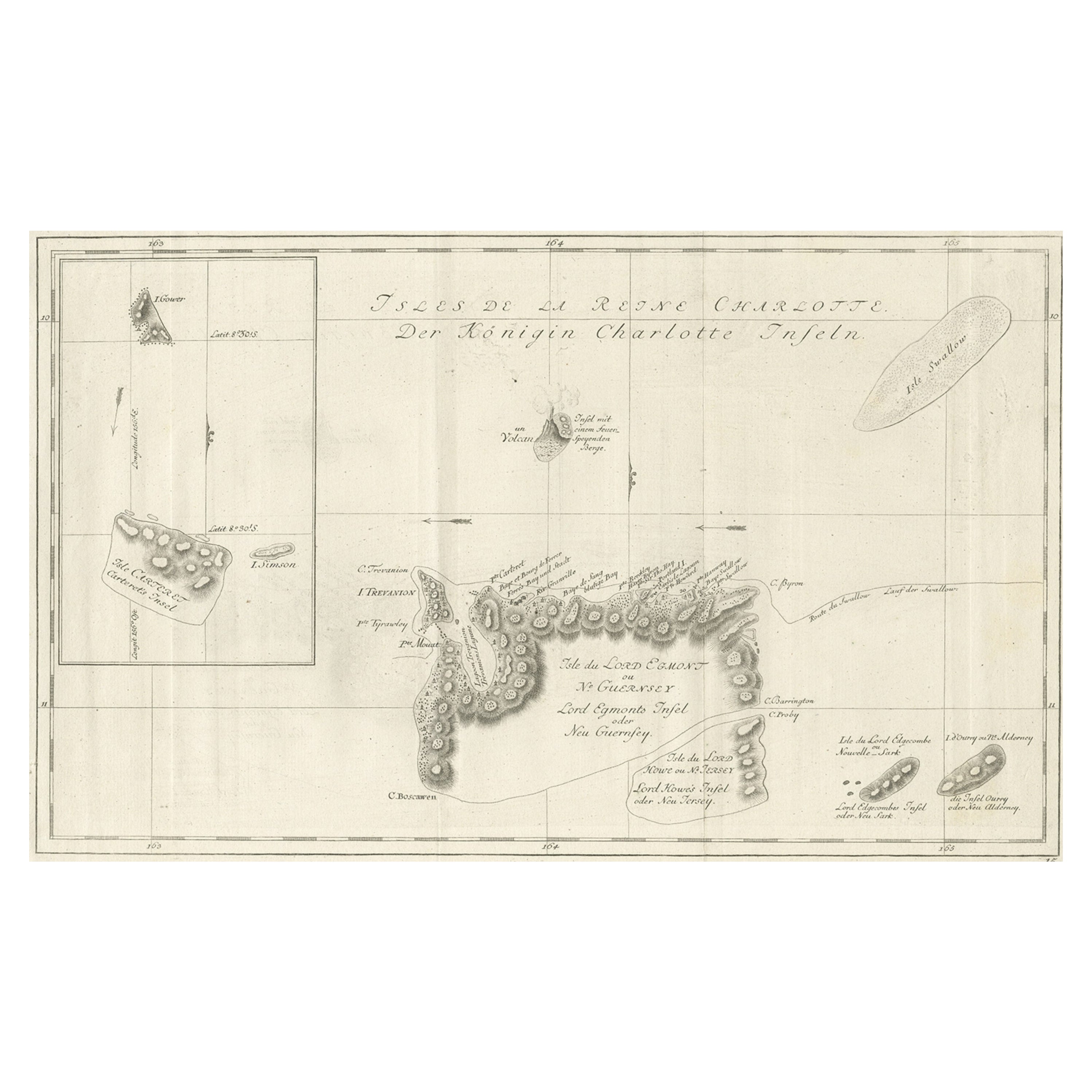
- Original Antique Chart of the Santa Cruz Islands, 1774Located in Langweer, NLAntique print titled 'Isles de la Reine Charlotte (..)'. A detailed chart of the Santa Cruz islands, to the north of the New Hebrides, with Carte...Category
Antique 1770s Maps
MaterialsPaper
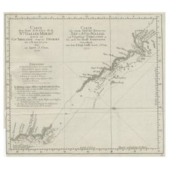
- Antique Sea Chart of the Shetland Islands, Scotland, ca.1745Located in Langweer, NLAntique map of Scotland titled 'Nieuwe Paskaard van Hitland met de daar omleggende eylanden na de nieuwe aftekening gemaakt by den Lofwaarden en onvermoeyden Hit en Zeeman Ian Bruyst...Category
Antique 1740s Maps
MaterialsPaper
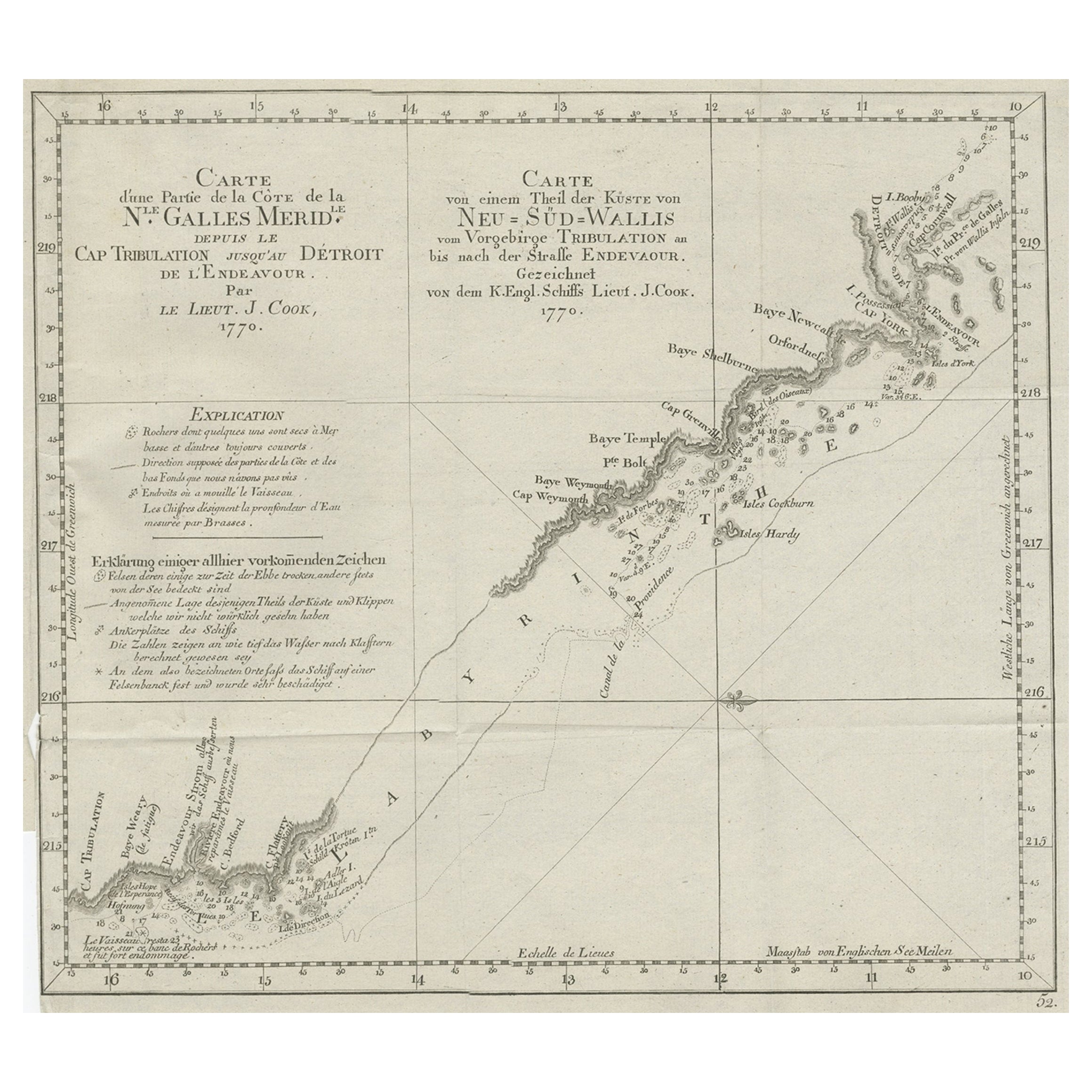
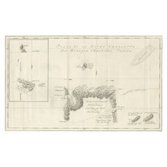
- Old Chart of the North-Eastern Coast of Australia Discovered by Cook, 1774Located in Langweer, NLAntique print titled Carte d'une Partie de la Cote de la N.le Galles Merid etc. An interesting chart of the north-eastern coast of Australia discovered by Cook in 1770, showing th...Category
Antique 1770s Maps
MaterialsPaper
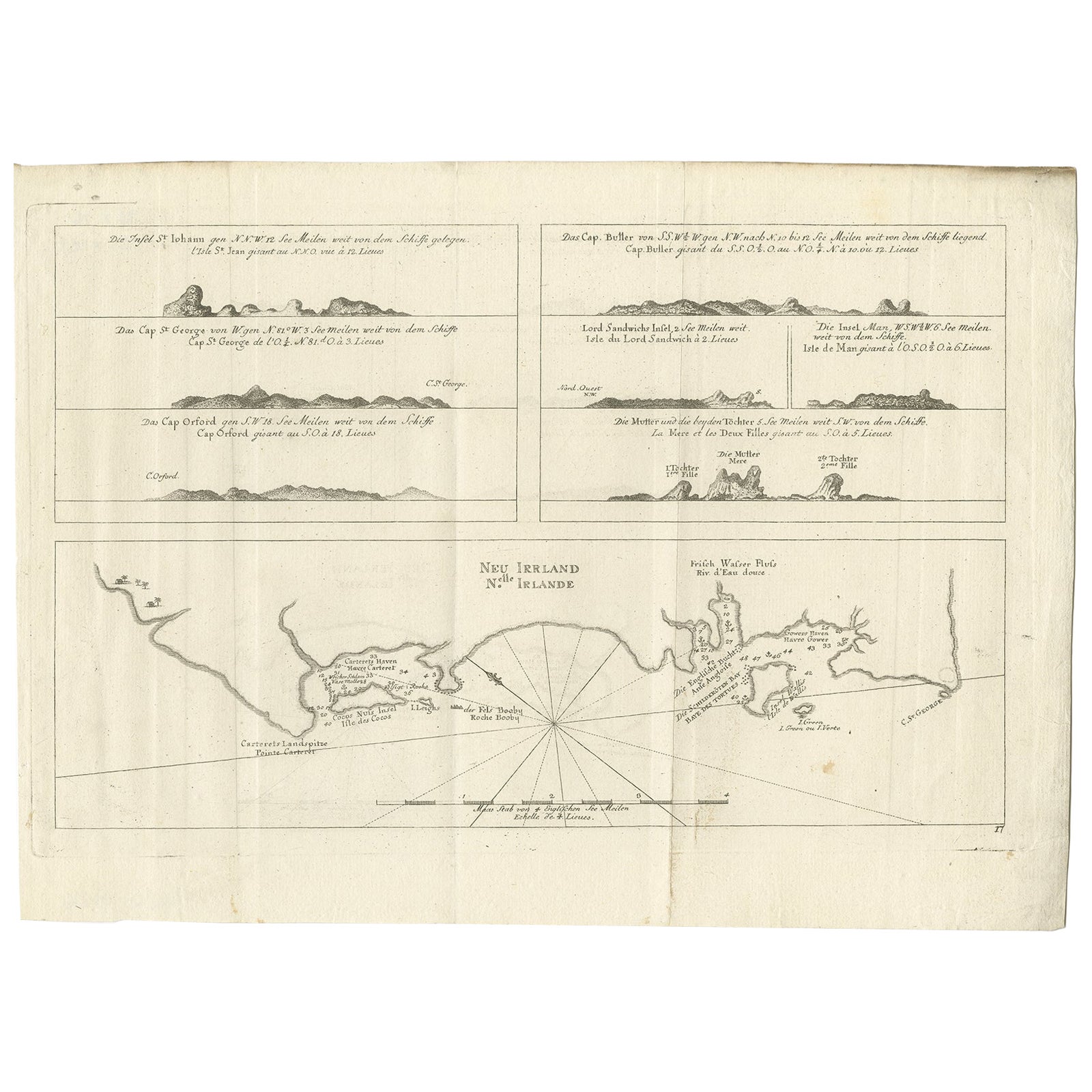
- Antique Map of New Ireland, 1774Located in Langweer, NLAntique print titled 'Neu Irrland (..)'. Antique map of New Ireland with 7 coastal profiles, Papua New Guinea. Originates from 'Geschichte der See-Reisen u...Category
Antique 18th Century Maps
MaterialsPaper
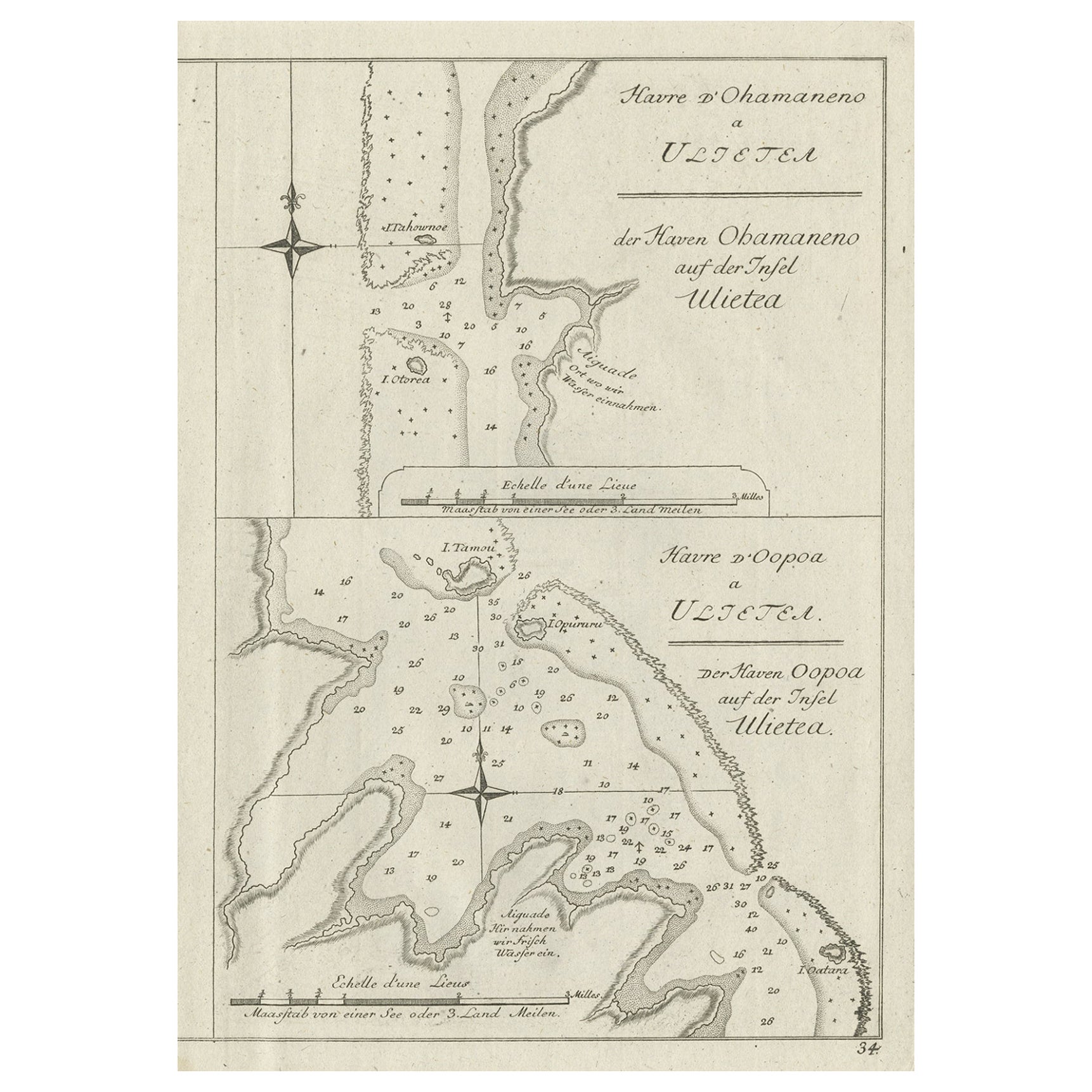
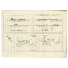
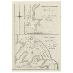
- Antique Print of Various Island in French Polynesia, circa 1774Located in Langweer, NLTwo antique maps on one sheet titled 'Havre d'Ohamaneno a Ulietea' and Havre d'Oopoa a Ulietea'. Also with German subtitles. The upper image depicts Ohamaneno (Vaiaau) Harbour Raiatea (Ulietea) - Leeward Islands...Category
Antique 18th Century Prints
MaterialsPaper
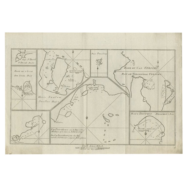
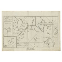
- Antique Chart of CAP Providence and Other Charts by Hawkesworth, 1774Located in Langweer, NLAntique print titled 'Baye du Cap Upright (..)'. Eight charts on one sheet of Cap Providence, St. David's Cove, the Bay of the Island, Swallow's Haven, Puzzling Bay, Baye du Cape Upr...Category
Antique 18th Century Prints
MaterialsPaper

You May Also Like
- Antique Anatomical Wall Chart Depicting the Human SkeletonLocated in Berghuelen, DEA rare 19th century anatomical wall chart depicting the human skeleton. On the sides On the sides are detailed description in German language. The wall...Category
Early 20th Century German Victorian Prints
MaterialsPaper
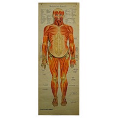
- Antique Foldable Anatomical Wall Chart Depicting Human MusculatureLocated in Berghuelen, DEAntique Foldable Anatomical Wall Chart Depicting Human Musculature The rare 19th century anatomical wall chart depicts the human musculature and inter...Category
Early 20th Century German Victorian Prints
MaterialsWood, Paper
- “A Football Match, Scotland v. England” Antique Engraving, Proof Edition of 100By Overend and SmytheLocated in Colorado Springs, COThis is the 1889 William H. Overend (1851-1898) and Lionel Smythe (1839-1918) first edition, photogravure of the Calcutta Cup – a Rugby match between Scotland and England, that has been played over 100 times, the first match...Category
Antique 19th Century English Prints
MaterialsPaper
- Anatomical Wall Chart Depicting the Human Lymphatic and Blood VesselsLocated in Berghuelen, DEA rare 19-carat anatomical wall chart depicting the human lymphatic and blood vessels. On the sides with detailed description in German language. Print...Category
Early 20th Century German Victorian Prints
MaterialsPaper
- Genito-Urinary Anatomical Chart Fritz FrohseBy Fritz Frohse, Nystrom / Frohse ArtLocated in Philadelphia, PAGenito-Urinary Anatomical Chart by Fritz Frohse. Dated 1922. Paper mounted on canvas. Shows wear but still presents very well!Category
Vintage 1920s German American Classical Prints
MaterialsCanvas, Paper
- Foldable Anatomical Wall Chart Depicting Human MusculatureLocated in Berghuelen, DEA rare 19th century anatomical wall chart depicting human musculature and internal organs. With removable multicolored human organs like lung, heart, l...Category
Early 20th Century German Victorian Prints
MaterialsPaper


Recently Viewed
View AllMore Ways To Browse
Antique Decor And More
Toner Chart
Royal Navy Antique
Antique Charts
Antique Chart
Scottish 18th
18th Century Scotland
18th Century Scottish
Antique And Collectable Fairs
18th Century Scottish Furniture
Captain Antique
King Of Scotland
Chart Antique
Antique Maps And Charts
Old Secretary
Antique Scottish Wood Furniture
British Royal Navy
British Secretary