Items Similar to Antique Map of Central and Southern China by Kuyper, 1880
Want more images or videos?
Request additional images or videos from the seller
1 of 5
Antique Map of Central and Southern China by Kuyper, 1880
About the Item
Plate 53 : 'China, Midden en Zuid.' (China, Central and South). This lithographed map originates from: 'Wereld-atlas voor Kantoor en Huiskamer' (transl: World Atlas for the office and living room), by J. Kuyper, published in 1880 - 1882 in Amsterdam, The Netherlands by G. L. Funke.
Artists and Engravers: Jacob Kuyper (1821 - 1908), Dutch cartographer.
Condition: Original middle fold as issued. Small tear in lower margin of fold, not affecting print. General age-related toning and occasional light stains from handling. Please study image carefully.
Date: c.1880
Overall size: 9.3 x 7.5 cm.
Image size: 0.001 x 7.9 x 6.3 cm.
- Dimensions:Height: 2.96 in (7.5 cm)Width: 3.67 in (9.3 cm)Depth: 0 in (0.01 mm)
- Materials and Techniques:
- Period:
- Date of Manufacture:circa 1880
- Condition:
- Seller Location:Langweer, NL
- Reference Number:
About the Seller
5.0
Platinum Seller
These expertly vetted sellers are 1stDibs' most experienced sellers and are rated highest by our customers.
Established in 2009
1stDibs seller since 2017
1,909 sales on 1stDibs
Typical response time: <1 hour
- ShippingRetrieving quote...Ships From: Langweer, Netherlands
- Return PolicyA return for this item may be initiated within 14 days of delivery.
More From This SellerView All
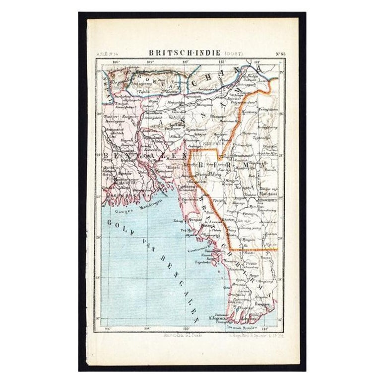
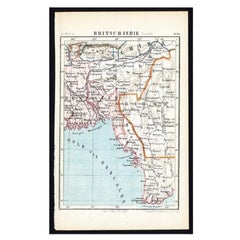
- Antique Map of Eastern India by Kuyper, C.1880Located in Langweer, NLPlate 55 : 'Britsch-Indie, Oost.' (British Indies, East). This lithographed map originates from: 'Wereld-atlas voor Kantoor en Huiskamer' (transl: World Atlas for the office and livi...Category
Antique 19th Century Maps
MaterialsPaper
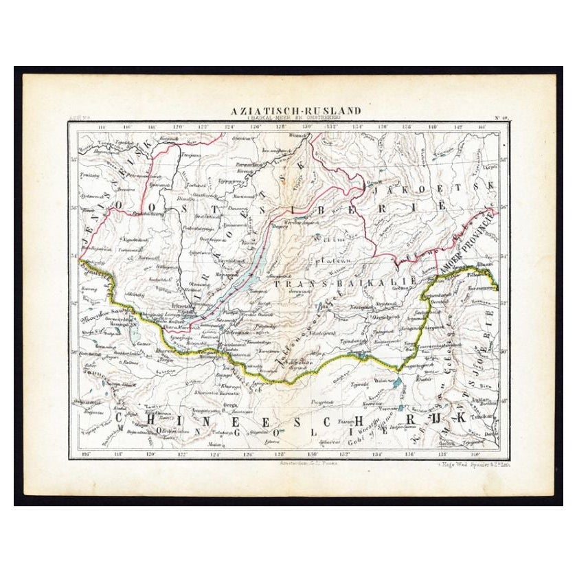
- Antique Map of Russia in Asia by Kuyper, c.1880Located in Langweer, NLAntique map plate 48 : 'Aziatisch Rusland. Balkasj Meer en omstreken.' Original antique map of Russia in Asia, showing Lake Balkhash and surroundings. This l...Category
Antique 19th Century Maps
MaterialsPaper
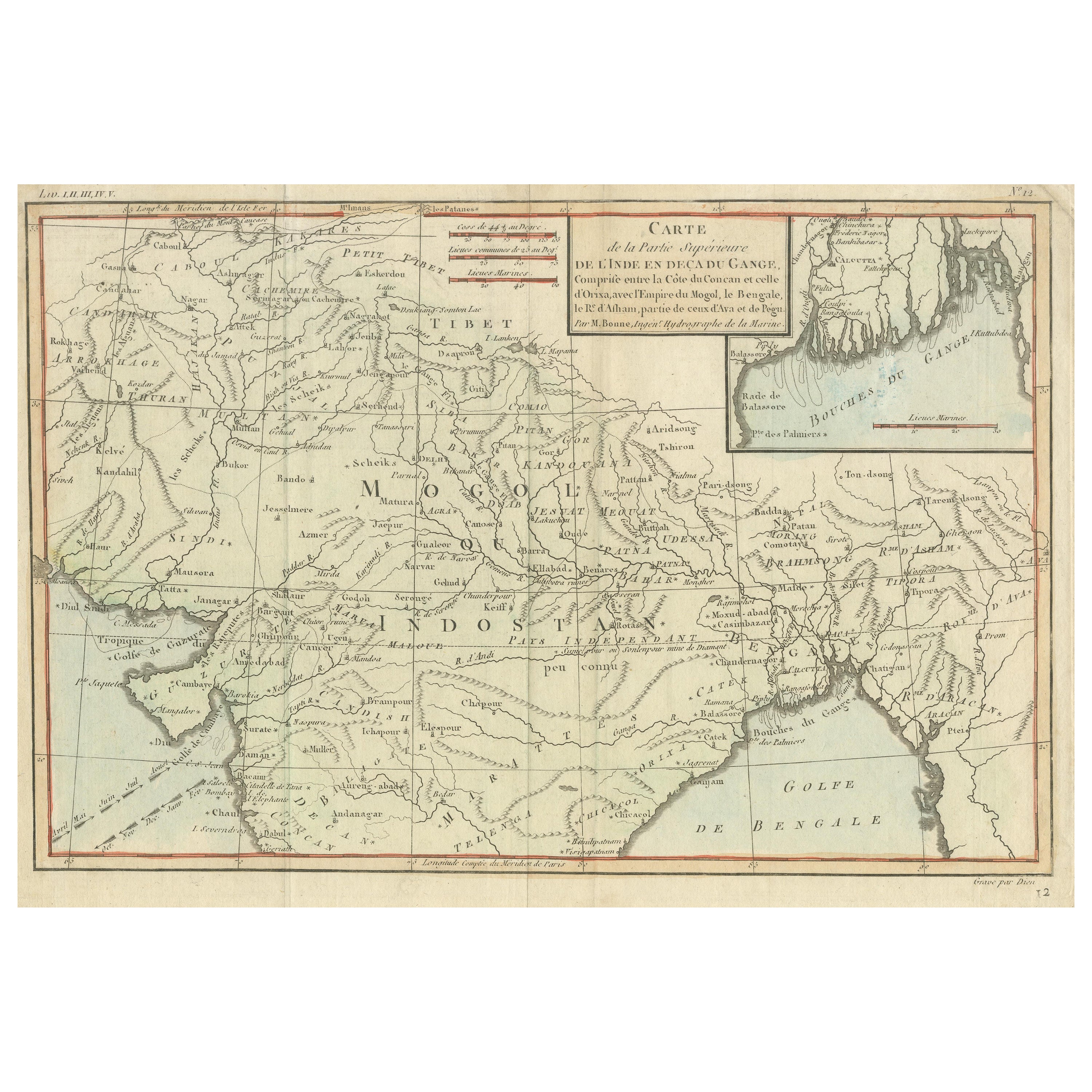
- Antique Map of part of Central and Southern AsiaLocated in Langweer, NLAntique map titled 'Carte de la Partie Superieure de l'Inde en deca du Gange. Comprise entre la Cote du Concan et celle d'Orixa, avec l'Empire du Mogol, le Bengale, le R. d'Asham, pa...Category
Antique Late 18th Century Maps
MaterialsPaper
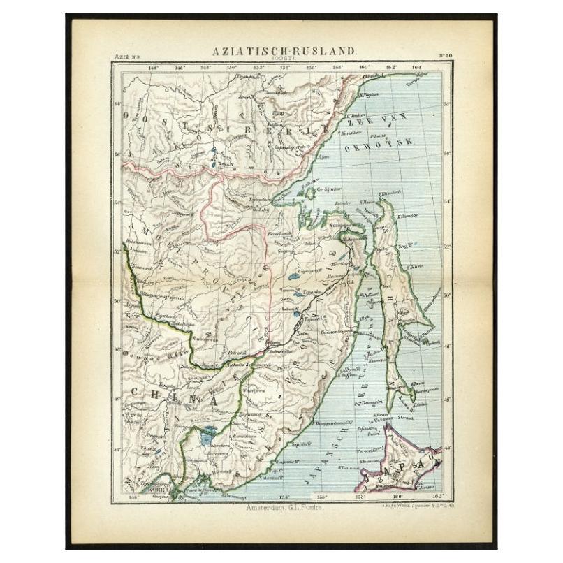
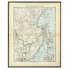
- Antique Map of Eastern Russia in Asia by Kuyper, 1880Located in Langweer, NLAntique map titled 'Aziatisch Rusland. Oost'. Original antique map of Eastern Russia in Asia. This lithographed map originates from: 'Wereld-atlas voor ...Category
Antique 19th Century Maps
MaterialsPaper
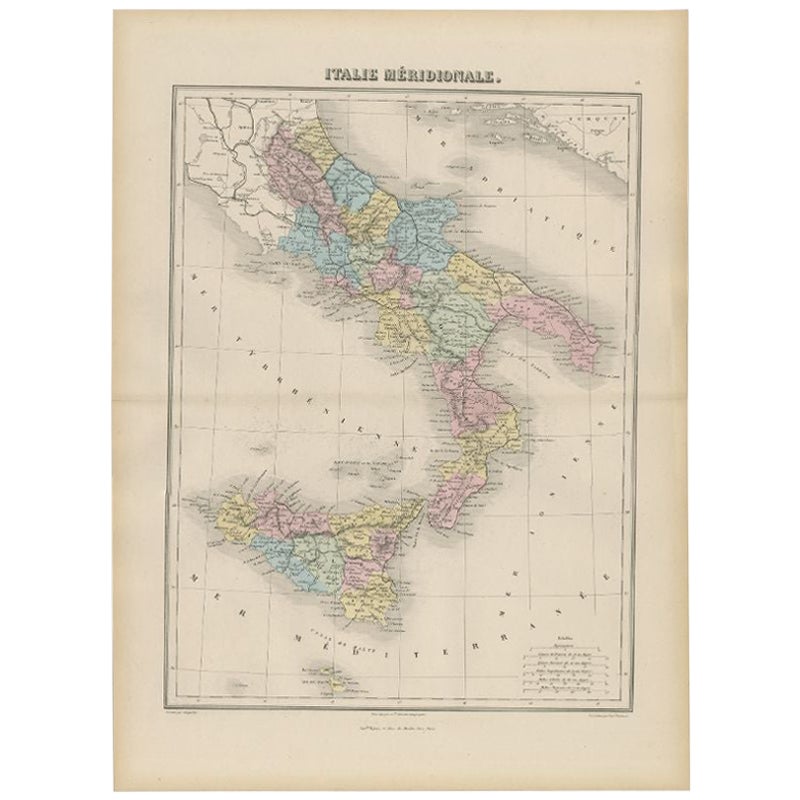
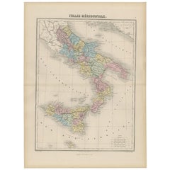
- Antique Map of Southern Italy by Migeon, 1880Located in Langweer, NL"Antique map titled 'Italie Méridionale'. Old map of southern Italy including Sicily/Sicilia. This map originates from 'Géographie Universelle Atlas-Mig...Category
Antique 19th Century Maps
MaterialsPaper
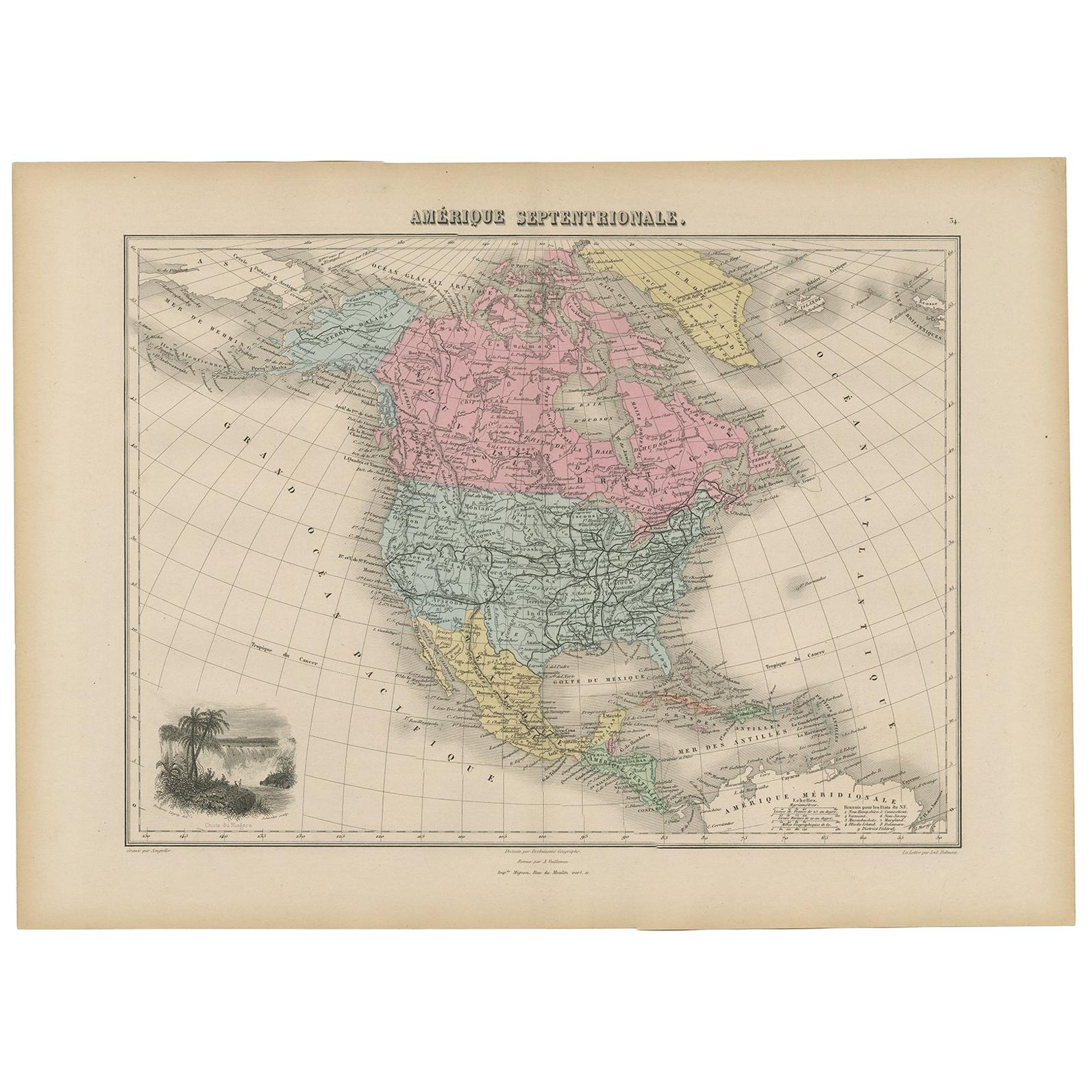
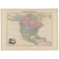
- Antique Map of North and Central America by Migeon '1880'By J. MigeonLocated in Langweer, NLAntique map titled 'Amérique Septentrionale'. Old map of North and Central America. With a decorative vignette of the Niagara Falls. This map originates from 'Géographie Universelle ...Category
Antique Late 19th Century French Maps
MaterialsPaper


You May Also Like
- Original Antique Map of Cyprus. Circa 1880Located in St Annes, LancashireGreat map of Cyprus Drawn and Engraved by R.Walker Published W.Mackenzie, London Original colour Unframed.Category
Antique 1880s English Maps
MaterialsPaper
- Original Antique Map of Central America / Florida, Arrowsmith, 1820Located in St Annes, LancashireGreat map of Central America. Drawn under the direction of Arrowsmith. Copper-plate engraving. Published by Longman, Hurst, Rees, Orme and Brown, 1820 Unframed.Category
Antique 1820s English Maps
MaterialsPaper
- Original Antique Map of China by Thomas Clerk, 1817Located in St Annes, LancashireGreat map of China Copper-plate engraving Drawn and engraved by Thomas Clerk, Edinburgh. Published by Mackenzie And Dent, 1817 Unframed.Category
Antique 1810s English Maps
MaterialsPaper
- Original Antique Map of China, Arrowsmith, 1820Located in St Annes, LancashireGreat map of China Drawn under the direction of Arrowsmith Copper-plate engraving Published by Longman, Hurst, Rees, Orme and Brown, 1820 Unfr...Category
Antique 1820s English Maps
MaterialsPaper
- 1899 Poole Brothers Antique Railroad Map of the Illinois Central RailroadLocated in Colorado Springs, COThis is an 1899 railroad map of the Illinois Central and Yazoo and Mississippi Valley Railroads, published by the Poole Brothers. The map focuses on the continuous United States from the Atlantic to the Pacific Oceans, the Gulf of Mexico, and the Antilles. Remarkably detailed, the rail routes of the Illinois Central RR are marked in red, which each stop labeled. Major stops are overprinted in red, bold letters, with the short rail distances to New York listed above the stop and short rail distances to New Orleans listed below the name. In addition to the Illinois Central network, numerous different rail lines are illustrated and the company running that line is noted along with many stops along each route. Sea routes from New Orleans to locations in Central America, the Caribbean, and Europe are marked and labeled with destination and distance, along with routes originating from Havana. Inset at bottom left is a map of Cuba; an inset map of Puerto Rico...Category
Antique 1890s American Maps
MaterialsPaper
- Framed Map of ChinaLocated in Greenwich, CTMap of China, 19th century. European print map of China Conservation frame with walnut frame Overall dimension : 28 1/2" wide 31" high 2" depth with fra...Category
Antique 19th Century European Qing Prints
MaterialsPaper


