Items Similar to Antique Map of China and Japan by Meyer, 1895


Want more images or videos?
Request additional images or videos from the seller
1 of 5
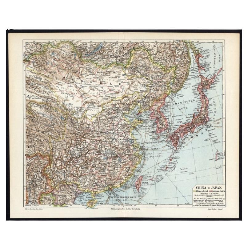
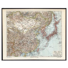
Antique Map of China and Japan by Meyer, 1895
About the Item
Antique map titled 'China und Japan'. Map of China, Mongolia, Taiwan and Japan. With an inset map of Jiaozhou Wan near Qingdao, and another of the region around Hongkong, including Kanton and Macau, with small plans of Hong Kong and Kanton. This map originates from a 1885-1907 edition of a famous German encyclopedia titled 'Meyers grosses Konversations-Lexikon', published in Leipzig and Vienna. Meyers Konversations-Lexikon was a major German encyclopedia that existed in various editions from 1839 until 1984, when it merged with the Brockhaus encyclopedia. Several of the plates were also used in Dutch Encyclopedia's like Winkler Prins.
Artists and Engravers: Meyers Konversations-Lexikon was a major German encyclopedia that existed in various editions from 1839 until 1984, when it merged with the Brockhaus encyclopedia. Several of the plates were also used in Dutch Encyclopedia's like Winkler Prins.
Condition: Very good, given age. Original fold, as issued. General age-related toning and/or occasional minor defects from handling. Please study image carefully.
Date: c.1895
Overall size: 40 x 24.4 cm.
Image size: 0.001 x 36 x 22 cm.
We sell original antique maps to collectors, historians, educators and interior decorators all over the world. Our collection includes a wide range of authentic antique maps from the 16th to the 20th centuries. Buying and collecting antique maps is a tradition that goes back hundreds of years. Antique maps have proved a richly rewarding investment over the past decade, thanks to a growing appreciation of their unique historical appeal. Today the decorative qualities of antique maps are widely recognized by interior designers who appreciate their beauty and design flexibility. Depending on the individual map, presentation, and context, a rare or antique map can be modern, traditional, abstract, figurative, serious or whimsical. We offer a wide range of authentic antique maps for any budget.
- Dimensions:Height: 9.61 in (24.4 cm)Width: 15.75 in (40 cm)Depth: 0 in (0.01 mm)
- Materials and Techniques:
- Period:
- Date of Manufacture:circa 1895
- Condition:
- Seller Location:Langweer, NL
- Reference Number:
About the Seller
5.0
Platinum Seller
These expertly vetted sellers are 1stDibs' most experienced sellers and are rated highest by our customers.
Established in 2009
1stDibs seller since 2017
1,914 sales on 1stDibs
Typical response time: <1 hour
- ShippingRetrieving quote...Ships From: Langweer, Netherlands
- Return PolicyA return for this item may be initiated within 14 days of delivery.
More From This SellerView All
- German Antique Map of China And Japan by Meyer, 1902Located in Langweer, NLAntique map titled 'China und Japan.' (Map of China and Japan). This attractive original old antique print / plate / map originates from the 6th edition of a famous German encycloped...Category
20th Century Maps
MaterialsPaper
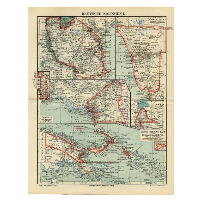
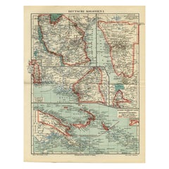
- Antique Map of German Colonies by Meyer, 1895Located in Langweer, NLAntique map titled 'Deutsche Kolonien.' Lithographed map of the German Colonies. German East-Africa, German Southeast-Africa, Cameroon, Marshall-Islands, German Colonies in the Pacif...Category
Antique 19th Century Maps
MaterialsPaper
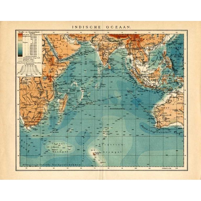
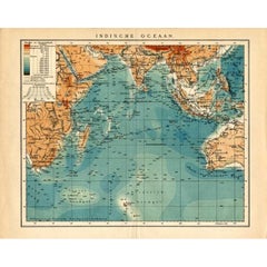
- German Antique Map of the Indian Oceaan, Meyers, 1895Located in Langweer, NLThis attractive original old antique print / plate / map originates from 1885-1907 editions of a famous German encyclopedia: 'Meyers grosses Konversations-Lexikon.', published in Leipzig and Vienna. Meyers Konversations-Lexikon was a major German encyclopedia that existed in various editions from 1839 until 1984, when it merged with the Brockhaus encyclopedia. Several of the plates were also used in Dutch Encyclopedia's like Winkler Prins...Category
Antique 19th Century Maps
MaterialsPaper
- Antique Map of China and Japan by Tardieu, 1821Located in Langweer, NLAntique map titled 'Carte de la Chine et du Japon'. Detailed map of China, showing Korea, Japan and Taiwan. This map originates from 'L'histoire général des voyages' by J.F. de la Harpe.Category
Antique Early 19th Century Maps
MaterialsPaper
- Antique Map of China and Japan by Johnson, 1872Located in Langweer, NLAntique map titled 'Johnson's China and Japan'. Map of China and Japan, with an inset map of the vicinity of Canton and Hong Kong. This map originates from 'Johnson's New Illustrated...Category
Antique Late 19th Century Maps
MaterialsPaper
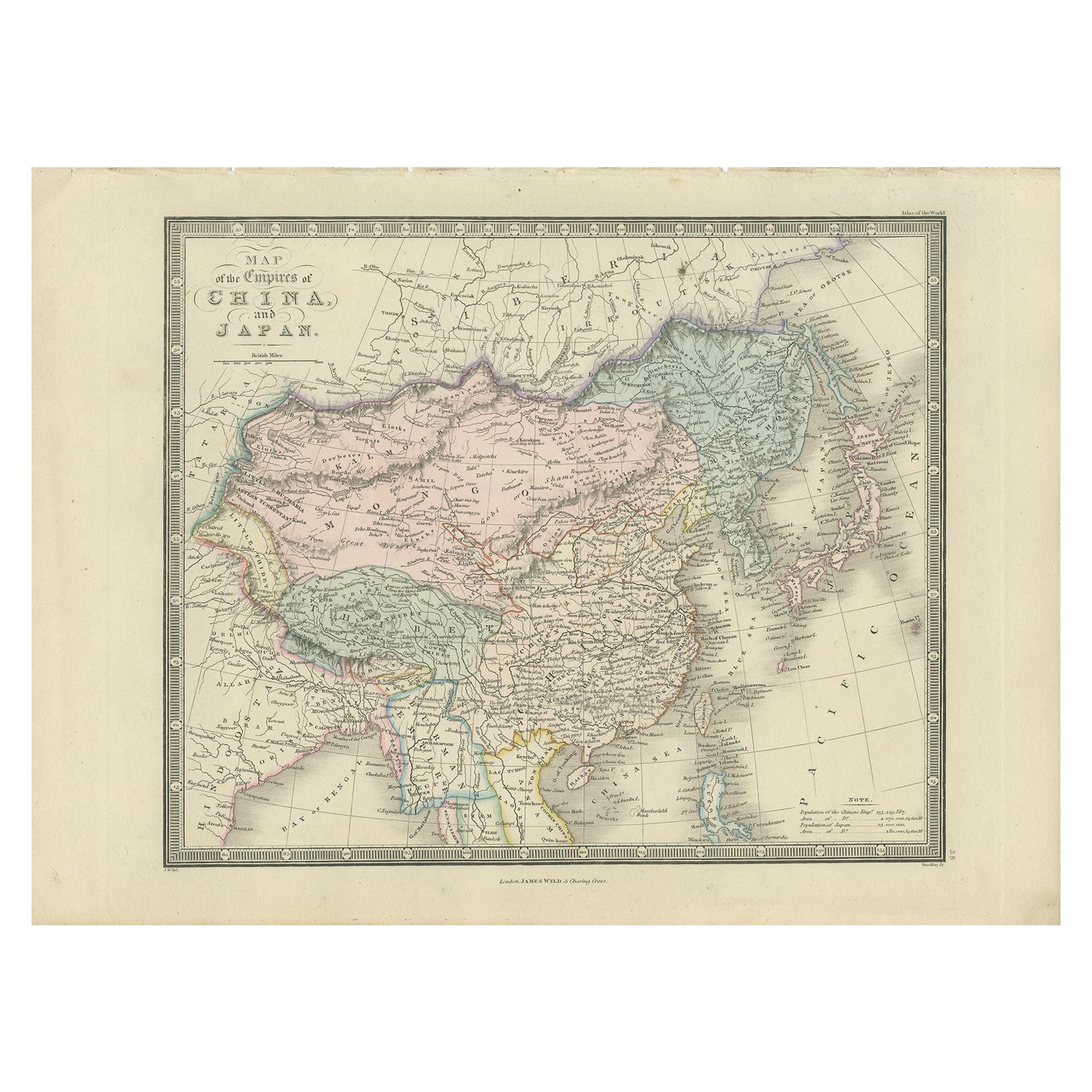
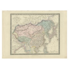
- Antique Map of China and Japan by Wyld '1845'Located in Langweer, NLAntique map titled 'Map of the Empires of China and Japan'. Original antique map of China and Japan. This map originates from 'An Atlas of the World, Comprehending Separate Maps of i...Category
Antique Mid-19th Century Maps
MaterialsPaper


You May Also Like
- Original Antique Map of China by Thomas Clerk, 1817Located in St Annes, LancashireGreat map of China Copper-plate engraving Drawn and engraved by Thomas Clerk, Edinburgh. Published by Mackenzie And Dent, 1817 Unframed.Category
Antique 1810s English Maps
MaterialsPaper
- 1849 Map of "Europaische Russland", 'Meyer Map of European Russia', Ric. R017Located in Norton, MA1849 Map of "Europaische Russland" ( Meyer Map of European Russia) Ric.r017 A lovely map of European Russia dating to 1849 by Joseph Meyer. It covers the European portions of...Category
Antique 19th Century Unknown Maps
MaterialsPaper
- Original Antique Map of China, Arrowsmith, 1820Located in St Annes, LancashireGreat map of China Drawn under the direction of Arrowsmith Copper-plate engraving Published by Longman, Hurst, Rees, Orme and Brown, 1820 Unfr...Category
Antique 1820s English Maps
MaterialsPaper
- Original Antique Decorative Map of Japan, Fullarton, C.1870Located in St Annes, LancashireGreat map of Japan Wonderful figural border From the celebrated Royal Illustrated Atlas Lithograph. Original color. Published by Fullarton, Edinburgh, C.1870 Unframed...Category
Antique 1870s Scottish Maps
MaterialsPaper
- Framed Map of ChinaLocated in Greenwich, CTMap of China, 19th century. European print map of China Conservation frame with walnut frame Overall dimension : 28 1/2" wide 31" high 2" depth with fra...Category
Antique 19th Century European Qing Prints
MaterialsPaper
- Large Original Antique Map of China, Fullarton, C.1870Located in St Annes, LancashireGreat map of China From the celebrated Royal Illustrated Atlas Lithograph by Swanston. Original color. Published by Fullarton, Edinburgh. C.1870 Repairs to minor edge te...Category
Antique 1870s Scottish Maps
MaterialsPaper


Recently Viewed
View AllMore Ways To Browse
1895 Antiques
Japanese Dutch
Dutch Japanese
Encyclopedia Used
Japanese Antique Collectables
Encyclopedia Used For
Chinese General
Japan Antiques Collectables
1895 Plates
Dutch Japanned
Japanese China Plate
Antique Encyclopedias
Encyclopedia Antique
German Antique China
Antique Germany China
Antique German China
Chinese Maps
China Map