
Antique Map of Solothurn 'Switzerland' by M. Merian, circa 1650
View Similar Items


Want more images or videos?
Request additional images or videos from the seller
1 of 5
Antique Map of Solothurn 'Switzerland' by M. Merian, circa 1650
About the Item
- Dimensions:Height: 12.8 in (32.5 cm)Width: 16.15 in (41 cm)Depth: 0.02 in (0.5 mm)
- Materials and Techniques:
- Period:Mid-17th Century
- Date of Manufacture:circa 1650
- Condition:General age-related toning. Please study image carefully.
- Seller Location:Langweer, NL
- Reference Number:Seller: BG-102701stDibs: LU3054310792963
About the Seller
5.0
Platinum Seller
These expertly vetted sellers are 1stDibs' most experienced sellers and are rated highest by our customers.
Established in 2009
1stDibs seller since 2017
1,916 sales on 1stDibs
More From This SellerView All
- Antique Map of Stavoren by Merian, c.1650Located in Langweer, NLAntique map titled 'Stavera'. Map of the city of Stavoren, Friesland. With German legend. Trimmed, originally published on one sheet with a map of Bolsward and Hindeloopen. Artists a...Category
Antique 17th Century Maps
MaterialsPaper
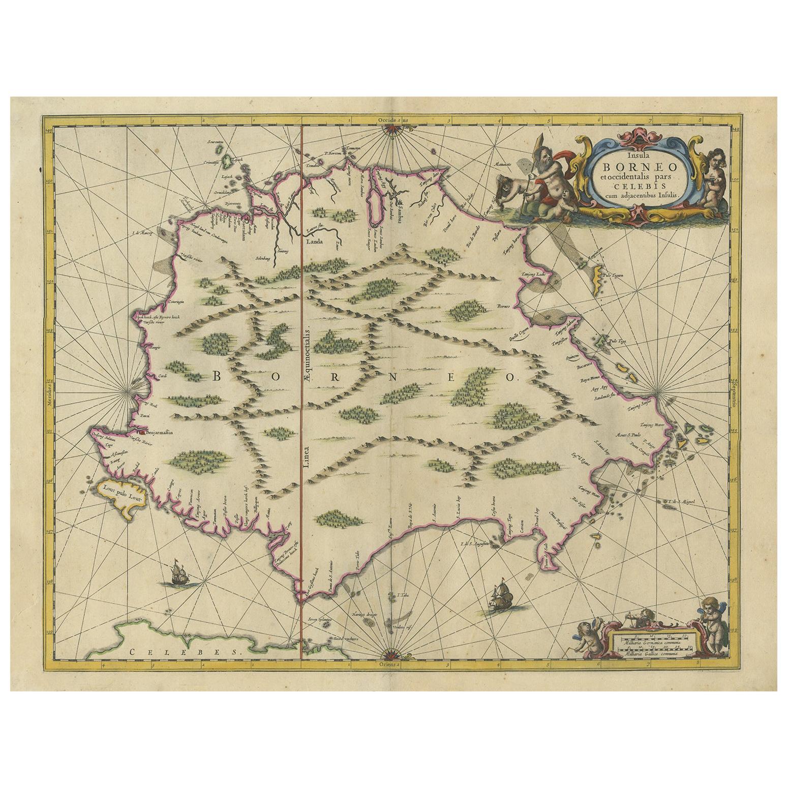
- Antique Map of the Island of Borneo by Janssonius, circa 1650Located in Langweer, NLAntique map titled 'Insula Borneo et Occidentalis pars Celebis cum adjacentibus Insulis'. Rare sea chart of the island of Borneo. Published by J. Janssonius, circa 1650.Category
Antique Mid-17th Century Maps
MaterialsPaper
 $1,610 Sale Price24% Off
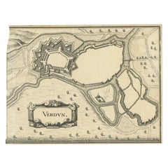
 - Antique Map of the City of Verdun by Merian, c.1650Located in Langweer, NLAntique map titled 'Verdun'. Orginal antique map of Verdun, a small city in the Meuse department in Grand Est in northeastern France. This map originates from 'Topographia Germaniae'...Category
Antique 17th Century Maps
MaterialsPaper
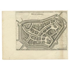
- Antique Map of the City of Bolsward by Merian, c.1650Located in Langweer, NLAntique map titled 'Bolzvardia'. Old map of the city of Bolsward, Friesland. This map was published with two other maps on one sheet (Hindeloopen and Stavoren). Artists and Engravers...Category
Antique 17th Century Maps
MaterialsPaper
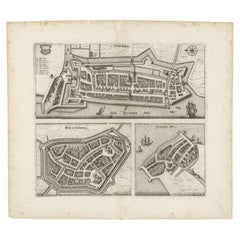
- Antique Map of Stavoren, Bolsward and Hindeloopen by Merian, c.1650Located in Langweer, NLAntique map titled 'Stavera, Bolzvardia, Hindelopia'. Three maps on one sheet depicting Stavoren, Bolsward and Hindeloopen (Friesland, The Netherlands). With German legend. Artists a...Category
Antique 17th Century Maps
MaterialsPaper
You May Also Like
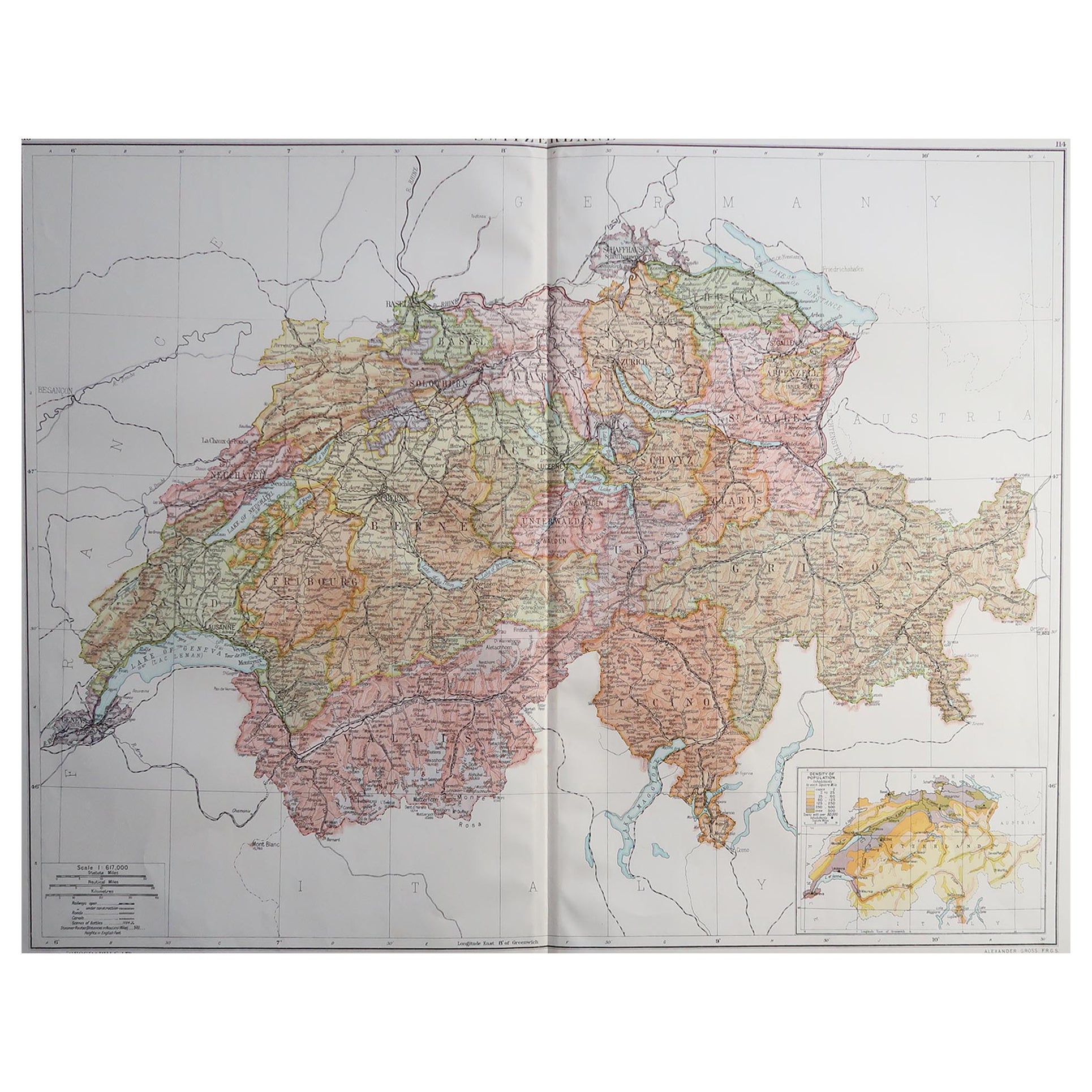
- Large Original Vintage Map of Switzerland, circa 1920Located in St Annes, LancashireGreat map of Switzerland Original color. Good condition Published by Alexander Gross Unframed.Category
Vintage 1920s English Maps
MaterialsPaper
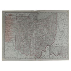
- Large Original Antique Map of Ohio by Rand McNally, circa 1900By Rand McNally & Co.Located in St Annes, LancashireFabulous monochrome map with red outline color Original color By Rand, McNally & Co. Published, circa 1900 Unframed Repairs to minor edge tears.Category
Antique Early 1900s American Edwardian Maps
MaterialsPaper
- Original Antique Map of South Dakota by Rand McNally, circa 1900By Rand McNally & Co.Located in St Annes, LancashireFabulous monochrome map with red outline color Original color By Rand, McNally & Co. Published, circa 1900 Unframed Minor edge tears.Category
Antique Early 1900s American Edwardian Maps
MaterialsPaper
- Large Original Antique Map of Arkansas by Rand McNally, circa 1900By Rand McNally & Co.Located in St Annes, LancashireFabulous monochrome map with red outline color Original color By Rand, McNally & Co. Published, circa 1900 Unframed Minor edge tears.Category
Antique Early 1900s American Edwardian Maps
MaterialsPaper
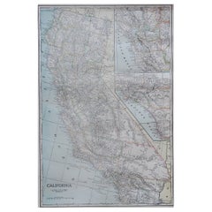
- Large Original Antique Map of California, USA, circa 1900Located in St Annes, LancashireFabulous map of California Original color Engraved and printed by the George F. Cram Company, Indianapolis. Published, circa 1900 Unframed Free shipping.Category
Antique 1890s American Maps
MaterialsPaper
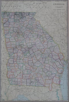
- Large Original Antique Map of Georgia, USA, circa 1900Located in St Annes, LancashireFabulous map of Georgia Original color Engraved and printed by the George F. Cram Company, Indianapolis. Published, circa 1900 UnframedCategory
Antique 1890s American Maps
MaterialsPaper


Recently Viewed
View AllMore Ways To Browse
Antique Map Switzerland
Antique Map Of Switzerland
Frankfurt Map
Antique Prints Maps
Antique Map Prints
Antique Maps And Prints
Antique Prints And Maps
Map 19th Century
Antique Atlas Furniture
Map Of France
Large Map
Large Maps
Antique German Collectibles
Original World Map
World Atlas
Map Of Itsly
Antique Map World
Antique Maps World