Items Similar to Italy, Sicily, Sardinia, Corsica and Dalmatian Coast: A 17th Century Dutch Map
Want more images or videos?
Request additional images or videos from the seller
1 of 10
Italy, Sicily, Sardinia, Corsica and Dalmatian Coast: A 17th Century Dutch Map
About the Item
This hand colored 17th century Dutch map entitled "Novissima et Accuratissima totius Italiae Corsicae et Sardiniae Descriptio" by Theodore Danckerts depicts the Italian Peninsula in its entirety. It also includes the Dalmatian coast, which at the time was controlled by the Republic of Venice. The islands of Corsica and Sardinia and part of Sicily are also represented. At the time this map was made, most of Italy was under Spanish control. Following the War of Spanish Succession (1701-1714), Spain would lose many of its territories to the Habsburg Empire of Austria, and then as a result controlled Italy.
A colorful title cartouche in the top right quadrant depicts two cherubs and an emperor. The scale in the bottom left is also illustrated with a cherub with measuring instruments. Various ships can be seen sailing in the waters as a naval battle rages in the Tyrrhenian Sea.
The map is presented in a tan colored wood frame with light gold colored inner and outer trim, with a double mat; the outer mat is cream-color and the inner mat is dark brown. There are focal areas of discoloration in the lower portion of the map, but the map is otherwise in very good condition.
The Danckerts were a prominent 17th and early 18th century Dutch cartographic, engraver and printing family. Cornelis Danckerts I (1603-1656) began the family business in Amsterdam. The skill and the trade was passed to his son, Justus Danckerts (1635-1701 and subsequently to his sons, Theodorus Danckerts I (1663-1727) and Cornelis Danckerts II (1664-1717)
- Creator:Theodorus Danckerts (Artist)
- Dimensions:Height: 18.13 in (46.06 cm)Width: 31.25 in (79.38 cm)Depth: 1.38 in (3.51 cm)
- Materials and Techniques:Paper,Engraved
- Place of Origin:
- Period:Late 17th Century
- Date of Manufacture:1690
- Condition:Wear consistent with age and use.
- Seller Location:Alamo, CA
- Reference Number:
About the Seller
5.0
Vetted Seller
These experienced sellers undergo a comprehensive evaluation by our team of in-house experts.
1stDibs seller since 2020
12 sales on 1stDibs
- ShippingRetrieving quote...Ships From: Alamo, CA
- Return PolicyA return for this item may be initiated within 7 days of delivery.
More From This SellerView All
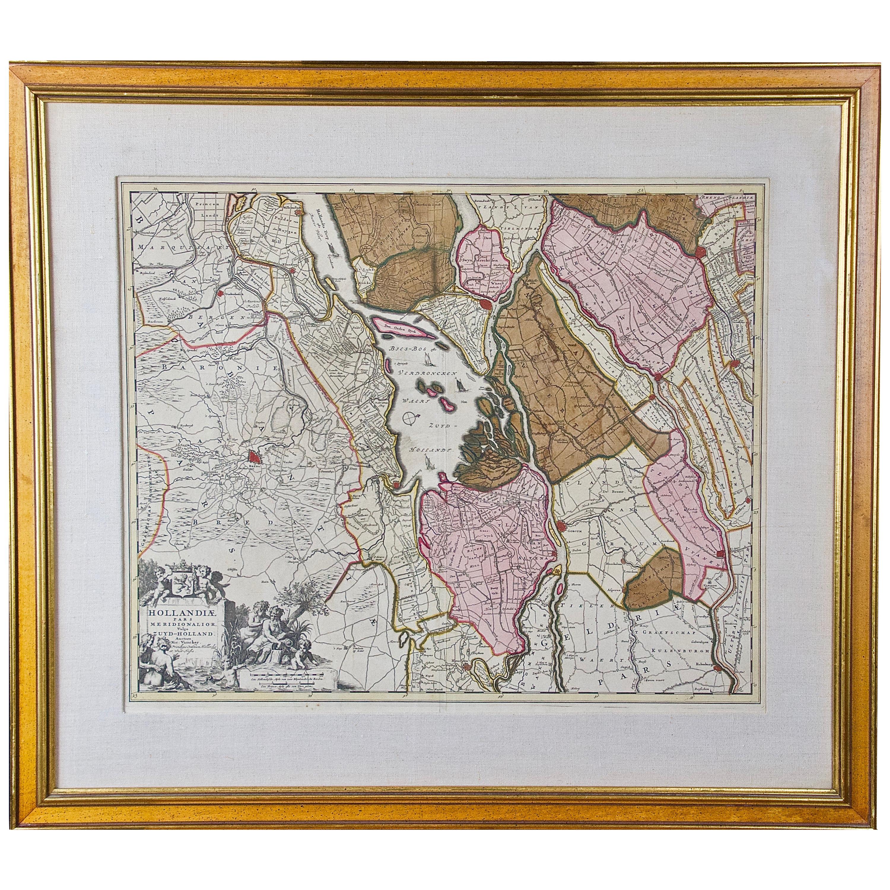
- Hand Colored 17th Century Visscher Map "Hollandiae" Southern HollandBy Nicolaes Visscher IILocated in Alamo, CAA hand colored 17th century map of the southern portions of Holland by Nicolaus (Nicolas) Visscher II entitled "Hollandiae pars Meridionalis, vulgo Zuyd-Holland", published in Amsterdam in 1678. The map shows the region between Breda, Heusden, Gornichem, Gouda, Dordrecht, and Willemstad. It includes a decorative cartouche in the lower left corner. The map is presented in an attractive maple colored wood frame with gold trim and a fabric mat. The Visscher family were one of the great cartographic families of the 17th century. Begun by Claes Jansz Visscher...Category
Antique Early 18th Century Dutch Maps
MaterialsPaper
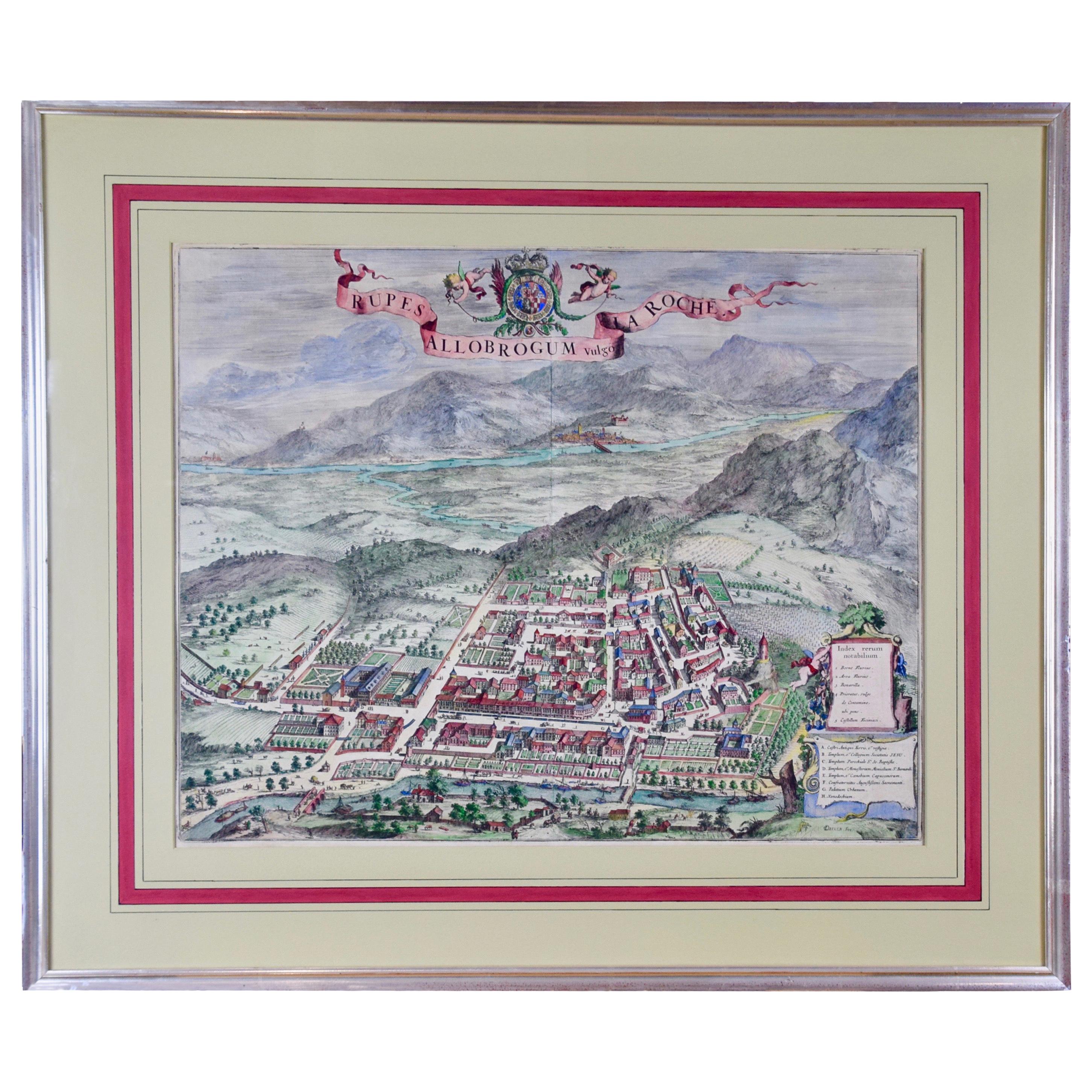
- Dutch Map and City Plan of La Roche-sur-Foron, France, 17th Century Hand ColoredBy Coenraet DeckerLocated in Alamo, CA"Rupes Allobrogum vulgo La Roche" by Dutch engraver Coenraet Decker (1650-1685) is from the atlas Theatrum Statuum Regiae Celestudinis Sabaudiae Ducis, published in 1682. This richly...Category
Antique Late 17th Century Dutch Maps
MaterialsPaper
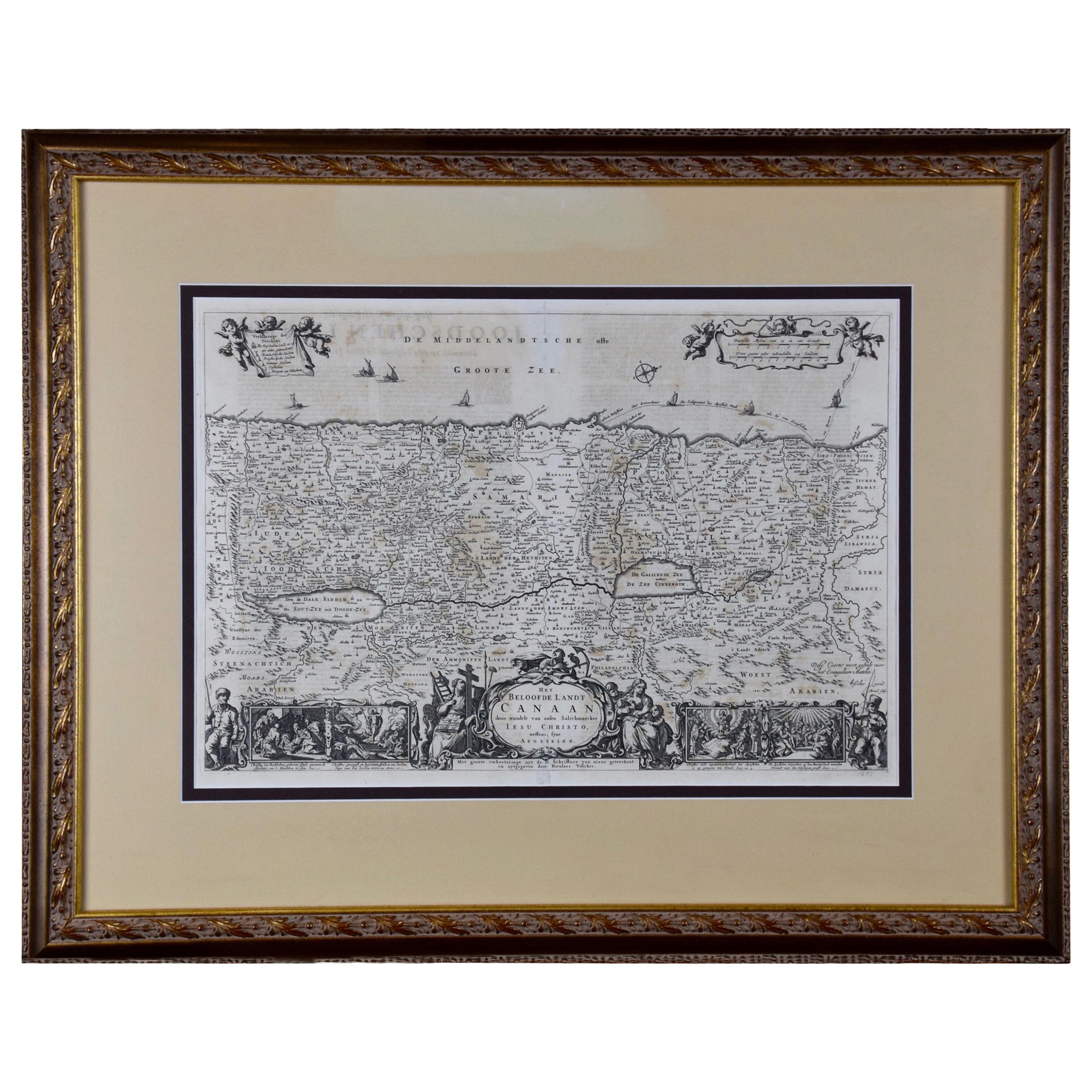
- The Holy Land at the Time of Jesus: A 17th Century Dutch Map by VisscherBy Nicolaes Visscher IILocated in Alamo, CAThis detailed Dutch map entitled "Het Beloofe de Landt Canaan door wandelt van onsen Salichmaecker Iesu Christo, nessens syne Apostelen" by Nicolaes Visscher was published in Amsterd...Category
Antique Mid-17th Century Dutch Maps
MaterialsPaper
- Africa: A Large 17th Century Hand-Colored Map by Sanson and JaillotBy Nicolas SansonLocated in Alamo, CAThis large original hand-colored copperplate engraved map of Africa entitled "L'Afrique divisee suivant l'estendue de ses principales parties ou sont distingues les uns des autres, L...Category
Antique 1690s French Maps
MaterialsPaper
- Northern Scotland: A 17th Century Hand-colored Map by MercatorBy Gerard MercatorLocated in Alamo, CAThis is a framed hand-colored 17th century map of Northern Scotland by Gerard Mercator entitled "Scotiae pars Septentrionalis", published in Amsterdam in 1636. It is a highly detailed map of the northern part of Scotland, with the northwest Highlands and the cities Inverness and Aberdeen, as well as the Orkney Islands and the Hebrides. There is a decorative title cartouche in the upper left corner. The map is presented in an antiqued brown wood...Category
Antique 1630s Dutch Maps
MaterialsPaper
- Portugal: A Large 17th Century Hand-colored Map by Sanson and JaillotBy Nicolas SansonLocated in Alamo, CAThis large hand-colored map entitled "Le Royaume de Portugal et des Algarves Divisee en see Archeveches, Eveches et Territoires Par le Sr Sanson" was originally created by Nicholas S...Category
Antique 1690s French Maps
MaterialsPaper


You May Also Like
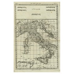
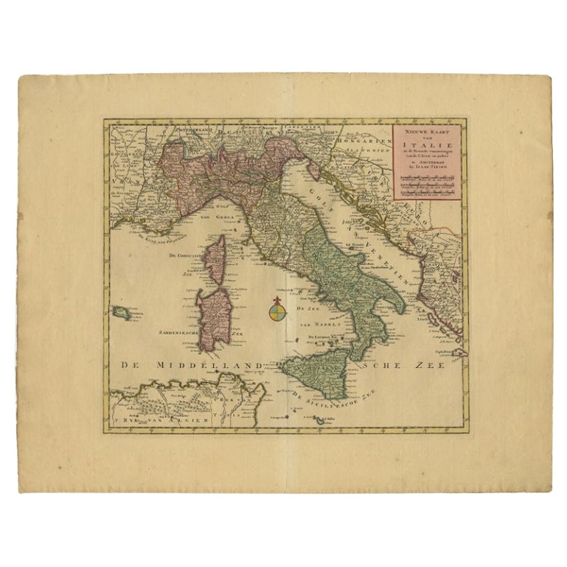
- Antique Map of Italy, Showing Corsica, Sardinia, Croatia, Malta and More, C.1740Located in Langweer, NLAntique map titled 'Nieuwe Kaart van Italie na de Nieuwste waarnemingen van de l'Isle en andere.' Attractive detailed map showing Italy as well as Corsica, Sardinia, Minorca, Croat...Category
Antique 18th Century Maps
MaterialsPaper
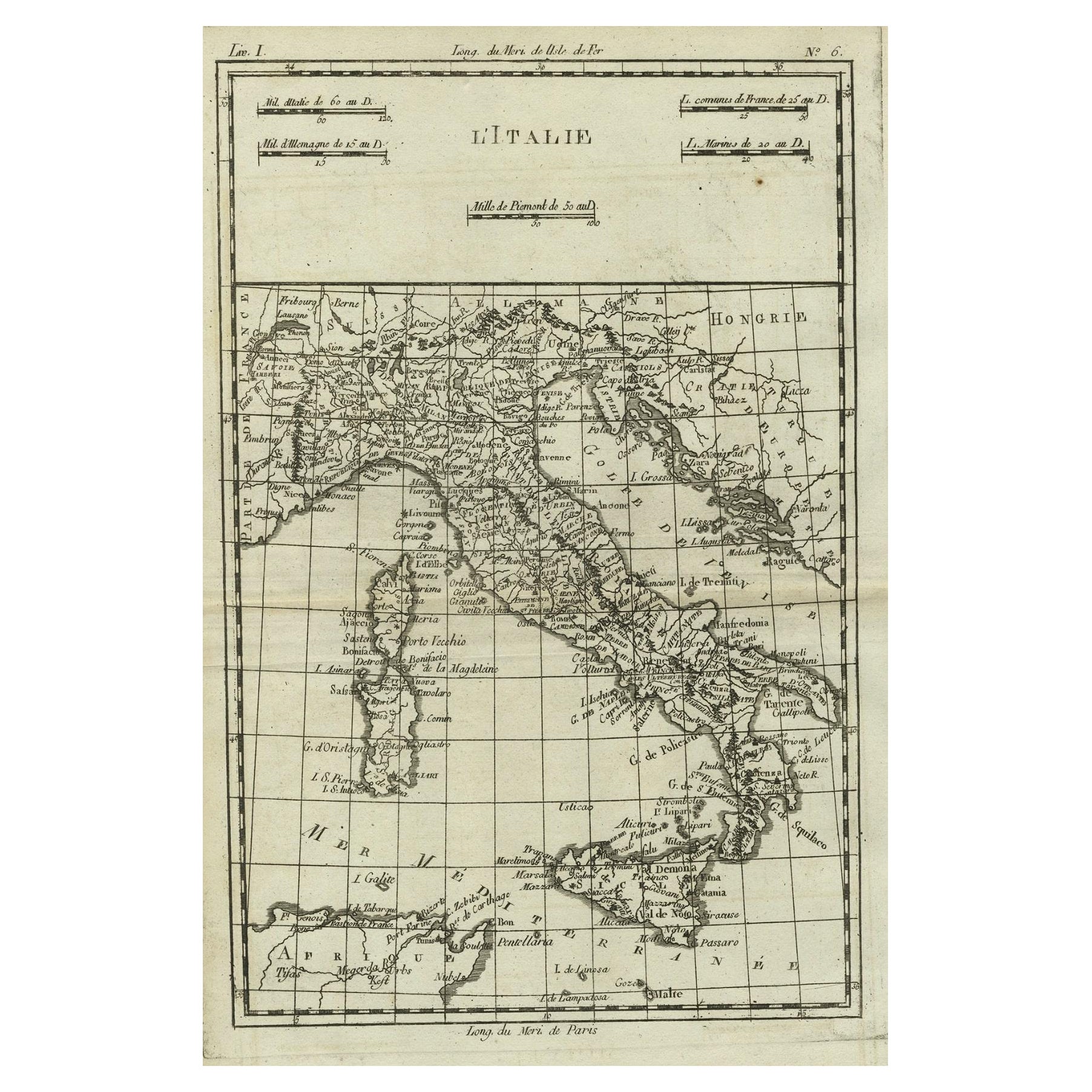
- Antique Map of Italy, Corsica, Sardinia and Sicily, ca.1780Located in Langweer, NLDescription: Antique map titled 'L'Italie.' Map of Italy, Corsica, Sardinia and Sicily. Highly detailed, showing towns, rivers, some topographical features and political boundari...Category
Antique 1780s Maps
MaterialsPaper
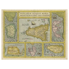
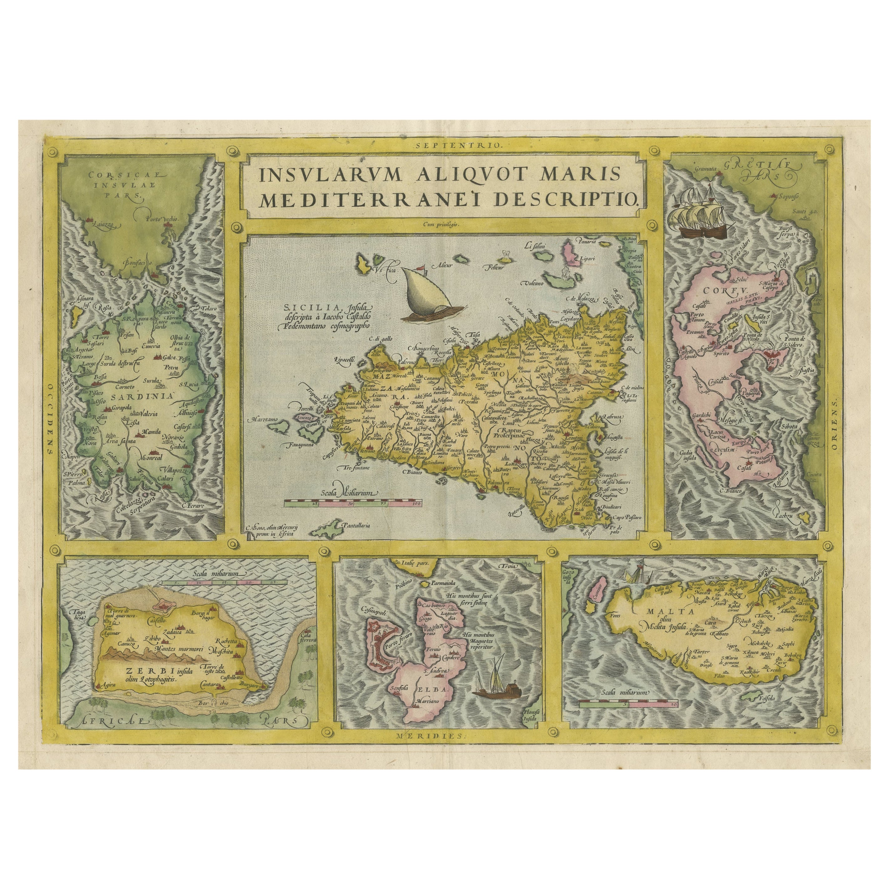
- Coloured Antique Map of Sicily, Sardinia, Corfu, Elba, Malta and Zerbi (Jerba)By Abraham OrteliusLocated in Langweer, NLAntique map titled 'Insularum Aliquot Maris Mediterranei Descriptio'. A very attractive example of Ortelius' map combining, on one page, maps of the islands of Sicily, Sardinia, Corfu, Elba, Malta and Zerbi (Jerba, off the coast of Tunisia.) The maps detail fortifications on the islands and other major features. (Jerba, for instance, is shown connected to the mainland by a causeway.) The waters are attractively engraved and are sailed by ships. A shipwreck, north of Malta, indicates the point at which St. Paul is thought to have shipwrecked. Volcanoes are indicated in the Sicily map...Category
Antique 16th Century Maps
MaterialsPaper
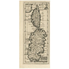
- Antique Map of Corsica and Sardini, 1729Located in Langweer, NLDetailed map of the Islands of Corsica and Sardinia, showing towns, rivers, lakes, mountains, bays, and other features. Cluver's Geography was one of the most enduring works of the ...Category
Antique Early 18th Century Maps
MaterialsPaper
- Old Nautical Map of CorsicaLocated in Alessandria, PiemonteST/556/1 - Old map of Corsica isle, surveyed by Captain Hell, of the French Royal Navy in 1824, engraved and published on 1874, with additions and corre...Category
Antique Early 19th Century English Other Prints
MaterialsPaper
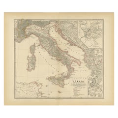
- Map of The Italian Peninsula with the islands of Sicily, Sardinia, Corsica, 1880Located in Langweer, NLThis map, titled "ITALIA, Sicilia, Sardinia, Corsica," represents the Italian Peninsula along with the islands of Sicily, Sardinia, and Corsica. Inset maps offer detailed views of "R...Category
Antique 1880s Maps
MaterialsPaper