Items Similar to Antique Map of the West Indies and Central America by Lowry '1852'


Want more images or videos?
Request additional images or videos from the seller
1 of 5
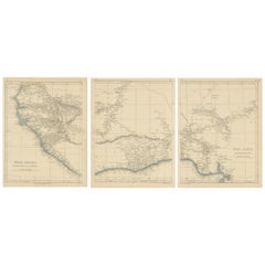
Antique Map of the West Indies and Central America by Lowry '1852'
About the Item
Antique map titled 'West Indies and Central America'. Original map of the West Indies and Central America. This map originates from 'Lowry's Table Atlas constructed and engraved from the most recent Authorities' by J.W. Lowry. Published 1852.
- Dimensions:Height: 9.65 in (24.5 cm)Width: 12.21 in (31 cm)Depth: 0.02 in (0.5 mm)
- Materials and Techniques:
- Period:
- Date of Manufacture:1852
- Condition:General age-related toning, blank verso. Minor wear, please study image carefully.
- Seller Location:Langweer, NL
- Reference Number:
About the Seller
5.0
Platinum Seller
These expertly vetted sellers are 1stDibs' most experienced sellers and are rated highest by our customers.
Established in 2009
1stDibs seller since 2017
1,913 sales on 1stDibs
Typical response time: <1 hour
- ShippingRetrieving quote...Ships From: Langweer, Netherlands
- Return PolicyA return for this item may be initiated within 14 days of delivery.
More From This SellerView All
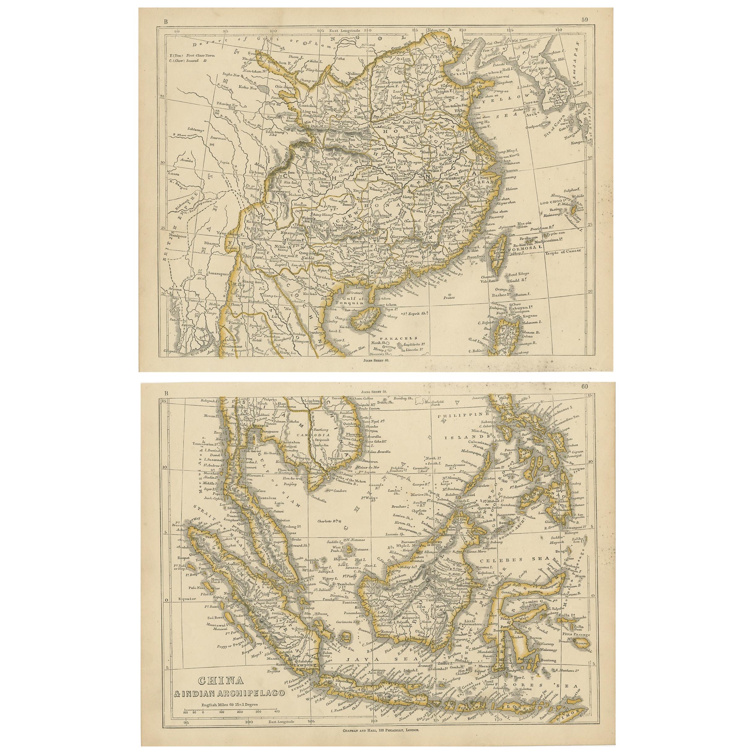
- Antique Map of China and the East Indies by Lowry, 1852Located in Langweer, NLAntique map titled 'China & Indian Archipelago'. Two individual sheets of China and the East Indies. This map originates from 'Lowry's table Atlas constructed and engraved from the m...Category
Antique Mid-19th Century Maps
MaterialsPaper
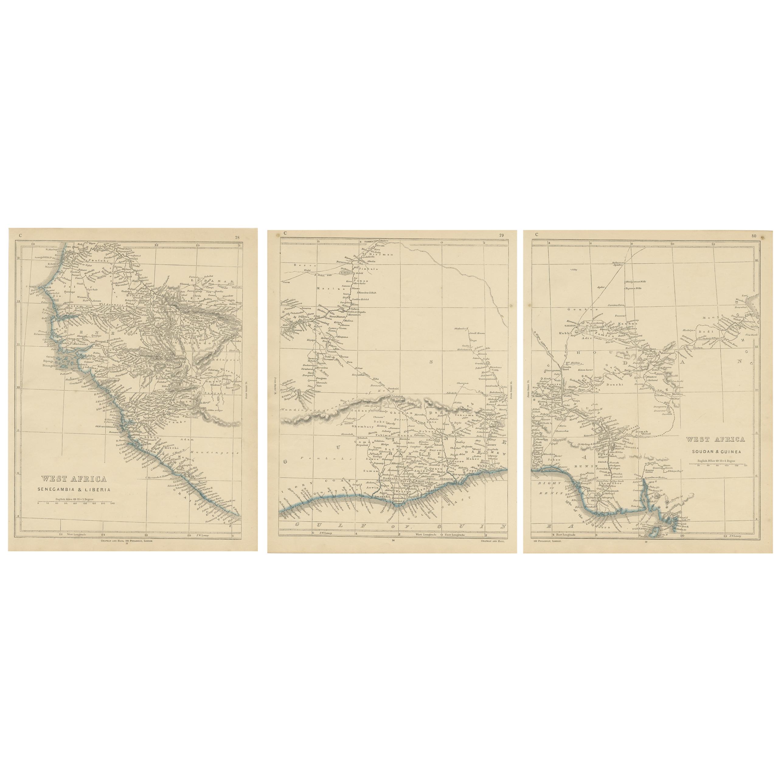
- Antique Map of West Africa by Lowry, 1852Located in Langweer, NLAntique map titled 'West Africa'. Three individual sheets of West Africa. This map originates from 'Lowry's table Atlas constructed and engraved from the most recent authorities' by ...Category
Antique Mid-19th Century Maps
MaterialsPaper
- Antique Map of the West Indies and Central America by W. G. Blackie, 1859Located in Langweer, NLAntique map titled 'The West India Island & Central America'. Original antique map of the West Indies and Central America, with inset map of Jamaica. Th...Category
Antique Mid-19th Century Maps
MaterialsPaper
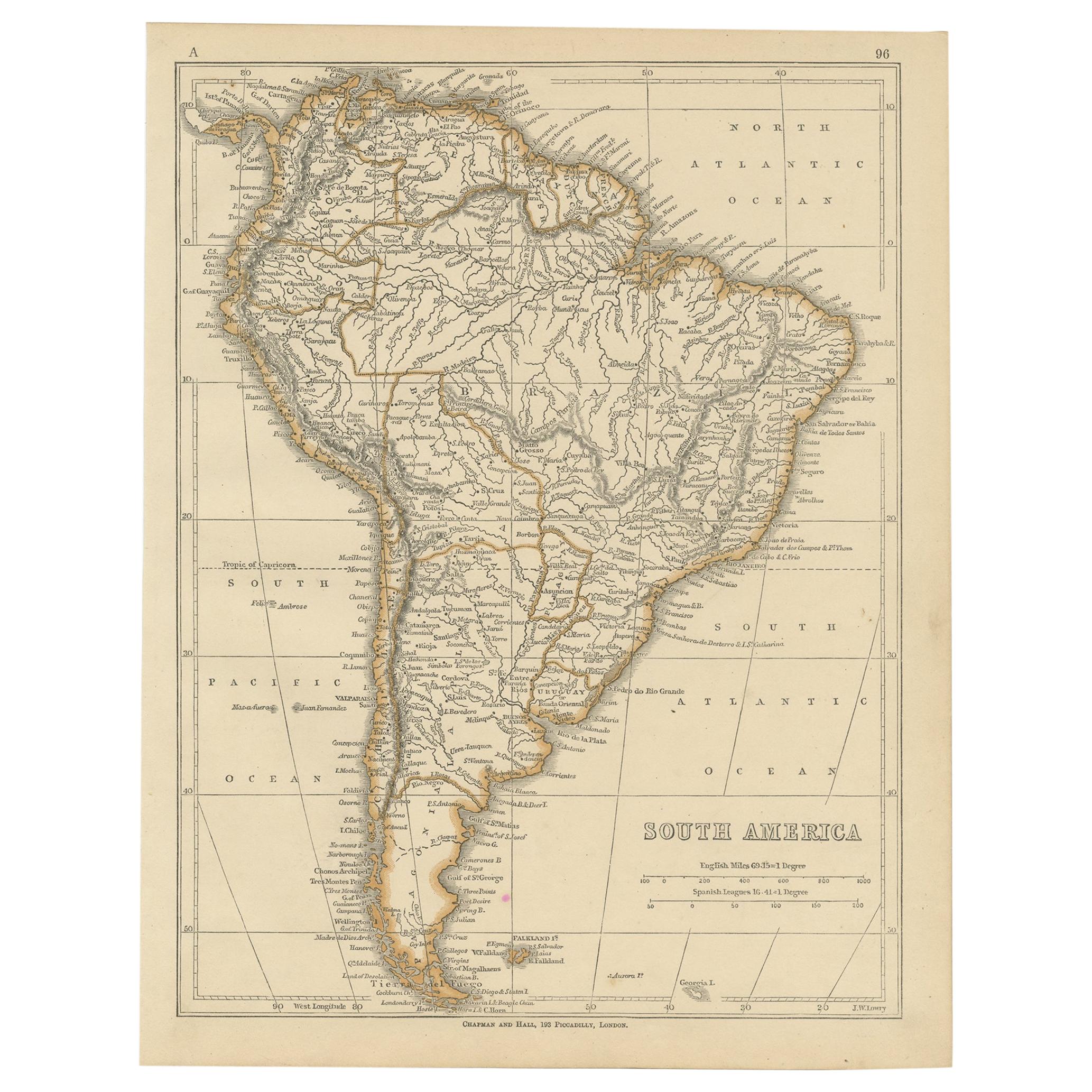
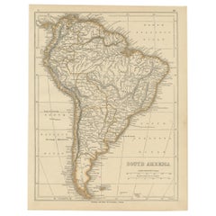
- Antique Map of South America by Lowry, 1852Located in Langweer, NLAntique map titled 'South America'. Original map of South America. This map originates from 'Lowry's Table Atlas constructed and engraved from the most recent authorities' by J.W. Lo...Category
Antique Mid-19th Century Maps
MaterialsPaper
- Antique Map of North America by Lowry '1852'Located in Langweer, NLAntique map titled 'North America'. Original map of North America. This map originates from 'Lowry's Table Atlas constructed and engraved from the...Category
Antique Mid-19th Century Maps
MaterialsPaper
- Antique Map of Mexico, Central America and West Indies by A & C. Black, 1870Located in Langweer, NLAntique map titled 'Mexico, Central America and West Indies'. Original antique map of Mexico, Central America and West Indies with inset map of Panama railway. This map originates fr...Category
Antique Late 19th Century Maps
MaterialsPaper


You May Also Like
- Original Antique Map of Central America / Florida, Arrowsmith, 1820Located in St Annes, LancashireGreat map of Central America. Drawn under the direction of Arrowsmith. Copper-plate engraving. Published by Longman, Hurst, Rees, Orme and Brown, 1820 Unframed.Category
Antique 1820s English Maps
MaterialsPaper
- Cricket Print, England v. West Indies at the Oval, by Arthur WeaverBy Arthur WeaverLocated in Oxfordshire, GB1990's Arthur Weaver Oval Cricket Ground Print, England v West Indies. A colourful cricket lithograph signed by the artist, Arthur Weaver, of the 'Final Test' at The Oval Cricket Gr...Category
1990s English Sporting Art Sports Equipment and Memorabilia
MaterialsPaper
- Large Antique 1859 Map of North AmericaLocated in Sag Harbor, NYThis Map was made by Augustus Mitchell in 1859 It is in amazing condition for being 163 years old. This price is for the rolled up easy to ship version of this piece. I will be Frami...Category
Antique Mid-19th Century American Maps
MaterialsCanvas, Paper

- Original Antique Map of South America. C.1780Located in St Annes, LancashireGreat map of South America Copper-plate engraving Published C.1780 Two small worm holes to left side of map Unframed.Category
Antique Early 1800s English Georgian Maps
MaterialsPaper
- Original Antique Map of South America by Thomas Clerk, 1817Located in St Annes, LancashireGreat map of South America Copper-plate engraving Drawn and engraved by Thomas Clerk, Edinburgh. Published by Mackenzie And Dent, 1817 Unframed.Category
Antique 1810s English Maps
MaterialsPaper
- Large Original Antique Map of The West Indies by Sidney Hall, 1847Located in St Annes, LancashireGreat map of The West Indies Drawn and engraved by Sidney Hall Steel engraving Original colour outline Published by A & C Black. 1847 Unframed Free shipping.Category
Antique 1840s Scottish Maps
MaterialsPaper


Recently Viewed
View AllMore Ways To Browse
Central America Mid Century
Mid Century Central America Furniture
West Indies
Antique Map America
American West Antiques
West Indies Furniture
Furniture West Indies
West Indies Antique Furniture
Map Of American West
West Indies Antiques
Antique Map Table
West Indies Table
West Indies Map
Map Of West Indies
Central America Map
West Indies Antique Map
Antique Maps West Indies
Antique Map Of The West Indies