Items Similar to Antique Map of Westfalia, Germany by Mercator/Hondius, circa '1620'


Want more images or videos?
Request additional images or videos from the seller
1 of 6
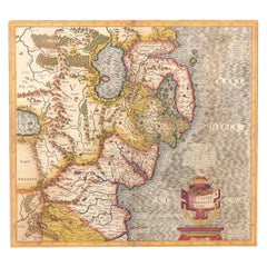
Antique Map of Westfalia, Germany by Mercator/Hondius, circa '1620'
About the Item
Antique map titled 'Westfalia cum dioecelsi Bremensi'. Original antique map of Germany. Published by Mercator/Hondius, circa '1620'
17th Century antique detailled map of Westphalia, East Friesland showing the Hanseatic towns Oldenburg, and Bremen. All in original color.
A nice strap work title cartouche with mileage scale near Oldenburg.
Latin text (Westfaliae Prima Tabvla) verso.
Origin: Mercator's Atlas.
Gerard Mercator Atlas sive Cosmographicae Meditationes de Fabrica Mundi et Fabricati Figura, was issued in numerous editions.
Jodocus Hondius (Latinized version of his Dutch name: Joost de Hondt) (14 October 1563 – 12 February 1612), sometimes called Jodocus Hondius the Elder to distinguish him from his son Jodocus Hondius II, was a Flemish / Dutch engraver, and cartographer. He is best known for his early maps of the New World and Europe, for re-establishing the reputation of the work of Gerard Mercator, and for his portraits of Francis Drake. He helped establish Amsterdam as the center of cartography in Europe in the 17th century.
Sheet app.: 52 x 43.5 cm. 20.5 x 17 inches.
Image app.: 45.5 x 35.5 cm. 18 x 14 inches.
Condition: Very good double page map, clean image in old hand coloring, vertical reinforcement over fold line on verso.
- Dimensions:Height: 17.72 in (45 cm)Width: 21.66 in (55 cm)Depth: 0.02 in (0.5 mm)
- Materials and Techniques:
- Period:
- Date of Manufacture:1600
- Condition:General age-related toning. Original folding line. Please study images carefully.
- Seller Location:Langweer, NL
- Reference Number:
About the Seller
5.0
Platinum Seller
These expertly vetted sellers are 1stDibs' most experienced sellers and are rated highest by our customers.
Established in 2009
1stDibs seller since 2017
1,914 sales on 1stDibs
Typical response time: <1 hour
- ShippingRetrieving quote...Ships From: Langweer, Netherlands
- Return PolicyA return for this item may be initiated within 14 days of delivery.
More From This SellerView All
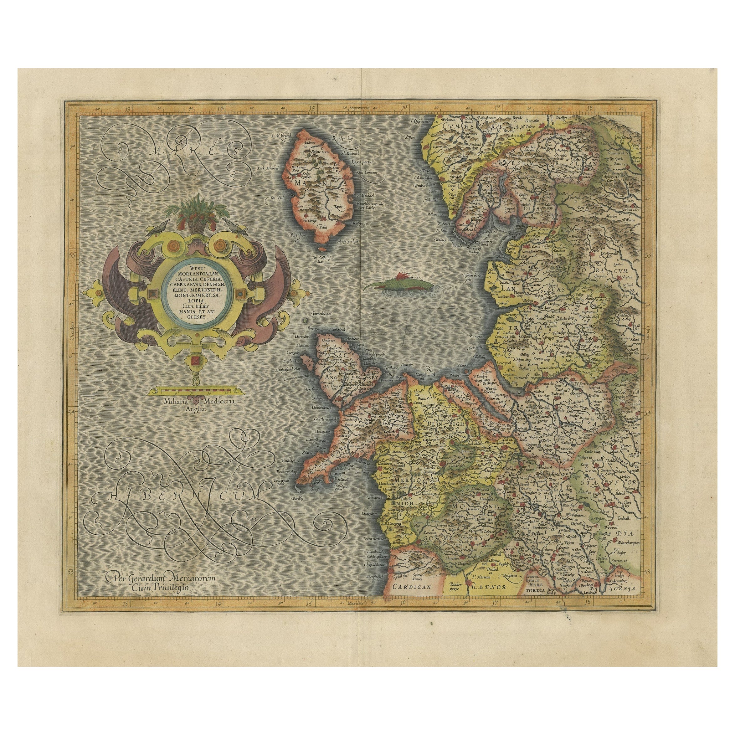
- Antique Map of England by Mercator/Hondius, circa 1600Located in Langweer, NLAntique map titled 'Westmorlandia, Lancastria, Caernvan, Denbigh, Flint, Merionidh, Dalopia cum issulis Mania et Anglesey'. Original antique map of England...Category
Antique 16th Century Maps
MaterialsPaper
- Antique Map of the Northeast of England by Mercator 'circa 1620'Located in Langweer, NLAntique map titled 'Eboracum Lincolnia, Derbia, Staffordia, Notinghamia, Lecestria, Rutlandia, et Norfolcia'. Decorative early map of the northeast of England, comprising the countie...Category
Antique Early 17th Century Maps
MaterialsPaper
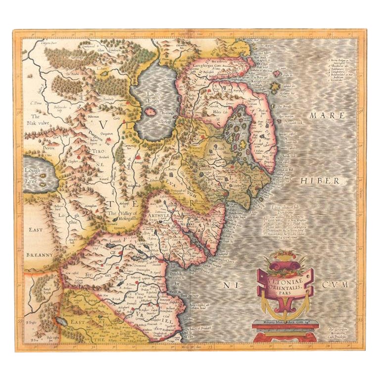
- Antique Map of Northern Ireland by Mercator/Hondius, Early 1600'sLocated in Langweer, NLAntique map titled 'Ultoniae Orientalis Pars'. Original antique map of Northern Ireland. Published by Mercator/Hondius, ca. 1600. Superb early map of the eastern part of Ulster, featuring Down and Antrim Counties in Northern Ireland. Mercator's famous moire pattern in the sea is used. Strong topographical features in the interior and ornamented with a title cartouche incorporating the distance scale. This was one of five Irish maps...Category
Antique 16th Century Maps
MaterialsPaper
- Antique Map of Styria by Mercator 'circa 1650'Located in Langweer, NLAntique map titled 'Stiria'. Original antique map of Styria, Austria. Published by G. Mercator, circa 1650.Category
Antique Mid-17th Century Maps
MaterialsPaper
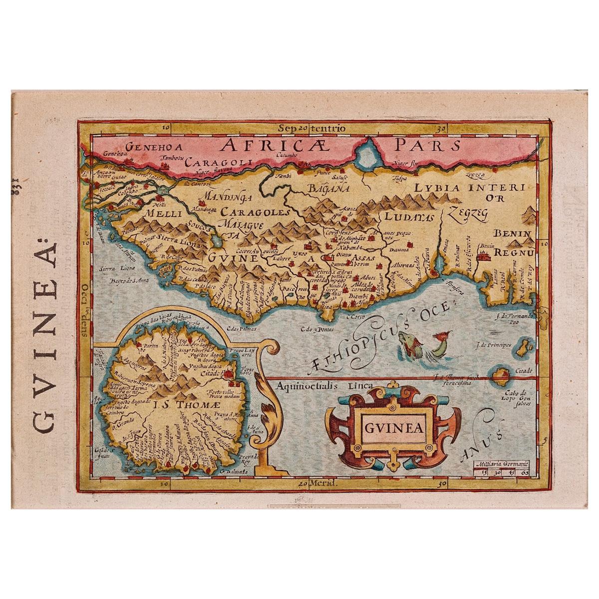
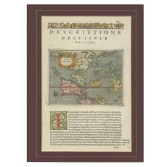
- Antique Map of the Moluccas by Porcacchi, 'circa 1620'Located in Langweer, NLAntique map titled 'Isole Molucche'. The map depicts the East Indies and Indochina, including modern-day Indonesia and the Philippines. The area covered stretches from the Bay of Bengal...Category
Antique Early 17th Century Maps
MaterialsPaper
- Antique Map of the Region of Beauvais by Hondius, circa 1630Located in Langweer, NLAntique map titled 'Beauvaisis - Comitatus Belovacium'. Old map of the region of Beauvais, France. This map originates from a composite atlas and is signed by J. Hondius.Category
Antique Mid-17th Century Maps
MaterialsPaper


You May Also Like
- 17th Century Hand-Colored Map of West Africa by Mercator/HondiusLocated in Alamo, CAA 17th century hand-colored map entitled "Guineae Nova Descriptio" by Gerard Mercator and Jodocus Hondius, published in their 'Atlas Minor' in Amsterdam in 1635. It is focused on the...Category
Antique Mid-17th Century Dutch Maps
MaterialsPaper
- 17th Century Hand-Colored Map of Southeastern England by Mercator and HondiusBy Gerard MercatorLocated in Alamo, CAA 17th century copperplate hand-colored map entitled "The Sixt Table of England" by Gerard Mercator and Jodocus Hondius, published in Amsterdam in 1635 in 'Cosmographicall Descriptio...Category
Antique Mid-17th Century Dutch Maps
MaterialsPaper
- Southeastern Ireland: A 17th Century Hand Colored Map by Mercator and HondiusBy Gerard MercatorLocated in Alamo, CAA 17th century copperplate hand-colored map entitled "The Second Table of Ireland, Udrone" by Gerard Mercator and Jodocus Hondius, published in Amsterdam in 1635 in 'Cosmographicall ...Category
Antique Mid-17th Century Dutch Maps
MaterialsPaper
- 17th Century Hand-Colored Map of Valencia and Murcia, Spain by Mercator/HondiusBy Gerard MercatorLocated in Alamo, CAA 17th century hand-colored map entitled "Regni Valentiae Typus, Valentia and Murcia" by Gerard Mercator and Joducus Hondius, published in Amsterdam in 1635 in 'Cosmographicall Descr...Category
Antique Mid-17th Century Dutch Maps
MaterialsPaper
- Antique 1630 Colored Belgium Map Flandria Gallica Flanders Henricus HondiusLocated in Dayton, OH"Antique hand colored map of Flanders, Belgium, circa 1630, engraved by Henricus Hondius. “Henricus Hondius II (1597 – 16 August 1651) was a Dutch eng...Category
Antique Early 17th Century Renaissance Maps
MaterialsPaper
- Northern Scotland: A 16th Century Hand-colored Map by MercatorBy Gerard MercatorLocated in Alamo, CAA framed hand-colored 16th century map of Northern Scotland by Gerard Mercator entitled "Scotiae pars Septentrionalis", published in Amsterdam in 1636. It is a highly detailed map of the northern part of Scotland, with the northwest Highlands and the cities Inverness and Aberdeen, as well as the Orkney Islands and the Hebrides. There is a decorative title cartouche in the upper left corner. The map is presented in an antiqued brown wood...Category
Antique 16th Century Dutch Maps
MaterialsPaper


Recently Viewed
View AllMore Ways To Browse
17th Century Antiques
Scale Map
Antique Maps Germany
Antique Map Of Germany
Antique Maps Of Germany
European Antique Portrait
Antique German Scales
Antique German Scale
Antique Town Maps
Antique German Portrait
Old Maps Of Europe
Old Europe Map
Circa 1620
Antique Apps
Antique App
18 German Century Portrait
Used Furniture Apps
Used Furniture App