Items Similar to Decorative Ancient World Map with Large Parts of the World Still Unknown, c 1731
Want more images or videos?
Request additional images or videos from the seller
1 of 6
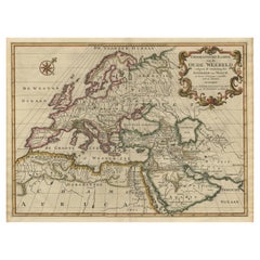
Decorative Ancient World Map with Large Parts of the World Still Unknown, c 1731
About the Item
Interesting ancient map of the world, based upon Strabo. The Southern tip of Africa is undiscovered. No sign of Japan, the Korean Peninsula or Australia and Oceana. Excellent NE Passage display. A marvelous world map, based upon 2000 year old geography. From an early edition of Cellarius' Notitia Orbis Antiqui (...) which was published in London, Amsterdam and other places over the next 100 years and was one of the most popular Ancient Geographies of its time.
Map maker/ publisher: Cellarius
Map title: Veteris orbis climata ex strabone
Year: 1731
Original copper engraving
Verso: blank. Condition: Good. later Hand Colouring. Minor foxing overall, but still very decorative and interesting print. The paper not strong, but without repairs, tears wormholes and wrinkles. Folding line in the middle.
- Dimensions:Height: 9.45 in (24 cm)Width: 14.57 in (37 cm)Depth: 0 in (0.02 mm)
- Materials and Techniques:
- Period:1730-1739
- Date of Manufacture:1731
- Condition:Wear consistent with age and use. Verso: blank. Condition: Good. later Hand Colouring. Minor foxing overall, but still very decorative and interesting print. The paper not strong, but without repairs, tears wormholes and wrinkles. Folding line in the middle.
- Seller Location:Langweer, NL
- Reference Number:
About the Seller
5.0
Platinum Seller
These expertly vetted sellers are 1stDibs' most experienced sellers and are rated highest by our customers.
Established in 2009
1stDibs seller since 2017
1,909 sales on 1stDibs
Typical response time: <1 hour
- ShippingRetrieving quote...Ships From: Langweer, Netherlands
- Return PolicyA return for this item may be initiated within 14 days of delivery.
More From This SellerView All
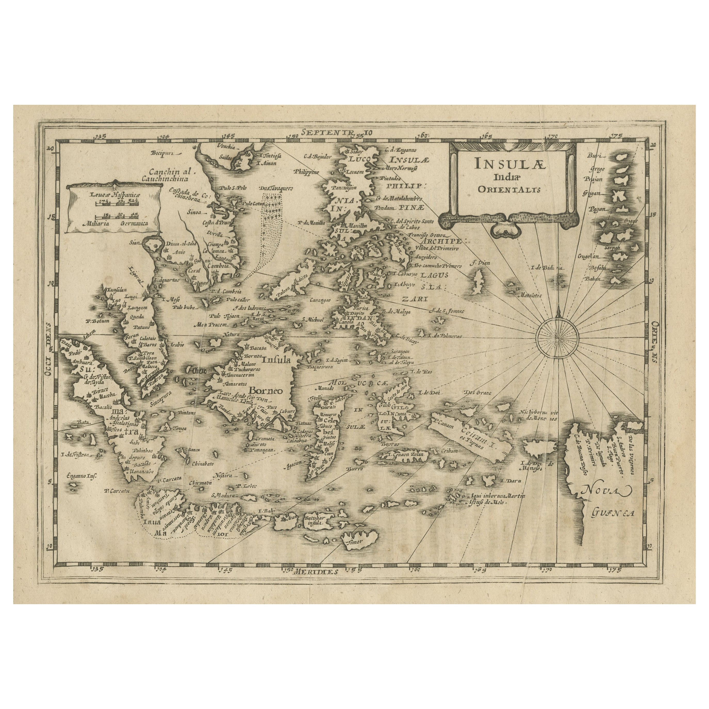
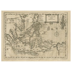
- Early Original Antique Map of South East Asia with Large Parts Still UnknownLocated in Langweer, NLAntique map titled 'Insulae Indiae Orientalis'. Original antique map of Southeast Asia. Shows towns, villages, landmarks, mountains, and rivers. Relief shown pictorially. This map or...Category
Antique Late 17th Century Maps
MaterialsPaper
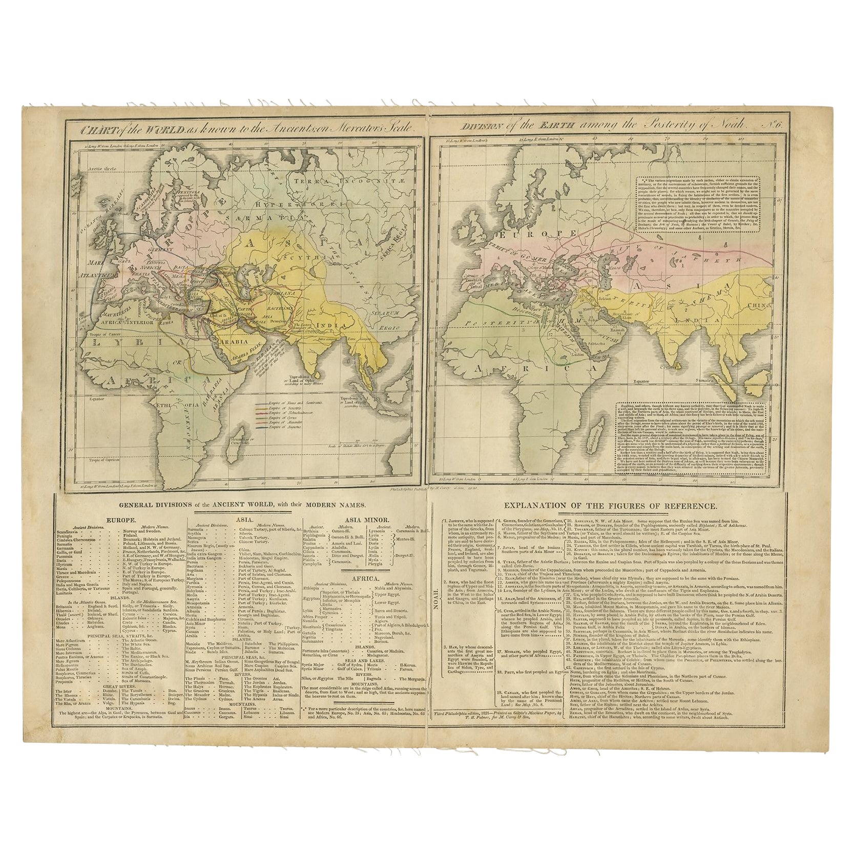
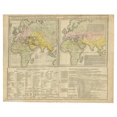
- Maps of the Ancient World and the Posterity of Noah, 1820Located in Langweer, NLTwo maps on one sheet. Hhand colored engraved lithograph, depicting the world as known to the Ancients on Mercator's projection and the Posterity of Noah. The first showns the Empire...Category
Antique 19th Century Prints
MaterialsPaper
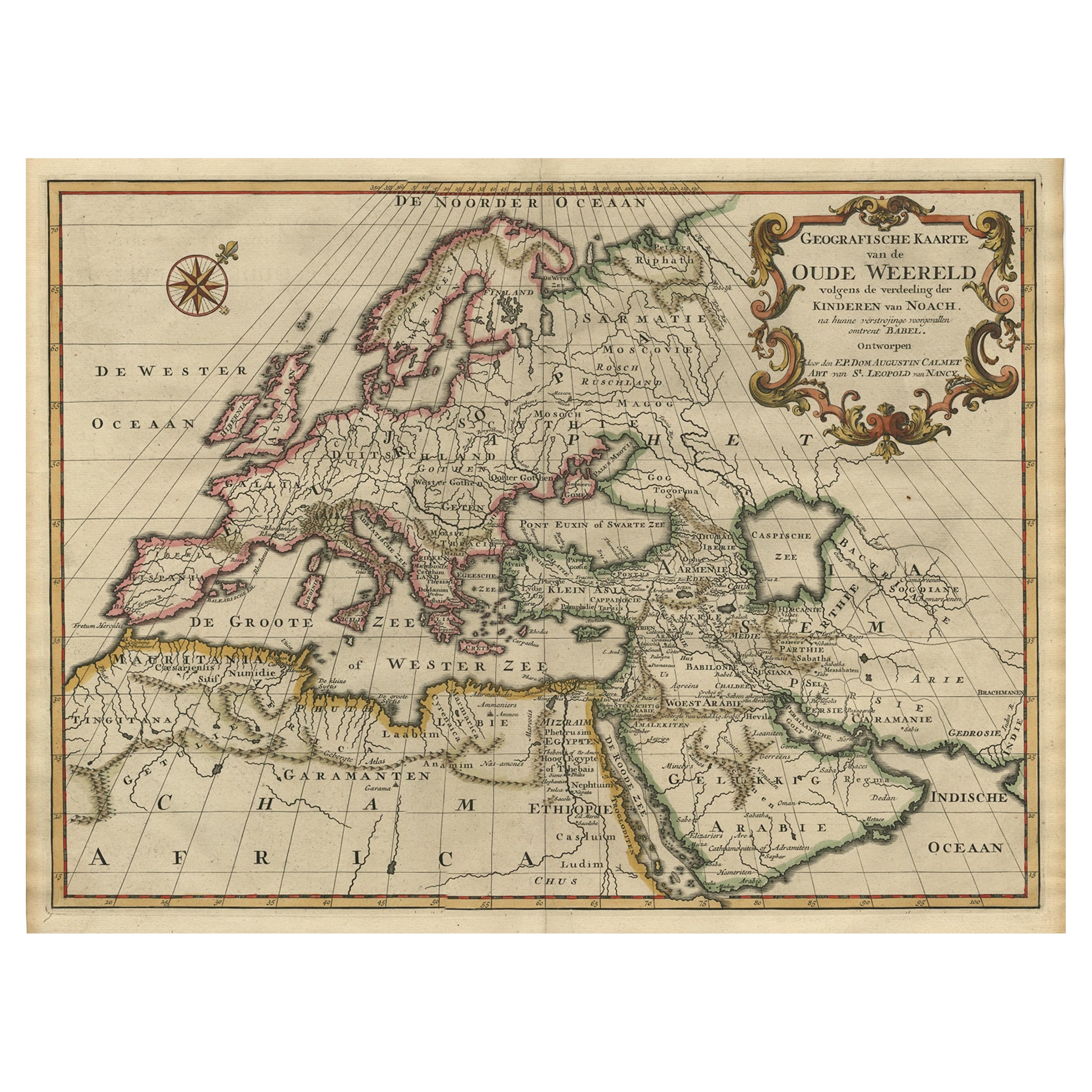
- Ancient World Map of Europe, Asia & Northern Africa with Ancient Names, 1725Located in Langweer, NLAntique map titled 'Geografische Kaarte van de Oude Weereld (..).' Original antique map of the ancient world depicting Europe, Asia, and northern Africa with ancient place names....Category
Antique 1720s Maps
MaterialsPaper
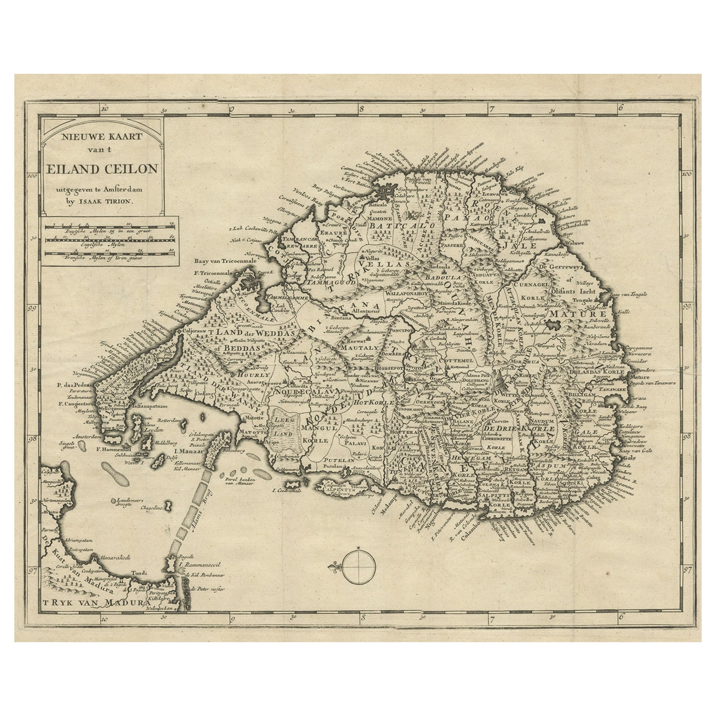
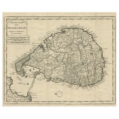
- Old Map of Ceylon 'Sri Lanka' with The North Oriented to The Left, 1731Located in Langweer, NLDescription: Antique map Ceylon titled 'Nieuwe Kaart van t Eland Ceilon'. Old map of present-day Sri Lanka with north oriented to the left. The ...Category
Antique 1730s Maps
MaterialsPaper
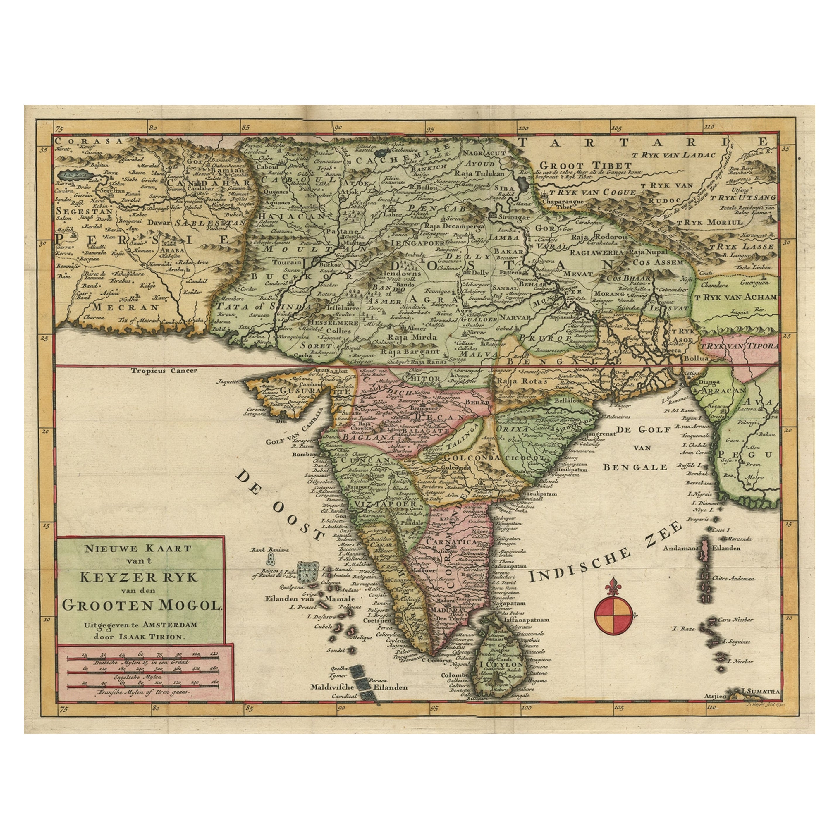
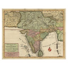
- Attractive Detailed Map of the Empire of the Great Mogul, Incl India, 1731Located in Langweer, NLAntique map titled 'Nieuwe Kaart van t Keyzer Ryk Grooten Mogol.' Attractive detailed map of the Empire of the Great Mogul, which included India, Sri Lanka, Pakistan and Banglade...Category
Antique 1730s Maps
MaterialsPaper
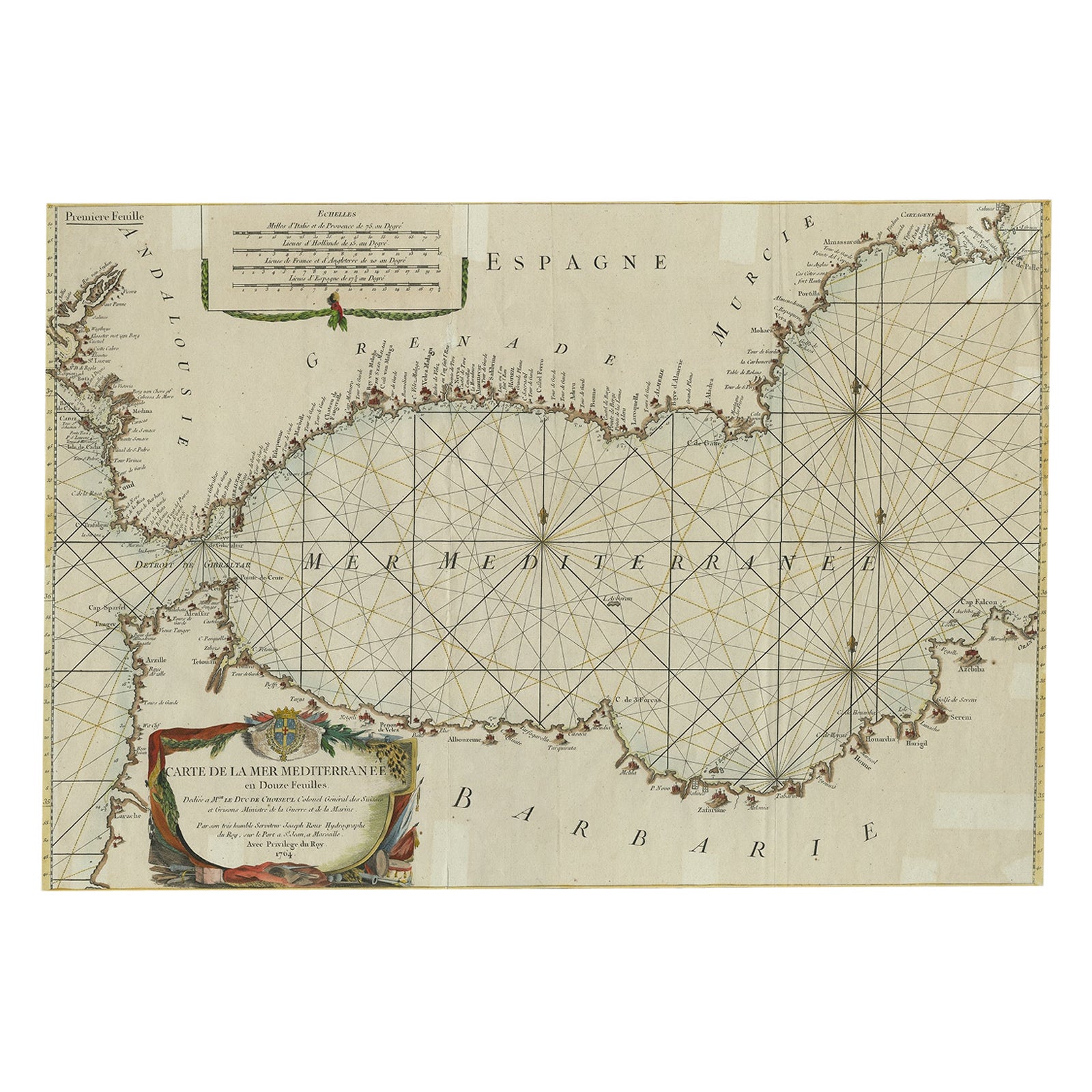
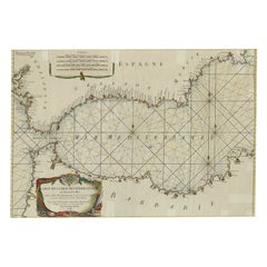
- Large Decorative Antique Map of the Mediterranean, ca.1770Located in Langweer, NLAntique map titled 'Carte de la Mer Mediterranee en Douze Feuilles'. First map out of twelve fine engraved double-page and folding maps that join to create a large wall map...Category
Antique 1770s Maps
MaterialsPaper
You May Also Like
- Original Antique Map of The World by Thomas Clerk, 1817Located in St Annes, LancashireGreat map of The Eastern and Western Hemispheres On 2 sheets Copper-plate engraving Drawn and engraved by Thomas Clerk, Edinburgh. Published by Mackenzie And Dent, 1817 ...Category
Antique 1810s English Maps
MaterialsPaper
- Original Antique Map of Ancient Greece, Achaia, Corinth, 1786Located in St Annes, LancashireGreat map of Ancient Greece. Showing the region of Thessaly, including Mount Olympus Drawn by J.D. Barbie Du Bocage Copper plate engraving by P.F Tardieu Original hand color...Category
Antique 1780s French Other Maps
MaterialsPaper
- Original Antique Map of Ancient Greece- Boeotia, Thebes, 1787Located in St Annes, LancashireGreat map of Ancient Greece. Showing the region of Boeotia, including Thebes Drawn by J.D. Barbie Du Bocage Copper plate engraving by P.F T...Category
Antique 1780s French Other Maps
MaterialsPaper
- Map of the Republic of GenoaLocated in New York, NYFramed antique hand-coloured map of the Republic of Genoa including the duchies of Mantua, Modena, and Parma. Europe, late 18th century. Dimension: 25...Category
Antique Late 18th Century European Maps
- Map "Estuary- Mouth of the Thames"Located in Alessandria, PiemonteST/426 - Antique French Map of the estuary of the Thames, map dated 1769 - "Mape of the entrance of the Thames. Designed by filing of Navy cards fo...Category
Antique Mid-18th Century French Other Prints
MaterialsPaper
- Large Antique 1859 Map of North AmericaLocated in Sag Harbor, NYThis Map was made by Augustus Mitchell in 1859 It is in amazing condition for being 163 years old. This price is for the rolled up easy to ship version of this piece. I will be Frami...Category
Antique Mid-19th Century American Maps
MaterialsCanvas, Paper


Recently Viewed
View AllMore Ways To Browse
Old World Furniture
Antique World Map Print
Large Map Of The World
Antique Old World Map
Old World Antique Map
Old Antique World Map
Old World Antique Maps
Antique Old Map Of The World
Large World Map
Antique London Map Print
Map Japan
Japan Maps
Map Of Japan
Large Antique World Maps
Large Antique World Map
Antique World Map Large
Large Antique Map Of The World
Antique Collectables Australia