20th Century Maps
64
417
to
50
364
52
417
417
417
13
8
5
4
4
2
1
1
1
2,903
2,128
417
5
231
33
11
85
7
59
8
3
3
5
5
2
385
25
20
19
14
95
62
39
36
31
9
3
1
1
1
Period: 20th Century
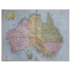
Large Original Vintage Map of Australia, circa 1920
Located in St Annes, Lancashire
Great map of Australia
Original color. Good condition
Published by Alexander Gross
Unframed.
Category
English Vintage 20th Century Maps
Materials
Paper
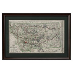
"Clason's Guide Map of Montana" by The Clason Map Company, Circa 1920s
Located in Colorado Springs, CO
Presented is “Clason's Guide Map of Montana,” published in the early 1920s by the Clason Map Company. Issued as a folding map, this map identifies county boundaries, county seats, Na...
Category
American Art Deco Vintage 20th Century Maps
Materials
Paper
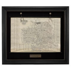
1915 "San Francisco City and County" Hanging Map by W. Bashford Smith
Located in Colorado Springs, CO
Presented is a rare wall map of San Francisco by W. Bashford Smith. Published in San Francisco in 1915, this map indicates streets and city districts, and, most notably, shows the si...
Category
American Art Deco Vintage 20th Century Maps
Materials
Wood, Paper
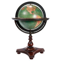
Antique Kittinger 8-inch Terrestrial World Globe on a Mahogany Wooden Stand
Located in Philadelphia, PA
A fine, antique 8 inch terrestrial globe.
Manufactured by Kittinger Company, Inc. (in collaboration with the publishers W. & A.K. Johnston, Ltd. of Edinburgh, Scotland).
On a turne...
Category
20th Century Maps
Materials
Mahogany, Gesso, Wood, Paper
Early 20th Century Terrestrial Globe by G. Thomas Paris
Located in Pease pottage, West Sussex
Early 20th Terrestrial Globe by G. Thomas. 44 Rue ND des Champs, Paris. Found on original ebonised turned base and brass fittings. Paris, France Circa 1920.
Category
French 20th Century Maps
Materials
Wood, Paper
Cram's 16" Deluxe Globe W/Daily Sun Ray and Season Indicator
Located in San Francisco, CA
Cram's 16" Deluxe Globe W/Daily Sun Ray and Season Indicator
1936
Category
Vintage 20th Century Maps
Materials
Metal
Antique Map of the Region of Tokyo and Nagasaki in Japan, 1922
Located in Langweer, NL
Antique map of Japan titled 'Japan - Environs of Tokio & Nagasaki'. Old map of Japan, includes inset maps of Tokyo, Nagasaki and surroundings. This map or...
Category
20th Century Maps
Materials
Paper
Art Deco Cartoon Style Map of Paris possibly by Arthur Zaindenberg circa 1930's
By Arthur Zaidenberg
Located in New York, NY
Art Deco cartoon style map of Paris possibly by Arthur Zaidenberg. The map depicts witty references to Parisians lifestyle, along with drawings of notable landmarks, circa 1930's. T...
Category
American Art Deco Vintage 20th Century Maps
Materials
Paper
Large Original Vintage Map of The World, circa 1920
Located in St Annes, Lancashire
Great map of The World
Original color.
Good condition / minor foxing
Published by Alexander Gross
Unframed.
Category
English Vintage 20th Century Maps
Materials
Paper
16-Inch Terrestrial Globe 1986 National Geographic
Located in Ottawa, Ontario
A 16-INCH TERRESTRIAL GLOBE 1986
NATIONAL GEOGRAPHIC
Large terrestrial globe with paper gores
on a stylish black lucite base
scale 1: 31,350,000
18" inches, (45.5cm.) high.
16" in...
Category
American Modern 20th Century Maps
Materials
Metal
Mariners Chart of Quicks Hole and Tarpaulin Cove by George Eldridge 1901
Located in Norwell, MA
Nautical chart showing the harbor and local waters of Naushon Island Quick Holes. The chart display depths buoys, lightness, etc., The chart shows the cove in Naushon with ships stor...
Category
North American Antique 20th Century Maps
Materials
Paper
Topographical and Administrative Cartography of Segovia in Spain, 1902
Located in Langweer, NL
An original old map of the province of Segovia from the year 1902. Segovia is a historic area located in the central part of Spain, northwest of Madrid. Known for its rich history, a...
Category
Antique 20th Century Maps
Materials
Paper
Atlantic Eden: The Azores and Madeira Archipelagos in 1903
Located in Langweer, NL
This original antique print is a historical map titled "PORTUGAL INSULAR," which translates to "Insular Portugal." It shows the Portuguese archipelagos of the Azores and Madeira, wit...
Category
Antique 20th Century Maps
Materials
Paper
Isles of Enchantment: The Balearic Archipelago in 1902
Located in Langweer, NL
The Balearic Islands, Spain, from the year 1902. The title on the map is "ISLAS BALEARES 1902." This map illustrates the Balearic archipelago in the Mediterranean Sea, highlighting t...
Category
Antique 20th Century Maps
Materials
Paper
European Vintage Earth Globe on Stand with Compass
Located in Sofia, BG
Vintage handmade world globe standing on a base with small compass in the bottom. The piece is in fare condition with no restaurations ever made.
France, circa 1950
Category
French 20th Century Maps
Materials
Plastic, Paper
Vintage Reproduction 17th Century Map of Europe, American, Cartography, Blaeuw
Located in Hele, Devon, GB
This is a vintage reproduction map of Europe. An American, paper stock cartography print in frame after the work by Blaeuw, dating to the late 20t...
Category
Central American Mid-Century Modern 20th Century Maps
Materials
Glass, Wood, Paper
Ávila in a Historical Map of 1902: A Geographic and Administrative Overview
Located in Langweer, NL
The map is of the province of Ávila, one of the provinces of the autonomous community of Castile and León in Spain, and it is dated from 1902. The map illustrates several geographic ...
Category
Antique 20th Century Maps
Materials
Paper
Álava in Northern Spain: The Geography of Basque Heritage and Terrain, 1902
Located in Langweer, NL
This original antique map is a historical depiction of the province of Álava (in Basque: Araba), which is one of the provinces of the Basque Country in northern Spain, as indicated b...
Category
Antique 20th Century Maps
Materials
Paper
Ciudad Real 1902: A Detailed Cartographic Survey of La Mancha in Spain
Located in Langweer, NL
This original antitque map presents the province of Ciudad Real, located in the autonomous community of Castilla-La Mancha in central Spain, as of 1902. It includes several notable f...
Category
Antique 20th Century Maps
Materials
Paper
Map of Sevilla Province, 1901: A Depiction of The Spanish Cultural Heartland
Located in Langweer, NL
The print for sale here depicts a historical map of the province of Sevilla (Seville) from the year 1901. Sevilla is located in the southern part of Spain and is part of the autonomo...
Category
Antique 20th Century Maps
Materials
Paper
Albacete, Spain - 1902: A Cartographic Depiction of Landscape and Infrastructure
Located in Langweer, NL
Albacete, Spain - 1902: A Cartographic Depiction of Landscape and Infrastructure
An original and historical map of the province of Albacete, dated 1902, from the "Atlas Geográfico I...
Category
Antique 20th Century Maps
Materials
Paper
Cartographic Heritage: The 1901 Map of the Vizcaya Province in Spain
Located in Langweer, NL
This is a historical map of the province of Vizcaya (Biscay) in Spain, dated 1901. The title on the map is "VIZCAYA. 1901." It shows the topographical details of the region with cont...
Category
Antique 20th Century Maps
Materials
Paper
Gipuzkoa 1902: A Cartographic Snapshot of the Basque Coastline and Highlands
Located in Langweer, NL
The map showcases the province of Gipuzkoa (also known as Guipúzcoa in Spanish), which is part of the autonomous community of the Basque Country in northern Spain, as of the year 190...
Category
Antique 20th Century Maps
Materials
Paper
Islands of Fire and Whispers: The Canary Islands in 1902
Located in Langweer, NL
This is a authentic historical map of the Canary Islands, specifically the "1A HOJA" or first sheet, from the year 1902. The title on the map is "ISLAS CANARIAS 1902." This map featu...
Category
Antique 20th Century Maps
Materials
Paper
The Lay of the Land: A 1901 Topographic Map of Oviedo, Asturias
Located in Langweer, NL
The province depicted on the historical map on offer, Oviedo, corresponds to the modern-day autonomous community of Asturias in northwestern Spain. Here are some points about Asturia...
Category
Antique 20th Century Maps
Materials
Paper
Toledo 1902: A Historical Cartographic Study of this Spanish Province
Located in Langweer, NL
The print is a historical map of the province of Toledo from 1902. It's a detailed, colored map, highlighting topographical features, such as mountain ranges and rivers, as well as i...
Category
Antique 20th Century Maps
Materials
Paper
La Coruña 1901: A Cartographic View of Galicia's Maritime Province
Located in Langweer, NL
This antique map for sale showcases the province of La Coruña (in Galician, A Coruña), located in the northwest of Spain, within the autonomous community of Galicia, as of the year 1...
Category
Antique 20th Century Maps
Materials
Paper
Teruel 1901: A Cartographic Depiction of Heritage and Natural Splendor in Spain
Located in Langweer, NL
Original antique map of Teruel in Spain, with highlighted gold. The province of Teruel, located in the region of Aragon in eastern Spain, is known for several unique features:
1. **Mudejar Architecture**: Teruel is famous for its well-preserved Mudejar architecture, which is a style that is a fusion of Christian and Islamic design. This includes notable examples like the Tower of El Salvador and the Teruel Cathedral, both of which are UNESCO World Heritage sites.
2. **Dinopolis**: It hosts Dinópolis, a paleontological park that is one of the largest of its kind in Europe, featuring dinosaur fossils and interactive...
Category
Antique 20th Century Maps
Materials
Paper
Zamora: A Mosaic of Romanesque Heritage and Natural Wonders in Spain, 1901
Located in Langweer, NL
This authentic antique print is a historical map of the province of Zamora, Spain, from the year 1901. The title on the map is "ZAMORA. 1901." As with the previous map, it displays t...
Category
Antique 20th Century Maps
Materials
Paper
Lugo 1901: A Cartographic Chronicle of Galicia's Ancient Roman Walled City
Located in Langweer, NL
The map presents the province of Lugo, located in the autonomous community of Galicia in northwestern Spain, as it was in 1901. Notable features include:
- **Topography**: The provi...
Category
Antique 20th Century Maps
Materials
Paper
An Antique Map of Extremadura: Crossroads of History and Nature, 1903
Located in Langweer, NL
The image is a historical map of Extremadura, an autonomous community of Spain, from an unspecified year. The map features the region's topography, including mountain ranges, river s...
Category
Antique 20th Century Maps
Materials
Paper
Guadalajara 1902: A Cartographic Image of Castilla-La Mancha's Northern Province
Located in Langweer, NL
The map illustrates the province of Guadalajara, part of the autonomous community of Castilla-La Mancha in Spain, as of 1902. The map includes various geographic and infrastructural ...
Category
Antique 20th Century Maps
Materials
Paper
Barcelona 1901: A Cartographic Portrait of Catalonia's Capital Province
Located in Langweer, NL
This orignal antique map is a historical depiction of the province of Barcelona from 1901.
It showcases the varied terrain of the province, with the Serra de Collserola ridge near the city of Barcelona and the Pyrenees to the north. The map includes the coastline along the Mediterranean Sea, indicating Barcelona's position as a coastal province. Blue lines indicate rivers, such as the Llobregat and Besòs, which are significant features in the province's geography. Dotted lines may signify the borders of the province within Catalonia.
The coat of arms of Barcelona, highlighted with gold, is prominently displayed, featuring the Cross of Saint George (Cruz de Sant Jordi), the patron saint of Catalonia, and the red and yellow bars which are a symbol of the Aragonese and Catalan heritage.
About the province of Barcelona:
The province of Barcelona is part of the autonomous community of Catalonia in northeastern Spain. It is the most economically significant region of Catalonia, playing a crucial role in the country's economy due to its port, manufacturing, and service industries. The city of Barcelona is the capital and the second most populous city in Spain, known for its rich cultural heritage, architecture by Antoni Gaudí, such as the Sagrada Família, and its influential art scene. The province enjoys a Mediterranean climate and features diverse landscapes from the beaches along the coast to the mountains in the interior. Barcelona is also known for its vibrant festivals, cuisine, fashion, and sports, particularly football, being home to FC Barcelona...
Category
Antique 20th Century Maps
Materials
Paper
Colonial Crossroads: Angola and Mozambique in 1903
Located in Langweer, NL
The image for sale is an original historical map from 1903 that shows the Portuguese colonies of Angola on the left and Mozambique on the right. These two territories on the African ...
Category
Antique 20th Century Maps
Materials
Paper
Islands of Diversity: Portugal's Atlantic Archipelagos in 1903
Located in Langweer, NL
The image is an original historical map from 1903 depicting Portuguese possessions in the Atlantic Ocean, specifically the islands of Cape Verde and the islands of São Tomé and Prínc...
Category
Antique 20th Century Maps
Materials
Paper
Almería 1901: Coastal Contours and Landscapes in a Map of Southeastern Spain
Located in Langweer, NL
An original antique map of the province of Almería, Spain, from the year 1901.
The Mediterranean Sea, labeled as "Mar Mediterraneo," forms the southeastern boundary of the province...
Category
Antique 20th Century Maps
Materials
Paper
Granada 1902: A Cartographic Exploration of Andalusia's Mountainous Province
Located in Langweer, NL
This original antique map depicts the province of Granada, part of the autonomous community of Andalusia in southern Spain, as of 1902. The map features several important details:
I...
Category
Antique 20th Century Maps
Materials
Paper
Cuenca 1901: A Historical Cartographic Detailing of High Plains and Mountains
Located in Langweer, NL
The original antique map displays the province of Cuenca, located in the autonomous community of Castilla-La Mancha in central Spain, as of 1901. Here are some of its features:
It i...
Category
Antique 20th Century Maps
Materials
Paper
Douro: The River of Tradition and Wine in Portugal, 1903
Located in Langweer, NL
The uploaded image is a historical map of the Beira Baixa region in Portugal. The map details the topography, including mountain ranges and river systems, as well as the transportati...
Category
Antique 20th Century Maps
Materials
Paper
Madrid 1901: A Historical Map of Spain's Capital Province
Located in Langweer, NL
The map is of the province of Madrid, the capital region of Spain, as it appeared in 1901. Here are the key features it displays:
The map shows the central part of Spain, with the Guadarrama mountain range prominently visible, marking the natural border to the north of Madrid.
Blue lines likely indicate rivers, including the Manzanares River, which flows through Madrid, and the Jarama River, a tributary to the Tagus.
Red lines depict the roads and railways, outlining the infrastructure that connects Madrid's various towns and cities within the province and beyond.
Symbols and labels mark the locations of cities, towns, and villages, with Madrid itself likely being the focal point. Dotted lines may represent the administrative divisions within the province. The map includes a legend (Signos Convencionales) that explains the symbols used for provincial capitals, roads, railways, and other geographic features.
The coat of arms of Madrid, featuring a bear and a strawberry tree (madroño), is prominently featured, symbolizing the city's and the province's historical coat of arms.
About the province of Madrid:
Madrid is not only the capital of Spain but also the heart of the Iberian Peninsula, both geographically and politically. The city is renowned for its rich repositories of European art, including the Prado Museum's works by Goya, Velázquez, and other Spanish masters. The province of Madrid is characterized by a blend of historical and modern elements, with a rich cultural life that includes theater, opera, and flamenco, as well as gastronomy that features a mix of traditional Spanish dishes and international cuisine...
Category
Antique 20th Century Maps
Materials
Paper
Orense in Depth: A 1902 Topographical Map of Galicia's Mountainous Province
Located in Langweer, NL
The map is a detailed cartographic representation of the province of Orense (Ourense in Galician), located in the northwest of Spain, as it was in 1902. Here's a brief description an...
Category
Antique 20th Century Maps
Materials
Paper
Córdoba 1901: A Cartographic Journey Through Andalusia’s Heartland in Spain
Located in Langweer, NL
The map provided is of the province of Córdoba, part of the autonomous community of Andalusia in southern Spain, as of the year 1901. It details various elements:
The map displays the varied terrain of Córdoba, including the Sierra Morena to the north and the beginning of the Subbaetic Range to the south. It shows blue lines indicating rivers, most likely including the Guadalquivir River, which runs through the province. Red lines represent the transportation network of roads and railways, detailing how the province is interconnected.
Symbols on the map mark the locations of cities, towns, and villages, with the capital city of Córdoba highlighted. Dotted lines suggest the borders of the province within the region of Andalusia. A legend (Signos Convencionales) details the symbols used for provincial capitals, roads, railways, and other features. A scale in kilometers is included to assist in measuring distances between points on the map.
The coat of arms of Córdoba is prominently featured, displaying a castle and a lion, which are common heraldic symbols with historical significance to the region.
About the province of Córdoba:
Córdoba is historically significant, known for its cultural heritage, particularly during the time when it was the capital of the Islamic Emirate and then Caliphate of Córdoba. This period left a lasting architectural mark, notably the Mezquita-Catedral (Mosque-Cathedral), which is a UNESCO World Heritage site. The province's geography is diverse, with fertile valleys in the Guadalquivir basin and extensive olive groves, making it one of the most important areas for olive oil production...
Category
Antique 20th Century Maps
Materials
Paper
Beira Alta: A Cartographic Journey Through Portugal's Heartland in 1903
Located in Langweer, NL
The uploaded image is a historical map of the Beira Alta region in Portugal. The map is detailed, showing the topography, hydrography, and transportation networks of the region, incl...
Category
Antique 20th Century Maps
Materials
Paper
Cáceres 1901: Mapping the Crossroads of Extremadura, Western Spain
Located in Langweer, NL
The map depicts the province of Cáceres in Spain, dated 1901. Key features of the map include:
The map shows detailed contour lines indicating the diverse terrain, which includes the northern part of the province being part of the Sistema Central mountain range. Blue lines mark the rivers and larger bodies of water, likely including the Tagus River, which passes through the province. Red lines indicate roads and railways, highlighting the connections within the province and to neighboring areas.
The coat of arms of Cáceres is featured prominently, displaying a castle and a lion, symbols associated with the historical heritage of the region. It is highlighted with a gold coating in the crown.
About the province of Cáceres:
Cáceres is one of the two provinces in the autonomous community of Extremadura, in western Spain, bordering Portugal. The province is known for its extensive natural environments, including part of the Monfragüe National Park, which is a UNESCO-designated Biosphere Reserve, and the Tagus River International Natural Park. The capital city, also named Cáceres, boasts a well-preserved old town with a wealth of Renaissance architecture...
Category
Antique 20th Century Maps
Materials
Paper
Maritime and Terrestrial Survey of Spanish Santander in 1901, An Original Map
Located in Langweer, NL
This antique map is a historical map of the province of Santander (currently known as Cantabria) from the year 1901. Santander is located along the northern coast of Spain, bordering...
Category
Antique 20th Century Maps
Materials
Paper
Trás-os-Montes: A Cartographic Exploration of Portugal's Hidden Province in 1903
Located in Langweer, NL
This print is an original historical map of the Trás-os-Montes region in the northeastern part of Portugal, dated 1903. Trás-os-Montes is often translated as "behind the mountains," ...
Category
Antique 20th Century Maps
Materials
Paper
Antique Map of Alentejo: Land of Tradition and Tranquility, 1903
Located in Langweer, NL
The image is a historical original antique map of the Alentejo region in Portugal. This map includes the topographical layout of the region, with its complex network of roads and wat...
Category
Antique 20th Century Maps
Materials
Paper
Original Antique Map of Palencia Province, in Northern Spain, 1901
Located in Langweer, NL
This historical map is of Palencia, a province in the northern part of Spain.
Palencia is situated within the autonomous community of Castilla y León. It is bordered by the provinc...
Category
Antique 20th Century Maps
Materials
Paper
Málaga 1901: A Cartographic Detailing of Andalusia's Coastal Jewel
Located in Langweer, NL
The map depicts the province of Málaga, located in the autonomous community of Andalusia in southern Spain, as it was in 1901. Here are the key features illustrated on the map:
- **...
Category
Antique 20th Century Maps
Materials
Paper
Volcanic Eden: The Canary Islands’ Tapestry of Land and Sea in 1902
Located in Langweer, NL
The map is the second sheet (2ª HOJA) of a historical map series of the Canary Islands from 1902. It depicts three of the major islands: Gran Canaria, Fuerteventura, and Lanzarote, a...
Category
Antique 20th Century Maps
Materials
Paper
Beira Baixa: A Cartographic Portrait of Portugal's Historic Frontier in 1903
Located in Langweer, NL
The uploaded image is a historical map of the Beira Baixa region in Portugal. The map details the topography, including mountain ranges and river systems, as well as the transportati...
Category
Antique 20th Century Maps
Materials
Paper
Cartographic Survey of Pontevedra, 1902: Crossroads of Galicia"
Located in Langweer, NL
This original old map of over 100 years old depicts the province of Pontevedra as it was in 1902. Pontevedra is located in the northwest of Spain, in the autonomous community of Gali...
Category
Antique 20th Century Maps
Materials
Paper
Jaén 1902: A Cartographic Depiction of Andalusia's Olive Heartland
Located in Langweer, NL
This original antique map displays the province of Jaén, located in the autonomous community of Andalusia in southern Spain, as of the year 1902. It contains various geographic and i...
Category
Antique 20th Century Maps
Materials
Paper
Minho: A Legacy of Lush Landscapes and Living Traditions in Portugal, 1903
Located in Langweer, NL
Ths authentic print is a historical map of the Minho region in the northwestern part of Portugal. The map includes detailed geographical features, such as rivers, mountain ranges, an...
Category
Antique 20th Century Maps
Materials
Paper
Algarve: A Tapestry of Sea and Sunlight in an Antique Map, 1903
Located in Langweer, NL
The image is a historical map of the Algarve, the southernmost region of Portugal. The map is titled "FARO. ALGARVE," indicating that it is centered around the city of Faro, which is...
Category
Antique 20th Century Maps
Materials
Paper
Cádiz 1901: Nautical Crossroads of the Atlantic and Mediterranean
Located in Langweer, NL
The map illustrates the province of Cádiz, located in the autonomous community of Andalusia, Spain, from the year 1901. It displays various geographic and man-made features:
The map...
Category
Antique 20th Century Maps
Materials
Paper
Map of Soria Province, 1901: Detailed Cartography of Northeastern Spain
Located in Langweer, NL
The map is a historical map of the province of Soria from 1901.
A decorative coat of arms enhances the aesthetic of the map, signifying the historical and cultural significance of ...
Category
Antique 20th Century Maps
Materials
Paper
Badajoz 1901: A Cartographic Record of Extremadura's Largest Province in Spain
Located in Langweer, NL
This original antique map for sale is of the province of Badajoz, part of the autonomous community of Extremadura in Spain, dated 1901. It illustrates several important features:
Th...
Category
Antique 20th Century Maps
Materials
Paper
Recently Viewed
View AllMore Ways To Browse
Antique Nautical Maps
Antique Classroom
Antique Mexican Maps
Antique Nautical Map
Antique Map Box
Sea Chart Map
Antique Nautical Charts
King Charles I Of England
17th Century Corpus
Mexican Antique Map
Antique Celestial Map
Celestial Maps Antique
Antique Celestial Maps
Middle East Antique Map
Topographical Plate
Central America Map
Antique Map Middle East
Vintage Wooden Roller
