Artículos similares a Map of Doubs France with Besançon and Swiss Border Landscape, 19th Century


¿Quieres más imágenes o vídeos?
Solicita imágenes o vídeos adicionales al vendedor
1 de 10
Map of Doubs France with Besançon and Swiss Border Landscape, 19th Century
120 €IVA incluido
Envío
Recuperando presupuesto…La promesa de 1stDibs
Garantía de autenticidad,
Garantía de devolución de dinero,
Cancelación dentro de las 24 horas
Acerca del artículo
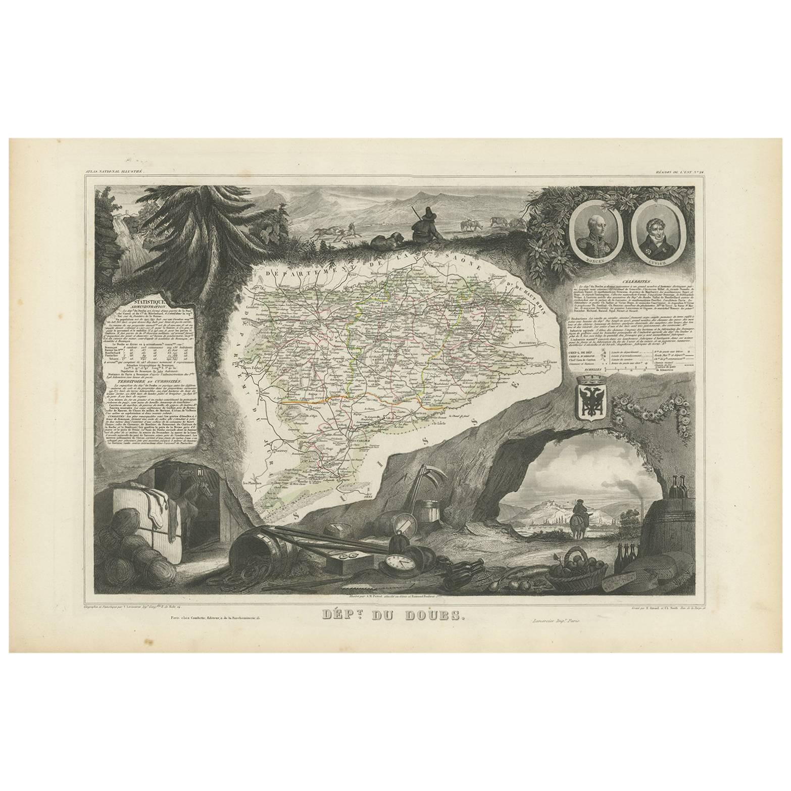
Map of Doubs France with Besançon and Swiss Border Landscape, 19th Century
Description:
This decorative 19th-century map of the department of Doubs in eastern France was drawn by Alexandre Vuillemin and published in Paris by Migeon as part of the *Nouvel Atlas Illustré*. Situated along the Swiss border, Doubs is a region defined by its mountainous terrain, rich natural beauty, and a long history of scientific and cultural achievement—all reflected in this finely engraved and hand-colored map.
The map shows the department in great detail, with towns, roads, rivers, and mountain ranges clearly engraved and bordered in soft violet watercolor. Besançon, the prefecture and historic heart of the region, is prominently displayed near the center. Other communes such as Montbéliard, Pontarlier, Morteau, and Baume-les-Dames are also clearly labeled.
In the lower left corner is a portrait of Georges Cuvier, the renowned naturalist and paleontologist born in Montbéliard. His scientific legacy is subtly honored in the floral and shell motifs surrounding his likeness. The vignette in the lower right captures the fortified city of Besançon along the Doubs River, nestled among hills and cliffs—an iconic scene that speaks to the city's strategic and cultural importance. The right edge also features the coat of arms of Doubs and a small image of the Saut du Doubs, a picturesque waterfall near the Swiss border.
Doubs is located within the Jura Mountains and forms part of the historic region of Franche-Comté. While not a major wine-producing department like nearby Burgundy, Doubs is known for its production of regional specialties including Comté cheese, smoked sausages, absinthe (especially around Pontarlier), and Jura wines from adjacent departments. Its mountainous terrain supports dairy farming, forestry, and small-scale viticulture along select valleys.
This map is not only a fine piece of decorative cartography, but also a celebration of Doubs’ blend of natural science, alpine beauty, and borderland heritage. It is ideal for collectors with interests in French geography, scientific history, or 19th-century engraving.
Condition summary:
Very good condition with some light foxing and toning in the margins. The engraved lines remain sharp and the original hand coloring is fresh and clean.
Framing tips:
This map suits a dark wood or black frame to emphasize the borderland topography. Pair with a light beige or soft lavender mat to enhance the violet border tones. Use UV-protective glass for long-term preservation.
- Dimensiones:Altura: 26,1 cm (10,28 in)Anchura: 32,5 cm (12,8 in)Profundidad: 0,2 mm (0,01 in)
- Materiales y técnicas:Papel,Grabado
- Lugar de origen:
- Época:
- Fecha de fabricación:circa 1850
- Estado:Very good condition with some light foxing and toning in the margins. The engraved lines remain sharp and the original hand coloring is fresh and clean.
- Ubicación del vendedor:Langweer, NL
- Número de referencia:Vendedor: BG-13331-241stDibs: LU3054345363862
Sobre el vendedor
5,0
Vendedor reconocido
Estos prestigiosos vendedores son líderes del sector y representan el escalón más alto en cuanto a calidad y diseño de artículos.
Vendedor Platino
Vendedores premium con una calificación de +4,7 y tiempos de respuesta de 24 horas
Establecido en 2009
Vendedor de 1stDibs desde 2017
2493 ventas en 1stDibs
Tiempo de respuesta usual: <1 hora
- EnvíoRecuperando presupuesto…Envío desde: Langweer, Países Bajos
- Política de devolución
Partes de esta página se han traducido automáticamente. 1stDibs no puede garantizar la exactitud de las traducciones. El inglés es el idioma predeterminado de este sitio web.
Garantía de autenticidad
En el improbable caso de que haya algún problema con la autenticidad de un artículo, ponte en contacto con nosotros en un plazo de 1 año para recibir un reembolso total. DetallesGarantía de devolución de dinero
Si tu artículo no es como se describe, sufre daños durante el transporte o no llega, ponte en contacto con nosotros en un plazo de 7 días para recibir un reembolso total. DetallesCancelación dentro de las 24 horas
Tienes un período de gracia de 24 horas para reconsiderar tu compra, sin preguntas.Vendedores profesionales aprobados
Nuestros vendedores de primera clase deben cumplir estrictos estándares de servicio para mantener la integridad de nuestros anuncios.Garantía de igualación de precios
Si encuentras que un vendedor publicó el mismo artículo por un precio menor en otro lado, igualaremos ese precio.Entrega global de confianza
Nuestra red de transporte de primera ofrece opciones de envío especializado en todo el mundo, que incluye envío personalizado.Más de este vendedor
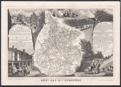
Ver todoMapa antiguo de Doubs 'Francia' por V. Levasseur, 1854
Por Victor Levasseur
Mapa antiguo titulado "Dépt. du Doubs". Mapa del departamento francés de Doubs, Francia. El conjunto está rodeado de elaborados grabados decorativos concebidos para ilustrar tanto la...
Categoría
Antiguo, Mediados del siglo XIX, Mapas
Materiales
Papel
144 € Precio de venta
Descuento del 20 %
Map of Aude France with Carcassonne and Languedoc Vineyards, 19th Century
Map of Aude France with Carcassonne and Languedoc Vineyards, 19th Century
Description:
This elegant 19th-century map of Aude, a department in southern France along the Mediterranean...
Categoría
Antiguo, Mediados del siglo XIX, Francés, Mapas
Materiales
Papel

Map of Aube France with Troyes and Champagne Wine Region, 19th Century
Map of Aube France with Troyes and Champagne Vineyards by Vuillemin, 19th c
Description:
This 19th-century map of the Aube department in the Grand Est region of northeastern France ...
Categoría
Antiguo, Mediados del siglo XIX, Francés, Mapas
Materiales
Papel

Map of Côtes-du-Nord France with Saint-Brieuc and Brittany Coastline, c.1850
Map of Côtes-du-Nord France with Saint-Brieuc and Brittany Coastline, 19th c
Description:
This elegant 19th-century map of Côtes-du-Nord, the historic name for what is now known as ...
Categoría
Antiguo, Mediados del siglo XIX, Francés, Mapas
Materiales
Papel

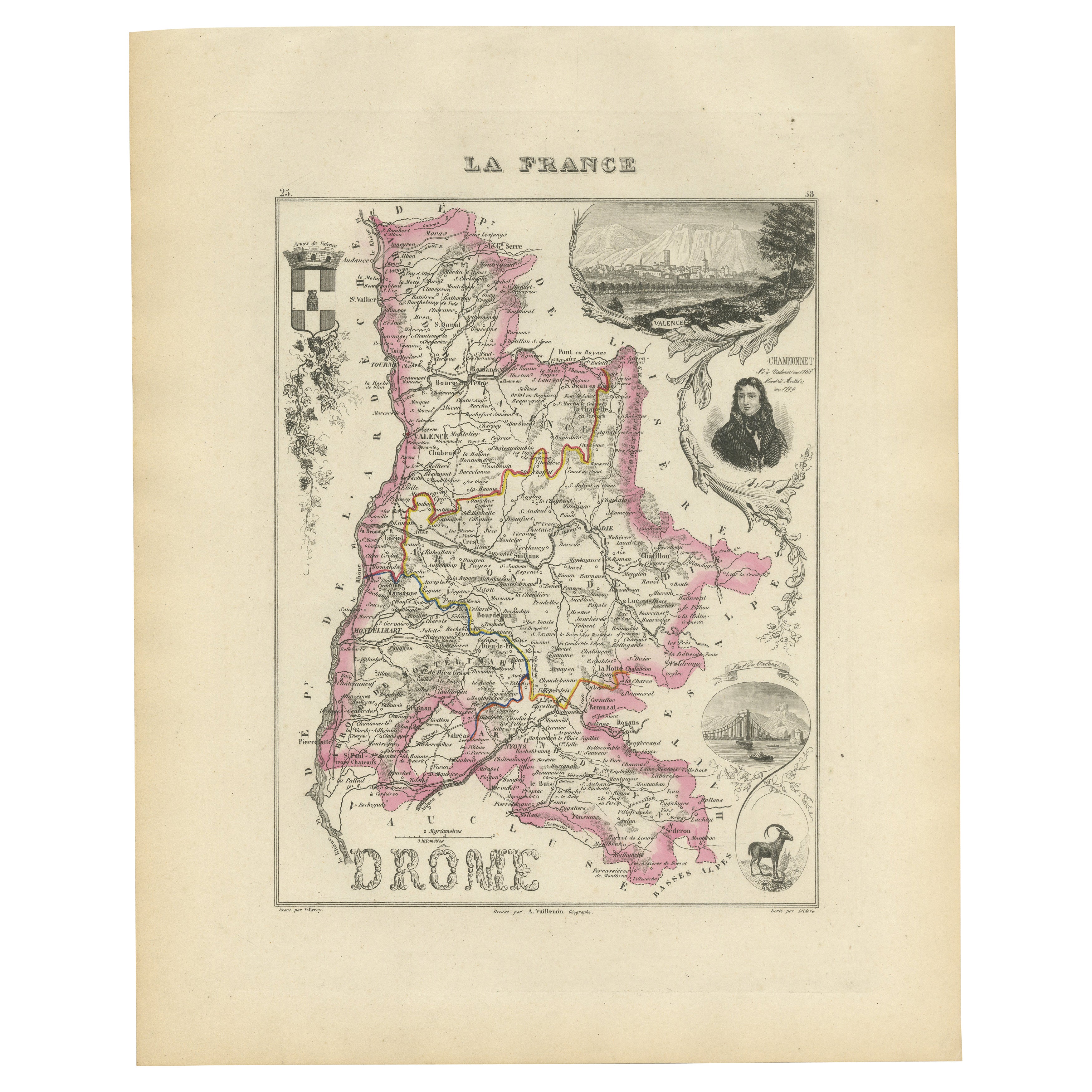
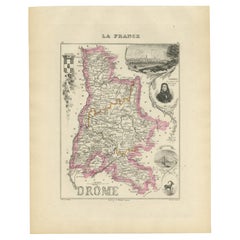
Map of Drôme France with Valence and Rhône Valley Wine Region, 19th Century
Map of Drôme France with Valence and Rhône Valley Wine Region, 19th Century
Description:
This beautifully engraved 19th-century map of the Drôme department in southeastern France wa...
Categoría
Antiguo, Mediados del siglo XIX, Francés, Mapas
Materiales
Papel
Map of Ariège France with Foix and Pyrenees Landscape by Vuillemin, 19th c
Map of Ariège France with Foix and Pyrenees Landscape by Vuillemin, 19th c
Description:
This beautifully detailed 19th-century map of the Ariège department in southwestern France wa...
Categoría
Antiguo, Mediados del siglo XIX, Francés, Mapas
Materiales
Papel

También te puede gustar
Aube, Francia. Mapa antiguo de un departamento francés, 1856
Por Victor Levasseur
Dept. de L'Aube", grabado en acero con contorno original coloreado a mano, 1856, del "Atlas National Illustre" de Levasseur.
Esta zona de Francia es conocida por su producción de C...
Categoría
siglo XIX, Naturalista, Impresiones de paisajes
Materiales
Grabado

Jura, Francia. Mapa antiguo de un departamento francés, 1856
Por Victor Levasseur
Dept. del Jura", grabado en acero con contorno original coloreado a mano, 1856, del "Atlas National Illustre" de Levasseur.
Los vinos del Jura son muy peculiares e inusuales, como ...
Categoría
siglo XIX, Naturalista, Impresiones de paisajes
Materiales
Grabado

Mapa de Deux Sèvres - Grabado original - Siglo XIX
Mapa de Deux Sèvres es un aguafuerte antiguo original realizado por un grabador anónimo del siglo XIX.
Impreso en serie de "France Pittoresque" en la parte superior central.
El est...
Categoría
siglo XIX, Moderno, Impresiones figurativas
Materiales
Grabado químico

Bajo Rin, Francia. Mapa antiguo de un departamento francés, 1856
Por Victor Levasseur
Dept. du Bas Rhin", grabado en acero con contorno original coloreado a mano, 1856, del Atlas National Illustre de Levasseur.
Parte de la región vinícola de Alsacia que rodea Estras...
Categoría
siglo XIX, Naturalista, Impresiones de paisajes
Materiales
Grabado

Gran mapa de Francia del siglo XIX
Gran mapa de Francia del siglo XIX.
Notable estado, con una agradable pátina desgastada por el tiempo.
Recientemente enmarcado.
Francia Circa 1874.
Categoría
Antiguo, Fines del siglo XIX, Francés, Mapas
Materiales
Lino, Papel

Altos Pirineos, Francia. Mapa antiguo de un departamento francés, 1856
Por Victor Levasseur
Dept. des Hautes Pyrenees", grabado en acero con contorno original coloreado a mano., 1856, del Atlas National Illustre de Levasseur.
En esta zona se encuentra la región vinícola d...
Categoría
siglo XIX, Naturalista, Impresiones de paisajes
Materiales
Grabado