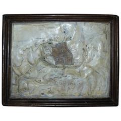
19th Century, Relief Map, Plaster, Jerusalem
View Similar Items


1 of 10
19th Century, Relief Map, Plaster, Jerusalem
About the Item
- Dimensions:Height: 14.3 in (36.3 cm)Width: 11.3 in (28.7 cm)Depth: 1.66 in (4.2 cm)
- Style:Grand Tour (In the Style Of)
- Materials and Techniques:Plaster,Faux Bois
- Place of Origin:
- Period:
- Date of Manufacture:Unknown
- Condition:Wear consistent with age and use.
- Seller Location:Biarritz, FR
- Reference Number:1stDibs: LU227835606153
You May Also Like
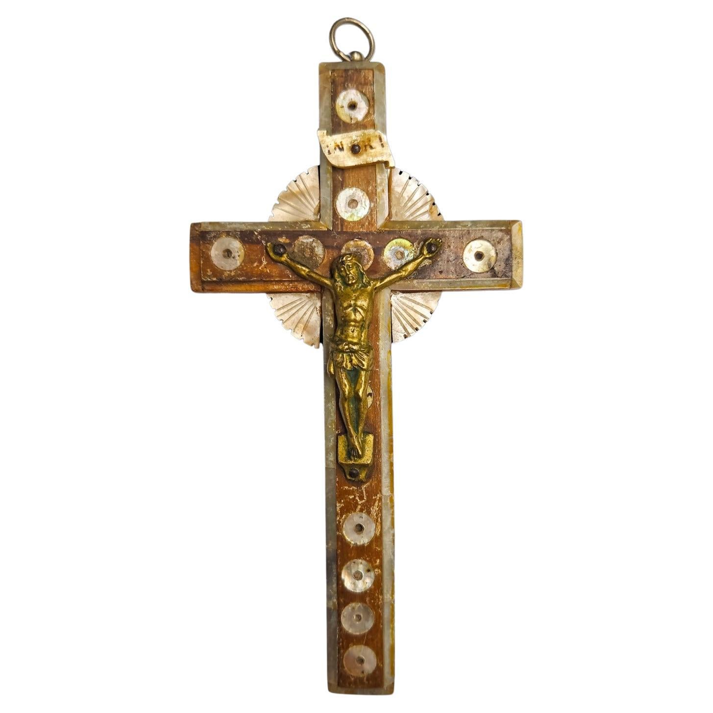
- Cross of Jerusalem, 19th CenturyBy Europa AntiquesLocated in Madrid, ESCross of Jerusalem 19th century. XIX century Jerusalem cross ancient xix century Jerusalem cross in olive wood and mother of pearl. Measures: 14x7 cm.Category
Antique 19th Century Italian Gothic Religious Items
MaterialsBronze
 $104 Sale Price20% Off
 - Plaster Altar Angels, 19th CenturyLocated in Savannah, GAA pair of polychromed plaster altar angels, France or Belgium, late 19th century. 11 inches wide by 10 inches deep by 20 ¼ inches tallCategory
Antique Late 19th Century Belgian Baroque Religious Items
MaterialsGesso, Wood, Paint
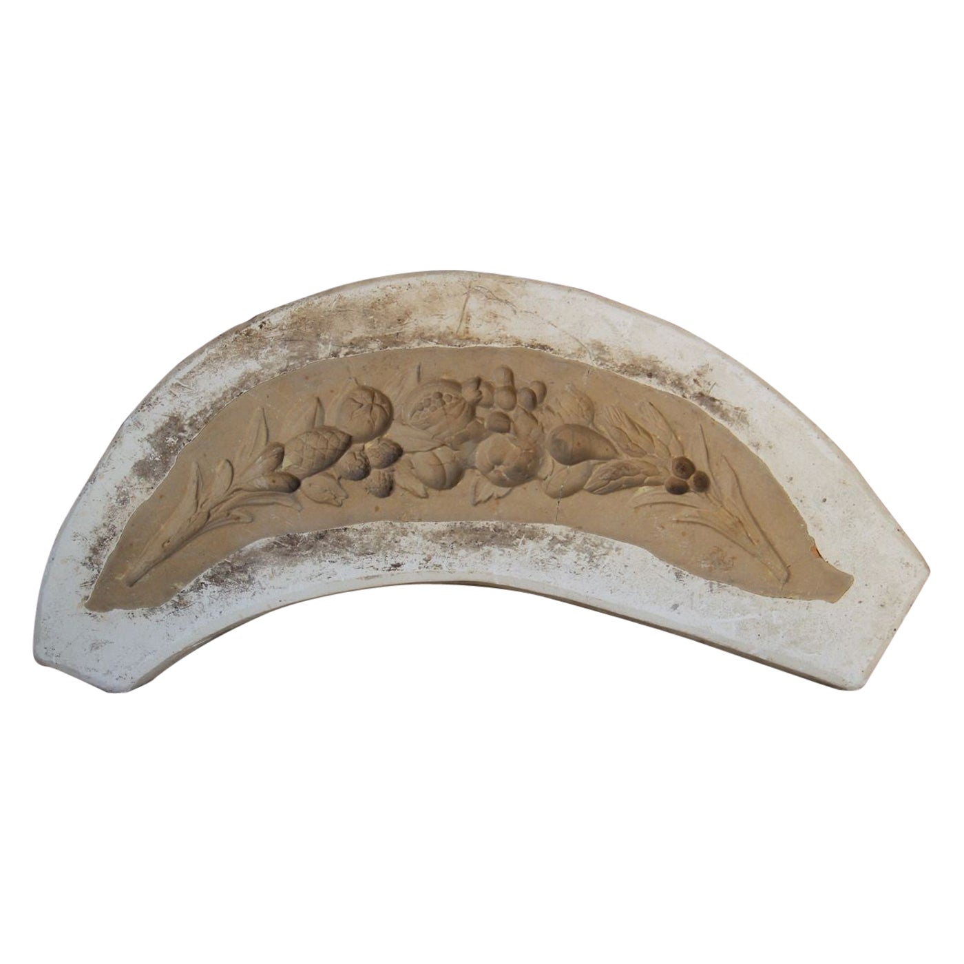
- 19th C. French Plaster MoldLocated in Wichita, KSA decorative French plaster mold from the 19th century. We offer expedited, fully-insured, custom packaged / crated, global shipping, including delivery...Category
Antique Early 19th Century French French Provincial Architectural Models
MaterialsPlaster
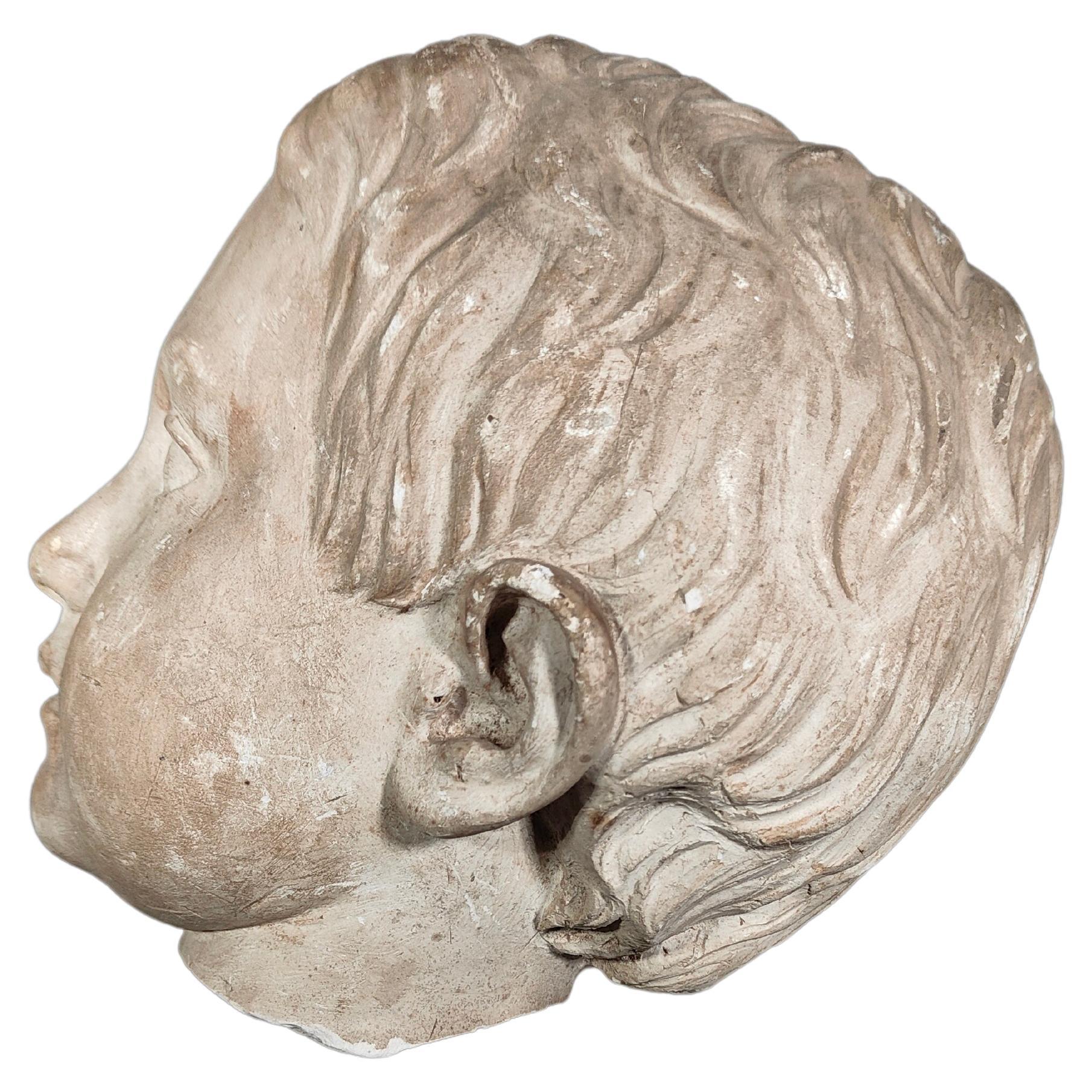
- Ancient Italian Head in Plaster 19th CenturyLocated in Madrid, ESAncient head in plaster xix century Ancient head in plaster xix century xix century head from Italy, in plaster, real size, very decorative. Measures: 20...Category
Antique 1880s Figurative Sculptures
MaterialsPlaster
 $633 Sale Price20% Off
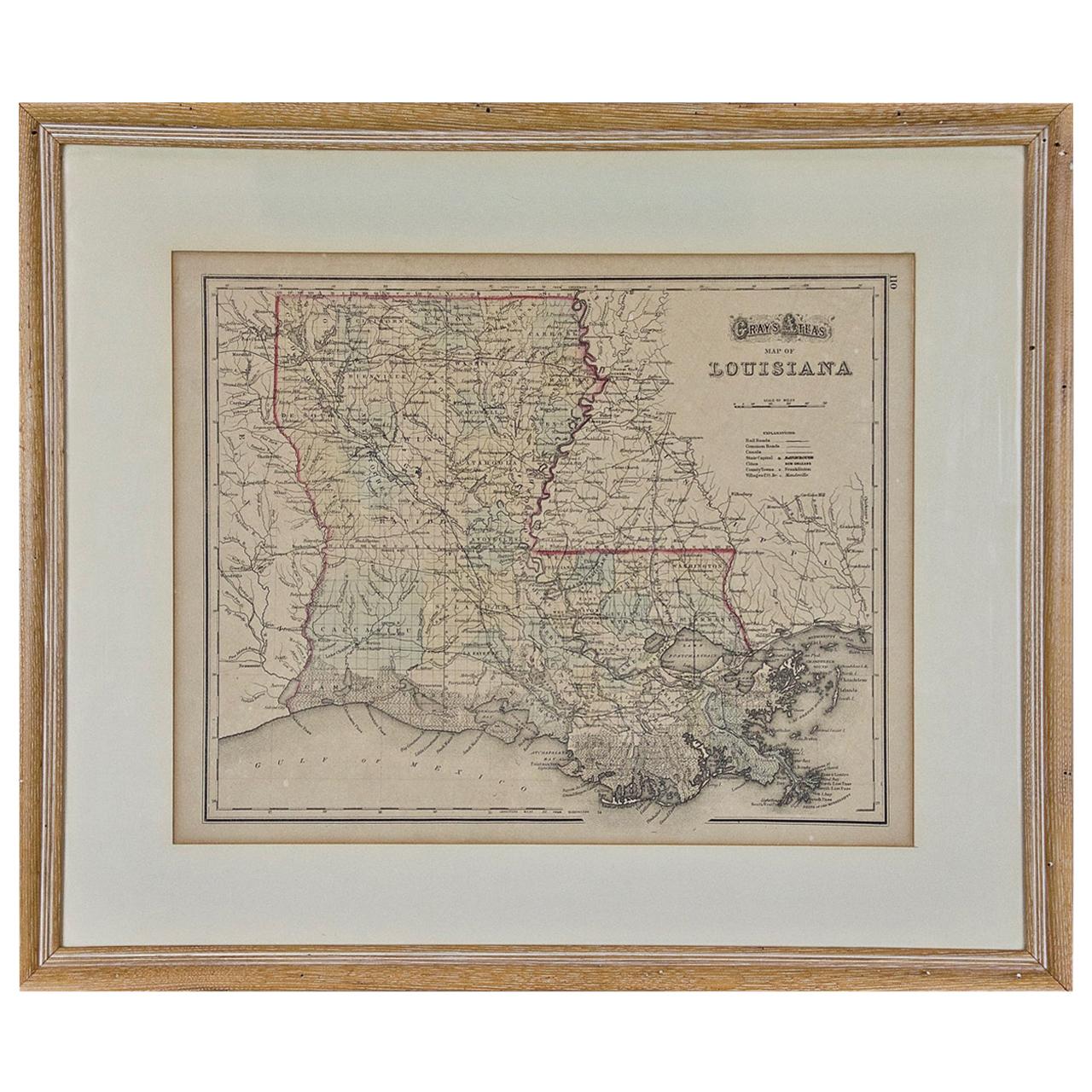
 - Louisiana: A Framed 19th Century Map by O. W. GrayBy Gray and CoLocated in Alamo, CAThis framed 19th century map of the Louisiana territory was published in "Gray's Atlas of the United States with General Maps of the World, accompanied by Descriptions Geographical, Historical, Scientific and Statistica" published in 1873 in Philadelphia by O.W. Gray and Son and Stedman, Brown and Lyon. It is a highly detailed map of Louisiana...Category
Antique Mid-19th Century American Other Maps
MaterialsPaper
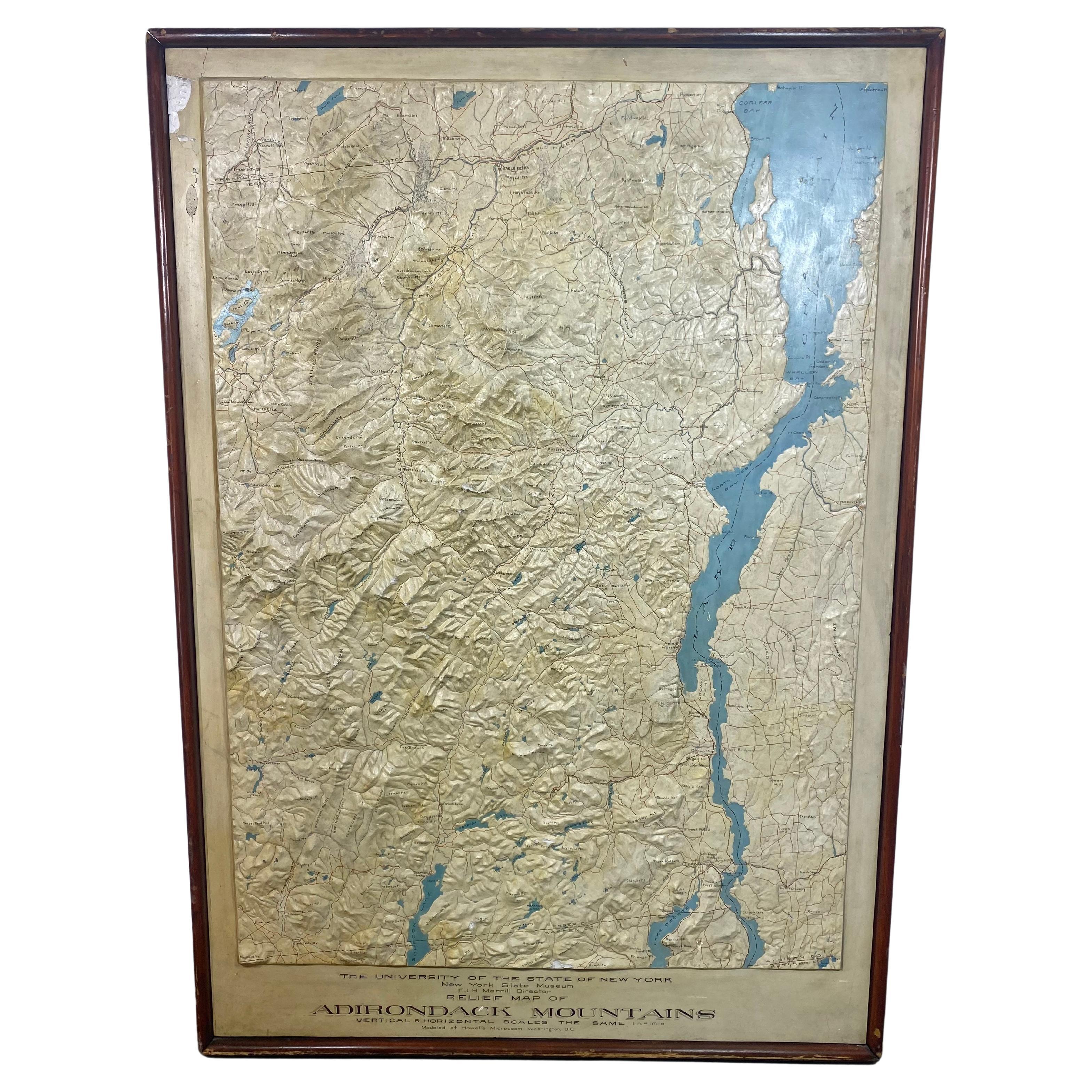
- World Relief MapLocated in Antwerp, BELarge world relief map. Measures: Width 232 cm. Height 158 cm.Category
Mid-20th Century German Mid-Century Modern Maps
MaterialsAcrylic
 $1,965


Recently Viewed
View AllMore Ways To Browse
Framed Plaster Relief
Map With Relief
Antique Plaster Relief
Grand Tour Reliefs
Antique Map Room
Grand Tour Plaster
Hand Painted Antique Map
Relief Map
Kingdom Of Jerusalem
Antique Map Of Jerusalem
Map Of Jerusalem
Used Models
Rare Books
My Antique Furniture
Old Vintage Collectables
Old Vintage Collectable
Miniature Design
Used Stamps For Collecting