Items Similar to 1762 Berri, Nivernois Bourbonois, Lyonois, Bourgogine, Bresse, et, Franche - Com
Want more images or videos?
Request additional images or videos from the seller
1 of 8
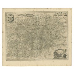
1762 Berri, Nivernois Bourbonois, Lyonois, Bourgogine, Bresse, et, Franche - Com
About the Item
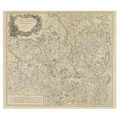
1762 Vaugondy map, entitled
"Berrl Nivernois Bourbonois Lyonois, Bourgone, Bresse, Et Franche-Comte,"
Ric.b003
About this Item
A fine Copperplate Engraving with original hand colouring 10½" x10" with large clean margins from Robert de Vaugondy's New Portable Atlas first issued in 1762 and here revised by his succesor Delamarche for d après la géographie moderne de feu l abbé Delacroix [Map 17]Original-
Dimension: Image Size: 10 1/2" W x 9 1/2" H (27 cm W x 24cm H) : Paper Size: 16 1/2" W x 11 1/4" H (41cm W x 28 cm H)
Condition: Good Condition with aging, please see photos.
- Dimensions:Height: 28 in (71.12 cm)Width: 41 in (104.14 cm)Depth: 1 in (2.54 cm)
- Materials and Techniques:
- Place of Origin:
- Period:
- Date of Manufacture:1762
- Condition:
- Seller Location:Norton, MA
- Reference Number:1stDibs: LU5848230268772
About the Seller
5.0
Platinum Seller
These expertly vetted sellers are 1stDibs' most experienced sellers and are rated highest by our customers.
Established in 2000
1stDibs seller since 2021
83 sales on 1stDibs
Typical response time: <1 hour
- ShippingRetrieving quote...Ships From: Norton, MA
- Return PolicyA return for this item may be initiated within 3 days of delivery.
More From This SellerView All
- 1718 Ides & Witsen Map "Route D'amsterdam a Moscow Et De La Ispahan Et GamronLocated in Norton, MA1718 Ides & Witsen map, entitled "Route D'Amsterdam A Moscow Et De La Ispahan Et Gamron," Ric.b005 Subject: Eastern Europe and Central Asia Period: 1718 (published) Publicati...Category
Antique Early 18th Century Dutch Maps
MaterialsPaper
- 1633 Map "La Souverainete De Sedan Et De Raucourt, Et La Prevoste Ric0011Located in Norton, MA1653 map entitled "La Souverainete de Sedan et de Raucourt, et la Prevoste de Doncheri," Ric0011 Description: Lovely map centered on Sedan and Doncheri and the Meuze River fr...Category
Antique 17th Century Dutch Maps
MaterialsPaper
- 1656 "La Souverainete de Sedan et de Raucourt, et la Prevoste de Doncheri Ric004Located in Norton, MA1656 map entitled "La Souverainete de Sedan et de Raucourt, et la Prevoste de Doncheri," Hand Colored Ric0004. Description: Lovely map centered on Sedan and Doncheri an...Category
Antique 17th Century Dutch Maps
MaterialsPaper
- 1627 Hondius Map "La Principaute d'Orange et Comtat de Ve", Ric.0003Located in Norton, MA1627 Hondius map entitled "La Principaute d'Orange et Comtat de Venaissin," Original Hand-Colored Description: From Johannes Janssonius's Atlantis Maioris Appendix of 1630. ...Category
Antique 17th Century Unknown Maps
MaterialsPaper
- 1640 Willem Blaeu Map Entitled "Contado di molise et principato vltra, " Ric.a003By Willem BlaeuLocated in Norton, MA1640 Willem Blaeu map entitled "Contado di molise et principato vltra," Colored Ric. a003 Measures: 38 x 49.6 cm and wide margins DBLAEU. Cou...Category
Antique 17th Century Dutch Maps
MaterialsPaper
- 1640 Joan Bleau Map Entitled"Diocecese de rheims et le pais de rethel, " Eic.a011Located in Norton, MA1640 Joan Bleau map entitled "Diocecese de rheims et le pais de rethel," Ric.a011 OAN BLAEU Diocecese de Rheims, et le pais de Rethel. Handcolored engraving, c.1640. ...Category
Antique 17th Century Dutch Maps
MaterialsPaper


You May Also Like
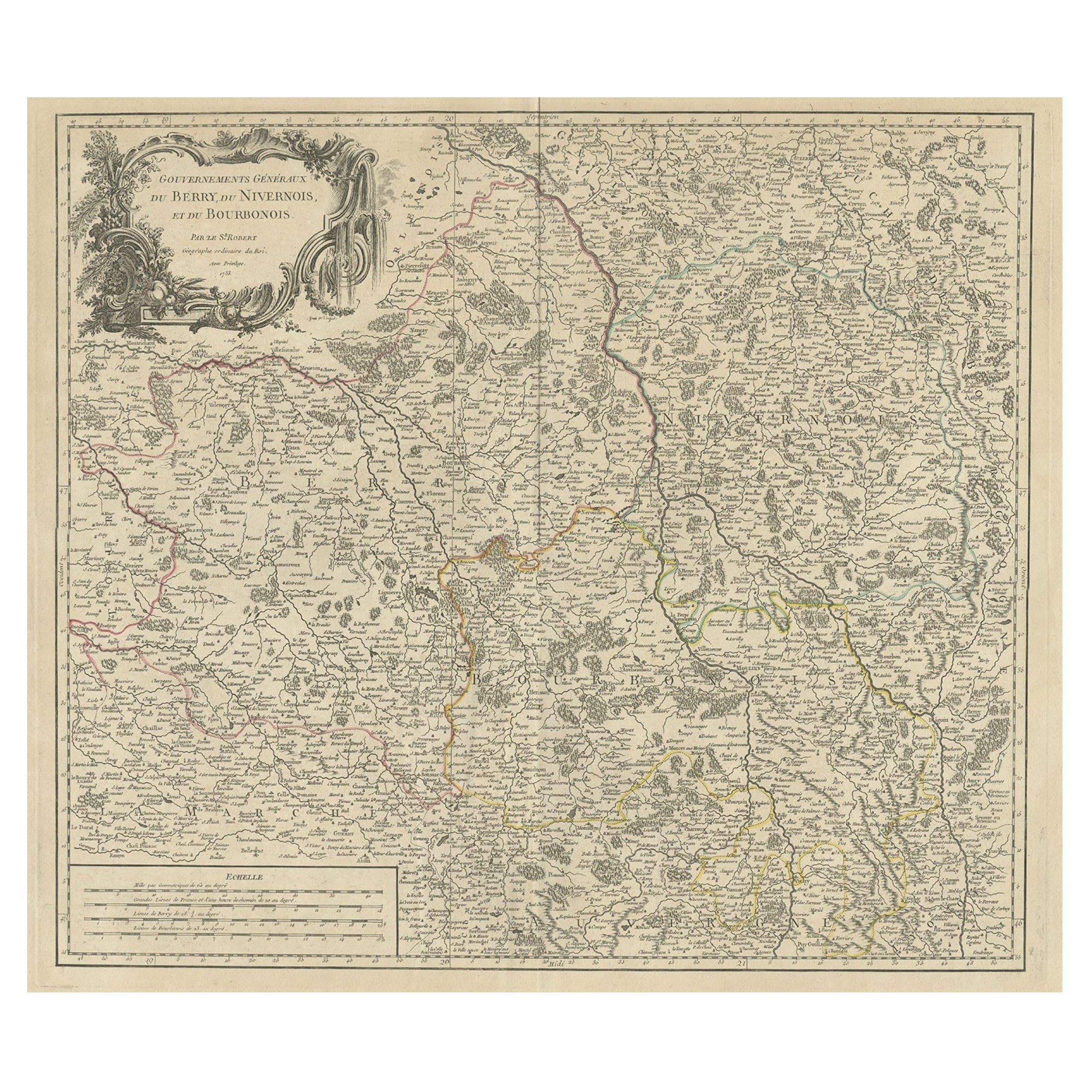
- Large Antique Map of the Region of Berry, Nivernois & Bourbonnais, France, 1753Located in Langweer, NLAntique map titled 'Gouvernements généraux du Berry, du Nivernois et du Bourbonois'. Large, original antique map of the region of Berry, Nivernois and Bourbonnais, France. Featur...Category
Antique 1750s Maps
MaterialsPaper
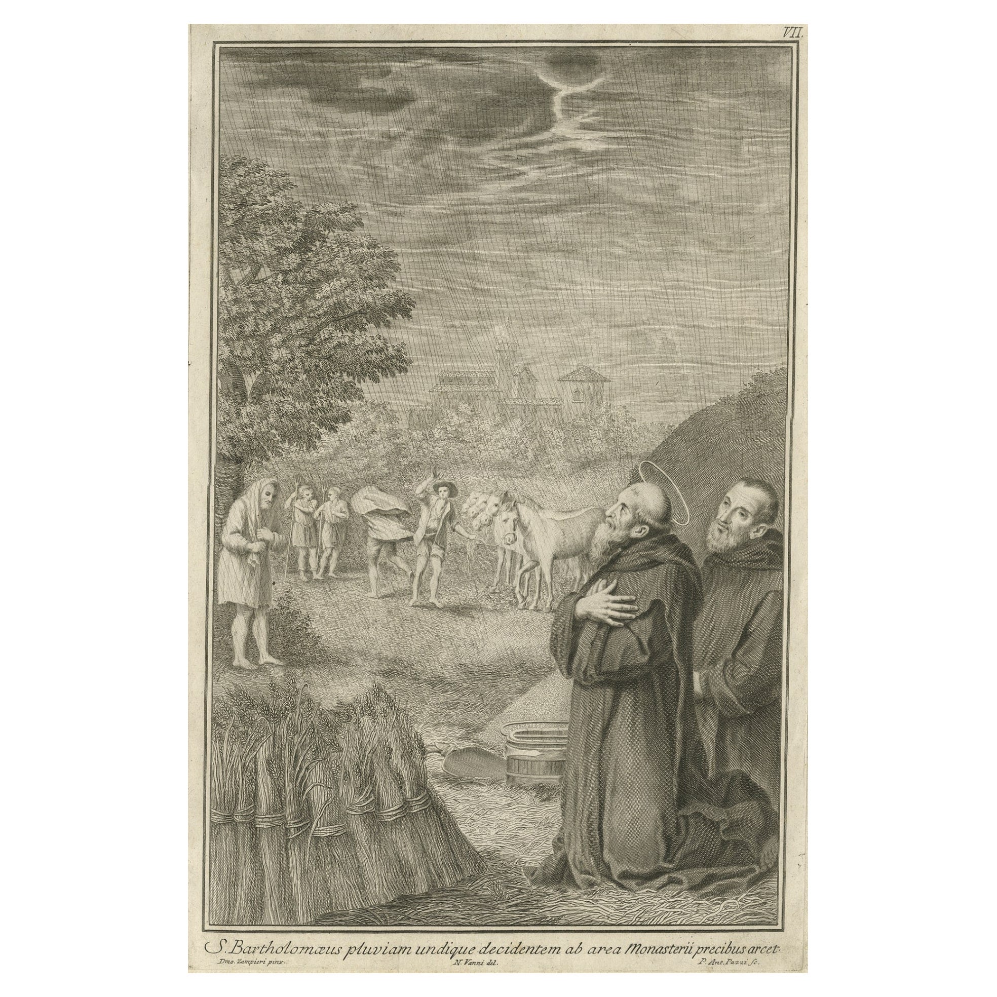
- Antique Print of Bartholomew the Apostle, 1762By Pietro Antonio PazziLocated in Langweer, NLAntique print titled 'S. Bartholomaeus pluvian undique decidentem ab area Monasterii precibus arcet'. Scarce plate showing Bartholomew the Apostle in the ...Category
Antique 18th Century Prints
MaterialsPaper
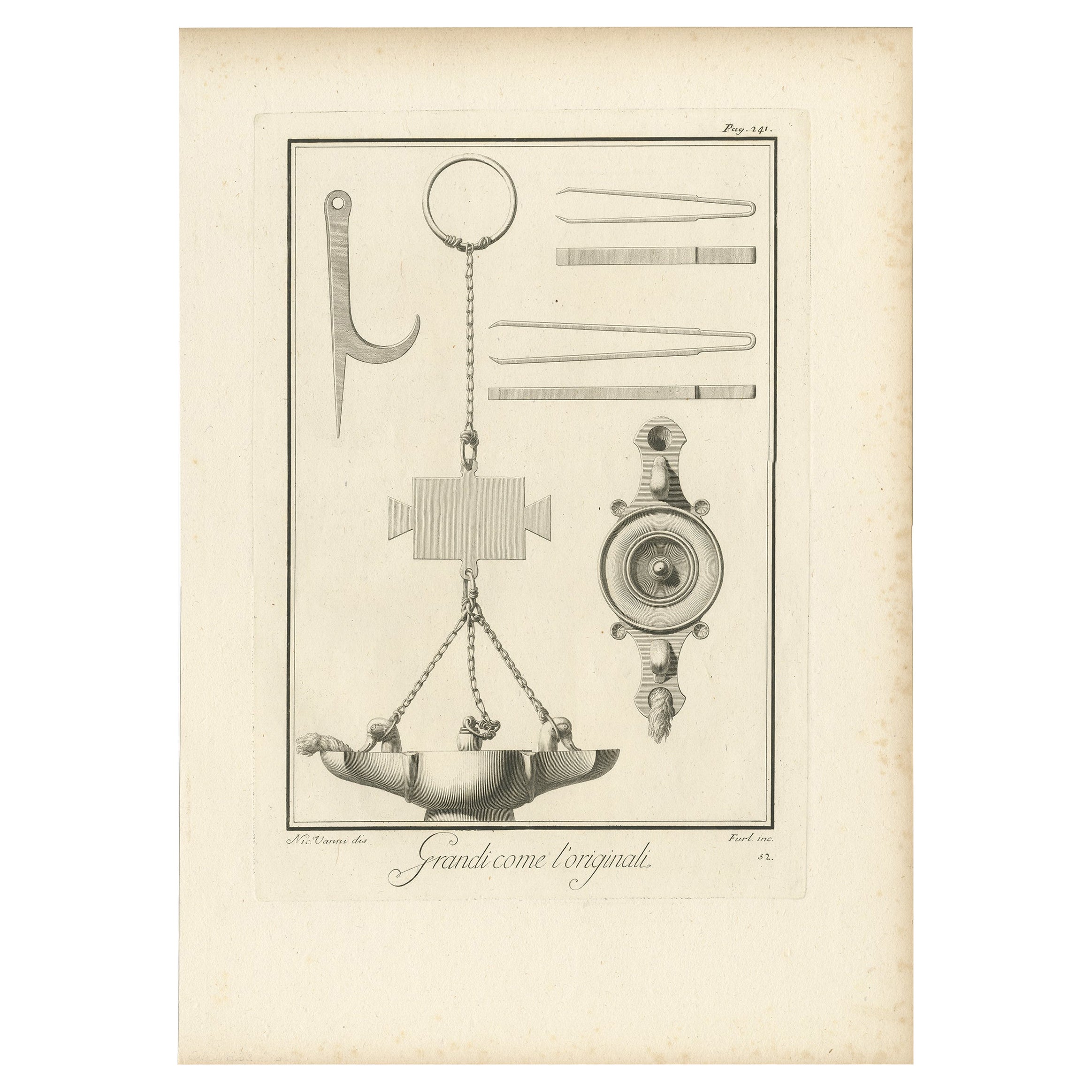
- Monuments of Herculaneum Engraved by Bayardi, 1762Located in Langweer, NLAntique print originating from 'Le Antichita di Ercolano Esposte'. A vast survey of the bronzes, statues, wall-paintings, and monuments of Herculaneum. This monumental work was the f...Category
Antique 18th Century Prints
MaterialsPaper
- Herculaneum Monuments, 1762: Bayardi's Engraving Plate 61Located in Langweer, NLAntique print originating from 'Le Antichita di Ercolano Esposte'. A vast survey of the bronzes, statues, wall-paintings, and monuments of Herculaneum. This monumental work was the f...Category
Antique 18th Century Prints
MaterialsPaper
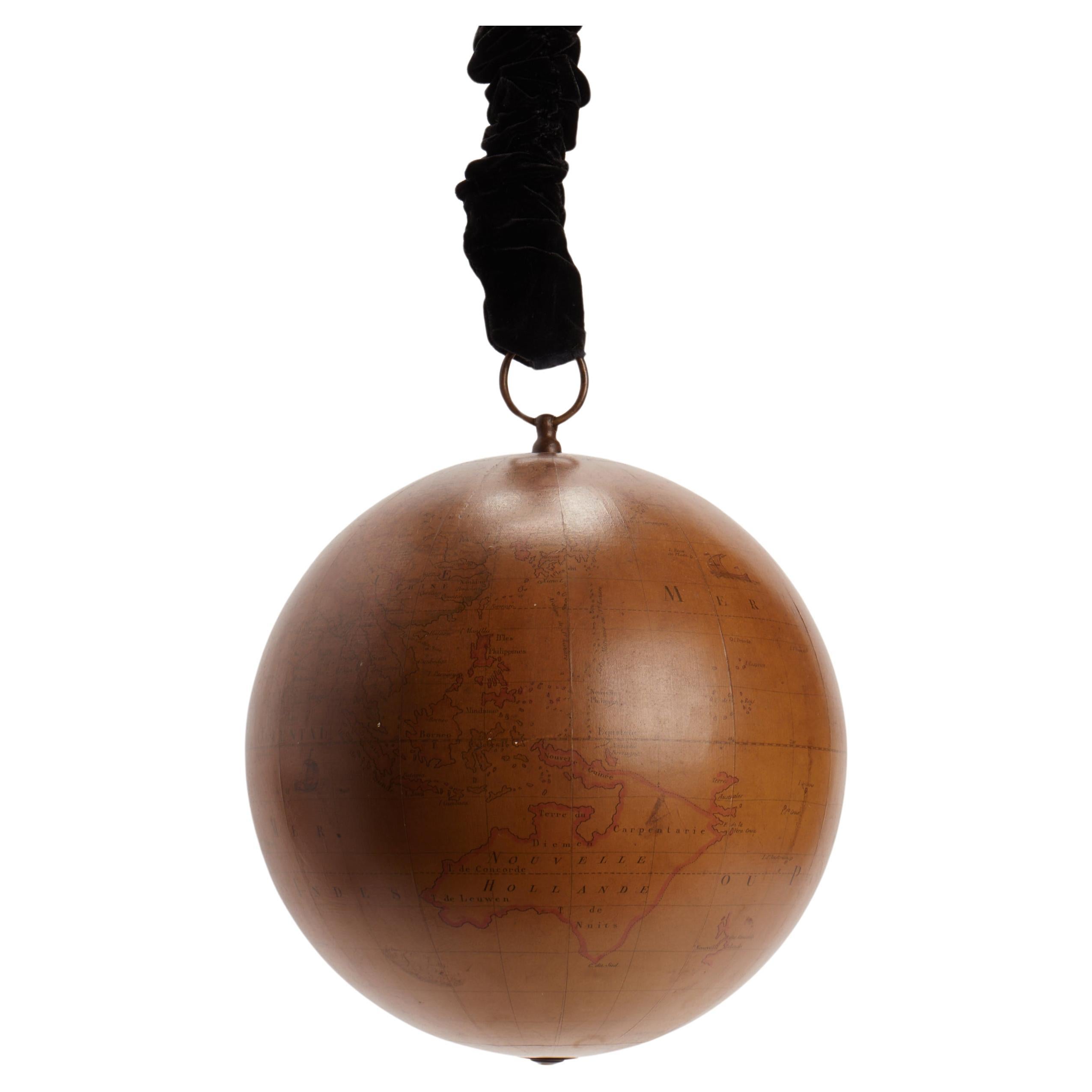
- Terrestrial globe apres Mr. Rizzi Zannoni, Paris 1762.Located in Milan, ITDesigned to be hanged to the ceiling, terrestrial globe, made out of paper machè and wood, brass hook. It is reported in the cartouche of the globe: globe terrestre d’après Mr. Rizz...Category
Antique Mid-18th Century French Scientific Instruments
MaterialsBrass
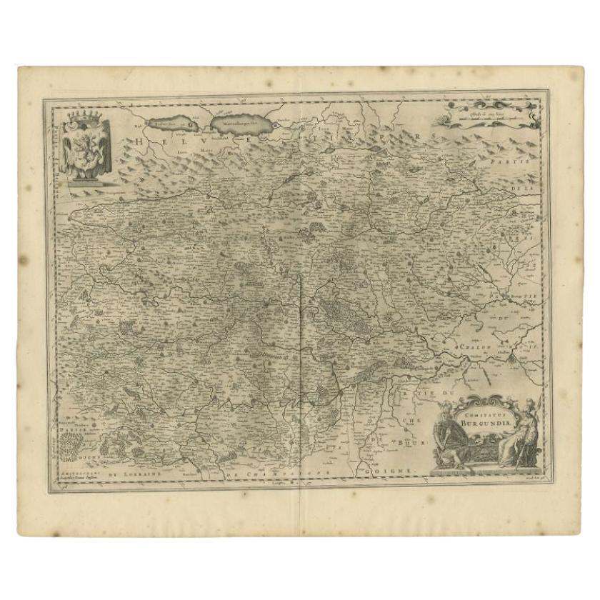
- Antique Map of the Burgundy-franche-Comté Region by Janssonius, 1657Located in Langweer, NLAntique map of France titled 'Comitatus Burgundiae'. Decorative map of the Burgundy-Franche-Comté region. This map originates from 'Atlas Novus, Sive Theatrum Orbis Orbis Terrarum: I...Category
Antique 17th Century Maps
MaterialsPaper

Recently Viewed
View AllMore Ways To Browse
Used Furniture Com
Antique Com
Engraved 28
Com De
Franche Comte
Antique Texas Collectables
Antique Furniture Alexandria
Victorian Fence
Alexandria Antique Furniture
Battle Maps
Antique Malaysia
Russian Antique Plates
Antique Railroad Collectables
Antique Railroad Collectibles
Floor Vase Wood
Antique Railroad Collectibles Collectibles
Mariner Furniture
Map Print Set