Items Similar to 1850 Old French Map Depicting the Entire Earth's Surface Divided into Two Parts

Want more images or videos?
Request additional images or videos from the seller
1 of 19
1850 Old French Map Depicting the Entire Earth's Surface Divided into Two Parts
About the Item
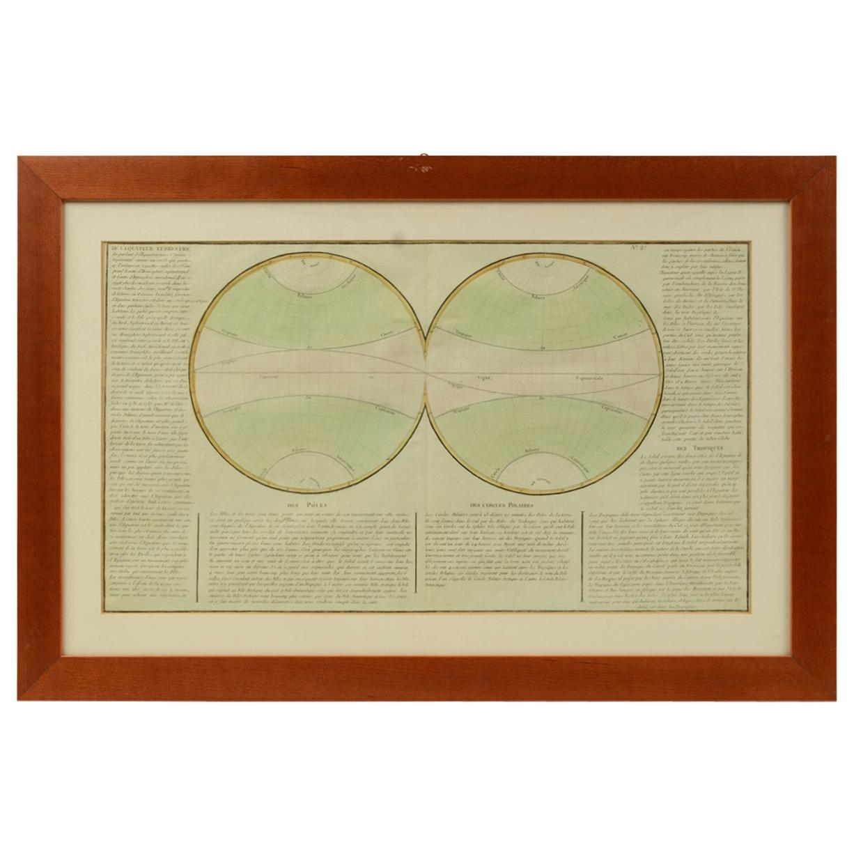
Geographical map depicting the entire earth’s surface divided into two parts that correspond to the two hemispheres or globes, the map deals with the latitudes and longitudes, the meridian 0 is indicated, also called the meridian of France fixed by Louis XIII in 1634 because it crossed the whole territory from Perpignan to Dunkerque and then replaced in 1884 by the Greenwich meridian. Detailed explanation in French. Printed on paper by engraving on copper plate, coeval coloring. Table n. 3, French manufacture from the mid-19th century, non-contemporary frame in cherry wood. Size with frame 65.7 x 47.2 cm - 25.8 x 18 inches, frame thickness 2 cm - 0.78 inches.
- Dimensions:Height: 18.19 in (46.2 cm)Width: 25.87 in (65.7 cm)Depth: 0.79 in (2 cm)
- Materials and Techniques:
- Place of Origin:
- Period:
- Date of Manufacture:Mid-19th Century
- Condition:Wear consistent with age and use.
- Seller Location:Milan, IT
- Reference Number:1stDibs: LU1020220893882
About the Seller
4.9
Platinum Seller
These expertly vetted sellers are 1stDibs' most experienced sellers and are rated highest by our customers.
Established in 1999
1stDibs seller since 2014
370 sales on 1stDibs
Typical response time: <1 hour
- ShippingRetrieving quote...Ships From: Milan, Italy
- Return PolicyA return for this item may be initiated within 3 days of delivery.
More From This SellerView All
- 1850 Old French Map Depicting the Entire Earth's Surface Divided into Two PartsLocated in Milan, ITMap depicting the entire earth's surface divided into two parts corresponding to the two hemispheres and showing the Arctic to Antarctic polar circle, the tropics of Cancer and Capri...Category
Antique Mid-19th Century French Maps
MaterialsGlass, Wood, Paper
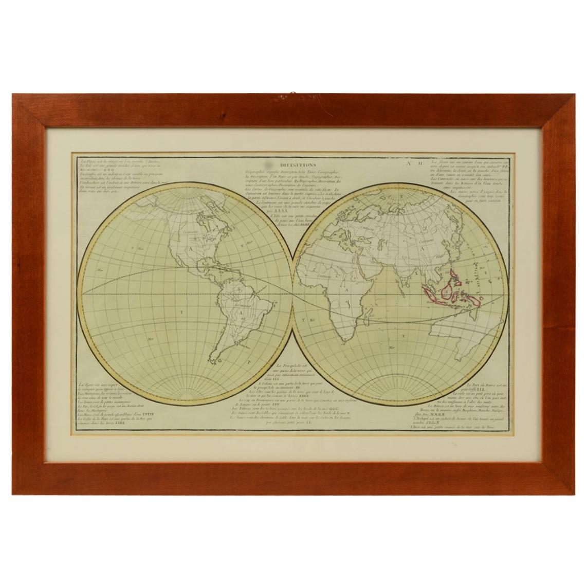
- 1850 Old French Map Depicting the Entire Earth's Surface Divided into Two PartsLocated in Milan, ITGeographical map depicting the entire earth's surface divided into two parts that correspond to the two hemispheres where the emerged lands are depicted which have been classified wi...Category
Antique Mid-19th Century French Maps
MaterialsGlass, Wood, Paper
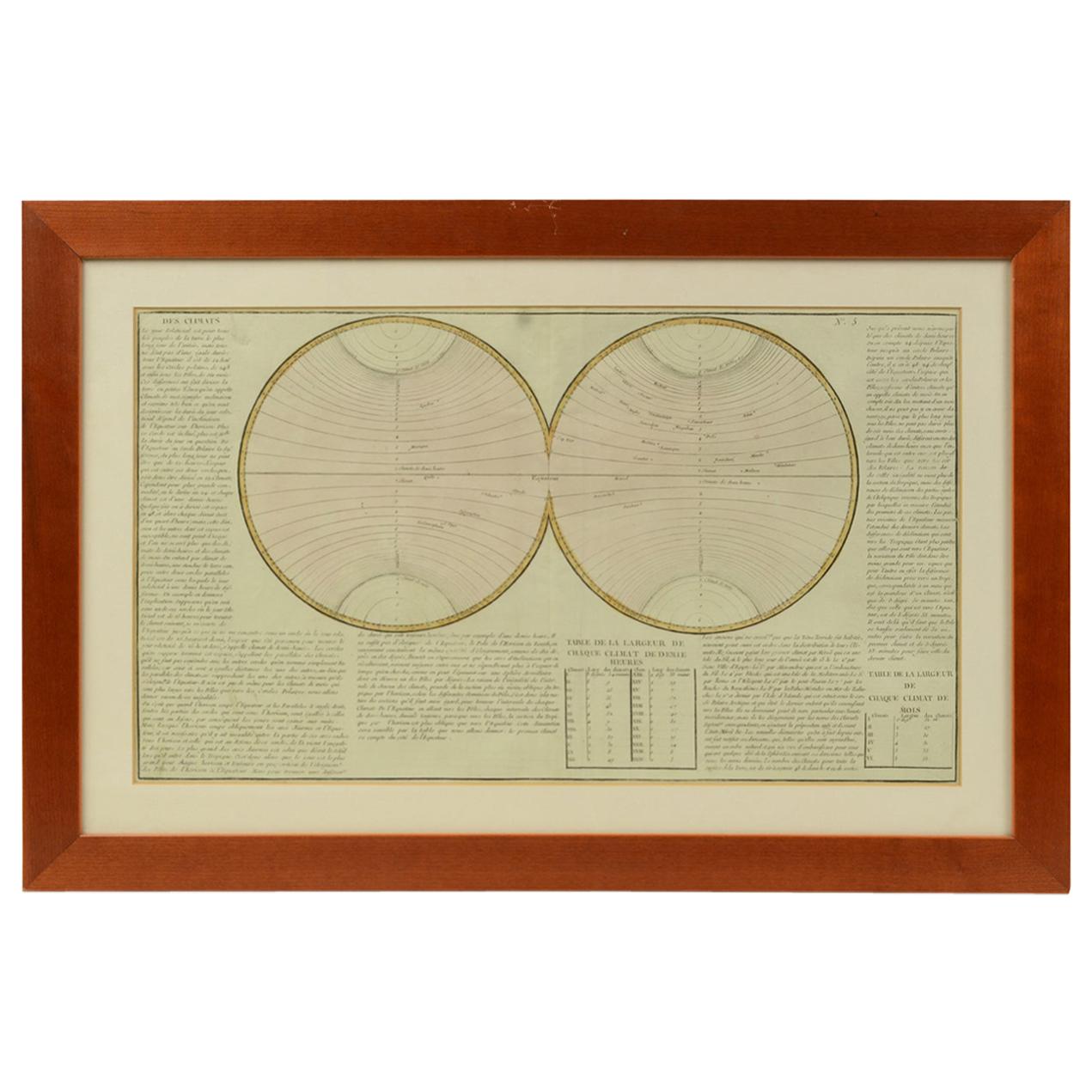
- 1850 Old French Map Depicting the Entire Earth's Surface Divided into Two PartsLocated in Milan, ITGeographical map depicting the entire earth's surface divided into two parts that correspond to the two hemispheres divided into small climatic zones that depict the climatic trend f...Category
Antique Mid-19th Century French Scientific Instruments
MaterialsGlass, Wood, Paper
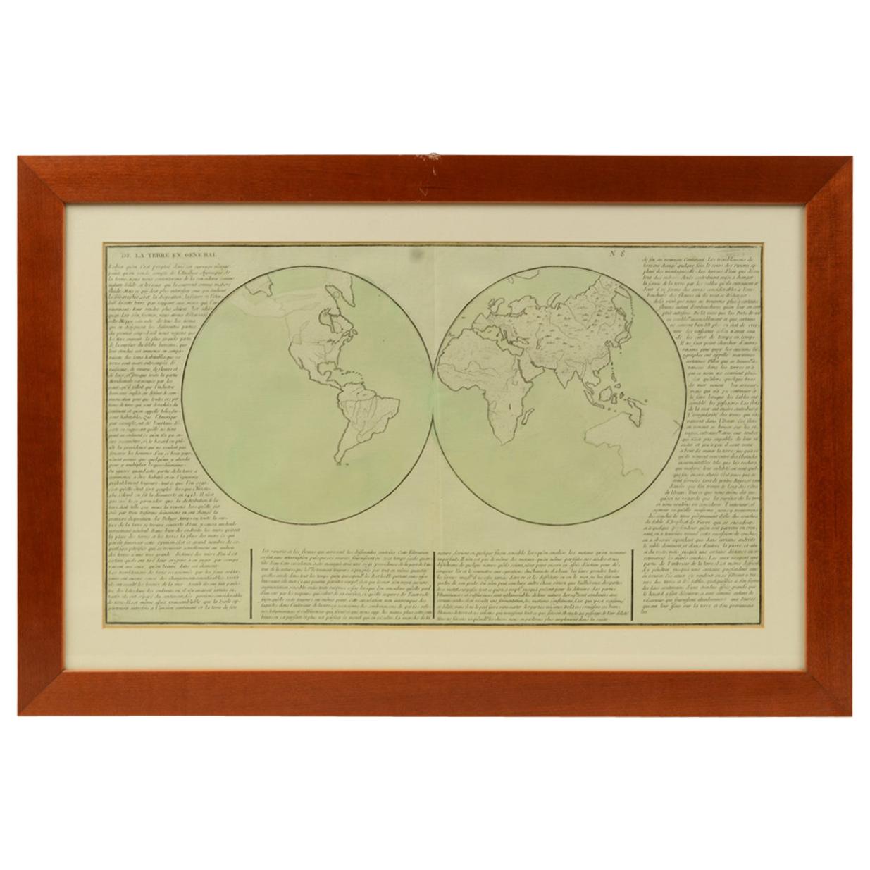
- 1850 Old French Map Depicting the Entire Earth's Surface Divided into Two PartsLocated in Milan, ITGeographical map depicting the entire earth's surface divided into two parts that correspond to the two hemispheres or globes, the map deals with the earth in general. Detailed expla...Category
Antique Mid-19th Century French Maps
MaterialsGlass, Wood, Paper
- Old Map Depicting the Entire Earth's Surface Divided into Six Parts France 1850Located in Milan, ITMap depicting the entire earth's surface divided into six parts which depicts the position of peoples on Earth based on the assumption that it is impossible for each people to have t...Category
Antique Mid-19th Century French Maps
MaterialsPaper, Glass, Wood
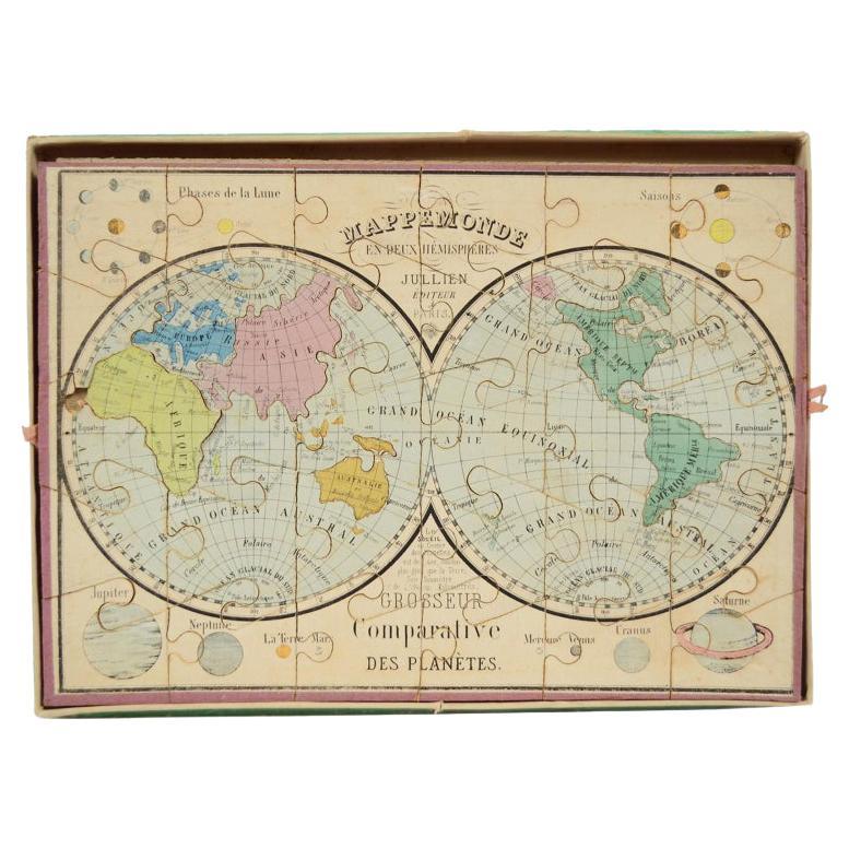
- Antique Puzzle of Colored Cardboard Depicting World Map, Europe and FranceLocated in Milan, ITEducational puzzle of colored cardboard composed of three folders depicting world map, Europe and France. The world map in addition to the territorial map of the continents depicts t...Category
Antique 1850s French Games
MaterialsPaper


You May Also Like
- Two Sheet Map of the Principality of Wales Divided into Counties, 1804Located in Langweer, NLA well engraved and detailed large-scale map of Wales, printed on two sheets . The map is thoroughly detailed and includes good information regarding t...Category
Antique Early 1800s Maps
MaterialsPaper
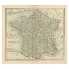
- Antique Map of France Divided into Departments, with Original Hand ColoringLocated in Langweer, NLAntique map titled 'A New Map of France (..)'. Original old map of France, divided into departments. With original/contemporary hand coloring. Published by John Cary, 1799. John Cary was an important and prolific London map seller...Category
Antique Late 18th Century Maps
MaterialsPaper
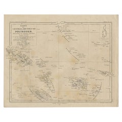
- Old German Map Depicting the Central Islands of Polynesia, 1857Located in Langweer, NLAntique map Polynesia titled 'Karte der Central-Gruppen von Polynesien'. Old map depicting the central islands of Polynesia. This map originates from 'Petermanns Geographische Mittei...Category
Antique 19th Century Maps
MaterialsPaper
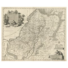
- Map of the Holy Land Divided into 12 Tribes, the Travels of Jesus Christ, 1700Located in Langweer, NLAntique map titled 'Het Heylige Land verdeeld in de Twaalf Stammen Israels (..)'. Decorative and detailed map of the Holy Land divided into 12 Tribes, sh...Category
Antique Early 1700s Maps
MaterialsPaper
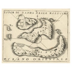
- Small Old Map Depicting the Banda Islands or the Spice Islands, Indonesia, 1706Located in Langweer, NLAntique map titled 'Isole di Banda Nelle Molucche'. Small old map depicting the Banda Islands, Indonesia. Artists and Engravers: Published by V.M. Coronelli in Venice, 1706.Category
Antique Early 1700s Maps
MaterialsPaper
- 1812 United States Map, by Pierre Tardieu, Antique French Map Depicting the U.S.By Pierre François TardieuLocated in Colorado Springs, CO1812 "United States of Nth America -- Carte des Etats-Unis De L'Amerique Septentrionale" Two-Sheet Map by Tardieu This attractive map, published in Paris in 1812, is one of the most rare large format maps from the period. It features a view of the East Coast of the U.S. from Maryland to just below South Carolina. Additionally, Ellicott’s plan for the City of Washington D.C. is included at the top right and an illustration of Niagara Falls is shown at the bottom right with a description in both French and English. This extremely detailed map not only depicts the mountainous regions of the southeastern U.S., but also includes names of regions, rivers, and towns. Based on the first state of Arrowsmith’s 4-sheet map of the United States, this map is completely engraved by Tardieu in Paris and showcases high quality engravings. This detailed map of the recently independent United States includes one of the largest and earliest examples of the Ellicott plan of Washington DC. The artist, Pierre François Tardieu (PF Tardieu) was a very well-known map engraver, geographer, and illustrator. Awarded a bronze medal by King Louis-Phillipe for the accuracy and beauty of his map-making, Tardieu produced many fine works including maps of Louisiana...Category
Antique 1810s French Maps
MaterialsPaper

Recently Viewed
View AllMore Ways To Browse
Old French
Old French Plates
Geographical Map
Divided Plate
Wood Mid Century Divider
Globe Of Earth
Antique Geographical Maps
Lloyd London
French Louis Xiii Table
Wood And Glass Divider
Shipping Maps
Old Wood Cross
French Cherry Table Louis
Meridian Furniture
Antique Globes London
French Cherries Glass
Old Antique Globes
Used Furniture Meridian