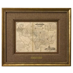
1856 Washington DC Map by Bohn
View Similar Items


Want more images or videos?
Request additional images or videos from the seller
1 of 2
1856 Washington DC Map by Bohn
About the Item
- Dimensions:Height: 22.5 in (57.15 cm)Width: 26.75 in (67.95 cm)Depth: 1.5 in (3.81 cm)
- Place of Origin:
- Period:
- Date of Manufacture:1856
- Condition:Wear consistent with age and use.
- Seller Location:Colorado Springs, CO
- Reference Number:Seller: M0921stDibs: LU90974627313
About the Seller
4.9
Platinum Seller
These expertly vetted sellers are 1stDibs' most experienced sellers and are rated highest by our customers.
Established in 2010
1stDibs seller since 2011
400 sales on 1stDibs
More From This SellerView All
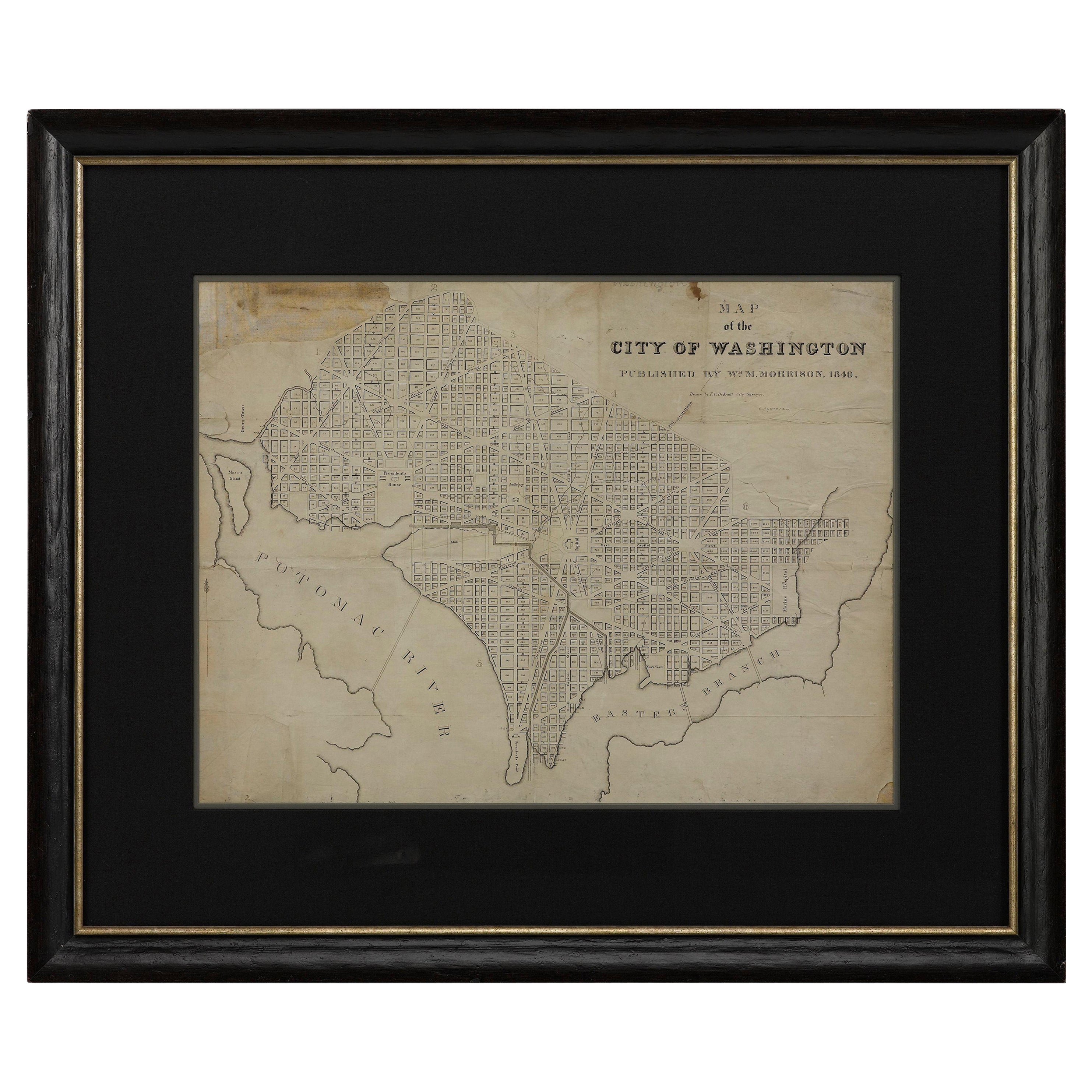
- 1840 Map of the City of Washington Published by William M. MorrisonLocated in Colorado Springs, COThis map, printed in 1840, is a detailed representation of Washington, D.C. in the mid-19th century. The map shows block numbers, wards, and government buildings as well as details o...Category
Antique 1840s American Federal Maps
MaterialsPaper
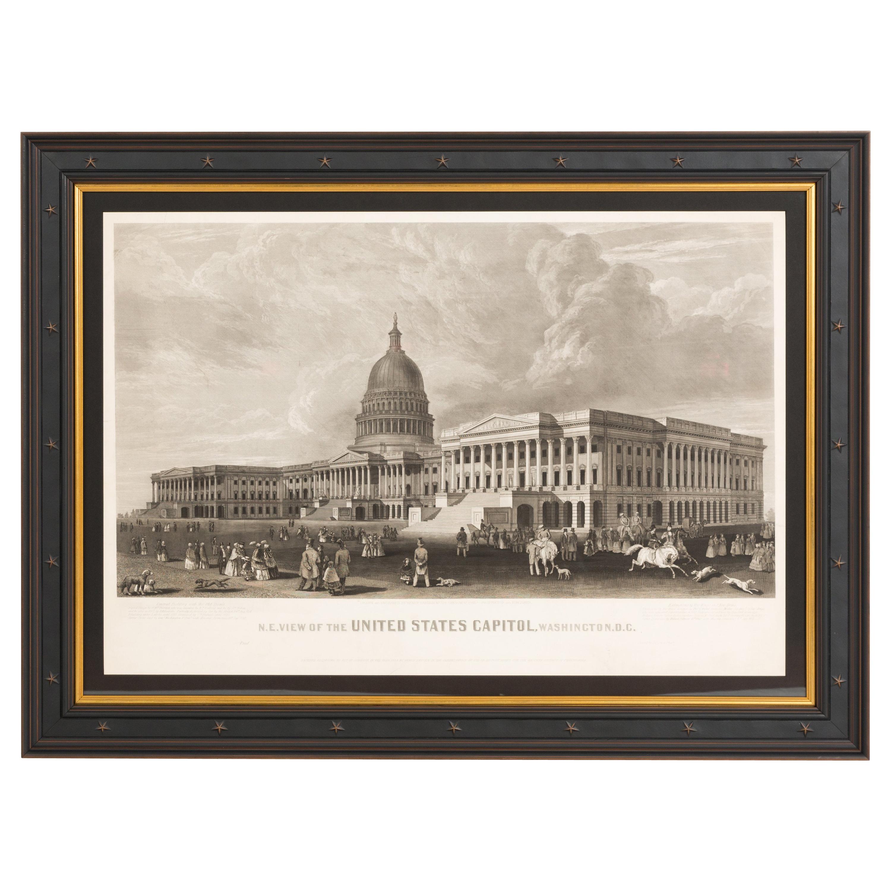
- N.E. View of the United States Capitol, Washington, DC Antique Proof Print 1858Located in Colorado Springs, COThis engraved print shows a view of the United States Capitol Building, in Washington, D.C. The print depicts the neoclassical building from the northeast orientation, with a bustling street scene in front. The steel engraving is a proof printing, drawn and engraved by Henry Sartain and published in 1858. Plans began in May 1854 to build a new cast-iron dome for the United States Capitol. The then-architect of the Capitol Thomas Walter and his team were sold on the aesthetics of a new dome, as well as the utility of a fire-proof one. A year later, on March 3, 1855, President Franklin Pierce...Category
Antique 1850s American Prints
MaterialsPaper
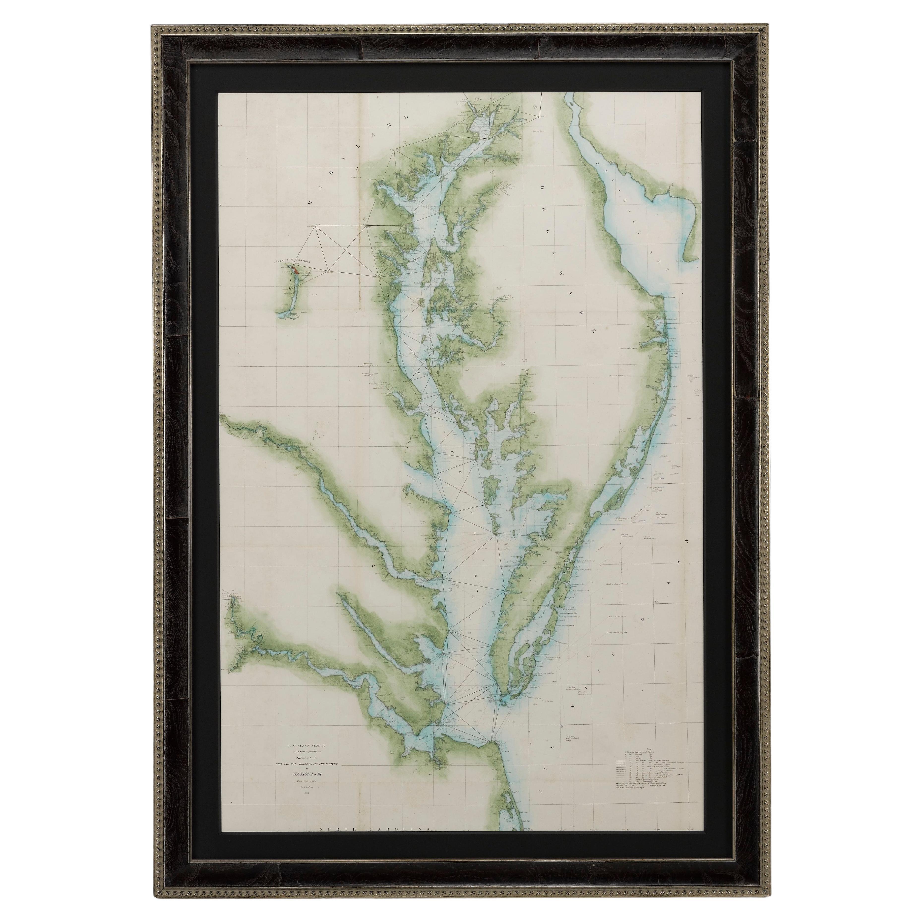
- 1856 U.S. Coast Survey Map of Chesapeake Bay and Delaware BayLocated in Colorado Springs, COPresented is U.S. Coast Survey nautical chart or maritime map of Chesapeake Bay and Delaware Bay from 1856. The map depicts the region from Susquehanna, Maryland to the northern Oute...Category
Antique 1850s American Maps
MaterialsPaper
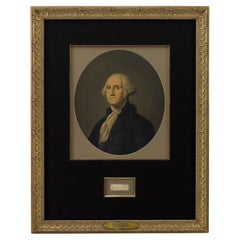
- George Washington Signature CollageLocated in Colorado Springs, COPresented is an original George Washington signature, presented framed with an oval chromolithographed portrait of George Washington printed by E. C....Category
Antique Late 18th Century American Federal Historical Memorabilia
MaterialsPaper
- 1907 Map of Colorado, Antique Topographical Map, by Louis NellLocated in Colorado Springs, COThis highly detailed pocket map is a topographical map of the state of Colorado by Louis Nell from 1907. The map "has been complied from all availabl...Category
Antique Early 1900s American Maps
MaterialsPaper
- "Lady Washington's Reception, " Engraved by A. H. Ritchie, Antique Print, 1865Located in Colorado Springs, COThis 1865, hand-colored engraving by A. H. Ritchie is entitled Lady Washington's Reception and is based on Daniel F. Huntington's original painting "Th...Category
Antique 1860s American Prints
MaterialsPaper


You May Also Like
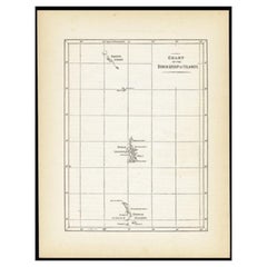
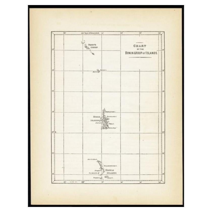
- Antique Map of the Bonin Islands by Hawks, 1856Located in Langweer, NLAntique map titled 'Chart of the Bonin Group of Islands.' The Bonin Islands, known in Japan as the Ogasawara Group are an archipelago of over 30 subtropical and tropical islands, som...Category
Antique 19th Century Maps
MaterialsPaper
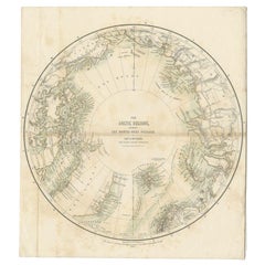
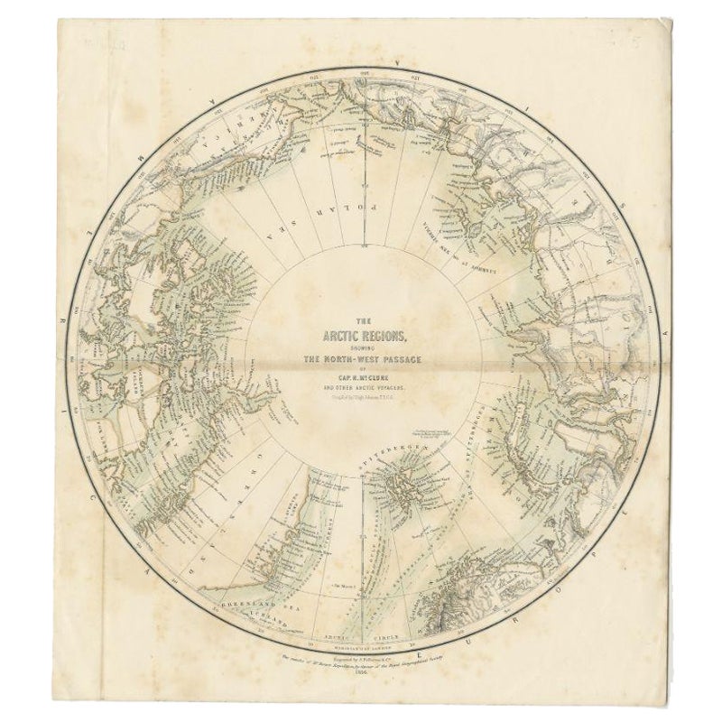
- Antique Map of the North Pole by Fullarton, 1856Located in Langweer, NLAntique map titled 'The Arctic Regions showing the North-West Passage of Captain R. McClure'. Old map of the North Pole, displaying the Northwest Passage di...Category
Antique 19th Century Maps
MaterialsPaper
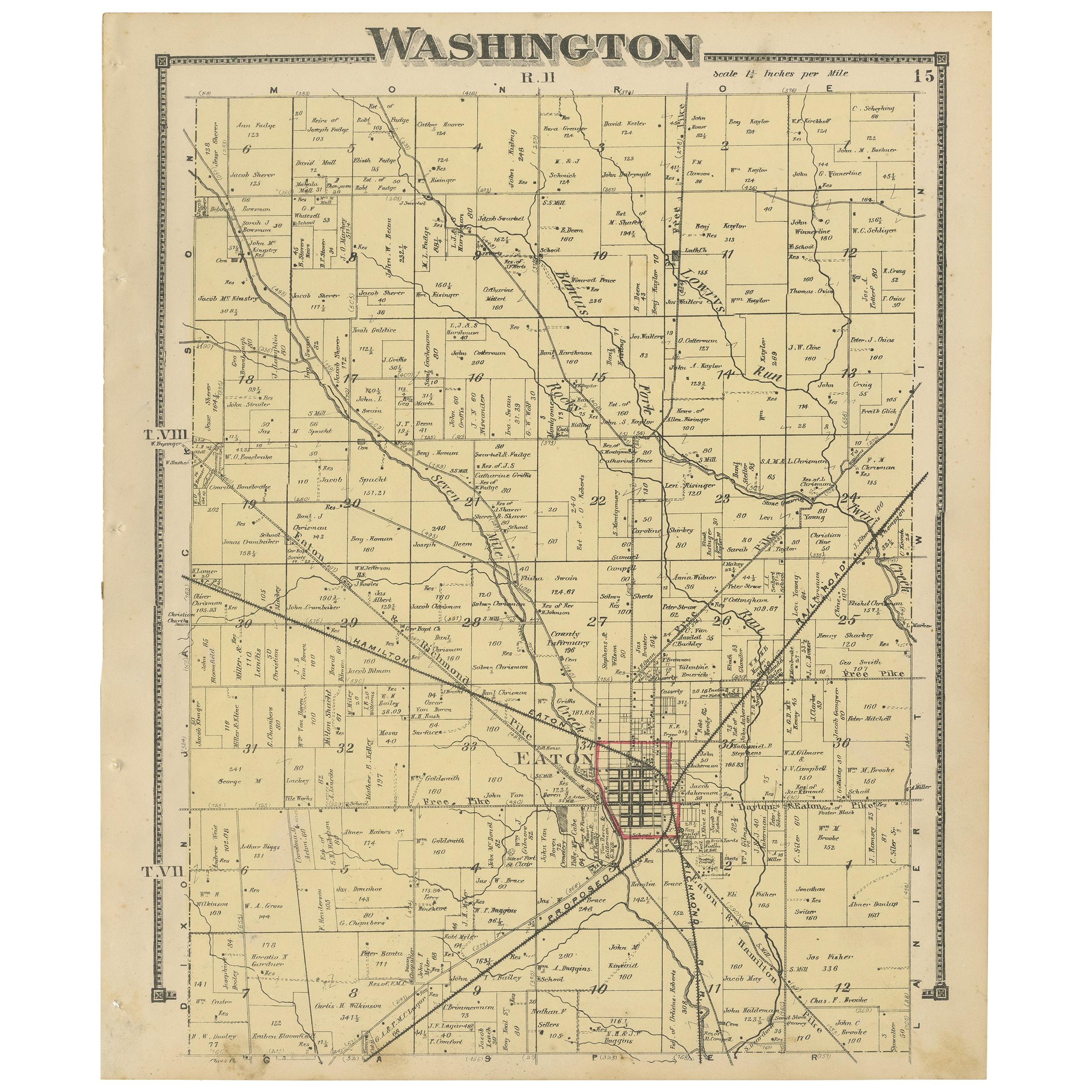
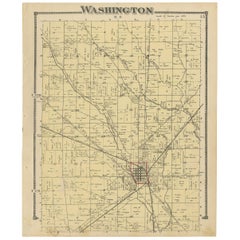
- Antique Map of Washington County 'Ohio' by Titus, 1871Located in Langweer, NLAntique map titled 'Washington'. Original antique map of Washington, Ohio. This map originates from 'Atlas of Preble County Ohio' by C.O. Titus. Published, 1871.Category
Antique Late 19th Century Maps
MaterialsPaper
 $205 Sale Price24% Off
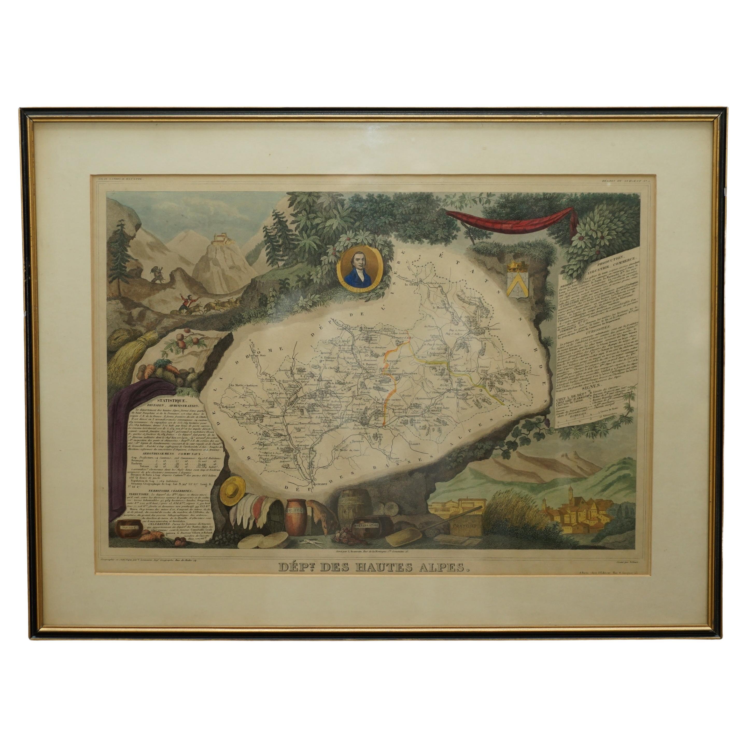
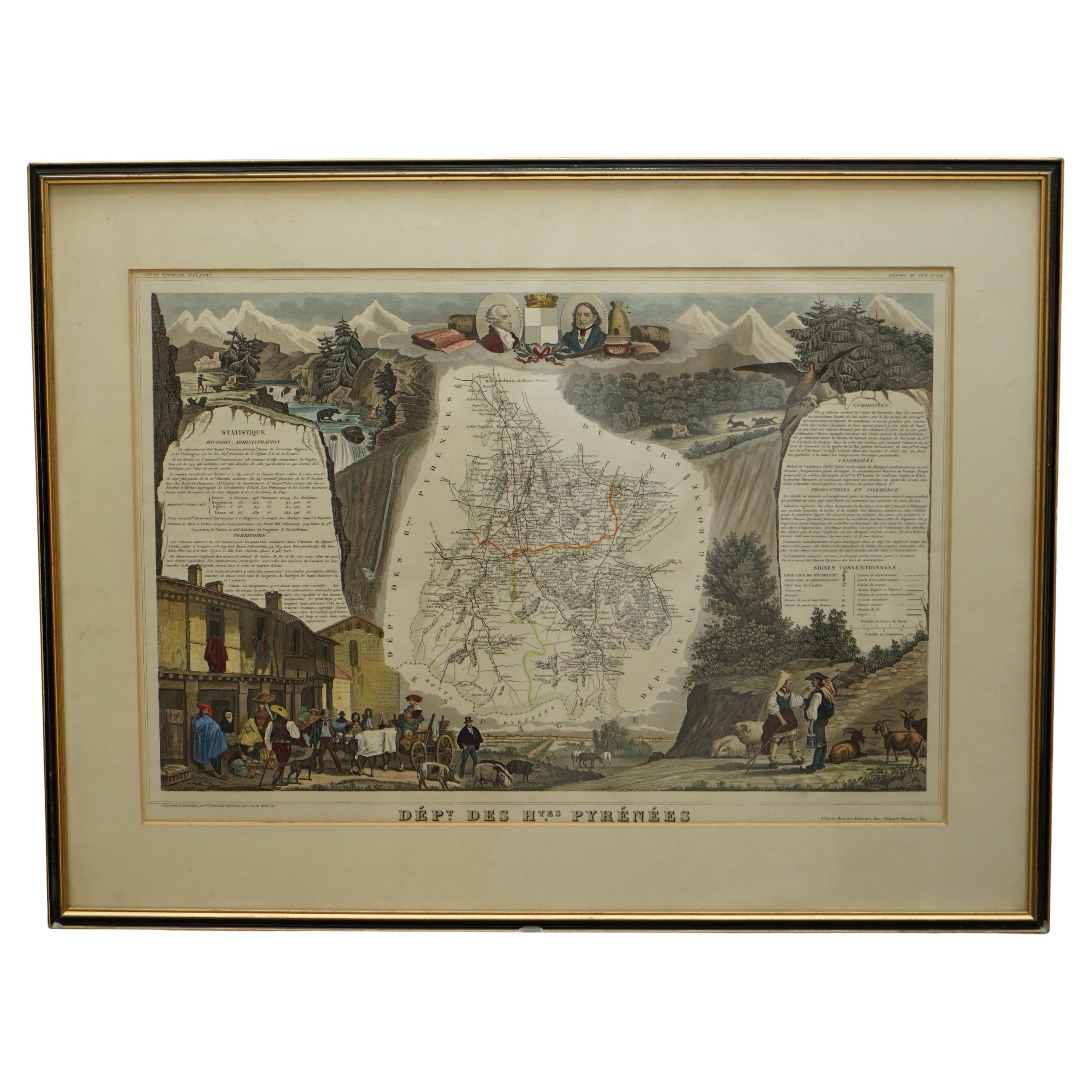
 - Fine Antique 1856 Hand Watercolour Map of Dept Des Hautes Alpes by Levasseur'sLocated in GBWe are delighted to offer for sale this stunning 1856 hand watercolour map of the Austrian Alps titled Dept Des Hautes Alpes taken from the Atlas National...Category
Antique 1850s French Early Victorian Maps
MaterialsPaper
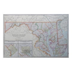
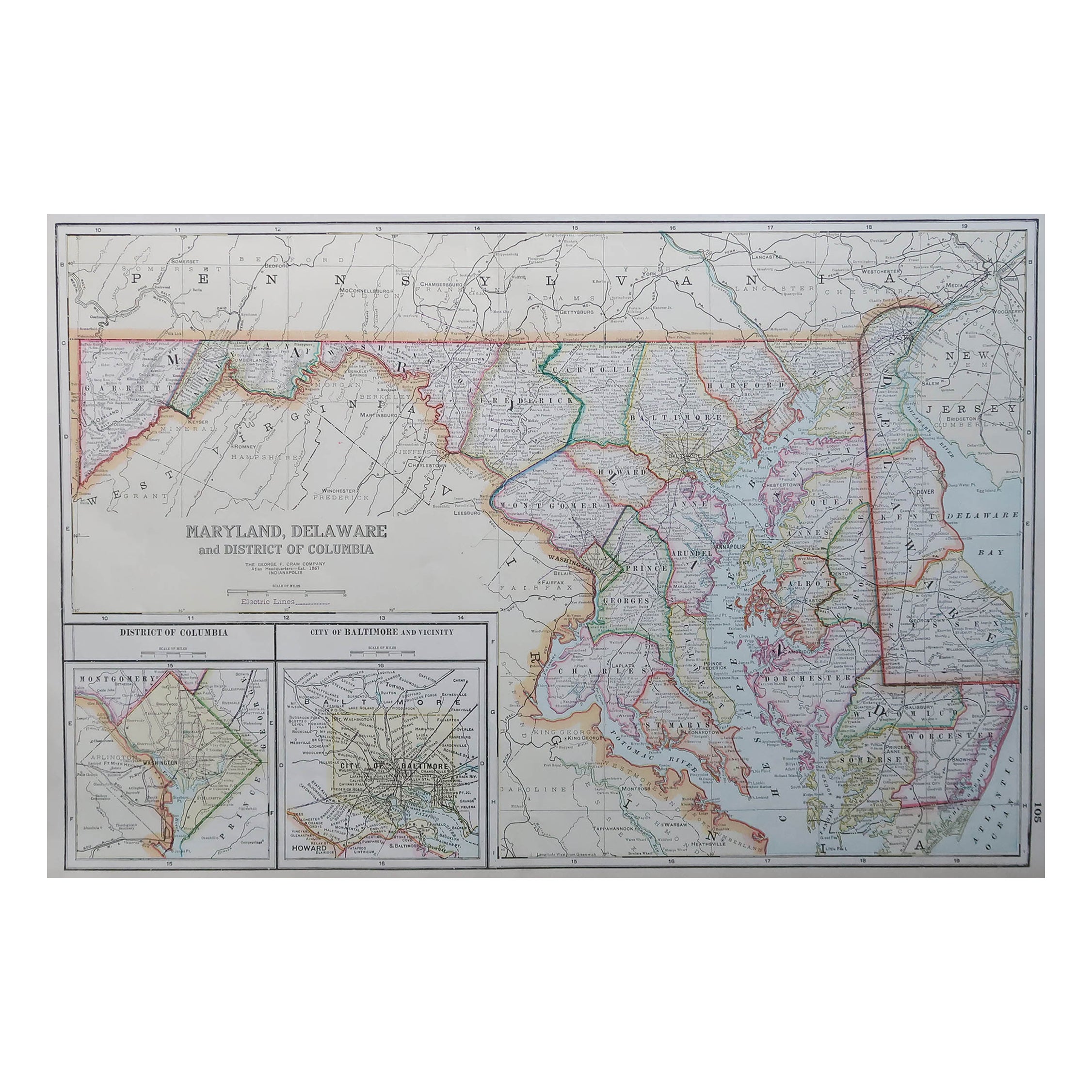
- Large Original Antique Map of Maryland, Delaware & DC, USA, C.1900Located in St Annes, LancashireFabulous map of Maryland, Delaware And District of Columbia Original color Engraved and printed by the George F. Cram Company, Indianapolis. Pu...Category
Antique 1890s American Maps
MaterialsPaper
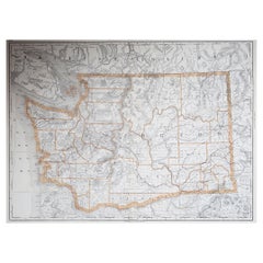
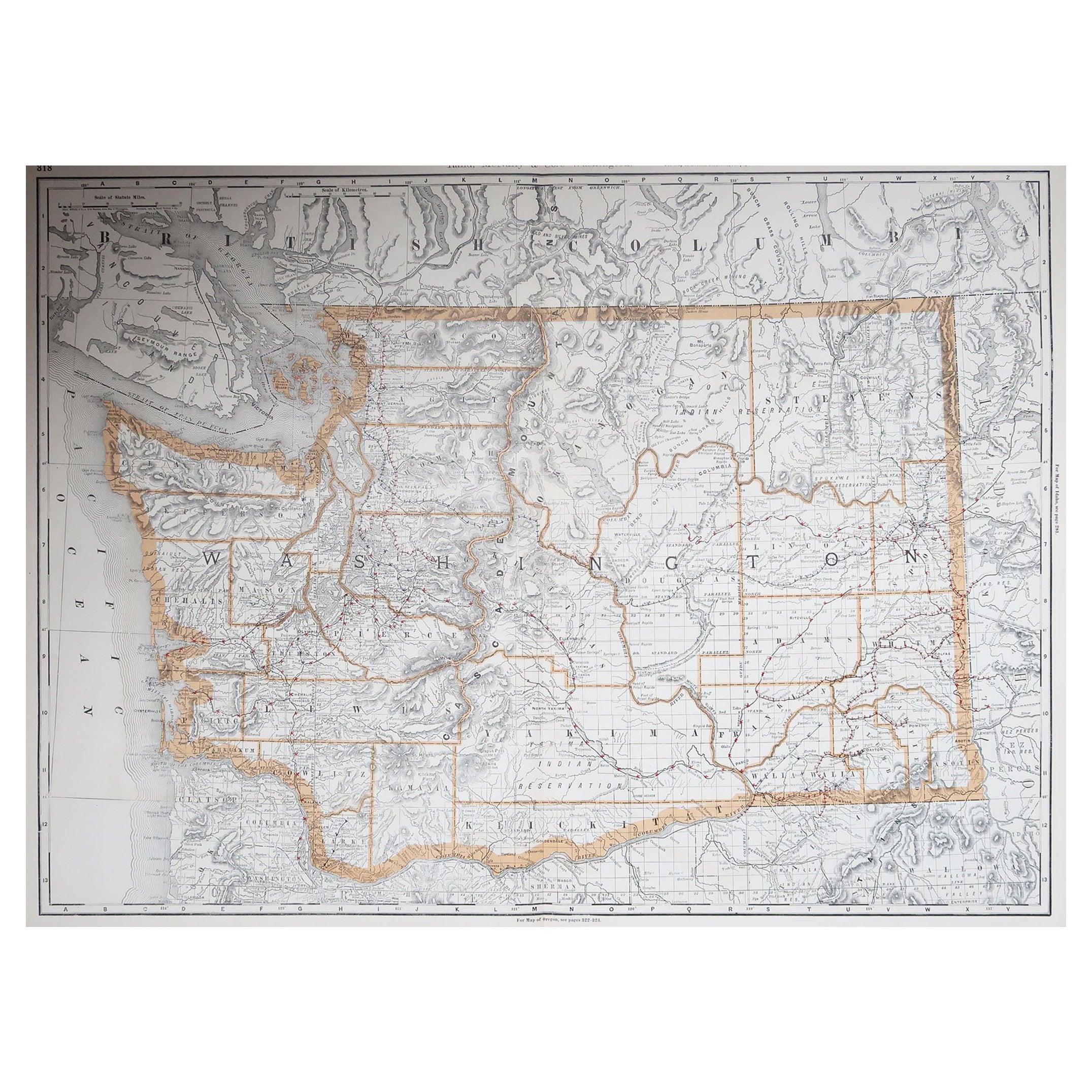
- Large Original Antique Map of Washington, 'State', USA, 1894By Rand McNally & Co.Located in St Annes, LancashireFabulous map of Washington. Original color. By Rand, McNally & Co. Published, 1894. Unframed. Free shipping.Category
Antique 1890s American Maps
MaterialsPaper