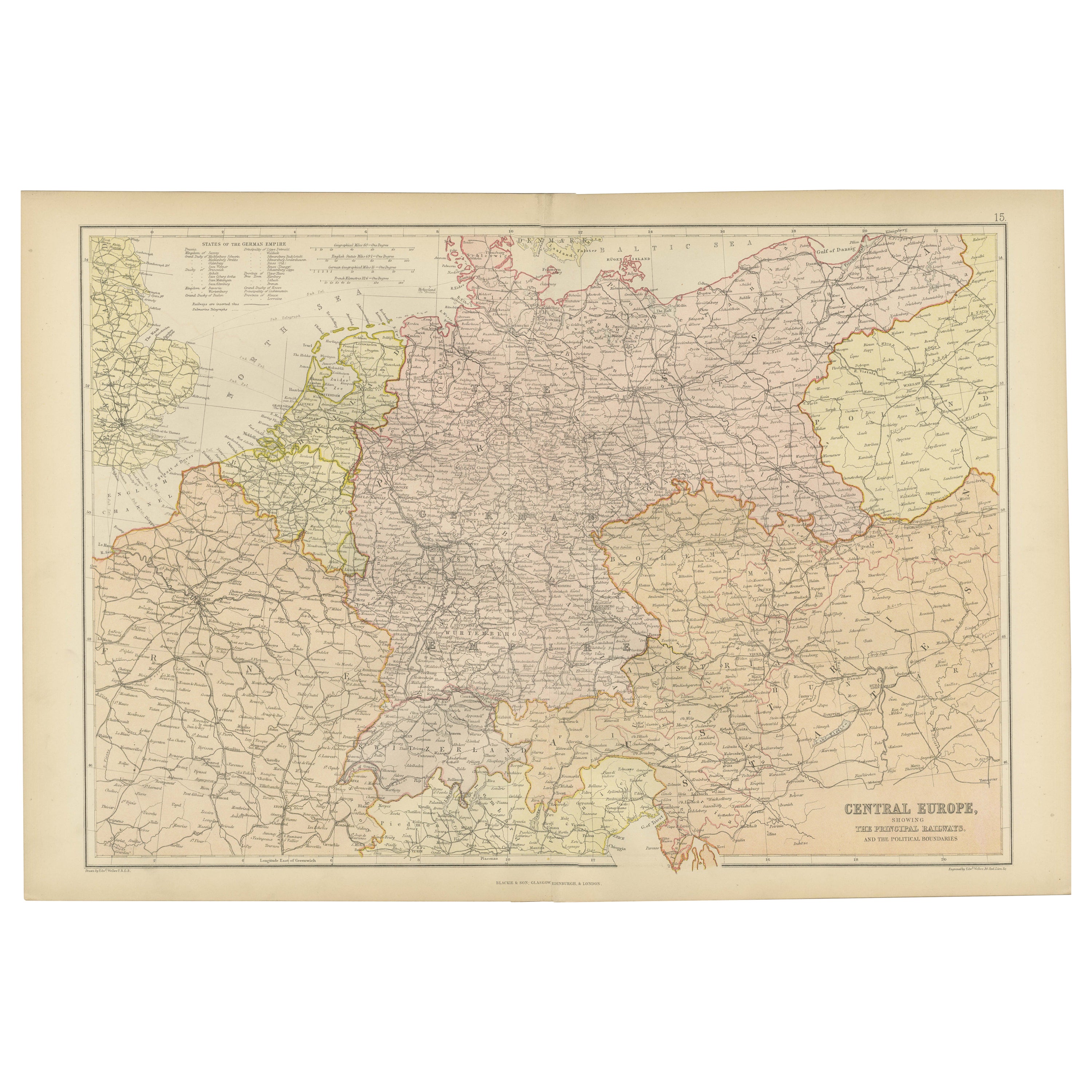
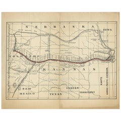
1886 Skeleton Map of the Union Pacific Railway
View Similar Items


Want more images or videos?
Request additional images or videos from the seller
1 of 5
1886 Skeleton Map of the Union Pacific Railway
About the Item
- Dimensions:Height: 15.5 in (39.37 cm)Width: 31 in (78.74 cm)Depth: 1 in (2.54 cm)
- Materials and Techniques:
- Place of Origin:
- Period:
- Date of Manufacture:1886
- Condition:Wear consistent with age and use.
- Seller Location:Colorado Springs, CO
- Reference Number:Seller: M2921stDibs: LU909718880202
About the Seller
4.9
Platinum Seller
These expertly vetted sellers are 1stDibs' most experienced sellers and are rated highest by our customers.
Established in 2010
1stDibs seller since 2011
400 sales on 1stDibs
More From This SellerView All
- 1861 Topographical Map of the District of Columbia, by Boschke, Antique MapLocated in Colorado Springs, COPresented is an original map of Albert Boschke's extremely sought-after "Topographical Map of the District of Columbia Surveyed in the Years 1856 ...Category
Antique 1860s American Historical Memorabilia
MaterialsPaper
- 1889 "The Pacific States and Territories"Located in Colorado Springs, COPresented is an uncommon 1889 map of the western United States, titled “The Pacific States and Territories.” The vertical map depicts the Western states at the time: Washington, Oregon, California, Montana, Idaho, Wyoming, Utah, Colorado, Arizona, and New Mexico. They are bordered by British America to the north, Lower California, Mexico and Texas to the south, and North Dakota, South Dakota, Nebraska and Texas to the east. The map provides a fascinating look at the western states of the United States, just before the turn of the century. In addition to excellent topographical detail of mountain ranges, the map identifies towns and cities, rivers, lakes, deserts and valleys. Crisscrossing across the states, railroad routes are identified with hatched blacklines. Death Valley, Yosemite, Yellowstone National Park, as well as the key mining towns, like Virginia City...Category
Antique 1880s American Maps
MaterialsPaper
- "Clason's Guide Map of Montana" by The Clason Map Company, Circa 1920sLocated in Colorado Springs, COPresented is “Clason's Guide Map of Montana,” published in the early 1920s by the Clason Map Company. Issued as a folding map, this map identifies county boundaries, county seats, Na...Category
Vintage 1920s American Art Deco Maps
MaterialsPaper
- 1908 "Map of Texas" by The Kenyon CompanyLocated in Colorado Springs, COPresented is an antique map of the state of Texas, printed as a pocket map in 1908 by The Kenyon Company. The state map is brightly colored by county, with principal cities and towns listed. The congressional districts are numbered and boldly outlined in red. Rivers, roads, and railroads all appear prominently on this fantastic map...Category
Antique Early 1900s American Maps
MaterialsPaper
- 1859 "Map of the United States of America..." by J. H. ColtonBy J.H. ColtonLocated in Colorado Springs, COPresented is an 1859 “Map of the United States of America, the British Provinces, Mexico, the West Indies and Central America with Part of...Category
Antique 1850s American Maps
MaterialsPaper
- 1840 Map of the City of Washington Published by William M. MorrisonLocated in Colorado Springs, COThis map, printed in 1840, is a detailed representation of Washington, D.C. in the mid-19th century. The map shows block numbers, wards, and government buildings as well as details o...Category
Antique 1840s American Federal Maps
MaterialsPaper


You May Also Like
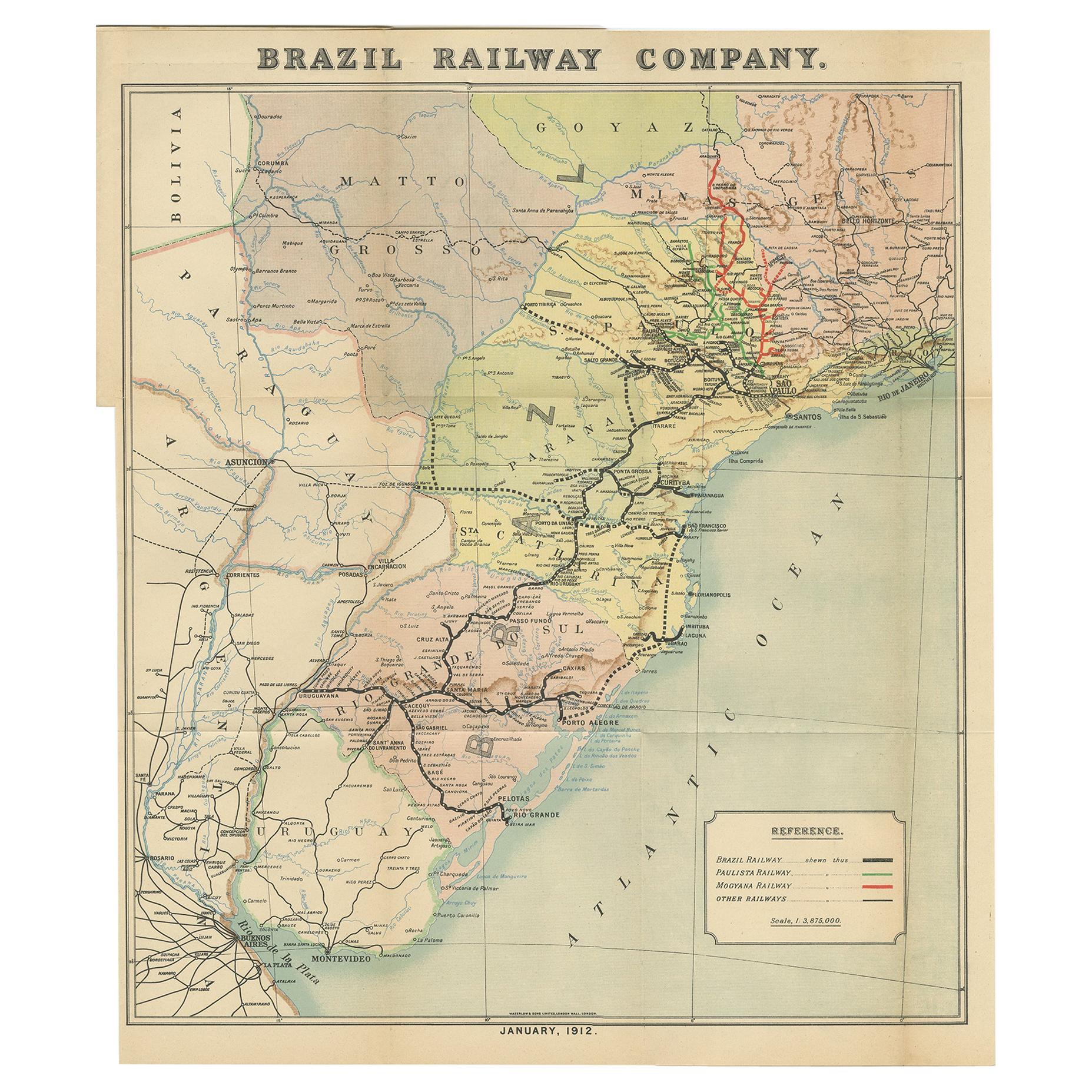
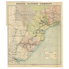
- Antique Map of the Brazil Railway Company, '1912'Located in Langweer, NLAntique map titled 'Brazil Railway Company'. This folding map is attached to the booklet titled 'The Brazil Railway Company'. It is a memorandum by A. H. A. Knox-Little, who was the ...Category
Early 20th Century Maps
MaterialsPaper
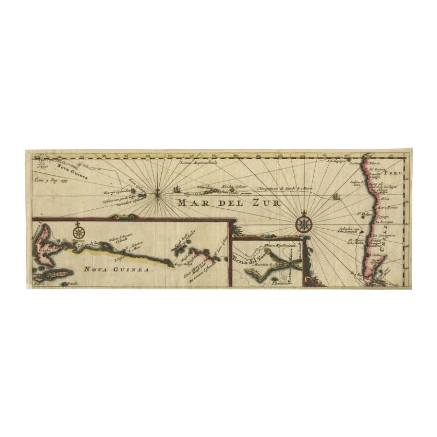
- Antique Map of the Pacific Ocean by Renneville, 1725Located in Langweer, NLRare map of the Southern Pacific, illustrating Le Maire's tracks, extending from the La Maire Straits to Nova Guinea, with a large inset of the northern Coastline of New Guinea and a...Category
Antique 18th Century Maps
MaterialsPaper
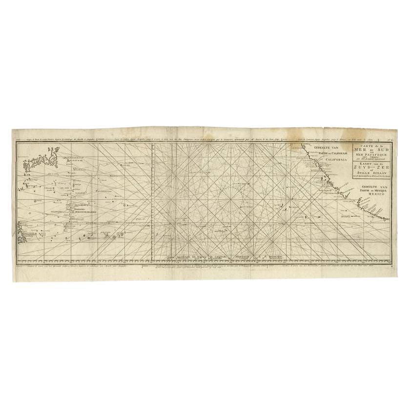
- Antique Map of the Pacific Ocean by Anson, 1765Located in Langweer, NLAntique map titled 'Carte de la Mer du Sud ou Mer Pacifique - Kaart van de Zuyd-Zee of stille oceaan (..)'. Nautical chart of the Pacific Ocean depicting the trade routes used by Spanish Galleons from Acapulco in Mexico to Manila in the Philippines. In particular this chart depicts the voyages of the Spanish Nostra Seigniora de Cabadonga and the British Navy Commodore George Anson. Anson succeed in capturing the Spanish treasure...Category
Antique 18th Century Maps
MaterialsPaper
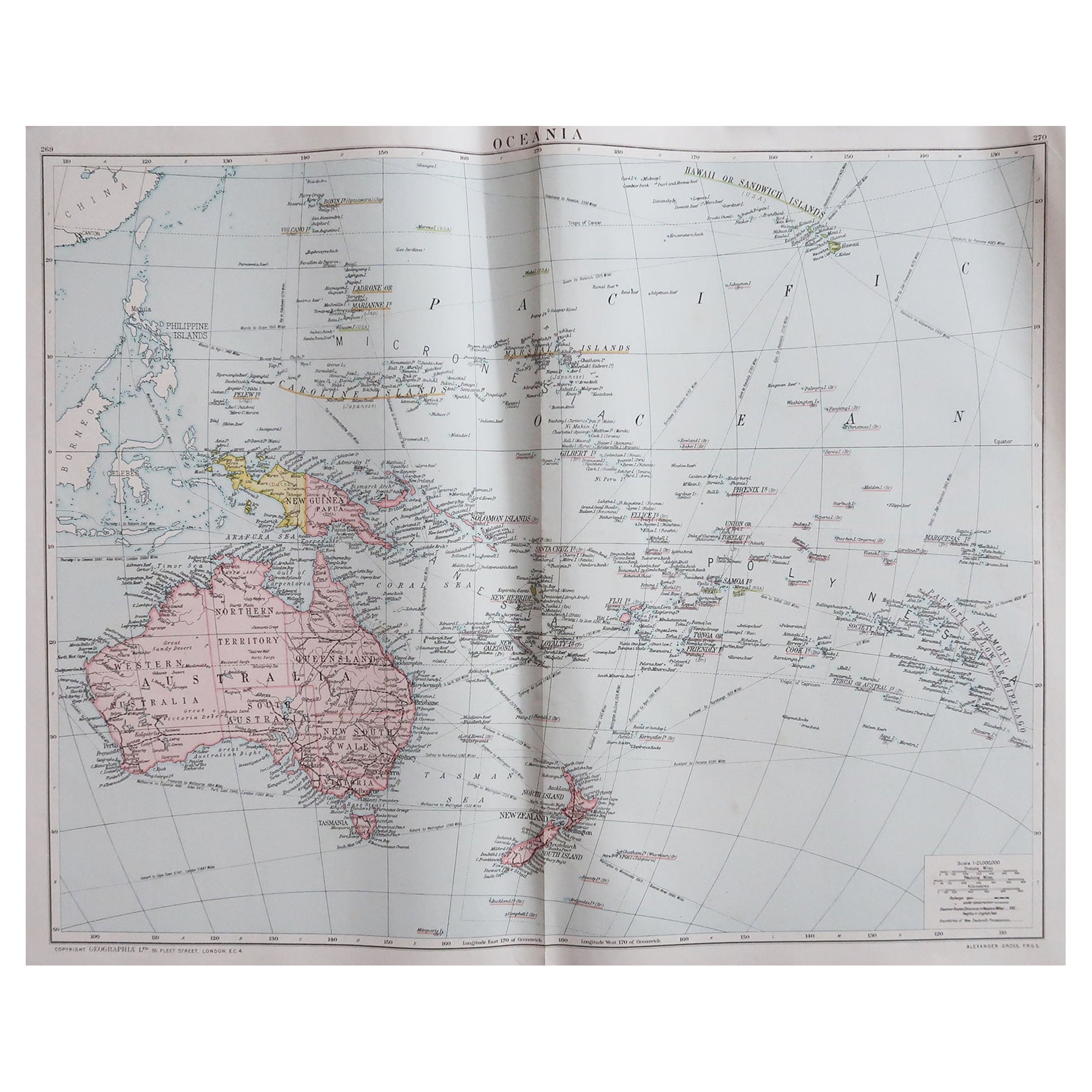
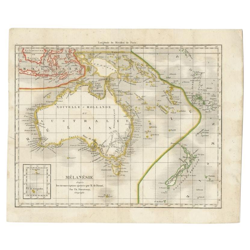
- Antique Map of the Pacific Ocean by Rienzi, 1836Located in Langweer, NLAntique map titled 'Mélanésie'. Map of the Pacific ocean around Australia, including Java, Timor, the Solomon Islands and New Zealand. This print or...Category
Antique 19th Century Maps
MaterialsPaper
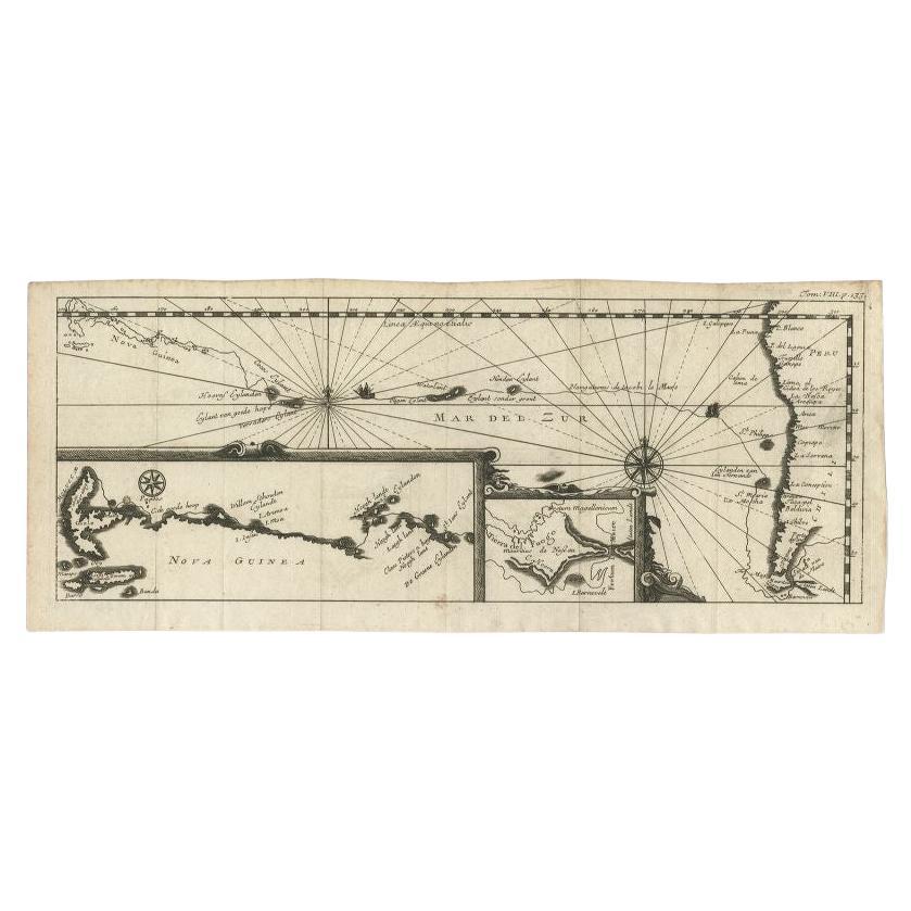
- Antique Map of the Pacific Ocean by Renneville, 1702Located in Langweer, NLAntique map, untitled. A map of the Pacific Ocean, with the coast of Peru in the right edge and the outline of New Guinea in the left edge. In betwe...Category
Antique 18th Century Maps
MaterialsPaper
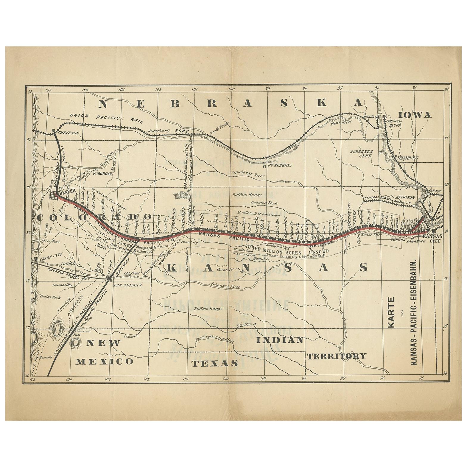
- Antique Map of the Kansas Pacific Railroad, circa 1900Located in Langweer, NLAntique map titled 'Karte der Kansas-Pacific-Eisenbahn'. Lithographed map of the Kansas Pacific railroad. German text on verso which reads 'Kansas Pacific Eisenbahn Gesellschaft erst...Category
Early 20th Century Maps
MaterialsPaper


Recently Viewed
View AllMore Ways To Browse
Pacific Railway
Great Northern Railway
Rail Road
Antique Linen Map
Antique Civil War Maps
Southern Pacific Railroad
Antique Railroad Maps
Antique Black And White Horse Prints
Locomotive Print
Antique Cowboy Collectibles
Map Railroad
Antique Locomotives
Lithograph 1800s
Central America Map
Southern Pacific Lines Railway
Old Map California
Old Map Of California
United States Civil War Map