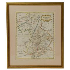
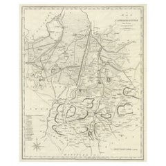
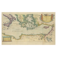
18th Century Map of Cambridgeshire
View Similar Items


Want more images or videos?
Request additional images or videos from the seller
1 of 7
18th Century Map of Cambridgeshire
About the Item
- Dimensions:Height: 23.75 in (60.33 cm)Width: 21 in (53.34 cm)Depth: 0.5 in (1.27 cm)
- Materials and Techniques:
- Place of Origin:
- Period:
- Date of Manufacture:18th Century
- Condition:Wear consistent with age and use. Excellent antique condition - Wear commensurate with age and use.
- Seller Location:Austin, TX
- Reference Number:Seller: R14851stDibs: LU8827824226
About the Seller
5.0
Vetted Seller
These experienced sellers undergo a comprehensive evaluation by our team of in-house experts.
Established in 1987
1stDibs seller since 2009
798 sales on 1stDibs
Typical response time: 1 hour
More From This SellerView All
- French Velocipede or Child's Horse Tricycle from the 19th CenturyLocated in Austin, TXA fine French velocipede or child's toy horse tricycle from the 19th century, featuring a body of carved wood with brushed steel face-plate and glass ey...Category
Antique 19th Century French Toys and Dolls
MaterialsSteel, Iron, Brass
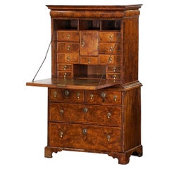
- George I Secretary Bureau or Escritoire of Figured Walnut from the 18th CenturyLocated in Austin, TXA fine English period George I secretary bureau escritoire or scriptor of figured patinated walnut from the 18th century featuring original s...Category
Antique 18th Century English George I Secretaires
MaterialsMetal, Brass
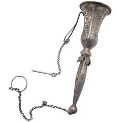
- Posy Holder of Silver from FranceLocated in Austin, TXA rare 19th century French posy holder or tussy-mussy of silver, featuring a six-sided flute and handle with etched foliate design. Including long pin a...Category
Antique 19th Century French Vases and Vessels
MaterialsSilver
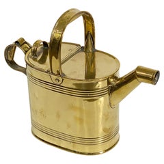
- English Garden Watering Can of BrassLocated in Austin, TXA fine English oval watering can of brass for the garden with a brass handle across the top, hinged back section, and a smaller handle at the end opposite the spout. With registratio...Category
Early 20th Century English Collectibles and Curiosities
MaterialsMetal, Brass
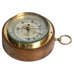
- English Barometer of Brass in Wood HousingLocated in Austin, TXA fine English barometer of brass with a glass facing and wood casing - with ring top for display. Reads Stormy - Rain - Change - Fair - Very DryCategory
20th Century English Scientific Instruments
MaterialsBrass
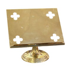
- English Lectern or Book Stand of BrassLocated in Austin, TXA fine English table top lectern, missal or book stand of brass, featuring a reading top with pierced quatrefoils at each corner. The revolving recta...Category
Early 20th Century English Religious Items
MaterialsMetal, Brass

You May Also Like
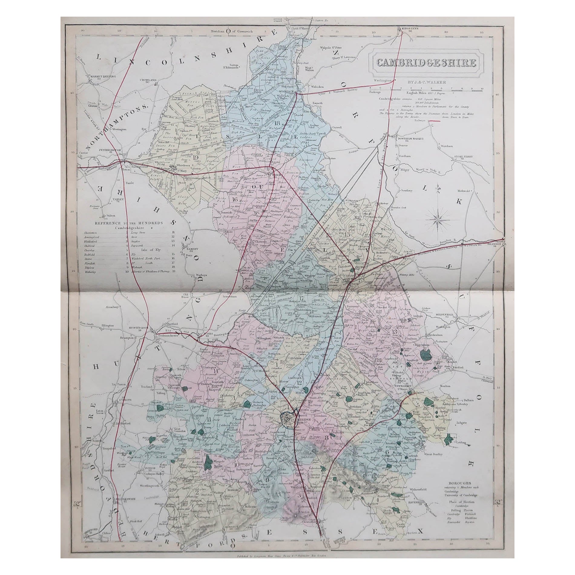
- Large Antique County Map of Cambridgeshire, EnglandLocated in Langweer, NLAntique map titled 'A Map of Cambridgeshire from the best Authorities'. Original old county map of Cambridgeshire, England. Engraved by John Cary. Originates from 'New British Atlas'...Category
Antique Early 19th Century Maps
MaterialsPaper
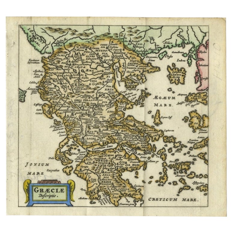
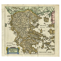
- Charming 18th Century Miniature Map of Greece, 1685Located in Langweer, NLAntique map titled 'Graeciae Descriptio.' Charming miniature map of Greece from the pocket atlas 'Introductionis in Universam Geographiam tam Veterem qu...Category
Antique 17th Century Maps
MaterialsPaper
- Antique 18th Century Map of the Province of Pensilvania 'Pennsylvania State'Located in Philadelphia, PAA fine antique of the colony of Pennsylvania. Noted at the top of the sheet as a 'Map of the province of Pensilvania'. This undated and anonymous map is thought to be from the Gentleman's Magazine, London, circa 1775, although the general appearance could date it to the 1760's. The southern boundary reflects the Mason-Dixon survey (1768), the western boundary is placed just west of Pittsburgh, and the northern boundary is not marked. The map has a number of reference points that likely refer to companion text and appear to be connected to boundaries. The western and southern boundaries are marked Q, R, S, for example. A diagonal line runs from the Susquehanna R to the Lake Erie P. A broken line marked by many letters A, B, N, O, etc., appears in the east. There are no latitude or longitude markings, blank verso. Framed in a shaped contemporary gilt wooden frame and matted under a cream colored matte. Bearing an old Graham Arader Gallery...Category
Antique 18th Century British American Colonial Maps
MaterialsPaper
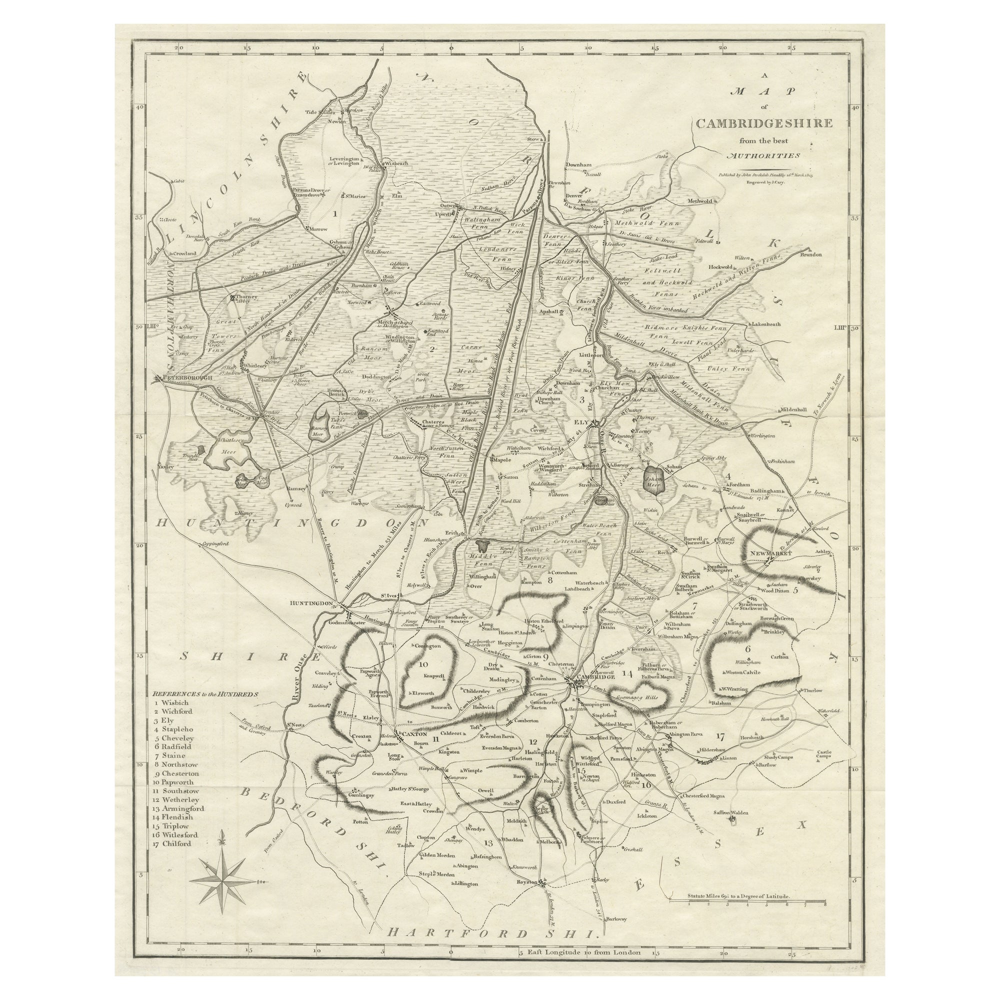
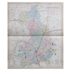
- Original Antique English County Map, Cambridgeshire, J & C Walker, 1851Located in St Annes, LancashireGreat map of Cambridgeshire Original colour By J & C Walker Published by Longman, Rees, Orme, Brown & Co. 1851 Unframed.Category
Antique 1850s English Other Maps
MaterialsPaper
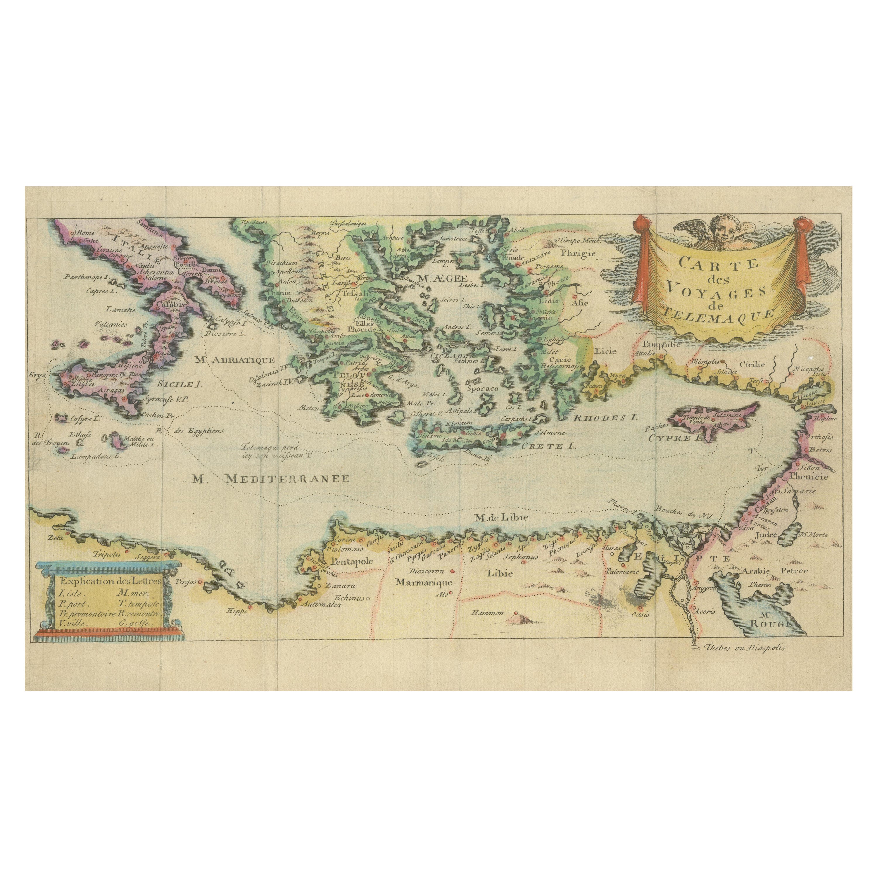
- Antique Map of the Mediterranean, Telemachus' Journey, Publ. Early 18th CenturyLocated in Langweer, NLTitle: Carte des voyages de Télémaque. Description: Antique map of Telemachus journey, the son of Odysseus and Penelope (Greek mythology ). This map appeared for the first time, e...Category
Antique Early 18th Century Maps
MaterialsPaper
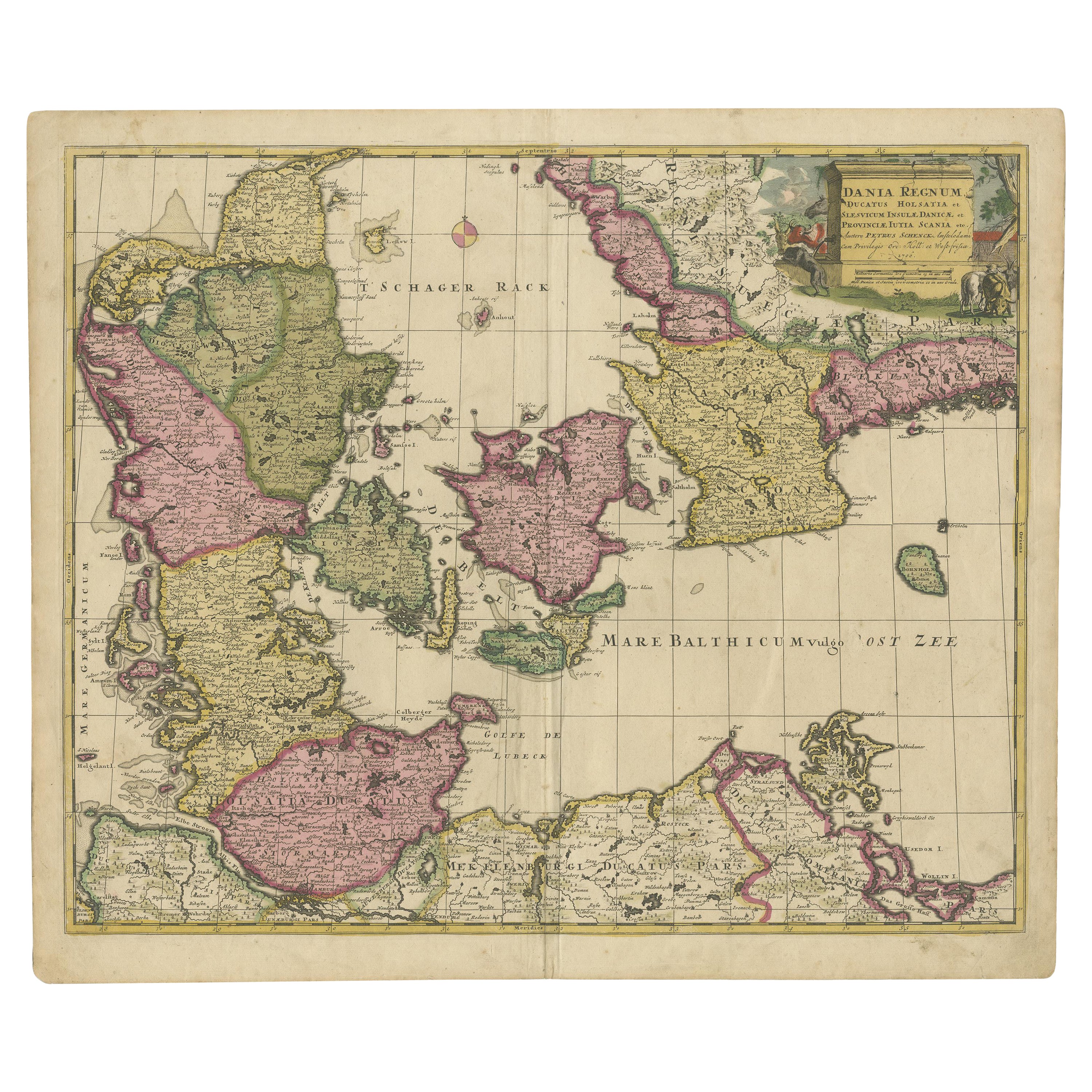
- Scandinavia & Portions of Eastern Europe: 18th Century Hand-Colored Homann MapBy Johann Baptist HomannLocated in Alamo, CAAn early 18th century hand-colored copper-plate map entitled "Regni Sueciae in omnes suas Subjacentes Provincias accurate divisi Tabula Generalis" by Johann Baptist Homann (1663-1724...Category
Antique Early 18th Century German Maps
MaterialsPaper


Recently Viewed
View AllMore Ways To Browse
Cambridge Map
Antique Cambridge Glass
Antique Furniture Camden
Antique Maps Cambridge
Antique Cambridgeshire
Antique Furniture Cambridgeshire
Maps Cambridge England
Antique Furniture South East London
Antique Island Caribbean
Teak Sphere
Atlas Stand
Antique Battle Maps
Reclaimed Lumber
Map Of Virginia
Antique Pirate
Bag With Map
Pirate Antique
Bonne Map