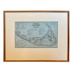
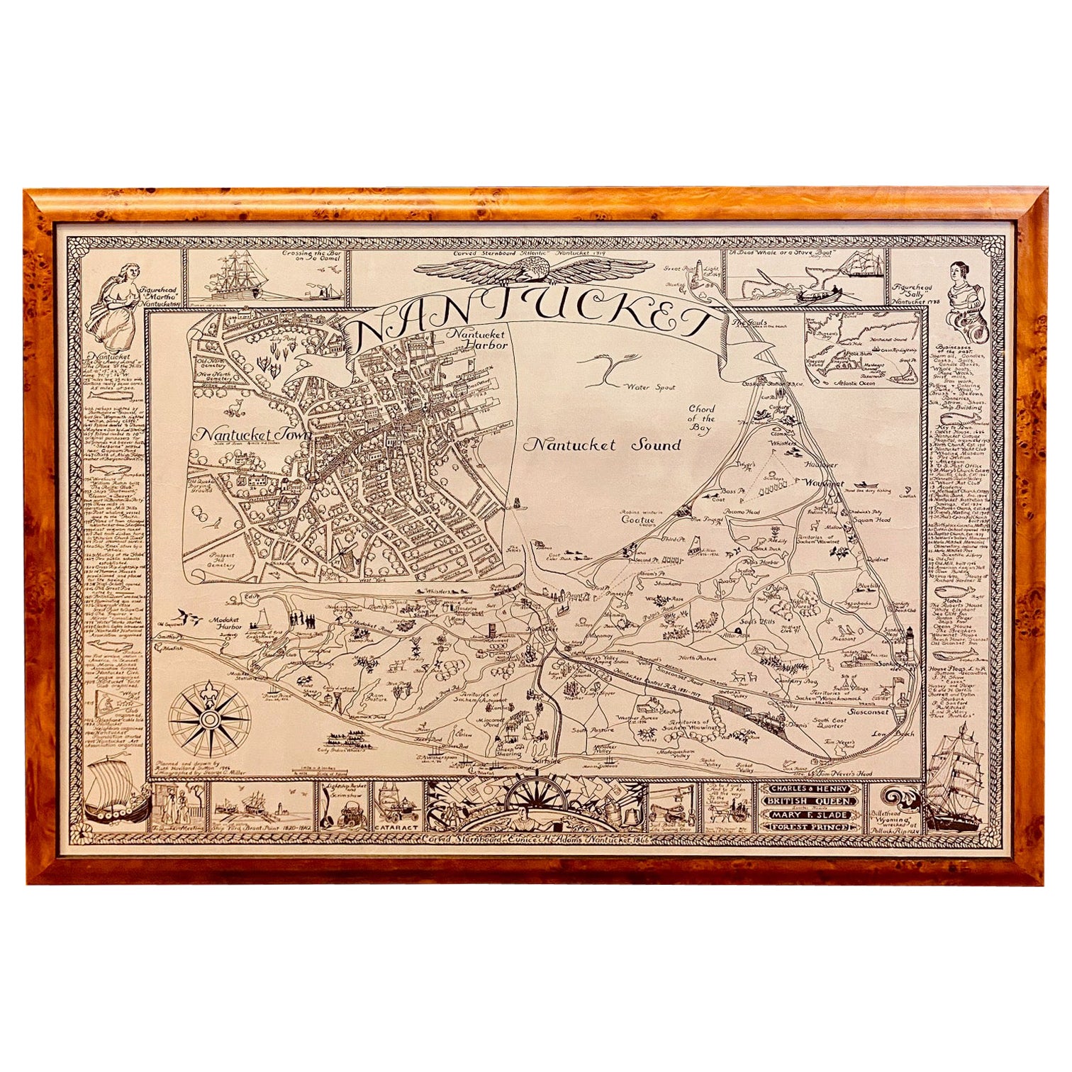
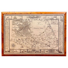
19th Century Nantucket Map by Rev, Ewer, circa 1886
View Similar Items


Want more images or videos?
Request additional images or videos from the seller
1 of 6
19th Century Nantucket Map by Rev, Ewer, circa 1886
About the Item
- Dimensions:Height: 17.75 in (45.09 cm)Width: 20 in (50.8 cm)Depth: 0.5 in (1.27 cm)
- Style:Victorian (Of the Period)
- Materials and Techniques:Paper,Other
- Place of Origin:
- Period:
- Date of Manufacture:1886
- Condition:Wear consistent with age and use. Minor structural damages. There appears to be one small tear along one of the original folds.
- Seller Location:Nantucket, MA
- Reference Number:Seller: AD - FH-30 LVA1stDibs: LU903923708852
About the Seller
5.0
Platinum Seller
These expertly vetted sellers are 1stDibs' most experienced sellers and are rated highest by our customers.
1stDibs seller since 2010
239 sales on 1stDibs
Typical response time: 1 hour
More From This SellerView All
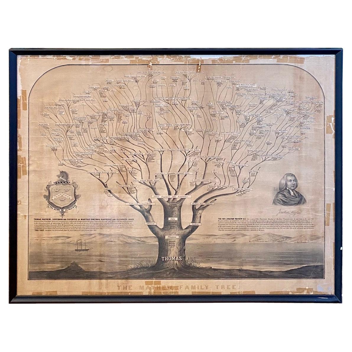
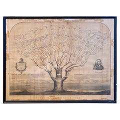
- 19th Century Mayhew Family Tree from Nantucket and Martha's Vineyard from 1855Located in Nantucket, MAVery rare 19th century Mayhew Family tree from Nantucket and Martha's Vineyard, lithograph on paper laid on linen, printed in 1855, in form of liter...Category
Antique 1850s American Other Historical Memorabilia
MaterialsPaper, Linen
- Vintage Map of Nantucket Town by Ruth Haviland Sutton, 1946Located in Nantucket, MAVintage Map of Nantucket Town by Ruth Haviland Sutton, 1946, a classic vintage tourist map of Nantucket Island showing historic landmarks and geogr...Category
Vintage 1940s American Other Maps
MaterialsPaper
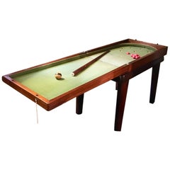
- 19th Century Child’s Mahogany Bagatelle Table, circa 1840Located in Nantucket, MA19th century child’s mahogany Bagatelle table, circa 1840, mounted on a period custom base. The shallow rectangular mahogany case is hinged to open as ...Category
Antique 1840s English Regency Games
MaterialsMahogany
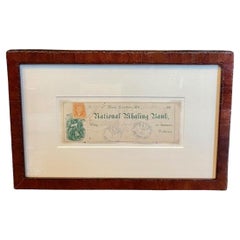
- 19th Century National Whaling Bank CheckLocated in Nantucket, MARare 19th Century Bank Check Drawn on the "National Whaling Bank" of New London, Connecticut, written on 23 December and deposited and cancelled on 5 January 1872. The check is adorn...Category
Antique 1870s American Victorian Historical Memorabilia
MaterialsPaper
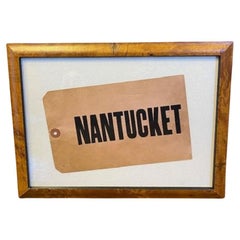
- Nantucket Steamship Luggage Tag, circa 1920sLocated in Nantucket, MAAntique Nantucket Steamship Luggage Tag, circa 1920s, heavy stock paper or card in faded red with the printed inscription "NANTUCKET." This is the last of a stash found in an attic on Nantucket. The tag is in excellent condition, with the color delightfully faded to what is popularly known today as "Nantucket Red...Category
Early 20th Century American Industrial Historical Memorabilia
MaterialsPaper
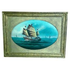
- 19th Century China Trade Seascape with a Junk, Signed, circa 1870Located in Nantucket, MA19th Century China Trade Seascape with a Junk, by Lee Heng, circa 1870, an oil on board seascape with large Chinese Junk under full sail in the fo...Category
Antique 1870s Chinese Chinese Export Paintings
MaterialsOther
You May Also Like
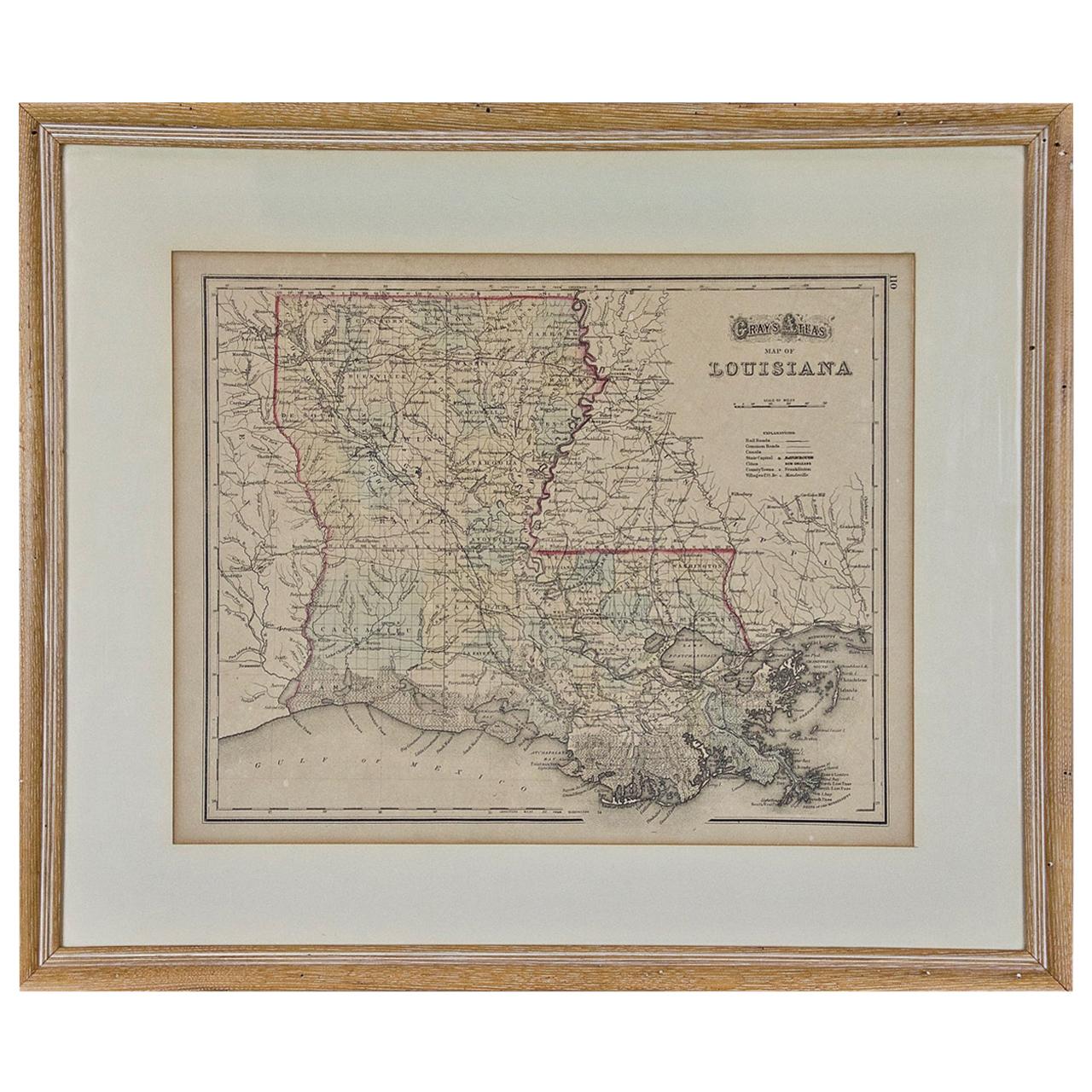
- Louisiana: A Framed 19th Century Map by O. W. GrayBy Gray and CoLocated in Alamo, CAThis framed 19th century map of the Louisiana territory was published in "Gray's Atlas of the United States with General Maps of the World, accompanied by Descriptions Geographical, Historical, Scientific and Statistica" published in 1873 in Philadelphia by O.W. Gray and Son and Stedman, Brown and Lyon. It is a highly detailed map of Louisiana...Category
Antique Mid-19th Century American Other Maps
MaterialsPaper
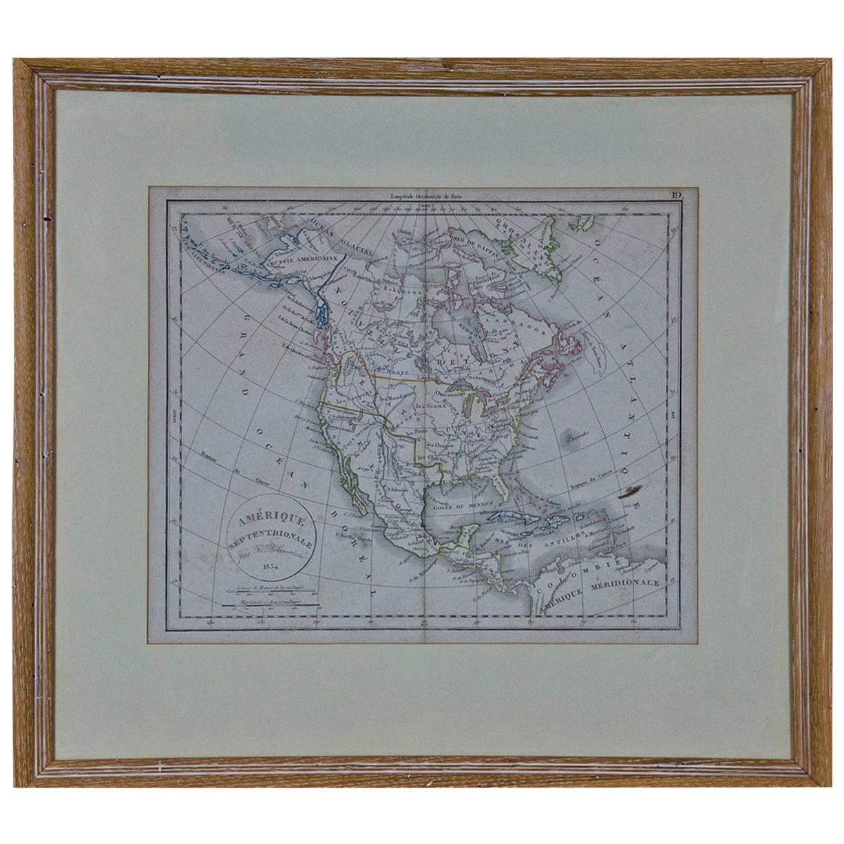
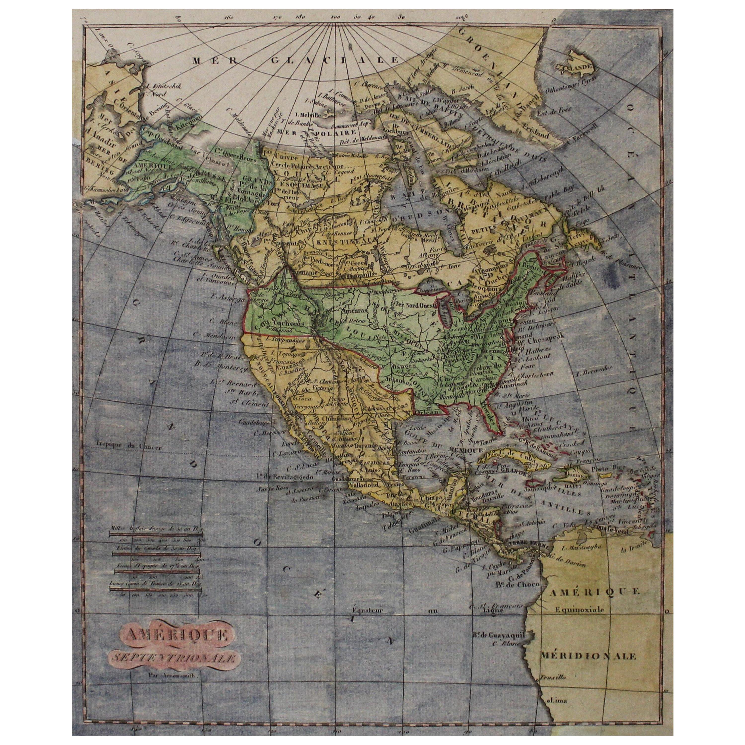
- America "Amérique Septentrionale": A 19th Century French Map by DelamarcheBy Maison Delamarche 1Located in Alamo, CAThis framed mid 19th century map of North America entitled "Amérique Septentrionale" by Felix Delamarche was published in Paris in 1854 by Quay de l'Horloge du Palais, avec les Carte...Category
Antique Mid-19th Century American Other Maps
MaterialsPaper
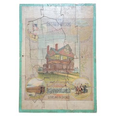
- Advertising Puzzle USA Map Sherwin Williams Paint, 19th CenturyLocated in Fulton, CAA cardboard advertising puzzle for Sherwin Williams Paint, circa 1883. All original pieces intact. Reverse of puzzle has map of United States. Feature...Category
Antique Late 19th Century American Late Victorian Historical Memorabilia
MaterialsComposition
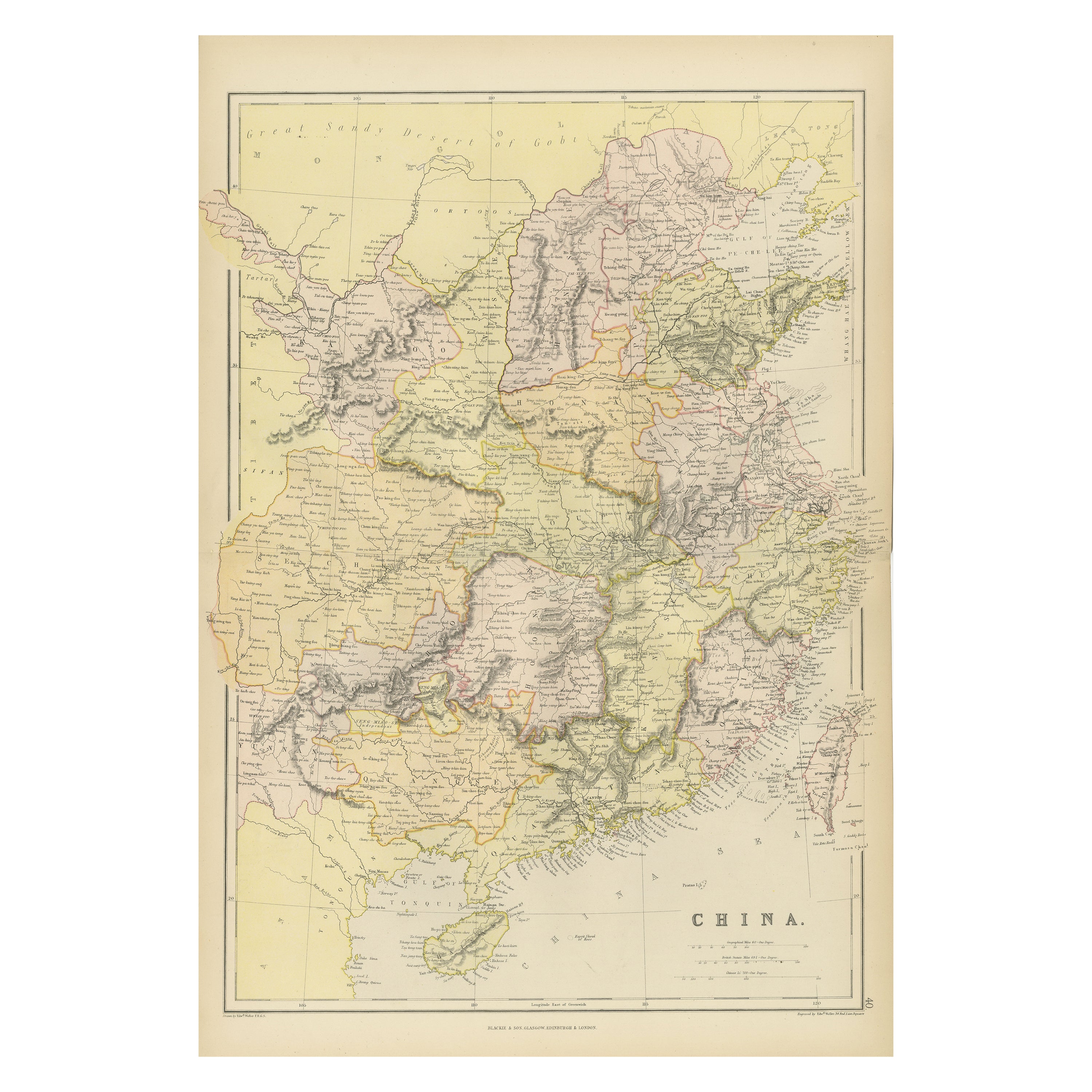
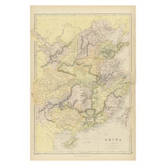
- Antique 19th Century Map of China by Blackie & Son, 1882Located in Langweer, NLThis map is an 1882 Blackie & Son map of China. The title "CHINA." is prominently displayed at the bottom. The map is colored to differentiate various regions, possibly indicating di...Category
Antique 1880s Maps
MaterialsPaper
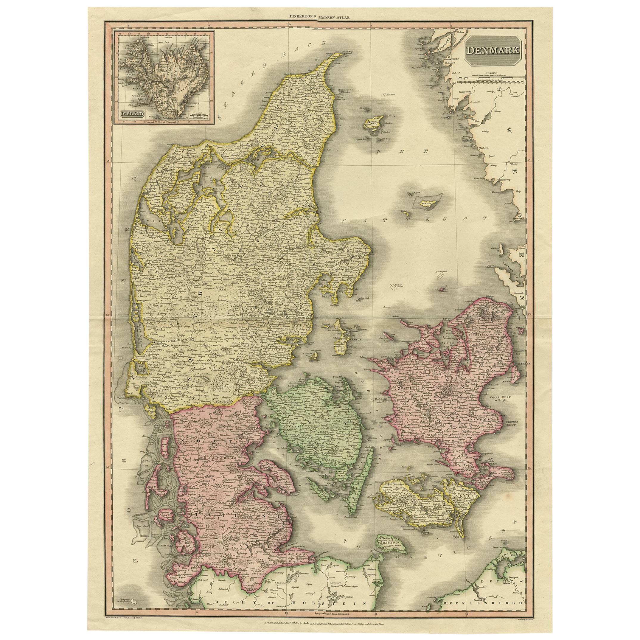
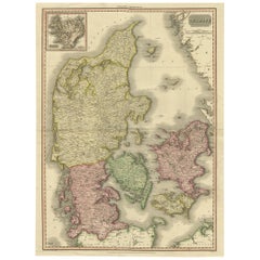
- 19th Century Large Original Antique Map of Denmark by J. Pinkerton, 1812By PinkertonLocated in Langweer, NLHighly detailed map of Denmark. One of the best large format English atlas maps of the period. Pinkerton's maps reflect the fine copperplate engraving work being done in the Britain...Category
Antique Early 19th Century Maps
MaterialsPaper
 $324 Sale Price40% OffFree Shipping
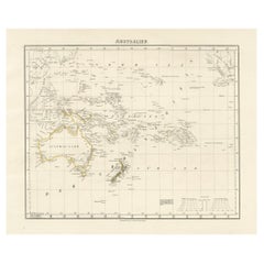
 - Title: Mid-19th Century Map of Australasia by Carl Flemming - 1855Located in Langweer, NLTitle: "Mid-19th Century Map of Australasia by Carl Flemming - 1855" Description: This original 1855 antique map from the Sohr-Berghaus Atlas, created by Carl Flemming, is a detaile...Category
Antique 1850s Maps
MaterialsPaper


Recently Viewed
View AllMore Ways To Browse
Railroad Collectibles
Nantucket Antique
Old Nantucket
Antique Railroad Collectibles Collectibles
Antique Railroad Collectables
Antique Railroad Collectibles
Old Colony Furniture
Antique Victorian Ewer
Map Of Boston
Boston Map
Antique Railroad Maps
Map Railroad
Historic Antique Maps
19th Century Nantucket
Antique Map Of Boston
Antique Maps Of Boston
Antique Brochure
Antique Nantucket Map