Maps
4
to
3
1
4
4
4
46
34
15
9
7
6
6
4
4
2
1
1
1
4
3
1
1
1
2
2
1
1
1
2
2
1
1
1
1
Maps For Sale
Style: Industrial
Style: Rococo
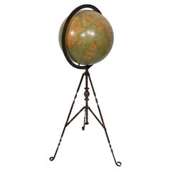
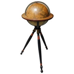
Antique Webber Costello Globe on Metal Tripod Base c 1900 / 1920's
Located in New York, NY
Rare floor model globe made by Weber Costello, circa 1900. The 12" globe rests on a folding metal base. This example is in very good, original condition, showing only light wear, nor...
Category
Early 20th Century American Industrial Maps
Materials
Metal
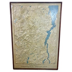
Rare and Early Plaster Relief Map of Adirondack Mountains by F J H Merrill
By P.F. Howells, E. W. Merrill
Located in Buffalo, NY
Rare and Early Monumental Plaster Relief Map of Adirondack Mountains by The University of the State of New York, New York State Museum..F J H Merrill director,,,modeled by Howell's ...
Category
1910s American Industrial Vintage Maps
Materials
Plaster, Wood
Large European 1930's Nautical Map Reader Magnifying Glass
Located in Haddonfield, NJ
This European set of two nautical magnifying glass map-readers are quite unusual and rarely found. It is fully encased in it's heavy wooden and metal enforced box. Hailing from betwe...
Category
1930s German Industrial Vintage Maps
Materials
Metal
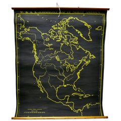
University Chart “Black Map of North America
Located in Chillerton, Isle of Wight
University Chart “Black Map of North America
W&A K Johnston’s Charts of Physical Maps By G W Bacon,
This is a Black Physical map of North A...
Category
Early 20th Century Industrial Maps
Materials
Linen
Related Items
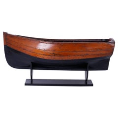
Large Mahogany Antique Boat Model
Located in Palm Beach, FL
Inspired model of a boat or skiff expertly crafted in mahogany, probably by a boat builder, having a graceful form and has acquired a well earned patina only time can give.
Category
19th Century English Folk Art Antique Maps
American Terrestrial Globe on Gilt Tripod Stand, Gilman Joslin, Boston C. 1850
Located in Hollywood, SC
American Terrestrial Brass Meridian Globe mounted on a turned bulbous gilt ringed and red stenciled tripod stand, Gilman Joslin, Boston. Mid 19th Century
Globe is 39" Tall / 16" Diam...
Category
1850s American American Empire Antique Maps
Materials
Brass
H 39 in W 22 in D 16 in
American Naval Two Masted Clipper Ship Brig Model Under Glass, US Perry 20th C.
Located in Hollywood, SC
American Naval two masted clipper ship brig model mounted on stand under a glass case. The US Perry was a brig commissioned by the United States Navy October 1843 prior to the American Civil War...
Category
20th Century American American Empire Maps
Materials
Glass, Mahogany, Pine, Paint
H 30.75 in W 40.5 in D 14.5 in
Antique Wooden Shoe Forms with Metal Handles, c.1920
Located in San Francisco, CA
Original pairs of cobbler's wooden shoe forms. They have retained their original finish and have the appropriate wear.
Creator unknown.
Date of manufacture c.1920
Materials and ...
Category
Early 20th Century Industrial Maps
Materials
Beech, Maple
Vintage Large Nautical Maritime Brass Glass Ship's Hourglass Display Model Timer
Located in San Diego, CA
Very unique large maritime/nautical brass and glass hourglass. Wonderful dorm and design. Brass has a wonderful patina and can be polished if desired. H...
Category
Mid-20th Century American Maps
Materials
Bronze
H 19.5 in W 7.25 in D 7.25 in
Antique Map of The United States of North America, 1882
Located in Langweer, NL
This is a historical map titled "The United States of North America, Central Part" from the 1882 Blackie Atlas. It depicts the continental United States with a high level of detail, ...
Category
1880s Antique Maps
Materials
Paper
Large Scale Hand Crafted Sail Boat Model
Located in Douglas Manor, NY
3-569 Hand crafted sail boat model on base.
Category
1960s Vintage Maps
Materials
Canvas, Hardwood
New Map of North America from the Latest Discoveries, 1763
Located in Philadelphia, PA
A fine antique 18th century map of the North American seaboard.
Entitled "A New Map of North America from the Latest Discoveries 1763".
By the Cartographer/Engraver - John Spil...
Category
Mid-18th Century English Georgian Antique Maps
Materials
Paper
Telescope with Tripod, Metal, Decorative Object
Located in Madrid, ES
Telescope with tripod. gold metallic antique finish
Decorative use, not functional.
Gilt metal telescope decorated with a dark band standing on...
Category
20th Century Unknown Other Maps
Materials
Other
Dutch Miniature Terrestrial Globe on Wooden Base, circa 1900
Located in Delft, NL
Dutch miniature terrestrial globe on wooden base, 16 cm high
A miniature globe made of papier mâché with Dutch text on a wooden stand,
circa 1900
Used object
The measurements...
Category
19th Century Dutch Antique Maps
Materials
Wood, Paper
Vintage Spiked Conch Shell Brass Stand Glass Showcase Curio Casket Display
Located in Dayton, OH
Vintage brass and glass display case / casket containing an ivory and copper colored spiked conch shell on a brass crescent stand....
Category
Late 20th Century Maps
Materials
Brass
Rare Small Antique Map of Great Britain and Ireland
Located in Langweer, NL
Antique map titled 'La Grande Bretagne et Irlande'. Small antique map of Great Britain and Ireland. Source unknown, to be determined. Publ...
Category
Mid-18th Century Antique Maps
Materials
Paper
Previously Available Items
Large 1907 Vintage Relief Map of Africa by Atlas School Supply of Chicago
By Atlas School Supply
Located in Lafayette, IN
Remarkably original, 1907 Relief map of Africa by the Atlas School Supply Co. of Chicago, Illinois. This exceptional quality map features its original oak f...
Category
Early 20th Century American Industrial Maps
Materials
Paper, Oak
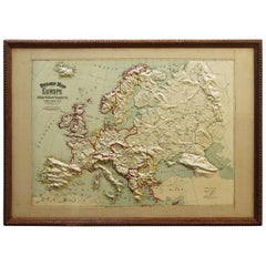
Large 1907 Vintage Relief Map of Europe by Atlas School Supply of Chicago
By Atlas School Supply
Located in Lafayette, IN
Remarkably original, 1907 Relief map of Europe by the Atlas School Supply Co. of Chicago, Illinois. This exceptional quality map features its original oak f...
Category
Early 20th Century American Industrial Maps
Materials
Oak, Paper
Large 1907 Vintage Relief Map of United States by Atlas School Supply of Chicago
By Atlas School Supply
Located in Lafayette, IN
Remarkably original, 1907 Relief map of the United States by the Atlas School Supply Co. of Chicago, Illinois. This exceptional quality map features its ori...
Category
Early 20th Century American Industrial Maps
Materials
Oak, Paper
H 34 in W 48 in D 2.5 in
Large 1907 Vintage Relief Map of World by Atlas School Supply of Chicago
By Atlas School Supply
Located in Lafayette, IN
Remarkably original, 1907 relief map of world by the Atlas School Supply Co. of Chicago, Illinois. This exceptional quality map features its original oak fr...
Category
Early 20th Century American Industrial Maps
Materials
Oak, Paper
Large 1907 Vintage Relief Map of Asia by Atlas School Supply of Chicago
By Atlas School Supply
Located in Lafayette, IN
Remarkably original, 1907 Relief map of Asia by the Atlas School Supply Co. of Chicago, Illinois. This is an exceptional quality map features its original o...
Category
Early 20th Century American Industrial Maps
Materials
Paper, Oak
1920s Double Sided Cartocraft Slated School Map, U.S.A. & World Denoyer Geppert
Located in Buffalo, NY
1920s Double Sided Cartocraft Slated School Map, One side depecting the United States, other side depecting the World, Made by Denoyer Geppert ,Pull down retractable, Slated material...
Category
1920s American Industrial Vintage Maps
Materials
Canvas, Wood
H 62 in W 68 in D 1 in
Hand-Colored Astronomical Engravings by Louis Charles Desnos, 1766
By Louis Charles Desnos
Located in Kinderhook, NY
Collection of three hand-colored astronomical map engravings illustrating celestial spheres in ornate rococo borders by Louis Brion de la Tour (1743-...
Category
Mid-18th Century French Rococo Antique Maps
Materials
Glass, Wood, Paper
1923 Denoyer-Geppert School House Map of Africa
Located in Garnerville, NY
Amazing size and quality Denoyer-Geppert Map of Africa. Africa's strong colonial influences and exploiters are still fully evident and give a great history lesson. Belgian Kongo, Ita...
Category
1920s American Industrial Vintage Maps
Materials
Oak, Paper
Rare 17th Century American Map of Virginia and Florida by Jan Janssonius
Located in Wiscasset, ME
In the 1630s, Janssonius formed a partnership with his brother in law Henricus Hondius, and together they published atlases as Mercator/Hondius/Janssonius. Under the leadership of Ja...
Category
18th Century and Earlier Dutch Rococo Antique Maps
H 25.25 in W 30.25 in D 2 in
Recently Viewed
View AllMore Ways To Browse
Antique Sailing Map
Antique Sailing Maps
Bay Area Antique Furniture
West Coat Of Arms
Greek Asia Minor
Hemisphere World Map
Speed Map
Antique Maps Canada
Antique Map Canada
Canada Antique Map
Malaysian Antique
West Indies Map
Blaeu World Map
Charing Cross
Antique Maps Of Canada
Bali Map
Antique Portuguese Plates
Map Of Brazil
