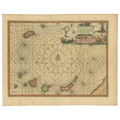
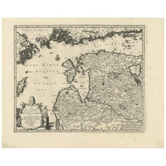
Antique Chart of the Canary Islands by Van der Aa, circa 1720
View Similar Items


Want more images or videos?
Request additional images or videos from the seller
1 of 5
Antique Chart of the Canary Islands by Van der Aa, circa 1720
About the Item
- Dimensions:Height: 12.13 in (30.8 cm)Width: 15.08 in (38.3 cm)Depth: 0.02 in (0.5 mm)
- Materials and Techniques:
- Period:
- Date of Manufacture:circa 1720
- Condition:Good, given age. A few minor spots. One tiny hole; backed. Original folds as issued. General age-related toning and/or occasional minor defects from handling. Please study images carefully.
- Seller Location:Langweer, NL
- Reference Number:Seller: PCT-614211stDibs: LU3054321367742
About the Seller
5.0
Platinum Seller
These expertly vetted sellers are 1stDibs' most experienced sellers and are rated highest by our customers.
Established in 2009
1stDibs seller since 2017
1,913 sales on 1stDibs
More From This SellerView All
- Antique Map of Peru by van der Aa, 'circa 1720'Located in Langweer, NLAntique map titled 'Le Perou, Grand Pays de l Amerique Meridionale (..)'. Decorative map of Peru including portions of Ecuador and northern Chile and Boliv...Category
Antique Early 18th Century Maps
MaterialsPaper
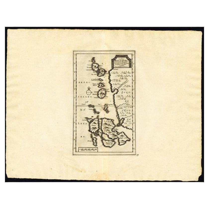
- Antique Map of the Island of Java, Indonesia by P. Van Der Aa, 1713Located in Langweer, NLThis rare map shows the Indonesian island of Java. With compass rose and scale. From: Nouvel Atlas, très exact et fort commode pour toutes sortes de personnes, Contenant Les Principa...Category
Antique Early 18th Century Maps
MaterialsPaper
 $482 Sale Price35% Off
 - Antique Map of Scandinavia by Van der Aa 'circa 1710'Located in Langweer, NLAntique map titled 'Scandinavie Septentrionale' and 'Scandinavie Meridionale'. Copper engraving with two maps on one sheet. The upper map depicts Northern Scandinavia with Norway, Sw...Category
Antique Early 18th Century Maps
MaterialsPaper
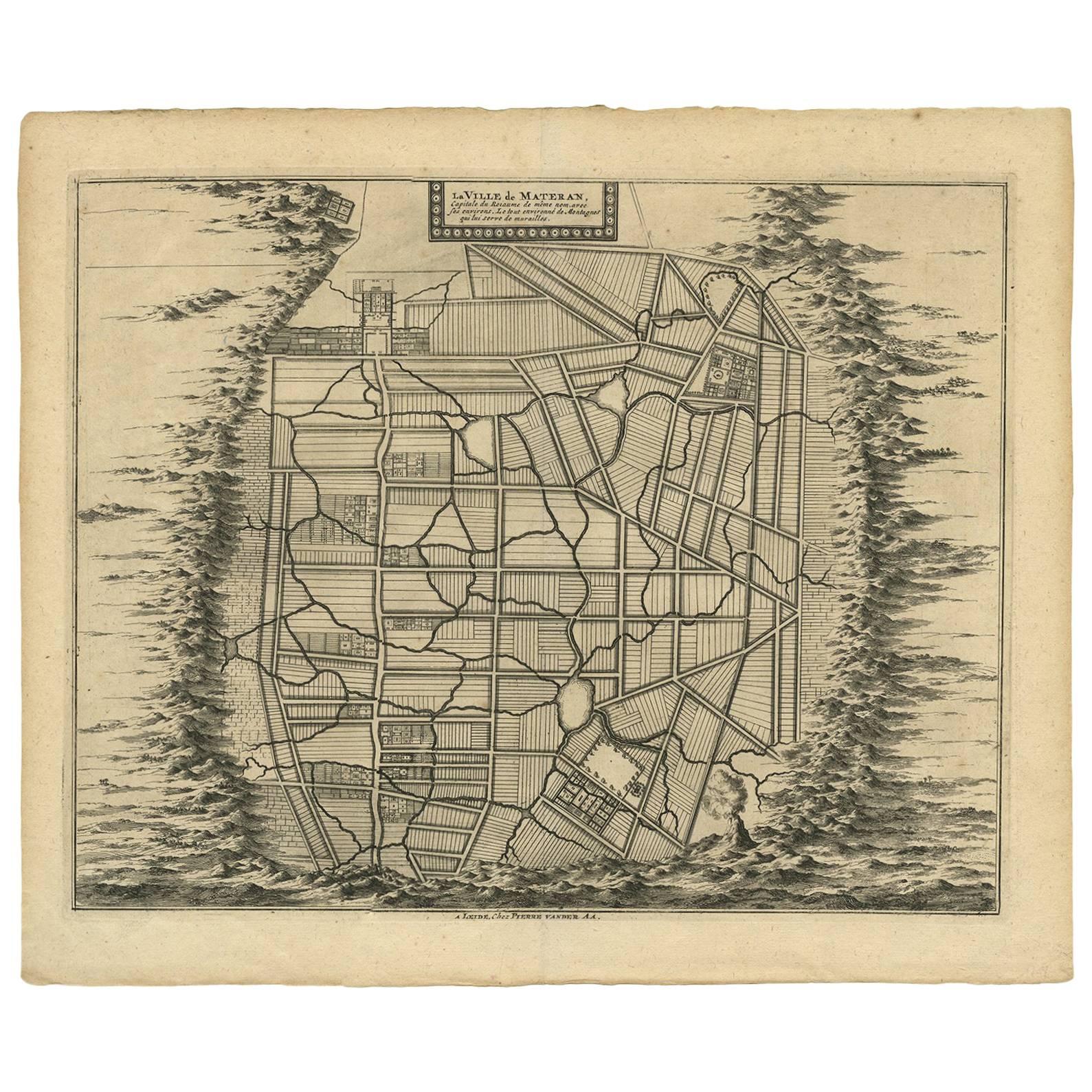
- Antique Map of the City of Materan 'Indonesia' by P. van der Aa, circa 1725By Pieter Van Der AaLocated in Langweer, NLAntique map titled 'La Ville de Materan, capitale de Roiaume de meme nom, avec ses environs. Le tout environne de Montagnes qui lui serve de murailles.' The city of Materan, capital ...Category
Antique Early 18th Century Maps
MaterialsPaper
 $322 Sale Price25% Off
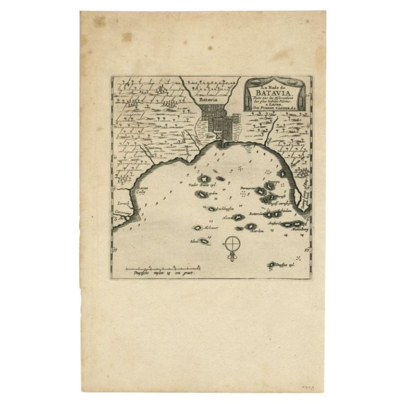
 - Antique Map of the City of Batavia by Van der Aa 'c.1730'Located in Langweer, NLAntique map titled 'Plan de la Ville et du Chateau de Batavia en l'Isle de Iava - Ware affbeeldinge wegens het Casteel ende Stadt Batavia gelegen op groot Eylant Java'. Detailed plan...Category
Antique Mid-18th Century Maps
MaterialsPaper
 $1,048 Sale Price20% Off
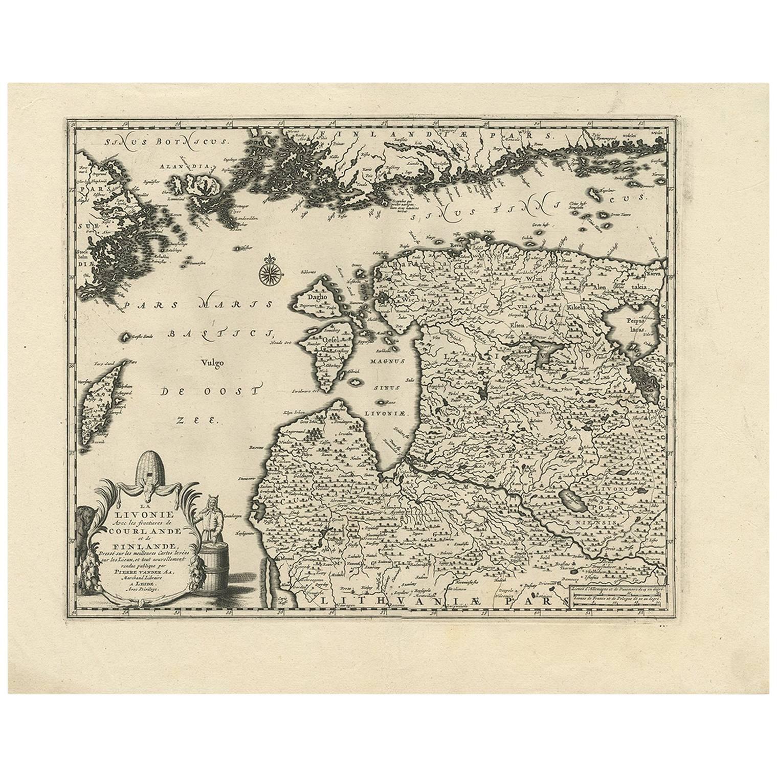
 - Antique Map of Livonia Baltic States by P. Van Der Aa, circa 1729Located in Langweer, NLDecorative map of Livonia. This well executed engraving was published in 1729 and 1727 by Pieter Van Der Aa, in Leiden in "Les Voyages tres-curieux et tres-renommez faits en Moscovie...Category
Antique Early 18th Century Maps
MaterialsPaper
 $436 Sale Price23% Off


You May Also Like
- Antique Anatomical Wall Chart Depicting the Human SkeletonLocated in Berghuelen, DEA rare 19th century anatomical wall chart depicting the human skeleton. On the sides On the sides are detailed description in German language. The wall...Category
Early 20th Century German Victorian Prints
MaterialsPaper
- 1865 Chart of the Islands of MadeiraLocated in Norwell, MARare James Imray chart from 1865 titled "Chart of the Islands of Madeira, Porto Santo and Dezerea" drawn from the survey made by Captain Ate Vidal Royal Navy, London. Published by Ja...Category
Antique 1860s European Maps
MaterialsPaper
- Antique Foldable Anatomical Wall Chart Depicting Human MusculatureLocated in Berghuelen, DEAntique Foldable Anatomical Wall Chart Depicting Human Musculature The rare 19th century anatomical wall chart depicts the human musculature and inter...Category
Early 20th Century German Victorian Prints
MaterialsWood, Paper
- Civil War Panorama of the Seat of War by John Bachmann, Antique Print circa 1864Located in Colorado Springs, COPanorama of the seat of war. Bird's-eye View of Virginia, Maryland, Delaware and the District of Columbia. This third state of this fascinating bird's eye view of the northernmost p...Category
Antique 1860s American Maps
MaterialsPaper
- Anatomical Wall Chart Depicting the Human Lymphatic and Blood VesselsLocated in Berghuelen, DEA rare 19-carat anatomical wall chart depicting the human lymphatic and blood vessels. On the sides with detailed description in German language. Print...Category
Early 20th Century German Victorian Prints
MaterialsPaper
- Original Antique Map of Belgium by Tallis, Circa 1850Located in St Annes, LancashireGreat map of Belgium Steel engraving Many lovely vignettes Published by London Printing & Publishing Co. ( Formerly Tallis ), C.1850 Origin...Category
Antique 1850s English Maps
MaterialsPaper


