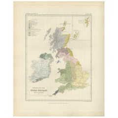
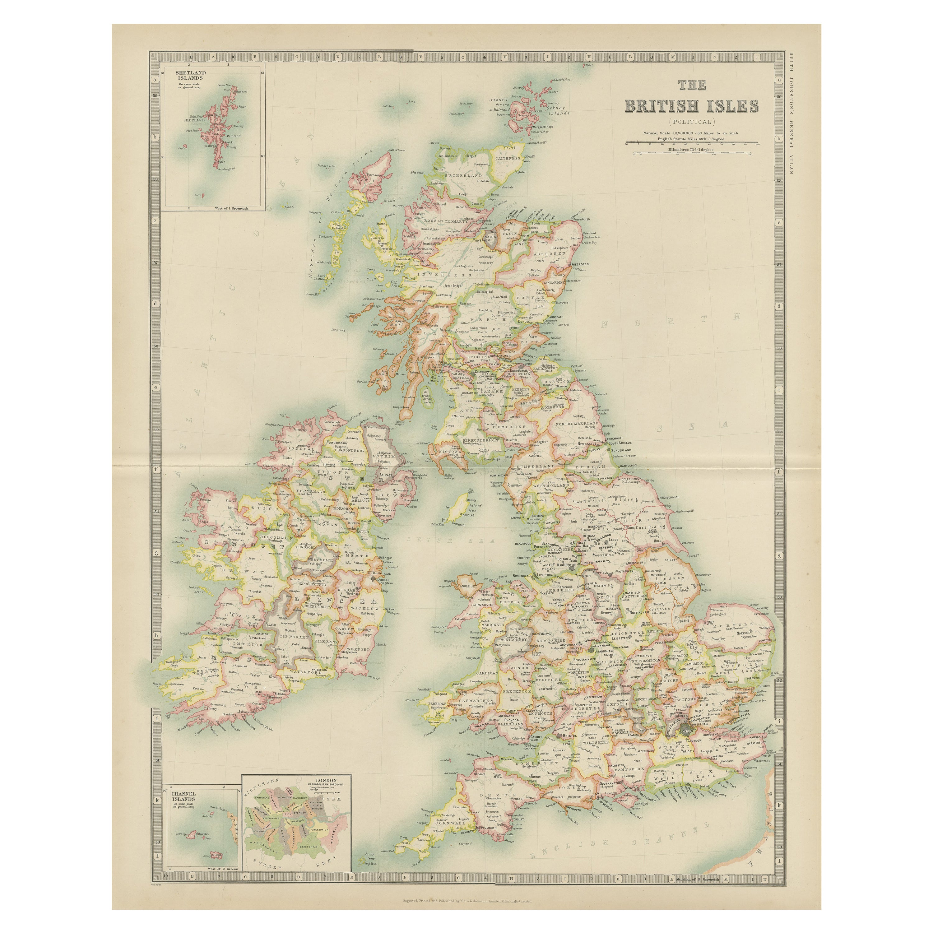
Antique Ethnographic Map of Great Britain and Ireland by Johnston '1850'
View Similar Items


Want more images or videos?
Request additional images or videos from the seller
1 of 5
Antique Ethnographic Map of Great Britain and Ireland by Johnston '1850'
About the Item
- Dimensions:Height: 14.18 in (36 cm)Width: 11.03 in (28 cm)Depth: 0.02 in (0.5 mm)
- Materials and Techniques:
- Period:
- Date of Manufacture:1850
- Condition:General age-related toning. Minor wear, blank verso. Please study image carefully.
- Seller Location:Langweer, NL
- Reference Number:Seller: BG-12790-251stDibs: LU3054323456612
About the Seller
5.0
Platinum Seller
These expertly vetted sellers are 1stDibs' most experienced sellers and are rated highest by our customers.
Established in 2009
1stDibs seller since 2017
1,914 sales on 1stDibs
More From This SellerView All
- Antique Ethnographic Map of the World by Johnston '1850'Located in Langweer, NLAntique map titled 'Ethnographic map of the world showing the present distribution of the leading races of man'. Original antique ethnographic map...Category
Antique Mid-19th Century Maps
MaterialsPaper
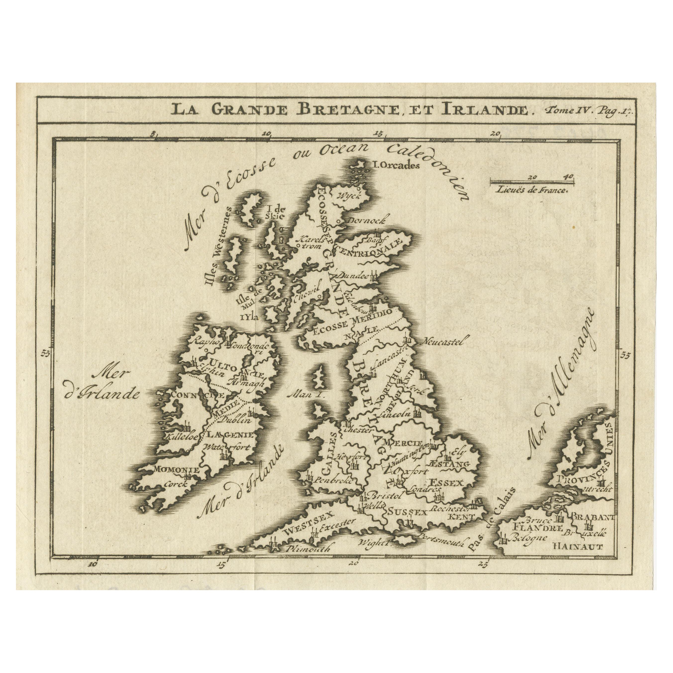
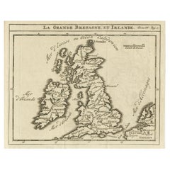
- Rare Small Antique Map of Great Britain and IrelandLocated in Langweer, NLAntique map titled 'La Grande Bretagne et Irlande'. Small antique map of Great Britain and Ireland. Source unknown, to be determined. Publ...Category
Antique Mid-18th Century Maps
MaterialsPaper
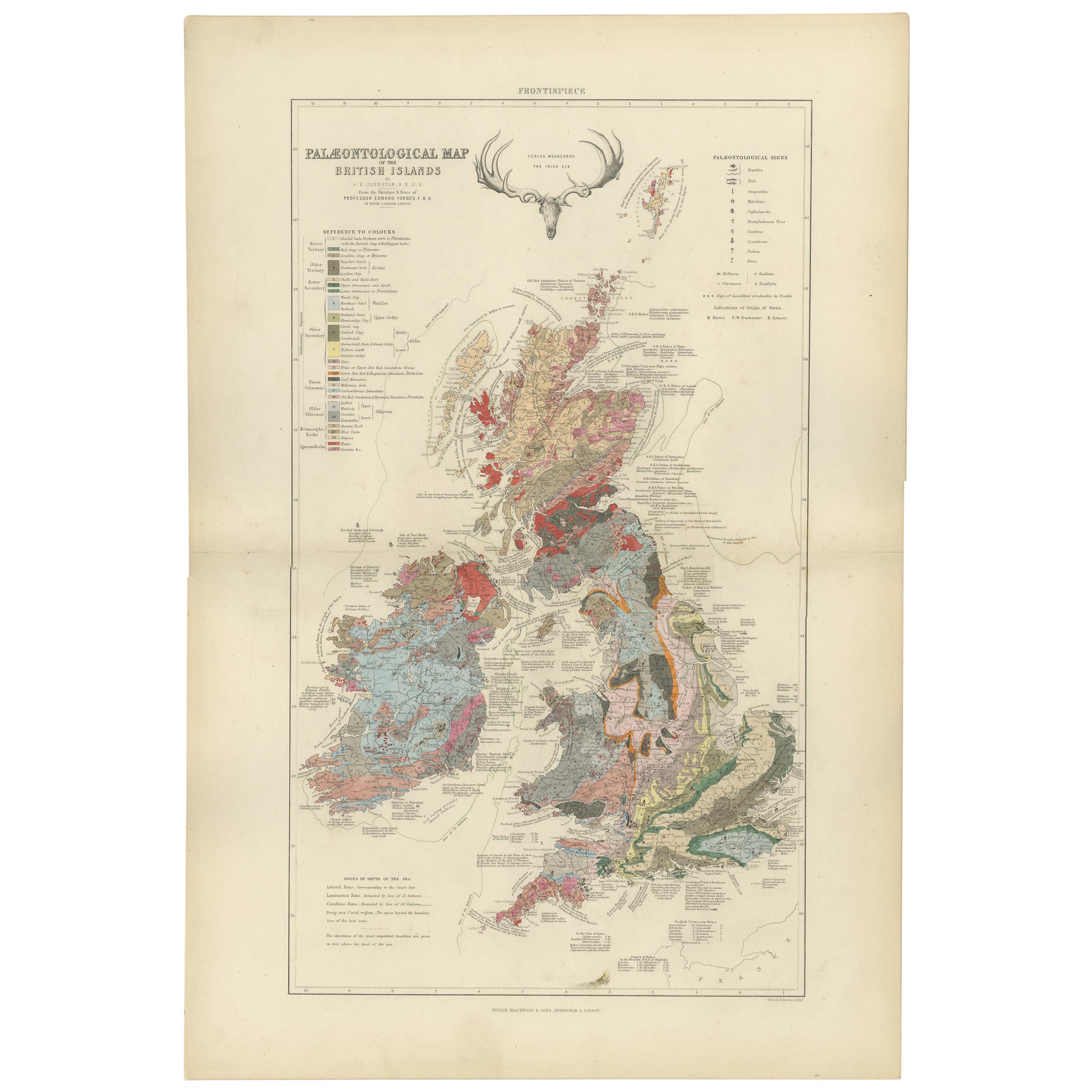
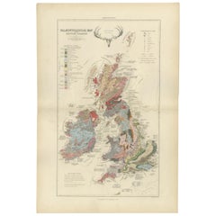
- Antique Map of the Palaeontology of the British Isles by Johnston '1850'Located in Langweer, NLAntique map titled 'Palaeontological Map of the British Islands'. Original antique map showing the palaeontology of the British Isles. This map originates from 'The Physical Atlas of...Category
Antique Mid-19th Century Maps
MaterialsPaper
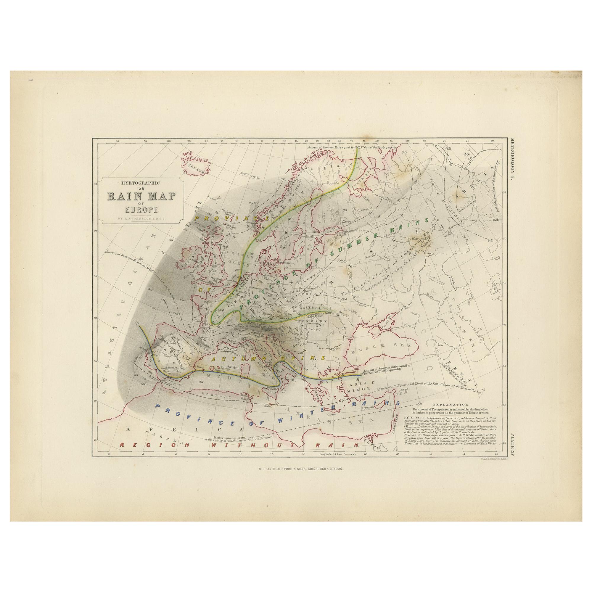
- Antique Rain Map of Europe by Johnston '1850'Located in Langweer, NLAntique map titled 'Hyetographic or Rain Map of Europe'. Original antique rain map of Europe. This map originates from 'The Physical Atlas of Natural Phenomena' by A.K. Johnston, pub...Category
Antique Mid-19th Century Maps
MaterialsPaper
- Antique Rain Map of the World by Johnston '1850'Located in Langweer, NLAntique map titled 'Hyetographic or Rain Map of the World'. Original antique rain map of the world. This map originates from 'The Physical Atlas of Natural Phenomena' by A.K. Johnsto...Category
Antique Mid-19th Century Maps
MaterialsPaper
- Antique Geological Map of the World by Johnston '1850'Located in Langweer, NLAntique map titled 'The Geological Structure of the Globe'. Original antique geological map of the world. This map originates from 'The Physica...Category
Antique Mid-19th Century Maps
MaterialsPaper


You May Also Like
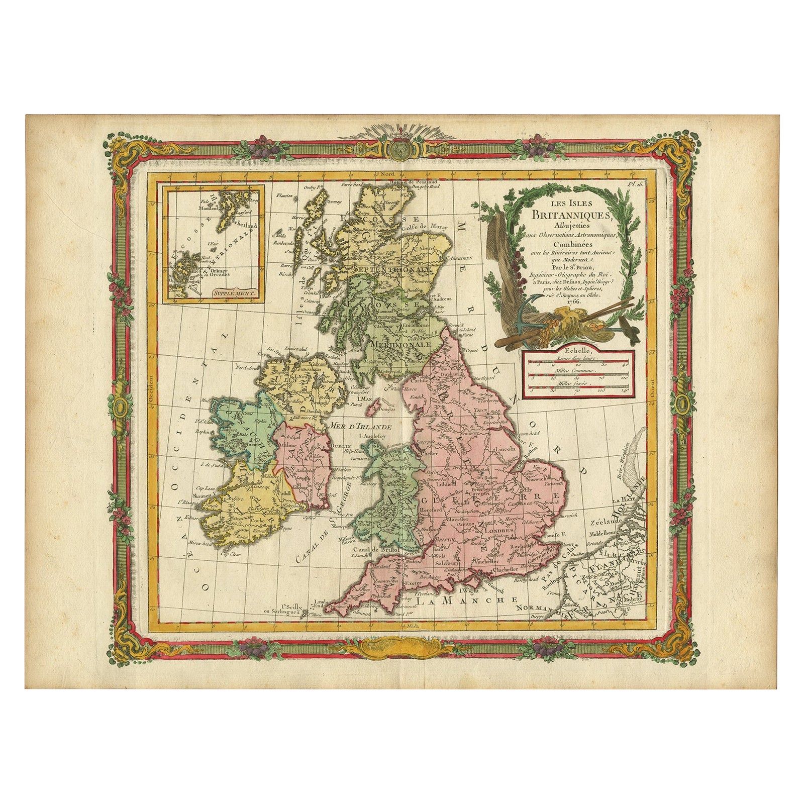
- England, Scotland & Ireland: A Hand Colored Map of Great Britain by TirionBy Isaak TirionLocated in Alamo, CAThis is a hand-colored double page copperplate map of Great Britain entitled "Nieuwe Kaart van de Eilanden van Groot Brittannien Behelzende de Kon...Category
Antique Mid-18th Century Dutch Maps
MaterialsPaper
- Original Antique Map of Ireland- Tipperary and Waterford. C.1840Located in St Annes, LancashireGreat map of Tipperary and Waterford Steel engraving Drawn under the direction of A.Adlard Published by How and Parsons, C.1840 Unframed.Category
Antique 1840s English Maps
MaterialsPaper
- Original Antique Map of Ireland- Kerry. C.1840Located in St Annes, LancashireGreat map of Kerry Steel engraving Drawn under the direction of A.Adlard Published by How and Parsons, C.1840 Unframed.Category
Antique 1840s English Maps
MaterialsPaper

- Original Antique Map / City Plan of Brussels by Tallis, circa 1850Located in St Annes, LancashireGreat map of Brussels. Steel engraving. Published by London Printing & Publishing Co. (Formerly Tallis), C.1850 Free shipping.Category
Antique 1850s English Maps
MaterialsPaper
- Southeastern Ireland: A 17th Century Hand Colored Map by Mercator and HondiusBy Gerard MercatorLocated in Alamo, CAA 17th century copperplate hand-colored map entitled "The Second Table of Ireland, Udrone" by Gerard Mercator and Jodocus Hondius, published in Amsterdam in 1635 in 'Cosmographicall ...Category
Antique Mid-17th Century Dutch Maps
MaterialsPaper
- Antique Map of Italy by Andriveau-Goujon, 1843By Andriveau-GoujonLocated in New York, NYAntique Map of Italy by Andriveau-Goujon, 1843. Map of Italy in two parts by Andriveau-Goujon for the Library of Prince Carini at Palazzo Carini i...Category
Antique 1840s French Maps
MaterialsLinen, Paper
 $3,350 / set


