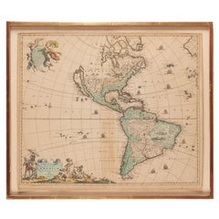
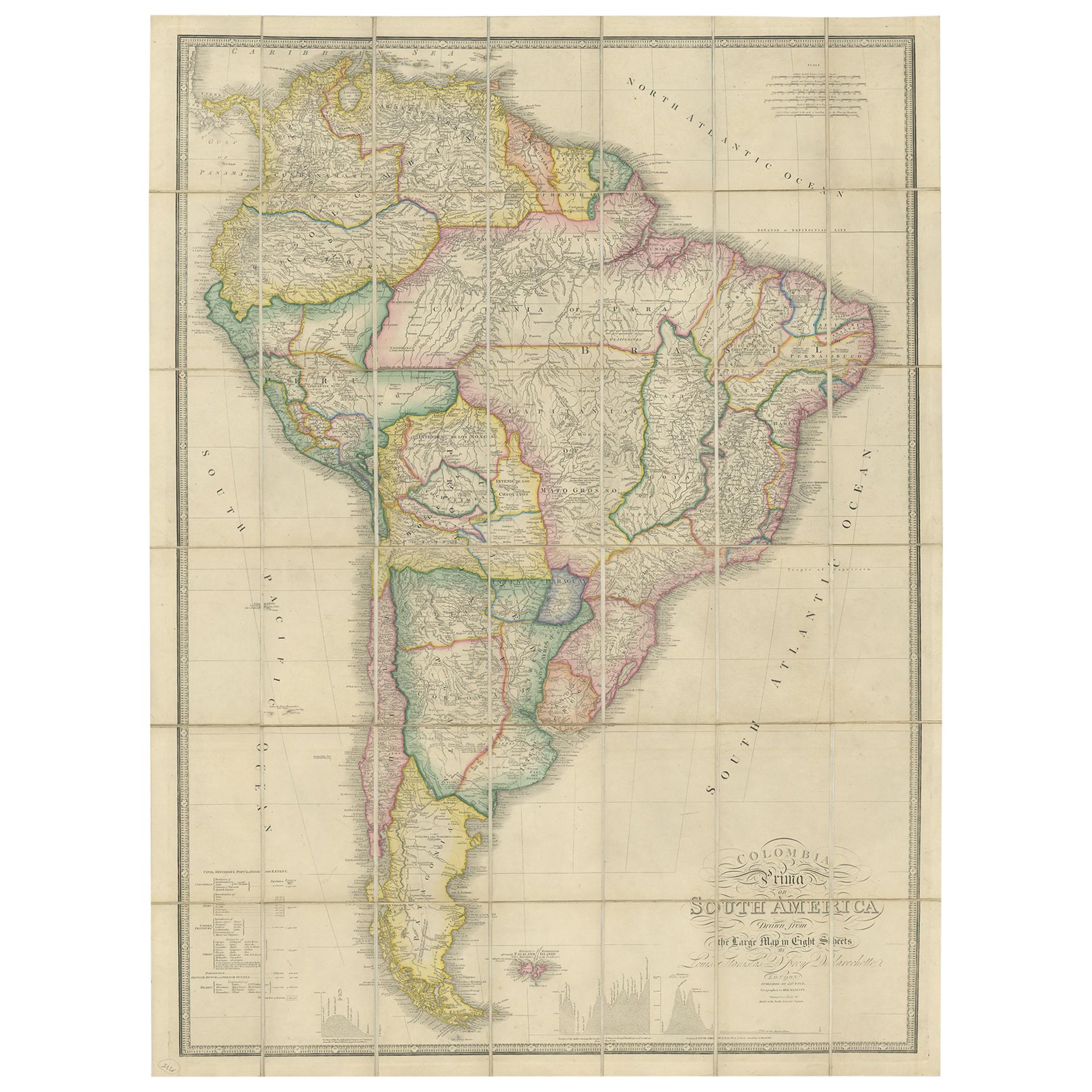
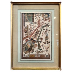
Antique Framed Hand Colored Map of the Americas by Frederick De Wit, circa 1675
View Similar Items


Want more images or videos?
Request additional images or videos from the seller
1 of 12
Antique Framed Hand Colored Map of the Americas by Frederick De Wit, circa 1675
About the Item
- Creator:Frederick de Wit (Maker)
- Dimensions:Height: 22.5 in (57.15 cm)Width: 26 in (66.04 cm)Depth: 1.75 in (4.45 cm)
- Style:Baroque (Of the Period)
- Materials and Techniques:
- Place of Origin:
- Period:1670-1679
- Date of Manufacture:1675
- Condition:Wear consistent with age and use.
- Seller Location:Morristown, NJ
- Reference Number:1stDibs: LU5990229614752
About the Seller
4.9
Platinum Seller
These expertly vetted sellers are 1stDibs' most experienced sellers and are rated highest by our customers.
Established in 2020
1stDibs seller since 2021
120 sales on 1stDibs
More From This SellerView All
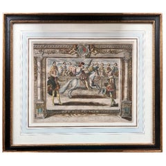
- C. 1625 After Antoine de Pluvinel, "Henry IV, Mounted", Hand Colored EngravingLocated in Morristown, NJEarly 17th century, French hand colored equestrian engraving. After Antoine de Pluvinel (French, 1552-1620), "Henry IV, Mounted", figure 42 from "L'Instruction du Roy en l'Exercice de Monter a Cheval", c. 1625, matted and framed under UF-3 plexiglass (blocks approx. 97% of UV) , gallery label verso. Figures from this publication have sold at Christie's. Those were not hand colored. A highly detailed engraving with the French King Henry 1V the central figure. Mounted on horseback, Le Roy (the King) is watched by no less than 10 courtiers some of whom are mounted on horseback, all of which are named in the engraving. Antoine de Pluvinel (1552, Crest, Dauphine - 24 August 1620) was the first of the French riding masters, and has had great influence on modern dressage. He wrote L’Instruction du Roy en L'exercice de Monter à Cheval ("instruction of the King in the art of riding"), was tutor to King Louis XIII, and is credited with the invention of using two pillars, as well as using shoulder-in to increase suppleness. In 1594, Pluvinel founded the "Academie d'Equitation" near what is now Place des Pyramides. There, the French nobility was trained not only in horsemanship, but also in all the accomplishments (dancing, fashionable dressing, etc.) It can be said that Pluvinel's influence on the aristocracy lasted from the late 16th century to the 17th century. Richelieu, the future Prime Minister of King Louis XIII attended the Academie; so did William, Duke of Cavendish. Pluvinel's book was published posthumously by the Flemish engraver Crispijn van de Passe II and the royal valet de chambre...Category
Antique Early 17th Century French Baroque Prints
MaterialsPlexiglass, Boxwood, Paint, Paper
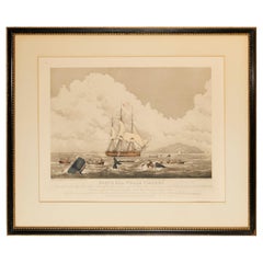
- 1825 Hand-Colored Aquatint Engraving by T. Sutherland "South Sea Whale Fishery"By William John HugginsLocated in Morristown, NJA hand-colored aquatint engraving dated January 1, 1825 and engraved by T. Sutherland, London. Titled "South Sea Whale Fishery", after a painting by Will...Category
Antique 1820s English George IV Prints
MaterialsGlass, Wood, Giltwood, Paper
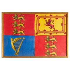
- Antique Royal Standard of the United Kingdom in Giltwood Frame and Under GlassLocated in Morristown, NJAn antique Royal Standard of the United Kingdom, possibly by Benjamin Edgington, London. The fabric is in a giltwood frame under glass. Each of the four quadrants on the flag represe...Category
Antique 1830s English British Colonial Historical Memorabilia
MaterialsFabric, Glass, Wood
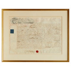
- Framed Antique Vellum Land Indenture, 1811, LondonLocated in Morristown, NJVellum land indenture, 1811, London. Parties mentioned include Richard Phillip Higham, Henry Parry, and John Alliston. The document contains two seals. The blue seal is likely a scrivener's seal. Scriveners were granted authority to draft contracts, wills, and documents similar to deeds that conveyed assets from one party to another. The red wax seal...Category
Antique 1810s British Georgian Decorative Art
MaterialsAnimal Skin, Glass, Wood
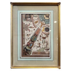
- Framed Antique Chromolithograph - Uffizi Gallery Ceiling, Florence, ItalyLocated in Morristown, NJAntique German architecture print on heavy paper showing an illustration of a portion of a ceiling painting in the Uffizi Gallery, Florence, 16th centur...Category
Antique 1890s German Renaissance Prints
MaterialsGlass, Wood, Paper
You May Also Like
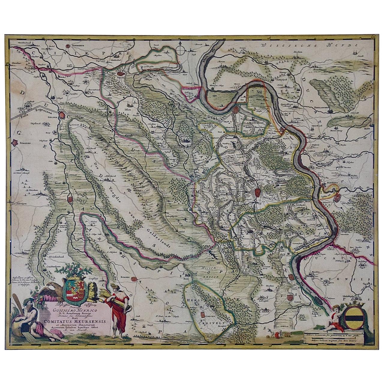
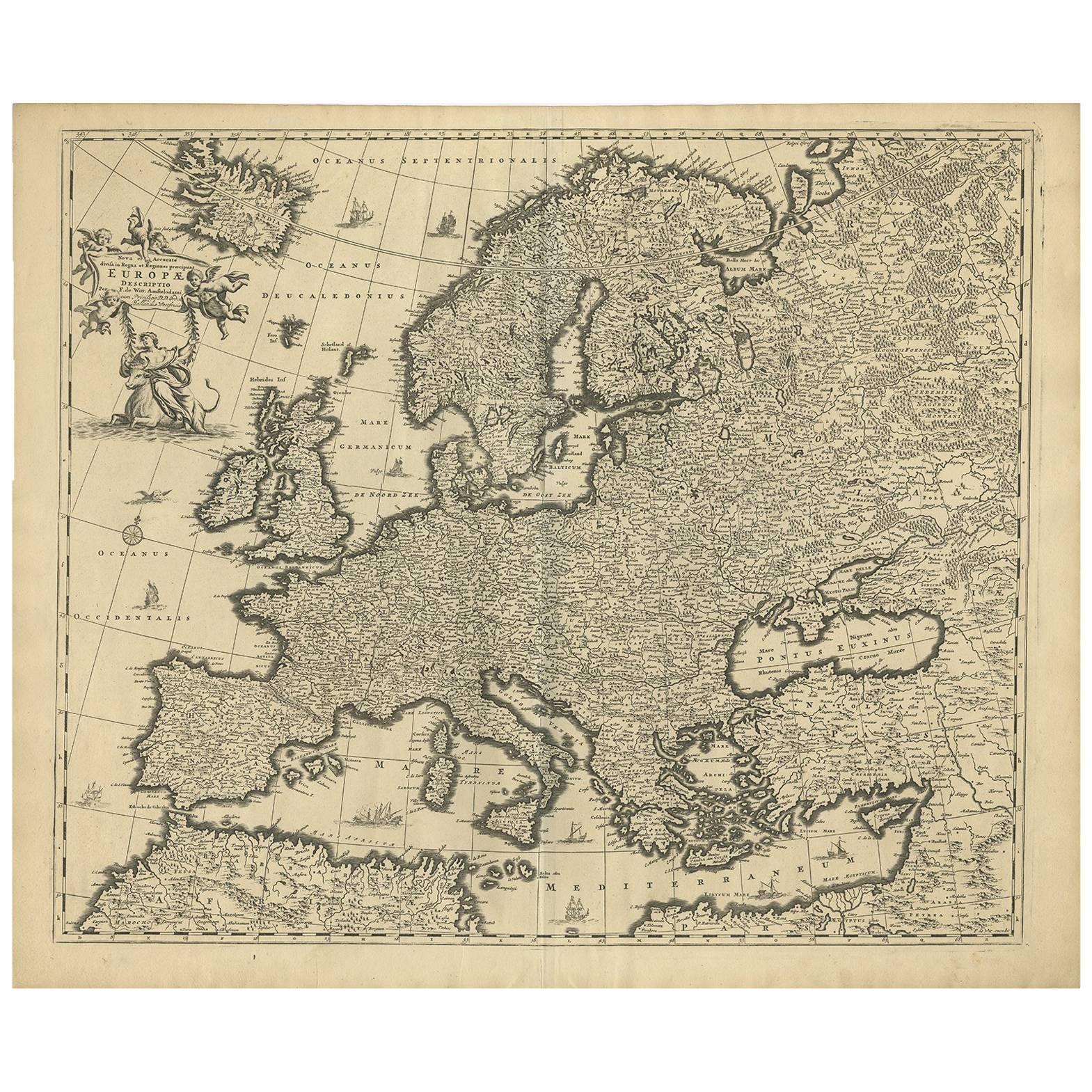
- Germany West of the Rhine: A Hand-colored 18th Century Map by de WitBy Frederick de WitLocated in Alamo, CAThis original 18th century hand-colored map of the county of Moers, Germany entitled "Illustrissimo Celsissmo Principi GUILIELMO HENRICO D.G. Arausionum Principi Domino suo Clementis...Category
Antique Early 18th Century Dutch Maps
MaterialsPaper
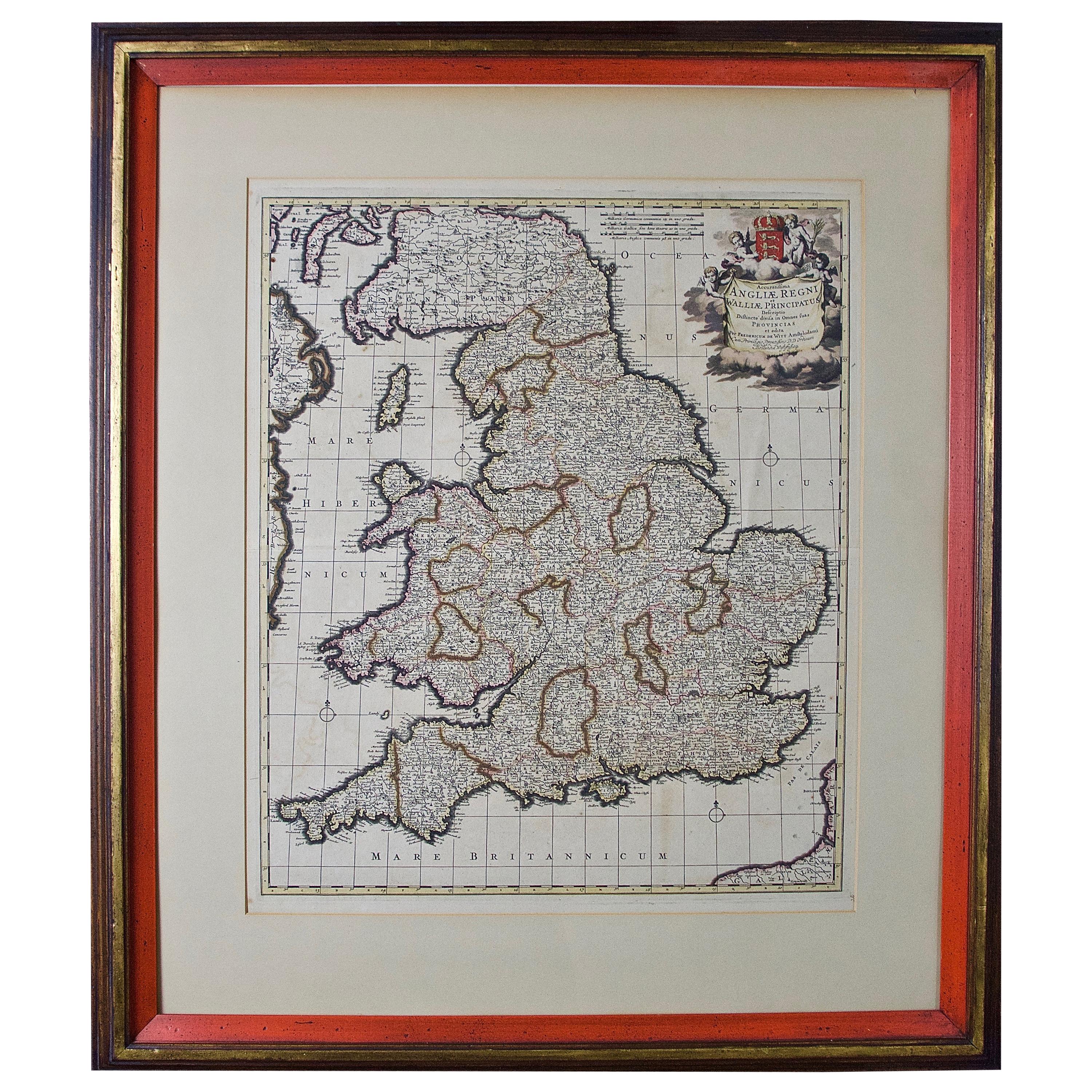
- Large 17th Century Hand Colored Map of England and the British Isles by de WitBy Frederick de WitLocated in Alamo, CAA large hand colored 17th century map of England and the British Isles by Frederick de Wit entitled "Accuratissima Angliæ Regni et Walliæ Principatus", published in Amsterdam in 1680. It is a highly detailed map of England, Scotland, the Scottish Isles...Category
Antique Late 17th Century Dutch Maps
MaterialsPaper
- Large Antique Map of France by De Wit, c.1680By Frederick de WitLocated in Langweer, NLAntique map titled 'Accuratissima Galliae Tabula vulgo Royaume de France'. Detailed map of France. Shows provinces, cities, rivers etc. Artists and Engravers: Frederick de Wit (1...Category
Antique 17th Century Maps
MaterialsPaper
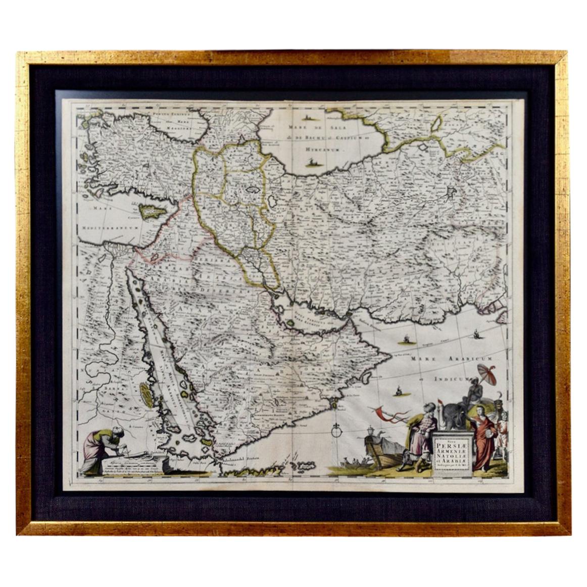
- Persia, Armenia & Adjacent Regions: A 17th Century Hand-colored Map by De WitBy Frederick de WitLocated in Alamo, CAA large 17th century hand colored copperplate engraved map entitled "Novissima nec non Perfectissima Scandinaviae Tabula comprehendens Regnorum Sueciae, Daniae et Norvegiae distincte...Category
Antique Late 17th Century Dutch Maps
MaterialsPaper
- Antique Hand-Colored Map of France by J.B. Elwe, 1792Located in Langweer, NLAntique map titled 'Carte Nouvelle du Royaume de France'. Beautiful antique map of France, including the Southern part of England. Decorated with cartouche and 12 coats of arms.Category
Antique Late 18th Century Maps
MaterialsPaper

- Antique Map of North America by Dufour 'circa 1834'Located in Langweer, NLAntique map titled 'Amérique Septentrionale'. Uncommon map of North America. Published by or after A.H. Dufour, circa 1834. Source unknown, to be determined.Category
Antique Mid-19th Century Maps
MaterialsPaper


Recently Viewed
View AllMore Ways To Browse
1700s America
Map New Holland
Michigan Map
Bay Antique Center
California Island Map
Hudson Ny Antique Furniture
Native American North Woods
Antique Furniture North Bay
California As An Island Map
Holland America Line
Used Furniture Erie
Antique Hudson Bay
Mare Island
Philips Spot
South Pacific Map
Antique Raleigh
Antique Glass Ontario
Antique Great Lakes Map