Items Similar to Antique Map of Abyssinia, Sudan and the Red Sea, Arabia and Egypt South, 1749

Want more images or videos?
Request additional images or videos from the seller
1 of 6
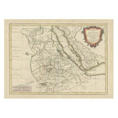
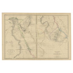
Antique Map of Abyssinia, Sudan and the Red Sea, Arabia and Egypt South, 1749
About the Item
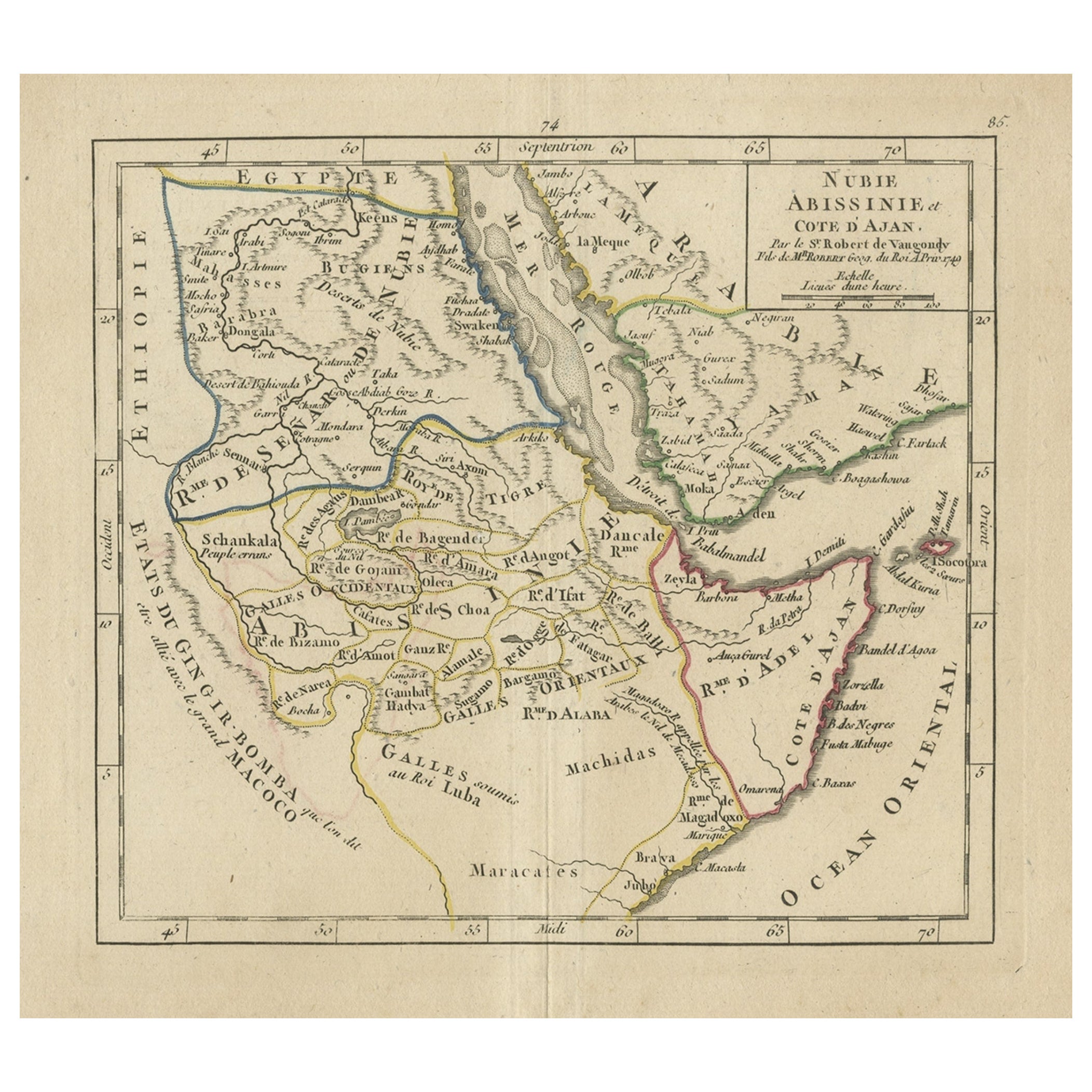
Antique map titled 'Nubie, Abissinie et Cote d'Ajan'. Map of Abyssinia, Sudan and the Red Sea by Robert Vaugondy. Covers from Arabia and Egypt south to Mogadishu and includes parts of modern day Sudan, Ethiopia, Somalia, Yemen, and Saudi Arabia. Originates from 'Atlas Portatif Universel et Militaire'.
Artists and Engravers: Gilles Robert de Vaugondy (1688-1766), also known as Le Sieur or Monsieur Robert, and his son, Didier Robert de Vaugondy (c.1723-1786), were leading cartographers in France during the 18th century.
Condition: Good, general age-related toning. Small defect (hole) in the middle of the image. Small split on folding line, please study image carefully.
Date: 1749
Overall size: 26 x 22 cm.
Image size: 18.5 x 16.5 cm.
We sell original antique maps to collectors, historians, educators and interior decorators all over the world. Our collection includes a wide range of authentic antique maps from the 16th to the 20th centuries. Buying and collecting antique maps is a tradition that goes back hundreds of years. Antique maps have proved a richly rewarding investment over the past decade, thanks to a growing appreciation of their unique historical appeal. Today the decorative qualities of antique maps are widely recognized by interior designers who appreciate their beauty and design flexibility. Depending on the individual map, presentation, and context, a rare or antique map can be modern, traditional, abstract, figurative, serious or whimsical. We offer a wide range of authentic antique maps for any budget.
- Dimensions:Height: 8.67 in (22 cm)Width: 10.24 in (26 cm)Depth: 0 in (0.01 mm)
- Materials and Techniques:
- Period:
- Date of Manufacture:1749
- Condition:
- Seller Location:Langweer, NL
- Reference Number:Seller: BG-12077-31stDibs: LU3054326271332
About the Seller
5.0
Platinum Seller
These expertly vetted sellers are 1stDibs' most experienced sellers and are rated highest by our customers.
Established in 2009
1stDibs seller since 2017
1,914 sales on 1stDibs
Typical response time: <1 hour
- ShippingRetrieving quote...Ships From: Langweer, Netherlands
- Return PolicyA return for this item may be initiated within 14 days of delivery.
More From This SellerView All
- Original Antique Map of Abyssinia, Sudan and the Red Sea, 1749Located in Langweer, NLAntique map titled 'Nubie, Abissinie et Cote d'Ajan'. Map of Abyssinia, Sudan and the Red Sea by Robert Vaugondy. Covers from Arabia and Egypt south to Mogadishu and includes parts...Category
Antique 1740s Maps
MaterialsPaper
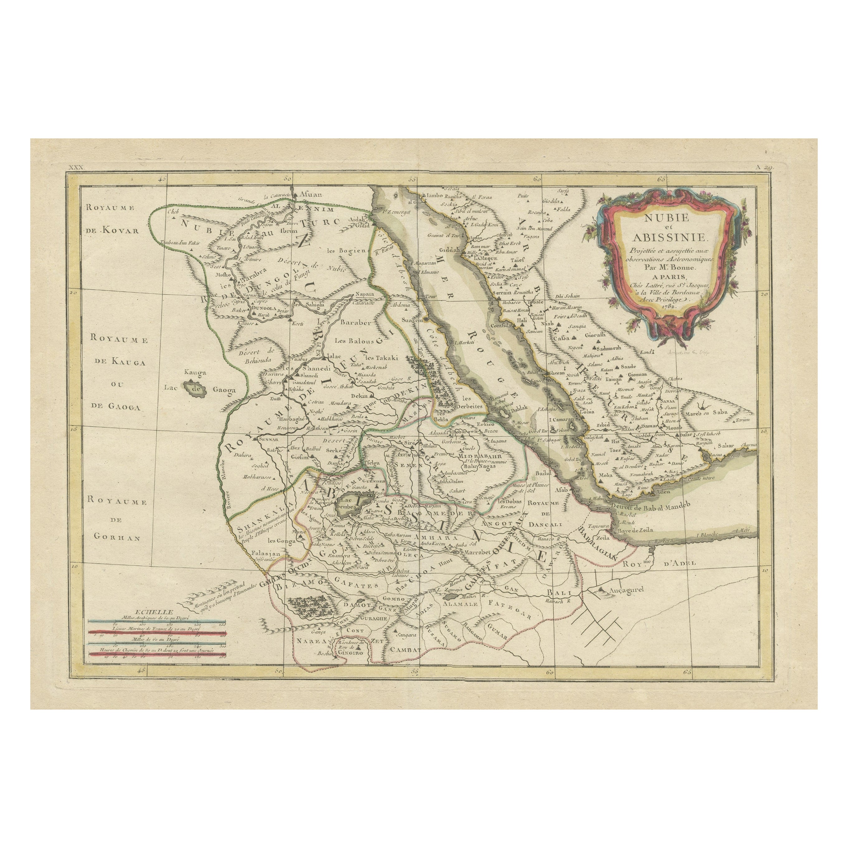
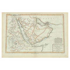
- Antique Map of Arabia including Nubia and Abyssinia, also shows the Red SeaLocated in Langweer, NLAntique map titled 'Nubie et Abissinie'. Original antique map of Nubia, a region along the Nile river, and Abyssinia or the Ethiopian Empire. This map o...Category
Antique Late 18th Century Maps
MaterialsPaper
- Original Antique Map of Arabia and the Red SeaLocated in Langweer, NLAntique map titled 'Carte de la Coste d'Arabie (..) - Kaart van de Kust van Arabië (..)'. This is a Dutch version, engraved by J. van Schley, of Bellin's map of Arabia and the Red Se...Category
Antique Mid-18th Century Maps
MaterialsPaper
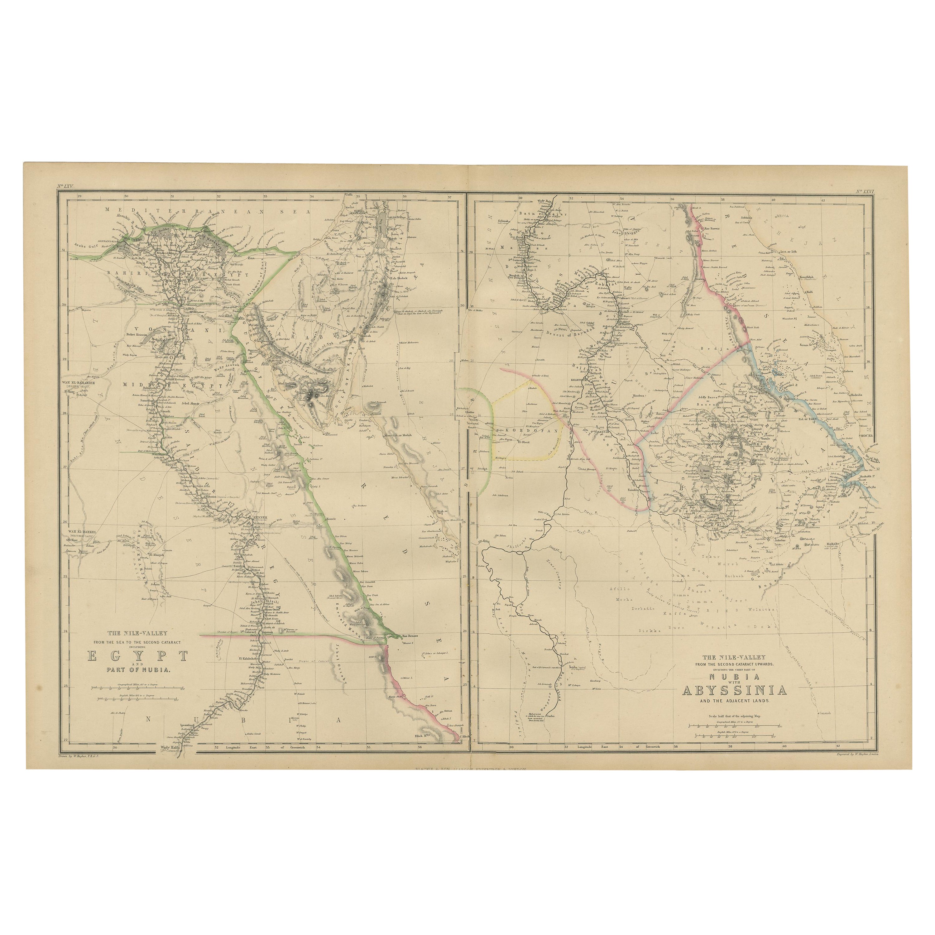
- Antique Map of Egypt and Abyssinia by W. G. Blackie, 1859Located in Langweer, NLAntique map titled 'Egypt and Abyssinia'. Original antique map of Egypt and part of Nubia and Nubia with Abyssinia. This map originates from ‘The Imperial Atlas of Modern Geography’....Category
Antique Mid-19th Century Maps
MaterialsPaper
- Old Map of the Arabian Peninsula with Parts of Egypt, Sudan, Eritrea & EthiopiaLocated in Langweer, NL"Carte de l'Arabie, du Golfe Persique, et de la Mer Rouge, avec l'Egypte, la Nubie et l'Abissinie", Bonne, Rigobert Subject: Arabia Period: 1780 (circa) Publication: Atlas de Toutes...Category
Antique 1780s Maps
MaterialsPaper
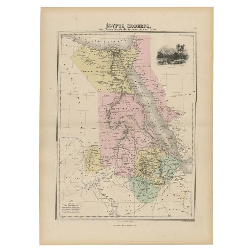
- Antique Map of The Nile, Egypt, Nubia and Abyssinia and Inset of Jerusalem, 1880Located in Langweer, NLAntique map titled 'Égypte Moderne'. Old map of Egypt, Nubia and Abyssinia (Ethiopia), Kordofan and Darfour (parts of Sudan), as well as part of Arabia. With decorative vignette of J...Category
Antique 19th Century Maps
MaterialsPaper


You May Also Like
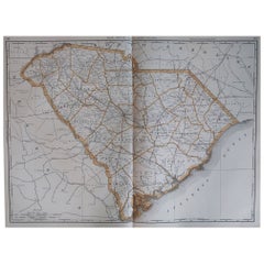
- Large Original Antique Map of South Carolina, USA, 1894By Rand McNally & Co.Located in St Annes, LancashireFabulous map of South Carolina Original color By Rand, McNally & Co. Published, 1894 Unframed Free shipping.Category
Antique 1890s American Maps
MaterialsPaper
- Large Original Vintage Map of The South Pacific, circa 1920Located in St Annes, LancashireGreat map of The South Pacific Original color. Good condition / repairs to minor edge tears on top edge Published by Alexander Gross Unf...Category
Vintage 1920s English Edwardian Maps
MaterialsPaper
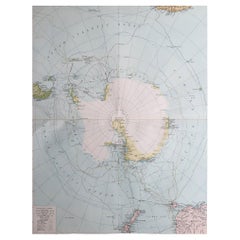
- Large Original Vintage Map of The South Pole, circa 1920Located in St Annes, LancashireGreat map of The South Pole Original color. Published by Alexander Gross Unframed. Repairs to minor edge tearsCategory
Vintage 1920s English Maps
MaterialsPaper
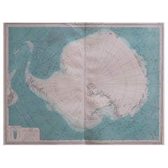
- Large Original Vintage Map of the South Pole, circa 1920Located in St Annes, LancashireGreat map of the South pole. Unframed. Original color. By John Bartholomew and Co. Edinburgh Geographical Institute. Published, circa 1920.Category
Vintage 1920s British Maps
MaterialsPaper
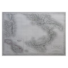
- Large Original Antique Map of South Italy and Malta by Sidney Hall, 1847Located in St Annes, LancashireGreat map of South Italy and Malta Drawn by Sidney Hall Steel engraving by G.Aikman Original color outline Published by A & C Black. 1847 Un...Category
Antique 1840s Scottish Maps
MaterialsPaper
- Large Original Vintage Map of Egypt, circa 1920Located in St Annes, LancashireGreat map of Egypt Unframed Original color By John Bartholomew and Co. Edinburgh Geographical Institute Published, circa 1920 Free shipping.Category
Vintage 1920s British Maps
MaterialsPaper