Items Similar to Antique Map of America by Vaugondy, 1778


Want more images or videos?
Request additional images or videos from the seller
1 of 5
Antique Map of America by Vaugondy, 1778
About the Item
Antique map titled 'Amerique ou Indes Occidentales (..)'. Vaugondy's map of America, pre-dating information from any of the Cook Voyages. The NW Coast of America is shown wildly distorted to the west, with a number of mythical rivers flowing from the Pacific eastward, including the River of the West. The discoveries of Admiral De Font and Martin D'Aguilar are noted. Much of the Southwestern US is also shown as being traversed by branches of these long rivers, searching for a watercourse to the Mississippi. Large insets of Martinique and Haiti. Published 1778.
- Dimensions:Height: 20.87 in (53 cm)Width: 27.56 in (70 cm)Depth: 0.02 in (0.5 mm)
- Materials and Techniques:
- Period:
- Date of Manufacture:1778
- Condition:Replacements made: Short margin at the bottom; remargined. Repaired: General age related toning and light staining. Worm holes at lower middle fold and bottom margin; paper separation lower middle fold, backed by identical paper. Irregular paper edges, chipped with small tears, backed by identical paper. General age related toning and light staining. Shows some creasing and wear. Please study images carefully.
- Seller Location:Langweer, NL
- Reference Number:
About the Seller
5.0
Platinum Seller
These expertly vetted sellers are 1stDibs' most experienced sellers and are rated highest by our customers.
Established in 2009
1stDibs seller since 2017
1,909 sales on 1stDibs
Typical response time: <1 hour
- ShippingRetrieving quote...Ships From: Langweer, Netherlands
- Return PolicyA return for this item may be initiated within 14 days of delivery.
More From This SellerView All
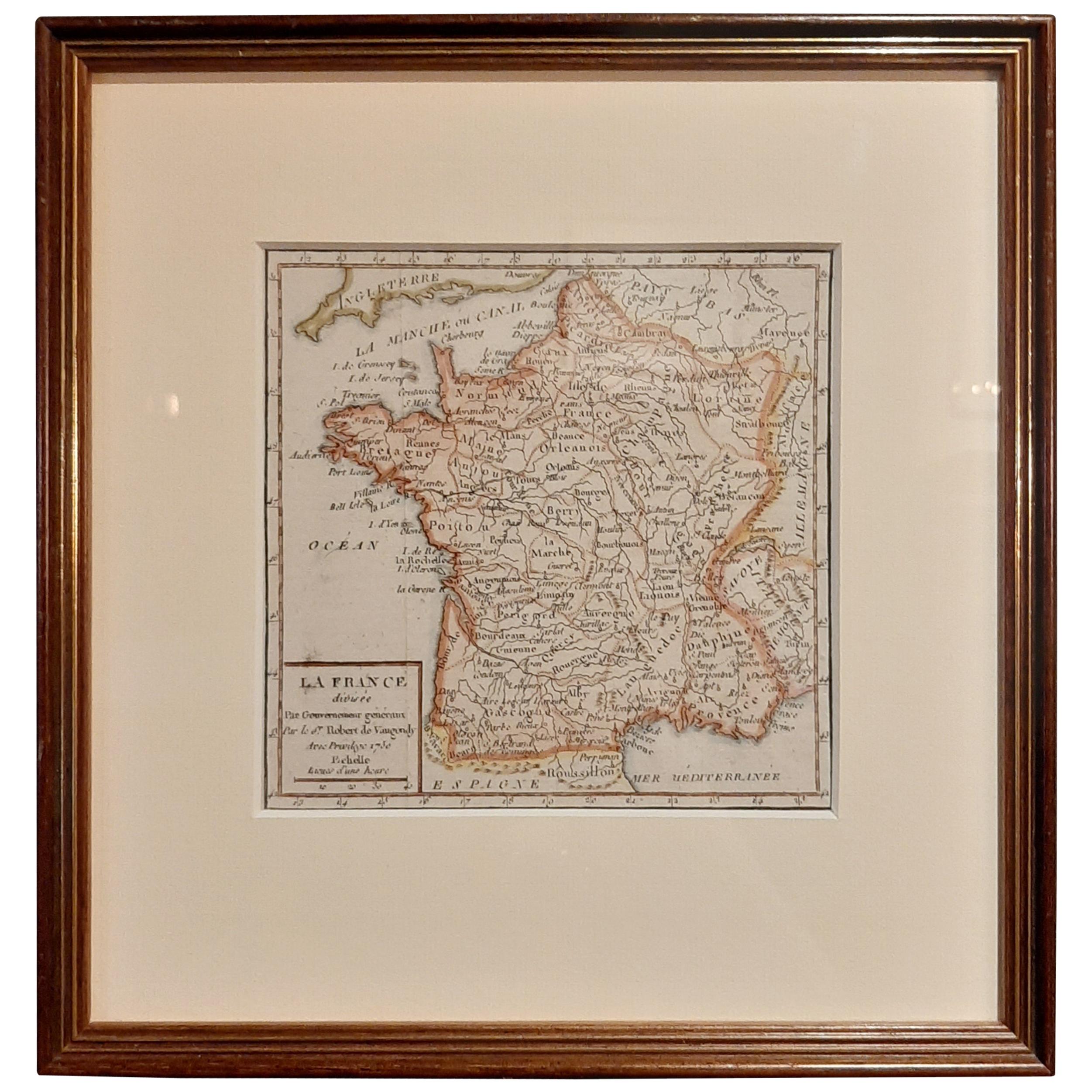
- Antique Map of France by Vaugondy, circa 1750Located in Langweer, NLAntique map titled 'La France divisée (..)'. Map of France published by Robert de Vaugondy, circa 1750. Frame included. We carefully pack our framed items to ensure safe shipping.Category
Antique Early 18th Century Maps
MaterialsPaper
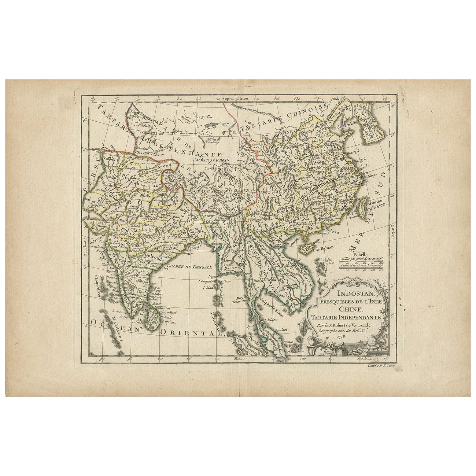
- Antique Map of Asia by Dussy, 1778Located in Langweer, NLAntique map of Asia titled 'Indostan presqu'isles de l'Inde, Chine, Tartarie Independante'. Depicting South-East Asia including Hindustan, India an...Category
Antique Late 18th Century French Maps
MaterialsPaper
- Antique Map of the Russian Empire in Europe by Vaugondy, 1750Located in Langweer, NLAntique map titled 'Partie Occidentale de l'Empire de Russie (..)'. Detailed map of the western part of Russia, extending south to the Caspian and east to Irkurkoy and Ilimskoy. A...Category
Antique 18th Century Maps
MaterialsPaper
- Antique Map of the Indonesian and Philippine Archipelagos by R. de VaugondyLocated in Langweer, NLStriking and highly detailed map of the region from Sumatra and Malaca and Southern China to the Philipines, New Guinea and Northern Australia, centered on Borneo. Includes a large i...Category
Antique Mid-18th Century Maps
MaterialsPaper
- Antique Map of China Including Korea and Taiwan by Vaugondy, 1749Located in Langweer, NLAntique map titled 'Empire de la Chine'. Beautiful map of China including Korea and Taiwan (Formosa). This map originates from 'Atlas Universel (..)' by Gilles Robert de Vaugondy, 17...Category
Antique Mid-18th Century Maps
MaterialsPaper
- Antique Map of New England and Part of Canada by Vaugondy 'circa 1755'Located in Langweer, NLAntique map titled 'Partie de l'Amérique septent qui comprend la nouvelle France ou le Canada'. Decorative and highly detailed map of New England an...Category
Antique Mid-18th Century Maps
MaterialsPaper


You May Also Like
- Large Antique 1859 Map of North AmericaLocated in Sag Harbor, NYThis Map was made by Augustus Mitchell in 1859 It is in amazing condition for being 163 years old. This price is for the rolled up easy to ship version of this piece. I will be Frami...Category
Antique Mid-19th Century American Maps
MaterialsCanvas, Paper

- Original Antique Map of South America by Thomas Clerk, 1817Located in St Annes, LancashireGreat map of South America Copper-plate engraving Drawn and engraved by Thomas Clerk, Edinburgh. Published by Mackenzie And Dent, 1817 Unframed.Category
Antique 1810s English Maps
MaterialsPaper
- California, Alaska and Mexico: 18th Century Hand-Colored Map by de VaugondyBy Didier Robert de VaugondyLocated in Alamo, CAThis an 18th century hand-colored map of the western portions of North America entitled "Carte de la Californie et des Pays Nord-Ouest separés de l'Asie par le détroit d'Anian, extra...Category
Antique 1770s French Maps
MaterialsPaper
- Original Antique Map of South America, circa 1830Located in St Annes, LancashireGreat map of South America Copper plate engraving Published by Butterworth, Livesey & Co., circa 1830 Unframed.Category
Antique Early 1800s English Other Maps
MaterialsPaper
- Original Antique Map of Central America / Florida, Arrowsmith, 1820Located in St Annes, LancashireGreat map of Central America. Drawn under the direction of Arrowsmith. Copper-plate engraving. Published by Longman, Hurst, Rees, Orme and Brown, 1820 Unframed.Category
Antique 1820s English Maps
MaterialsPaper
- Antique Map of Italy by Andriveau-Goujon, 1843By Andriveau-GoujonLocated in New York, NYAntique Map of Italy by Andriveau-Goujon, 1843. Map of Italy in two parts by Andriveau-Goujon for the Library of Prince Carini at Palazzo Carini i...Category
Antique 1840s French Maps
MaterialsLinen, Paper


Recently Viewed
View AllMore Ways To Browse
Antique Maps 18th Century
Antique American 18th Century Furniture
18th Century American Antiques
River Map
Antique Map America
Antique American Maps
Antique American Map
America Antique Map
Antique Map Of America
Antique Maps Of America
American West Antiques
Late 18th Century Antique American
Antique Admiral
Map Of The Pacific
Map Of American West
Map Of Us
Antique Southwestern Furniture
Southwestern Antiques