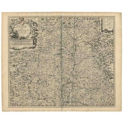
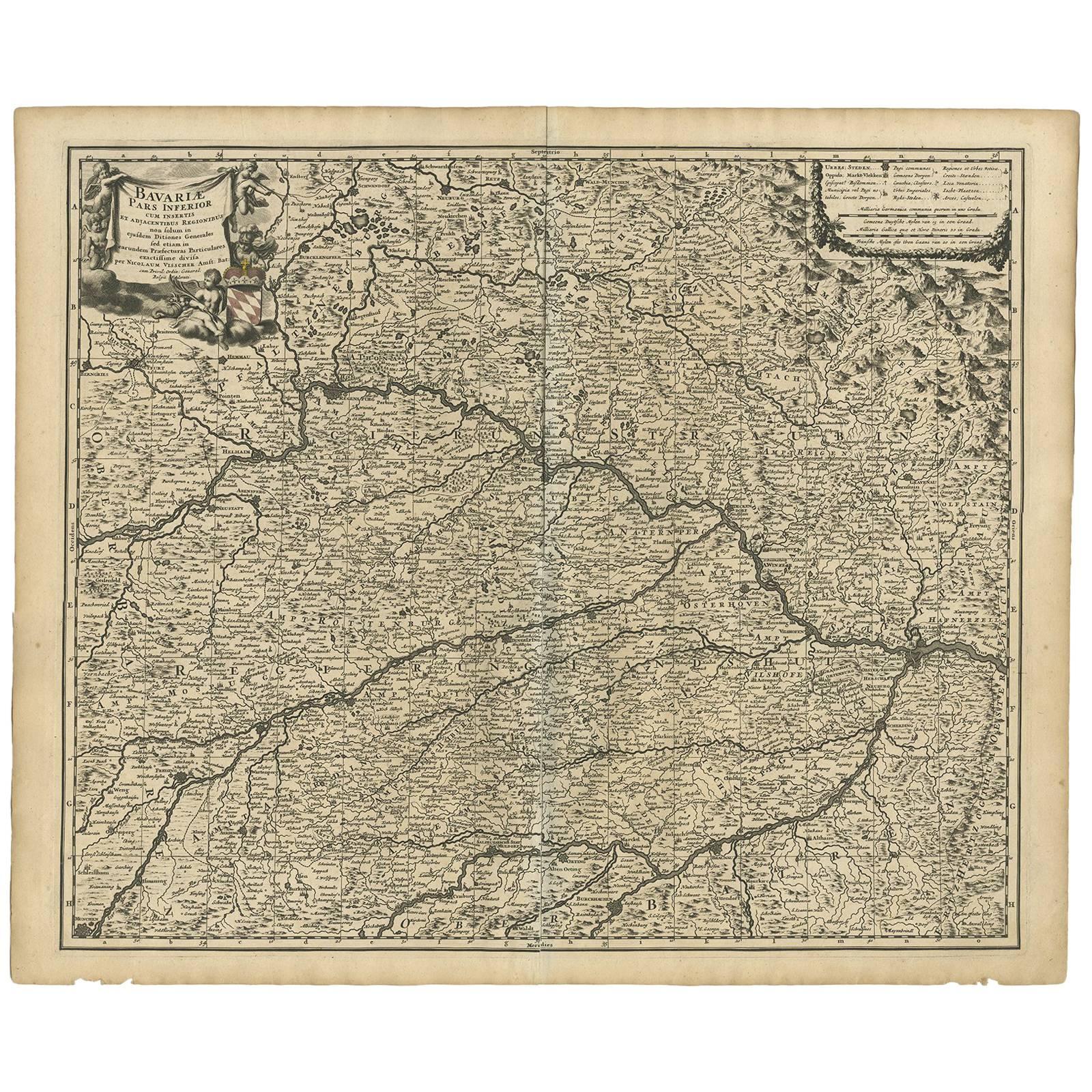
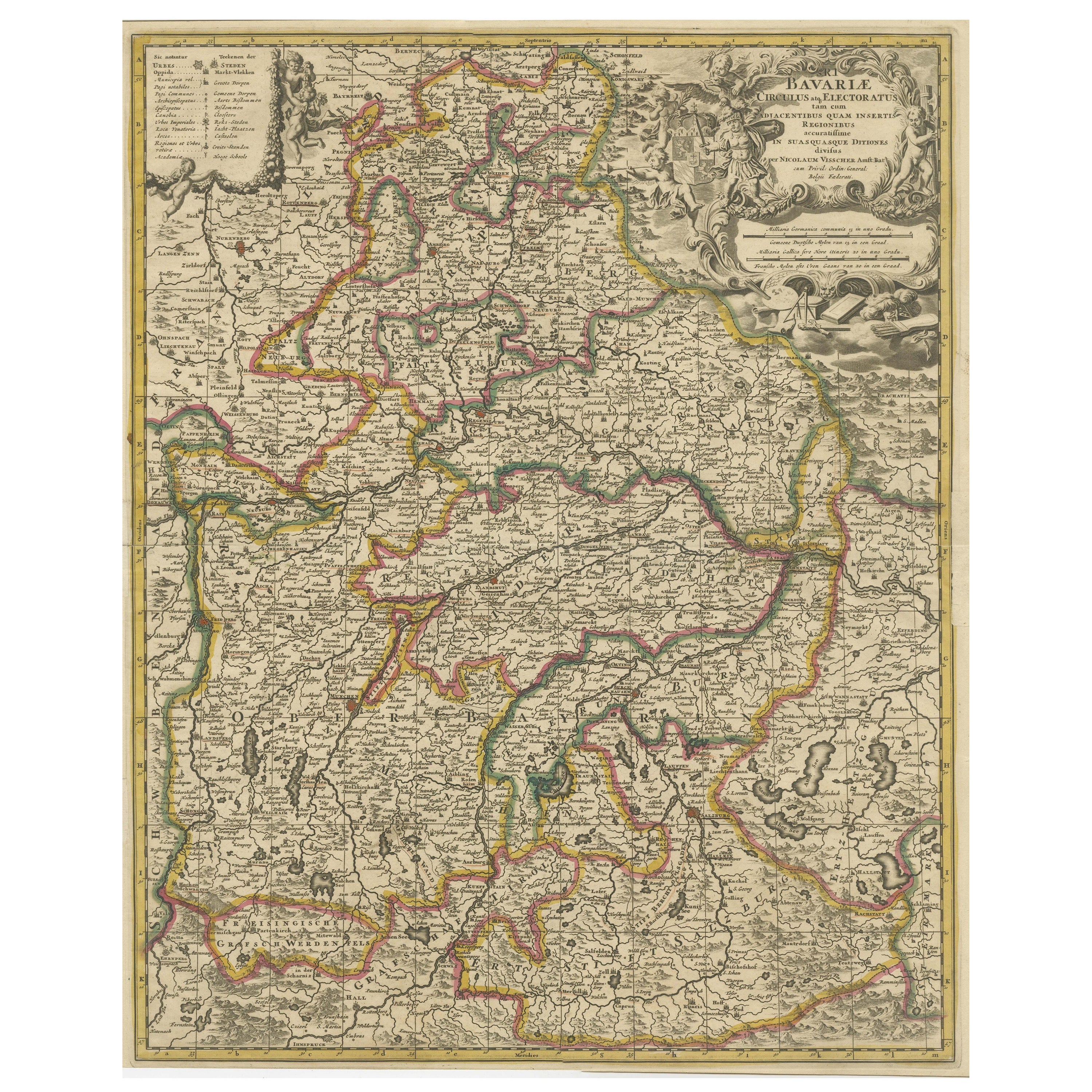
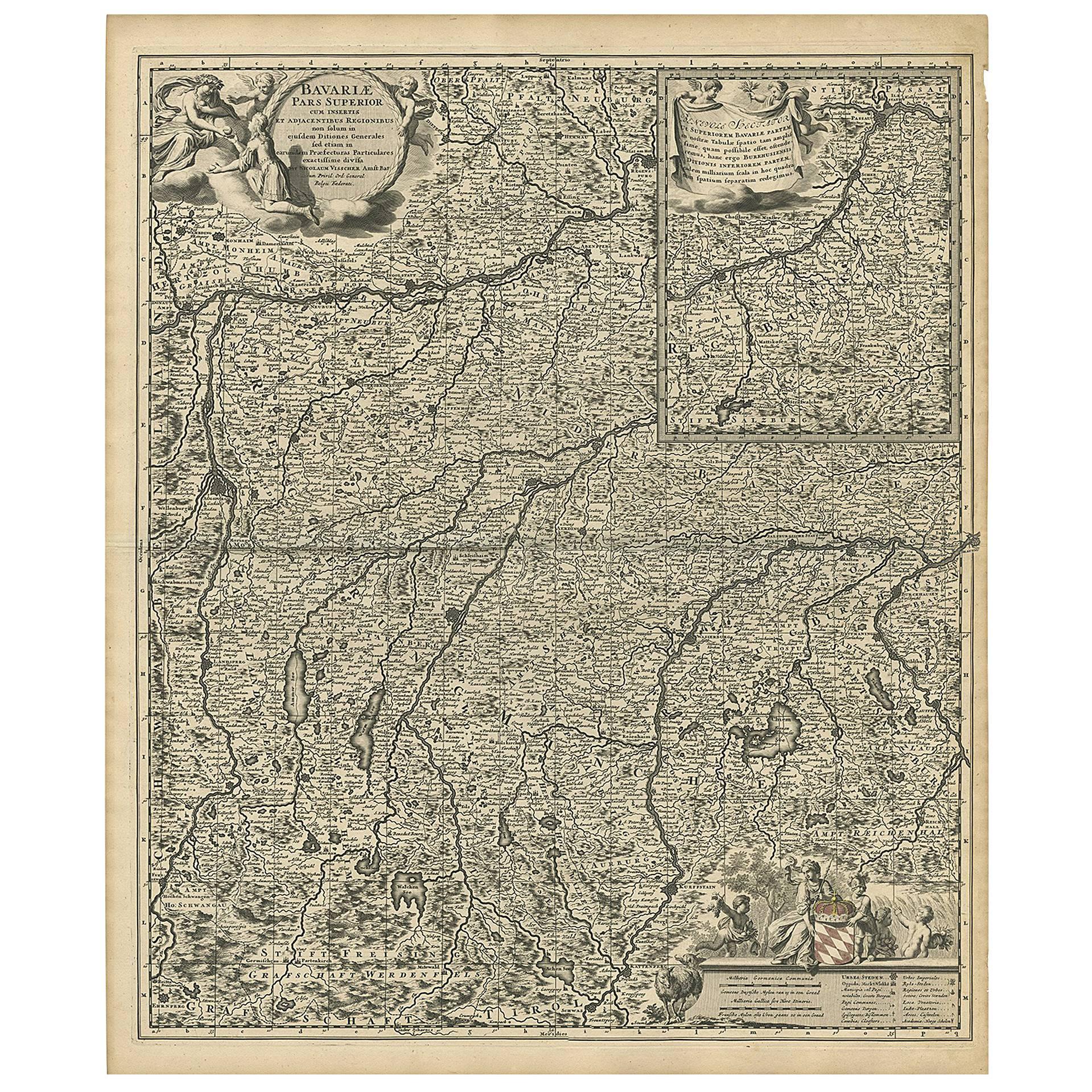
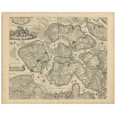
Antique Map of Bavaria Bayern, Germany by N. Visscher, circa 1690
View Similar Items


Want more images or videos?
Request additional images or videos from the seller
1 of 2
Antique Map of Bavaria Bayern, Germany by N. Visscher, circa 1690
About the Item
- Dimensions:Height: 20.87 in (53 cm)Width: 24.81 in (63 cm)Depth: 0.02 in (0.5 mm)
- Period:Late 17th Century
- Date of Manufacture:circa 1690
- Condition:Minor structural damages. Minor fading. Some folding in the map. Please study image carefully.
- Seller Location:Langweer, NL
- Reference Number:Seller: BG-091591stDibs: LU305439931571
About the Seller
5.0
Platinum Seller
These expertly vetted sellers are 1stDibs' most experienced sellers and are rated highest by our customers.
Established in 2009
1stDibs seller since 2017
1,914 sales on 1stDibs
More From This SellerView All
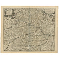
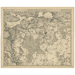
- Antique Map of Bavaria ‘Bayern, Germany’ by N. Visscher, circa 1700Located in Langweer, NLAntique map titled 'Bavariae pars inferior cum insertis et adjacentibus regionibus (..)'. Published circa 1700 in N. Visscher's World Atlas. The map "Bavariae pars inferior cum inse...Category
Antique Early 18th Century Maps
MaterialsPaper
 $436 Sale Price34% Off
 - Antique Map of Switzerland by N. Visscher, circa 1690Located in Langweer, NLAntique map titled 'Tabula Geogaphica qua Pars Meridionalis sive Superior Rheni, Mosae, et Mosellae (..)'. Published by N. Visscher, Amsterdam, circa 1690. Contemporary coloring.Category
Antique Late 17th Century Maps
MaterialsPaper
 $580 Sale Price20% Off
 - Antique Map of Austria by N. Visscher, circa 1690Located in Langweer, NLAntique map titled 'Austriae Archiducatus pars superior in omnes ejusdem'. Spectacular large map of Upper and Lower Austria between Passau and Wien with figurative cartouche and armo...Category
Antique Late 17th Century Maps
MaterialsPaper
 $764 Sale Price24% Off
 - Antique Map of Switzerland by N. Visscher, circa 1690Located in Langweer, NLBeautifully detailed map of Switzerland and surrounding regions in present-day France, Germany, and Italy. This map features two decorative cartouches: the larger is flanked by two p...Category
Antique Late 17th Century Maps
MaterialsPaper
 $546 Sale Price26% Off
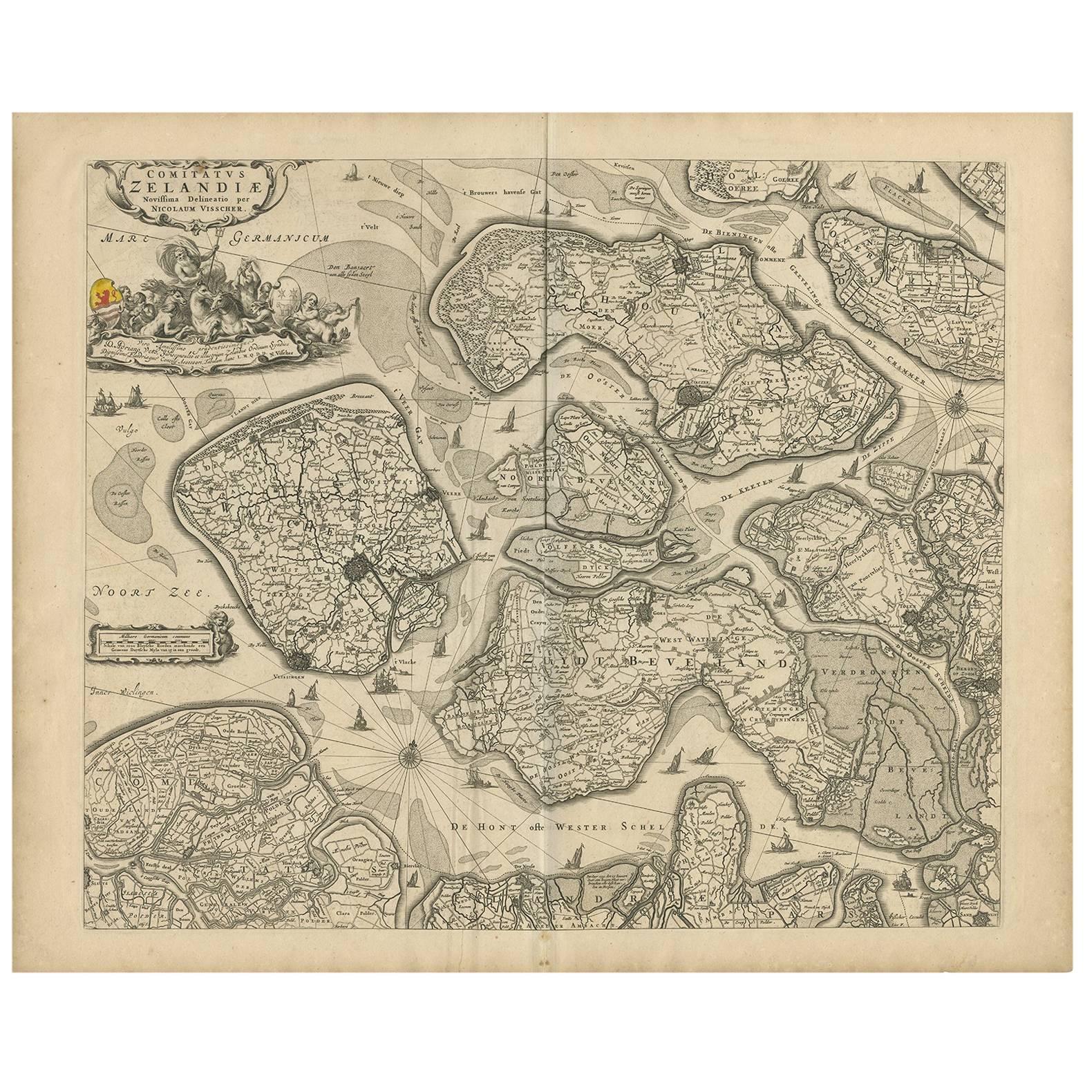
 - Antique Map of Zeeland 'The Netherlands' by N. Visscher, circa 1690Located in Langweer, NLAntique map titled 'Comitatus Zelandiae (..)'. Detailed chart of the province Zeeland, The Netherlands, with details shown pictorially. Published by N. Visscher.Category
Antique Late 17th Century Maps
MaterialsPaper
 $576 Sale Price20% Off
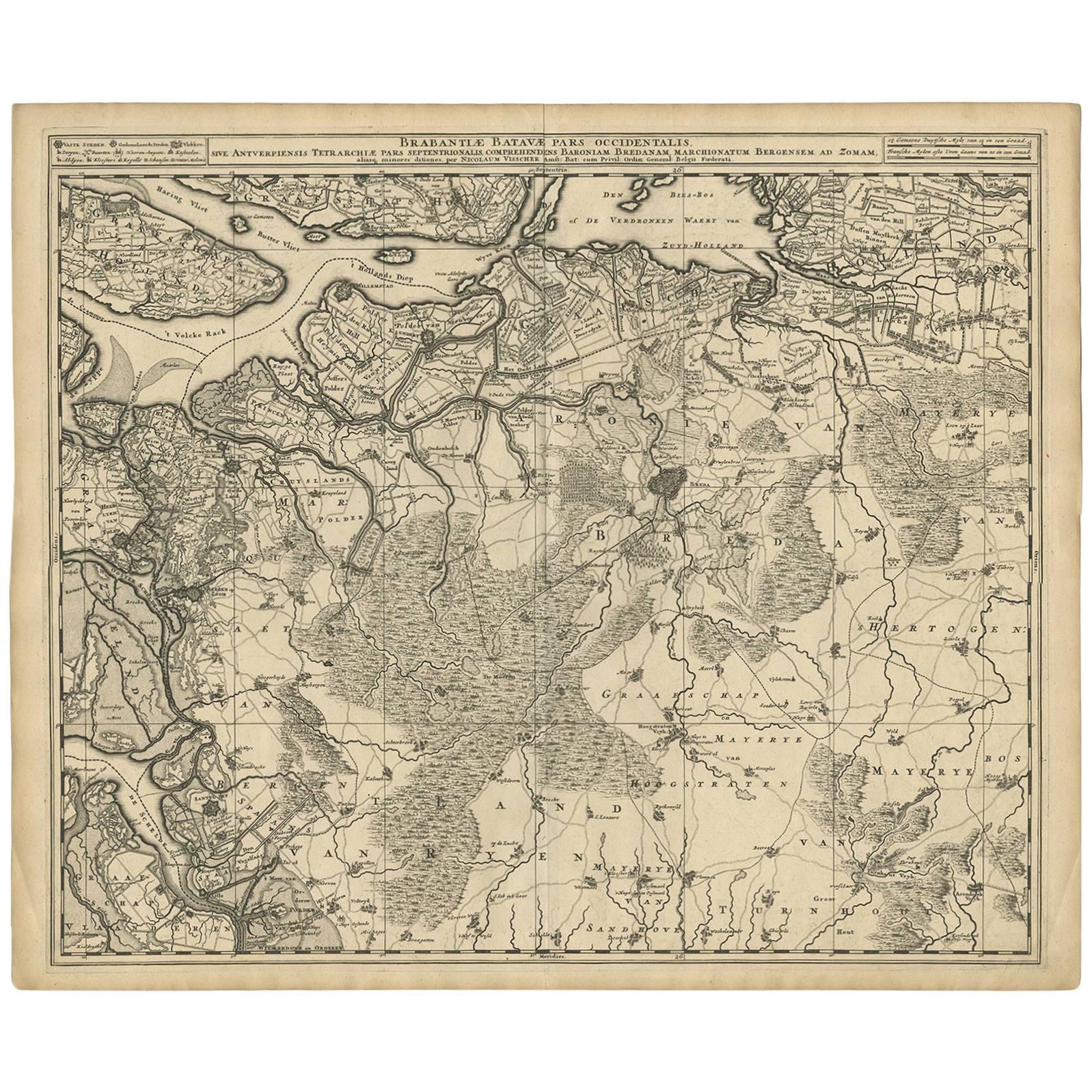
 - Antique Map of Brabant 'The Netherlands' by N. Visscher, circa 1690Located in Langweer, NLAntique map titled 'Brabantiae Batavae Pars Occidentalis (..)'. Highly detailed map of the region between Bergen Op Zoom, Breda, Hoogstraten and Sandvliet, The Netherlands. Published...Category
Antique Late 17th Century Maps
MaterialsPaper
 $524 Sale Price27% Off
You May Also Like
- 17th Century Nicolas Visscher Map of Southeastern EuropeLocated in Hamilton, OntarioA beautiful, highly detailed map of southeastern Europe by Nicolas Visscher. Includes regions of Northern Italy (showing the cities Bologna, Padua, and Venice), Bohemia, Austria (sho...Category
Antique 17th Century Dutch Maps
MaterialsPaper
 $1,350 Sale Price38% Off
 - "Africae Accurata", a Hand-Colored 17th Century Map of Africa by VisscherBy Nicolaes Visscher IILocated in Alamo, CAAn 18th century hand-colored map of Africa entitled "Africae Accurata Tabula ex officina" by Nicolaes Visscher, published in Amsterdam in 1680. This beautiful, colorful and detailed map is embellished by eleven sailing ships, a whale, flying fish and multiple land animals. It includes the Mediterranean Sea and adjacent portions of Portugal, Spain, Italy, Greece and Asia Minor. The map perpetuates several long-standing errors, including the origin of the Nile River from two imaginary lakes in southern Africa, which are shown adjacent to the imaginary Lunae Montes (Mountains of the Moon...Category
Antique Late 17th Century Dutch Maps
MaterialsPaper
- 18th Century Hand Colored Map of Spain and Portugal by VisscherBy Nicolaes Visscher IILocated in Alamo, CAThis is an early 18th century map of Spain and Portugal, with attractive original hand-coloring, entitled "Hispaniae et Portugalliae Regna per Nicolaum Visscher cum Privilegio Ordinu...Category
Antique Early 18th Century Dutch Maps
MaterialsPaper
- Antique Handcrafted German Railroad / Train Station Ticket Booth By Bing BavariaLocated in Lisse, NLVery rare and great looking antique toy train ticket dispenser by Gebruder Bing, Nurnberg (GBN). Since buying and selling only the rarest antiques h...Category
Early 20th Century German Arts and Crafts Toys and Dolls
MaterialsMetal
- 17th Century Hand Colored Map of the Liege Region in Belgium by VisscherBy Nicolaes Visscher IILocated in Alamo, CAAn original 17th century map entitled "Leodiensis Episcopatus in omnes Subjacentes Provincias distincté divisusVisscher, Leodiensis Episcopatus" by Nicolaes Visscher II, published in Amsterdam in 1688. The map is centered on Liege, Belgium, includes the area between Antwerp, Turnhout, Roermond, Cologne, Trier and Dinant. This attractive map is presented in a cream-colored mat measuring 30" wide x 27.5" high. There is a central fold, as issued. There is minimal spotting in the upper margin and a tiny spot in the right lower margin, which are under the mat. The map is otherwise in excellent condition. The Visscher family were one of the great cartographic families of the 17th century. Begun by Claes Jansz Visscher...Category
Antique Late 17th Century Dutch Maps
MaterialsPaper
- Original Antique Map of Belgium by Tallis, Circa 1850Located in St Annes, LancashireGreat map of Belgium Steel engraving Many lovely vignettes Published by London Printing & Publishing Co. ( Formerly Tallis ), C.1850 Origin...Category
Antique 1850s English Maps
MaterialsPaper