Items Similar to Antique Map of Belgium and The Netherlands by A.K. Johnston, 1865


Want more images or videos?
Request additional images or videos from the seller
1 of 5
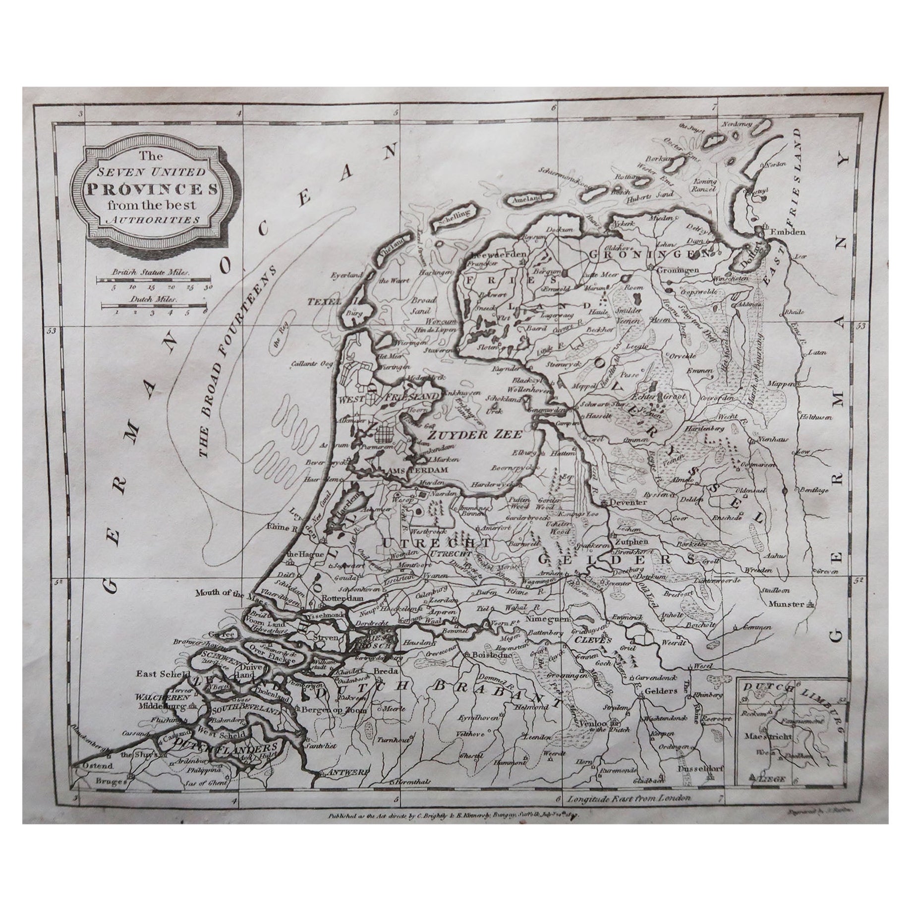
Antique Map of Belgium and The Netherlands by A.K. Johnston, 1865
About the Item
Antique map titled 'Belgium and The Netherlands'. This map originates from the ‘Royal Atlas of Modern Geography’ by Alexander Keith Johnston. Published by William Blackwood and Sons, Edinburgh and London, 1865.
- Dimensions:Height: 24.41 in (62 cm)Width: 19.1 in (48.5 cm)Depth: 0.02 in (0.5 mm)
- Materials and Techniques:
- Period:
- Date of Manufacture:1865
- Condition:General age-related toning. Please study image carefully.
- Seller Location:Langweer, NL
- Reference Number:Seller: BG-05553/161stDibs: LU3054310726823
About the Seller
5.0
Platinum Seller
These expertly vetted sellers are 1stDibs' most experienced sellers and are rated highest by our customers.
Established in 2009
1stDibs seller since 2017
1,909 sales on 1stDibs
Typical response time: <1 hour
- ShippingRetrieving quote...Ships From: Langweer, Netherlands
- Return PolicyA return for this item may be initiated within 14 days of delivery.
Auctions on 1stDibs
Our timed auctions are an opportunity to bid on extraordinary design. We do not charge a Buyer's Premium and shipping is facilitated by 1stDibs and/or the seller. Plus, all auction purchases are covered by our comprehensive Buyer Protection. Learn More
More From This SellerView All
- Antique Map of Denmark by A.K. Johnston, 1865Located in Langweer, NLAntique map titled 'Denmark and the Duchies Schleswig, Holstein & Lauenburg; Hanover, Brunswick, Mecklenburg, Oldenburg, Anhalt and Lippe'. With an inset map of Iceland, Copenhagen a...Category
Antique Mid-19th Century Maps
MaterialsPaper
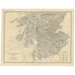
- Antique Map of Scotland 'South' by A.K. Johnston, 1865Located in Langweer, NLAntique map titled 'Scotland (Southern Sheet)'. This map originates from the ‘Royal Atlas of Modern Geography’ by Alexander Keith Johnston. Published by William Blackwood and Sons, E...Category
Antique Mid-19th Century Maps
MaterialsPaper
- Antique Map of South Australia by A.K. Johnston, 1865Located in Langweer, NLAntique map titled 'South Australia, New South Wales, Victoria & Queensland'. This map originates from the ‘Royal Atlas of Modern Geography’ by Alexander Keith Johnston. Published by...Category
Antique Mid-19th Century Maps
MaterialsPaper
- Antique Map of Sweden & Norway by A.K. Johnston '1865'Located in Langweer, NLAntique map titled 'Sweden & Norway (Scandinavia)'. With an inset map of Stockholm and environments. This map originates from the ‘Royal Atlas of Modern Geography’ by Alexander Keith...Category
Antique Mid-19th Century Maps
MaterialsPaper
- Antique Map of England and Wales by A.K. Johnston, 1865Located in Langweer, NLAntique map titled 'England and Wales (Southern Sheet)'. With an inset map of the Scilly Islands. This map originates from the ‘Royal Atlas of Modern Geography’ by Alexander Keith Jo...Category
Antique Mid-19th Century Maps
MaterialsPaper
- Antique Map of China and Japan by A.K. Johnston, 1865Located in Langweer, NLAntique map titled 'China and Japan'. Depicting Eastern China, the Islands of Japan and more. This map originates from the ‘Royal Atlas of Modern Geography’ by Alexander Keith Johnst...Category
Antique Mid-19th Century Maps
MaterialsPaper


You May Also Like
- 17th Century Hand Colored Map of the Liege Region in Belgium by VisscherBy Nicolaes Visscher IILocated in Alamo, CAAn original 17th century map entitled "Leodiensis Episcopatus in omnes Subjacentes Provincias distincté divisusVisscher, Leodiensis Episcopatus" by Nicolaes Visscher II, published in Amsterdam in 1688. The map is centered on Liege, Belgium, includes the area between Antwerp, Turnhout, Roermond, Cologne, Trier and Dinant. This attractive map is presented in a cream-colored mat measuring 30" wide x 27.5" high. There is a central fold, as issued. There is minimal spotting in the upper margin and a tiny spot in the right lower margin, which are under the mat. The map is otherwise in excellent condition. The Visscher family were one of the great cartographic families of the 17th century. Begun by Claes Jansz Visscher...Category
Antique Late 17th Century Dutch Maps
MaterialsPaper
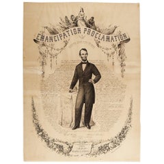
- 1865 Emancipation Proclamation, Antique Lithograph by P.S. Duval and SonLocated in Colorado Springs, COPresented is a lithographic broadside of the text of the Emancipation Proclamation issued on January 1, 1863. This broadside was published in...Category
Antique 1860s American Historical Memorabilia
MaterialsPaper
- Antique 1630 Colored Belgium Map Flandria Gallica Flanders Henricus HondiusLocated in Dayton, OH"Antique hand colored map of Flanders, Belgium, circa 1630, engraved by Henricus Hondius. “Henricus Hondius II (1597 – 16 August 1651) was a Dutch eng...Category
Antique Early 17th Century Renaissance Maps
MaterialsPaper
- Map of the Republic of GenoaLocated in New York, NYFramed antique hand-coloured map of the Republic of Genoa including the duchies of Mantua, Modena, and Parma. Europe, late 18th century. Dimension: 25...Category
Antique Late 18th Century European Maps
- Antique Map of Italy by Andriveau-Goujon, 1843By Andriveau-GoujonLocated in New York, NYAntique Map of Italy by Andriveau-Goujon, 1843. Map of Italy in two parts by Andriveau-Goujon for the Library of Prince Carini at Palazzo Carini i...Category
Antique 1840s French Maps
MaterialsLinen, Paper
- Antique Map of Principality of MonacoBy Antonio Vallardi EditoreLocated in Alessandria, PiemonteST/619 - "Old Geographical Atlas of Italy - Topographic map of ex-Principality of Monaco" - ediz Vallardi - Milano - A somewhat special edition ---Category
Antique Late 19th Century Italian Other Prints
MaterialsPaper


Recently Viewed
View AllMore Ways To Browse
Belgium Map
Map Edinburgh
Antique Map Edinburgh
Antique Map Of Edinburgh
Map Of Belgium
Alexander Keiths
Antique Blackwood
Antique Blackwood Furniture
Belgium Antique Map
Antique Whimsical
Antique Atlas Map
Antique Maps Prints
Antique Map Prints
Antique Map Print
Antique Prints Maps
Antique Prints And Maps
Antique Maps And Prints
Map 19th Century