Items Similar to Antique Map of the Cambrai Region by Pitt, circa 1680


Want more images or videos?
Request additional images or videos from the seller
1 of 5
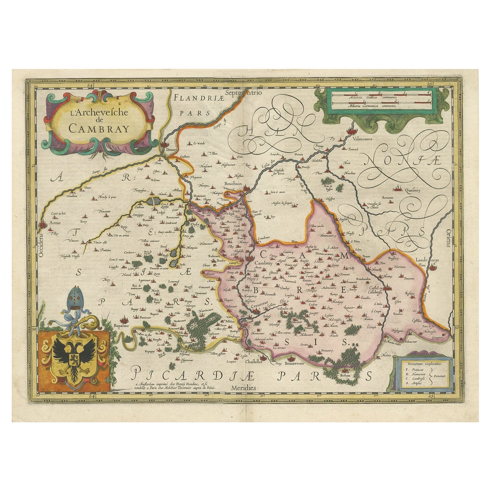
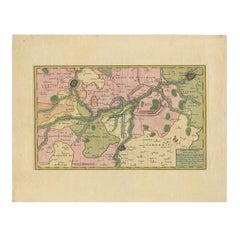
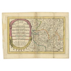
Antique Map of the Cambrai Region by Pitt, circa 1680
About the Item
Antique map titled 'Archiepiscopatus Cameracensis - Archevesche de Cambray'. Decorative map of the Cambrai region of France. This map originates from 'The English Atlas' by Moses Pitt. Moses Pitt, a London bookseller, had an ambitious plan to produce a 12-volume atlas in the Blaeu-Jansson tradition: however, only the first four atlases were published, and only the text to the fifth was printed. The project halted when Pitt was imprisoned for debts incurred as a result of building speculation.
- Dimensions:Height: 20.87 in (53 cm)Width: 25.99 in (66 cm)Depth: 0.02 in (0.5 mm)
- Materials and Techniques:
- Period:Late 17th Century
- Date of Manufacture:circa 1680
- Condition:General age-related toning, minor wear. Blank verso. Please study image carefully.
- Seller Location:Langweer, NL
- Reference Number:
About the Seller
5.0
Platinum Seller
These expertly vetted sellers are 1stDibs' most experienced sellers and are rated highest by our customers.
Established in 2009
1stDibs seller since 2017
1,913 sales on 1stDibs
Typical response time: <1 hour
- ShippingRetrieving quote...Ships From: Langweer, Netherlands
- Return PolicyA return for this item may be initiated within 14 days of delivery.
More From This SellerView All
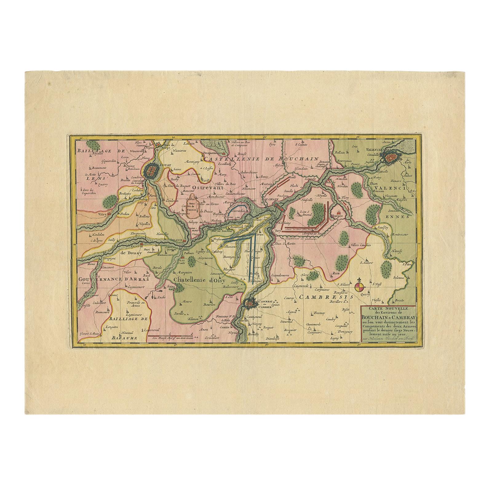
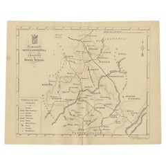
- Antique Map of the Region of Bouchain and Cambrai by Visscher 'circa 1680'By Nicolaes Visscher IILocated in Langweer, NLAntique map titled 'Carte Nouvelle des Environs de Bouchain & Cambray'. Uncommon map of the region of Bouchain and Cambrai (Cambray, France) showing the camps of two armies.Category
Antique Late 17th Century Maps
MaterialsPaper
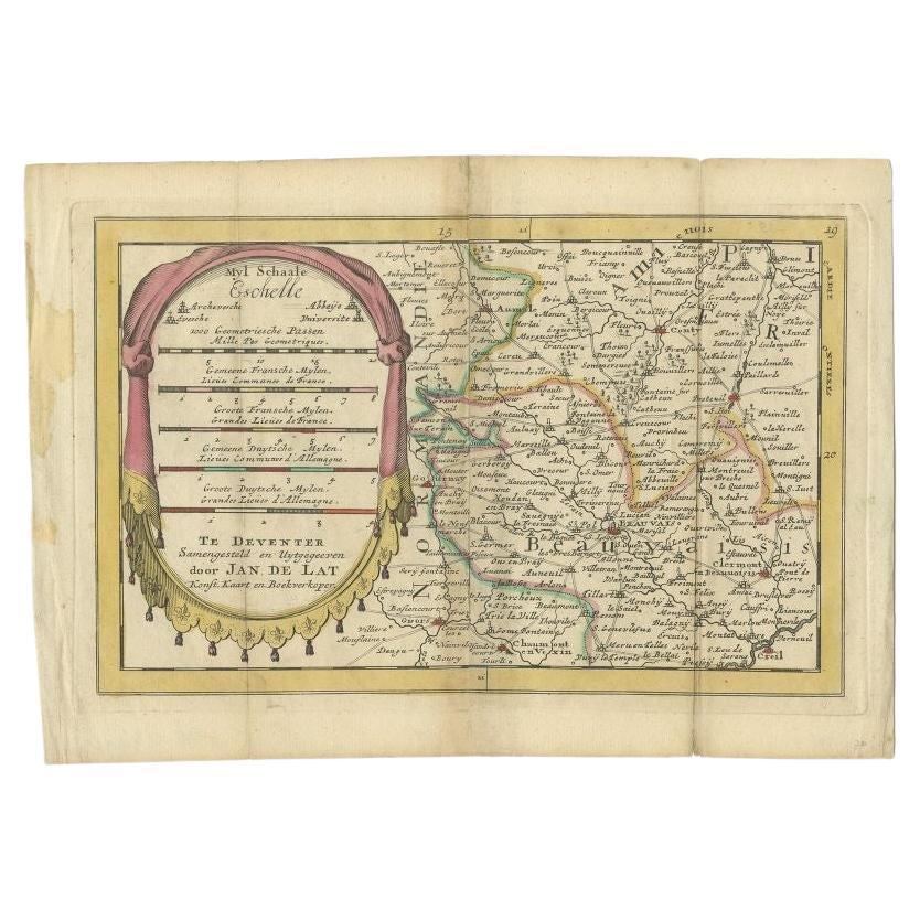
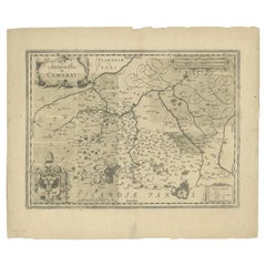
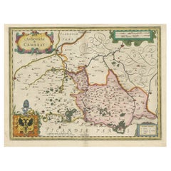
- Antique Map of the Region of Cambrai in France, c.1630Located in Langweer, NLAntique map titled 'l'Archevesche de Cambray'. Decorative map of the region of Cambrai, France. Includes the cities of Cambrai, Valencienes, Douai, and Bouchain. Artists and Engrav...Category
Antique 17th Century Maps
MaterialsPaper
- Antique Map of the Hesse Region of Germany by Blaeu, 1665Located in Langweer, NLAntique map titled 'Hassia Landgraviatus'. Map of the Hesse Region of Germany. This map originates from 'Atlas Maior Sive Cosmographia Blaviana, Qua Solvm, Salvm, Coelvm, Accvratissi...Category
Antique 17th Century Maps
MaterialsPaper
- Decorative Antique Map of the Region of Cambrai, France, ca.1630Located in Langweer, NLAntique map titled 'l'Archevesche de Cambray'. Decorative map of the region of Cambrai, France. Includes the cities of Cambrai, Valencienes, Douai, and Bouchain. Artists and Engravers: Henricus...Category
Antique 1630s Maps
MaterialsPaper
- Antique Map of the Region Near the Gulf of Zula, 1870Located in Langweer, NLAntique map titled 'Map of the Country between Annesley Bay and the Plain of Salt'. Lithographed map of the region near the Gulf of Zula, also known as Annesley Bay, Baia di Arafali ...Category
Antique Mid-19th Century Maps
MaterialsPaper
- Antique Map of the Region of Beauvais in France, 1737Located in Langweer, NLUntitled map of the region of Beauvais, France. This map originates from 'Nieuw en beknopt Kaart-Boekje vertoonende de XVII. Nederlandse Provintien (..)'. Artists and Engravers: Au...Category
Antique 18th Century Maps
MaterialsPaper

You May Also Like
- Original Antique Map of The United States of America, circa 1890Located in St Annes, LancashireGreat map of the USA By The Stanford's Geographical Establishment Original colour Unframed.Category
Antique 1890s English Victorian Maps
MaterialsPaper
- Large Original Antique Map of the World, Fullarton, circa 1870Located in St Annes, LancashireGreat map of the World. From the celebrated Royal Illustrated Atlas Lithograph. Original color. Published by Fullarton, Edinburgh, circa 1870. Unframed.Category
Antique 1870s Scottish Maps
MaterialsPaper
- Silver Leaf Foil Wall World Map Engraving Based on the Original Moses Pitt, 1681Located in GBWe are delighted to offer for sale this lovely antique style pictorial silver leaf foil world map taken from and original engraving my Moses Pitt, 1681 This is a very interesting ...Category
20th Century English Modern Maps
MaterialsSilver Leaf
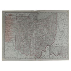
- Large Original Antique Map of Ohio by Rand McNally, circa 1900By Rand McNally & Co.Located in St Annes, LancashireFabulous monochrome map with red outline color Original color By Rand, McNally & Co. Published, circa 1900 Unframed Repairs to minor edge tears.Category
Antique Early 1900s American Edwardian Maps
MaterialsPaper
- Original Antique Map of South Dakota by Rand McNally, circa 1900By Rand McNally & Co.Located in St Annes, LancashireFabulous monochrome map with red outline color Original color By Rand, McNally & Co. Published, circa 1900 Unframed Minor edge tears.Category
Antique Early 1900s American Edwardian Maps
MaterialsPaper
- Large Original Antique Map of Arkansas by Rand McNally, circa 1900By Rand McNally & Co.Located in St Annes, LancashireFabulous monochrome map with red outline color Original color By Rand, McNally & Co. Published, circa 1900 Unframed Minor edge tears.Category
Antique Early 1900s American Edwardian Maps
MaterialsPaper


Recently Viewed
View AllMore Ways To Browse
Antique English Maps
Used Bookseller
Used Booksellers
Antique London Map Print
Antique Booksellers
Antique Bookseller
Antique Furniture Building Plans
Map Blaeu
Blaeu Maps
Antique Map Blaeu
Russian Collectable
Office World Map
Sea Collectables
Antique Curiosities Prints
Antique Appreciation
United States Map
Antique Collectible Plate
Prints Of Antique Maps