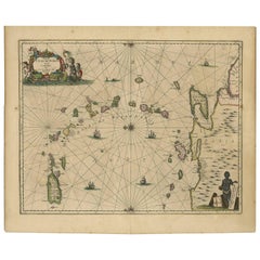
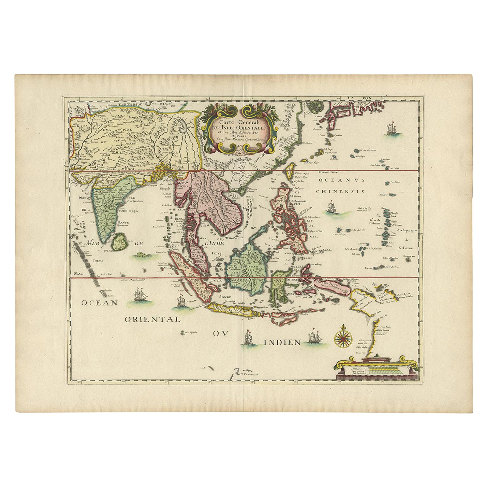
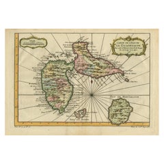
Antique Map of the Caribbean Islands by J. Jansson, circa 1650
View Similar Items


Want more images or videos?
Request additional images or videos from the seller
1 of 6
Antique Map of the Caribbean Islands by J. Jansson, circa 1650
About the Item
- Creator:J. Jansson (Artist)
- Dimensions:Height: 18.9 in (48 cm)Width: 22.84 in (58 cm)Depth: 0.02 in (0.5 mm)
- Materials and Techniques:Engraved,Hand-Painted
- Period:Mid-17th Century
- Date of Manufacture:circa 1650
- Condition:Good condition with some minor brown spots/overall browning.
- Seller Location:Langweer, NL
- Reference Number:Seller: D-00051stDibs: LU305438685683
About the Seller
5.0
Platinum Seller
These expertly vetted sellers are 1stDibs' most experienced sellers and are rated highest by our customers.
Established in 2009
1stDibs seller since 2017
1,914 sales on 1stDibs
More From This SellerView All
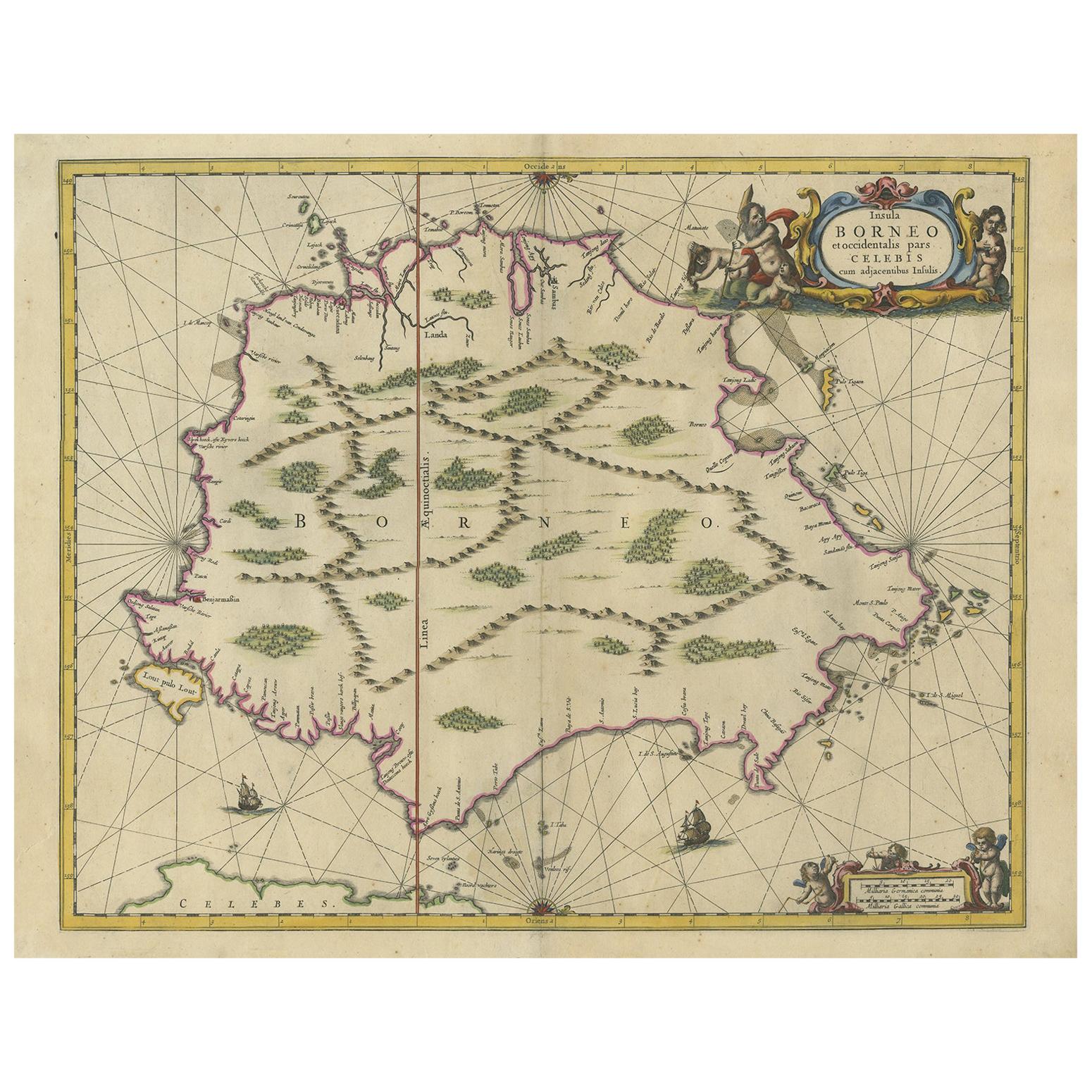
- Antique Map of the Island of Borneo by Janssonius, circa 1650Located in Langweer, NLAntique map titled 'Insula Borneo et Occidentalis pars Celebis cum adjacentibus Insulis'. Rare sea chart of the island of Borneo. Published by J. Janssonius, circa 1650.Category
Antique Mid-17th Century Maps
MaterialsPaper
 $1,610 Sale Price24% Off
 - Antique Map of the Island Java, Indonesia, c.1650Located in Langweer, NLAntique map titled 'Insulae Iavae cum parte insularum Boreno Sumatrae (..)'. Beautiful map of the island of Java and part of Borneo, Bali, Madura and Sumatra. With decorative carto...Category
Antique 17th Century Maps
MaterialsPaper
 $2,662 Sale Price24% Off
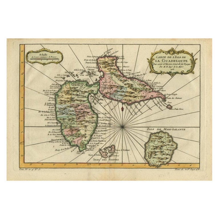
 - Antique Map of Guadeloupe, Island in the Caribbean, c.1757Located in Langweer, NLAntique map titled 'Carte de L'Isle de la Guadeloupe'. A very decorative map of Guadeloupe in the Caribbean, adorned with rhumb lines, fleur-de-lys, and two decorative rococo-style...Category
Antique 18th Century Maps
MaterialsPaper
 $576 Sale Price20% Off
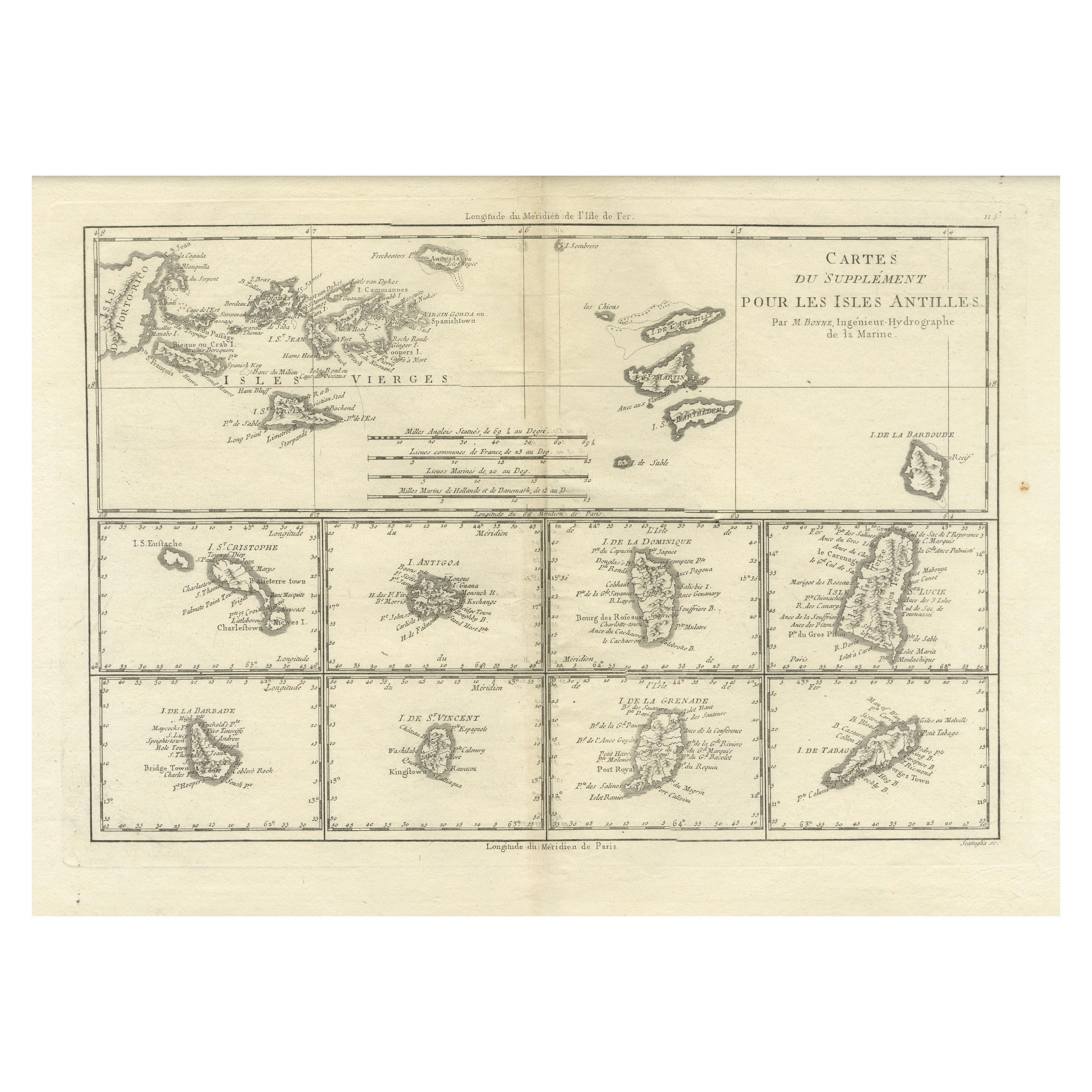
 - Detailed Antique Map of the Windward Islands in the CaribbeanBy Covens & MortierLocated in Langweer, NLAntique map titled 'Carte des Antilles Francoises et des Isles Voisines'. Original antique map of the French Antilles, covering an area stretching from Guadeloupe in the north to Gre...Category
Antique Early 18th Century Maps
MaterialsPaper
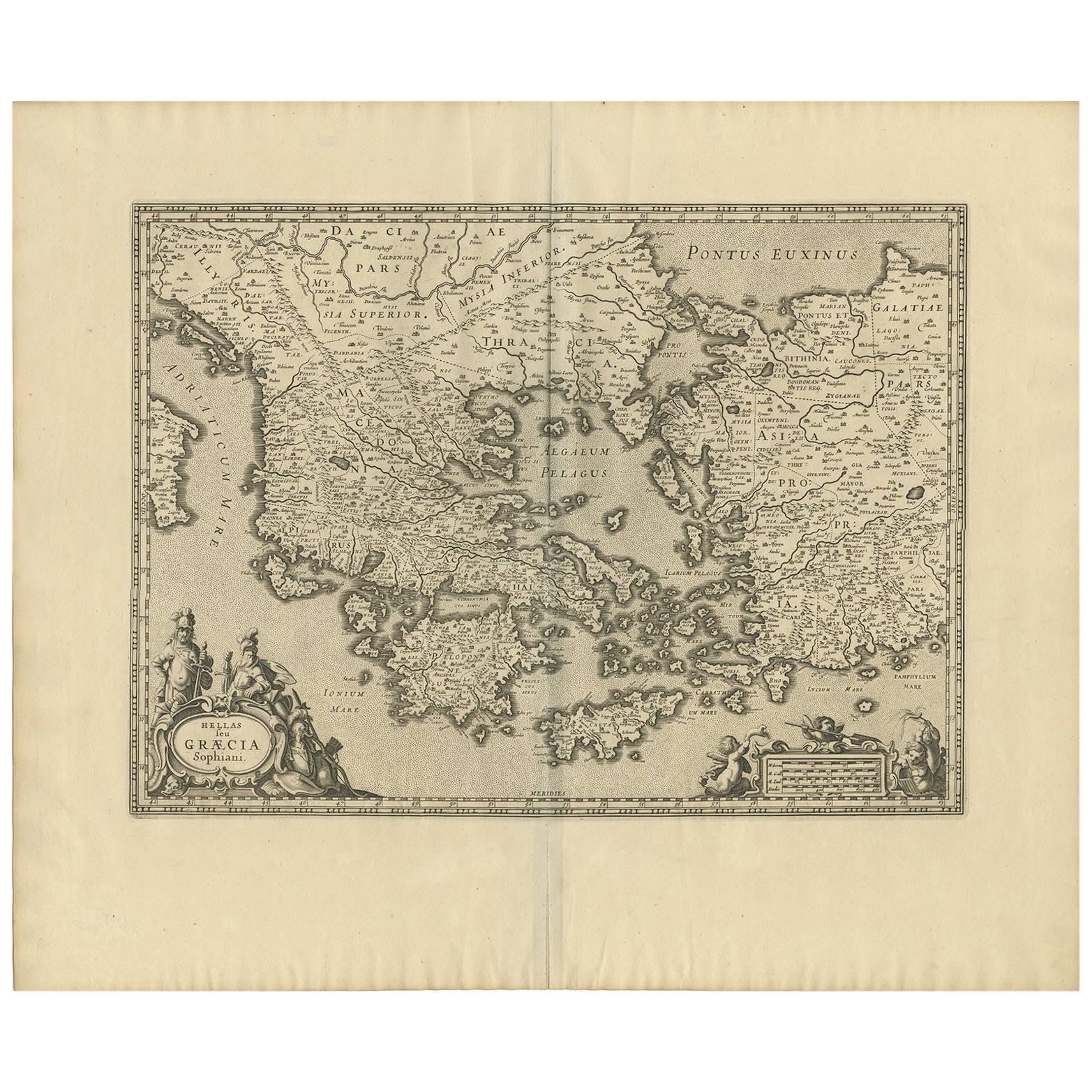
- Antique Map of Greece by J. Jansson, circa 1653Located in Langweer, NLThis is an authentic antique map of the Greece by Jan Jansson. The map was published in Amsterdam, circa 1653. This striking 17th century map of Greece was based on “Totius Graeciae ...Category
Antique Mid-17th Century Maps
MaterialsPaper
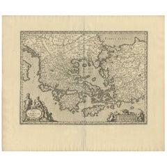 $764 Sale Price20% Off
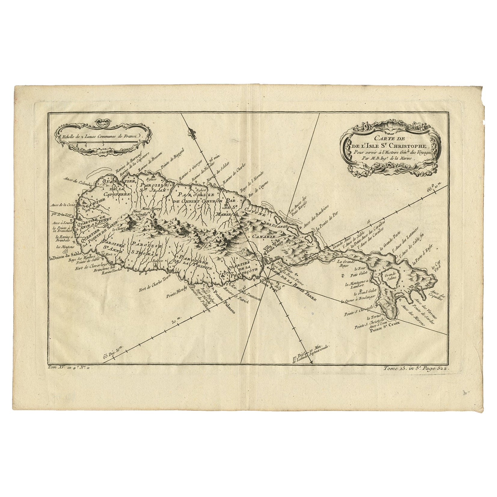
 - Antique Map of the Caribbean Island of St Kitts, ca.1750Located in Langweer, NLDescription: Antique map titled 'Carte de l'Isle St. Christophe pour Servir a l'Histoire Genle. des Voyages.' Detailed map of the Island of St. Kitts, showing the Parishes, towns, ...Category
Antique 1750s Maps
MaterialsPaper
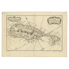 $629 Sale Price20% Off

You May Also Like
- Early 19th Century Hand Colored Map of the United States and Caribbean IslandsLocated in Hamilton, OntarioHand coloured early 19th century map by Giraldon of France titled "Etats Unis et Grandes Antilles" (United States and Greater Antilles).Category
Antique Early 19th Century French Maps
MaterialsPaper
 $595 Sale Price40% Off
 - 1854 Map of Massachusetts, Connecticut and Rhode Island, Antique Wall MapLocated in Colorado Springs, COThis striking wall map was published in 1854 by Ensign, Bridgman & Fanning and has both full original hand-coloring and original hardware. This impression is both informative and highly decorative. The states are divided into counties, outlined in red, green, and black, and subdivided into towns. Roads, canals, and railroad lines are prominently depicted, although they are not all labeled. The mapmakers also marked lighthouses, banks, churches, and prominent buildings, with a key at right. The map is an informative and comprehensive overview of the infrastructural development of New England prior to the Civil War. Physical geographies depicted include elevation, conveyed with hachure marks, rivers and lakes. The impression features an inset map of Boston...Category
Antique 19th Century American Maps
MaterialsPaper
- 1636 Jansson Map of Ireland Entitled "Comitatus Lageniae, " Ric.a007Located in Norton, MA1646 Jansson map entitled "Procinvia connactiae," Ric.a006 Description: The PROVINCE of CONNAVGT 490 x 380From vol 4 of Jansson's Atlas Novus 1646, published in Amsterdam with...Category
Antique 17th Century Unknown Maps
MaterialsPaper
- Large Original Antique Map of Rhode Island, USA, C.1900Located in St Annes, LancashireFabulous map of Rhode Island Original color Engraved and printed by the George F. Cram Company, Indianapolis. Published, C.1900 Unframed Free ...Category
Antique 1890s American Maps
MaterialsPaper
- 1861 Topographical Map of the District of Columbia, by Boschke, Antique MapLocated in Colorado Springs, COPresented is an original map of Albert Boschke's extremely sought-after "Topographical Map of the District of Columbia Surveyed in the Years 1856 ...Category
Antique 1860s American Historical Memorabilia
MaterialsPaper
- 1646 Jansson Map Entitled "Procinvia Connactiae, " Ric.a006Located in Norton, MA1646 Jansson map entitled "Procinvia connactiae," Ric.a006 Description: The PROVINCE of CONNAVGT 490 x 380From vol 4 of Jansson's Atlas Novus 1646, published in Amsterdam with...Category
Antique 17th Century Unknown Maps
MaterialsPaper


