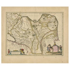
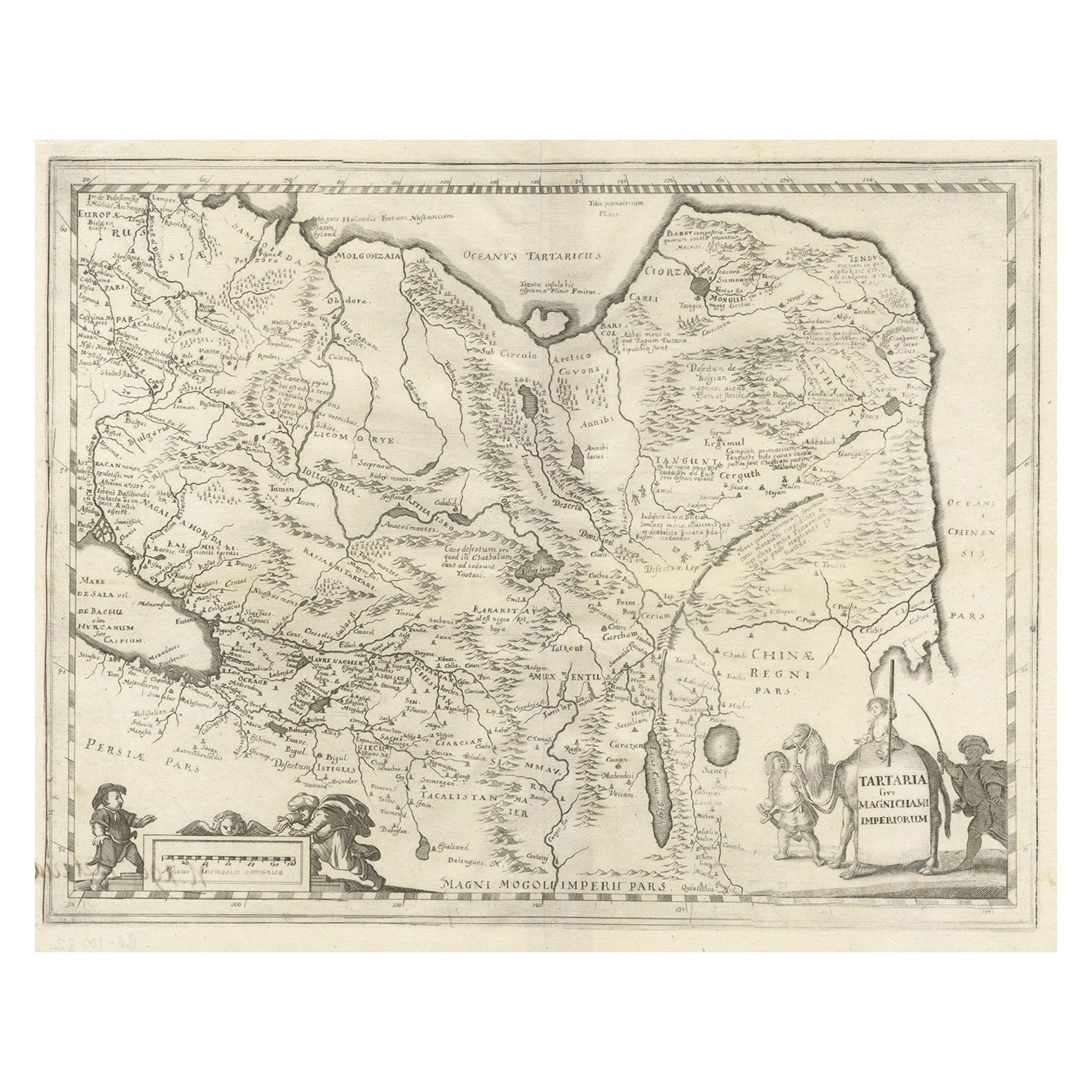
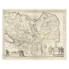
Antique Map of China, Tartary and Central Asia by Blaeu, circa 1645
View Similar Items


Want more images or videos?
Request additional images or videos from the seller
1 of 5
Antique Map of China, Tartary and Central Asia by Blaeu, circa 1645
About the Item
- Dimensions:Height: 20.08 in (51 cm)Width: 23.43 in (59.5 cm)Depth: 0.02 in (0.5 mm)
- Materials and Techniques:
- Period:Mid-17th Century
- Date of Manufacture:circa 1645
- Condition:Original/contemporary hand coloring. Original folding line, with splits. General age-related toning. Minor wear and soiling. Latin text on verso. Please study images carefully.
- Seller Location:Langweer, NL
- Reference Number:Seller: BG-127481stDibs: LU3054321879222
About the Seller
5.0
Platinum Seller
These expertly vetted sellers are 1stDibs' most experienced sellers and are rated highest by our customers.
Established in 2009
1stDibs seller since 2017
1,914 sales on 1stDibs
More From This SellerView All
- Antique Map of China, Tartary and Central Asia by Blaeu, c.1645Located in Langweer, NLAntique map titled ‘Tartaria sive Magnichami Imperiorum‘. Early map of Siberia based upon the journals of Marco Polo. The map covers from the Caspian Sea and the Volga River east as far as the China Sea and the city of Xanadu. It extends north to Nova Zembla and south to the Upper Ganges River. When Blaeu drew this map this part of the world was almost entirely unknown. Blaeu relied on the journals of Marco Polo to compile most of the map. Devils and dragons frolic in the Lop Nor and far to the north the summer seat...Category
Antique 17th Century Maps
MaterialsPaper
 $829 Sale Price20% Off
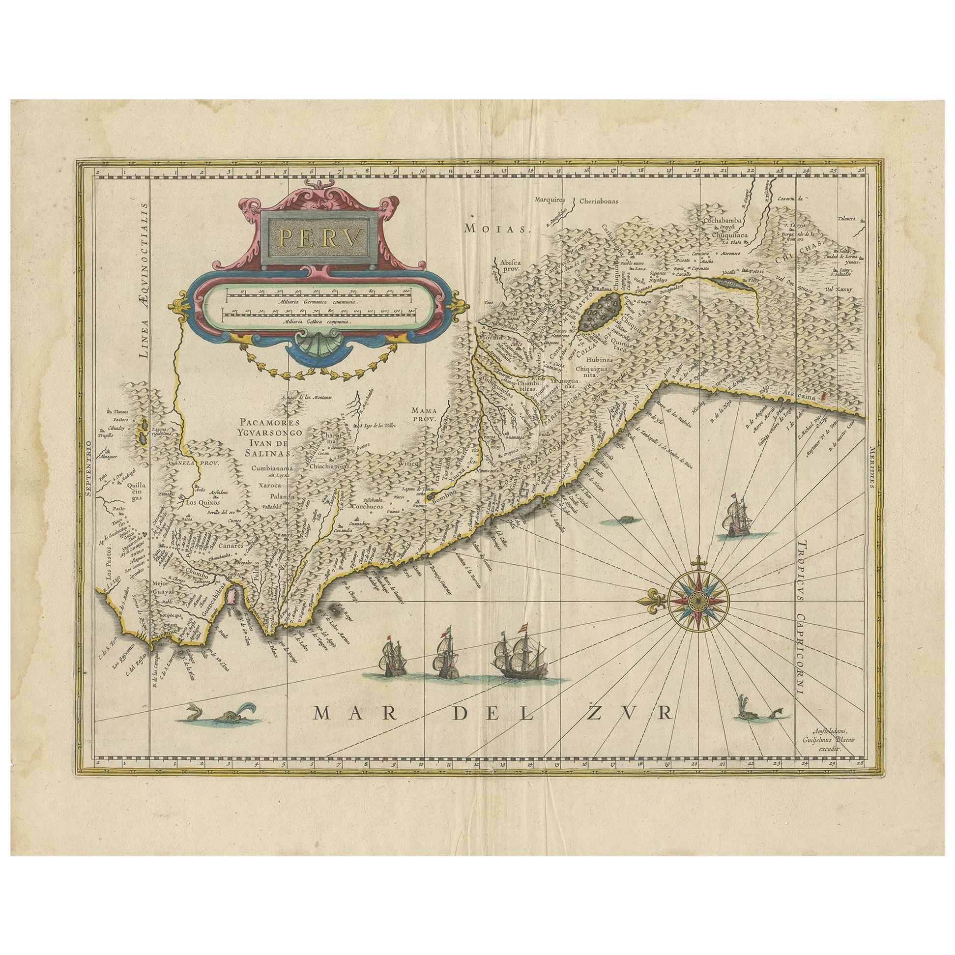
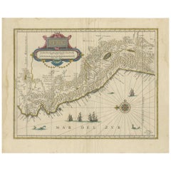
 - Antique Map of Peru in South America by Blaeu, circa 1645Located in Langweer, NLAntique map titled 'Peru'. Original antique map of Peru. With cartouche, compass rose, ships and two sea-monsters. Published by W. Blaeu, circa 1645.Category
Antique Mid-17th Century Maps
MaterialsPaper
 $614 Sale Price24% Off
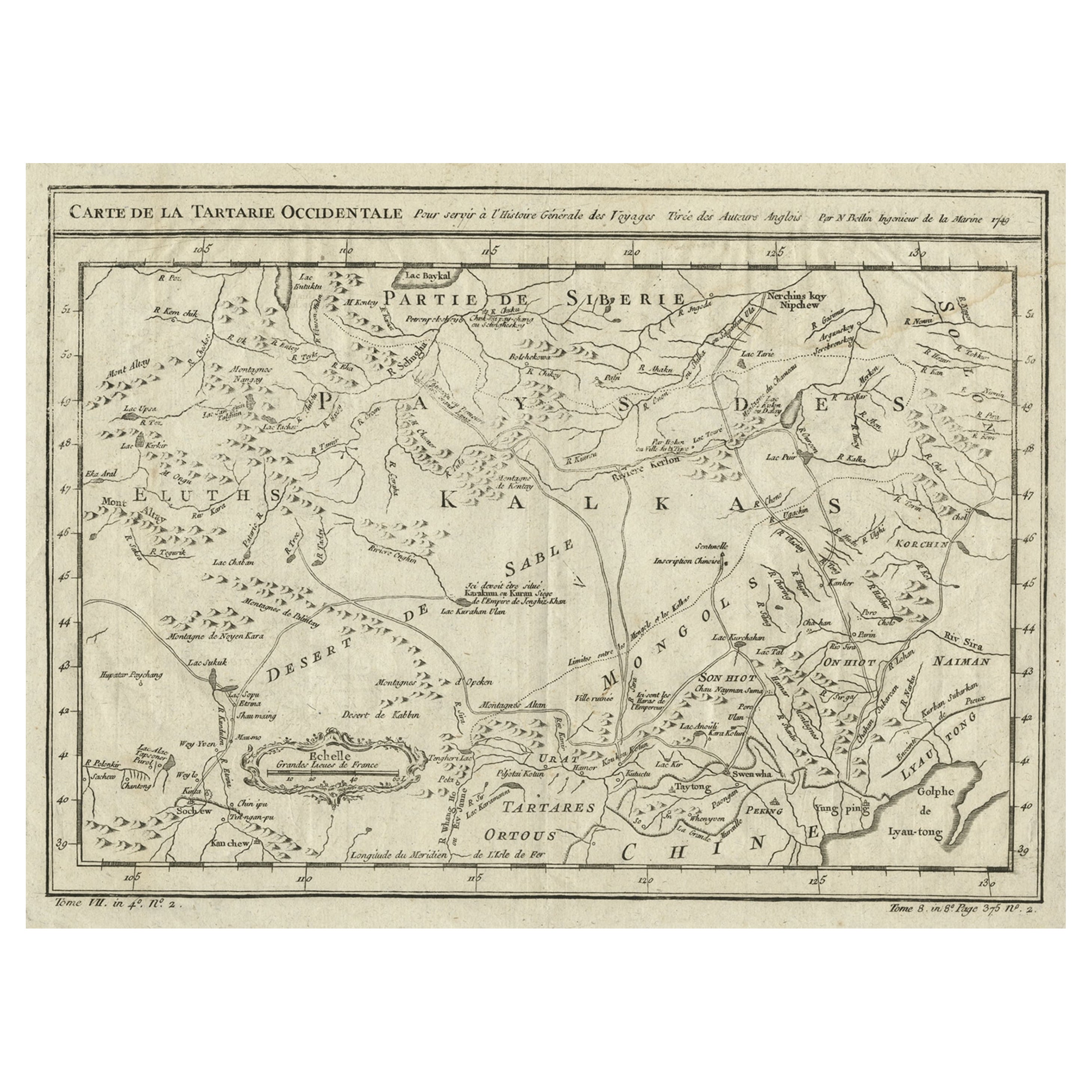
 - Antique Map of Tartary and Northeast Asia by Bellin, circa 1750By Jacques-Nicolas BellinLocated in Langweer, NLAntique map titled 'Carte de la Tartarie Occidentale'. Map of Tartary and northeast Asia, from Lake Baykal, Partie du Siberia in the north, Pays des Kalkas at the center, as well as ...Category
Antique Mid-18th Century European Maps
MaterialsPaper
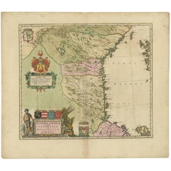
- Antique Map of Central Sweden by J. Blaeu, 1662Located in Langweer, NLA striking, rare map with a cartouche dedicated to Gabriel Bengtsson Oxenstierna. Published by J. Bleau, Amsterdam, 1662. Contemporary coloring.Category
Antique Mid-17th Century Maps
MaterialsPaper
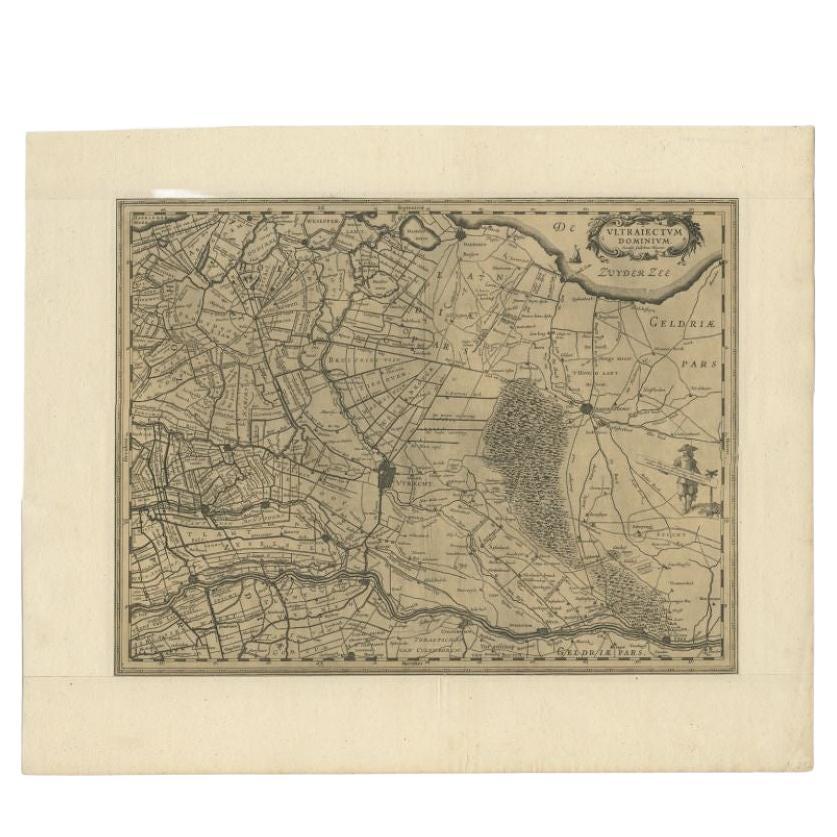
- Original Antique Map of Utrecht in the Netherlands by Blaeu, C.1645Located in Langweer, NLAntique map titled 'Ultraiectum Dominium'. Old map of the province of Utrecht, the Netherlands. This map originates from 'Theatrum Orbis Terrarum (..)'. Artists and Engravers: Wi...Category
Antique 17th Century Maps
MaterialsPaper
- Antique Map of Tartary and Northeast Asia, c.1750Located in Langweer, NLAntique map titled 'Carte de la tartarie occidentale'. An interesting map of Tartary and northeast Asia, from Lake Baykal, Partie du Siberia in the north, Pays des Kalkas at the cent...Category
Antique 18th Century Maps
MaterialsPaper


You May Also Like
- Original Antique Map of South East Asia by Becker, circa 1840Located in St Annes, LancashireGreat map of South East Asia Steel engraving with original color outline Engraved by Becker Published by Virtue, circa 1840. Unframed.Category
Antique 1840s English Other Maps
MaterialsPaper
- Original Antique Map of Asia. C.1780Located in St Annes, LancashireGreat map of Asia Copper-plate engraving Published C.1780 Two small worm holes to right side of map Unframed.Category
Antique Early 1800s English Georgian Maps
MaterialsPaper

- Original Antique Map of Central America / Florida, Arrowsmith, 1820Located in St Annes, LancashireGreat map of Central America. Drawn under the direction of Arrowsmith. Copper-plate engraving. Published by Longman, Hurst, Rees, Orme and Brown, 1820 Unframed.Category
Antique 1820s English Maps
MaterialsPaper
- Original Antique Map of South East Asia by Thomas Clerk, 1817Located in St Annes, LancashireGreat map of South East Asia Copper-plate engraving Drawn and engraved by Thomas Clerk, Edinburgh. Published by Mackenzie And Dent, 1817 Unframed.Category
Antique 1810s English Maps
MaterialsPaper
- Original Antique Map of China by Thomas Clerk, 1817Located in St Annes, LancashireGreat map of China Copper-plate engraving Drawn and engraved by Thomas Clerk, Edinburgh. Published by Mackenzie And Dent, 1817 Unframed.Category
Antique 1810s English Maps
MaterialsPaper

- Original Antique Map of South East Asia, Arrowsmith, 1820Located in St Annes, LancashireGreat map of South East Asia Drawn under the direction of Arrowsmith Copper-plate engraving Published by Longman, Hurst, Rees, Orme and Brown, 1820 Unframed.Category
Antique 1820s English Maps
MaterialsPaper


Recently Viewed
View AllMore Ways To Browse
Volga Volga
Blaeu World Map
West Nova
Maps South East Asia
Samarkand Pictorial
Map Central Asia
Antique South East Asia Map
Blaeu Wall Map
Map South China Sea
Used Furniture Edinburgh
Maps Of Europe
Map Of Europe
Map Of La
India Company
Antique Maps Buy
Antique Maps 18th Century
Map Of Paris
Antique Victorian American